
Recommandé
Contenu connexe
Tendances
Tendances (20)
En vedette
Similaire à Boston Historical Landmarks
Similaire à Boston Historical Landmarks (20)
Dernier
Dernier (20)
Boston Historical Landmarks
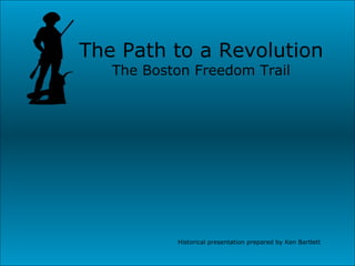
- 1. The Path to a Revolution The Boston Freedom Trail Historical presentation prepared by Ken Bartlett
- 2. A Map of the Boston Area This the map of the Boston area to which I will refer throughout out the presentation. Several slides will link back to this map so the story can be followed on the map. The Boston Freedom Trail is marked with the heavy gray line. A note before I begin. A bibliography is included at the end of this presentation. Many of the stories in this presentation are based on information from these sources and information learned while visiting these sites in Boston. The Ride Bunker Hill Battle The riders
- 3. The Beginning The Boston Commons This is the modern day Boston Commons. It was the pasture of Boston’s first white settler, William Blackstone. He came to the New World in 1622 and moved to this spot when his original colony failed. He lived here as a hermit with his collection of 200 books. The Puritans arrived in the area in 1630 and settled across the river in Charlestown.When their water supply failed Blackstone invited them across the river. For his generosity the Puritans gave him fifty acres of his own land. Blackstone moved to Rhode Island, only to return 25 years later.
- 4. The Park Street Church The town granary was on this site in the 1700s. The town stored grain to be sold to the poor for a low price. After the American Revolution this practice ended and the building was leased. In 1797 sails were made for the U.S.S.Constitution in the granary’s loft. The church was built 1809. William Lloyd Garrison gave his first public anti-slavery speech here on July 4, 1829. Next to the Park Street Church is the much older Granary Burying Ground.
- 5. Granary Burying Grounds Resting Place of Patriots In this small 2 acre plot near the heart of Boston, are the remains of three signers of the Declaration of Independence, the victims of the Boston Massacre, Ben Franklin’s parents, Paul Revere, a Mother Goose, and nine governor’s of Massachusetts. As you enter the graveyard there is a boulder commemorating the speech of James Otis, delivered in 1761 against the Writs of Assistance. This speech was called “the birth of the child Independence.” Otis was considered the patriots “spiritual leader” until he lost his sanity after being clubbed over the head by a British officer in a brawl. He was killed by lightning in 1783. Gravesites are found here for Samuel Adams, the organizer of the Revolution; John Hancock; and the victims of the Boston Massacre: Samuel Gray, Samuel Maverick, James Caldwell, Crispus Attucks, and Patrick Carr.
- 6. Boston Massacre I am jumping a few stops along the Boston Freedom Trail to the site of the Boston Massacre. The plaque on the concrete triangle in the middle of the intersection marks the actual spot. My daughter is standing there looking back across the street at the camera. Antagonism had been mounting between the British and the colonist throughout the winter of 1770. On the miserably cold, snowy night of March 5 th , 1770 a mob gathered in front of the State House. They pelted British regulars with garbage and snowballs, while taunting the soldiers. As told by Blanche M.G. Linden in the Boston Freedom Trail, “ Three mobs converged, goading, ‘Come on, you rascals you bloody-backs, you lobster scoundrels—fire if you dare.’ Bells rang out, just as they often did to summon Bostonians to save a burning house. Someone yelled ‘Fire!’ The British did.” Eight People were wounded and five were killed.
- 7. King’s Chapel The grave marker is in Boston’s oldest burying ground, started in the 1630s. As you can see it is the burial site of William Dawes the other rider of the “midnight ride” fame. Also found here is the grave of Mary Chilton, the first Pilgrim to touch Plymouth Rock. The burying ground is next to the King’s Chapel. King’s chapel was built on a corner of the burying ground. In 1686 a plot of land was seized by Governor Andros, since no Puritan would sell him land to build an Anglican Church. A small wooden chapel was dedicated in 1689. The granite church was built around the earlier wooden chapel in 1749. Then wooden structure was dismantled and the pieces tossed out the windows. In the bottom picture, the view is of King’s Chapel across the burying ground.
- 8. First Public School in America This statue of Ben Franklin is located near the site of the first public school in America, the Latin School. Since reading the Bible was a basic element of the Puritan faith, the school was established to teach all who would attend. Among the school’s famous students were Ben Franklin, John Hancock, and Samuel Adams. The school was started in the schoolmaster’s home on April 13, 1635. In 1645 a small wooden school was built. It was torn down in 1749 to allow expansion of the nearby King’s Chapel. A new two story brick building was constructed to house the Latin School.
- 9. Old South Meeting House In 1729, the brick structure of Old South was completed. It had the largest capacity for meetings of any structure in Boston. A crowd of about 5,000 people met here on December 16, 1773, to discuss action against the British East India Company’s ship docked at Griffin’s Wharf. Liberty Boys vowed to block the decree to unload the cargo of taxed tea. The Royal Governor refused to let the ships leave Boston with their cargo. Finally, Samuel Adams exclaimed,” This meeting can do nothing to save the country.” Hearing this secret signal, 100 men slipped away as prearranged to dress for the “tea party”. They reappeared dressed in dark blankets, with darkened faces, and tomahawks. They led a mob to the ships to dump all 342 chests of tea into the harbor.
- 10. Paul Revere This is a picture of Paul Revere’s house. It is Boston’s oldest remaining building. It was originally built in 1681. Paul Revere bought the house in 1770. Paul Revere was renown for reasons beyond the famous “midnight” ride. He had made earlier rides to spread the news of rebellion. On one ride he carried the news of the Boston Tea Party, which he helped organize. The next three slides will tell more about that famous ride— it was, after all, the birth of a legend and helped create a new country.
- 11. “ The Midnight Ride” Paul Revere and William Dawes At about 10:00 0n the night of April 18, 1775, Lieutenant Francis Smith led 7oo British soldiers from the Boston Commons to boats with muffled oars. They loaded the boats and crossed to Charlestown. While this was happening the British guarded the Charles River with a warship — the Somerset. Their mission was to seize stockpiled munitions and the Patriot leaders, John Hancock and Samuel Adams. (See the map) Revere knew the troops were crossing “by sea” and arranged for sexton Robert Newman to hang two lanterns in the steeple of the Old North Church as a backup signal. Revere was rowed across the water to Charlestown in a boat with muffled oars to sneak past the Somerset. He borrowed a horse and set off through Arlington toward Lexington and Concord. The picture at the left frames the steeple of the Old North Church between the trees. Map
- 12. The Midnight Riders Paul Revere, William Dawes, and numerous others rode off that night to warn the Minutemen the British were on the move. After warning the Lexington Minutemen, Revere met Dawes and they left for Concord. Dr. Samuel Prescott joined them enroute. Along the way a British patrol stopped them, detaining Revere while Dawes and Prescott escaped. Dawes lost his horse so only Prescott reached Concord to spread the warning that the British were coming. Paul Revere’s famous ride was fifteen miles to Lexington, but it was almost a year before he could return to his house in Boston. He sent a smuggled letter to his wife Rachel telling her to join him in Watertown. She escaped Boston with their children, except their oldest son, just before General Gage declared martial law on June 12 th . Their oldest son, Paul, stayed behind to protect the house from looting by the British soldiers. The pictures at left show the location Revere began his ride. The top picture looks back across the water toward Boston. This site is near where the USS Constitution is anchored today. (See the map) Map
- 13. Lexington and Concord The Minutemen had been warned by Revere and the other riders. They met the British on the Lexington Green. A shot rang out, followed by a volley from the British. Eight Americans were killed and ten were wounded. The first American blood had been shed in the Revolutionary War. The British continued on to Concord, crossing the Old North Bridge. They set fire to the Town House in the Concord Center while trying to burn gun carriages. The Minutemen saw the smoke and believed the Redcoats were deliberately burning Concord. The British retreated over the Old North Bridge. They fired across the bridge killing two Minutemen. The minutemen returned the fire. Three British soldiers are killed. The Minutemen continued to fire on the Redcoats as they retreated toward Boston. The picture is of the reconstructed Old North Bridge. The image of the minuteman in the picture is an image of the famous sculpture done by Concord artist Daniel Chester French for the 1875 Centennial.
- 14. Bunker Hill This is the monument to commemorate the Battle of Bunker Hill. The monument sets on top of Breed’s Hill, since that is where the battle actually took place. In June of 1775, the town of Boston was held by the British and surrounded by the “rebels.” General Gage planned to sweep the rebels from around Boston. His war council thought this was going to be an easy action. On the night of June 16, 1775 about 1,000 New England soldiers marched to Charlestown. By dawn they had built a small fortification, about 132 feet square, atop Breed’s Hill — not Bunker Hill as had been planned. (This could have been due to a change of plans or due to confusion in the dark.) The British were surprised by the fortification at dawn, but were not worried. They continued with plans to sweep the Americans from the countryside. (See the map.) Map
- 15. The Battle of Bunker Hill The British charged up Breed’s Hill three times. Finally, on the third try, the New England soldiers ran out of ammunition and the British took the hill. During the battle Dr. Joseph Warren was killed and 441 other Patriots were killed or wounded. The British loses were over 1,000. The cost to the British was so severe that their planned foray of the bay was never to happen. The picture shows a view from the statue at the top of Breed’s Hill looking out over Boston. Map
- 16. The USS Constitution “Old Ironsides” Our last stop is the USS Constitution. It is the oldest commissioned warship in the world. It is here with the story of our beginning because it came to symbolize the same type of spirit that allowed the colonists to defy British rule. “ Old Ironsides” helped preserve the freedom the earlier Patriots achieved. The USS Constitution was launched on October 21, 1797. In 1925 a national campaign was undertaken to restore “Old Ironsides.” She then went on a tour of American waters and returned to Boston May 7, 1934. She has been there ever since. Web site: www.ussconstitutionmuseum.org
- 17. Bibliography 1. Andrews, Joseph L., Jr., M.D. and Contributors. Revolutionary Boston, Lexington, and Concord; The Shots Heard Round the world!. Concord: Concord guides Press, 1999. 2. Bahne, Charles. The Complete Guide to Boston’s Freedom Trail . Cambridge: Newtowne Publishing, 1998. 3. Dunwell, Steve and Linden, Blanche, M.G. Boston Freedom Trail . Boston: Back Bay Press, 1996. 4. Dunwell, Steve and Contributors. USS Constitution; Old Ironsides . Little Compton: Fort Church Publishers, Inc.,1991. 5. Web site <http://www.nps.gov/bost/> Beginning
Notes de l'éditeur
- There is more to the story. See p.6 0f the Trail guide. Blackstone comes back to Boston 25 years later riding a white bull to marry a widow.