
Recommandé
Contenu connexe
Plus de laurennwaggoner
Plus de laurennwaggoner (10)
Dernier
Dernier (20)
Tornado powerpoint
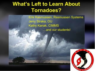
- 1. What’s Left to Learn About Tornadoes? Erik Rasmussen, Rasmussen Systems Jerry Straka, OU Kathy Kanak, CIMMS …and our students!
- 2. “ There are known knowns. These are things we know that we know. There are known unknowns. That is to say, there are things that we now know we don’t know. But there are also unknown unknowns. These are things we do not know we don’t know. ” —United States Secretary of Defense Donald Rumsfeld
- 3. n ct io Deep shear, adequate CAPE o nve e ep c ar-sid De f re o m ent Supercell lop ion Deve itat p ec i pr next gence, RFD to C onver near- of tilting H nd SR Updraft grou Baroclinic ; gene ration Tornado g archin Cyclone n States cont ractio Vortex Processes Tornado
- 4. n ct io Deep shear, adequate CAPE o nve e ep c ar-sid De f re o m ent Supercell lop ion Deve itat p ec i pr next gence, RFD to C onver near- of tilting H nd SR Updraft grou E oclinic ER Bar ; H ration E gene Tornado AR g archin U Cyclone YO n States cont ractio Vortex Processes Tornado
- 5. tornado—1. A violently rotating column of air, in contact with the ground, either pendant from a cumuliform cloud or underneath a cumuliform cloud, and often (but not always) visible as a funnel cloud.
- 6. tornado—1. A violently rotating column of air, in contact with the ground, either pendant from a cumuliform cloud or underneath a cumuliform cloud, and often (but not always) visible as a funnel cloud.
- 7. tornado—1. A violently rotating column of air, in contact with the ground, either pendant from a cumuliform cloud or underneath a cumuliform cloud, and often (but not always) visible as a funnel cloud.
- 8. tornado—1. A violently rotating column of air, in contact with the ground, either pendant from a cumuliform cloud or underneath a cumuliform cloud, and often (but not always) visible as a funnel cloud.
- 9. tornado—1. A violently rotating column of air, in contact with the ground, either pendant from a cumuliform cloud or underneath a cumuliform cloud, and often (but not always) visible as a funnel cloud.
- 10. tornado—1. I know one when I see one.
- 12. n ct io Deep shear, adequate CAPE o nve e ep c ar-sid De f re o m ent Supercell lop ion Deve itat p ec i pr next gence, RFD to C onver near- of tilting H nd SR Updraft grou E RER oclinic HE Bar EE ; ration ERH gene Tornado UUARA g archin YO Cyclone YO n States cont ractio Vortex Processes Tornado
- 13. The Tornado Cyclone is roughly 10 times the diameter of the visible Tornado B A A B
- 14. Angular momentum M=Vr = tangential, swirling velocity times radius. Dimmitt tornado, 2 June 1995. From single- Doppler analysis. M=14000 contour
- 15. Approximate swirling windspeed and angular momentum in the Dimmitt tornado early in mature stage about 200 m above the ground.
- 17. This flow would evolve from the previous in < 5 minutes with a modest inflow of (e.g.) about 5 m/s at 500 m radius
- 18. As the high-M air penetrates closer to the axis, maximum swirling wind speed ~doubles for each halving of the radius of penetration of the large M region.
- 20. Early: ~307 K, least precip, warmest air near the tornado Late: ~305 K, most precip, cooler
- 21. Thoughts... • Most supercells probably have tornado cyclones*. Nomenclature isn't so important as understanding that... • A tornado, whatever wind speed or appearance criteria being used, is the inner portion of a tornado cyclone where enough angular momentum has been transported toward the center to give tornadic windspeeds.
- 22. Thoughts... • Tornadogenesis failure is possibly generally a failure of contraction of the tornado cyclone. • Strength of the inner portion of the vortex (the tornado) depends partially on angular momentum in the outer portion, and the removal of mass upward through the vortex (and hence convergence below).
- 23. Thoughts... • Hence we seek to understand why most supercells are not conducive to transporting sufficient air upward through the tornado cyclone to increase the vortex to tornado strength. • Operationally, even if tornado cyclones are close enough to the 88D for detection, the differences between tornadic and non-tornadic TCs may almost always be ~unresolvable.
- 24. Thoughts... • Tornado life cycle appears to be related to the changes of the secondary flow (in- up vs. down-out) in the tornado cyclone. • Conjecture: long-lived tornadoes occur in tornado cyclones that (for reasons unknown) have a very slow transition from in-up to down-out.
- 25. n ct io Deep shear, adequate CAPE o nve e ep c ar-sid De f re o m ent lop ion E Supercell eve itat ER D H p ec i RE pr next ence, UA g RFD to C onver near- YO of tilting H nd SR Updraft grou Baroclinic ; gene ration Tornado g archin Cyclone n States cont ractio Vortex Processes Tornado
- 26. So how did the Tornado Cyclone come into existence? • Does the Rear-Flank Downdraft have a role? • Here are some historically validated observations about the supercell:
- 27. • Updraft acquires horseshoe shape. • Counter-rotation is observed. • A Rear-Flank Downdraft is present in the interior of the horseshoe pattern. • The tornado cyclone is centered in strong vertical velocity gradient on the interior left edge of the horseshoe. • A gust front is present below the rear edge of the updraft.
- 31. A simulation... Vortex straddles up/downdraf Horseshoe- t shaped Counter- updraft rotating vortices Rear-Flank Downdraft*
- 33. Mechanism 1: Arching In a nutshell, vortex rings about the RFD are tugged upward at the leading edge in the low-level updraft, giving rise to vortex line arches and counter-rotating vortices. See Straka et al. In the Electronic Journal of Severe Storms Meteorology, Vol 2. (EJSSM.org)
- 35. Mechanism 2: Tilting/stretching of inflow streamwise vorticity
- 36. Mechanism 3: Agglomeration of shear vortices
- 38. Real mechanism: All three acting together (others?)
- 39. RFD Genesis • Different forcings for different parts? • One example showing evidence that precipitation plays a role...
- 41. 0050 UTC • From airborne DRC Doppler • 40 dBZ Western tip of forward-flank precipitation North
- 42. Western tip of forward-flank precipitation • From airborne Doppler • Away • To North DRC
- 43. Crowther video frame… 0050 UTC (north-northwest)
- 44. • 500 m Gust AGL front 21 m/s C 21 m/s DRC A
- 45. The Blob Blobette BWER A C North
- 46. Bobby Eddins video frames ~0053 UTC (N-W)
- 47. Gust • 500 m front AGL 21 m/s Blobette C 18 m/s Blob A
- 48. A C North
- 49. Bobby Eddins video ~0055 UTC (north)
- 50. Tornado Forms
- 51. Ian Wittmeyer photo ~0106 UTC (northwest)
- 52. In summary…. • The descent of a DRC is associated with… • Locally stronger outflow; • A gust front that surges; • Counter-rotating vortices to the ground. • A locally intense downdraft embedded in the RFD is the key feature, and the DRC is associated with this downdraft.
- 53. n ct io Deep shear, adequate CAPE o nve e E p c sid ER De e ar- H f re RE o ent UA m lop ion YO Supercell Deve itat p ec i pr next gence, RFD to C onver near- of tilting H nd SR Updraft grou Baroclinic ; gene ration Tornado g archin Cyclone n States cont ractio Vortex Processes Tornado
- 54. Role of the Mesocyclone and Supercell • It creates the precipitation structure needed to facilitate all those neato mechanisms of Tornado Cyclone formation (heretical, hyperbolic, etc.) • And that's all I have to say about that (F. Gump, 1994).
- 55. E ER H RE n UA ct io Deep shear, nve YO adequate CAPE o e ep c ar-sid De f re o m ent Supercell lop ion Deve itat p ec i pr next gence, RFD to C onver near- of tilting H nd SR Updraft grou Baroclinic ; gene ration Tornado g archin Cyclone n States cont ractio Vortex Processes Tornado
- 56. The supercell environment • Issues from being in the field again with VORTEX2.... • You don't need no Shtinkin' CAPE • You DO need upper-tropospheric storm- relative flow • You VERY MUCH need good low-level shear, low-level humidity, and adequate (?) low-level CAPE.
- 57. The supercell environment • High-CAPE days • Very subjectively: • You DO need upper-trop storm-relative flow • You VERY MUCH need good low-level shear, low-level humidity, and adequate (?) low-level CAPE.
- 58. Finally, my latest quasi- eccentric perspective change... • Cloud models initialized with a warm bubble and a supercell sounding love to produce Tornado Cyclones (or tornadoes if they have enough resolution)
- 59. Finally, my latest quasi- eccentric perspective change... • Watching storms in VORTEX2, I felt that many storms would produce tornadoes “if only...”
- 60. Finally, my latest quasi- eccentric perspective change... • Hypothesis: Most supercells would be tornadic if something did not interrupt the series of processes leading to tornado formation.
- 61. 45-120 min 30 min 20 min 5-20 min n ct io Deep shear, adequate CAPE o nve e ep c ar-sid De f re o m ent Supercell lop ion Deve itat p ec i pr next gence, RFD to C onver near- of tilting H nd SR Updraft grou Baroclinic ; gene ration Tornado g archin Cyclone n States cont ractio Vortex Processes Tornado
- 62. So if... the typical supercell needs to go through a 1.5-3 hour sequence of processes to produce a tornado, and there are a plethora of ways to interrupt and interfere with these processes, then warning and research emphases really should be on... identifying the physics and probabilities of these interfering mechanisms, not on... identifying the right most-special environments supportive of supercell tornadoes.
- 63. Thank you! This research is supported by you through the National Science Foundation erik@rasmsys.com http://rasmsys.com
Notes de l'éditeur
- Individuals most directly involved in this research. This talk is largely from the perspective of our research emphasis. Other scientists would have considerably different viewpoints.
- It’s really not possible to give a complete talk on things we don’t know: there are many things that we don’t realize we have no understanding of. But I can talk about the things we are aware of that are not well understood. In fact, this statement that has its origins in risk analysis work, says a lot about science. The “known knowns” are the things that are taught at school, in the lower grades as well as at the undergraduate level in “science” courses. These classes convey information and knowledge that has been generated through the scientific process (leaving aside the issue of how well scientific method was adhered to). The second level, “known unknowns”, is where science happens. This is where scientific methodology should be rigorously applied to test proposed explanations about the unknowns. Known unknowns is the realm of this talk. The third level is what it is. Of course there are all sorts of phenomena related to tornadoes that we just know nothing about; we don’t even know they exist. These sorts of unknowns are very often revealed through new and innovative observation systems and strategies, such as the mobile radar work by Drs. Wurman and Bluestein. Once these phenomena have been observed, they move into the second class… known unknowns with the potential of becoming known knowns through scientific research.
- This is a diagram of the processes that appear to lead from a storm-free environment to a tornado. Yellow circles represent states in the atmosphere, and red arrows, with magenta labels, represent processes.
- This is a diagram of the processes that appear to lead from a storm-free environment to a tornado. Yellow circles represent states in the atmosphere, and red arrows, with magenta labels, represent processes.
- This is the definition of a tornado that I found in the online Glossary of the American Meteorological Society.
- All tornadoes develop through the contraction of a larger, not-so-violently rotating column of air. So tornadogenesis could be interpreted as the crossing of a violence (windspeed?) threshold. I will comment later about this windspeed threshold.
- This phrase may be a vestige from the era when we wanted to distinguish between “benign” funnel clouds and not-so-benign. In fact, there is evidence to suggest that most supercells have rotating columns of air in contact with the ground, and a sufficient pressure drop to cause a funnel would typically corroborate the presence of this vortex. The pressure deficit needed to lead to the condensation of a funnel cloud depends on the low-level humidity. In drier environments, a funnel indicates a larger pressure drop, and more intense vortex. In nearly-saturated environments, and funnel could be associated with a relatively weak vortex.
- Vortices are not observed to terminate in a fluid. The vortex could become very diffuse and hard-to-identify at cloud base, causing the appearance that a vortex is “pendant” below the cloud, but this is never observed. Indeed, since the cloud indicates updraft, and the updraft is responsible for the stretching and contraction of the vortex, it should be expected that any vortex present below cloud base also extends well up into the cloud. Often we observe well-developed tornadoes extending through much of the depth of the cumulonimbus.
- E.g., during the daytime but not at night?
- Why does it matter? First, we often think that when we can define or classify an object or phenomenon that we understand it. This is not the case. Definitions and classifications are summations of scientific knowledge suitable for certain audiences. Scientists should never assume that a thing is understood just because it can be defined or classified. Second, definitions can get in the way of understanding. A tornado, in common parlance, is a visual manifestation of part of a larger, evolving vortex. Researching tornadogenesis is all about understanding the evolution of that larger vortex, and how a certain portion of it can become intense enough to provide visual manifestations. Scientists are professional skeptics. There are some principals we have to accept even though our understanding is not perfect, or the approximations behind the principals trouble us. But there really is no such thing as “settled science”. There is a body of information that is the best current state of understanding, but science is all about methodological challenging of ideas, not “settling” them. Only the relatively incurious users of knowledge believe it is completely settled.
- In terms of the known unknowns about the tornado itself, the lowest approximately 10 meters (30 ft) is where we are focused. The interaction of the larger swirling flow with the ground governs how close to the center that swirling flow penetrates. The closer it goes, the stronger the wind. And unfortunately this very poorly understood interaction occurs where most human-built structures are found. Story-tellers like to portray the tornado as some mysterious living thing that we must get inside of in order to understand. But recall my earlier comments. What you see here is a vortex from one side of the image to the other. Near the center, the air is swirling fast enough to lower the pressure enough for water vapor to condense into droplets, giving a funnel cloud. There is no dramatic change in the “thing” from outside to inside. At some distance from the center, the wind starts decreasing as you go closer to the center. There are no great mysteries here that are Known Unknowns. It is enticing to believe that there are great Unknown Unknowns here, probably because of our natural fear and awe. And, indeed, as we begin to probe the tornado in more detail with in situ sensors and remote sensors, some Unknown Unknowns may be revealed. But at this time in the evolution of our understanding, as scientists, our focus is on the Known Unknowns of the tornado “corner region”… the magenta box above. This is where the inflowing air “turns the corner” and begins to spiral upward around the tornado. In some cases, the inflow erupts strongly upward near the axis (“endwall jet”) , and in other circumstances air sinks all the way to the ground along the center axis. The nature of the corner flow is strongly associated with the asymmetric* aspects of the airflow, such as suction vortices. Some of these features on scales smaller than the tornado itself may be associated with transient wind speed maxima capable of enhanced destruction. However, we are not yet adequately equipped to study these issues, although we're getting closer. Perhaps there will be major strides over the next 10-20 years. * By symmetric we mean the aspects of the flow that are the same all around the tornado. A good first guess is that the flow is symmetric about a central axis that is nearly vertical. In other words, if I am at a height of 100 m above the ground, and am a distance 50 m away from the center of the tornado, the windspeed is the same in every direction I sample. Asymmetries are therefore aspects of the flow that don’t follow this pattern. Examples include inflow jets and subvortices… smaller-scale whirlwinds embedded in the larger tornado.
- This is a diagram of the processes that appear to lead from a storm-free environment to a tornado. Yellow circles represent states in the atmosphere, and red arrows, with magenta labels, represent processes. The preceding discussion of tornadoes should have made it clear that what we call a tornado… the thing we “see”… is really not very distinct from the larger vortex that contains it. I think if we were more careful about our nomenclature, we would call this whole vortex, typically about ten times the size of the visible tornado, a “tornado”. It’s one vortex. As far as I know, nothing very dramatic happens as one moves toward the center of this vortex and into the “tornado” except it gets cloudy and there’s a lot of junk in the air. But the real challenge right now is to find out if that is a true statement! Maybe we can discover that physical processes do vary in certain ways across this big vortex, and then maybe we can give better names to different parts of the vortex based on the processes occurring there. But, for now, we’re probably stuck calling this parent vortex that contains the visible tornado a “Tornado Cyclone” So let’s look at the Tornado Cyclone and how it gives rise to the Tornado.
- This is the Dimmitt tornado from 2 June 1995 (VORTEX; see Rasmussen and Straka; JAS; pp. 1365-). The photograph is looking toward the west-southwest, toward the plane marked in the map. The gray shades in the map are DOW reflectivities, theknobby hook echo is within the circle. The circle denotes the tornado cyclone, as defined in the above reference. In the photo, the tornado cyclone extends nearly the width of the image at the distance of the tornado. Contours in the image are DOW reflectivity at the vertical plane containing the tornado.
- Analysis of azimuthally averaged (averaged around the tornado) secondary flow and angular momentum from the mobile Doppler volume collected commencing 0105:12 UTC. Gray block shading denotes rough outline of azimuthally averaged cloud determined photogrammetrically (CB base continues past 1600 m radius). Contours x1000 m^2/ s. The maximum vector is 8 m/s. OK, what is “secondary flow”? In a vortex, the primary flow is the swirling part. It is the strongest part. In terms of the components of velocity in a cylindrical coordinate system, it is the tangential wind, or the part that is parallel to the circles of constant radius. The secondary flow consists of the in/out part (the “radial component of velocity”… that part of the wind that is directly toward or directly away from the center axis), and the up/down part (the “vertical component of velocity”… that part of the wind that is directly up or down in a vertically oriented vortex, or parallel to the center axis). Basically we measure angular momentum to get a sense of how fast the skater would spin if she brought in her arms… how strong would the wind get if the swirling flow well away from the tornado was transported inward toward the tornado? Here we have used one Doppler radar to compute the average around the tornado of the swirling part (best visible at the sides because the Doppler radar only measures toward/away motion), the radial part (best visible at the front and rear for the same reason), and we have computed the vertical part through the mass continuity equation. In essence, it expresses the idea that air cannot accumulate… if it flows toward the tornado, it must eventually turn upward and flow out of the box we have drawn. The vectors here (arrows) show the direction and strength of the secondary part of the wind in the Tornado Cyclone… the in/up and down/out part.
- Across much of the tornado cyclone, angular momentum M is fairly uniform at about 14000-16000 m^2/s. Since M=Vr, V=M/r, so V increase inward toward the axis in a field of ~constant M.
- Here we have the same angular momentum in the outer portion of the Tornado Cyclone as in the Dimmitt mature tornado. But we contemplate a situation early in the life cycle where this angular momentum has not been advected nearly as far toward the axis. Note that windspeeds throughout the vortex are modest... about 17 m/s at the most. This might be enough to raise a little dust here and there over dry, bare ground. So considering a region about 2 miles across, with a very similar vortex at that scale, one can barely raise a little dust, and the other has a mature tornado.
- This is what the windspeed and M profiles look like if we move parcels halfway toward the axis, from the previous slide's positions, conserving angular momentum. In the average around the vortex, it is approximately conserved above the surface layer and in the absence of large eddy flux of angular momentum. See Rasmussen and Straka (JAS, 2007, pp. 1365- for much more detail).
- A further contraction, with inward flow transporting the large, uniform M to about 200 m radius, leads to a much stronger vortex... now 80 m/s. Each additional halving of the radius to which this angular momentum penetrates doubles the peak windspeed. However, associated with these windspeed increases are pressure falls in the tornado. Fortunately, there are several mechanisms which tend to limit how far toward the axis this large-M air penetrates, and there are diffusive mechanisms that also taper the M profile toward the axis. Otherwise, extremely destructive tornadoes would be the norm. The mechanics of tornado intensification and structure will continue to be a topic of research emphasis over the next decade or two, at least.
- So we ask: why does the vortex not keep contracting and the tornado continue to intensify? Or a question more consistent with the Known Unknowns: what governs the tornado life cycle of contraction/intensification, maturity, and eventual demise? This slide shows how the angular momentum and secondary flow evolved in the Dimmitt Tornado Cyclone. Early in the life cycle, while the tornado was still intensifying, the flow in the parent Tornado Cyclone was mainly in-up, transporting angular momentum toward the center, and increasing/maintaining the tornado strength. Eventually, the secondary flow became down and out, which tended to move angular momentum away from the tornado. In the latter stages, there is still plenty of angular momentum for a tornado, and the Dimmitt tornado contracted into an intense rope stage before it dissipated. But there is not enough angular momentum to maintain a tornado that is both large and strong.
- The numbers in the 300 range are the “potential temperature” in degrees Kelvin. In this case, it’s closely related to the actual temperature measured by the mobile mesonets… warmer air is less dense and can be lofted more easily in the tornado.
- The reader must understand that I am not reporting scientific findings here, but talking from a hypothetical perspective about things we understand poorly at best. I am attempting to give the audience a sense of how we might arrive at future research directions. When I say “tornado cyclone”, I think a rough way to define it would be a vortex larger than a tornado, capable of producing a tornado if sufficient contraction occurs. This could also be described as a “low-level mesocyclone” or “near-ground mesocyclone”. No terminology is perfect. The term “tornado cyclone” may erroneously convey that the vortex does contain a tornado (as opposed to potentially contain a tornado). The terms involving “mesocyclone” may indicate that there is a dynamical link to the mid-level mesocyclone so frequently detected on Doppler radar, and such a link has not been established.
- But there is so much more. Nature often provides sufficient angular momentum for very destructive tornadoes, but there are other braking mechanisms, such as updraft strength, parcel negative buoyancy (including water loading), etc. that seem to limit the amount of vortex intensification that can be realized.
- With regard to the first bullet, Rasmussen and collaborators are examining the hypothesis that most supercells would be tornadic if some processes (unknown at present) did not interfere with the contraction. One way to look at the question is simply this: Contraction requires a certain time scale, and the storm must be able to support contraction for at least that time scale, or tornadogenesis fails. A lot can go wrong during the contraction stage, including introduction of too much precipitation and hence loss of buoyancy, a cold outflow from the storm or another storm impinging, loss of updraft in the parent storm owing to changes in the environment, etc.) With regard to the latter bullet, recall in my hypothetical examples (via physical reasoning regarding the conservation of angular momentum), and my actual example of the Dimmitt vortex, that the wind profile on detectable scales is identical or nearly so between the non-tornadic, weakly tornadic, and violently tornadic vortices. Also, note that a very weak tornado cyclone at detectable scales can result in a violent tornado given sufficient contraction.
- The first bullet is based on the analysis of one case! But, storm chasers very commonly observe the erosion of cloud material around the tornado, indicating downdrafts. In fact, the Goshen County, Wyoming tornado from VORTEX2 was a beautiful example, with the updraft eroded away for perhaps several kilometers depth, leaving a very, very tall funnel cloud. With regard to the latter bullet, I have the fuzzy impression that long-lived tornadoes are surrounded by long-lived wall clouds, and “clear slots” that track right with the tornado and never really engulf it. But I would have to review some videos to confirm this.
- This is a diagram of the processes that appear to lead from a storm-free environment to a tornado. Yellow circles represent states in the atmosphere, and red arrows, with magenta labels, represent processes.
- The typical supercell updraft becomes horseshoe-shaped as the storm matures.
- The mesocyclone is found on the left side looking along the motion of the storm, or the right side as the storm approaches. The mesocyclone involves both updraft and downdraft in the mature stage of the supercell (Lemon description).
- The mature supercell often features a meso-anticyclone on the opposite side of the updraft as the mesocyclone. It is often overlooked because there are fewer reflectors there making it hard/impossible to see in radar data, and visually the eye is drawn toward the mesocyclone because of its tornado potential and (often) more rapid rotation.
- The red shades are positive vertical vorticity, blue shades negative (anticyclonic). Magenta contours denote downdraft; green contours updraft. This is a near-ground horizontal plane. Vectors are airflow. This simulation was conducted by Jerry Straka and the journal article is at http://www.ejssm.org/ojs/index.php/ejssm/issue/view/11 This is the Electronic Journal of Severe Storms Meteorology, and I encourage everyone to utilize this excellent free, peer-reviewed journal. This is jumping ahead a little, but note that the trailing downdraft is the original precipitation-laden downdraft. The downdraft immediately behind the gust front is associated with the intense rolling-motion associated with horizontal vorticity originally created by the rainy downdraft, as those vortex tubes spread eastward and are tugged upward. This seems to be a viable mechanism for yet another “class” of supercell downdrafts (as yet unnamed!). Dynamically, this is not the so-called occlusion downdraft (there is no swirl below or above!). I do want to point out that this is in the same location as the sometimes-observed downward cascade, or “waterfall”, that is seen in the clear slot as it progresses just ahead of a developing tornado cyclone.
- This is the remarkable part. In this computer simulation, at the initial time there was no flow, hence no shear, no vorticity, no helicity. There was simply a warm bubble in which rain was introduced near the rear side. If we are to believe this simulation, one explanation of most of the features in the rear side of a supercell, including the tornado cyclone, is that the flow evolves in response to the simple geometric positioning of precipitation within an updraft. This ignores many important issues, such as why is there precip in the back side of the updraft, and how does environmental flow/shear modulate the evolution?
- This diagram by Paul Markowski of Penn State illiustrates the origin of rotation near the ground in a supercell. Tilting of environmental vorticity leads to rotation in the mid-level updraft. I should add that in a tornado cyclone, some of these lines probably participate directly in the tornado cyclone, as air comes in from the southeast through north. But also note the arching process. At stage 1, rotation forms in rings around the Rear-Flank Downdraft, moving toward the ground at stage 2. At stage 3, they spread away from the downdraft. And at stage 4, they are tugged back upward into the low-level updraft. This leads to arch-shaped vortex lines, with cyclonic rotation on the left looking along the direction of storm motion (from behind).
- This is a perspective view of the lower levels below the supercell updraft and RFD. The red streamlines represent inflow. The cyan arrows give the sense of rotation implied by the streamwise vorticity. This vorticity is the spin that is oriented along the direction of the airflow (the part of vorticity that is oriented across the airflow is called crosswise vorticity; it is probably not a significant player in low-level rotation dynamics). The salmon-colored area is where positive vertical vorticity develops as a result of tilting of the inflow as the air passes into the gust front convergence zone and updrafts occur. The strength of the vertical vorticity in this region depends primarily on how abruptly the inflow is tilted, how much streamwise vorticity it contains, and how much stretching occurs in the low-level updrafts. It is not unreasonable to assume that this process could lead to intense horizontal shear in the gust front convergence zone, and perhaps identifiable vortices or tornadoes. I believe it is probable that this mechanism contributes to the tornado cyclones in most supercells.
- If one of the first two mechanisms create positive vertical vorticity in the gust front convergence zone, there is a good possibility that this will be manifest as strong horizontal shear. Here and there, owing to shearing instabilities, inhomogeneous tilting/lifting in the convergence zone, or other causes, one might expect to see fairly well developed vortices. These have been observed in Doppler analyses and show up in cloud model simulations. These tend to migrate toward the north end of the developing circulation. The presence of these vortices does not increase the net circulation in the tornado cyclone, they just represent an inhomogeneous distribution of the vorticity within that cyclone. However, it is an open question whether they may play a role in the dynamical processes through which the tornado cyclone contracts into a tornado. Note that in the foregoing, I speak of “gust front convergence zone”. This region really is a zone of windshift on a scale of perhaps hundreds of meters, not a discontinuity. I have represented it with the cold front symbol for convenience... conceptually, I'm trying to mark the center of the zone of convergence.
- This is an analysis of the tornado cyclone at Dimmitt Texas, 2 June 1995. The top part is a map (north to the top) of dual-Doppler analyzed vertical vorticity (red: cyclonic, blue: anticyclonic). The heavy black line is the zero vertical velocity line in this low-level analysis, so it encloses the RFD. The low-level updraft maximum sits atop the gust front convergence zone, with upward motion contoured in orange. (Rain is the blue transparent region; more on that later.) The lower portion is a vertical cross section along A-B. The heavy green lines are vortex lines. Two are chosen to represent two distinct families of lines. Near the updraft/downdraft interface, vortex lines form arches. About half of the low-level tornado cyclone (darker red shades, c at center) is comprised of lines from this family... arches. The northeast half of the tornado cyclone is comprised of lines that travel horizontally near the ground, and then erupt nearly straight upward. This nicely illustrates the first two mechanisms in combination. To my knowledge, we have no theoretical reason to argue that any of these mechanisms are sufficient or necessary for tornado cyclone formation. The arching pattern is very commonly observed, but could a tornado cyclone form just from tilting inflow vorticity? Could a tornado cyclone form absent this vorticity? It's too early to say.
- The genesis if the RFD is nearly unknown at this time. Some plausible explanations: Precipitation at the rear of the supercell updraft can lead to downdraft formation in the usual ways... hydrometeor mass loading, evaporation, and melting. There is good evidence (Dr. Paul Markowski's talk) that in tornadic supercells, the RFD arrives at the ground relatively warm compared to your typical thunderstorm downdraft. This could happen if the downdraft starts out cool through melting and evaporation, accelerates downward, and then much of the precipitation melts/evaporates. When that happens, the downdraft would continue downward while warming adiabatically, and could arrive at the ground warmer than surroundings (this is essentially the “heat burst” effect). Lack of cold air is also favored by a paucity of hydrometeors (e.g. a few large drops). Others have suggested that the RFD occurs because there is more spin, hence a local pressure deficit, near the ground than aloft. This leads to what we call a downward-directed non-hydrostatic pressure gradient force. However, in the Dimmitt supercell (coming slides) the RFD preceded low-level spin. Further, I am often troubled by the fact that this pressure force mechanism isn't used to explain axial downdrafts in vortices instead of RFDs. Note that this pressure-force induced downdraft is usually called an “occlusion downdraft”. Also note that s arches form, simulations show locally enhanced sinking on the back side of the arches, leading to a downdraft maximum that strongly resembles what we see in the clear slot when chasing supercells.
- This is a solid surface depiction of the WSR88D reflectivity in the Dimmitt Texas tornadic supercell about five minutes prior to tornado formation. The blob-like echo is known as a Descending Reflectivity Core (DRC), and has been noted in other supercells, both tornadic and non-tornadic. In the PPI view, this feature is a local reflectivity maximum in the overall rear-side echo appendage.
- This is an analysis of the Blob 3D isosurface, as seen from the south, about 8 ½ minutes before tornado formation. The data source is airborne Doppler radar, with the aircraft flying back and forth at the west side of the storm.
- An analysis of Doppler velocities. The aircraft is looking to the east, so green shades are a westerly component, and blue shades an easterly component. The heavy red lines denote maxima/minima in Doppler velocity. Thus, the area between the lines is convergent or divergent as shown. The pale blue line is the gust front location, embedded in the convergence zone, so there should be rising motion above it. The DRC is the orange 40 dBZ contour. The V denotes a developing vortex on the light blue storm gust front. Notice also an intense anticyclonic vortex about 2 miles south of the cyclonic vortex, at the southeast edge of the DRC.
- Picture from the same time, looking NNW toward the supercell. Clear slot is faintly visible cutting into the CB base. The anticyclonic vortex is in the near side of the cloud base; cyclonic in the far side. The blob itself is falling down in the front part of the clear slot and is not visible here or in later photos. A small patch of 40 dBZ rain (likely large drops or small hailstones) can be undetectable to the human eye (I.e., transparent).
- Now we are getting closer to tornado formation (4 min away). Note how intense the jetlet (bright green) associated with the DRC and RFD is becoming, giving rise to fairly intense cyclonic and anticyclonic vortices. At this time, the tornado cyclone has almost as much angular momentum as it will throughout its life cycle. It simply will tighten up to the point that winds will reach damaging levels and a funnel will form, giving rise to what observers would call a tornado. These are Doppler velocities, with the aircraft viewing angle shown with the fine red arrow.
- In 3D, we now have a Blob and Blobette (looking toward the west-northwest). I believe this is because the intensifying tornado cyclone extracted some rain from the Blob and is now wrapping it around itself. Interestingly, tornado photographs often show a patch of sinewy rain curtains surrounding tornadoes, and I wonder if this evolution is possibly fairly common.
- At the same time, this is a panorama of views from the west through the north, taken from Mr. Bobby Eddins’ video. We are grateful to him for sharing this important footage. Here, the cloud erosion associated with the RFD can be seen cutting into the back of the CB base. In viewing the video, intensifying cyclonic rotation can be seen beyond the eroded portion, and anticyclonic rotation on the near side. Again, the Blob is not visually apparent, but is near the leading portion of the clear slot.
- We’re now four minutes away from tornado formation, and you can see that the cyclonic vortex has contracted even more, while the anticyclonic member is perhaps “de-contracting” just a bit. It is very likely that this is because the cyclonic member is in the low-level roots of the main storm updraft, while the other vortex is somewhat more removed from the main updraft.
- Same time, 3D view. Blobette is now off on her own, while the blob continues marching eastward behind the RFD gust front.
- About 3.5 min prior to tornado formation, we now have solid visual clues of the threat. A dramatic clear slot has formed in the CB base, with sunlight illuminating the clouds at its edges. The Blob is over the highway beneath the leading part of this clear slot. Anticyclonic rotation was obvious in the cloud base near the photographer, with intensifying cyclonic rotation off to the north-northwest under the bent-back portion of the CB base to the north of the slot. This sort of cloud evolution is very indicative of the presence of a well-developed tornado cyclone, even without an obvious wall cloud or funnel.
- These photos are from the arbitrary time that we say the Dimmitt tornado formed. The development of the funnel to the ground simply signifies that, for the amount of humidity present, the pressure has fallen enough for condensation. It does not imply that the winds have increased greatly as the funnel lowered. This is a nice example of how misleading the term “touch down” is for tornado formation.
- And a few minutes later from the south-southeast. The rain splashing off the pavement ahead of the photographer is from the Blob.
- The reflectivity isosurfaces are from a pre-tornadic supercell looking north. The broad main updraft suspends precipitation particles leading to the Bounded Weak-Echo Region within the supercell. If we looked upward from ahead of the DRC, we would see a dome. Just behind the DRC is the Rear-Flank Downdraft, which spreads upon reaching the ground, leading to locally stronger outflow behind the blue gust front. One the far side of the DRC is a “C” denoting the cyclonic vortex, and on the near side the “a” denotes the anticyclonic vortex. The red lines are vortex lines, which are discussed next.
- This is a diagram of the processes that appear to lead from a storm-free environment to a tornado. Yellow circles represent states in the atmosphere, and red arrows, with magenta labels, represent processes.
- At this stage of the evolution of our understanding of supercells and tornadoes, we have perhaps moved as far away from the idea that “supercells somehow produce tornadoes” as we will ever be. As time goes on, I think we will have to take some new approaches to understanding the role of supercells and mesocyclones. So this slide is somewhat tongue-in-cheek. Clearly, supercells seem to provide a good incubator for tornado cyclones, or for some reason we don’t see other classes of storms being so prolific in their association with tornado cyclones and tornadoes. One thought is that it is the small-scale downdraft that occurs at the rear of supercells that should be the target of our work. This sort of downdraft does not seem to occur in squall lines for example, where we find a very long region of more uniform sinking behind the leading updraft. We typically don’t find localized downdrafts at the rear side of ordinary convective cells. But there is more to it than this. Why do supercells seem to occur when low-level shear is exceptionally large? Is the supercell rotation just a vorticity meter telling us that the deep shear is strong? This is a complicated puzzle. We will ultimately understand the association between supercells and tornadoes, but it is safe to say that somehow the rotation of the supercell produces the rotation of the tornado. The supercell either sets up the small-scale low-level events that lead to tornado formation, or the supercell happens in environments that are also conducive to tornado formation.
- This is a diagram of the processes that appear to lead from a storm-free environment to a tornado. Yellow circles represent states in the atmosphere, and red arrows, with magenta labels, represent processes.
- I am not a modeler, but as a storm chaser I wish the atmosphere would be as prolific!
- Doesn’t that sum up the majority of our storm chases?
- Now that is not an especially testable or refutable hypothesis. Yet. But there are ways that we can investigate this issue. Our group is simulating pairs of supercells to see how they interact and reduce tornado potential. More…
- This is a diagram of the processes that appear to lead from a storm-free environment to a tornado. Yellow circles represent states in the atmosphere, and red arrows, with magenta labels, represent processes. The time estimates are very optimistic… if everything falls in place perfectly. Once the first deep convection forms, it generally takes 45 minutes to two hours to become supercellular. Once we have those characteristics, it seems to take at least a half hour before the RFD develops; another 20 minutes at least to get the intense low-level rotation, and then perhaps at least five minutes (and sometimes seemingly forever) for a tornado to form.
- If you have any questions, email me at rasm1@inbox.com