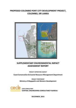
This document provides a supplementary environmental impact assessment report for the proposed Colombo Port City development project in Sri Lanka. The 269-hectare reclamation project aims to develop a new financial hub as part of the Western Region Megapolis plan. Extensive studies were conducted to characterize the existing physical, ecological and socioeconomic environment that could be affected. The assessment addresses bathymetry, coastal processes, water quality, biodiversity including corals and fisheries, and ambient air quality. It also provides details of the proposed reclamation design and land use plan as well as measures to manage potential environmental impacts.
5.
CECB ‐ SEIA Report – Proposed Colombo Port City Development Project‐ December 2015 Page i
TABLE OF CONTENTS
Chapter 1: Introduction
1.1 Background of the Project 01
1.1.1 The Western Region Megapolis Regional Structure Plan of 2004 01
1.1.2 The Colombo Port City Project: The Administrative Process 02
1.1.3 Key Terms of the Project Agreement 03
1.1.4 The EIA Process for Reclamation 04
1.1.5 Sand Extraction & Basis for Commencement of Reclamation Works 05
1.1.6 Other Permits secured 06
1.1.7 The Suspension of Construction and Way Forward 07
1.2 Objective and Justification of the Project 07
1.2.1 Objectives in Relation to Western Region Megapolis Structure Plan (CESMA Plan) 07
1.2.2 The Strategic Objectives of Colombo Port City 08
1.2.3 Permissible Developments within Colombo Port City 09
1.2.4 Forces that Produce Financial Centres: Some Theory 09
1.3 Objective of the SEIA Report 10
1.3.1 The 2‐Stage EIA Process 10
1.3.2 Precedence of 2‐stage EIA Process 11
1.4 Extent and scope of the study 11
1.5 Methodologies and technologies adopted in SEIA report preparation 12
1.5.1
Desk Studies
12
1.5.2 Feasibility Design Investigations and their relevance to the EIA Process 12
1.5.3
Wave and Hydrodynamics
12
1.5.4 Geophysical Investigations 13
1.5.5
Bathymetry Survey
13
1.5.6
Ecological Studies
13
1.5.7 Assessment of Socio‐economic Environment 17
1.6 Main beneficiaries 18
1.6.1 Importance of Western Region Development 18
1.6.2 Key Economic Benefits from Colombo Port City 18
1.7 Applicable laws and regulations 19
1.7.1 Sri Lanka Lands Ordinance and UDA Act No 41 of 1978 19
1.7.2 National Environmental Act No. 47 as amended by Act No. 56 of 1988 (NEA) 19
1.7.3 Coast Conservation Act No. 57 of 1981 20
6.
CECB ‐ SEIA Report – Proposed Colombo Port City Development Project‐ December 2015 Page ii
1.7.4 Mines and Mineral Act No.33 of 1992 (MMA) 20
1.7.5 Marine Pollution Prevention Act No. 59 of 1981 20
1.7.6 The Antiquities Ordinance No. 9 of 1940 21
1.7.7 Civil Aviation Authority Act No 14 of 2010 21
1.8 Conformity to Coastal Resources Management Plan and any other development/
conservation plans of the area
22
1.8.1 The Coastal Zone Management Plan (CZMP) 22
1.8.2 The Master Plan for Coastal Erosion Management 22
1.9 Approvals needed from relevant agencies and any conditions laid down by such
agencies for reclamation, sand and rock extraction
22
1.9.1 Geological Survey and Mines Bureau 22
1.9.2 Urban Development Authority 22
1.9.3 Department of Coast Conservation & Coastal Resources Management 22
1.9.4 Colombo Municipal Council 23
1.9.5 Marine Environmental Protection Authority (MEPA) 23
1.9.6 Department of Fisheries 23
1.9.7 Board of Investment of Sri Lanka 23
1.9.8 Strategic Development Act 23
1.9.9 Land Commission’s Department 23
1.9.10 Department of Archaeology 23
1.9.11 Road Development Authority 24
Chapter2: Description of the Proposed Project and Reasonable Alternatives
2.1 Justification of the Proposed Project 01
2.1.1 Justification in relation to the Western Region Megapolis Regional Structure Plan 01
2.1.2 Justification for Port City in terms of Government Policy 04
2.1.3 Independent Reports on Real Estate Market Indicating Pent up demand 05
2.1.4 International Trends and Examples of Creating New Land by the Sea 05
2.2 Project Location 09
2.2.1 Reclamation Area 09
2.2.2 Extent of the site 13
2.2.3 Estimated reserves 13
2.2.4 Quantity of sand to be extracted 13
2.2.5 Water depth to the sand deposit 13
2.2.6 Proposed mining depth from the surface of the deposit 13
2.2.7 Mining history of the site and its environs 15
7.
CECB ‐ SEIA Report – Proposed Colombo Port City Development Project‐ December 2015 Page iii
2.3 Project Details 17
2.3.1 Design of reclamation scheme and detail and functioning of marine works 18
2.3.2 Details of reception facilities 38
2.3.3 Supply of quarry material for construction 38
2.3.4 Dredging and extraction of sand, for reclamation of 269 Ha. for the proposed port
city project
60
2.3.5 General Description of Future Development Activities on reclaimed land including
time frames
71
2.3.5.1 Proposed Development Activities Under CESMA Plan 71
2.3.5.2 Architectural concept plan together with the layout/master plan for Colombo Port
City
71
2.3.5.3 Land Use Plan and Gross Floor Area 73
2.3.5.4 Urban Design 76
2.3.5.5 Infrastructure & Utilities – Responsibilities Under the Project Agreement 80
2.3.5.6 Roads – Responsibilities Under the Project Agreement 80
2.3.5.7 Colombo Port City – an integrated eco‐cycle approach to infrastructure design 80
2.3.5.8 Power Source and Requirement (Subject to Completion of Phase 2 EIA) 81
2.3.5.9 Sewerage and Wastewater Source & Requirement (Subject to Completion of Phase
2 EIA)
82
2.3.5.10 Water Supply (Subject to Completion of Phase 2 EIA) 83
2.3.5.11 Solid Waste Collection & Disposal (Subject to Completion of Phase 2 EIA) 84
2.3.5.12 IT & Communications Infrastructure (Subject to Completion of Phase 2 EIA) 85
2.3.5.13 Transportation & Traffic Strategy within Port City (Subject to Completion of Phase 2
EIA)
85
2.3.5.14 External Road Transportation & Traffic Connecting Port City 86
2.3.5.15 Maintenance 89
2.4 Evaluation of alternatives 90
2.4.1 Project location and possible alternatives 90
2.4.2 Approach to the overall conceptual design 91
2.4.3 Site specific layout 95
2.4.4 Scale of reclamation 105
2.5 Work Force: Availability of work force during construction & Employment of Sri
Lankans
105
2.6 Future expansion of project 105
2.6.1 Phased implementation schedule 105
2.7 Financial Commitments 107
8.
CECB ‐ SEIA Report – Proposed Colombo Port City Development Project‐ December 2015 Page iv
Chapter 3: Description of the Existing Environment
3.1 Physical Environment 01
3.1.1 Bathymetry of the reclamation area 01
3.1.2 Bathymetry of the Sand mining area and 1 km beyond the sand mining sites 03
3.1.3 Details of hydraulic circulation and description and assessment of prevailing current
fields including current characteristics such as velocity, speeds and directions and
tides.
05
3.1.3.1 Tide 06
3.1.3.2 Current 07
3.1.3.4 Description and assessment of prevailing wave conditions including wave heights
and directions.
10
3.1.5 Description and assessment of coastal morphology and the dominant coastal
processes
12
3.1.6 Coastal features including beach profile 13
3.1.7 Coastal erosion and /or accretion trends 16
3.1.8 Water quality of project area 21
3.1.8.1 Reclamation Area 21
3.1.8.2 Sand Dredging Area 25
3.1.9 Description of existing natural and manmade drainage outfalls discharging into
project area
29
3.1.9.1 Beira Lake Outfall 29
3.1.9.2 Other drains 37
3.1.9.3 Details of Drainage Outlets 40
3.2 Biological Environment 43
3.2.1 Description and assessment of present distribution, biodiversity and health of coral
reefs.
43
3.2.2 Health of the reefs 50
3.2.3 Description and assessment of the present distribution and living state of sea grass
beds.
54
3.2.4 Description and assessment of the present distribution, species composition and
richness of sea bottom macro‐zoo‐benthos.
55
3.2.5 Description and assessment of the present occurrence of endangered species or
extra ordinary natural resources3.2.7 Description of biodiversity profile within the
sand borrow sites
61
3.2.6 Description of the present conditions concerning nutrient dynamic, algae blooms
and water turbidity.
64
3.2.7 Description of breading grounds / spawning grounds and migratory routs for commercial
and ecologically important marine organisms
74
3.2.8 Description of biodiversity profile within the sand borrow sites 78
9.
CECB ‐ SEIA Report – Proposed Colombo Port City Development Project‐ December 2015 Page v
3.2.9 Identification and mapping of fishing grounds 79
3.3 Ambient Air Quality of the Reclamation Area 81
3.3.1 Ambient Air Quality Standards 81
3.3.2 Air Quality Measurements 81
3.4 Socio‐Cultural Conditions 83
3.4.1 Description and assessment of resources in the project area 83
3.4.2 Description and assessment of the present fishery and aquaculture resources
in the study area
83
3.4.2.1 Number of fishers (Fishing Population) 83
3.4.2.2 Number and types of fishing crafts operated and their sizes 85
3.4.2.3 Number and type of fishing gears used 88
3.4.2.4 Number of Beach seine 88
3.4.2.5 Seasons of fishing operations 88
3.4.2.6 Species diversity and quantity of fish captured 89
3.4.2.7 Income level of the fishers 91
3.4.2.8 No. of dependents 91
3.4.2.9 Seasonal migration/Movement 92
3.4.3 Description and assessment of the fishery 92
3.5 Archaeological and cultural aspects 93
Chapter4: Assessment of anticipated Environmental Impacts
4.1 Physical / Chemical conditions 01
4.1.1 Hydraulic circulation 01
4.1.2 Wave conditions 06
4.1.3 Coastal Morphology 18
4.1.3.1 Erosion of adjacent shore line due to change of current, wave height regimes
attributed to the coastal structures with reclamation area
23
4.1.3.2
Erosion effects in either sides of the coastal stretch before and after construction as
well as in long term.
25
4.1.3.2 Changes in sediment transport pattern on both periods (Short terms and long
terms)
30
4.1.4 Suspended sediments 31
4.1.4.1 Dredging Process 35
4.1.4.2 Dumping Process 39
4.1.5 Water quality 56
4.1.5.1 Beira Lake 56
10.
CECB ‐ SEIA Report – Proposed Colombo Port City Development Project‐ December 2015 Page vi
4.1.5.2 Dredging and Reclamation 64
4.1.6 Drainage 66
4.1.7 Colombo South Port 67
4.1.7.1 Impacts of Port City on the Port Structures 67
4.1.7.2 Impacts of Port City on the Wave at Navigation Channel 68
4.1.7.3 Impacts of Port City on the Morphology near the Port 70
4.2 Biological ‐ Ecological Conditions 71
4.2.1 Coral Reefs 71
4.2.2 Sea grass beds 73
4.2.3 Soft bottom macro‐zoo‐benthos 73
4.2.4 Endangered species 74
4.2.5 Impact of fishing grounds / breading grounds / spawning grounds 75
4.3 Socio‐cultural impacts 78
4.3.1 Aesthetic and recreational value 78
4.3.1.1 Aerial Views of Colombo Port City in Relation to Important Landmarks 78
4.3.1.2 General Principles of Massing Aesthetics 80
4.3.1.3 Height of Port City Breakwater and its Visual Impact 80
4.3.1.4 The Open Space Concept of Port City 81
4.3.1.5 The Canal 83
4.3.1.6 Aesthetics of landfill 84
4.3.2 Fishery and Aquaculture 84
4.3.2.1 Areas of fishing grounds and aquaculture directly impacted by the project during
dredging and reclamation and their importance to the local and regional socio
economy
84
4.3.2.2 Areas of fishing ground and aquaculture indirectly impacted by the project during
construction due to increased noise levels in the water columns or through the release of
suspended sediments, increased level of pollutants or changed current patterns.
84
4.3.2.3 Value of fishery and aquaculture impacted by the project 84
4.3.2.4 Employment in fishery and aquaculture impacted by the project. 85
4.3.2.5 Impacts on food‐fish and ornamental fish catches (quantity and diversity), fishing
seasons, economic gains to fisher communities
85
4.3.2.6 Proposed socio economic benefits program due to disturbances of fishing activities
(if any)
85
4.3.3 Employment 86
4.3.3.1 Description and assessment of the effects of the project on the employment
opportunities.
86
4.3.3.2 Socio ‐cultural and socio economic benefits (other than employments) to the local
people
87
11.
CECB ‐ SEIA Report – Proposed Colombo Port City Development Project‐ December 2015 Page vii
4.3.4 Transportation of quarry material 87
4.3.5 Demand for quarry material 88
4.3.6 Handling and stockpiling of material 89
4.3.7 Cultural and archaeological issues 89
4.3.8 Noise and vibration 89
4.3.9 Navigation 92
4.3.9.1 Safety requirement during construction 94
4.3.9.2 Safety requirement s post construction 95
4.3.9.3 Post construction modifications to shipping lanes and anchorage areas 96
4.3.9.4 Safety requirements for submerged cables and pipelines during construction 96
Chapter 5: Proposed Mitigation Measures
5.1 Introduction to Mitigatory Measures 01
5.2 Mitigatory Measures Adopted in the Design Phase (Mitigation by Design) 01
5.3 Mitigation Measures ‐ Physical Resources 02
5.3.1 Dredging Site
5.3.1.1 Dredging of Sand and Transportation 02
5.3.2 Reclamation Site 03
5.3.2.1 Mitigation on the Coastal Environment 03
5.3.2.2 Mitigation for Transport by Sea of Dredged Sand in the Dredger 03
5.4 Mitigation Measures: Biological and Socio – Cultural Resources including Fisheries
5.4.1 Mitigation of Impacts on Biological & Socio‐Cultural Resources at Dredging Sites 04
5.4.1.1 Impacts for the Sensitive Habitats 04
5.4.1.2 Impacts of Breading grounds/Spawning grounds 04
5.4.1.3 Impacts to the soft bottom macrozoobenthos & endangered species 04
5.4.1.4 Suspended sediment effects on sessile, slow‐moving invertebrates & fish 05
5.4.1.5 Suspended sediment (turbidity) effect on phytoplankton &other aquatic plants 05
5.4.1.6 Impact for water quality 06
5.4.1.7 Mitigation of Impacts on fisheries 06
5.4.1.8 Mitigation through access to SLLRDC borrow area 07
5.4.1.9 Methodology for assessing proposed income support & benefits programme for
potential income loss by fisherman
07
5.4.2 Reclamation Site 08
5.4.2.1 Mitigation of Accidents during Transport of Sand for Reclamation 08
5.4.2.2 Mitigation of Impacts on Road Surface due to Transportation of Material (Quarry
Material, Armour Rock etc.,) for Protection Works
08
12.
CECB ‐ SEIA Report – Proposed Colombo Port City Development Project‐ December 2015 Page viii
5.4.2.3 Mitigatory Measures for Impacts due to Handling and Stockpiling of Quarry
Materials
11
5.4.2.4 Noise and vibration control measures 12
5.5 Mitigation Measures ‐ Biological ‐ Ecological Resources 13
5.5.1 Reclamation Area: 13
5.5.1.1 Proposed sewage and waste water treatment systems, solid waste disposal
methods.
13
5.5.1.2 Mitigation of the Impacts on Beira Lake 14
5.5.1.3 Possible mitigation measures to minimize blockage of storm water outlets 16
5.6 Risk Management and Disaster Mitigation 20
5.6.1 Marine Pollution and Oil Spillage arising from accidents 21
5.6.2 Collisions of vessels 22
5.6.3 Sea level related hazards 22
5.7 Mechanism for implementation of the Mitigatory Measures 22
Chapter 6: Extended Cost Benefit Analysis
6.1 Introduction 01
6.2 Identification of Potential Impacts 01
6.3 Multiplier effects and Long term Outcomes 02
6.4 Extended Cost‐Benefit Analysis (CBA) 03
6.4.1 Extended Cost‐Benefit Analysis for the reclamation stage 04
6.4.1.1 Benefit Streams 04
6.4.2.1 Cost Streams 07
6.4.2 Extended Cost‐Benefit Analysis for the CPC 07
6.4.2.1 Economic benefits 08
6.4.2.2 Economic costs 08
6.4.2.3 Others 08
6.5 Overall Assessment 09
6.6 Summary of CBA 11
6.7 Sensitivity Analysis ‐ NPV 12
6.7.1 Reclamation and 20 years of Business Operations 13
Chapters 7: Environmental management plan
7.1 Purpose of an Environmental Management Plan 01
7.2 Implementation of Mitigatory Measures 01
7.3 Implementation of Monitoring Procedures 01
16.
CECB ‐ SEIA Report – Proposed Colombo Port City Development Project‐ December 2015 Page xii
ABBREVIATIONS
ADB Asian Development Bank
AG Attorney General
ANZECC Australian and New Zealand Environment and Conservation Council
ARs Artificial Reefs
BOI Board of Investment
BRT Bus Rapid Transit
CA Concession Agreement
CBA Cost Benefit Analysis
CBD Central Business District
CBOs Community Based Organizations
CCA Coast Conservation Act
CCCC China Communications Construction Company
CC&CRMD Coast Conservation and Coastal Resources Management Department
CCD Coast Conservation Department
CEA Central Environmental Authority
CEB Ceylon Electricity Board
CHEC China Harbour Engineering Company
CMA Colombo Metropolitan Area
CMC Colombo Municipal Council
CMP Compliance Monitoring Plan
CMR Colombo Metropolitan Region
CPC Colombo Port City
CPCDP Colombo Port City Development Project
CPEP Colombo Port Expansion Project
CPTU Peizocone Test
CPUE Catch per Unit Effort
CRMP Coastal Resources Management Plan
CSD Cutter Suction Dredger
CSH Colombo South Harbour
CZMP Coastal Zone Management Plan
DFAR Department of Fisheries and Aquatic Resources
EIA Environmental Impact Assessment
EMC Environmental Monitoring Committee
EMP Environmental Management Plan
EMoP Environmental Monitoring Programme
ETA Estimated time of Arrival
FADs Fish Aggregating Devices
FDI Foreign Direct Investment
FEM Finite Element Method
GCWMP Greater Colombo Wastewater Management Project
GFA Gross Floor Area
GFG Galle Face Green
GIS Galerkin Interface Stabilization
17.
CECB ‐ SEIA Report – Proposed Colombo Port City Development Project‐ December 2015 Page xiii
GND Grama Niladhari Division
GOH Grand Orient Hotel
GPS Global Positioning System
GSMB Geological Survey and Mines Bureau
GSMB‐TS GSMB Technical Services
GoSL Government of Sri Lanka
ICT Information Telecommunication Technology
IEE Initial Environmental Examination
IMO International Maritime Organization
JCT Jaye Container Terminals
JICA Japan international Corporation Agency
JLL Jones Lang Lasalle
LWOST Low Water Ordinary Spring Tide
MEPA Marine Environmental Protection Authority
MoM &WD Ministry of MegaPolis and Western Development
MMA Mines and Mineral Act
MEPA Marine Pollution Prevention Act
MoU Memorandum of Understanding
MSL Mean Sea Level
MTB Mechanized Traditional Boasts
NARA National Aquatic Resources, Research and Development Agency
NBRO National Building Research Organization
NBSB Non‐Mechanized Beach Seine Boat
NBT Nation Building Tax
NFD Negambo Fisheries District
NEA National Environmental Act
NTRB Non‐Mechanized Traditional Boasts
NWSDB National Water Supply and Drainage Board
OBM Outboard Motor
ODA Official Development Assistance
OFRP Outboard Motor Fiber Reinforced Plastic Boats
PAA Project Approving Agency
PRDA Provincial Road Development Authority
RDA Road Development Authority
SCARC Standing Cabinet Appointed Review Committee
SEIA Supplementary Environmental Impact Assessment
SLLRDC Sri Lanka Land Reclamation and Development Corporation
SLPA Sri Lanka Ports Authority
SLT Sri Lanka Telecom
Sp. Non‐identified species of a genus
Spp. Non‐identified species of the same genus
SPT Standard Penetrations test
STPM Suction Tube Position Monitoring
TEC Technical Evaluation Committee
TIA Transport Impact Assessment
19. CECB ‐ SEIA Report – Proposed Colombo Port City Development Project‐ December 2015 ES ‐ Page 1
EXECUTIVE SUMMARY
SUPPLEMENTARY ENVIRONMENTAL IMPACT ASSESSMENT STUDY: COLOMBO PORT CITY
DEVELOPMENT PROJECT
Introduction
This Supplementary Environmental Impact Assessment (SEIA) study is carried out for the
expansion of the reclamation area of the Colombo Port City project from an area of 200 ha, which
was approved by the Project Approving Agency, the Department of Coast Conservation and
Coastal Resources Management, subsequent to an Environmental Impact Assessment (EIA) study
that was subject to public comments via a notice placed in newspapers on 11th
June 2011, to an
altered design comprising an area of 269 ha, together with the impacts of extraction of sand from
the identified borrow areas and quarry material required for the entire landfill and protective
works. The above‐mentioned EIA for 200ha did not cover environmental impacts of sand
extraction as a separate and inconclusive Initial Environmental Impact Assessment (IEE) process
was adopted by the Sri Lanka Ports Authority in this respect, and this lacuna is being addressed via
this SEIA study.
Notwithstanding the EIA of 2011 for 200 ha being approved after the public review process, this
SEIA study covers the entire reclamation footprint and the extraction of quarry material and sand
required for the entire project.
The Project Proponent to this SEIA, the Ministry of Megapolis & Western Development, appointed
the Central Engineering Consultancy Bureau (CECB) as Lead Consultant to execute this SEIA study.
This SEIA is guided by the following important principles:
(a) Terms of Reference for the SEIA issued by the Department of Coast Conservation and Coastal
Resources Management (CCD) to the Ministry of Urban Development, Water Supply &
Drainage on 30th
August 2015 titled: “Terms of Reference For the Supplementary
Environmental Impact Assessment Report of the Reclamation, Dredging, Construction of
Protection Structures such as Breakwaters and Revetments and Extraction of Sand and
Quarry Material required for reclamation and protection works for proposed Colombo Port
City Development Project”
(b) The Terms of the Agreement entered into between the Ministry of Ports and Shipping, acting
on behalf of the Government of Sri Lanka (GOSL), and CHEC Port City Colombo (Pvt) Ltd (the
Project Company), signed on 16th
September 2014 and extended on 17th
September 2015
(hereafter referred to as the “GOSL Agreement”) and the Concession Agreement attached to
the said GOSL Agreement as a binding annexure (hereafter referred to as the “Project
Agreement”), stipulates inter alia that the Sri Lanka Ports Authority (SLPA)/GOSL is
responsible for securing the required environmental permits and approvals.
(c) The Decision of the Cabinet of Ministers on 17th
June 2015 that authorized the UDA to step
into the role of SLPA and, pending the required legal formalities being finalized, the Ministry
of Urban Development, Water Supply and Drainage would to take responsibility for
implementing matters connected to this SEIA as the Project Proponent. With the UDA being
assigned under the Ministry of Megapolis & Western Development, this Ministry has now
taken over such responsibilities.
(d) In terms of the Project Agreement, the Colombo Port City will be developed in two distinct
phases, with required environmental approvals obtained in two phases as well as follows:
20. CECB ‐ SEIA Report – Proposed Colombo Port City Development Project‐ December 2015 ES ‐ Page 2
Phase 1 EIA: For Reclamation, sand extraction and construction of coastal structures to
protect the landfill and landscaping aesthetics for the proposed Colombo Port City. This
SEIA is a continuation of work connected to Phase 1 and being carried out as a
supplementary to the approved EIA for 200 ha. Reclamation works will re‐commence
upon this SEIA receiving required approvals.
Phase 2 EIA: Construction of the buildings and infrastructure of the Port City. This EIA
study will be based on the concept master plan and infrastructure requirements
submitted to the UDA (and described in this SEIA in Chapter 2). The construction of
permanent structures/built environment on the landfill will take place only upon
receiving necessary approvals for the Phase 2 EIA study.
Origins of Colombo Port City
Expansion of the Colombo Central Business District (CBD) by reclaiming the sea was originally
proposed under the Government‐initiated Western Region Megapolis Regional Structure Plan
dated July 2004, prepared by the Singapore based urban planning consultants, CESMA
International Pte. Ltd. According to the “Colombo Core Area Plan” of the Plan (referred to as the
CESMA Plan), the Colombo CBD was to be expanded to release lands for real estate development
by:
(a) Reclaiming 145 ha of land from the sea to the South of the proposed Colombo South Port
breakwater by 2010 (i.e. the current location of Colombo Port City)
(b) Relocating port related activities at the existing Jaye Container Terminals (JCT) to the
Colombo South Port, releasing around 76 ha of land for real estate development
(c) Creating 221 ha (145ha+ 76ha) of new waterfront lands adjacent to the Colombo Port,
which includes a marketable land extent of 139.5 ha, to meet the real estate needs of
Colombo CBD up to 2030
In comparison, the Colombo Port City project proposes to create a total land area of 269 ha
including a marketable land area of 173 ha. Therefore, the marketable land envisaged under Port
City is 24% higher than the 139.5 ha land extent envisaged under the CESMA Plan, within the
same geographic area. Moreover, the CESMA Plan envisaged the South Port reclamation and JCT
area developments to commence in 2010 and meet the city’s land requirements for 20 years till
2030. The Colombo Port City development plan is intended to span a 25‐year period ending in
2040. Accordingly, under both plans, the average land extent to be released for development
works out to around 7 ha per annum.
An important aspect that should be noted when comparing the CESMA Plan and the Colombo
Port City Project is that, under the latter, the entirety of the proposed new land area is to be
created by reclamation without any interference with and/or relocation of existing infrastructure,
whereas under the CESMA Plan part of the new land was to be created by relocation of existing
facilities at the Jaye Container Terminals
Therefore, creating a landfill for real estate development adjacent to the Port of Colombo under
the Colombo Port City Project is not a new concept. It is an initiative that falls within the broad
parameters of the master plans developed by CESMA approximately 11 years ago, which are
currently being updated.
If a large‐scale reclamation project was to be undertaken with minimum impact to the coast to
capitalize on the advantage of the site being an area where sand would naturally accumulate, the
only location technically and financially feasible is within the shadow of the southern arm of the
breakwater of the newly built Colombo South Port Project. The new South Port breakwater,
21. CECB ‐ SEIA Report – Proposed Colombo Port City Development Project‐ December 2015 ES ‐ Page 3
funded by the ADB, was the most challenging Coastal/Port Engineering project undertaken in Sri
Lanka. Apart from the breakwater extending 1.5 km perpendicular to the beach, thus acting as a
protective barrier to Port City, dredging for the South Port involved an area of about 820 ha and
the reclaimed area covered about 340 ha. This SEIA report will demonstrate that Colombo Port
City developments covered under this SEIA has far less environmental impacts than the Colombo
South Port.
Colombo Port City – A Collaboration between the Project Company and Government of Sri
Lanka
The CPC project was initially conceived as a public sector/Government funded project to be
undertaken by The Sri Lanka Port Authority (SLPA). Consequently, the SLPA commissioned at its
own cost an “Initial Technical Feasibility Study” in April 2010 for the reclamation of land South of
the new breakwater. Around June 2010, an EIA study was commissioned by SLPA also at its own
cost through the University of Moratuwa (UoM) for a reclamation area of 200 ha. In October
2010, the UDA completed a master plan study based on the above mentioned Initial Technical
Feasibility Study and submitted a Project Proposal to the SLPA for consideration.
In April 2011, based on an unsolicited concept proposal submitted by China Communications &
Construction Company (CCCC), the parent of the Project Company, the Government of Sri Lanka
(GOSL) decided to not to commit public funds to construct the Port City Project and proceeded to
negotiate with CCCC to implement the project entirely as a foreign direct investment, with no
financial guarantees by the Government on the investment.
After a 2 ½ year period of negotiation with a Standing Cabinet Appointed Review Committee
(SCARC) and a TEC represented by 16 Government organizations, on 16th
September 2014 an
Agreement (referred to hereafter as the “Project Agreement”) was entered into between the
Project Company and the Secretary to the Ministry of Highways, Ports and Shipping (acting for
and on behalf of the GOSL). The Agreement was signed and the project’s construction works
ceremonially inaugurated on the same day in the presence of the President of the Peoples’
Republic of China and the President of the Democratic Socialist Republic of Sri Lanka, during the
Chinese President’s State visit to Sri Lanka.
During the period leading to the signing of the Project Agreement and in terms of the Agreement
itself, the responsibility for carrying out the required environmental studies and obtaining the
required permits and consents in relation to the reclamation and sand extraction has been the
responsibility of the SLPA, and, in terms of Clause 3 of the above‐mentioned GOSL Agreement and
the Project Agreement annexed thereto, all rights, obligations and liabilities of the SLPA are
deemed as rights, obligations and liabilities of the GOSL.
The Project Agreement states that of the total marketable land area at Port City (i.e. land to be
sold or leased under applicable laws in Sri Lanka to third party investors for development after
allowing for public parks, roads and beaches) shall be no less than 170 ha. Of this, no less than 62
ha will be allocated to the GOSL/SLPA (to be replaced by UDA) and no less than 108 ha will be
allocated to the Project Company. It should be noted that the allocation of marketable land
between the Project Company and GOSL would be carried out on an equitable basis where the
Project Company will first select a marketable land extent of less than 10 ha and then the
Government will select a similar extent. This process of alternative selections will be repeated
until such time one of the Parties has reached the maximum amount of marketable land to be
allocated to that Party. Therefore, the marketable lands allocated between the Government and
Project Company will be in non‐contiguous blocks. Note that the public areas such as roads, parks,
beaches will be under the GOSL/UDA/CMC
22. CECB ‐ SEIA Report – Proposed Colombo Port City Development Project‐ December 2015 ES ‐ Page 4
In consideration of receiving its share of the commercially developable land (63 ha with a current
market value of Rs 225 billion), the SLPA/GOSL would be responsible for ensuring the supply of
utilities (water, power, sewerage) to the boundary of the reclamation site at a suitable connection
point and with sufficient capacity as and when needed and improve the transport infrastructure
leading to the site. This is a common arrangement in priority investment projects where the
developer meets the cost of all common infrastructures within the site and the Government
agencies concerned provide infrastructure connections to the periphery (e.g. industrial parks,
housing projects have been implemented in Sri Lanka on this basis)
Objective of the SEIA Report – The two‐Stage EIA Process
Several important issues were raised in the Initial Technical Feasibility Study of 2010 and the EIA
study of 2011 for the 200 ha reclamation. They were:
(a) The proposed Port City has to be developed in two stages. The first stage will be the landfill,
the offshore breakwater and the coast protection for the protection of the landfill. The
Second Stage will be the planned development of Port City with all infrastructure and support
services
(b) If there is a modification to the overall design, then environmental consultants would be
commissioned to present an addendum to the EIA to confirm that the changes and resultant
environmental impacts will not make a significant change to the findings of the initial EIA
completed for 200ha. If changes to the design are significant then a fresh EIA will be carried
out.
(c) A detailed EIA will have to be carried out for the infrastructure development plan of the Port
City and the proposed developments on the reclaimed land.
The objective of this Supplementary EIA is a consequence of (b) above: that is, to capture the
design changes since the completion of the EIA of 2011 and to subject to public scrutiny the aspects
covered in the Addendum to the EIA of 2013 and subsequent changes. It is noted that the
Addendum to the EIA of 2011 was not open to public comments in 2013.
Varying approaches can be undertaken for environmental studies. It is the prerogative of the
Government policy makers led by the Project Approving Agency (PAA) to decide on the scope of the
environmental studies. Accordingly, the respective Government appointed review committees
evaluating the Port City project recommended to the Cabinet of Ministers to adhere to a 2 stage
EIA process for Port City, and accordingly provision was made for such a course of action in the
Project Agreement signed between the GOSL and the Project Company. Therefore, as mentioned
earlier, Colombo Port City will be developed in two distinct phases, with required environmental
approvals obtained via two related EIA studies.
This SEIA is therefore to be read as a Supplementary to the approved EIA of 2011. The Phase 2 EIA
for the construction of the buildings and infrastructure of the Port City, including traffic impact
assessment will commence in parallel or immediately after completing this SEIA study.
Environmental Approvals leading to the current SEIA
The Department of Coast Conservation & Coastal Resources Management (CCD), as the Project
Approving Agency (PAA), made the EIA report of April 2011 for 200ha available for public
comments as required under Section 16 Sub section 2(b) of the Coast Conservation Act No 57 of
1981. In this respect, the CCD placed advertisements in major newspapers on 21st
June 2011 in all
23. CECB ‐ SEIA Report – Proposed Colombo Port City Development Project‐ December 2015 ES ‐ Page 5
three languages informing the availability of the report for review at 11 locations including the
CEA, UDA, CMC, GSMB etc. Public comments received were responded to as necessary.
In view of the investment proposal submitted by CCCC, in 2012 proposing a reclamation area of
233 ha, an Addendum report to the 2010 EIA was prepared by UoM and submitted via the SLPA to
the CCD in September 2013. The main objective of the Addendum report to the EIA was to inform
the PAA of a “deviation which has taken place to expand the project from 200 ha to 233 ha…”.
This was accepted and on 23rd
October 2014, the CCD issued a “Permit for a Development Activity
under Part III – Section 14 of the Coast Conservation & Coastal Resource Management Act No 57
of 1981, for reclamation, dredging and construction of breakwaters, revetments”. This permit
contained 42 conditions of which condition No 40 states ”A Separate approval should be obtained
from the CEA for extracting sand from the offshore to be reclaimed the proposed near shore area
and submitted to this department prior to the commencement of the construction.”
In parallel to the above process, the SLPA commissioned NARA to carry out two IEE studies for 2
sand borrow areas for which the GSMB issued exploration licenses to SLPA for purposes of
securing sand for the reclamation works to be carried out under the Port City Project. The CEA as
the PAA for this study provided the Terms of Reference for the IEE. Obtaining the required
consents for the fishermen’s compensation program was a pre‐requisite for the CEA to grant the
necessary permits to dredge sand. Despite almost a year of attempting to obtain the required
consents, the SLPA encountered several roadblocks in fulfilling this task. In the circumstances, the
SLPA could not obtain the required sand extraction permits from the CEA for the identified
borrow areas as stipulated in the development permit of the CCD and in terms of the Project
Agreement, which assigned this responsibility to the GOSL/SLPA.
The Project Company commenced sand extraction and reclamation works on 16th
September
2014 consequent to the GOSL’s wish to inaugurate the project at the time of the State visit by the
President of China and in terms of Clause 4.1 of the Project Agreement, which states that “on and
from the date of this Agreement, the Project Company shall design and carry out the reclamation
works in accordance with the Concession Agreement”. In addition, the Project Company was
granted written permission by the SLPA to dredge the Colombo Harbour navigation channel
pending (as understood by the Project Company) the finalization of the two IEE studies by NARA
for identified sand borrow areas.
Under the above circumstances, where in terms of Article 12.1 of the Project Agreement the
obligation to obtain the necessary/applicable licenses and permits is a responsibility of the
SLPA/GOSL, the Project Company has taken the position that sand extraction and reclamation
works commenced on 16th
September 2014 on the basis of provisions contained in the Agreement
itself and on the basis of written clearances provided by the SLPA.
Subsequently, the new Government elected on 8th
January 2015 appointed an Evaluation
Committee to review the Port City project on 30th
January 2015. On the basis of certain
conclusions reached by this Committee (without any consultation with the Project Company), on
4th
March 2015, the Cabinet of Ministers made a decision to suspend the construction works of
the Port City Project. This decision was communicated to the Project Company by the Secretary
Ministry of Ports, Shipping & Aviation on 6th
March 2015.
The said suspension is operative to date. During the period of suspension, the Government has
made the following decisions, in consultation with the Project Company where necessary:
24. CECB ‐ SEIA Report – Proposed Colombo Port City Development Project‐ December 2015 ES ‐ Page 6
(a) The GOSL Agreement of 16th
September 2014 would be amended to inter alia permit the
UDA to step into the role of the SLPA and the end date of the said GOSL Agreement would
be extended by 6 months to inter alia facilitate the said transition
(b) The necessary amendments to the Project Agreement shall be effected via a tri‐partite
agreement between the GOSL represented by the Ministry in charge of the UDA (the
Ministry of Megapolis and Western Development), the UDA and the Project Company.
(c) A Supplementary Environmental Impact Assessment (SEIA) shall be carried out for
expansion of the reclamation area from 200 ha to an altered design of 269 ha together
with the impacts of extraction of sand from the identified borrow areas and quarry
material required for the altered design.
This SEIA is a consequence of the aforesaid decisions taken by the Government.
Objective and Justification of the Project
The location of Port City takes advantage of twin attractions of proximity to the Colombo CBD and
oceanfront living in a carefully master‐planned area. This is a tried and tested formula by city
centres that aspire to position themselves as destinations for tourism, living, working, shopping
and entertainment. Also, the Colombo CBD has limited oceanfront lands available for
development, especially in view of the land area facing Galle Face, formerly occupied by the
Defence forces, now being allocated to Shangri‐La and ITC Hotels.
Presently, Colombo is not a “Destination”, but primarily a transit point for tourists. The average
stay by tourists is roughly 1.6 nights for Colombo, which is too low by international norms. (In
comparison, average stay at a beach location of a typical tourist to Sri Lanka is around 5.5 nights).
The lack of vibrancy of Colombo in terms of shopping and entertainment is a significant deterrent
to attracting South and East Asian tourists to Sri Lanka. Sri Lanka’s tourist arrivals being impacted
by cyclicality (with higher arrivals being recorded during the traditional winter season) can be
largely attributed to Colombo not being a sought after tourist destination.
Investment Details & Strategic Objectives of Colombo Port City
The objectives of Colombo Port City as formulated by the Project Company are as follows:
To foster integrated oceanfront living within the CBD to provide high quality of life through
world‐class office, residential and recreational spaces that will attract tourists,
professionals, entrepreneurs, managers and retirees.
Position Colombo as the most liveable city in South Asia
To create a regional business hub, a city with a distinct brand with high quality public
spaces and infrastructure facilities, attractive to local and international developers and
investors
To create a tourism hub with a unique character that reflects the distinctive local culture
and the existing urban fabric
To design and build a sustainable urban city space that adapts to local climate, creates a
comfortable micro‐climate and make efficient use of energy resources
Colombo cannot become a destination that appeals to the international business travellers or
tourists with ad‐hoc and fragmented developments and without distinct positioning. Therefore,
Colombo Port City provides an opportunity for the old and historic part of Colombo’s central
business district to seamlessly interface with a modern planned metropolis like no other in South
Asia.
25. CECB ‐ SEIA Report – Proposed Colombo Port City Development Project‐ December 2015 ES ‐ Page 7
The investor in Port City, CCCC, is a Fortune 500 (No 187) and public listed company in Hong Kong
and among the world’s largest construction and real estate companies with assets of over $100
billion. It is also the world’s largest dredging company having undertaken iconic land reclamation
projects in China and the main dredging contractor for the world’s 2 largest reclamation projects –
the new airport projects at Hong Kong and Macau. The total foreign direct investment in the
reclamation stage of the Port City envisaged at around $1400 million. CCCC has plans to
undertake further investments in a real estate project in Port City upon the completion of the
phase 1 investment in reclamation and the phase 2 EIA.
The Project Company has also hired world‐renowned international consultants working together
with local specialists to advise on various aspects connected to the development: For e.g: Atkins
of UK: Master plan review; Aecom of USA: Utility design, road design and landscaping; Sweco of
Sweden: Overall master planning; Jones Lang LaSalle (JLL) and CB Richard Ellis (CBRE) of UK:
financial and marketing pre‐feasibility and CDR International of The Netherlands: technical review
of designs of the contractor.
The investment required for the breakwater and other protective structures (both submerged and
above‐water) of the Port City Project is around $225 million. Therefore, in order to recover the
cost of the breakwater and the allocation of 63 ha of marketable land together with 96 ha of
common area land to the Government (a total of 159 ha or 59% out of 269 ha), the Port City
project, if made smaller, would not be financially viable to the investor. Stated another way, the
Project Company will retain only 41% of the reclaimed land extent for marketing to developers
(110 ha of non‐contiguous land).
It is noted that Port City will have around 45 ha of public parks (9 times the size of Galle Face
Green) anchored by a 22 ha Central Park and a well‐protected beach and so called lagoon (water
area between breakwater and beach) suitable for swimming and water recreational activities –
currently not available to residents in Colombo CBD. The reclaimed land area is also a function of
the length of the Colombo South Port breakwater and takes advantage of the full length of the
shadow of the breakwater.
Future Developments
Permissible developments within the 269 reclaimed land area will be In keeping with Sri Lanka’s
planning and building regulations. Developments proposed under the concept master plan for
Port City submitted to the UDA for preliminary planning clearance include commercial
establishments, residential, health and educational institutes, small businesses and services, arts
and entertainment, community developments, marina and convention facilities. No industrial
activities will be allowed within Port City.
Colombo Port City will be implemented over a 25‐year period. There is no future addition or
expansion envisaged beyond the 269 ha area after the reclamation works covered under this SEIA
study is completed.
The Hon. Attorney General has opined that the UDA cannot be a signatory to the Project
Agreement replacing the SLPA as it lacks the legal capacity under the UDA Act. Upon creation of
new land by reclamation of the sea, the entire Port City land will be gazetted under the Sri Lanka
Lands Ordinance, a subject matter falling under the purview of His Excellency the President in
terms of the said Ordinance. The UDA could therefore declare the land reclaimed by the Port City
Project as an “Urban Development Area” only after the reclamation process is over and a
declaration is made under the Lands Ordinance.
26. CECB ‐ SEIA Report – Proposed Colombo Port City Development Project‐ December 2015 ES ‐ Page 8
Accordingly, the sovereign rights of the Government of Sri Lanka including the right of eminent
domain, is applicable within the reclaimed land.
Outline of Studies Carried Out
A comprehensive review of the modelling work and preliminary designs carried out for the
Feasibility Study of Port City were undertaken during the preparation of this SEIA. This includes
separate comprehensive 2D and 3D physical model test studies and numerical modelling studies,
which includes interpretation of coastal evolution and siltation due to proposed development,
sediment transport modelling considering dredging and reclaiming and interpretation of
contaminant concentration at the Beira Lake outfall with the proposed mitigation measures.
In addition, ground investigations have been carried out over a period of more than two years to
better understand the technical requirements that would need to be taken into account in the
implementation of the project. In summary, the following engineering studies have been carried
out and reports compiled during the feasibility and environmental study phase of this project
using the services of local and international experts/organizations:
Wave climate modelling – LHI Coast & Water (LHI)
Hydrodynamic modelling (LHI)
Wave disturbance modelling (LHI)
Sediment transport modelling (LHI)
Sediment dispersal modelling (LHI)
Shore profile survey (LHI)
2‐D Stability physical model Test on Offshore Breakwater and Revetment for Marina –
Tianjin Research Institute of Water Transport Engineering (TRIWTE)
3‐D Physical Model study Test ‐ South Part and North Part – Nanjing Hydraulic Research
Institute (NHRI)
Analysis (numerical modelling) of Coastal Evolution and Siltation – TRIWTE
Numerical modelling of Water Exchange – TRIWTE and LHI
Ground Investigations – Forth Harbour Design Institute
Water quality sampling and analysis (NARA)
Assessment of inland quarry material availability, permits, transportation routes, impacts
etc. (GSMB Technical Services)
Model and ecological studies at reclamation area (University of Moratuwa)
Impacts on Beria Lake outfall and storm water drain outlets impacts due to the proposed
development, including 3D numerical model (CDR International, Netherlands)
Other important study reports this SEIA builds on include:
Colombo Port Efficiency & Expansion Project, Environmental Impact Assessment of 2005
carried out by Scott Wilson.
EIA Study for Proposed Colombo Port City (2011) and Addendum thereto (2013) by the
University of Moratuwa,
Summary of Important Findings on Coastal Erosion
The South Port Project breakwater extends 2km in length perpendicular to the coast. This can
potentially create erosion north of Colombo. However, monitoring over the last 4 years or so has
confirmed erosion has not taken place. This is mainly because of sediment supply from Kelani
27. CECB ‐ SEIA Report – Proposed Colombo Port City Development Project‐ December 2015 ES ‐ Page 9
River, discharged north of the Colombo Port. The construction of Colombo South Port had
increased the wave shadow, extending it northwards. As a consequence wave conditions in this
area had become calmer, and the shoreline between the Colombo South Port and the Kelani River
have remained stable after construction of the Colombo South Port
The Kelani River is believed to contribute some 100,000 to 200,000 m3/year to the sediment
budget of the area. Historically this is believed to have been much higher, perhaps 400,000
m3
/year, but has declined due to sand mining and development upstream. As a consequence
there has been ongoing erosion of the coast to the north of the Kelani. Therefore, since Port City
is in the shadow of the Colombo South Port breakwater, it has no impact on coastal erosion north
of Colombo Port.
The coastal stretch south of Colombo is stable with very little seasonal changes. The net longshore
sediment transport along the west coast of Sri Lanka is predominantly directed towards the north
as a result of the wave climate (South‐West monsoon sea waves and swell). Transport rates have
been dominated by swell waves, with sea waves contributing little net transport. Most of the net
transport occurs during the southwest monsoon season. However during the NE monsoon the
sediment transport (as a result of waves from North West) is usually directed towards south for a
limited period. Therefore, Port City has no impact on erosion South of the Colombo Port
Moreover, when consider the shoreline change with this sediment transport rate for last 10 years,
there is no significant accretion or erosion in the coastal stretch north or south of Colombo Port.
The changes of shoreline of selected locations over the last 10 years corroborate this fact.
When dredging is taking place for sand, material must be taken away from the active dynamic
zone, where waves do not have an influence on the seabed. In the case of Port City, dredging
areas have been identified on this basis. It must be emphasised however that the change of wave
climate due to natural reasons may lead to movement of sand which can take place anywhere
around the island. Accordingly, studies carried out and extensively described in this SEIA report
and annexes clearly establish that Port City will not cause coastal erosion.
Four years of monitoring of the Colombo South Port Project has illustrated that the turbidity
represented by total suspended sediment near the Kelani River outfall has been always greater
than the mobile points around the dredging and reclamation sites (3 mobile station). This means
that the natural environment has a greater impact on the ecosystem than arising from dredging
and reclamation. Sediment laden plume of the Kelani River can have an impact on ecosystem. It is
noted that the sediment‐laden plume from the Kelani River covers the South Port region during
heavy monsoon rainy weather.
Material Required to Construct Port City
To complete the Port City Project, a total of 2.83 mn cu m of quarry material and 65 mn cu m of
dredged sea sand will be required. All the quarries identified for the supply of quarry material are
either IML‐A or IML‐B grade quarries. Hence, such licensed quarries are bound to comply with the
environmental regulations during the operations. Port City will obtain quarry material only from
independent IML‐A licensed quarry suppliers who will individually obtain required local authority,
environmental and transport permits.
Sand is to be extracted from 2 areas designated by GSMB with exploration licenses EL/177 dated
21st
June 2011 (Site 1) and Exploration License No: EL/281 dated 8th
November 2013 (Site 2)
28. CECB ‐ SEIA Report – Proposed Colombo Port City Development Project‐ December 2015 ES ‐ Page 10
issued to the SLPA. Under this SEIA, environmental impacts have been ascertained for these sites,
which comprise a combined area of 100 sq. km (46 sq. km for Site 1 and 54 for Site 2) and a
dredge‐able/available sand quantity estimated at 112 mn cu. m (44 mn cu m for Site 1 and 68 mn
cu m for Site 2) or almost double the sand requirement for completion of Port City.
Supply of Quarry Material
A total of 11 different quarry sites with required approvals, located in Kaduwela, Hanwella,
Padukka, Delgoda and Divulapitiya area, have been surveyed for obtaining quarry material for
construction of necessary structures to protect the reclamation. According to GSMB Technical
Services estimates, the required quantity of Port City works out to around 43% of the quarry
material available at these sites. Furthermore, the 11 quarry sites represent around 7‐9% of the
total registered quarries in the Colombo and Gampaha districts. Consequently, the impact of this
project on the national quarry material requirement would be negligible and therefore no price
impact to the construction industry according to the GSMB Technical Services. It was revealed
during the GSMB study that most of the IML‐A category quarries are not operating due to lack of
demand.
Around 300 six wheeler trucks and 38 ten wheelers are to be used for transportation from the
quarry sites to the project site. Transportation shall be done through two sessions, avoiding peak
hours, and via six different routes to minimize traffic congestion.
The trucks shall be covered to avoid any spilling of transported material or release of dust to the
environment. Dust generation during the transportation via unpaved internal roads shall be
controlled by sprinkling water along the roads at regular intervals. Sprinkling water to wash
quarry materials loaded in trucks before unloading them at the stockpiling site shall minimize dust
generation during the unloading. The movements of the wet returning trucks may cause Spitting
mud along the road surfaces outside the project site. Washing the tires of the trucks, before they
are moving out of the project site shall control this impact.
There is facility for parking for about 75 trucks around the port gate without disturbing moving
vehicles along the road. As the gate will open at 7am, trucks will enter the stockpiling site through
the road inside the port, which also mitigates road congestion.
During the 6‐month period of construction of Port City from September 16th
2014 to March 6th
2015, prior to entering into supply arrangements with quarry owners, the Project Company’s
contractor ensured that the supplier had a valid Mining License and quantity supplied was within
allowable limits. Moreover, each quarry site was subject to inspection. The same practice will
continue upon the recommencement of construction of the Port City Project.
Dredging Methodology
NARA, who was commissioned by the Project Proponent to carry out the marine ecological
studies and socio economic impacts, and LHI, who carried out studies on shoreline/coastal
impacts, have recommended guidelines for dredging that are designed to minimize impacts on
the coastal area, ecology and income from fisheries. The important applicable guidelines for sand
extraction stipulated in this SEIA based on recommendations by NARA and LHI are as follows:
1. Use modern dredging methods. It is stated in the SEIA report that 4 modern Trailing
Suction Hopper Dredgers will be used in the dredging.
2. Dredging to occur 3km beyond the shoreline and at water depths of 15m or more. The
29. CECB ‐ SEIA Report – Proposed Colombo Port City Development Project‐ December 2015 ES ‐ Page 11
dredging at 15 m depths will ensure that there will be no impact on coastal erosion based
on nearshore activity and the 3km distances will minimize impacts on fishing routes and
fishing activities. Moreover the 3 km minimum distance will ensure no impact on “ma dal”
fishing.
3. Obtain no greater than 30% of total sand requirement (30% of 65 mn cu m) from SLPA
Site 1 and the rest from Site 2. This is due to Site 1 having sensitive fish spawning areas
4. Dredging depth to be limited to 2m from the surface of sediment on Site 1 and from site 2
dredging may occur at greater depths provided 0.5 m of sediment is preserved after
extraction
5. As much as possible, dredging has to be avoided in areas having fish spawning and unique
habitat.
6. Dredging to commence from Site 2 initially
7. Allow fishermen to engage in fishing within the allocated dredging sites by giving proper
notice in advance and after dredging work is done to re‐commence fishing. (This will be in
accordance with COLREG regulations issued by the International Maritime Organization)
8. Implement an income support and benefits program to fishermen (outlined in detail in
Chapter 5 of this SEIA report and summarized below)
Independent of this SEIA, as a mitigation measure, the Project Proponent, Ministry of Megapolis &
Western Area Development, has directed the SLLRDC to enter into an arrangement with the
Project Company to supply sand from the adjacent 100 sq km borrow area assigned to SLLRDC for
which environmental approvals have already obtained from the CEA for dredging sand in limited
quantities to meet the requirements of the construction industry. This borrow area is estimated
to have a dredge‐able sand quantity of 264 mn cu m, though subject to exploration studies being
carried out. It has been recommended as a mitigation measure in this SEIA that once SLLRDC
obtains required environmental clearances to dredge its site, dredging activities in Site 1 would be
reduced even further from levels mentioned above or curtailed altogether. On 19th
November
2015, SLLRDC has secured concurrence from the CEA to dredge 4 mn cu m of sand based on the
approved EIA of November 2007. SLLRDC intends to make this quantity available for purposes of
Port City reclamation, pending carrying out further exploration to secure clearances from the CEA
for extraction of up to 70 mn cu m for use by Port City and SLLRDC’s own use in the future.
Assuming the sand available in the SLLRDC borrow pit is added as planned, the sand requirement
for Port City is only 17% of the dredge‐able sand available within the 3 designated borrow areas.
Considering an average dredging depth of 2 meters, the area to be dredged will be around 30‐40
sq. km out of a total area of around 100 sq km allocated for SLPA sites 1 and 2 (or around 30‐40%
of area). Assuming that the borrow area allocated to SLLRDC is added, thereby increasing the
dredging area to 200 sq kms, the dredging area will reduce to only 15‐25% of the total allocated
area. Accordingly, the mitigation measures suggested during sand extraction such as avoiding
fishing grounds and routes are feasible.
Summary of Environmental Impacts & Mitigation
To a substantial extent, environmental considerations have been incorporated into the planning of
the layout and the feasibility design process from its inception. This has allowed the early
identification of any environmental issues, which may impose constrains on the design. This
approach of “Mitigation by Design” has reduced the need for a range of specific mitigation
measures. The key findings from this SEIA study, potential impacts and solutions to mitigate these
impacts are summarized below:
30. CECB ‐ SEIA Report – Proposed Colombo Port City Development Project‐ December 2015 ES ‐ Page 12
1. There will be no reduction in fishing grounds in the reclamation area since this is not an
ideal habitat for fish breeding due to already silted conditions.
2. There will be some beneficial effects of using granite boulders and concrete elements for
protection works, as these will serve as suitable habitats for fauna and flora. Further,
these will provide shelter for benthic animals that inhabit reefs such as lobsters and some
fish. In addition these boulders will serve as habitats for coral organisms as observed in
the newly constructed breakwaters of the Hambantota port. Therefore, the populations of
such animal may increase.
3. Dredging will occur at or beyond the minimum stipulated depth of 15m to a maximum of
30m. Such dredging depth is greater than the depth of closure and therefore no impact on
the shoreline/coastal erosion.
4. A comparison was made of the workability of a Cutter Suction Dredger (CSD) and a Trailing
Suction Hopper Dredger (TSHD) working offshore during the monsoon and inter‐monsoon
periods. Based on the environmental and production considerations, TSHD was
considered to be the most environmentally friendly equipment for the reclamation. The
proposed methodology of the use of TSHDs limits the impact of turbidity.
5. As and when necessary, silt curtain will be installed to prevent silt migration. The silt
curtain will be formed by polyester‐ fibre textile sheets to be hanged from buoys and be
weighted down by steel chains. An opening will be provided to allow for navigation of
TSHDs and other construction vessels in and out of the reclamation site.
6. Sand dredging is expected to cause some temporary impacts by removing benthic fauna
and increasing turbidity as a result of an increase in suspended particles in the water
column. The proposed dredging area experiences turbidity conditions and existing
organisms are likely adapted to high turbidity levels. However, the above‐mentioned
restriction of the dredge depth is expected to mitigate impacts.
7. The dominant fish resources in the area are pelagic, transient species that are likely to
avoid unsuitable environmental conditions and return once normal conditions are
established in the long term. The area selected for dredging has previously been dredged
and as such is not a completely undisturbed habitat. As such it presents the best possible
option compared to alternate sites that may be in a less disturbed state.
8. Several modelling studies were carried out to represent Southwest monsoon, Northeast
monsoon and non‐monsoon periods. During this period, the number of simulations
performed was 21, which covers a period of 252 days. That is, each simulation was over 12
days representing 50 dredging cycles, carried out 21 times (21 days x 12days = 252 days).
Under this modeling frequency, all possible environmental conditions (monsoonal effects,
tidal effects, wind/wave pattern), dredging process & different stages of dredging,
relevant dredge sediment data were taken into consideration. A significant change of
sediment transport pattern has not been observed in the vicinity of the Port City
development. Clear sediment transport patterns are present in the surf zone and shallow
areas. Areas where the depth exceeds 16–18m do not show the existence of any
sediment transport, especially under sea wave conditions. It was observed from the
results that the concentration of suspended sediments level is less than 1.5x10⁶ g/m3
(1.5 mg/l) for almost all cases. Although spreading is occurring up to certain extent,
concentration of the suspended sediment is less than 2 mg/l, which is insignificant.
Therefore, dispersion of fine sediment due to dredging operations should not have any
impact on the surrounding environment.
9. The satellite remote sensing images of the project area obtained in 2002 and 2013 were
digitally enhanced and compared. Although there have been minor fluctuations of the
shoreline, there has not been any significant change of the shoreline during these 11
years, even after construction of the Colombo South Port. The construction of the
Colombo South Port does not seem to have any significant impact on the evolution of the
31. CECB ‐ SEIA Report – Proposed Colombo Port City Development Project‐ December 2015 ES ‐ Page 13
shoreline, which had remained stable. It should be noted that the development of the
Port City could, from the perspective of hydrodynamics, be considered as an extension of
Colombo South Port. As such, the development of the Port City is not expected to cause
any significant change of the shoreline
10. A numerical model was built specifically for assessing the impact of Port City on the
discharge from the Beira Lake outfall. This assumed the elimination of current sewerage
discharge into the Lake will not be finalized by the Government prior to completion of
reclamation work of Port City. The final engineering design adpoted at the Beira lake
outfall will not block the outlet but will streamline the continuity of the discharge and
bring water further to the sea, improving dispersion and preventing any obstruction to the
Beira outlet. The apporach proposed in this SEIA has the additional advantage as it allows
for the formation of a beach close to Galle Face Green without obstructing the outlet.
11. Existing storm water drain outlets around the site have been identified and solutions have
been proposed to avoid any negative impacts for these drains.
12. Siltation intensity within the Port City is studied using the numerical model, considering
both the Southwest Monsoon and the Northeast Monsoon. It is concluded that the
average computed siltation intensity within the lagoon of the Port City will be around 30
mm per year, and normal maintenance dredging should be sufficient at the operation
stage
13. The Colombo South Port is an enclosed water area connected to open water by the
navigation channel. Since there will not be any change to the siltation intensity at the
navigation channel, it is not anticipated that there will be any change in siltation intensity
within the Harbour.
14. The mouth of the Kelani River is located about 4.5 km north of the Colombo South Port,
and it is within the computation domain of the numerical model carried out for this study.
From the change in the siltation intensity computed from the model, the construction of
Port City will not have any impact on the siltation rate at the Kelani River mouth.
15. The construction of Port City on the southern side of the Colombo South Port will not
cause any changes the hydrodynamics and sediment transport of the Colombo Harbour,
the Kelani river outfall and the northern coastal area. The impact is considered as low.
16. Since the Port City is to be constructed on the southern side and in the shadow of the
main east‐west breakwater of the Colombo South Port, it will in no way affect coastal
erosion north of the Harbour. The coastline north of the Port City is already shielded by
the breakwater of the Colombo South Port, which has prevented any transportation of
sediment between the south and the north. As such, the construction of the Port City will
not change the pattern of littoral drift at the shoreline to the north.
17. The coastal stretch south of Colombo is stable with very little seasonal changes. The net
longshore sediment transport along the west coast of Sri Lanka is predominantly directed
towards the north as a result of the wave climate (SW monsoon sea waves and swell). The
comparison of the seabed profile between 2008 and 2012 indicates that the seabed close
to the shoreline is stable over the four‐year period. According to the results of the survey,
there is no obvious deposition close to the shore after the construction of the Colombo
South Port. It indicates that the influence of the breakwater on longshore sediment
transportation is not very obvious. Therefore, the reclamation work and the construction
of the breakwater of Port City are likely to result in similar insignificant bathymetric
change to the South of Colombo Port and the impact is negligible compared to the already
constructed the South Port.
18. Measurements of suspended sediments of the study area shows the TSS range of 2‐
25mg/l for different locations and different periods. Although spreading is occurring up to
certain extent, concentration of the suspended sediment is less than 2mg/l which is
almost equal to ambient concentration. Therefore dispersion of fine sediment due to
32. CECB ‐ SEIA Report – Proposed Colombo Port City Development Project‐ December 2015 ES ‐ Page 14
dredging operations doesn’t show any impact to the surrounding environment
19. The navigation channel of the Colombo South Port is located to the north‐west of the
port. Since navigation of vessels mainly depend on the wave conditions and bed level
changes of the surrounding area, hydrodynamic and sediment transport modelling carried
out in navigation channel showed no significant current increase or impact on the siltation
intensity and therefore no significant impact on vessel navigation.
20. The reclaimed land has no impact on regulation and control of matters related to civil
aviation and aviation in general, in terms of the Civil Aviation Authority Act No. 14 of 2010
The Port City Project is a collaborative venture between the GOSL/Ministry of Megapolis and the
Project Company and both parties would work together to ensure required social and
environmental obligations would be met. The latter is also important in considering that Port City
will be positioned as an eco‐friendly environment for living and recreation.
It is intended that the Project Company and the GOSL/Ministry of Megapolis & Western
Development/UDA will enter into an understanding on mitigation measures and resource
requirements for implementing such measures. This takes into account that certain commitments
for mitigation are the responsibility of the GOSL (such as the income support and benefits
program for the fishing community).
With regard to improvements in social infrastructure in the vicinity of the project, the Project
Company has already committed to this aspect by providing over 45 ha (around 1/6th
of the total
reclaimed area) for parks and other recreational spaces within Port City for use by the general
public. The Project Company is committed to maintain the project site and undertake necessary
mitigation measures in keeping with the approved EIA, this SEIA and the Ministry of Megapolis
will adhere to and ensure the conditions in the development permit to be issued by the CCD to
the Ministry upon approval of this SEIA will be adhered by the Ministry/UDA/SLPA and the Project
Company.
Income Support & Benefits Programme for fishermen
This SEIA concludes that sand dredging is expected cause local and temporary impacts on the
biological environment due to the removal of benthic fauna and increasing turbidity as a result of
an increase in suspended particles in water columns. Hence it is proposed that the income
support and benefits programme will be worked out in detail by the relevant Ministries and
organizations / departments involved, with the inputs of community based organizations (CBOs)
such as the fishermen’s societies, churches, etc. As mentioned in this SEIA study, under the
Project Agreement entered into between the GOSL and the Project Company, formulation of such
a programme and the disbursement of funds is the responsibility of the GOSL and not the Project
Company.
Accordingly, it is proposed that a sum of Rs. 500 million be allocated to the Ministry of Fisheries
and Aquatic Resources Development via the Ministry of Megapolis and Western Development to
meet the requirements of the proposed fisher community income support and benefits program,
with supplementary funds allocated as needed, based on the evaluation of the effectiveness and
actual impact of dredging on fishery and aquaculture after a one year period. The Rs 500 million
will be deposited in a designated account in instalments for funds to be disbursed no less than on
a monthly basis. The Department of Fisheries and Aquatic Resources will finalize the overall
budgets and guidelines for the income support and community benefits program prior to
commencement of dredging and inform the fisher community and civic society at large.
35.
CECB ‐ SEIA Report – Proposed Colombo Port City Development Project‐ December 2015 Chapter 1 ‐ Page 1
CHAPTER 1
INTRODUCTION
1.1 Background of the Project
1.1.1The Western Region Megapolis Regional Structure Plan of 2004
Expansion of the Colombo Central Business District (CBD) by reclaiming the sea was originally proposed
under the Western Region Megapolis Regional Structure Plan of July 2004, designated for
implementation by the Western Region Megapolis Task Force and the Board of Investment of Sri Lanka
(BOI). The Principal Technical Consultant to the Western Region Megapolis Master Planning Project was
CESMA International of Singapore, currently known as Surbana Jurong Pte Ltd (Surbana), appointed by
the Government of Sri Lanka in 2003. Surbana is a Singapore Government‐linked firm of urban planning
consultants established around 50 years ago for master planning the urban landscape of Singapore. To
date Surbana has completed urban planning studies in over 50 countries.
According to the Regional Structure Plan of 2004 (hereafter referred to as the CESMA Plan), the
expansion of the Colombo CBD had several components:
(a) To create new land banks for development and revitalization of the water‐edges to form the
water front city image
(b) To relocate existing Jaye Container Terminals (JCT) within the proposed Colombo South Harbour
and release land for waterfront real estate developments to reinforce the new CBD fabric.
(c) Figure 1.1: Proposed Port Expansion
Jaye Container Terminal
Source: Regio nal Structure Plan of the Western Region Megapolis (2004) Volume 1, page 61
North Port
36.
CECB ‐ SEIA Report – Proposed Colombo Port City Development Project‐ December 2015 Chapter 1 ‐ Page 2
(d) Subsequent to the construction of the ADB‐funded new Colombo South Harbour breakwater
(now completed), reclaim from the sea around 145 ha of land as an extension of the CBD by 2010.
This is the same location as the current Colombo Port City as shown in Figure 1.1
(e) Reclamation for the North Port by 2030 for port expansion and to provide lands for port related
facilities
Accordingly, the reclamation of land bordering the Colombo South Harbour breakwater was envisaged
11 years ago under the Western Region Megapolis Regional Structure Plan.
The implementation of the CESMA Plan was abandoned in 2005 primarily due to a change of
Government and the conflict situation that prevailed in the country. The Plan will however be reviewed
and updated in 2015‐16, again with technical assistance from Surbana, assisting the newly created
Ministry of Megapolis and Western Development.
1.1.2 The Colombo Port City Project: The Administrative Process
It is only with the advent of peace in Sri Lanka in 2009 and the commencement of construction of the
ADB funded Colombo South Port with its 5.4 km long breakwater that reclamation of land south of the
breakwater became technically and financially feasible.
The administrative process followed by the former Government in conceiving and developing what is
now known as Colombo Port City (CPC) is summarized below. (Section 1.1.4 summarizes the
environmental approval process)
(a) The CPC project was initially conceived as a public sector/Government funded project to be
undertaken by The Sri Lanka Port Authority (SLPA).
(b) Consequently, the SLPA commissioned at its own cost an “Initial Technical Feasibility Study” in
April 2010 for the reclamation of land South of the new breakwater retaining the services of
coastal engineers (local and foreign) and urban planners.
(c) Concurrently, around June 2010, an Environment Impact Assessment (EIA) study was
commissioned by SLPA at its own cost for a reclamation area of 200 ha. The University of
Moratuwa (UoM) was appointed as lead consultant and the Coast Conservation & Coastal
Resources Management Department (CCD) functioned as the Project Approving Agency (PAA)
(d) In October 2010, the UDA prepared a concept master plan for the area to be reclaimed and
submitted a Project Proposal to the SLPA for consideration.
(e) On 29th
April 2011, China Communications & Construction Company (CCCC) submitted an initial
concept proposal for Colombo Port City to SLPA for an envisaged reclamation area of 200 ha, with
the entire financial investment for the project committed by CCCC as a Foreign Direct Investment
(FDI), without any Government guarantees on the investment.
(f) With the Government deciding to not to commit public funds to construct the Port City Project, a
Standing Cabinet Appointed Review Committee (SCARC) was appointed to review the above
concept proposal submitted by CCCC.
(g) In August 2011, SCARC, which comprised Secretaries of several Ministries, agreed to proceed with
the project as an unsolicited proposal and recommended that the Secretary, Ministry of Ports,
Highways & Shipping sign a non‐committal MOU between the SLPA and CCCC and to obtain a
detailed proposal from the investor. SCARC also recommended appointing a Technical Evaluation
Committee (TEC) comprising members from SLPA, CCD, Urban Development Authority (UDA),
Board of Investment (BOI), and Central Bank.
(h) Further to a recommendation by SCARC, the MoU between SLPA and CCCC was signed in
November 2011.