SlideShare a Scribd company logo
1 of 10
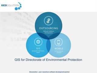
GIS for Directorate of Environmental Protection


          Geosolution - your nearshore software development partner
Who is Geosolution


• We are an innovative software
  house


• Our roots: GIS


• We listen and we know how to
  turn it into results


                   Geosolution - your nearshore software development partner
Background


• In December 2012 Geosolution completed the
  GIS project for Regional Inspectorate of
  Environment

• Based on our experience:
   – Polish Geological Institute
   – Institute of Geodesy and Cartography
   – Wolow District
   – and the others …

• Based on open source and Java technology:
   – Open layers
   – Geoserver
   – GWT, J2EE
                  Geosolution - your nearshore software development partner
What is the geoportal for?


                                        Public geoportal presenting data
                                        specifically for scientists and
                                        entrepreneur


                                                                          Administration panel
                                                                          allowing to manage user
                                                                          roles and access to the
                                                                          data


Android
based app
to collect
data in the
field


              Geosolution - your nearshore software development partner
Mobile application


• Dedicated to Android tablet
• Allows to:
   – Make a picture of a situation
   – Add description
   – Edit a geometry
• Collected data will be send to
  the central server and approved
  by administrator


                   Geosolution - your nearshore software development partner
Public geoportal


• Distinction for 2 types of
  users: local entrepreneurs
  and environmental
  scientists
• Communication system
• Advanced information
  about clicked point
• Raport (KML/GML/SHP),
  Projection choice
• Advanced visualisation
  (Ortho, Scanned maps,
  etc)
• INSPIRE – integration with
  external services (WMS)

  Geosolution - your nearshore software development partner
Administration


• One of the major feature of
  the system was the
  FLEXIBILITY
• Extended administration
  was the important factor.
  Access to the following can
  be modified:
   – Data
   – Legend
   – Functions

• Data sent from Android
  devices must be verified and
  approved before import

                  Geosolution - your nearshore software development partner
Architecture


• Based on well known open                          Dedicated apps
  source technology components                        (services)
• The source code can be easily
  extended and customized as                            J2EE App
  white label solution                                   Server


                                                                              SOA Ready
• The architecture as the set of
  web services is ready to                              Geoserver
  implement in SOA environment
• The system is according to the
  INSPIRE directive – opened
  for standards and extensions
                                                    Oracle database


                  Geosolution - your nearshore software development partner
How we do that?


• We manage based on
  scrum methodology
• Requirements must
  be well defined
• Code should be
  simple and
  understandable
• Continuous
  integration is (one of)
  the key to the success


                   Geosolution - your nearshore software development partner
Michał Kukułka
                                                            Geosolution sp. z o.o.

                                                            Warsaw (Racławicka 36/56)
                                                            Katowice (Grabowa 2)

                                                            info@geosolution.pl


     Let’s discuss your case!


Geosolution - your nearshore software development partner

More Related Content

Similar to GIS implementation for RDOS

GWT 2014: Emergency Conference - 02 le soluzioni geospaziali per la gestione ...
GWT 2014: Emergency Conference - 02 le soluzioni geospaziali per la gestione ...GWT 2014: Emergency Conference - 02 le soluzioni geospaziali per la gestione ...
GWT 2014: Emergency Conference - 02 le soluzioni geospaziali per la gestione ...Planetek Italia Srl
 
Presentation our world is open inspire gwf 2015
Presentation our world is open inspire gwf 2015Presentation our world is open inspire gwf 2015
Presentation our world is open inspire gwf 2015Marc Vloemans
 
Ist africa2012 solution supporting building of global earth observation syste...
Ist africa2012 solution supporting building of global earth observation syste...Ist africa2012 solution supporting building of global earth observation syste...
Ist africa2012 solution supporting building of global earth observation syste...Karel Charvat
 
OSGeo Live Lightening Overview
OSGeo Live Lightening OverviewOSGeo Live Lightening Overview
OSGeo Live Lightening OverviewJody Garnett
 
Leverage Progress Technologies for Telerik Developers
Leverage Progress Technologies for Telerik DevelopersLeverage Progress Technologies for Telerik Developers
Leverage Progress Technologies for Telerik DevelopersAbhishek Kant
 
JBoss presentation 2003 11 for matrix
JBoss presentation 2003 11 for matrixJBoss presentation 2003 11 for matrix
JBoss presentation 2003 11 for matrixrunsignup
 
GIS Standards and Interoperability
GIS Standards and InteroperabilityGIS Standards and Interoperability
GIS Standards and InteroperabilityNasr Khashoggi
 
Building Enterprise SDI with Geonode
Building Enterprise SDI with GeonodeBuilding Enterprise SDI with Geonode
Building Enterprise SDI with GeonodeRafael Soto
 
Orbit GT Mobile Mapping Solutions
Orbit GT Mobile Mapping SolutionsOrbit GT Mobile Mapping Solutions
Orbit GT Mobile Mapping SolutionsPeter Bonne
 
Gamma Soft and NuoDB Speed Up Data Consolidation And Cloud Migration
Gamma Soft and NuoDB Speed Up Data Consolidation And Cloud MigrationGamma Soft and NuoDB Speed Up Data Consolidation And Cloud Migration
Gamma Soft and NuoDB Speed Up Data Consolidation And Cloud MigrationNuoDB
 
The Business Impact of Virtualization
The Business Impact of VirtualizationThe Business Impact of Virtualization
The Business Impact of VirtualizationFlexera
 
NELotus - OpenNTF.org & XPages Mobile Controls
NELotus - OpenNTF.org & XPages Mobile ControlsNELotus - OpenNTF.org & XPages Mobile Controls
NELotus - OpenNTF.org & XPages Mobile ControlsJohn Head
 
GWT 2014: Energy Conference - 02 Le soluzioni Geospaziali per il mondo energy
GWT 2014: Energy Conference - 02 Le soluzioni Geospaziali per il mondo energyGWT 2014: Energy Conference - 02 Le soluzioni Geospaziali per il mondo energy
GWT 2014: Energy Conference - 02 Le soluzioni Geospaziali per il mondo energyPlanetek Italia Srl
 
Beyond GeoServer Basics
Beyond GeoServer BasicsBeyond GeoServer Basics
Beyond GeoServer BasicsJody Garnett
 
Microgroove (GoGrid Customer) Presentation at Cloud Connect 2012
Microgroove (GoGrid Customer) Presentation at Cloud Connect 2012Microgroove (GoGrid Customer) Presentation at Cloud Connect 2012
Microgroove (GoGrid Customer) Presentation at Cloud Connect 2012GoGrid Cloud Hosting
 
Ocular imaging Challenge
Ocular imaging ChallengeOcular imaging Challenge
Ocular imaging ChallengeChris Han
 

Similar to GIS implementation for RDOS (20)

GWT 2014: Emergency Conference - 02 le soluzioni geospaziali per la gestione ...
GWT 2014: Emergency Conference - 02 le soluzioni geospaziali per la gestione ...GWT 2014: Emergency Conference - 02 le soluzioni geospaziali per la gestione ...
GWT 2014: Emergency Conference - 02 le soluzioni geospaziali per la gestione ...
 
Presentation our world is open inspire gwf 2015
Presentation our world is open inspire gwf 2015Presentation our world is open inspire gwf 2015
Presentation our world is open inspire gwf 2015
 
Ist africa2012 solution supporting building of global earth observation syste...
Ist africa2012 solution supporting building of global earth observation syste...Ist africa2012 solution supporting building of global earth observation syste...
Ist africa2012 solution supporting building of global earth observation syste...
 
OSGeo Live Lightening Overview
OSGeo Live Lightening OverviewOSGeo Live Lightening Overview
OSGeo Live Lightening Overview
 
Leverage Progress Technologies for Telerik Developers
Leverage Progress Technologies for Telerik DevelopersLeverage Progress Technologies for Telerik Developers
Leverage Progress Technologies for Telerik Developers
 
JBoss presentation 2003 11 for matrix
JBoss presentation 2003 11 for matrixJBoss presentation 2003 11 for matrix
JBoss presentation 2003 11 for matrix
 
Private cloud in a box
Private cloud in a boxPrivate cloud in a box
Private cloud in a box
 
Geode Meetup Apachecon
Geode Meetup ApacheconGeode Meetup Apachecon
Geode Meetup Apachecon
 
Parking Lot App
Parking Lot AppParking Lot App
Parking Lot App
 
GIS Standards and Interoperability
GIS Standards and InteroperabilityGIS Standards and Interoperability
GIS Standards and Interoperability
 
Building Enterprise SDI with Geonode
Building Enterprise SDI with GeonodeBuilding Enterprise SDI with Geonode
Building Enterprise SDI with Geonode
 
Orbit GT Mobile Mapping Solutions
Orbit GT Mobile Mapping SolutionsOrbit GT Mobile Mapping Solutions
Orbit GT Mobile Mapping Solutions
 
Gamma Soft and NuoDB Speed Up Data Consolidation And Cloud Migration
Gamma Soft and NuoDB Speed Up Data Consolidation And Cloud MigrationGamma Soft and NuoDB Speed Up Data Consolidation And Cloud Migration
Gamma Soft and NuoDB Speed Up Data Consolidation And Cloud Migration
 
Ms project 2010 - Synergy
Ms project 2010 - SynergyMs project 2010 - Synergy
Ms project 2010 - Synergy
 
The Business Impact of Virtualization
The Business Impact of VirtualizationThe Business Impact of Virtualization
The Business Impact of Virtualization
 
NELotus - OpenNTF.org & XPages Mobile Controls
NELotus - OpenNTF.org & XPages Mobile ControlsNELotus - OpenNTF.org & XPages Mobile Controls
NELotus - OpenNTF.org & XPages Mobile Controls
 
GWT 2014: Energy Conference - 02 Le soluzioni Geospaziali per il mondo energy
GWT 2014: Energy Conference - 02 Le soluzioni Geospaziali per il mondo energyGWT 2014: Energy Conference - 02 Le soluzioni Geospaziali per il mondo energy
GWT 2014: Energy Conference - 02 Le soluzioni Geospaziali per il mondo energy
 
Beyond GeoServer Basics
Beyond GeoServer BasicsBeyond GeoServer Basics
Beyond GeoServer Basics
 
Microgroove (GoGrid Customer) Presentation at Cloud Connect 2012
Microgroove (GoGrid Customer) Presentation at Cloud Connect 2012Microgroove (GoGrid Customer) Presentation at Cloud Connect 2012
Microgroove (GoGrid Customer) Presentation at Cloud Connect 2012
 
Ocular imaging Challenge
Ocular imaging ChallengeOcular imaging Challenge
Ocular imaging Challenge
 

GIS implementation for RDOS

  • 1. GIS for Directorate of Environmental Protection Geosolution - your nearshore software development partner
  • 2. Who is Geosolution • We are an innovative software house • Our roots: GIS • We listen and we know how to turn it into results Geosolution - your nearshore software development partner
  • 3. Background • In December 2012 Geosolution completed the GIS project for Regional Inspectorate of Environment • Based on our experience: – Polish Geological Institute – Institute of Geodesy and Cartography – Wolow District – and the others … • Based on open source and Java technology: – Open layers – Geoserver – GWT, J2EE Geosolution - your nearshore software development partner
  • 4. What is the geoportal for? Public geoportal presenting data specifically for scientists and entrepreneur Administration panel allowing to manage user roles and access to the data Android based app to collect data in the field Geosolution - your nearshore software development partner
  • 5. Mobile application • Dedicated to Android tablet • Allows to: – Make a picture of a situation – Add description – Edit a geometry • Collected data will be send to the central server and approved by administrator Geosolution - your nearshore software development partner
  • 6. Public geoportal • Distinction for 2 types of users: local entrepreneurs and environmental scientists • Communication system • Advanced information about clicked point • Raport (KML/GML/SHP), Projection choice • Advanced visualisation (Ortho, Scanned maps, etc) • INSPIRE – integration with external services (WMS) Geosolution - your nearshore software development partner
  • 7. Administration • One of the major feature of the system was the FLEXIBILITY • Extended administration was the important factor. Access to the following can be modified: – Data – Legend – Functions • Data sent from Android devices must be verified and approved before import Geosolution - your nearshore software development partner
  • 8. Architecture • Based on well known open Dedicated apps source technology components (services) • The source code can be easily extended and customized as J2EE App white label solution Server SOA Ready • The architecture as the set of web services is ready to Geoserver implement in SOA environment • The system is according to the INSPIRE directive – opened for standards and extensions Oracle database Geosolution - your nearshore software development partner
  • 9. How we do that? • We manage based on scrum methodology • Requirements must be well defined • Code should be simple and understandable • Continuous integration is (one of) the key to the success Geosolution - your nearshore software development partner
  • 10. Michał Kukułka Geosolution sp. z o.o. Warsaw (Racławicka 36/56) Katowice (Grabowa 2) info@geosolution.pl Let’s discuss your case! Geosolution - your nearshore software development partner