SlideShare a Scribd company logo
1 of 14
Orienteering
What is Orienteering?

The exciting sport of
navigating through the
woods with map and
compass.

Control locations are marked
on your map and your goal is
to find them in the woods.
History of Orienteering
Began in the late 19th century in Sweden.
The actual term "orientering" was first used in
1886 and meant the crossing of unknown land
with the aid of a map and a compass.
Grew from military training in land navigation
into a competitive sport for military officers, then
for civilians.
The first orienteering competition open to the
public was held in Nor way in 1897.
Equipment     Control
                           Description
                              Sheet


Compass


Finger Stick       Map
General Information
You can orienteer solo, or in
small groups.

You are competing for the
fastest time.

To ensure fairness bet ween
competitors the map is not
provided until the start, and
starts are staggered with
competitors starting at
intervals.
How to Orienteer
Using your map and
compass, you search for
the controls in the woods.

They are marked by
orange and white
triangular kites.

When you find a control,
you “check-in” using your
finger stick.
Holding Your Map
If you hold the map properly, it will show you where to go.
Hold the map with your "weak" hand (left hand if you are
right-handed, right hand if you are left-handed.)
Always keep your map parallel to the ground (horizontal)
and never up in front of your face (vertical).
Always hold the map so that the features on the map are in
the same directions around you as they are on the ground.
Keep your "weak" thumb on your present position on the
map at all times. That way you always know where you
are!
Map Key
Blue = water

Yellow = open area

Green = ground vegetation

Black = rock features or man-made
objects

White = forest you can move through
easily

Brown = contour lines, which show the
shape of the land
Understanding the Map Key


 White means forest you can
 move through easily.

 It does not mean open, empty
 land!
Understanding the Map Key
 Black can be either rock or cliff, or a
 man-made feature like a trail, road or
 building.

 Use common sense: rocks aren't long
 and thin (trails are), and humans don't
 leave little dots of buildings out in the
 woods (but rocks are shown that way).

 Remember that if blue has a black line
 around it or if there is a patch of dark
 green, that means NO GO for ANYONE:
 it's just too hard.
Contour Lines
Those brown squiggly lines. They
are called contour lines, and they
are actually the most important
thing on the map.

Experienced orienteers rely greatly
on contour lines, because they
show the actual shape of the land.

To start with, learn that a closed
circle is the top of a hill, so
everything around it is downhill.
Contour Lines

Lines close together show a steep
hillside.

Lines far apart show much
flatter land.

Also, it is helpful to remember the
little tabs on the cliff symbol on
the map always point downhill.
The Course
The orienteering course
is marked in purple or
red on a map.

A triangle is used to
indicate the start and a
double circle indicates
the finish.

Circles are used to show
the control points.
Control Description Sheet
Competitors receive a "control
description sheet" or "clue
sheet" which gives a precise
description of the feature and
the location of the kite.

More Related Content

What's hot

STREET AND HIP-HOP DANCES
STREET AND HIP-HOP DANCESSTREET AND HIP-HOP DANCES
STREET AND HIP-HOP DANCES
Ppanyang_143
 
Elements Of Music
Elements Of MusicElements Of Music
Elements Of Music
jansonke
 
2nd quarter lesson1 art-7-mimaropa
2nd quarter lesson1 art-7-mimaropa2nd quarter lesson1 art-7-mimaropa
2nd quarter lesson1 art-7-mimaropa
None
 

What's hot (20)

Individual Sports
Individual SportsIndividual Sports
Individual Sports
 
Nature and background of outdoor
Nature and background of outdoorNature and background of outdoor
Nature and background of outdoor
 
Mountaineering
MountaineeringMountaineering
Mountaineering
 
MAPEH 7 (MUSIC OF MINDANAO)
MAPEH 7 (MUSIC OF MINDANAO) MAPEH 7 (MUSIC OF MINDANAO)
MAPEH 7 (MUSIC OF MINDANAO)
 
Shs core pe-and-health-cg
Shs core pe-and-health-cgShs core pe-and-health-cg
Shs core pe-and-health-cg
 
STREET AND HIP-HOP DANCES
STREET AND HIP-HOP DANCESSTREET AND HIP-HOP DANCES
STREET AND HIP-HOP DANCES
 
Traditional Games in the Philippines
Traditional Games in the PhilippinesTraditional Games in the Philippines
Traditional Games in the Philippines
 
Sports Officiating
Sports OfficiatingSports Officiating
Sports Officiating
 
Cheerdance
CheerdanceCheerdance
Cheerdance
 
H.O.P.E. 3 Grade 12
H.O.P.E. 3 Grade 12 H.O.P.E. 3 Grade 12
H.O.P.E. 3 Grade 12
 
Elements Of Music
Elements Of MusicElements Of Music
Elements Of Music
 
2nd quarter lesson1 art-7-mimaropa
2nd quarter lesson1 art-7-mimaropa2nd quarter lesson1 art-7-mimaropa
2nd quarter lesson1 art-7-mimaropa
 
PHYSICAL EDUCATION 7 1ST QUARTER Lesson 1 physical fitness
PHYSICAL EDUCATION 7 1ST QUARTER Lesson 1 physical fitnessPHYSICAL EDUCATION 7 1ST QUARTER Lesson 1 physical fitness
PHYSICAL EDUCATION 7 1ST QUARTER Lesson 1 physical fitness
 
Aquatic activities
Aquatic activitiesAquatic activities
Aquatic activities
 
Team Sports
Team SportsTeam Sports
Team Sports
 
TABLE TENNIS
TABLE TENNISTABLE TENNIS
TABLE TENNIS
 
INDIVIDUAL SPORTS.pptx
INDIVIDUAL SPORTS.pptxINDIVIDUAL SPORTS.pptx
INDIVIDUAL SPORTS.pptx
 
Basketball ppt
Basketball pptBasketball ppt
Basketball ppt
 
Physical Education 8- TEAM SPORTS (Basketball)
Physical Education 8- TEAM SPORTS (Basketball) Physical Education 8- TEAM SPORTS (Basketball)
Physical Education 8- TEAM SPORTS (Basketball)
 
First aid & bandaging
First aid & bandaging First aid & bandaging
First aid & bandaging
 

Similar to Orienteering

Land Navigation With Map And Compass
Land Navigation With Map And CompassLand Navigation With Map And Compass
Land Navigation With Map And Compass
Kevin Estela
 
Orienteering 101
Orienteering 101Orienteering 101
Orienteering 101
rsintobin
 
Other map symbols on topographic maps Occasionally you will.pdf
Other map symbols on topographic maps Occasionally you will.pdfOther map symbols on topographic maps Occasionally you will.pdf
Other map symbols on topographic maps Occasionally you will.pdf
syedabdul78662
 
Folding and reading a map
Folding and reading a mapFolding and reading a map
Folding and reading a map
volkanmidilli
 
Folding and reading a map
Folding and reading a mapFolding and reading a map
Folding and reading a map
Volkan Midilli
 

Similar to Orienteering (17)

ONTAP - Map and Compass
ONTAP - Map and CompassONTAP - Map and Compass
ONTAP - Map and Compass
 
Land Navigation With Map And Compass
Land Navigation With Map And CompassLand Navigation With Map And Compass
Land Navigation With Map And Compass
 
Navigating In The Australian Bush
Navigating In The Australian BushNavigating In The Australian Bush
Navigating In The Australian Bush
 
GEOGRAPHY IGCSE: MAP SKILLS
GEOGRAPHY IGCSE: MAP SKILLSGEOGRAPHY IGCSE: MAP SKILLS
GEOGRAPHY IGCSE: MAP SKILLS
 
Orienteering 101
Orienteering 101Orienteering 101
Orienteering 101
 
Chapter 4 maps ppt
Chapter 4 maps pptChapter 4 maps ppt
Chapter 4 maps ppt
 
Geography - Maps - Class 6
Geography - Maps - Class 6Geography - Maps - Class 6
Geography - Maps - Class 6
 
Contour lines
Contour linesContour lines
Contour lines
 
Unit 1. Our world
Unit 1. Our worldUnit 1. Our world
Unit 1. Our world
 
map-reading (1).pdf
map-reading (1).pdfmap-reading (1).pdf
map-reading (1).pdf
 
Other map symbols on topographic maps Occasionally you will.pdf
Other map symbols on topographic maps Occasionally you will.pdfOther map symbols on topographic maps Occasionally you will.pdf
Other map symbols on topographic maps Occasionally you will.pdf
 
MAPS AND GLOBES PRESENTATION FOR SCHOOL STUDENTS
MAPS AND GLOBES PRESENTATION FOR SCHOOL STUDENTSMAPS AND GLOBES PRESENTATION FOR SCHOOL STUDENTS
MAPS AND GLOBES PRESENTATION FOR SCHOOL STUDENTS
 
Folding and reading a map
Folding and reading a mapFolding and reading a map
Folding and reading a map
 
Folding and reading a map
Folding and reading a mapFolding and reading a map
Folding and reading a map
 
Aeronautical Charts
Aeronautical ChartsAeronautical Charts
Aeronautical Charts
 
Map and Grid references
Map and Grid referencesMap and Grid references
Map and Grid references
 
Social Science Skills for Years 9-11
Social Science Skills for Years 9-11Social Science Skills for Years 9-11
Social Science Skills for Years 9-11
 

More from mrsbauerart

History of Radio Dramas
History of Radio DramasHistory of Radio Dramas
History of Radio Dramas
mrsbauerart
 
History of Early Radio Technology
History of Early Radio TechnologyHistory of Early Radio Technology
History of Early Radio Technology
mrsbauerart
 
Early Italian Renaissance
Early Italian RenaissanceEarly Italian Renaissance
Early Italian Renaissance
mrsbauerart
 
Public Service Announcements
Public Service AnnouncementsPublic Service Announcements
Public Service Announcements
mrsbauerart
 
Print Public Service Announecments
Print Public Service AnnounecmentsPrint Public Service Announecments
Print Public Service Announecments
mrsbauerart
 
Radio Public Service Announcements
Radio Public Service AnnouncementsRadio Public Service Announcements
Radio Public Service Announcements
mrsbauerart
 
Linear Perspective
Linear PerspectiveLinear Perspective
Linear Perspective
mrsbauerart
 
The Photographic Essay
The Photographic EssayThe Photographic Essay
The Photographic Essay
mrsbauerart
 
Decoding Photographs
Decoding PhotographsDecoding Photographs
Decoding Photographs
mrsbauerart
 
Objective vs Subjective Analysis of Photographs
Objective vs Subjective Analysis of PhotographsObjective vs Subjective Analysis of Photographs
Objective vs Subjective Analysis of Photographs
mrsbauerart
 
Digital Photography Manual Exposure Controls
Digital Photography Manual Exposure ControlsDigital Photography Manual Exposure Controls
Digital Photography Manual Exposure Controls
mrsbauerart
 
A Beginner's Guide to Capturing Motion
A Beginner's Guide to Capturing MotionA Beginner's Guide to Capturing Motion
A Beginner's Guide to Capturing Motion
mrsbauerart
 
Depicting Time With Photography
Depicting Time With PhotographyDepicting Time With Photography
Depicting Time With Photography
mrsbauerart
 
Theories of Photographic Composition
Theories of Photographic CompositionTheories of Photographic Composition
Theories of Photographic Composition
mrsbauerart
 
Elements of Art and Principles of Design
Elements of Art and Principles of DesignElements of Art and Principles of Design
Elements of Art and Principles of Design
mrsbauerart
 
A Timeline of Television Technology
A Timeline of Television TechnologyA Timeline of Television Technology
A Timeline of Television Technology
mrsbauerart
 

More from mrsbauerart (20)

History of Radio Dramas
History of Radio DramasHistory of Radio Dramas
History of Radio Dramas
 
Propaganda
PropagandaPropaganda
Propaganda
 
History of Early Radio Technology
History of Early Radio TechnologyHistory of Early Radio Technology
History of Early Radio Technology
 
Early Italian Renaissance
Early Italian RenaissanceEarly Italian Renaissance
Early Italian Renaissance
 
Public Service Announcements
Public Service AnnouncementsPublic Service Announcements
Public Service Announcements
 
Print Public Service Announecments
Print Public Service AnnounecmentsPrint Public Service Announecments
Print Public Service Announecments
 
Radio Public Service Announcements
Radio Public Service AnnouncementsRadio Public Service Announcements
Radio Public Service Announcements
 
Linear Perspective
Linear PerspectiveLinear Perspective
Linear Perspective
 
Shape
ShapeShape
Shape
 
The Photographic Essay
The Photographic EssayThe Photographic Essay
The Photographic Essay
 
Decoding Photographs
Decoding PhotographsDecoding Photographs
Decoding Photographs
 
Objective vs Subjective Analysis of Photographs
Objective vs Subjective Analysis of PhotographsObjective vs Subjective Analysis of Photographs
Objective vs Subjective Analysis of Photographs
 
Digital Photography Manual Exposure Controls
Digital Photography Manual Exposure ControlsDigital Photography Manual Exposure Controls
Digital Photography Manual Exposure Controls
 
Texture
TextureTexture
Texture
 
A Beginner's Guide to Capturing Motion
A Beginner's Guide to Capturing MotionA Beginner's Guide to Capturing Motion
A Beginner's Guide to Capturing Motion
 
Depicting Time With Photography
Depicting Time With PhotographyDepicting Time With Photography
Depicting Time With Photography
 
Theories of Photographic Composition
Theories of Photographic CompositionTheories of Photographic Composition
Theories of Photographic Composition
 
Elements of Art and Principles of Design
Elements of Art and Principles of DesignElements of Art and Principles of Design
Elements of Art and Principles of Design
 
A Timeline of Television Technology
A Timeline of Television TechnologyA Timeline of Television Technology
A Timeline of Television Technology
 
Value
ValueValue
Value
 

Recently uploaded

Spellings Wk 3 English CAPS CARES Please Practise
Spellings Wk 3 English CAPS CARES Please PractiseSpellings Wk 3 English CAPS CARES Please Practise
Spellings Wk 3 English CAPS CARES Please Practise
AnaAcapella
 
1029 - Danh muc Sach Giao Khoa 10 . pdf
1029 -  Danh muc Sach Giao Khoa 10 . pdf1029 -  Danh muc Sach Giao Khoa 10 . pdf
1029 - Danh muc Sach Giao Khoa 10 . pdf
QucHHunhnh
 
Activity 01 - Artificial Culture (1).pdf
Activity 01 - Artificial Culture (1).pdfActivity 01 - Artificial Culture (1).pdf
Activity 01 - Artificial Culture (1).pdf
ciinovamais
 

Recently uploaded (20)

psychiatric nursing HISTORY COLLECTION .docx
psychiatric  nursing HISTORY  COLLECTION  .docxpsychiatric  nursing HISTORY  COLLECTION  .docx
psychiatric nursing HISTORY COLLECTION .docx
 
How to Create and Manage Wizard in Odoo 17
How to Create and Manage Wizard in Odoo 17How to Create and Manage Wizard in Odoo 17
How to Create and Manage Wizard in Odoo 17
 
Micro-Scholarship, What it is, How can it help me.pdf
Micro-Scholarship, What it is, How can it help me.pdfMicro-Scholarship, What it is, How can it help me.pdf
Micro-Scholarship, What it is, How can it help me.pdf
 
ICT role in 21st century education and it's challenges.
ICT role in 21st century education and it's challenges.ICT role in 21st century education and it's challenges.
ICT role in 21st century education and it's challenges.
 
Food safety_Challenges food safety laboratories_.pdf
Food safety_Challenges food safety laboratories_.pdfFood safety_Challenges food safety laboratories_.pdf
Food safety_Challenges food safety laboratories_.pdf
 
Spellings Wk 3 English CAPS CARES Please Practise
Spellings Wk 3 English CAPS CARES Please PractiseSpellings Wk 3 English CAPS CARES Please Practise
Spellings Wk 3 English CAPS CARES Please Practise
 
How to Give a Domain for a Field in Odoo 17
How to Give a Domain for a Field in Odoo 17How to Give a Domain for a Field in Odoo 17
How to Give a Domain for a Field in Odoo 17
 
SKILL OF INTRODUCING THE LESSON MICRO SKILLS.pptx
SKILL OF INTRODUCING THE LESSON MICRO SKILLS.pptxSKILL OF INTRODUCING THE LESSON MICRO SKILLS.pptx
SKILL OF INTRODUCING THE LESSON MICRO SKILLS.pptx
 
Basic Civil Engineering first year Notes- Chapter 4 Building.pptx
Basic Civil Engineering first year Notes- Chapter 4 Building.pptxBasic Civil Engineering first year Notes- Chapter 4 Building.pptx
Basic Civil Engineering first year Notes- Chapter 4 Building.pptx
 
1029 - Danh muc Sach Giao Khoa 10 . pdf
1029 -  Danh muc Sach Giao Khoa 10 . pdf1029 -  Danh muc Sach Giao Khoa 10 . pdf
1029 - Danh muc Sach Giao Khoa 10 . pdf
 
Application orientated numerical on hev.ppt
Application orientated numerical on hev.pptApplication orientated numerical on hev.ppt
Application orientated numerical on hev.ppt
 
Explore beautiful and ugly buildings. Mathematics helps us create beautiful d...
Explore beautiful and ugly buildings. Mathematics helps us create beautiful d...Explore beautiful and ugly buildings. Mathematics helps us create beautiful d...
Explore beautiful and ugly buildings. Mathematics helps us create beautiful d...
 
Activity 01 - Artificial Culture (1).pdf
Activity 01 - Artificial Culture (1).pdfActivity 01 - Artificial Culture (1).pdf
Activity 01 - Artificial Culture (1).pdf
 
microwave assisted reaction. General introduction
microwave assisted reaction. General introductionmicrowave assisted reaction. General introduction
microwave assisted reaction. General introduction
 
Accessible Digital Futures project (20/03/2024)
Accessible Digital Futures project (20/03/2024)Accessible Digital Futures project (20/03/2024)
Accessible Digital Futures project (20/03/2024)
 
Mehran University Newsletter Vol-X, Issue-I, 2024
Mehran University Newsletter Vol-X, Issue-I, 2024Mehran University Newsletter Vol-X, Issue-I, 2024
Mehran University Newsletter Vol-X, Issue-I, 2024
 
Unit-IV- Pharma. Marketing Channels.pptx
Unit-IV- Pharma. Marketing Channels.pptxUnit-IV- Pharma. Marketing Channels.pptx
Unit-IV- Pharma. Marketing Channels.pptx
 
SOC 101 Demonstration of Learning Presentation
SOC 101 Demonstration of Learning PresentationSOC 101 Demonstration of Learning Presentation
SOC 101 Demonstration of Learning Presentation
 
UGC NET Paper 1 Mathematical Reasoning & Aptitude.pdf
UGC NET Paper 1 Mathematical Reasoning & Aptitude.pdfUGC NET Paper 1 Mathematical Reasoning & Aptitude.pdf
UGC NET Paper 1 Mathematical Reasoning & Aptitude.pdf
 
PROCESS RECORDING FORMAT.docx
PROCESS      RECORDING        FORMAT.docxPROCESS      RECORDING        FORMAT.docx
PROCESS RECORDING FORMAT.docx
 

Orienteering

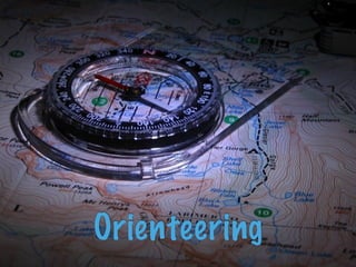
  • 2. What is Orienteering? The exciting sport of navigating through the woods with map and compass. Control locations are marked on your map and your goal is to find them in the woods.
  • 3. History of Orienteering Began in the late 19th century in Sweden. The actual term "orientering" was first used in 1886 and meant the crossing of unknown land with the aid of a map and a compass. Grew from military training in land navigation into a competitive sport for military officers, then for civilians. The first orienteering competition open to the public was held in Nor way in 1897.
  • 4. Equipment Control Description Sheet Compass Finger Stick Map
  • 5. General Information You can orienteer solo, or in small groups. You are competing for the fastest time. To ensure fairness bet ween competitors the map is not provided until the start, and starts are staggered with competitors starting at intervals.
  • 6. How to Orienteer Using your map and compass, you search for the controls in the woods. They are marked by orange and white triangular kites. When you find a control, you “check-in” using your finger stick.
  • 7. Holding Your Map If you hold the map properly, it will show you where to go. Hold the map with your "weak" hand (left hand if you are right-handed, right hand if you are left-handed.) Always keep your map parallel to the ground (horizontal) and never up in front of your face (vertical). Always hold the map so that the features on the map are in the same directions around you as they are on the ground. Keep your "weak" thumb on your present position on the map at all times. That way you always know where you are!
  • 8. Map Key Blue = water Yellow = open area Green = ground vegetation Black = rock features or man-made objects White = forest you can move through easily Brown = contour lines, which show the shape of the land
  • 9. Understanding the Map Key White means forest you can move through easily. It does not mean open, empty land!
  • 10. Understanding the Map Key Black can be either rock or cliff, or a man-made feature like a trail, road or building. Use common sense: rocks aren't long and thin (trails are), and humans don't leave little dots of buildings out in the woods (but rocks are shown that way). Remember that if blue has a black line around it or if there is a patch of dark green, that means NO GO for ANYONE: it's just too hard.
  • 11. Contour Lines Those brown squiggly lines. They are called contour lines, and they are actually the most important thing on the map. Experienced orienteers rely greatly on contour lines, because they show the actual shape of the land. To start with, learn that a closed circle is the top of a hill, so everything around it is downhill.
  • 12. Contour Lines Lines close together show a steep hillside. Lines far apart show much flatter land. Also, it is helpful to remember the little tabs on the cliff symbol on the map always point downhill.
  • 13. The Course The orienteering course is marked in purple or red on a map. A triangle is used to indicate the start and a double circle indicates the finish. Circles are used to show the control points.
  • 14. Control Description Sheet Competitors receive a "control description sheet" or "clue sheet" which gives a precise description of the feature and the location of the kite.

Editor's Notes

  1. \n
  2. \n
  3. \n
  4. \n
  5. \n
  6. \n
  7. \n
  8. \n
  9. \n
  10. \n
  11. \n
  12. \n
  13. \n
  14. \n