3lmontgomery
•Télécharger en tant que PPTX, PDF•
0 j'aime•576 vues

This document discusses various topics related to clouds and precipitation, including how adiabatic temperature changes can cause air to cool, how different types of lifting mechanisms like orographic lifting and frontal wedging can cause clouds to form, the different types of clouds like cirrus, cumulus and stratus clouds, and how precipitation occurs through both warm cloud and cold cloud processes. It also describes different forms of precipitation like rain, snow, sleet, glaze and hail.

Recommandé
Contenu connexe
Tendances
En vedette
Similaire à 3lmontgomery
Similaire à 3lmontgomery (18)
Plus de FC Meteorology
Plus de FC Meteorology (19)
Dernier
Dernier (20)
3lmontgomery
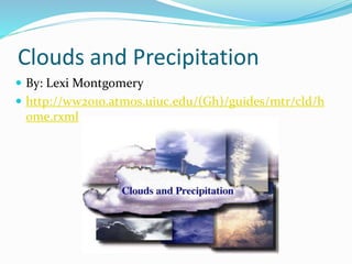
- 1. Clouds and Precipitation By: Lexi Montgomery http://ww2010.atmos.uiuc.edu/(Gh)/guides/mtr/cld/h ome.rxml
- 2. Adiabatic Temperature Changes and Expansion and Cooling Adiabatic temperature changes are temperature changes that happen even though heat isn’t added or subtracted. Wet adiabatic rate is the rate of adiabatic cooling in saturated air and it is always slower then the dry adiabatic rate. http://apollo.lsc.vsc.edu/classes/met130/notes/chapte r6/adiab_cool.html
- 3. Orographic lifting Orographic lifting of air occurs when elevated terrains, such as mountains, act as barriers to air flow, forcing the air to go otherwise. http://ag.arizona.edu/watershedsteward/resources/m odule/Climate/az-climate_pg2.htm
- 4. Frontal wedging The boundary between colliding warm and cold air is a front. The process that occurs at a front which cold, dense air acts as a barrier over warmer, less dense air is frontal wedging. http://www.harding.edu/lmurray/113_files/HTML/d2_ Earth%20Revised/sld046.htm
- 5. Convergence The lifting of air that results from air in the lower atmosphere flowing together is convergence. http://ww2010.atmos.uiuc.edu/(Gh)/guides/mtr/cld/d vlp/cnvrg.rxml
- 6. Localized Convective Lifting When unequal heating of Earth’s surface warms a pocket of air more than the surrounding air, making the air pockets density lower is called localized convective lifting. http://wps.prenhall.com/esm_lutgens_foundations_4 e/47/12104/3098876.cw/content/index.html
- 7. Stability (Density Differences & Stability and Daily Weather) When air temperature increases with height is when the most stable conditions happen. This is called temperature inversion. http://www.meted.ucar.edu/afwa/avalanche/print.ht m
- 8. Condensation When condensation occurs in the air above the ground, little pieces of a specific matter , called condensation nuclei, are for surfaces for water-vapor condensation. http://keep3.sjfc.edu/students/kes00898/e- port/condensation%20page%20for%20unit.html
- 9. Types of Clouds Cirrus clouds are high in the sky, white and thin. These types of clouds occur as patches or as delicate sheets or extended wispy fibers that often have a feathery look. Cirrus also stands for (a curl of hair) Cumulus clouds are the clouds that consist of rounded individual cloud masses. They usually have a flat base and appear as rising towers or domes. Cumulus also stands for (a pile) Stratus clouds are the clouds that are described as sheets or layers that cover a good amount of the sky. Stratus also stands for (a layer) http://eo.ucar.edu/webweather/cloud3.html
- 10. High Clouds 3 cloud tpes make up the family of high clouds. Cirrus, cirrostratus, and cirrocumulus. Cirrocumulus clouds are fluffy, they have flat layers and warn any stormy weather. All high clouds are thin, white and are often made of ice crystals. http://www.enchantedlearning.com/subjects/astrono my/planets/earth/clouds/
- 11. Middle Clouds Clouds that appear in the middle range (2,000-6,000 meters) Altocumulus clouds are rounded and differ from cirrostratus clouds. These clouds are white and grayish, you also might get a light snow or drizzle with these clouds. http://scienceprep.org/clouds.htm
- 12. Low Clouds 3 types of low clouds; stratus, stratocumulus, & nimbostratus. Stratus clouds have a fog-like layer that covers much of the sky. Stratocumulus forms when stratus clouds develop a scalloped bottom or in broken rounded patches. Nimbostratus get the name from latin (nimbus) means rainy and cloudy these form during stable conditions. http://anthonyjstewart.wordpress.com/2009/05/28/ch icago-low-clouds-and-mist/
- 13. Clouds of Vertical Development Some clouds don’t fit into the 3 categories When upward movement happens acceleration happens with clouds with a large vertical range form http://www.uwgb.edu/dutchs/EarthSC102Notes/102Cl ouds.htm
- 14. Fog (by cooling and by evaporation) Fog can form on warm and cool air. As the night progresses, a thin layer of air in contact with the ground is cooled below its due point, as it cools it will become more dense. http://ocw.usu.edu/Forest__Range__and_Wildlife_Sci ences/Wildland_Fire_Management_and_Planning/Un it_4__Temperature-Moisture_Relationship_7.html
- 15. Cold Cloud Precipitation (Bergeron process) The Bergeron process is a theory that relates the formation of precipitation to very cold clouds, freezing nuclei, and the different saturation levels of ice and liquid water. Supercooled is when water in the liquid state is below 0 degrees Celcius. http://rst.gsfc.nasa.gov/Sect14/Sect14_1d.html
- 16. Warm Cloud Precipitation (collision-coalescence process) Supersaturated is when air is saturated (100% realative humidity) with respect to water. With ice (greater than 100% humidity) Collision-coalescence is a theory of raindrop formation in warm clouds in which large cloud droplets collide and join together with smaller droplets to form a raindrop. http://www.liveweatherblogs.com/weatherblog/5568/ Clouds-Precipitation-as-earth-s-thermostat
- 17. Rain and Snow Rain means drops of water that fall from a cloud and have a diameter of at least 0.5 mm. At temperatures warmer then -5 degrees Celsius, ice crystals join together making larger clumps. Snowfalls of larger clumps are heavy and make higher moisture filling. http://zahiym5tlc.edublogs.org/
- 18. Sleet, Glaze and Hail Sleet is the fall of small particles of clear to translucent ice. Glaze (freezing rain) is when rain drops become supercooled, fall to the ground, and turn to ice when they hit objects. Hail is produced in cumulonimous clouds, they start as small ice pellets that got bigger by connecting really cold water droplets as they fall through a cloud. http://kvgktrailblazers.weebly.com/forms-of- precipitation.html
- 19. THEEEEEEE ENDDDDDD!!!! http://www.srh.noaa.gov/jetstream/synoptic/precip.ht m