SlideShare une entreprise Scribd logo
1  sur  19
4th International
        Terrestrial Laser Scanning
               User Meeting
         Munich, Germany - June 4-5, 2008

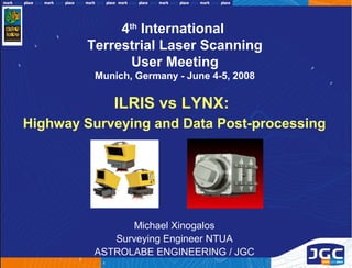
            ILRIS vs LYNX:
Highway Surveying and Data Post-processing


                Michael Xinogalos
            Surveying Engineer NTUA
         ASTROLABE ENGINEERING / JGC
Highway surveying projects
• Korinthos – Tripoli (80 km, ILRIS, 2006-2007)
• Elefsina – Korinthos (60 km, LYNX, 2008)
Highway surveying projects
•   Concession Self Financing Projects: Construction of a new
    highway section / Reconstruction and Maintenance of an
    existing highway section
•   Existing Highways: Dual Carriageway, 2-3 lanes &
    shoulder
Highway survey requirements

•   Detail “as built” survey of all highway features
    (pavement, structures, slopes, signage, poles, etc.)
•   Efficient archiving of “as built” situation for future
    reference
•   Positional accuracy: 2-3 cm
•   Elevation accuracy: 1-2 cm
•   3D model (TIN) for highway reconstruction design
•   Background survey maps (scale 1:500)
•   No significant traffic closure or delay
•   Efficient safety plan
•   Permits from local traffic authorities
Korinthos – Tripoli Highway
                         Project tasks (1/3)
•   Establishment of geodetic infrastructure networks (triangulation,
    leveling, polygonometry), also necessary for construction
•   Static (stop & scan) laser scanning with Optech ILRIS36D
•   Scanner carried by a vehicle moving or standing always on the
    shoulder lane, protected by a traffic regulation trailing vehicle
•   Scanning from both sides of the highway, distance between scanning
    positions 50-80m
•   1100 total scanning stations, 120 working days for 80 km of highway
Korinthos – Tripoli Highway
                            Project tasks (2/3)
•   Critical issue for horizontal objects: lifting the scanner (better scanning
    angle, improved object visibility, lower scanning resolution and / or
    fewer scanning positions required)
•   Lifting device used: Genie Super Hoist (5.6m, 113 kg capacity, CO2)
•   Custom modifications: Trailer integration, 5/8 bolt, longer ethernet and
    power cables, stabilizers, fuel generator & UPS, etc.
Korinthos – Tripoli Highway
                          Project tasks (3/3)
•   Scanning resolution: 55mm @ 25m horizontal / 20mm @ 25m vertical
•   Pan-tilt base overlap set to maximum (20% overlap, 15 frames/3600)
•   Primary georeferencing: with conic targets (standard traffic cones:
    easy to install, measure and model), 1 cone (anchor point) per scan
    position required for sequential georeferencing (Polyworks IMAlign -
    IMInspect)
Elefsina - Korithos Highway
                          Project tasks (1/3)
•   Establishment of geodetic infrastructure networks (triangulation,
    leveling, polygonometry), also necessary for construction
•   Mobile laser scanning with Optech LYNX Mobile Mapper (SINECO)
•   Sensors – GPS/IMU carried by a vehicle moving at 50 km/h on the
    shoulder and left lane, protected by traffic regulation vehicles
•   2 passes for each carriageway (shoulder lane – left lane) for better
    data quality
•   240 km total scanning distance, 1 working day for 60 km of highway
Elefsina - Korithos Highway
                          Project tasks (2/3)
•   Base GPS station support (6 base stations on known points)
•   Measurement of positional Ground Control Points (natural targets
    identifiable on pointcloud)
Elefsina - Korithos Highway
                         Project tasks (3/3)
•   Basic data processing / alignment (SINECO) and delivery of
    georeferenced pointclouds in 500 m segments for each carriageway
•   Conversions between global (WGS84/UTM/zone 34) and local
    (CGRS87) geodetic reference systems
•   Positional GCP alignment for groups of 3-5 segments of 500 m
    (Polyworks IMInspect - typical target registration accuracy < 3cm)
Both Highway surveys
                   Post-Processing Project tasks
•   Georeferencing refinement for elevations: using additional points
    measured on both edges of each carriageway every 50-80m
    (Polyworks IMInspect – typical elevation alignment accuracy < 1 cm)
•   Feature collection from pointclouds (Polyworks IMInspect)
•   3D Modeling (TIN) from features and Survey Maps (scale 1:500)
    generation (Autodesk Civil 3D)
•   Archiving for future reference: Pointclouds segmented per km
    (Polyworks IMView)
Highway survey products

Point cloud vs TIN model / 3D features (ILRIS survey)
Highway survey products
Point cloud / 3D features (LYNX survey)
Highway survey products
Background survey map (scale 1:500)
Highway survey products
Background survey map (scale 1:500)
ILRIS vs LYNX comparison (1/3)

                            Data Quality
LYNX:
• Uniform resolution homogeneous pointclouds
• No unnecessary overlaps
• Less noise from passing traffic
• Better object coverage with 2 sensors

ILRIS:
• Better detail for close objects
• Better viewing angle when lifted
• Produces organized pointclouds (with normal vectors)
ILRIS vs LYNX comparison (2/3)

                            Accuracy
LYNX:
• No errors from overlapping frame ICP alignment
• No errors from sequential scan positions ICP alignment
• Good relative accuracy for segments of 500 m

ILRIS:
• No errors from GPS outage or poor satellite conditions
• No errors from attitude compensation
• Excellent relative accuracy for each frame
• Lifting device can lower accuracy with bad weather conditions
ILRIS vs LYNX comparison (3/3)

                            Productivity
LYNX:
• Field works: Dramatically faster (1 day vs months) and safer
• Faster alignment and georeferencing of datasets
• Significantly faster and easier noise cleaning
• Automated feature extraction tools work better with uniform density
homogeneous pointclouds

ILRIS:
• Easier manual feature collection with shaded organized pointclouds
• Advanced filtering techniques work only with organized pointclouds
• Better level of detail for close objects (resolution – viewing angle)
Conclusions…


        Any questions?
Visit: www.astrolabe.gr www.jgc.gr

Contenu connexe

Tendances

40th_csrs&ga_fredericton2019_ndirlarouche
40th_csrs&ga_fredericton2019_ndirlarouche40th_csrs&ga_fredericton2019_ndirlarouche
40th_csrs&ga_fredericton2019_ndirlaroucheP. Medoune Ndir
 
Accuracy Assessment Of An eBee UAS Survey
Accuracy Assessment Of An eBee UAS SurveyAccuracy Assessment Of An eBee UAS Survey
Accuracy Assessment Of An eBee UAS SurveysenseFly
 
Optimized Neural Networks Using Principal Component Analysis for Automatic Ro...
Optimized Neural Networks Using Principal Component Analysis for Automatic Ro...Optimized Neural Networks Using Principal Component Analysis for Automatic Ro...
Optimized Neural Networks Using Principal Component Analysis for Automatic Ro...Conferenceproceedings
 
Poster Presentation "Generation of High Resolution DSM Usin UAV Images"
Poster Presentation "Generation of High Resolution DSM Usin UAV Images"Poster Presentation "Generation of High Resolution DSM Usin UAV Images"
Poster Presentation "Generation of High Resolution DSM Usin UAV Images"Nepal Flying Labs
 
What is photogrammetry overview and resources
What is photogrammetry overview and resourcesWhat is photogrammetry overview and resources
What is photogrammetry overview and resourcesNI BT
 
Archaeological Surveying in the Middle East
Archaeological Surveying in the Middle EastArchaeological Surveying in the Middle East
Archaeological Surveying in the Middle Eastpmabry
 
MiPlEx - Online Task Planning for Exploration Tasks in Urban Terrain
MiPlEx - Online Task Planning for Exploration Tasks in Urban TerrainMiPlEx - Online Task Planning for Exploration Tasks in Urban Terrain
MiPlEx - Online Task Planning for Exploration Tasks in Urban TerrainFlorian-Michael Adolf
 
Underground utility survey
Underground utility surveyUnderground utility survey
Underground utility surveyDipak Kadam
 
06 e-flightplanning
06 e-flightplanning06 e-flightplanning
06 e-flightplanningRehmat Kaur
 
Online Camer Calibration
Online Camer CalibrationOnline Camer Calibration
Online Camer CalibrationFei-Fei Zheng
 
Engineering survey in the construction industry
Engineering survey in the construction industryEngineering survey in the construction industry
Engineering survey in the construction industrynoah kertich
 
Accuracy checks in the production of orthophotos
Accuracy checks in the production of orthophotosAccuracy checks in the production of orthophotos
Accuracy checks in the production of orthophotosAlexander Decker
 
Amr Gamal Zahran-c.v
Amr Gamal Zahran-c.vAmr Gamal Zahran-c.v
Amr Gamal Zahran-c.vAmr Zahran
 
Brosure Laser 4D Monitoring Systems 3DLM UK Jogja
Brosure Laser 4D Monitoring Systems 3DLM UK JogjaBrosure Laser 4D Monitoring Systems 3DLM UK Jogja
Brosure Laser 4D Monitoring Systems 3DLM UK JogjaMurabet, MRT
 
mapping application of Remort sensing
mapping application of Remort sensingmapping application of Remort sensing
mapping application of Remort sensingAshishBhadani4
 
Data Usability Assessment for Remote Sensing Data: Accuracy of Interactive Da...
Data Usability Assessment for Remote Sensing Data: Accuracy of Interactive Da...Data Usability Assessment for Remote Sensing Data: Accuracy of Interactive Da...
Data Usability Assessment for Remote Sensing Data: Accuracy of Interactive Da...Beniamino Murgante
 
ALDRIGHI_LandUseMappingUsingCoarseResolutionSarDataAtTheObjectLevelExploiting...
ALDRIGHI_LandUseMappingUsingCoarseResolutionSarDataAtTheObjectLevelExploiting...ALDRIGHI_LandUseMappingUsingCoarseResolutionSarDataAtTheObjectLevelExploiting...
ALDRIGHI_LandUseMappingUsingCoarseResolutionSarDataAtTheObjectLevelExploiting...grssieee
 
Horizontal directional drilling (hdd) by Mohamed Freeshah
Horizontal directional drilling (hdd) by Mohamed FreeshahHorizontal directional drilling (hdd) by Mohamed Freeshah
Horizontal directional drilling (hdd) by Mohamed Freeshahfreeshah2010
 
A new remote sensing methodology for detailed international mapping in the V4...
A new remote sensing methodology for detailed international mapping in the V4...A new remote sensing methodology for detailed international mapping in the V4...
A new remote sensing methodology for detailed international mapping in the V4...mirijovsky
 
Generation of high resolution DSM using UAV Images
Generation of high resolution DSM using UAV Images  Generation of high resolution DSM using UAV Images
Generation of high resolution DSM using UAV Images Nepal Flying Labs
 

Tendances (20)

40th_csrs&ga_fredericton2019_ndirlarouche
40th_csrs&ga_fredericton2019_ndirlarouche40th_csrs&ga_fredericton2019_ndirlarouche
40th_csrs&ga_fredericton2019_ndirlarouche
 
Accuracy Assessment Of An eBee UAS Survey
Accuracy Assessment Of An eBee UAS SurveyAccuracy Assessment Of An eBee UAS Survey
Accuracy Assessment Of An eBee UAS Survey
 
Optimized Neural Networks Using Principal Component Analysis for Automatic Ro...
Optimized Neural Networks Using Principal Component Analysis for Automatic Ro...Optimized Neural Networks Using Principal Component Analysis for Automatic Ro...
Optimized Neural Networks Using Principal Component Analysis for Automatic Ro...
 
Poster Presentation "Generation of High Resolution DSM Usin UAV Images"
Poster Presentation "Generation of High Resolution DSM Usin UAV Images"Poster Presentation "Generation of High Resolution DSM Usin UAV Images"
Poster Presentation "Generation of High Resolution DSM Usin UAV Images"
 
What is photogrammetry overview and resources
What is photogrammetry overview and resourcesWhat is photogrammetry overview and resources
What is photogrammetry overview and resources
 
Archaeological Surveying in the Middle East
Archaeological Surveying in the Middle EastArchaeological Surveying in the Middle East
Archaeological Surveying in the Middle East
 
MiPlEx - Online Task Planning for Exploration Tasks in Urban Terrain
MiPlEx - Online Task Planning for Exploration Tasks in Urban TerrainMiPlEx - Online Task Planning for Exploration Tasks in Urban Terrain
MiPlEx - Online Task Planning for Exploration Tasks in Urban Terrain
 
Underground utility survey
Underground utility surveyUnderground utility survey
Underground utility survey
 
06 e-flightplanning
06 e-flightplanning06 e-flightplanning
06 e-flightplanning
 
Online Camer Calibration
Online Camer CalibrationOnline Camer Calibration
Online Camer Calibration
 
Engineering survey in the construction industry
Engineering survey in the construction industryEngineering survey in the construction industry
Engineering survey in the construction industry
 
Accuracy checks in the production of orthophotos
Accuracy checks in the production of orthophotosAccuracy checks in the production of orthophotos
Accuracy checks in the production of orthophotos
 
Amr Gamal Zahran-c.v
Amr Gamal Zahran-c.vAmr Gamal Zahran-c.v
Amr Gamal Zahran-c.v
 
Brosure Laser 4D Monitoring Systems 3DLM UK Jogja
Brosure Laser 4D Monitoring Systems 3DLM UK JogjaBrosure Laser 4D Monitoring Systems 3DLM UK Jogja
Brosure Laser 4D Monitoring Systems 3DLM UK Jogja
 
mapping application of Remort sensing
mapping application of Remort sensingmapping application of Remort sensing
mapping application of Remort sensing
 
Data Usability Assessment for Remote Sensing Data: Accuracy of Interactive Da...
Data Usability Assessment for Remote Sensing Data: Accuracy of Interactive Da...Data Usability Assessment for Remote Sensing Data: Accuracy of Interactive Da...
Data Usability Assessment for Remote Sensing Data: Accuracy of Interactive Da...
 
ALDRIGHI_LandUseMappingUsingCoarseResolutionSarDataAtTheObjectLevelExploiting...
ALDRIGHI_LandUseMappingUsingCoarseResolutionSarDataAtTheObjectLevelExploiting...ALDRIGHI_LandUseMappingUsingCoarseResolutionSarDataAtTheObjectLevelExploiting...
ALDRIGHI_LandUseMappingUsingCoarseResolutionSarDataAtTheObjectLevelExploiting...
 
Horizontal directional drilling (hdd) by Mohamed Freeshah
Horizontal directional drilling (hdd) by Mohamed FreeshahHorizontal directional drilling (hdd) by Mohamed Freeshah
Horizontal directional drilling (hdd) by Mohamed Freeshah
 
A new remote sensing methodology for detailed international mapping in the V4...
A new remote sensing methodology for detailed international mapping in the V4...A new remote sensing methodology for detailed international mapping in the V4...
A new remote sensing methodology for detailed international mapping in the V4...
 
Generation of high resolution DSM using UAV Images
Generation of high resolution DSM using UAV Images  Generation of high resolution DSM using UAV Images
Generation of high resolution DSM using UAV Images
 

En vedette

Οι σαρωτές laser στην παραγωγική διαδικασία του τοπογράφου μηχανικού
Οι σαρωτές laser στην παραγωγική διαδικασία του τοπογράφου μηχανικούΟι σαρωτές laser στην παραγωγική διαδικασία του τοπογράφου μηχανικού
Οι σαρωτές laser στην παραγωγική διαδικασία του τοπογράφου μηχανικούMichael Xinogalos
 
Plant survey & Intelligent 3D Modeling
Plant survey & Intelligent 3D ModelingPlant survey & Intelligent 3D Modeling
Plant survey & Intelligent 3D ModelingMichael Xinogalos
 
Road Construction
Road ConstructionRoad Construction
Road ConstructionDanish Mohd
 
INTRODUCTION TO SURVEYING
INTRODUCTION TO SURVEYINGINTRODUCTION TO SURVEYING
INTRODUCTION TO SURVEYINGfarhana saiyed
 
road construction project
road construction projectroad construction project
road construction projectnishant singh
 

En vedette (6)

Οι σαρωτές laser στην παραγωγική διαδικασία του τοπογράφου μηχανικού
Οι σαρωτές laser στην παραγωγική διαδικασία του τοπογράφου μηχανικούΟι σαρωτές laser στην παραγωγική διαδικασία του τοπογράφου μηχανικού
Οι σαρωτές laser στην παραγωγική διαδικασία του τοπογράφου μηχανικού
 
Plant survey & Intelligent 3D Modeling
Plant survey & Intelligent 3D ModelingPlant survey & Intelligent 3D Modeling
Plant survey & Intelligent 3D Modeling
 
Road Construction
Road ConstructionRoad Construction
Road Construction
 
INTRODUCTION TO SURVEYING
INTRODUCTION TO SURVEYINGINTRODUCTION TO SURVEYING
INTRODUCTION TO SURVEYING
 
Road construction
Road constructionRoad construction
Road construction
 
road construction project
road construction projectroad construction project
road construction project
 

Similaire à Ilris vs lynx highway surveying and data post processing - munich2008

2006 mine integration plan
2006 mine integration plan2006 mine integration plan
2006 mine integration planElliot Duff
 
2006 mine integration plan
2006 mine integration plan2006 mine integration plan
2006 mine integration planElliot Duff
 
Veridict Trafiklab meetup 2016 12-06
Veridict Trafiklab meetup 2016 12-06Veridict Trafiklab meetup 2016 12-06
Veridict Trafiklab meetup 2016 12-06Elias Arnestrand
 
Mobile Mapping Technology and Applications.pdf
Mobile Mapping Technology and Applications.pdfMobile Mapping Technology and Applications.pdf
Mobile Mapping Technology and Applications.pdfsooryaK18
 
Total station, digital self leveling levels,
Total station, digital self leveling levels,Total station, digital self leveling levels,
Total station, digital self leveling levels,Darshil Vekaria
 
Severn Partnership
Severn Partnership Severn Partnership
Severn Partnership Steve Jones
 
Traffic jam detection using image processing
Traffic jam detection using image processingTraffic jam detection using image processing
Traffic jam detection using image processingSai As Sharman
 
Geo-Navigation, an Augmented Reality Perspective
Geo-Navigation, an Augmented Reality PerspectiveGeo-Navigation, an Augmented Reality Perspective
Geo-Navigation, an Augmented Reality PerspectiveAntonio Camara
 
Unpaved Road Assessment Technology Demonstration - Michigan Tech Research Ins...
Unpaved Road Assessment Technology Demonstration - Michigan Tech Research Ins...Unpaved Road Assessment Technology Demonstration - Michigan Tech Research Ins...
Unpaved Road Assessment Technology Demonstration - Michigan Tech Research Ins...Integrated Global Dimensions LLC
 
Multi Inertial Measurement Units (MIMU) Platforms: Designs & Applications
Multi Inertial Measurement Units (MIMU)  Platforms: Designs & ApplicationsMulti Inertial Measurement Units (MIMU)  Platforms: Designs & Applications
Multi Inertial Measurement Units (MIMU) Platforms: Designs & Applicationsoblu.io
 
Total station and its application to civil engineering
Total station and its application to civil engineeringTotal station and its application to civil engineering
Total station and its application to civil engineeringTushar Dholakia
 
Survey Grade LiDAR Technologies for Transportation Engineering
Survey Grade LiDAR Technologies for Transportation EngineeringSurvey Grade LiDAR Technologies for Transportation Engineering
Survey Grade LiDAR Technologies for Transportation EngineeringQuantum Spatial
 
Global positioning system by abhiram
Global positioning system by abhiramGlobal positioning system by abhiram
Global positioning system by abhiramAbhiram Reddy Kamsani
 
Urban Traffic Estimation & Optimization: An Overview
Urban Traffic Estimation & Optimization: An OverviewUrban Traffic Estimation & Optimization: An Overview
Urban Traffic Estimation & Optimization: An OverviewRakedet
 
ROADART - Research On Alternative Diversity Aspects foR Trucks
ROADART - Research On Alternative Diversity Aspects foR TrucksROADART - Research On Alternative Diversity Aspects foR Trucks
ROADART - Research On Alternative Diversity Aspects foR TrucksEuropean Green Vehicle Initiative
 
Geospatial Research At UCL
Geospatial Research At UCLGeospatial Research At UCL
Geospatial Research At UCLJeremy Morley
 
GIS for traffic signal optimization.
GIS for traffic signal optimization.GIS for traffic signal optimization.
GIS for traffic signal optimization.Vinod Shinde
 
Real time-image-processing-applied-to-traffic-queue-detection-algorithm
Real time-image-processing-applied-to-traffic-queue-detection-algorithmReal time-image-processing-applied-to-traffic-queue-detection-algorithm
Real time-image-processing-applied-to-traffic-queue-detection-algorithmajayrampelli
 

Similaire à Ilris vs lynx highway surveying and data post processing - munich2008 (20)

2006 mine integration plan
2006 mine integration plan2006 mine integration plan
2006 mine integration plan
 
2006 mine integration plan
2006 mine integration plan2006 mine integration plan
2006 mine integration plan
 
Veridict Trafiklab meetup 2016 12-06
Veridict Trafiklab meetup 2016 12-06Veridict Trafiklab meetup 2016 12-06
Veridict Trafiklab meetup 2016 12-06
 
Mobile Mapping Technology and Applications.pdf
Mobile Mapping Technology and Applications.pdfMobile Mapping Technology and Applications.pdf
Mobile Mapping Technology and Applications.pdf
 
Total station, digital self leveling levels,
Total station, digital self leveling levels,Total station, digital self leveling levels,
Total station, digital self leveling levels,
 
Severn Partnership
Severn Partnership Severn Partnership
Severn Partnership
 
EsriMF_senseFly_Gervaix
EsriMF_senseFly_GervaixEsriMF_senseFly_Gervaix
EsriMF_senseFly_Gervaix
 
Traffic jam detection using image processing
Traffic jam detection using image processingTraffic jam detection using image processing
Traffic jam detection using image processing
 
Geo-Navigation, an Augmented Reality Perspective
Geo-Navigation, an Augmented Reality PerspectiveGeo-Navigation, an Augmented Reality Perspective
Geo-Navigation, an Augmented Reality Perspective
 
Unpaved Road Assessment Technology Demonstration - Michigan Tech Research Ins...
Unpaved Road Assessment Technology Demonstration - Michigan Tech Research Ins...Unpaved Road Assessment Technology Demonstration - Michigan Tech Research Ins...
Unpaved Road Assessment Technology Demonstration - Michigan Tech Research Ins...
 
Multi Inertial Measurement Units (MIMU) Platforms: Designs & Applications
Multi Inertial Measurement Units (MIMU)  Platforms: Designs & ApplicationsMulti Inertial Measurement Units (MIMU)  Platforms: Designs & Applications
Multi Inertial Measurement Units (MIMU) Platforms: Designs & Applications
 
Total station and its application to civil engineering
Total station and its application to civil engineeringTotal station and its application to civil engineering
Total station and its application to civil engineering
 
Survey Grade LiDAR Technologies for Transportation Engineering
Survey Grade LiDAR Technologies for Transportation EngineeringSurvey Grade LiDAR Technologies for Transportation Engineering
Survey Grade LiDAR Technologies for Transportation Engineering
 
Global positioning system by abhiram
Global positioning system by abhiramGlobal positioning system by abhiram
Global positioning system by abhiram
 
Urban Traffic Estimation & Optimization: An Overview
Urban Traffic Estimation & Optimization: An OverviewUrban Traffic Estimation & Optimization: An Overview
Urban Traffic Estimation & Optimization: An Overview
 
ROADART - Research On Alternative Diversity Aspects foR Trucks
ROADART - Research On Alternative Diversity Aspects foR TrucksROADART - Research On Alternative Diversity Aspects foR Trucks
ROADART - Research On Alternative Diversity Aspects foR Trucks
 
Geospatial Research At UCL
Geospatial Research At UCLGeospatial Research At UCL
Geospatial Research At UCL
 
GIS for traffic signal optimization.
GIS for traffic signal optimization.GIS for traffic signal optimization.
GIS for traffic signal optimization.
 
IoT at railways proposal
IoT  at railways proposalIoT  at railways proposal
IoT at railways proposal
 
Real time-image-processing-applied-to-traffic-queue-detection-algorithm
Real time-image-processing-applied-to-traffic-queue-detection-algorithmReal time-image-processing-applied-to-traffic-queue-detection-algorithm
Real time-image-processing-applied-to-traffic-queue-detection-algorithm
 

Dernier

Demystifying gRPC in .Net by John Staveley
Demystifying gRPC in .Net by John StaveleyDemystifying gRPC in .Net by John Staveley
Demystifying gRPC in .Net by John StaveleyJohn Staveley
 
Integrating Telephony Systems with Salesforce: Insights and Considerations, B...
Integrating Telephony Systems with Salesforce: Insights and Considerations, B...Integrating Telephony Systems with Salesforce: Insights and Considerations, B...
Integrating Telephony Systems with Salesforce: Insights and Considerations, B...CzechDreamin
 
Strategic AI Integration in Engineering Teams
Strategic AI Integration in Engineering TeamsStrategic AI Integration in Engineering Teams
Strategic AI Integration in Engineering TeamsUXDXConf
 
THE BEST IPTV in GERMANY for 2024: IPTVreel
THE BEST IPTV in  GERMANY for 2024: IPTVreelTHE BEST IPTV in  GERMANY for 2024: IPTVreel
THE BEST IPTV in GERMANY for 2024: IPTVreelreely ones
 
Unpacking Value Delivery - Agile Oxford Meetup - May 2024.pptx
Unpacking Value Delivery - Agile Oxford Meetup - May 2024.pptxUnpacking Value Delivery - Agile Oxford Meetup - May 2024.pptx
Unpacking Value Delivery - Agile Oxford Meetup - May 2024.pptxDavid Michel
 
How Red Hat Uses FDO in Device Lifecycle _ Costin and Vitaliy at Red Hat.pdf
How Red Hat Uses FDO in Device Lifecycle _ Costin and Vitaliy at Red Hat.pdfHow Red Hat Uses FDO in Device Lifecycle _ Costin and Vitaliy at Red Hat.pdf
How Red Hat Uses FDO in Device Lifecycle _ Costin and Vitaliy at Red Hat.pdfFIDO Alliance
 
Choosing the Right FDO Deployment Model for Your Application _ Geoffrey at In...
Choosing the Right FDO Deployment Model for Your Application _ Geoffrey at In...Choosing the Right FDO Deployment Model for Your Application _ Geoffrey at In...
Choosing the Right FDO Deployment Model for Your Application _ Geoffrey at In...FIDO Alliance
 
Secure Zero Touch enabled Edge compute with Dell NativeEdge via FDO _ Brad at...
Secure Zero Touch enabled Edge compute with Dell NativeEdge via FDO _ Brad at...Secure Zero Touch enabled Edge compute with Dell NativeEdge via FDO _ Brad at...
Secure Zero Touch enabled Edge compute with Dell NativeEdge via FDO _ Brad at...FIDO Alliance
 
What's New in Teams Calling, Meetings and Devices April 2024
What's New in Teams Calling, Meetings and Devices April 2024What's New in Teams Calling, Meetings and Devices April 2024
What's New in Teams Calling, Meetings and Devices April 2024Stephanie Beckett
 
ASRock Industrial FDO Solutions in Action for Industrial Edge AI _ Kenny at A...
ASRock Industrial FDO Solutions in Action for Industrial Edge AI _ Kenny at A...ASRock Industrial FDO Solutions in Action for Industrial Edge AI _ Kenny at A...
ASRock Industrial FDO Solutions in Action for Industrial Edge AI _ Kenny at A...FIDO Alliance
 
TEST BANK For, Information Technology Project Management 9th Edition Kathy Sc...
TEST BANK For, Information Technology Project Management 9th Edition Kathy Sc...TEST BANK For, Information Technology Project Management 9th Edition Kathy Sc...
TEST BANK For, Information Technology Project Management 9th Edition Kathy Sc...marcuskenyatta275
 
Extensible Python: Robustness through Addition - PyCon 2024
Extensible Python: Robustness through Addition - PyCon 2024Extensible Python: Robustness through Addition - PyCon 2024
Extensible Python: Robustness through Addition - PyCon 2024Patrick Viafore
 
Optimizing NoSQL Performance Through Observability
Optimizing NoSQL Performance Through ObservabilityOptimizing NoSQL Performance Through Observability
Optimizing NoSQL Performance Through ObservabilityScyllaDB
 
Measures in SQL (a talk at SF Distributed Systems meetup, 2024-05-22)
Measures in SQL (a talk at SF Distributed Systems meetup, 2024-05-22)Measures in SQL (a talk at SF Distributed Systems meetup, 2024-05-22)
Measures in SQL (a talk at SF Distributed Systems meetup, 2024-05-22)Julian Hyde
 
AI revolution and Salesforce, Jiří Karpíšek
AI revolution and Salesforce, Jiří KarpíšekAI revolution and Salesforce, Jiří Karpíšek
AI revolution and Salesforce, Jiří KarpíšekCzechDreamin
 
Designing for Hardware Accessibility at Comcast
Designing for Hardware Accessibility at ComcastDesigning for Hardware Accessibility at Comcast
Designing for Hardware Accessibility at ComcastUXDXConf
 
AI presentation and introduction - Retrieval Augmented Generation RAG 101
AI presentation and introduction - Retrieval Augmented Generation RAG 101AI presentation and introduction - Retrieval Augmented Generation RAG 101
AI presentation and introduction - Retrieval Augmented Generation RAG 101vincent683379
 
Where to Learn More About FDO _ Richard at FIDO Alliance.pdf
Where to Learn More About FDO _ Richard at FIDO Alliance.pdfWhere to Learn More About FDO _ Richard at FIDO Alliance.pdf
Where to Learn More About FDO _ Richard at FIDO Alliance.pdfFIDO Alliance
 
Future Visions: Predictions to Guide and Time Tech Innovation, Peter Udo Diehl
Future Visions: Predictions to Guide and Time Tech Innovation, Peter Udo DiehlFuture Visions: Predictions to Guide and Time Tech Innovation, Peter Udo Diehl
Future Visions: Predictions to Guide and Time Tech Innovation, Peter Udo DiehlPeter Udo Diehl
 
Top 10 Symfony Development Companies 2024
Top 10 Symfony Development Companies 2024Top 10 Symfony Development Companies 2024
Top 10 Symfony Development Companies 2024TopCSSGallery
 

Dernier (20)

Demystifying gRPC in .Net by John Staveley
Demystifying gRPC in .Net by John StaveleyDemystifying gRPC in .Net by John Staveley
Demystifying gRPC in .Net by John Staveley
 
Integrating Telephony Systems with Salesforce: Insights and Considerations, B...
Integrating Telephony Systems with Salesforce: Insights and Considerations, B...Integrating Telephony Systems with Salesforce: Insights and Considerations, B...
Integrating Telephony Systems with Salesforce: Insights and Considerations, B...
 
Strategic AI Integration in Engineering Teams
Strategic AI Integration in Engineering TeamsStrategic AI Integration in Engineering Teams
Strategic AI Integration in Engineering Teams
 
THE BEST IPTV in GERMANY for 2024: IPTVreel
THE BEST IPTV in  GERMANY for 2024: IPTVreelTHE BEST IPTV in  GERMANY for 2024: IPTVreel
THE BEST IPTV in GERMANY for 2024: IPTVreel
 
Unpacking Value Delivery - Agile Oxford Meetup - May 2024.pptx
Unpacking Value Delivery - Agile Oxford Meetup - May 2024.pptxUnpacking Value Delivery - Agile Oxford Meetup - May 2024.pptx
Unpacking Value Delivery - Agile Oxford Meetup - May 2024.pptx
 
How Red Hat Uses FDO in Device Lifecycle _ Costin and Vitaliy at Red Hat.pdf
How Red Hat Uses FDO in Device Lifecycle _ Costin and Vitaliy at Red Hat.pdfHow Red Hat Uses FDO in Device Lifecycle _ Costin and Vitaliy at Red Hat.pdf
How Red Hat Uses FDO in Device Lifecycle _ Costin and Vitaliy at Red Hat.pdf
 
Choosing the Right FDO Deployment Model for Your Application _ Geoffrey at In...
Choosing the Right FDO Deployment Model for Your Application _ Geoffrey at In...Choosing the Right FDO Deployment Model for Your Application _ Geoffrey at In...
Choosing the Right FDO Deployment Model for Your Application _ Geoffrey at In...
 
Secure Zero Touch enabled Edge compute with Dell NativeEdge via FDO _ Brad at...
Secure Zero Touch enabled Edge compute with Dell NativeEdge via FDO _ Brad at...Secure Zero Touch enabled Edge compute with Dell NativeEdge via FDO _ Brad at...
Secure Zero Touch enabled Edge compute with Dell NativeEdge via FDO _ Brad at...
 
What's New in Teams Calling, Meetings and Devices April 2024
What's New in Teams Calling, Meetings and Devices April 2024What's New in Teams Calling, Meetings and Devices April 2024
What's New in Teams Calling, Meetings and Devices April 2024
 
ASRock Industrial FDO Solutions in Action for Industrial Edge AI _ Kenny at A...
ASRock Industrial FDO Solutions in Action for Industrial Edge AI _ Kenny at A...ASRock Industrial FDO Solutions in Action for Industrial Edge AI _ Kenny at A...
ASRock Industrial FDO Solutions in Action for Industrial Edge AI _ Kenny at A...
 
TEST BANK For, Information Technology Project Management 9th Edition Kathy Sc...
TEST BANK For, Information Technology Project Management 9th Edition Kathy Sc...TEST BANK For, Information Technology Project Management 9th Edition Kathy Sc...
TEST BANK For, Information Technology Project Management 9th Edition Kathy Sc...
 
Extensible Python: Robustness through Addition - PyCon 2024
Extensible Python: Robustness through Addition - PyCon 2024Extensible Python: Robustness through Addition - PyCon 2024
Extensible Python: Robustness through Addition - PyCon 2024
 
Optimizing NoSQL Performance Through Observability
Optimizing NoSQL Performance Through ObservabilityOptimizing NoSQL Performance Through Observability
Optimizing NoSQL Performance Through Observability
 
Measures in SQL (a talk at SF Distributed Systems meetup, 2024-05-22)
Measures in SQL (a talk at SF Distributed Systems meetup, 2024-05-22)Measures in SQL (a talk at SF Distributed Systems meetup, 2024-05-22)
Measures in SQL (a talk at SF Distributed Systems meetup, 2024-05-22)
 
AI revolution and Salesforce, Jiří Karpíšek
AI revolution and Salesforce, Jiří KarpíšekAI revolution and Salesforce, Jiří Karpíšek
AI revolution and Salesforce, Jiří Karpíšek
 
Designing for Hardware Accessibility at Comcast
Designing for Hardware Accessibility at ComcastDesigning for Hardware Accessibility at Comcast
Designing for Hardware Accessibility at Comcast
 
AI presentation and introduction - Retrieval Augmented Generation RAG 101
AI presentation and introduction - Retrieval Augmented Generation RAG 101AI presentation and introduction - Retrieval Augmented Generation RAG 101
AI presentation and introduction - Retrieval Augmented Generation RAG 101
 
Where to Learn More About FDO _ Richard at FIDO Alliance.pdf
Where to Learn More About FDO _ Richard at FIDO Alliance.pdfWhere to Learn More About FDO _ Richard at FIDO Alliance.pdf
Where to Learn More About FDO _ Richard at FIDO Alliance.pdf
 
Future Visions: Predictions to Guide and Time Tech Innovation, Peter Udo Diehl
Future Visions: Predictions to Guide and Time Tech Innovation, Peter Udo DiehlFuture Visions: Predictions to Guide and Time Tech Innovation, Peter Udo Diehl
Future Visions: Predictions to Guide and Time Tech Innovation, Peter Udo Diehl
 
Top 10 Symfony Development Companies 2024
Top 10 Symfony Development Companies 2024Top 10 Symfony Development Companies 2024
Top 10 Symfony Development Companies 2024
 

Ilris vs lynx highway surveying and data post processing - munich2008

  • 1. 4th International Terrestrial Laser Scanning User Meeting Munich, Germany - June 4-5, 2008 ILRIS vs LYNX: Highway Surveying and Data Post-processing Michael Xinogalos Surveying Engineer NTUA ASTROLABE ENGINEERING / JGC
  • 2. Highway surveying projects • Korinthos – Tripoli (80 km, ILRIS, 2006-2007) • Elefsina – Korinthos (60 km, LYNX, 2008)
  • 3. Highway surveying projects • Concession Self Financing Projects: Construction of a new highway section / Reconstruction and Maintenance of an existing highway section • Existing Highways: Dual Carriageway, 2-3 lanes & shoulder
  • 4. Highway survey requirements • Detail “as built” survey of all highway features (pavement, structures, slopes, signage, poles, etc.) • Efficient archiving of “as built” situation for future reference • Positional accuracy: 2-3 cm • Elevation accuracy: 1-2 cm • 3D model (TIN) for highway reconstruction design • Background survey maps (scale 1:500) • No significant traffic closure or delay • Efficient safety plan • Permits from local traffic authorities
  • 5. Korinthos – Tripoli Highway Project tasks (1/3) • Establishment of geodetic infrastructure networks (triangulation, leveling, polygonometry), also necessary for construction • Static (stop & scan) laser scanning with Optech ILRIS36D • Scanner carried by a vehicle moving or standing always on the shoulder lane, protected by a traffic regulation trailing vehicle • Scanning from both sides of the highway, distance between scanning positions 50-80m • 1100 total scanning stations, 120 working days for 80 km of highway
  • 6. Korinthos – Tripoli Highway Project tasks (2/3) • Critical issue for horizontal objects: lifting the scanner (better scanning angle, improved object visibility, lower scanning resolution and / or fewer scanning positions required) • Lifting device used: Genie Super Hoist (5.6m, 113 kg capacity, CO2) • Custom modifications: Trailer integration, 5/8 bolt, longer ethernet and power cables, stabilizers, fuel generator & UPS, etc.
  • 7. Korinthos – Tripoli Highway Project tasks (3/3) • Scanning resolution: 55mm @ 25m horizontal / 20mm @ 25m vertical • Pan-tilt base overlap set to maximum (20% overlap, 15 frames/3600) • Primary georeferencing: with conic targets (standard traffic cones: easy to install, measure and model), 1 cone (anchor point) per scan position required for sequential georeferencing (Polyworks IMAlign - IMInspect)
  • 8. Elefsina - Korithos Highway Project tasks (1/3) • Establishment of geodetic infrastructure networks (triangulation, leveling, polygonometry), also necessary for construction • Mobile laser scanning with Optech LYNX Mobile Mapper (SINECO) • Sensors – GPS/IMU carried by a vehicle moving at 50 km/h on the shoulder and left lane, protected by traffic regulation vehicles • 2 passes for each carriageway (shoulder lane – left lane) for better data quality • 240 km total scanning distance, 1 working day for 60 km of highway
  • 9. Elefsina - Korithos Highway Project tasks (2/3) • Base GPS station support (6 base stations on known points) • Measurement of positional Ground Control Points (natural targets identifiable on pointcloud)
  • 10. Elefsina - Korithos Highway Project tasks (3/3) • Basic data processing / alignment (SINECO) and delivery of georeferenced pointclouds in 500 m segments for each carriageway • Conversions between global (WGS84/UTM/zone 34) and local (CGRS87) geodetic reference systems • Positional GCP alignment for groups of 3-5 segments of 500 m (Polyworks IMInspect - typical target registration accuracy < 3cm)
  • 11. Both Highway surveys Post-Processing Project tasks • Georeferencing refinement for elevations: using additional points measured on both edges of each carriageway every 50-80m (Polyworks IMInspect – typical elevation alignment accuracy < 1 cm) • Feature collection from pointclouds (Polyworks IMInspect) • 3D Modeling (TIN) from features and Survey Maps (scale 1:500) generation (Autodesk Civil 3D) • Archiving for future reference: Pointclouds segmented per km (Polyworks IMView)
  • 12. Highway survey products Point cloud vs TIN model / 3D features (ILRIS survey)
  • 13. Highway survey products Point cloud / 3D features (LYNX survey)
  • 14. Highway survey products Background survey map (scale 1:500)
  • 15. Highway survey products Background survey map (scale 1:500)
  • 16. ILRIS vs LYNX comparison (1/3) Data Quality LYNX: • Uniform resolution homogeneous pointclouds • No unnecessary overlaps • Less noise from passing traffic • Better object coverage with 2 sensors ILRIS: • Better detail for close objects • Better viewing angle when lifted • Produces organized pointclouds (with normal vectors)
  • 17. ILRIS vs LYNX comparison (2/3) Accuracy LYNX: • No errors from overlapping frame ICP alignment • No errors from sequential scan positions ICP alignment • Good relative accuracy for segments of 500 m ILRIS: • No errors from GPS outage or poor satellite conditions • No errors from attitude compensation • Excellent relative accuracy for each frame • Lifting device can lower accuracy with bad weather conditions
  • 18. ILRIS vs LYNX comparison (3/3) Productivity LYNX: • Field works: Dramatically faster (1 day vs months) and safer • Faster alignment and georeferencing of datasets • Significantly faster and easier noise cleaning • Automated feature extraction tools work better with uniform density homogeneous pointclouds ILRIS: • Easier manual feature collection with shaded organized pointclouds • Advanced filtering techniques work only with organized pointclouds • Better level of detail for close objects (resolution – viewing angle)
  • 19. Conclusions… Any questions? Visit: www.astrolabe.gr www.jgc.gr