Waterfront 6 1 07
•
4 j'aime•393 vues

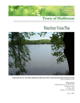
This report was prepared for the New York State Department of State with funds provided under Title 11 of the Environmental Protection Fund. Clough Harbour & Associates LLP was selected by the Town of Halfmoon to assist the project steering committee in completion of this study. The goal of this project was to identify an exciting, yet realistic vision for the future of Halfmoon’s waterfront located along the Mohawk and Hudson Rivers.

Recommandé
Contenu connexe
Tendances
En vedette
En vedette (8)
Similaire à Waterfront 6 1 07
Similaire à Waterfront 6 1 07 (20)
Plus de Nelson Ronsvalle
Plus de Nelson Ronsvalle (20)
Dernier
Dernier (20)
Waterfront 6 1 07
- 1. Town of Halfmoon Prepared for the New York State with funds provided under Title 11 of the Environmental Protection Fund & Town of Halfmoon, NY Prepared by: Clough Harbour & Associates LLP III Winners Circle PO Box 5269 Albany, NY 12205-0269 June 1, 2007
- 2. Town of Halfmoon Waterfront Vision Plan Table of Contents 1.0 Project Context 1 1.1 Introduction....................................................................................................1 1.2 Regional Setting .............................................................................................1 1.3 Waterfront Study Area....................................................................................2 2.0 Planning Process 3 3.0 Goals for Waterfront Development 4 4.0 Inventory and Analysis 5 4.1 Introduction....................................................................................................5 4.2 Hudson River Waterfront ...............................................................................5 4.2.1 Existing Land Uses, Waterfront Uses and Zoning ................................5 4.2.2 Property Ownership Patterns ................................................................6 4.2.3 Infrastructure .......................................................................................6 4.2.4 Historic Resources ...............................................................................7 4.2.5 Topography and Geology.....................................................................7 4.2.6 Wetlands and Flood Zones ...................................................................7 4.3 Mohawk River Waterfront .............................................................................8 4.3.1 Existing Land Uses, Waterfront Uses and Zoning ................................8 4.3.2 Property Ownership Patterns ................................................................9 4.3.3 Infrastructure .......................................................................................9 4.3.4 Historic Resources ...............................................................................9 4.3.5 Topography and Geology...................................................................10 4.3.6 Wetlands and Flood Zones .................................................................10 Draft 11/30/06 i
- 3. 5.0 Opportunities and Constraints 11 5.1 Hudson River Waterfront .............................................................................11 5.2 Mohawk River Waterfront............................................................................12 6.0 Waterfront Vision 13 6.1 Hudson River Waterfront .............................................................................13 6.2 Mohawk River Waterfront............................................................................14 7.0 Implementation 16 List of Figures Following Page Figure 1 Hudson River Opportunities and Constraints......................................11 Figure 2 Mohawk River Opportunities and Constraints ....................................12 Figure 3 Hudson River Waterfront Vision .......................................................13 Figure 4 Mohawk River Waterfront Vision ......................................................14 Draft 11/30/06 ii
- 4. Town of Halfmoon Waterfront Vision Plan 1.0 Project Context 1.1 Introduction This report was prepared for the New York State Department of State with funds provided under Title 11 of the Environmental Protection Fund. Clough Harbour & Associates LLP was selected by the Town of Halfmoon to assist the project steering committee in completion of this study. The goal of this project was to identify an exciting, yet realistic vision for the future of Halfmoon’ waterfront located along the s Mohawk and Hudson Rivers. This report summarizes the planning process followed to develop a vision for Halfmoon’ s waterfront. In addition, it serves as documentation of the waterfront areas existing conditions, vision for the future as well as a series of steps proposed to implement the vision. The primary source of background information that serves as a basis for the vision is from the Town of Halfmoon Comprehensive Plan (2003), unless otherwise noted. 1.2 Regional Setting The Town of Halfmoon is located in south central Saratoga County. It is bounded to the south by the Mohawk River, to the west by the Town of Clifton Park, to the north by the City of Mechanicville and Town of Malta and to the east by the Hudson River. Saratoga County is situated within the northern extent of the Hudson- Mohawk Lowlands physiographic region and the southern extent of the Regional Location Map Adirondack Mountains. 1
- 5. 1.3 Waterfront Study Areas As indicated on the Study Area Location Map below, the Town of Halfmoon enjoys the benefits of having direct access to both the Hudson River and the Mohawk River. A brief description of each study area is provided below. Hudson River Waterfront Study Area The Hudson River waterfront study area includes the lands east and west of US Route 4 to the Old Champlain Canal and west to the Hudson River. The city of Mechanicville bounds the study area on the north and the Town of Waterford borders it on the south. Mohawk River Waterfront Study Area The Mohawk River waterfront study area extends from the town of Clifton Park west to the town of Waterford. The Mohawk River makes up the southern boundary and Clam Steam Road and Beach Road define the northern boundary. Study Area Location Map 2
- 6. 2.0 Planning Process The planning process began by selecting a waterfront steering committee to oversee the completion of the project in cooperation with municipal officials and Clough Harbour & Associates LLP. The committee represented community interests as well as the New York State Department of State. All meetings conducted with the steering committee were publicized in the local newspaper and open to the public. The initial meeting with the steering committee involved a review the waterfront revitalization area boundaries, identification of waterfront issues and project requirements. In addition, goals for the future of the waterfront areas were defined to guide the subsequent steps of the planning process. After this meeting, the steering committee toured the waterfront study areas by bus and photographed key areas visible from the water. An inventory and analysis of the existing conditions for both study areas was prepared as part of the planning process and is discussed further under Section 4.0 of this report. Opportunities and constraints for future use and development of the waterfront areas summarized the inventory and analysis to serve as a basis for establishing the vision for the future. A community open house was conducted midway through the planning process. Town residents were invited to express their concerns and ideas for the future of the waterfront areas. In addition, a survey was completed by those in attendance asking them to identify specific land uses and/or activities to be included in the vision statement for the waterfront areas. Upon review of the inventory and analysis, opportunities and constraints, and community’comments, a vision plan was prepared. s . 3
- 7. 3.0 Goals for Waterfront Development As stated, the steering committee established goals for the future of Halfmoon’ s waterfront during its first meeting. These goals take into consideration the goals expressed in the town’ comprehensive plan for future of the Hudson and Mohawk s waterfront. They include the following: Enhance boat access to the waterfront. Create opportunities for mixed-use development to be located along the waterfront where appropriate. Maintain the residential character of established communities located along the waterfront. Celebrate the historical significance of the Erie Canal and historic structures located along the waterfront. Capitalize on the interpretive value of the locks located on the Hudson River. Improve visual and physical access of the waterfront. Continue to coordinate with the Town of Clifton Park, City of Mechanicville and Town of Waterford with efforts to develop and expand use of the Hudson and Mohawk waterfront. Explore opportunities to connect the Crescent Trail with the proposed Champlain Trail and the Hudson River. 4
- 8. 4.0 Inventory and Analysis 4.1 Introduction This section presents a summary of the existing conditions within the Hudson and Mohawk waterfronts. A description of existing land uses, zoning, ownership patterns, infrastructure, historic resources, topography, geology, wetlands, floodplains and zoning is provided below for each waterfront area. 4.2 Hudson River Waterfront 4.2.1 Existing Land Uses, Waterfront Uses and Zoning Based on the 2005 New York State Office of Real Property Service data, the land use along US Route 4 between the Old Champlain Canal and the Hudson River, within the waterfront study area, mainly includes residential, commercial, community and public service, and vacant land. There are a few areas that included industrial and recreational uses. The waterfront study area north of the intersection of Upper Newtown Road and US Route 4 has a different character than the waterfront properties south of this intersection. The northern area includes small single family properties and multi-family residences. There are several large vacant properties and public service properties. Commercial properties exist immediately north of this intersection and south of the State Route 146 intersection. South of the Upper Newtown Road intersection, the majority of waterfront properties are small single family residential properties. There are a few multi-family properties spread throughout this corridor. Vacant lands and commercial properties become more prominent south of the Brookwood Road intersection. The majority of commercial properties are on the west side of US Route 4. The properties within the Hudson River waterfront study area have zoning designations that include Agriculture-Residence District Hudson River (A-R), Residence District (R-1), Light Industrial-Commercial Waterfront Land Use District (LI-C), and Industrial (M-1). Residential zoning lines most of the Hudson River waterfront. Residential zoning extends from about half way between State Route 146 and Upper Newtown Road south to 5
- 9. approximately 1,700 feet south of Brookwood Road. A portion of the area between Upper Newtown Road and Lower Newtown Road is zoned Agriculture-Residence District (A-R). The remainder of the Hudson River waterfront study area is zoned for industrial uses. The far north and south portions of the study area are zoned for Industrial (M-1) allowing industrial and manufacturing uses. A portion of the study area north of Upper Newtown Road is zoned Light Industrial-Commercial (LI-C) which allows for light industrial and commercial uses. None of the LI-C zone is waterfront property along the Hudson River. 4.2.2 Property Ownership Patterns The majority of property within this waterfront study area is privately owned. There are however, several properties that are publicly owned within or adjacent to this area. The western boundary of the study area, the Old Champlain Canal, is owned by the Town of Halfmoon. The NYS Thruway Authority owns several key pieces of waterfront property. These properties occupy about half of the town’ waterfront along the s Hudson River. Most of these properties are vacant and forested. There are several parcels owned by Saratoga County just south of State Route 146 and west of US Route 4. Two parcels south of Brookwood Road and west of Route 4 are also under county ownership. The Town of Halfmoon owns several parcels of property south of Brookwood Road, two of which are waterfront properties. The town also owns two parcels along Brookwood Road that are adjacent to the railroad. The remainder of properties within the study area are privately owned, most of which are individual residential property owners. There are several large private property owners including Hudson River Power Hudson River Corp and National Grid that own key waterfront properties along the Waterfront Zoning Hudson River south of Route 146. 4.2.3 Infrastructure The Hudson River waterfront area is almost completely serviced with water. A water line runs along Route 4 in the waterfront area from Route 146 south to about half way between Brookwood Road and the Town’ southern boundary. The Hudson River s waterfront area is not serviced by sewers. 6
- 10. 4.2.4 Historic Resources The Hudson River waterfront study area and adjacent property between the Old Champlain Canal and the Hudson River has 10 historical sites. The abandoned Champlain Canal as well as Lock #7, Lock #8, and the former locktender’ house (no longer s standing) of the canal are designated historic sites. The aqueduct over the McDonald Creek between Upper Newtown Road and Lower Newtown Road is also a designated historic site. Another historic site near the Old Champlain Canal is the former site of the Jonathan Gates Tavern (c. 1773). Closer to the Hudson River and east of the railroad are several more historical sites. Between Upper Newtown Road and Route 146 are the Leland Farm (1737) and the oldest hydro power plant in the United States (c. 1895). Near the Brookwood Road and Route 4 intersection is the historic site of the Thomas Peebles Home, Brookwood Farm and Cemetery, and an early tavern that hosted many notables. South of this intersection along Route 4 is the last historic site in or adjacent to the waterfront study area, the Red, White and Blue Farm (c. 1840) which was one time a hotel of J. Pratt. 4.2.5 Topography and Geology The waterfront study area is relatively flat and rolling. There is a gradual down slope from the Old Champlain canal east to the Hudson River. In general there is about a 50 foot elevation change Hudson River Waterfront between the canal and the Hudson River. Ownership & Historic Resources 4.2.6 Wetlands and Flood Zones The Hudson River waterfront study area has an extensive amount of wetlands throughout. The majority being located within the large undeveloped parcels in the light industrial/industrial zoned areas along Route 4 between Route 146 and Upper Newtown Road. There are also scattered wetlands along tributaries to the Hudson River and within the southern industrial area near the Halfmoon and Waterford town line. Hudson River Waterfront Wetlands and Flood Zones Flood zones extend from the banks of the Hudson River and west toward 7
- 11. Route 4 and in some instances beyond this major transportation route. Flood zones are also present along tributaries to the Hudson River between Brookwood Road and Upper Newtown Road. Existing land use within these Flood zone areas consists of vacant, residential and commercial uses. 4.3 Mohawk River Waterfront 4.3.1 Existing Land Uses, Waterfront Uses and Zoning The town owns a strip of land that that extends along the Mohawk River waterfront from Interstate Route 87 to US Route 9 that is ranges is width from 120-150’ The rest of the study area consists of . additional vacant lands, commercial properties, and single and multi- family residences. The intersection of US Route 9 and Crescent Road is surrounded by commercial properties, community services and single family residences. Single family residences line the waterfront east of this Mohawk River Waterfront Land Use intersection. West of this intersection and along Beach Road and Canal Road are apartments, single family residences, a scattering of multi-family residences and various size vacant properties. The Crescent Boat Club operates a marina slightly east of the Beach Road and Canal Road intersection. Mohawk River Waterfront Zoning 8
- 12. The Mohawk River study area has several zoning districts including Residence District (R-1), Commercial District (C-1), Planned Development District (PDD), and Town Owned (TO). The majority of this waterfront area is zoned residential. The thin strip of property owned by the town that runs along the waterfront from the Northway to US Route 9 is zoned Town Owned (TO). North of Vischers Ferry Road and northwest of its intersection with Route 9 is zoned as Commercial which allows all types of retail uses to offices, motels, gasoline stations, and car sales. Residential uses are also allowed in this district. 4.3.2 Property Ownership Patterns Private businesses and residential owners are the majority owner in this waterfront study area. Callanan Road Improvement owns several of the largest properties in the study area, south of the Dunsbach Road and Clam Steam Road intersection. The Diamond Reef Yacht Club and the Crescent Boat Club are a few privately owned waterfront properties. This waterfront area is unique in that the Town of Halfmoon owns a thin strip of waterfront land from the Northway to Route 9. Most of this land is vacant land that is cared for by the Town. The State of New York owns several vacant waterfront areas. Saratoga County owns two parcels west of Route 9 that are also vacant properties Mohawk River Waterfront Ownership and Historic Resources 4.3.3 Infrastructure The Mohawk River waterfront area is serviced with water. Town water lines run along Clam Steam Road, Beach Road, Jones Road, Whites Lane, and a majority of Canal Road. In this study area sewer service is only available to the properties east of Route 9 along Church Hill Road. 4.3.4 Historic Resources There are several historic sites within or adjacent to this waterfront study area. Two historic sites are in the southwest portion of the study area in the vicinity of Interstate 87. These sites include the ferry site of Cornelius Claes Vandenburg as well as the Vandenburg farmhouse (c. 1834) which is now a privately owned residence. 9
- 13. The remainder of the historic sites is within the US Route 9 and Church Hill Road intersection area and east toward Harris Road known as the Crescent-Church Historic District. The historic sites include the following: DeVoe/Peter Woodin House (c. 1850) Hamlet of Crescent (19th Century settlement) Union Cemetery 1866 Methodist Church of Crescent 1852 Duncan McMartin Home (c. 1840) Taylor Home (c. 1810) Halfmoon Academy 1821 Site of early grist mill Halfmoon Hamlet Cemetery C.L. VanSlacke octagon house (c. 1820) Alfred Noxon Home (c. 1840) Site of Eric Canal and Crescent Aqueduct (c. 1850) Farmer’Bank of Saratoga County (c. 1840) s For additional information on these and other historic sites please refer to the Town of Halfmoon Comprehensive Plan. 4.3.5 Topography and Geology This area is generally flat and with minor rolling hills. The steepest point of the study area is south of the intersection of Clam Steam Road and Beach Road. 4.3.6 Wetlands and Flood Zones Wetlands are mainly present west of Interstate 87 and in small patches east of Canal Road and Church Hill Road along the Mohawk River waterfront and near Beach Road. Flood zones are generally contained within the Town owned property along the waterfront but also include some areas north of Canal Road, all of Krause’Restaurant and the Grove property and the majority of s property west of Interstate 87. The Town of Halfmoon and the State of New York own most of the areas constrained by wetlands or within flood zones. Mohawk River Waterfront Wetlands and Flood Zones 10
- 14. 5.0 Opportunities and Constraints Before identifying a vision for each waterfront area, a series of opportunities and constraints were noted as a means of summarizing the existing conditions as well as issues identified by those in attendance at the Community Open House. 5.1 Hudson River Waterfront The opportunities and constraints for the Hudson River waterfront are described below: Opportunities Several historic properties are located along the Hudson River that provides richness to the area and opportunities for tourism. Examples of this include Locks 1 and 2 and the hydroelectric plant located at the north end of the waterfront. Route 4/32 is a major transportation route that provides access to the area. Many parcels have excellent access to both, the Hudson River and Route 4/32. These present the opportunity for redevelopment as water oriented uses. The intersection of Route 146 and Route 4/32 provide the opportunity to serve as a major gateway to the Town of Halfmoon and the Hudson River waterfront. The Old Champlain Canal is owned by the Town and available for use as a trail route connecting to the town-wide and regional trail system. Brookwood Road, Lower Newtown Road and Upper Newtown Road provide opportunities to create trail connections to the waterfront. Wetlands located in this area present the opportunities for nature education. Constraints Numerous wetlands in the northern section of the waterfront constrain future development opportunities. The physical and visual access to the waterfront is limited in some areas. Some areas along the waterfront are zoned for uses that may not be compatible with the vision of community. 5.2 Mohawk River Waterfront The opportunities and constraints for the Mohawk River waterfront are described below. Opportunities The Town of Halfmoon owns a 120’-150’strip of land along waterfront. A trail planned to be located along the waterfront is presently under development. 11
- 15. Coordination with the Town of Clifton Park for development of regional trails is ongoing. The Crescent-Church Hill Road Historic District, located at the northeast point of the study area, provides richness to the area and opportunities for tourism. Constraints Land along the waterfront is within the flood zone Soil conditions in this area are poor and septic systems often fail. There is a known contamination site is located within Town-owned property that was once the Old Erie Canal. This area was once filled in with municipal waste and covered. 12
- 16. 6.0 Waterfront Vision Presented below are summary statements of the community’desired vision of the future s of the Town’waterfront along the Hudson River and Mohawk River. These statements s are presented for each waterfront area as a whole and by individual subareas as depicted on Figure 3: Mohawk River Vision and Figure 4: Hudson River Vision. 6.1 Hudson River Waterfront Vision The Halfmoon Hudson River Waterfront area occupies the strip of land between the Hudson and the historic Old Champlain Canal. Future land use should reflect and build upon the area’ historical significance as a key transportation corridor; an appropriate s balance of respectful uses and preservation should complement and protect the natural character along this waterway. Visions for this area include expanded community access to scenic views and recreational opportunities along the waterfront. The Hudson River’ s role in shaping the local heritage will persist into the future as waterfront uses encourage public enjoyment and appreciation of its natural assets. As depicted in Figure 3 the Hudson River waterfront has been divided into three subareas. Visions for each of these subareas are provided below. Vision for Subarea #1: Route 146 to Upper Newtown Road A vision for this portion of the Hudson River includes safeguarding the largest remaining uninterrupted natural areas along the Hudson in Halfmoon. The area’ valuable forest, s wetland, and riparian habitat will be sheltered from widespread development, and its ecological integrity will be maintained. Trailways will highlight and provide connections between natural features and historic sites, which include the old hydroelectric plant, Lock 2, and the Old Champlain Canal. Mixed-use concepts may hold a place in long- term visions, allowing water-oriented service establishments and housing to introduce new dimensions of community participation and enjoyment to this portion of the Hudson waterfront. Vision for Subarea #2: Upper Newtown Road to Brookwood Drive In the future, open space areas will serve as multi-use public lands offering expanded riverfront access and recreational opportunities. This area will serve as the Hudson Waterfront’ center of activity in Halfmoon, hosting water related small-scale service s establishments that complement its historical significance and beckon community members to explore attractions along the waterway. Trail networks and interpretative signage will celebrate local history by highlighting important sites and adding depth to enrich recreational experiences. 13
- 17. Vision for Subarea #3 Brookwood Drive to Waterford Town Line This area’ character will be maintained and enhanced in the future. Unintrusive s commercial and industrial uses will continue to play roles in a well-balanced mixture of land uses upholding the quality of residential life along the waterfront. Public spaces will facilitate recreational opportunities, and undeveloped waterfront land will remain preserved. Trailways will connect waterfront residents with the businesses located slightly further inland and tie into Halfmoon’ extended trail network. These linkages s will allow access to resources along the entire Hudson Waterfront and beyond, advancing the themes of waterfront continuity and inclusion that have been central to the creation of these visions. 6.2 Mohawk River Waterfront Vision This area’ character will be maintained and enhanced in the future. Unintrusive s commercial and industrial uses will continue to play roles in a well-balanced mixture of land uses upholding the quality of residential life along the waterfront. Public spaces will facilitate recreational opportunities, and undeveloped waterfront land will remain preserved. Trailways will connect waterfront residents with the businesses located slightly further inland and tie into Halfmoon’ extended trail network. These linkages s will allow access to resources along the entire Hudson Waterfront and beyond, advancing the themes of waterfront continuity and inclusion that have been central to the creation of these visions. As depicted in Figure 4, the Mohawk River waterfront has been divided into three subareas. Visions for each of these subareas are provided below. Vision for Subarea #1: Town of Waterford Line - Vischers Ferry Road The Crescent – Church Hill Road Historic District will be revitalized to maintain standards attune to the local heritage. This key district is envisioned as a principal destination along the Mohawk River Waterfront, and in the future it will serve as a connective hub providing access to the Town of Halfmoon’ waterways and trail s networks. Marine, automobile, bicycle, and pedestrian travelers will be able to enjoy the district’ onshore services along with the abundant natural and historic features s lining the waterway. The Crescent Trail will provide an eastward linkage to recreational opportunities townwide. Vision for Subarea #2: Vischers Ferry Rd. –Beach Rd. (intersection with Canal Rd) Natural features in the central portion of Halfmoon’ Mohawk River Waterfront will s remain largely unaltered, and passive recreational opportunities will be expanded. Well- maintained trailhead parking and facilities will make the Mohawk Towpath Scenic Byway’ historic and natural resources more accessible to residents and visitors. s Boaters will also be invited to learn about the history of Halfmoon’ waterways as they s utilize improved public docking and onshore amenities that feature interpretative trailways and waterfront scenery. 14
- 18. Vision for Subarea #3: Beach Road –Clifton Park Townline The community will benefit from protection of natural resources in the westernmost portion of Halfmoon’ Mohawk River Waterfront. Natural areas will remain protected s from erosion and development, and during the summer months a portion of Canal Road will be reserved for community members to walk, jog, or bike along the water’ edge. s Many of the Town’ natural assets will be within reach via the Crescent Trail and other s networked trailways; parklands and historical education will encourage further connection between visitors and the Halfmoon Waterfront. 15
- 19. ad Ro n ow wt d R oa Ne er wn w Lo wt o B ro r Ne Ro ok w ut U p pe n al e1 lain Ca ood a mp 46 Old Ch a nicville R oad Mec h R oa Subarea 2 Subarea 1 t tre e d Ma i n S Subarea 3 Hudson R i ve r Ro ad Route 4/3 2 Route 4/32 Hudson River FIGURE 3 Waterfront Waterfront Visioning Project Town of Halfmoon, New York 0 500 1,000 2,000 3,000 4,000 Feet
- 20. te 2 Rou Cr es ce d nt oa V isc R he h rs ac Fe sb 9 rry d un oa te Ro D hR ou Cla m Steam Ro ad ad eac R B Road US Riv erview Subarea 2 ad l R o ad Wh Ro C a na 87 ch ite s Lane ad ea Ro te Ch B ta ur ne ch rs Hi St o te lR oa d ll R In Subarea 3 C a na Subarea 1 oad Mohawk River FIGURE 4 Waterfront Waterfront Visioning Project Town of Halfmoon, New York 0 375 750 1,500 2,250 3,000 Feet
- 21. Town of Halfmoon Waterfront Vision Plan Implementation Plan The following implementation plan provides a list of administrative, planning and construction activities that the Town could complete to realize the vision established for the Hudson River and Mohawk River Waterfronts. In all cases, the town has been identified as the project leader. Organizations that should be involved in moving the activity forward have been identified as well as potential funding sources and a suggested timeline for completion. This implementation plan should be reviewed and updated on an annual basis. Implementation Potential Timing Project Other Involved Implementation Element Funding st 2-5 Leader* Organizations* 1 5+ Sources* year year years s Administrative Activities 1. Meet with representatives from Saratoga County Saratoga County, and adjacent municipalities biannually to coordinate Waterford, waterfront development activities within each TH Mechanicville, x x x municipality. Clifton Park 2. Review this report within the context of the Town’ Comprehensive Plan and Natural Resource s and Open Space Conservation Plan for overlapping TH x x x recommendations. 3. Continue administration of the Dock Permit Program along the Mohawk River. TH x x x 4. Continue to provide winter storage docking for residents located along the Mohawk River. TH x x x *Abbreviations key on Page 19 16
- 22. Planning Activities 1. Review and revise current zoning designations and regulations to reflect the visions presented for TH NYSDOS x both Hudson and Mohawk waterfronts. 2. Develop design guidelines to be incorporated into revised the zoning ordinance that aim to protect existing scenic views of both rivers as identified through a community forum. Also, these design guidelines should encourage the design of commercial and industrial uses to be compatible TH NYSDOS x with existing residential properties, in particular those areas along the Hudson River Waterfront that are currently zoned as Industrial. (Subarea #1 and Subarea #3) 3 Engage in additional public discussion regarding future, possible development scenarios for the large vacant parcels located within Subarea #1 of the Hudson River study area. Investigate environmental TH x x and infrastructure issues when determining redevelopment potential. 4. Develop a gateway plan to the Hudson River waterfront area at the intersections of Route 4/32 NYSDOT, Saratoga County, and Route 146. Develop plan, gain community TH City of NYSDOT, NYSDOS x x consensus and obtain funding for signage and Mechanicville roadside enhancements. 4. Develop a trail plan, obtain community consensus, gather required permits/easements and funding to construct a trail along the Hudson River Town of Clifton with connections to the historic hydroelectric plan NYSDOT, NYSDOS, and Lock 2 located within Subarea #1 of the TH Park, City of NYSOPRHP x x x Mechanicville Hudson River study area. Trail routes with interpretative signage could also extend through the wetlands located along the shore of the Hudson *Abbreviations key on Page 19 17
- 23. River with connections to the Old Champlain Canal trail and to trailhead parking provided at the County Sewage Treatment Plant (within Subarea #2 of the Hudson River Study Area) and trailhead parking to be located at the Town’ water treatment plant s (within Subarea #1 of the Hudson River Study Area. Trail connections should also be studied as part of this plan to link the Crescent Trail to be located along the Mohawk River to the Hudson River trail. 5. Prepare a waterfront a redevelopment plan for the section of Subarea #2 of the Hudson River study area that is located between Route 4/32 and the Hudson River. This area could be redeveloped with TH NYSDOS x water-related uses while emphasizing the local historic significance of river access to the development of the region. 6. Coordinate with NYS, develop a park plan and obtain funding to create a new town park within Subarea #2 of the Hudson River Study Area. NYS NYSDOS, own land located in this area could be combined NYSOPRHP with adjacent Town-owned land for development of TH NYSOPRHP x x this park. Consider including car-top boat access to the river and picnic facilities as part of the park design. 7. Prepare a redevelopment plan for Subarea #1 of the Mohawk River study area that highlights it as a gateway to the Town from the south. Consideration should be given to introducing water-related mixed use development that complements the Crescent- TH Town of Waterford NYSDOS x Church Hill Road Historic District. Consider purchase of parcel adjacent to the NYS owned docks for development as a parking lot for boaters launching their boat into the Mohawk River. *Abbreviations key on Page 19 18
- 24. 8. Enter into a partnership with the Town of Waterford to develop a visitor’ center within s Subarea #1 of the Mohawk River study area NYSDOS, designed to promote the early history of the Barge TH Town of Waterford NYSOPRHP x Canal. Coordinate to select a parcel, prepare a design plan and obtain funding to construct the design plan. 9. Coordinate with NYS to plan and construct improvements to the state-owned docks located northeast of the Route 9 bridge located within TH NYSDOS x subarea #1 of the Mohawk River study area. 10. Study the impacts of closing Canal Road to vehicular use between Krause’ property and Clam s Steam Road to allow pedestrian use only of this TH x route. 11. Prepare a plan, obtain funding and develop a park on town-owned land located adjacent to the NYSDOS, intersection of Canal Road and Clam Steam Road. TH NYSOPRHP x This park could include car-top boat launching and picnic facilities. Construction Activities 1. Continue to construct Crescent Trail along the Mohawk River extending from the Clifton Park TH x x town line to the Waterford town line. 2. Construct kiosk along the Mohawk River to describe the history of the Erie Canal TH NYSDOS x Key: NYSDOS = NYS Department of State Division of Coastal Resources NYS OPRHP = NYS Office of Parks, Recreation, and Historic Preservation NYSDOT = NYS Department of Transportation *Abbreviations key on Page 19 19