SDS Episode 3 - Sky Islands; Life Above The Trees
•Télécharger en tant que PPTX, PDF•
1 j'aime•1,745 vues

Learn about Sky Islands and the challenges trees and plants face at high elevations. Snow, wind, cold, aridity, UV light all impact treeline, as well as, provide opportunities for forests to grow in an otherwise desert landscape.

Recommandé
Contenu connexe
En vedette
Similaire à SDS Episode 3 - Sky Islands; Life Above The Trees
Similaire à SDS Episode 3 - Sky Islands; Life Above The Trees (20)
Plus de Olympus High School - Jeff Taylor
Plus de Olympus High School - Jeff Taylor (20)
Dernier
Dernier (20)
SDS Episode 3 - Sky Islands; Life Above The Trees
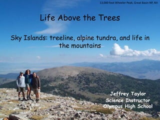
- 1. 13,000 foot Wheeler Peak, Great Basin NP, NV Life Above the TreesSky Islands: treeline, alpine tundra, and life in the mountainsJeffrey Taylor Science Instructor Olympus High SchoolGet Your High School Diploma Online
- 2. Life Is Tough in the Mountains Aletsch Glacier, Switzerland
- 3. Strong Winds, Cold Temperatures, Frozen Soil, Deep Snow, Summer Heat, UV radiation all take its toll… Grand Ridge, Olympic NP, WA
- 4. Two Main Factors Affect VegetationMoisture and Temperature
- 5. Two Factors Affect Moisture and TemperatureElevation and Aspect
- 7. Cooler air causes water vapor to condense into clouds
- 9. Rainshadow Effect Windward Leeward Rainshadow Desert Coastal rainforests Drier intermountain trough Ocean
- 10. Water From The Sky 380” 19” 5 miles West Maui Wailuku at sea level gets 19” of rain while PuʻuKukui at 5,300 feet gets 380” of rain!
- 12. Moloka’iRainshadow From Kamakou Peak at 4
- 13. The Effect of Topographic Lifting Alpine Tundra Ecosystems Desert Sky Islands Ice Age Refugia Snowpack Water Storage and Glaciers
- 14. Factors That Affect Treeline For there to be alpine tundra, something has to prevent trees from growing There are 3 primary reasons trees can not grow; Snow Depth (summer growing season too short) Temperature (too cold) Moisture (too dry)
- 15. Aspect and Treeline Comparing the reasons why forests give way to alpine tundra meadows
- 16. Aspect The direction a slope faces. North aspects are in the shadows all winter and thus stay colder than south aspects. South Aspect North Aspect of the Trees in the Shade
- 17. Winter Solstice
- 18. Winter Solstice Notice the long shadows and the valley in the dark all day
- 19. Spring Equinox
- 20. Spring Equinox Shadows are not as long
- 21. Summer Solstice
- 22. Summer Solstice With the sun directly overhead, there are almost no shadows
- 23. An Autumn Day
- 24. Shadows in October The shadows are growing again
- 25. The Effects of Aspect The snow is piling up on the northern side of the ridge Wind blows snow These trees are buried
- 26. The Effects of Aspect Same spot in mid-summer, notice the lingering snow on north slope
- 27. North Versus South Aspect on High Divide in July Forest growing on south-slope Bare on the north-slope
- 28. High Divide Other Side in July
- 29. The Build Up of Winter Snowpack First Snows in Early October
- 30. Late November
- 31. Early Winter Accumulations Late December
- 32. Maximum Snowpack in Early Spring Late March
- 33. Late March
- 34. Early June The Lingering Summer Snowpack
- 36. Mid-August
- 37. Late September
- 38. The Effect of Aspect on Treeline Tree Island Snowbank Dry Meadows Wet Meadows Treeline 5500 feet 4500 feet Sea Level South North Pacific Northwest
- 39. A Cross-Section of a Pacific Northwest Valley Glacier > 6500” Rock/Ice Alpine meadows 5000-6500 ft Alpine meadows Subalpine Forest 4000-5000 ft subalpine fir/yellow cedar Subalpine Forest subalpine fir/yellow cedar Montane Forests 2000 to 4000 ft silver fir/mountain hemlock/Douglas fir Riparian Forest maple/alder/willow Montane Forests silver fir/mountain hemlock/Douglas fir Lowland Forest Sea Level to 2000 ft Douglas fir/western hemlock/grand fir western red cedar/Sitka spruce Lowland Forest Douglas fir/western hemlock/grand fir western red cedar/Sitka spruce
- 40. Life in the Subalpine Environment
- 42. Subalpine Firs at the Edge
- 44. Other Factors Affecting Treeline Temperature Some places are too cold for trees to grow Moisture Some places are too dry for trees to grow
- 45. Treeline Elevations of Western North America 15000 15000 10000- 10000 Alpine/Tundra Glaciers and Ice Forests 5000 5000 treeline Deserts/semi-arid shrublands 1000 1000 Arctic Washington Oregon Central California SE Alaska Arizona Central Mexico
- 46. Arctic Tundra Alaska’s North Slope above the Arctic Circle
- 47. Treeline in the Arctic Denali, Alaska
- 48. Treeline in the Rocky Mountains -40° winter temperature line 12,000 feet Notice no trees in the valley?
- 49. Treeline in the Rocky Mountains Cold Air Sinks
- 50. Treeline in the Rocky Mountains Cold Air Sinks
- 51. White Mountains, NH Low Treelines of the EastCold Air Sinking Down from Canada
- 52. Treeline in the Northern Appalachians White Mountains in New Hampshire at 4,000 feet
- 53. Treeline in the Northern Appalachians Mount Mansfield, VT at 4,000 feet
- 54. Treeline in the Southern Appalachians? Mount Mitchell, NC is 6,700 feet Predicted treeline would be nearly at 8,000 feet
- 55. Southern Appalachian Balds Roan Highlands, NC at about 6,000 feet
- 56. Treeline in the Tropics 17,000 feet Mount Kenya at the Equator Páramo in Colombia at 10,000 feet
- 57. Hawaiian Treeline Clouds condense at 5,000 feet and above 8,000 feet it is like a desert Mauna Kea and Mauna Loa 13,700 feet
- 58. Treeline on Mexican Volcanoes Matlalceuitl Volcano, Mexico at 13,000 feet
- 59. MontiSibillini, Italy Grazing Pressure on Treeline Treeline is about 1,500 feet lower than it would be naturally
- 60. Treeline in Italy Northern Apennines, Tuscany, Italy 4,500 feet
- 61. Treeline Elevations in the Northern Hemisphere
- 62. Treeline 11500 ft Montane Forest Pine, Fir, and Spruce 8500 ft 7000 ft 6000 ft Pinyon Pine – Juniper Zone 4500 ft High Desert – Sagebrush Zone 3500 ft 2000 ft Low Desert Sea Level South North Desert Southwest Sky Island
- 63. Desert Sky Islands Spruce/Fir Forests at 9,000 feet Sonoran Desert at 2,000 feet
- 64. Aspect in the Desert Southwest Mount Graham at 10,000 feet
- 65. North Aspect in the Desert Southwest Lingering snow on Mount Graham’s north slope
- 66. South Aspect in the Desert Southwest Snow is gone on south slope
- 67. Desert Sky Islands View down to the desert from Mount Graham
- 68. Ice Age Refugia Mountain Goats 6,000 feet Red Spruce Forest in North Carolina Alpine Wildflowers Ancient Bristlecone Pines 9,000 feet Mount Graham Red Squirrel, AZ 11,000 feet
- 69. Thanks For Joining Me! Mount Ellinor, Olympic Mountains, WA
Notes de l'éditeur
- The image at left shows the beginnings of a rain shower in the Gila Wilderness of New Mexico. The clouds became dense enough and the droplets heavy enough that they began to fall as rain.The image at right shows the eastern Sierra Nevada mountains. The elevation where the dew point temperature has been reached is about 10,000 feet. Snow has fallen on the mountains, but conditions in the valley are desert-like because temperatures remain above the dew point temperature.
- An Illustration of the Rainshadow Effect
- As clouds pass over the mountains, they drop precipitation on the windward side. But, when the air drops on the leeward side, it warms up, causing the clouds to evaporate again due to the temperature rising above the dew point temperature. This adiabatic heating and cloud evaporation results in drier conditions on the leeward side of the mountains. This is the rainshadow effect.The image top-left shows the leeward side of Molokai in Hawaii. The top of the mountain is a rainforest at 300” of rain per year. On the dry slopes, it drops to less than 30”. But, notice the gullies carved by runoff from the rainforest above.The image at lower left shows the rainshadow effect of the Cascade mountains resulting in dry conditions in eastern Washington. The image at lower right shows the rainshadow effect of the Olympic Mountains, resulting in the “blue hole” in the Dungeness valley and north Puget Sound.
- Dew point is the temperature at which water vapor will condense into liquid. As warm moist air from the ocean runs into and rises above the coastal mountains, the cooler air causes the water vapor to condense into tiny droplets that form clouds.The dew point temperature varies depending on the absolute humidity (quantity of water vapor molecules in the air) and air pressure (quantity of air molecules for a given volume). But, when dew point is reached, the relatively humidity is 100% and any additional water vapor must condense.Relative humidity is the percentage of water vapor in the air compared to the amount that can be held in the air at that temperature. If relative humidity is 50%, then the air can hold two times more moisture than it currently has. A relative humidity of 100% means the air can hold no more moisture.The top image shows how warm humid air condenses onto the colder water bottle that can hold less moisture. The lower-left image shows large convection clouds forming in Arizona as they rise to the point where the temperature is cool enough for the vapor to condense. The lower-right shows clouds condensing on Maui at 4,000 feet elevation. That is the elevation where the temperature is at the dew point and relative humidity is at 100%. Below that elevation, the humidity is not high enough for condensation, so conditions remain dry and sunny. Notice that the land is brown at low elevation and green up high. Ask the students why.
- Aspect refers to what direction a slope faces. Due to the angle of the sun in the sky, south-facing slopes get much more sun than north-facing slopes, particularly in winter. In winter, some north-facing slopes get absolutely no sun (in the shadows), while the south-facing slopes get all of the available sun. Even in summer, when the sun is the brightest and highest, the sun remains slightly in the south in the day, meaning north-facing slopes remain in colder.Notice in the left image that the south-sides of the trees have no snow on the branches, but the north-side branches still have snow. The image on the right shows that despite it being a bright sunny day, the long shadows results in darkness for anything north of an obstruction. Notice the large drift that is not melting off on the side? Both of these images were taken on the same day.
- On the winter solstice, notice that the sun rises in the southeast and sets in the southwest. Even at noon, the sun remains far to the south and casts long shadows.
- Ridges create shadows that keep the north-facing slopes in darkness all day long. Notice in the image how the shadows darken one side of the ridge.This is the first in a series of shots taken at Hurricane Ridge looking into the Elwha river watershed throughout the year.
- On the spring equinox the sun rises due east and sets due west. However, all day long the sun remains to the south, casting shadows on the northern slopes. Notice on the image how the ridge still casts shadows on the north-aspect.
- Notice on the image how the ridge still casts shadows on the north-aspect.
- During the summer solstice, the sun rises to the northeast and sets in the northwest. This is the only time of year that north-facing slopes receive significant sunlight. However, at noon the sun is back in the more southerly sky creating some shadows. But, this is the time when the sun is most directly overhead.
- Notice on the image above how most, but of the ridges are receiving sunlight, with few shadows.
- In Autumn the sun returns to its normal southerly location and the long shadows are cast on the north-facing slopes once again.
- With October having arrived, cooler temperatures and the first snowfall of the year, the shadows grow long again and the north-facing slopes stay in the shadows longer.
- This is snow that has piled up on the north-facing slope of Hurricane Ridge by late winter. The blowing drifts have accumulated up to 30 feet deep in places. These north-facing drifts melt much more slowly than the south-facing slopes due to the long winter shadows.
- This image shows the same slope in August and there is still a patch of snow that has lingered because of the shadows that dominate this side all winter. It is extremely difficult for trees to become established on this slope on due to the short growing season. Trees at the edges may remain under a blanket of snow for 9 months or more.
- On the High Divide, the north-facing slopes still have snow in July and are devoid of trees. The south-facing slopes in the distance have long since shed their snow. In addition, there is more vegetation on those south-facing slopes.
- This image is also taken from High Divide on the same day looking south from the ridgeline. Rather than barren slopes and snow, it contains green meadows and forests. These slopes have a longer growing season, because the snow melts out faster. Because the trees are not buried by snow as long, the treeline is further up the slope on the south side than on the north side.
- The is the first snowfall of the year at Hurricane Ridge (elevation 5,200 feet) in mid-October. This dusting will not last long, as typically it snows and melts off several times in the early fall while temperatures are still relatively mild. It will not be till late-November or December that snow starts to stick for good.
- By late November, the snow usually starts to accumulate for the winter. The typical “snow line” is about 2,000 feet in the Pacific Northwest in the winter. Below 2,000 feet, precipitation will fall as rain. Although the freezing level will vary dramatically from storm-to-storm (from sea level to above 9,000 feet), typically about 2,000 feet is where you’ll run into the first long-term winter snow pack during the winter months.
- By late-December or January, deep snow has accumulated following a series of powerful winter storms. In certain locations, strong winds will blow the snow into drifts 10-20 feet deep, while exposing other areas.
- By March, 20-30 foot snow banks have piled up at Hurricane Ridge, but warmer early spring temperatures have begun to melt the snow off the darker-colored trees. Dark spots melt out faster, because they absorb more solar radiation. Often a deep hole in the snow forms around pine cones or rocks that fall on the snow surface.
- Approximately 400 inches of snow falls at Hurricane Ridge in a typical winter and as much as 1000+ inches on Mount Olympus. This makes for some thick piles of snow in the parking lot and a lot of work for the snow plows.
- With snowpack reaching its maximum around March, the winter snowpack will begin to melt out with increasingly warmer temperatures and longer days of sun around April. Rain falling instead of snow will speed up the process. However, due to the depth of the snowpack, by mid-June there still remains thick blankets of snow in the subalpine forest and alpine meadows. While patches of bare ground open up, many high elevation trails are still mostly impassable.
- By mid-July, most alpine meadow areas have melted out and the wildflowers start making an appearance, particular on south-facing slopes. However, deep snow packs remain in the higher elevations and in sheltered north-facing basins.
- By August, almost all of the winter snowpack has melted, but sheltered pockets on north-faces remain. Some high elevation ridges still have significant patches of snow.
- By October, the long summer drought is coming to an end and the temperatures are dropping back toward freezing. Virtually all of winter snow pack is gone, except for the glaciers. But, the first snowfall of the next season is just about to begin. Sometimes there are sheltered places where previous year’s snow pack has not fully melted out before the next season’s snow begins.
- While there are exceptions to this rule based on many factors, such as slope steepness, soil type, wind conditions, and latitude, the general trend is that treelines are lower on north-facing slopes than south-facing slopes because of the longer time it takes for the winter snowpack to melt off.The treeline in the Pacific Northwest averages around 5,000 feet elevation, but can vary by up to 1,000 feet in either direction based on local conditions. Often there are also tree islands, particularly on the tops of ridges, where the snowpack and soil moisture neither melt and then dry out too fast nor linger too long into the summer. Notice the trees are taller and larger, the further down the slope you go. Warmer temperatures and less snowpack provide longer growing seasons for these trees, regardless of the impact of shadows.
- Looking at a cross-section of a typical river valley in the Pacific Northwest, there are changes in species composition and ecosystem processes based on elevation and aspect. Each species is best adapted to specific climatic conditions, but they also have a wide range of variability. The lowland forests tend to be dominated by some of the largest tree species in the world, such as Douglas fir, western hemlock, grand fir, and western red cedar. The mild and wet conditions at low elevation, with freezing temperatures being uncommon, makes this an ideal environment for the trees to grow very large and live for a long time. Sitka spruce also becomes more dominate in coastal areas with salt spray and even wetter conditions. At middle elevations, where the temperatures are cooler and more of the precipitation falls as snow, Pacific silver fir and mountain hemlock become more dominant. Douglas fir and western hemlock also play important roles in these montane forests.At higher elevations, deep snow packs, intense winter winds, and high summer solar radiation make life difficult for trees. Only species adapted to these subalpine environments can thrive, such as subalpine fir and Alaska yellow cedar. Mountain hemlock, Douglas fir, whitebark and lodgepole pine can be found in some subalpine locations.Above 5,000 feet, the growing season becomes too short for trees to survive and the alpine meadows dominate. However, above 6,000 feet the climatic conditions become too harsh even for those hardy species. Above 6,500 feet the mountains become essentially bare rock and ice.
- This image shows the montane forest where Pacific silver firs dominate. They grow together densely, providing each other protection from the winds and heavy snow. The understory tends to barren, due to heavy snow packs, dark shadows from the trees above, acidic soils formed by dropping fir needles, and the short growing season.
- In the subalpine zone, subalpine fir and Alaska yellow cedar dominate. One strategy for survival in an area that can get 400” of snow each winter is to go grow very straight and narrow, so that snow will slide off the branches, as opposed to accumulating and then snapping the branches off. Alaska yellow cedar, on the other hand, has very flexible branches that easily bend to release accumulated snow and then snap back up.
- On a south-facing slope, dry meadows form where conditions are too dry to support trees because of the intense summer sun. However, tree islands often form on the ridgetops, where conditions are more moderate. The young subalpine fir to the right is twisted and bend from being buried all winter by 30 feet of snow. Subalpine firs have to be flexible to survive that kind of weight. Subalpine firs grow very slowly in their first 30-50 years because of the short growing seasons. Once they are large enough to keep their limbs above the snow pack, their growing season is longer and their growth rate faster.
- This image shows a series of alpine meadows, rock fields, and tree islands at the very edge of the alpine zone near 6,000 feet. Notice the skirting at the base of the subalpine firs. This is another strategy for surviving deep snowpacks and intense solar radiation. These skirts protect the soil from solar radiation in summer, keeping the soil moist for the mainstem of the tree. In winter, these skirts keep the snow off the ground and insulate the roots from cold temperatures. Eventually small arms will grow upwards from the skirts and once they reach high enough to be above the snowpack in the winter, it too can grow tall like its neighbors.
- Aspect refers to what direction a slope faces. Due to the angle of the sun in the sky, south-facing slopes get much more sun than north-facing slopes, particularly in winter. In winter, some north-facing slopes get absolutely no sun (in the shadows), while the south-facing slopes get all of the available sun. Even in summer, when the sun is the brightest and highest, the sun remains slightly in the south in the day, meaning north-facing slopes remain in colder.Notice in the left image that the south-sides of the trees have no snow on the branches, but the north-side branches still have snow. The image on the right shows that despite it being a bright sunny day, the long shadows results in darkness for anything north of an obstruction. Notice the large drift that is not melting off on the side? Both of these images were taken on the same day.
- From a latitudinal basis, treeline elevation increases as you head south. As temperatures rise moving south, the elevations needed to accumulate enough snow or low enough temperature to hinder tree growth rises higher and higher. Once you reach the lower latitudes, forests also experience a “lower treeline” as arid conditions make surviving in lower elevations impossible.
- This image is located in Alaska’s north slope, well north of the arctic treeline. When meadows occur above the treeline on mountains, they are called alpine meadows. When they occur north of the arctic treeline, they are called tundra. Functionally, these meadow types are very similar and many of the species of plants that live in them are the same.
- The treeline of the arctic is classified more on latitude than on elevation. It refers to the furthest north trees can grow. Like in the Rocky Mountains, it occurs where winter temperatures are low enough to freeze the sap in trees and kill them. In addition, permafrost plays a major role, as it solidifies the soil, making it impossible for trees to put stable roots into the ground. It usually occurs around 65-75 degrees North latitude. There is no Antarctic treeline in the southern hemisphere because of the lack of land. In general, the southern continents have trees and then there are none on the sub-Antarctic islands and Antarctica itself. This image shows the northern edge of the boreal forest in Alaska, with small and scattered white spruce.
- The treeline in the Rocky mountains has more to do with minimum winter temperatures than the depth of the snowpack. At the same latitude where treeline is 5,000 feet in the Olympics, the treeline is nearly 12,000 feet in the Rocky mountains. In this more arid region, caused by the rainshadow effect of the Cascades and Sierra Nevada mountains, sufficient rainfall for trees does not occur until about 6,000 feet elevation. Above that there are forests that climb the slopes until reaching a zone where winter temperatures sometimes drop to below -30°F. Those extremely cold temperatures freeze the sap inside the trees and the formation of ice crystals destroy their cells, causing death. This forms pretty distinct lines above which trees can not grow, unlike in the Pacific Northwest where the lines are not distinct and depend on the snow depth at any particular spot.This is an image from Rocky Mountain National Park in Colorado. The meadows at the bottom of the valley are formed when very cold air in winter sinks into the valley, killing trees at the bottom, as well as, above the treeline.
- The treeline in the Rocky mountains has more to do with minimum winter temperatures than the depth of the snowpack. At the same latitude where treeline is 5,000 feet in the Olympics, the treeline is nearly 12,000 feet in the Rocky mountains. In this more arid region, caused by the rainshadow effect of the Cascades and Sierra Nevada mountains, sufficient rainfall for trees does not occur until about 6,000 feet elevation. Above that there are forests that climb the slopes until reaching a zone where winter temperatures sometimes drop to below -30°F. Those extremely cold temperatures freeze the sap inside the trees and the formation of ice crystals destroy their cells, causing death. This forms pretty distinct lines above which trees can not grow, unlike in the Pacific Northwest where the lines are not distinct and depend on the snow depth at any particular spot.This is an image from Rocky Mountain National Park in Colorado. The meadows at the bottom of the valley are formed when very cold air in winter sinks into the valley, killing trees at the bottom, as well as, above the treeline.
- The treeline in the Rocky mountains has more to do with minimum winter temperatures than the depth of the snowpack. At the same latitude where treeline is 5,000 feet in the Olympics, the treeline is nearly 12,000 feet in the Rocky mountains. In this more arid region, caused by the rainshadow effect of the Cascades and Sierra Nevada mountains, sufficient rainfall for trees does not occur until about 6,000 feet elevation. Above that there are forests that climb the slopes until reaching a zone where winter temperatures sometimes drop to below -30°F. Those extremely cold temperatures freeze the sap inside the trees and the formation of ice crystals destroy their cells, causing death. This forms pretty distinct lines above which trees can not grow, unlike in the Pacific Northwest where the lines are not distinct and depend on the snow depth at any particular spot.This is an image from Rocky Mountain National Park in Colorado. The meadows at the bottom of the valley are formed when very cold air in winter sinks into the valley, killing trees at the bottom, as well as, above the treeline.
- The treeline in the northernAppalachian mountains hovers around 4,000 feet, because like the Rocky mountains, extremely cold temperatures from the Arctic come down in winter and kill the trees. This image is a view near the treeline on Mount Washington in New Hampshire. Mount Washington is famous for having the “worst weather in the world” with temperatures below -40°F in winter and winds over 100 mph. During one storm, it recorded a world record of a wind gust at 231 mph (not counting tornadoes).
- On Mount Mansfield, Vermont above treeline at 4,000 feet, smallkrummholzspruces cling to cavities in the rock. Only in these small sheltered creases can trees get some protection from fierce winds, sand paper like blowing ice, and arctic temperatures.
- In the southern Appalachian mountains, there is no true treeline, not even on 6,700 foot Mount Mitchell in North Carolina. Temperatures simply do not get cold enough in winter at that latitude to kill trees. This image shows the view from the summit of Mount Mitchell to the parking lot. Notice the spruce trees go all the way to the summit. The dead trees in the image are killed by a combination of invasive insects, such as woolly adelgids and acid rain.
- There are open meadow areas on some summits in the southern Appalachians called “balds”. These balds can develop in places where fires, grazing, or forest clearing by humans eliminated the trees from the summits. However, the recolonization of trees is slow in these areas due to the harsher climate at these elevations. While not true subalpine meadows, they do mimic them in many ways. They are important habitat for many species of plants and animals. Today, they are often maintained by pulling encroaching trees, mowing, and prescribed burns. This image shows the Roan Highlands at 5,800 feet in North Carolina.
- The Páramo of Central and South America and the Afromontane ecosystems of Africa are tropical alpine zones above the cloud forest treeline. These areas, while at elevations over 9,000 feet, are lower than one would expect based on a linear graph of treelines versus latitude in the northern hemisphere. There are multiple reasons for tropical alpine zones to have lower elevations than further north. For one, they are located above the dew point line for tropical moisture, making these areas much drier than the lower elevations. Secondly, as isolated islands of vegetation located thousands of miles from temperate zones, the species of the tropics are not well adapted to survival in cold temperatures. These images show the Afromontane vegetation on Mount Kenya in Africa at around 9,000 feet elevation.
- In the high volcanic arc of central Mexico, the ecosystems are more closely related to and adapted to the temperate climates from the north, due to the movement of ecosystems southward during the ice ages. Thus the treeline areas are dominated by pines, firs, and oak forests, much like further north. These plants are able to survive cold and arid conditions more readily than tropical species and therefore the treeline is significantly higher (around 13,000 feet). This image is of the treeline on Matlalcueitl volcano in Mexico at about 13,000 feet.
- In Europe and across central Asia and the Middle East, heavy grazing pressures by sheep,goats, and cattle in more arid areas can cause treeline to be lower than they would be naturally. Livestock munch on seedling trees near the edge of the subalpine meadows.In addition, the increased solar radiation and wind exposure makes it difficult for the forest to expand upward, even when grazing pressures are later reduced.This image taken in the central Apennines in Italy shows a herd of cattle down by the small ponds below. Their grazing prevents the forests from becoming established except for the steeper slopes which the cows avoid. The high mountain in the distance rises high above the natural treeline and even above the alpine meadows to a summit of nearly 9,000 feet elevation.
- This image shows the treeline in the northern Apennines in Italy at around 4,500 feet elevation. The dense beech forests abruptly give way to alpine meadows. Even in national parks, small-scale traditional shepherds routinely graze sheep in these meadows.
- This is a plot of treeline elevations all across the northern hemisphere from the arctic treeline at 70°N (point where treeline is at sea level) south to the Equator. While there is some significant variation based on local temperature, moisture, and snowpack conditions, the overall trend is higher treeline elevations at lower latitudes. The curve does begin to flatten in the subtropical zone, because climate patterns and moisture availability changes from the temperate zones. In fact, treeline is often higher in sub-tropical arid zones than in truly tropical equatorial zones.
- This is a schematic of a Sky Island in the Desert Southwest. It still has climatic characteristics similar to mountains in the coastal regions, except that it is much warmer and drier, resulting in a lower treeline (desert). The desert zone is higher on south-facing slopes than north-facing slopes, because the higher sun exposure means hotter and drier conditions for plants. Trees begin to appear at about 5,000-6,000 feet elevation (the point where enough moisture falls in winter and temperatures are cooler). Drought-tolerant pines and juniper give way to moisture-loving firs and spruces at about 8,000 feet. The treeline is about 11,500 feet, where winter temperatures and wind exposure conspire with exposure to intense summer sun to prevent the growth of trees.
- The Madrean Sky Islands of the Desert Southwest are high elevation mountains that contain conifer forests above low deserts in the valleys. This image shows the view from Saguaro National Park in the Sonaran Desert at about 1,000 feet elevation, with the forest-covered 9,000 foot Santa Catalina Mountains in the distance.
- While north-facing slopes tend to have lower treelines in the Pacific Northwest, than south-facing slopes, an opposite effect occurs in the Desert Southwest. North-facing slopes tend to have forested areas descend further down slope in the mountains than on south-facing slopes. That is because, in this arid region, soil moisture is the limiting factor for trees. Thus, north-facing slopes maintain winter snowpack and soil moisture longer into the spring and summer, making it easier for trees to survive. The shade also keeps air temperatures lower.This image shows the summit area of Mount Graham in Arizona, at nearly 11,000 feet. While it is low desert below, at the summit, the area is dominated by montane coniferous forests.
- Near the summit area of Mount Graham in Arizona at nearly 11,000 feet, the north-facing slopes are covered in dense coniferous forests. In this image taken in May, temperatures already approach 100°F in the low desert, while snow remains on the ground on the north-facing slope. These cooler, wetter slopes are dominated by Douglas fir and Engelmann spruce.
- This is an image of a south-facing slope also taken in June at about the same elevation. This slope, receiving more sun in the winter has already melted the snowpack away. With drier conditions occurring earlier, Ponderosa pine is the dominant species because it is more adapted to arid conditions than Douglas fir or Engelmann spruce.
- This image shows the view from high on Mount Graham, the highest of the Madrean Sky Islands at nearly 11,000 feet. From the Sonoran desert flood, it rises through chaparral shrublands, juniper-pinyon stands, ponderosa pines, Douglas fir, and eventually a fir-spruce forest at the summit.