neighborhood scenario planning | Eliot Allen
•Télécharger en tant que KEY, PDF•
4 j'aime•1,361 vues


Recommandé
Contenu connexe
En vedette
En vedette (6)
Similaire à neighborhood scenario planning | Eliot Allen
Similaire à neighborhood scenario planning | Eliot Allen (20)
Plus de OpenPlans
Plus de OpenPlans (6)
Dernier
Dernier (20)
neighborhood scenario planning | Eliot Allen
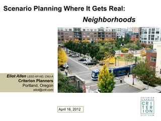
- 1. Scenario Planning Where It Gets Real: Neighborhoods Eliot Allen LEED AP-ND, CNU-A Criterion Planners Portland, Oregon eliot@crit.com April 16, 2012
- 2. INDEX Scenario Planning Applications
- 3. What is Where What are Where Are we How important are we our do we want taking the . are we to us? now? options? to go? right steps? doing?
- 4. Birmingham U.S. 11 Neighborhoods
- 5. Neighborhood Defined • Perry 1927: quarter-mile radius/125 ac • LEED-ND up to 320 acres • Half-mile radius = 500 acres • Social/economic boundaries Neighborhood Processes Using Scenarios • Land-use/transportation plan updates • Transit station area development • Brownfield redevelopment • EIR/EIS alternatives • Eco-districts • Regional centers/corridors implementation • California: SB 375 Sustainable Communities
- 6. Simplified Scenario Planning Steps Existing Indicator Values Indicator Conditions Goal Setting Rating & Survey Selection SWOT Weighting and driving informs user-defined forces success Build- Create Design/ Evaluate Impleme Out Scenario Assemble & Iterate nt& or other • buildings 3 to 4 - reference • land-use incremental case • urban design consistency • circulation - update • infrastructure benchmarks
- 8. Designing a Cool Spot in Tampa Tampa Heights Central Plaza Scenarios 1 8 DU/ac 2 6 DU/ac 42 Emp/ac 3 5 Emp/ac Multi-family Mixed retail/office/res Mixed retail/res Parking garage 3 5 DU/ac 4 9 DU/ac 26 Emp/ac 4 0 Emp/ac
- 9. CO2 lbs/capita/yr 1 2 3 4 Scenarios Cool Spot Footprints
- 10. Scenario Land Geographies & Data House - hold Neighborhoo Floor Building d Job boundary • Municipality • Parcel Census Unincorporated units • County • Subregion Job Land TAZ • Region
- 11. Scenario Transportation Geographies Neighborhood-scale prerequisite: walk, bike, transit, auto networks
- 12. Built Environment Components (abbreviated list) • Site/building features, land-use types, place types. • Multi-modal circulation networks: walk, bike, transit, auto; and parking. • User-defined metrics for evaluating scenario performance & ranking scenarios by goal achievement. • Existing conditions SWOT analysis: Strengths, Weaknesses, Opportunities, Threats – informs goal setting & scenario assembly. • ‘Susceptibility to change’ screening: spatial focus. • Real estate development feasibility; infrastructure assessment; sustainability evaluation.
- 13. Scenario Planning Tools Land-use Transportation INDEX Travel demand/traffic impact models CommunityViz F&P Quick Response Tools ET LEED-ND Connections Tool SmartPlan MIT Urban Network Toolbox SIMM OpenTripPlanner RapidFire/Uftprint Real estate development LUCIS Argus Developer What If UrbanSim Landscape/ecology Pencil Out I-Tree Procedural 3D visualization Vista UrbanVision (w/ dynamic transp) CityGreen CityEngine
- 15. Existing Conditions SWOT’ed With User Values
- 16. Weymouth, MA Naval Base Reuse Plan
- 17. SpatialIndicator Mapping Diagnostics: Housing Proximity to Housing Proximity to Amenity (grocery) Transit Stops
- 18. Optimizing Development Feasibility Paul Waddell UrbanSim
- 19. Focusing on Susceptibility to Change Atlanta Midtown Alliance
- 20. Sustainability Scenarios at a Neighborhood-Scale • EarthCraft Communities • Enterprise Green Communities • Envision Infrastructure Neighborhood/ • Great Neighborhoods community rating • GreenLITES systems: • GreenTRIP - Expert vetted. • LEED for Neighborhood Development - Menus of measures. • SITES - Assemble local packages/ • STAR Community Index scenarios. - Iterate/evaluate. - Calif: SB 375 SCS.
- 21. LEED-ND Scenarios: Dial-In Silver to Platinum • Density • Use mix • Jobs/housing balance • Housing diversity/affordability • Pedestrian network • Bicycle network • Transit service • Street network • Building form & function • Visitability & universal design • Green building performance • Site disturbance • Climate integration • Infrastructure efficiency
- 22. LEED-ND Low Carbon Totals 63 ND Points Gold Certificatio n & 30% CO2 Reduction 12,000 CO2 lbs/capita/ year avoided
- 23. Criterion Planners Arizona State University Urban Research Lab
- 24. Criterion Planners Arizona State University Urban Research Lab
- 25. Cool New Tools for • Portland Metro Context Scenarios • City of Portland PDX BikeShare • US EPA Smart Location Database & Impervious Surface Growth Model • US EDA Triple Bottom Line Tool (beta now open) • USGBC RegGIS
- 26. Online Neighborhood Dashboard: Portland Metro Context
- 27. PDX BikeShare: Crowd-Sourced Scenarios OpenPlans.org
- 28. U.S. EPA • Smart Location Database • Impervious Surface Growth Model SLD ISGM
- 29. U.S. EDA
- 30. INDEX RegGIS use case: what portions of a Minneapolis transit corridor merit heat island reduction & stormwater mgmt?
- 31. INDEX RegGIS use case: what portions of a Minneapolis transit corridor merit heat island reduction & stormwater mgmt?
- 32. INDEX RegGIS use case: what portions of a Minneapolis transit corridor merit heat island reduction & stormwater mgmt?
- 34. 1. Locate Floodplains 2. Buffer Floodplains
- 35. 1. Locate Floodplains 3. Locate Wetlands 2. Buffer Floodplains
- 36. 1. Locate Floodplains 3. Locate Wetlands 2. Buffer Floodplains 4. Buffer Wetlands
- 37. 1. Locate Floodplains 3. Locate Wetlands 5. Union Buffered Floodplains 2. Buffer Floodplains and Wetlands 4. Buffer Wetlands
- 38. 1. Locate Floodplains 3. Locate Wetlands 5. Union Buffered Floodplains 2. Buffer Floodplains and Wetlands 4. Buffer Wetlands 6. Locate Tree Canopy
- 39. 1. Locate Floodplains 3. Locate Wetlands 5. Union Buffered Floodplains 2. Buffer Floodplains and Wetlands 4. Buffer Wetlands 6. Locate Tree Canopy from 7. Subtract Tree Canopy Unioned Floodplains and Wetlands
- 40. 1. Locate Floodplains 3. Locate Wetlands 5. Union Buffered Floodplains 2. Buffer Floodplains and Wetlands 4. Buffer Wetlands 6. Locate Tree Canopy from 7. Subtract Tree Canopy 8. Locate Impervious Surfaces Unioned Floodplains and Wetlands
- 41. 1. Locate Floodplains 3. Locate Wetlands 5. Union Buffered Floodplains 2. Buffer Floodplains and Wetlands 4. Buffer Wetlands 6. Locate Tree Canopy from 7. Subtract Tree Canopy 8. Intersect Impervious Surfaces 9. Locate Impervious Surfaces Unioned Floodplains and Wetlands
- 42. 1. Locate Floodplains 3. Locate Wetlands 5. Union Buffered Floodplains 2. Buffer Floodplains and Wetlands 4. Buffer Wetlands 10. Apply LEED-ND credits for heat islands and stormwater mgmt. 6. Locate Tree Canopy from 7. Subtract Tree Canopy 8. Intersect Impervious Surfaces 9. Locate Impervious Surfaces Unioned Floodplains and Wetlands
- 43. Favorite Neighborhood Planning References
- 44. Mechanics of Tool-Supported Scenario Planning
- 45. Scenario Planning Going Forward • More web software/mobile apps, less desktop/expert based. • Open source GIS overtakes ESRI in innovation/local markets. • BIM (bldg info models) linked dynamically with GIS/visualization tools and analytics. • Greater availability of more reliable national datasets at smaller scales. • Hyper feedback from engagement tools/social media; too much of a good thing? • Expanded use of scenarios, especially short term problem solving, leads to greater uptake by practitioners/citizens.
Notes de l'éditeur
- Notes:\n\nWelcome.\n
- \n
- \n
- \n
- \n
- \n
- \n
- \n
- \n
- \n
- \n
- \n
- \n
- \n
- \n
- \n
- \n
- \n
- \n
- \n
- Notes:\n\nSee reference guide chart.\n
- Notes:\n
- \n
- \n
- \n
- \n
- \n
- \n
- \n
- \n
- \n
- \n
- \n
- \n
- \n
- \n
- \n
- \n
- \n
- \n
- \n
- \n