1. City of Newport
Form Based Code
Regulating Plan
DR AFT
07-06-10
Zoning Administrator: Paul J. Dreher
FORM BASED CODE THROUGH PARTNERSHIPS:
REFRESHING REAL ESTATE DEVELOPMENT
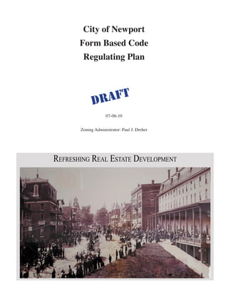
historic photo
PAUL DREHER CITY OF NEWPORT NEWPORT, VERMONT
TODD SCOTT KING COUNTY HISTORIC PRESERVATION SEATTLE, WASHINGTON
3. INDEX
Form Based Code Definitions 4
Overview 5
Process /Administration / & Issuance 5
Requirements
Streetscape 6
Lots, Blocks, Streets And Alleys 6
Buildings 7
Parking 8
Retail 9
Graphic Standards
Form 1 Main Street 10 - 11
Form 2 Downtown 12
Form 3 High Density 13 -14
Form 4 Urban Waterfront High Density 15
Form 5 Urban Waterfront Medium Density 18
Form 6 High Density Residential - Mixed Use 19
Downtown Regulating Map 16 - 17
Possible Frontage Types 20
Street Types & Street Type Standards 21
Secondary Street Types 22
Primary Transit Street 23
Proposed Corridors / Alleys / Recreation Paths 24
Building Breaks and Store Frontage 25
Main Street - Current Possible Build-Out 26
Main Street - FBC Possible Build-Out 27
Pommerleau Peninsula - Current Possible Build-Out 28
Pommerleau Peninsula - FBC Possible Build-Out 29
4. Form Based Code Definitions
ALLEY: The public right of way for vehicles and pedestrians within a BLOCK that provides access to the rearof buildings, vehicle
parking (e.g., garages), utility meters, and recycling and garbage bins.
AWNING: A cantilevered, projected or suspended cover over the sidewalk portion of the street. Also, a roof like coverings, usually of
canvas or metal and often adjustable, placed over the sidewalk, windows, or doors to provide protection from sun and rain.
BLOCK: An aggregate of private lots, passages, alleys and Lanes, circumscribed by public streets.
BLOCK CORNER:Two public streets meet on a Block.
BLOCK FACE: Is the aggregate of all the building facades on one side of a Block.
BUILDING ENVELOPE STANDARDS(BES): The part of the Code that establishes basic parameters regulating building form, in-
cluding the envelope, placement (in three dimensions) and certain permitted/required building elements, suchas storefronts, and street
walls. The BES establish both the boundaries within which things may be done and specific things that must be done. The applicable
BES for a site is determined by its street frontage and street type as per the regulating plan. This produces a coherent street and allows
the building greater latitude behind its street facade.
BUILD-TO-LINE: A line parallel to the street right-of-way line at any story level of a building and representing the minimum distance
which all or any part of the building is set back from said right-of-way line. Front porches, stairs and handicap ramps may extend
beyond the build-to line up to half their depth.
CIVIC BUILDING: A building operated by not-for-profit organizations dedicated to arts, culture, rligion, education, recreation, gov-
ernment, transit, and municipal parking, or for use approved by the legislative body.
CIVIC SPACE An outdoor area dedicated for public use.
COMMON YARD: A planted private frontage wherein the facade is set back from the front property line.
FRONT :The side of a property facing a public street.
FRONTAGE: The linear distance measured along the front lot line between the points of intersection with the side lot lines. For the
purpose of measurement, lot “frontage” shall be continuous and measured along the joining boundary of the front lot line and a public
right-of-way
GALLERY: A private frontage conventional for retail use wherein the facade is aligned close to the front property line with an at-
tached cantilevered shed or lightweight colonnade overlapping the Sidewalk.
GROUND FLOOR: The street level floor of a structure.
NEIGHBORHOOD STORE: Is any retail store containing a maximum of 1500 sq ft of enclosed space with no on-site parking permit-
ted or required.
OUTBUILDING: Is an accessory building, usually located toward the rear of the same lot as a principal building, and sometimes con-
nected to the Principal Building.
OFF STREET PARKING: A parking facilities located in city or privately owned lots and structures.
PARAPET: A low protective wall or railing along the edge of a raised structure such as a roof or balcony.
PRINCIPAL BUILDING: Is the main building on a Lot, usually located toward the Frontage
PUBLIC SPACE: Is space open to public view or access.
REAR Is the private back portion of a property.
REGULATING PLAN: Is a zoning map or set of maps that shows the sub-districts subject to regulation by the form based code.
STORE FRONT: means a private frontage conventional for retail use, with substantial glazing and an awning, wherein the facade is
aligned close to the front property line with the building entrance at sidewalk grade.
SIDEWALK: Is the paved section of the public frontage dedicated to pedestrian activity, café seating, and other street furniture.
SQUARE: Is a civic space designed for unstructured recreation and civic purposes, spatially defined by building frontages and consist-
ing of paths, lawns and trees.
STOOP: A private frontage wherein the facade is aligned close to the front property line with the first story elevated from the sidewalk
for privacy, with an exterior stair and landing at the entrance.
STREET: A city thoroughfare for pedestrian and vehicle access.
STREET FURNITURE: means benches and other structures incorporated into the streetscape for use by pedestrians.
STREET LIGHTS: Is pedestrian scale lighting incorporated into the streetscape and in parking facilities to promote safe travel during
evening hours.
STREET TREES: Means a canopy trees used to reinforce the area along vehicular streets where pedestrian activities are encouraged.
STREET WALLS: A freestanding wall built along the front property line. It may mask a parking lot from the street, provide privacy to
a side yard, and/or strengthen the spatial definition of the public realm.
STREETSCAPE: Is the physical elements along a street including trees, benches, waste bins, and bike racks.
4
5. Overview
Form Based Code (FBC) identifies the basic physical characteristics of building sites/zones/street
types and determines the Building Envelope Standards or BES (See Graphic Standards Sheets) to be
applied in accordance with the City of Newport Form Based Code Regulating Plan.
Newport’s Regulating Plan Illustrates disposition of each property or lot and how it relates to its
adjacent properties and streets/building sites. All sites/lots described in Newport’s FBC overlay are
regulated by street frontage/type and building envelope standards.
Intent
Newport’s FBC overlay district is intended to be understood/coded as perimeter blocks with
buildings typically placed at the street along the outer edge of their sites or lots. The street
type and zone-building envelope standards promote a coherent streetscape throughout the FBC
overlay district. The prescribed standards will, additionally, assist building owners/developers in
understanding the relationship between streets, lots, built environment and the public realm. These
standards will endeavor to establish an environment that encourages and facilitates pedestrian
activity.
Process /Administration / & Issuance
In the Newport City Form Based Code overlay district there are two discreet review processes for
the Form Based Code review. The two are Administrative process or Special Requirement process.
All Conditional Use and/or Special Requirement permit will require that the permit application be
reviewed by the Development Review Board (DRB). Special Requirements are dependent upon
site size, project size and/or the need for minor variations/adjustment to the Form Base Code BES
standards. Additionally all permit applications that require Act 250 review shall require DRB review.
If the proposed use is a permitted use but Special Requirements Review is triggered the DRB shall
only review the proposed permit application utilizing the appropriate Form requirements.
Section 604 of the Newport City Zoning & Subdivision Bylaw sets forth the provisions and
requirements for the DRB Review Process However, in the FBC overlay district the criterion for
review will be: 1.Regulating Map, 2.Building Envelop Standards, 3.Streetscape Standards.
A) Administrative Review
Size Requirements: Projects on sites less than 40,000 square feet or with proposed building square
footages less than 30,000 square feet, shall be reviewed administratively. If the permit application
meets all of the standards of Form Based Code and are also a permitted use the Zoning Administrator
shall issue a zoning permit. Permits will not be issued for building activity until review is completed
and a determination made that the proposal is consistent with Form Based Code requirements. All
permits will be issued in accordance with standards set for Section 601 of Newport City Zoning &
Subdivision Bylaw.
B) Special Requirement Permit Review -DRB.
5
6. The Conditional Use and/or Special Requirement Permit --DRB review will be required for
sites over 40,000 square feet or with proposed building square footages over 30,000 square feet.
Such sites/proposed projects will be required to meet the intent of the FBC Standards and will be
evaluated in terms of how well they conform to FBC Standards and also meet objectives described in
Site Plan Review of the Newport City Zoning & Subdivision Bylaw.
The DRB review process with Special Requirement Permits may allow for deviations in the FBC
standards-- Examples of these deviations may include problems related to topography or street grade,
the location of alley and streets, building breaks and passages between buildings, signs, streetscape
details, design issues related to the inclusion of existing buildings proposal. Where properties of less
than 40,000 square feet have such difficulties they shall require DRB Review.
All permit issuance requirements shall be in accordance Title 24 VSA, Chapter 117 and Newport
City Zoning & Subdivision Bylaw.
Requirements
Streetscape
• In the built environment the street and building façade receives more attention than the rest of
the building. Streetscape elements, such as built edge, brick pavers, benches and waste-bins,
throughout Newport’s Designated Downtown and FBC overlay district must be consistent within
a project and should be consistent from project to project within a building activity node.
• Building facades are the public “face” of every building and support the life of the street.
Owners/developers are encouraged to utilize recommended Architectural Standards and
streetscape amenities—such as planters and window boxes.
• Building rear façade or the more private, rear portions of the lots (toward the alley) are
considered valuable/contributing members to the public realm—to be developed, maintained and
are required to adhere to appropriates Streetscape standards.
• Street Furniture, Bike Racks, Benches, Trash Receptacles are required--see BES for specific
requirements.
• Street Trees are part of an overall Streetscape, Tree requirements determined by Street Type—
See Tree Chart.
Tree Chart TBD
(This will define tree type based on location).
Lots, Blocks, Streets and Alleys
• All lots shall share a frontage line with a street or alley (no landlocked lots.)
• All lots and/or all contiguous Lots shall be considered to be part of a block. No block face shall
have a length greater than 400 feet without an alley, common access easement or pedestrian
6
7. pathway providing through-access to another street, alley, common access easement or courtyard.
Alleys may provide access to the rear of all lots. Alley construction is required as part of
redevelopment projects at the rear of property, unless an alley already exists.
• Where an alley does not exist and is not constructed at the time of redevelopment of any
property, the developer is required to dedicate the alley right of way within or at the rear of the
lot--Alley Type 1 standard—minimum.
Alleys shall be kept clear of debris, stored materials, and vehicles.
• Curb Cuts shall be limited to no more than one per 200 feet on Primary Streets
• On sites with no alley access, there shall be a 12 foot setback from the rear Lot line to provide
alley or delivery channel access.
Buildings
The hierarchy of Building Envelope Standards (BES) in descending order (most dense to least
dense) is as follows:
Form 1 Main street
Form 2 High Density Downtown
Form 3 High Density
Form 4 Urban Water High Density
Form 5 Urban Water Medium Density
Form 6 High Density Residential/Mixed Use
• The maximum building floor-plate (footprint) is 40,000 square feet; beyond that limit a special
exception is necessary. Large stores may have a maximum ground floor floorplate of 50,000
square feet—overall square footage may be greater.
• For each block, building(s) along the Build-To Line shall present a complete and discrete vertical
façade composition at an average street frontage length of 30 feet--varies per Form Building
Envelope Standards (BES). Each façade on Primary or Secondary (per Form BES) streets shall
include a functioning, public entry. This may be satisfied through the use of shops for large floor-
plate buildings
• Consistent Building Envelope Standards (BES) shall front one another on the Regulating Plan.
• When the Building Envelope/Edge Standard designation changes along a property frontage,
the property owner has the option of applying either Building Envelope Standard (BES) for a
maximum additional distance of 50 feet in either direction along that frontage.
• Publicly-owned, Civic Buildings (e.g. courthouses, municipal offices, etc) may be exempt from
prescriptions of this Code. The Development Review Board may modify all other provisions of
7
8. this Form Based Code for publicly-owned, Civic Buildings.
Building Breaks
The physical design of buildings facades should vary minimally at an interval determined by form
standard. The variations can be achieved through by utilizing the following techniques:
• Architectural division into multiple buildings,
• Break or articulation of the façade--Building Break Types (see diagram, §____)
1. Façade height change
2. Vertical surface shift
3. Horizontal surface shift /adjustment—section change
4. Significant material change
5. Arcade/gallery
• Significant change in facade design,
• Placement of window and door openings, or position of awnings and canopies.
Parking
General goals and standards.
• Sites/lots fewer than 20,000 square feet in land area have no minimum parking requirements.
• Enable people to park once at a convenient location and to access a variety of commercial
enterprises in pedestrian-friendly environments by encouraging shared parking.
• Reduce diffused, inefficient, single-purpose reserved parking.
• Avoid adverse parking impacts on neighborhoods adjacent to redevelopment areas.
• Maximize on-street parking. Provide flexibility for redevelopment of small sites and for the
preservation of historic buildings.
• Promote prototype projects using flexible and creative incentives.
Garage and Parking Entrances
• Any garage and/or vehicle (autos, trailers, boats, etc.) parking areas-except where parking is
located in an ancillary structure enclosed in a rear-loading town-house garage, or in a below
grade garage – on private property shall not be located within 25 feet from any Build-to-Line
(except for basement garages) and screened from the street by a street wall.
8
9. • Parking access shall be from an alley where present. Designated garage entries and alleys shall
be the sole means of automobile access to a site unless otherwise approved by the DRB
• Garage doors on residential parking shall not face (be at an angle of less than 90 degrees from the
primary front Build-to-Line or right of way unless otherwise approved by the DRB
• These requirements are not applicable to on-street parallel parking.
Parking Types
In general allowed parking is as follows:
• Behind structure-surface parking. Ground level public or private parking lot that is located in the
rear yard behind a building. If possible, access to the parking should be taken from an alley.
• Parking structure-a building with a primary function is to provide parking. Ground level building
edge at primary and secondary street fronts shall maintain a pedestrian related use.
• Tucked under-ground level private covered parking lot located directly beneath the second floor
of building. Tucked under parking shall not be visible from the public right-of-way unless the
right-of-way is a City designated alley.
• Sub-surface/under-parking facility that is below grade.
• [Next to structure-disallowed in Form(s) 1,2,3, 4 & 5.] Next to the building is allowed but
discouraged in Form 6.
Retail General Intentions
Retail is required on the ground level at primary streets and, to a lesser degree, on secondary streets-
see specific Building Envelope Standards(BES) §_____. The inclusion of retail enlivens the street
and creates a purpose for pedestrians/citizens to inhabit the streets. Unless otherwise noted, retail is
an inclusive phrase that encompasses consumer comparison—goods, general merchandise, apparel,
furnishings and other types of similar merchandise, convenience goods, food/delis, gifts, drugstore
items, personal care, cards/stationery, personal business services, professional, restaurants, grocery
stores, lodging, hotel, theater, and other uses that provide visual interest and create active street life.
Retail that does not directly sell goods will be divided into two categories/types—See Building
Envelope Standards and Street Types for retail types usable locations
Retail Divides into two distinct types:
Primary Retail Uses: Generally, uses that provide entertainment or leisure activities, promote high
walk-in customer counts, or are shopping destinations.
Secondary Retail Uses: Generally, uses that provide personal or business services.
9
26. 26
Main Street - Spates Block
Current Possible Build-Out
Spates Block Infill (Current Codes) - View from West (April 15 1:30 pm)
CLIENT PROJECT ISSUE
Newport City Planning & Zoning Core 1 Form Code 04.15.10
05
27. Main Street
FBC Possible Build-Out
Block Infill - View from West (April 15 1:30 pm)
T PROJECT ISSUE
port City Planning & Zoning Core 1 Form Code 04.07.10
04
27
28. Pomerlea Point
FBC Possible Build-Out
High Density Waterfront as seen from Southwest (3:00 pm, May 15 )
28
29. High Density Waterfront as seen from Northeast (9:00 am, June 21 )
29
High Density Waterfront as seen from Southeast (9:30 am, May 12 )