THE GEOSPATIAL REVOLUTION
•
1 j'aime•545 vues

The document discusses the growing mainstream adoption of geospatial technologies. It notes that geospatial data is now easily accessible and integrated into many applications as just another data type. Crowdsourcing of geospatial data through projects like OpenStreetMap is allowing much more comprehensive and up-to-date maps to be created at a fraction of the traditional cost. The widespread availability of location sensing technologies and real-time geospatial data is enabling new applications and use cases across many domains.

Recommandé
Recommandé
Contenu connexe
En vedette
Similaire à THE GEOSPATIAL REVOLUTION
Similaire à THE GEOSPATIAL REVOLUTION (20)
Plus de Peter Batty
Plus de Peter Batty (14)
Dernier
Dernier (20)
THE GEOSPATIAL REVOLUTION
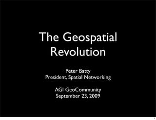
- 1. The Geospatial Revolution Peter Batty President, Spatial Networking AGI GeoCommunity September 23, 2009 1
- 2. Overview • Mainstream at last! • A real-time, multimedia view of the world • Crowdsourcing 2
- 3. GIS was a specialized backroom technology for many years 3
- 4. “1995: the year that GIS disappeared” Doug Seaborn AM/FM conference, 1992 4
- 5. Disruptive technology Functionality / lo gy performance c hno he d te bl is E sta Mainstream Market requirements lo gy chno e te ru ptiv Dis Time 5
- 6. Now much easier to include location data Free or cheap Location Geocoding map data tracking 6
- 7. Finally, geospatial data is just another data type flickr.com/photos/26664862@N04/2499573972/ 7
- 8. The neogeographers Google Microsoft Open Source ... and more 8
- 9. Fun and cool Performance Ease of use API Continued innovation 9
- 10. 3D buildings Birds eye view Photosynth SQL Server 10
- 11. Strong in database Strong in web mapping Weaker on desktop Data improving fast Spans both “GIS” and “neogeo” spaces 11
- 12. “But these new systems are just simple web mapping, they’re not GIS” 12
- 14. 14
- 15. Data creation and maintenance Upcoming Mapzen editor Cloudmade 15
- 16. Data creation and maintenance “Walking Papers” for OpenStreetMap Stamen Design Here’s a print of Chinatown, San Francisco. 16
- 17. Geospatial analysis Stamen Design 17
- 18. Geospatial analysis FortiusOne / GeoCommons 18
- 19. The peasants can’t do what they need with Google Maps! Well let them use ESRI instead! Marie Antoinette 19
- 20. Graphic showing “peace” Maybe hippies holding hands (Shouldn’t fight neogeo vs GIS - all same problem) neogeography = GIS 20
- 21. A real-time, multimedia view of the world 21
- 22. September 7, 2009 22
- 23. 23
- 24. 24
- 25. Microsoft Photosynth 25
- 26. Google Streetview 26
- 27. maps Microsoft Virtual Earth Manhattan 27
- 28. C3 Technologies Las Vegas 28
- 29. prototypegame.org Manhattan 29
- 30. Live Video Live 30
- 31. The Sensor Web Need a spatial context to make sense of all this 31
- 32. Location sensing UWB GPS Wi-Fi RFID Cell towers 32
- 33. New TomTom traffic speed dataset derived from 600 billion speed readings from users real time data within 3 minutes flickr.com/photos/rutlo/3164449930/ 33
- 34. location based services are real at last! 34
- 35. Smart Grid “The Internet brought to our electric system” Storage Renewable Energy Demand Response Intelligent devices and control systems 35
- 36. Will have the ability to know where everything is - and what is happening - all the time 36
- 37. Crowdsourcing 37
- 38. Web Web 1.0 2.0 publishing participation 38
- 39. Wikipedia 39
- 40. Hurricane Katrina New Orleans 40
- 41. Community generated data scipionus.com 41
- 43. 43
- 44. “The future is user created data” Google MapMaker Michael Jones, Google 44
- 45. 45
- 46. OpenStreetMap 46
- 47. December 3, 2007 Google OpenStreetMap July 7, 2009 47
- 48. Denver, CO Denver, CO USA USA “Mousetrap” junction of I-25 and I-70 Cape Royal Grand Canyon, AZ Cropston USA England 48
- 49. 132,764 users 24m km of highways crazy 34m km of ways momentum!! OSM stats from May 2009 NAVTEQ had 18m km of highways in Dec 2007 flickr.com/photos/pimpmasterjazz/2601898276/ 49
- 50. What about quality? Dr Muki Haklay of UCL “OSM quality is beyond good enough, it is a product that can be used for a wide range of activities” Based on a detailed analysis http://tinyurl.com/mukiosm 50
- 51. Database 2007 data 69 countries 11m miles (18m km) of roads 18m points of interest People “Creating, maintaining and delivering a comprehensive, high quality map database is a Field force 700 multi-step, labor-intensive process. We Central production 270 currently employ over 270 employees in our centralized production facility and a global Technology 500 workforce of over 700 geographic analysts in 32 countries” Total 3349 Financial Revenue $853m (~€604m) Data creation & distribution costs $396m (~€280m) 51
- 52. Crowdsourcing is a paradigm shift for data creation flickr.com/photos/jamescridland/613445810/ 52
- 53. In summary ... a wild ride ahead! 53
- 54. ? peter.batty@spatialnetworking.com geothought.blogspot.com 54