To G or not to G
•Télécharger en tant que KEY, PDF•
0 j'aime•1,180 vues

My first presentation at WhereCamp EU, relating to the work we're doing with Ubisense myWorld. In the title G=Google and the question has two meanings ... if you're a traditional GIS user, should you be using Google Maps or something similar (answer=yes), and given that, should you be using Google specifically (answer is it depends ... we no longer use Google App Engine, we do use Google Maps but have been testing OpenLayers for offline applications).

Recommandé
Contenu connexe
En vedette
Similaire à To G or not to G
Similaire à To G or not to G (20)
Plus de Peter Batty
Plus de Peter Batty (18)
Dernier
Dernier (20)
To G or not to G
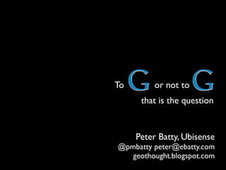
- 1. To or not to that is the question Peter Batty, Ubisense @pmbatty peter@ebatty.com geothought.blogspot.com
- 2. GIS has been a specialized backroom technology for many years
- 5. flic.kr/p/7NEJzF Location is now Pervasive and Simple in consumer applications flic.kr/p/7rnNAD
- 7. Disruptive technology Functionality / performance og y ch nol he d te a blis Est Mainstream Market requirements lo gy chno te pti ve ru Dis Time
- 9. “But these new systems are just simple web mapping, they’re not GIS”
- 10. Demo Offline
- 11. Mobile Photo by John Spooner - http://flic.kr/p/7eRgRe
- 12. Wireless broadband becoming pervasive
- 13. Revolution in simple but powerful smartphones and tablets
- 18. Multiple networked devices Phone or tablet outside Laptop in truck
- 19. Augmented reality Pole #374109 Wood, 30ft Switch #1307 Circuit #254, ABC Inspected 2010/08/15
- 21. 2007 Prius 2010 iPad! $2000 $2.99 + $2.99/mo
- 22. Why the cloud?
- 23. Ray Ozzie Ex Chief Software Architect, Microsoft Picture from microsoft.com
- 24. Complexity kills. Ray Ozzie Ex Chief Software Architect, Microsoft Picture from microsoft.com
- 25. Complexity kills. Complexity sucks the life out of users, developers and IT. Complexity makes products difficult to plan, build, test and use. Complexity introduces security challenges. Complexity causes administrator frustration. Ray Ozzie Ex Chief Software Architect, Microsoft Picture from microsoft.com
- 26. We’re moving toward a world of: cloud-based continuous services that connect us all and do our bidding, and appliance-like connected devices enabling us to interact with those cloud-based services. Ray Ozzie Ex Chief Software Architect, Microsoft Picture from microsoft.com
- 27. We’re moving toward a world of: cloud-based continuous services that connect us all and do our bidding, and appliance-like connected devices enabling us to interact with those cloud-based services. See http://ozzie.net/docs/dawn-of-a-new-day/ or google “ray ozzie new day” Ray Ozzie Ex Chief Software Architect, Microsoft Picture from microsoft.com
- 30. This is an old Google data center (2005) Each container holds servers 1,160 This facility holds an estimated 150,000 servers
- 31. Google has an estimated 40 data centers… …holding an estimated 1 million servers
- 32. 3 billion searches per day 35,000 searches per second
- 33. 2 billion videos per day
- 34. 100 million monthly users
- 35. one zillion times more computer science PhDs than your company or mine has
- 36. HUGE economies of scale Google Amazon Your IT department
- 37. Save BIG!! flic.kr/p/64kFKH
- 38. EC2 Pricing September 5, 2010
- 39. My daily quotas (max $5 per day) 46.5 CPU hours 43.2m web requests! 6.5 CPU hours free
- 40. My total server costs for development of myWorld to initial launch (Sept 2010) 13c
- 41. flic.kr/p/4iCux7 but is it SECURE???
- 42. There is a strong case that your data is more secure in the cloud
- 43. Agility Google Maps had 400 releases in its first 4 years flic.kr/p/7BM8zr
- 44. Cloud benefits Server side Ultra scalable Secure Major cost savings Hardware, admin, upgrades Much faster enhancements & fixes flic.kr/p/7Bzn5E
- 45. cloud-pocalypse!!! Photo by darkmatter - http://flic.kr/p/oCmz8
- 46. Photo by makelessnoise - http://flic.kr/p/csxdY
- 47. Photo by Steve Punter - http://flic.kr/p/5qXFV9
- 49. Google reserves the right (but shall have no obligation) to pre-screen, review, flag, filter, modify, refuse or remove any or all Content from the Service Photo by Auntie P - http://flic.kr/p/2vPH2
- 50. you give Google a worldwide, royalty-free, and non- exclusive license to reproduce, adapt, modify, translate, publish, publicly perform, publicly display and distribute such Application for the sole purpose of enabling Google to provide you with the Service in accordance with its privacy policy Photo by Auntie P - http://flic.kr/p/2vPH2
- 51. Architecture 1 Arc2Earth Runs on Google App Engine (only) Google Maps
- 52. Architecture 2 PostGIS + MapFish Runs on any Linux or Windows server, in cloud or in house Google Maps
- 53. Architecture 3 PostGIS + MapFish OpenLayers or Openlayers can be used in offline mode, Google Maps can’t Google Maps
- 54. Pros and cons of Google Maps and OpenLayers Google Maps Search (geocoding) built in Routing, traffic Street View Lightweight Extra mobile features More innovation OpenLayers Free (gratis) Free (libre) Can be used offline Can work with more data providers (Google, Bing, OSM etc)
- 55. September 12-16 Huge growth in Free and Open Source Software
- 56. Why Open Source? It’s free! More flexible terms (usually) Access to source code Longevity
- 57. flic.kr/p/nHFSw
- 64. Google basemap gives context
- 67. Street View gives extra info
- 68. Street View gives extra info
- 69. Street View gives extra info
- 70. Google style one box search Something on “Google style search”
- 71. Ability to link to maps
- 74. Reports in search too
- 76. Google geocoding very flexible
- 78. “Enterprise mashups” Outages Trucks WMS CIS Smart Grid
- 79. Ability to link to maps
- 80. Click link, no software needed! Demo
Notes de l'éditeur
- \n
- “GIS” has been around for 25-30 yearsFor most of that time, has been a specialized niche outside mainstream ITThis is changing, due to various factors:Support of spatial data in mainstream databasesEntry of Google and Microsoft into geospatialGreater commercial availability of spatial data\n
- \n
- \n
- \n
- \n
- \n
- \n
- \n
- \n
- \n
- \n
- \n
- \n
- \n
- \n
- \n
- \n
- \n
- \n
- \n
- \n
- \n
- Ray Ozzie retired in October 2010\n
- Ray Ozzie retired in October 2010\n
- Ray Ozzie retired in October 2010\n
- \n
- Note that evernote is a nice example of something that runs on multiple clients, can run offline, auto syncs when connected, does some more complex processing (text recognition) in the cloud\nDropbox lets you share files seamlessly between machines on different platforms - including Windows, Mac, iPad, iPhone\n
- \n
- \n
- \n
- \n
- \n
- \n
- \n
- \n
- \n
- \n
- \n
- \n
- Mention example of field systems – how are these currently secured?\nGrowth in customer web portals – need to work out internet security\nMore complex network security challenges in smart grid\n
- \n
- \n
- \n
- \n
- \n
- \n
- \n
- \n
- \n
- \n
- \n
- \n
- \n
- \n
- \n
- Mention change from enterprise driven innovation to consumer driven innovation\n
- \n
- \n
- \n
- \n
- This is a typical utility basemap in Smallworld – fairly sparse. But you can see with the raster tiled approach that the data looks exactly like it does in Smallworld\n
- Adding in a Google Street Map gives a lot more context. Maintaining base maps is not a core activity for utilities, and is very expensive. It really makes sense to use basemaps maintained by somebody else. There are ways that you can add updates where necessary, for example adding a new subdivision which isn’t on the basemap yet.\n
- And Google satellite imagery is good for many applications. I hear a lot of people say that Google imagery is out of date but I think they are updating it more and more frequently.\n
- What if your data doesn’t match the Google landbase? Many utilities have an old and inaccurate landbase and want to transform or conflate their network data to a new and more accurate landbase, for multiple reasons – sharing data with other entities, using GPS, and working with external data like Google Maps, or imagery from other sources. This is an example of some data from PNG, who went through such a conflation exercise. You can see here how much better their pipes align with a Google map background after the conflation progress. That’s not the main focus of my talk today, but \n
- \n
- Google street view can give you valuable extra information about facilities. Often you can see details on pole configuration and so on that may not be stored in the database. We’ve integrated tightly with this, so that when you click on a facility you automatically get the right street view displayed. In cases where the data doesn’t line up exactly it’s easy to adjust the view and save that for next time.\n
- A very powerful feature is that you can display icons in the street view itself and mouse over or click them for more information.\n
- In this example we can see several poles further away as we look along the street.\n
- \n
- \n
- \n
- \n
- \n
- \n
- \n
- \n
- \n
- \n
- \n