Balanced Rock in Idaho Resembles Africa
•Télécharger en tant que DOC, PDF•
1 j'aime•746 vues

1) Balanced Rock in Idaho resembles the shape of Africa and was likely carved in antiquity to serve as a monument, not a completely natural formation. 2) It commemorates the Egyptian discovery of America and a comet catastrophe around 2344 BC that caused a global flood, killing 54% of the world's population of 4.8 million through rain, fires, and cold over 4 months. 3) Evidence at the site such as locations, distances, and latitudes are used to encode information about the flood's timing, duration, rainfall amount, and global effects.

Recommandé
Contenu connexe
Tendances
Tendances (20)
Similaire à Balanced Rock in Idaho Resembles Africa
Similaire à Balanced Rock in Idaho Resembles Africa (20)
Plus de INSTITUTE OF MEGALITHIC RESEARCH
Plus de INSTITUTE OF MEGALITHIC RESEARCH (13)
Dernier
Dernier (20)
Balanced Rock in Idaho Resembles Africa
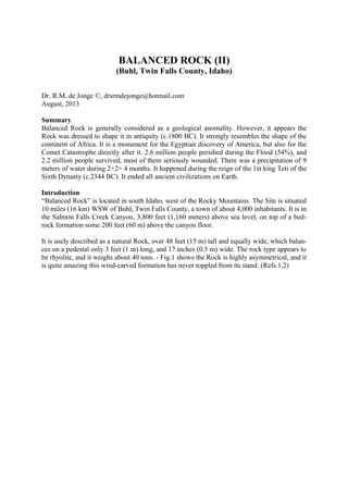
- 1. BALANCED ROCK (II) (Buhl, Twin Falls County, Idaho) Dr. R.M. de Jonge ©, drsrmdejonge@hotmail.com August, 2013 Summary Balanced Rock is generally considered as a geological anomality. However, it appears the Rock was dressed to shape it in antiquity (c.1800 BC). It strongly resembles the shape of the continent of Africa. It is a monument for the Egyptian discovery of America, but also for the Comet Catastrophe directly after it. 2.6 million people perished during the Flood (54%), and 2.2 million people survived, most of them seriously wounded. There was a precipitation of 9 meters of water during 2+2= 4 months. It happened during the reign of the 1st king Teti of the Sixth Dynasty (c.2344 BC). It ended all ancient civilizations on Earth. Introduction “Balanced Rock” is located in south Idaho, west of the Rocky Mountains. The Site is situated 10 miles (16 km) WSW of Buhl, Twin Falls County, a town of about 4,000 inhabitants. It is in the Salmon Falls Creek Canyon, 3,800 feet (1,160 meters) above sea level, on top of a bed- rock formation some 200 feet (60 m) above the canyon floor. It is usely described as a natural Rock, over 48 feet (15 m) tall and equally wide, which balan- ces on a pedestal only 3 feet (1 m) long, and 17 inches (0.5 m) wide. The rock type appears to be rhyolite, and it weighs about 40 tons. - Fig.1 shows the Rock is highly asymmetrical, and it is quite amazing this wind-carved formation has never toppled from its stand. (Refs.1,2)
- 2. Fig.1 Balanced Rock in south Idaho resembles the continent of Africa (c.1800 BC) (Courtesy: Tom Foster, Ref.1) Comet Catastrophe Sixth Dynasty Balanced Rock closely resembles a coast map of the continent of Africa (Fig.1). The Medi- terranean Sea is in the North, the Red Sea in the North-East, the Indian Ocean in the East, and the Atlantic Ocean in the West. Egypt is located in the north-eastern corner of Africa, where the Med meets the Red Sea. In the lower part of Balanced Rock a deep, horizontal line was carved (see Fig.1). It repre- sents a series of important waterways in the southern part of Africa. From west to east these are the Cunene River, the Cubango River, the Zambezi River, and Lake Kariba, pointing to the north-east. (Note, that Lake Victoria is also shown.) These waterways are located at a latitude of c.17.5°S, which is 42.5+17.5= 60° south of Ba- lanced Rock. This difference in latitude refers to the Sixth Dynasty, when a huge Comet Cata- strophe occurred. - Latitudes were already known c.4800 BC, as shown by the monument of Barnénez, Brittany, France.
- 3. In antiquity the Head of a Comet was symbolized by the island of Greenland, which consists of ice and stones. The Tail of a Comet was represented by the North Atlantic Ocean below it, which contains a huge amount of water. Cape Farvel, the south cape of Greenland, is located at 60°N. It confirms the Sixth Dynasty, when the Biblical Flood occurred. The latitude line of Balanced Rock, at 42.5°N, crosses the Atlantic Ocean over 60° of longitude, confirming it, again. The SW Cape of Greenland is located at 60+1= 61°N. It shows it happened during the reign of the 1st King Teti (c.2370-2338 BC) of this Dynasty. This is correct, because it happened in c.2344 BC (tree-ring dating). The meridian, or north-south line of Balanced Rock leaves the south coast of Great Slave Lake, Canada, at 60+1= 61° N, confirming it. The Rock is situated 1.0 centimoira= 1,100 m above sealevel, confirming the first king. (Refs.3-6) Duration The ancient Egyptians used this Rock as a monument for the Comet Catastrophe (or Flood), which happened just after their discovery of America. (Ref.2) Balanced Rock, ID, is located at 42.5°N. The North Cape of Africa is located near the town of Bizerte, Tunesia, at 37.5°N (Fig.1). The average latitude of exactly 40°N refers to the 40th la- titude line, which connects both continents. It encodes the 4 months duration of the Comet Catastrophe. The Nile Delta (Fig.1), at 30°N, confirms the 30 days of the month. The four African waterways, mentioned above, confirm it. Balanced Rock, Twin Falls Coun- ty, is located 0.40 moiras, or 44 km west of Twin Falls, confirming it, too (1 Egyptian moira = 1°= 111 km). Twin Falls, in the Snake River, shows it was a two-stage-event: each stage lasted for 2 months (Fig.2). The meridian of Balanced Rock hits the northern shore of North Arm, Great Slave Lake, 62.5-42.5= 20° above the Site, confirming it. - Cape Farvel, the south cape of Green- land, is located at the complementary latitude of the Nile Delta (Fig.1), at 90-30= 60°N. In antiquity the use of complementary latitudes was very common. It confirms each stage lasted for 2x30= 60 days. Its “complementary latitude” on the Northern Hemisphere equals 180-60= 120°N, confirming the total duration of the Calamity of 60+60= c.120 days. (Refs.7-9) Nature of the Event During the first time period of two months the Earth was inside the Tail of the Comet (or Co- met Swarm). The falling stones were causing horrible forest-fires, and the melting ice resulted in torrential rains and worldwide floodings. It was completely dark on Earth. Many people drowned. The second time period also lasted two months. The Earth was outside the Tail of the Comet, again. The climate was completely disrupted. The terrible rains continued, but it also became extremely cold. So, the rains changed into ferrocious snow and hail storms. Many people died from starvation. (Refs.10-17) The Strait of Gibraltar is shown in the north-western corner of Balanced Rock, where the Med meets the Atlantic (Fig.1). It is located 36-30= 6° above the Nile Delta (Fig.1), referring to the Sixth Dynasty, when the Comet Catastrophe occurred. Its latitude, at 36°N, refers to the cir- cumference of the planet Earth: 36 Moiras, or 360°. It shows it was a worldwide Disaster.
- 4. Gibraltar is located 115-6= 109° east of Balanced Rock, encoding the real duration of the Bi- blical Flood: 109 days. (It was a little less than the 120 days, mentioned above.) The latitude line of Balanced Rock hits the west coast of Iberia 115-9= 106° east of the Site, confirming the c.106 days of the Flood. Its meridian runs to the mouth of the Colorado River, at 32°N, which is 42.5-32= 10.5° below the Site, confirming the total duration of c.105 days. The south point of Ungava Bay, Labrador, is located at the complementary latitude of the mouth of the Colorado River, at 90-32= 58°N. It encodes the periodicity of the Comet: c.580 years. The mouth of the River, at c.30°N, confirms it was a number of three figures. (Refs.18- 22) Fig.2 Twin Falls in the Snake River shows the Flood was a two-stage-event. Each stage lasted for two months (c.2344 BC). Casualties Balanced Rock, ID, is located at c.42°N. It refers to the East Cape of Newfoundland, and North America, at the complementary latitude of 90-42= 48°N. This Cape encodes the origi- nal world population before the Comet Catastrophe of 4.8 million men. The Rock is situated at a distance of 7.0 moiras, or 770 km from the West Coast, confirming the 7 figures of this number. The island of Bimini, off shore Florida, is located at the “relative latitude” of (48/90)x48= 26°N. It encodes the number of casualties: 2.6 million men (54%). - Cape Verde is the West Cape of Africa (see Fig.1). It is located c.260° west of Balanced Rock, confirming it. - Cape Kendall, Coronation Gulf, and the south coast of Dolphin and Union Strait, Canada, are loca- ted 68.5-42.5= c.26° above the Rock, confirming it, too. These places are situated at a latitude of c.70°N, confirming the 7 figures of the number.
- 5. Balanced Rock is located c.220° east of the River Nile, confirming the 4.8-2.6= 2.2 million survivors. Most of them were seriously injured. - The meridian of the Rock runs to Lake Mead (Colorado River), at 36°N. It refers to the circumference of the planet Earth, again: 36 Moiras, or 360°. It confirms it was a worldwide Disaster. - Groswater Bay, Labrador, is loca- ted at the complementary latitude of 90-36= 54°N. It confirms the percentage of casualties: 54%. (Refs.23-26) Precipitation Cape Agulhas is the South Cape of the continent of Africa (Fig.1), at 35°S. It is located 35+42.5= 77.5° or c.80° below Balanced Rock, ID. It encodes the total precipitation during the Flood of about 80 micromoiras= 80x0.11= 8.8, or 9 meters of water. The latitude line of the Rock runs to the North Platte River, Wyoming, 8° of longitude to the east, confirming it. It corresponds to an ice ball with a volume of 5.106 km3 , having a diameter of 200 km (or 130 miles). The content of this dirty ice ball, with stones, ended all ancient civilizations on Earth, including the Old Kingdom of Egypt. The Biblical Flood had a profound influence on the climate on Earth. The meridian of Balan- ced Rock runs to the mouth of the Colorado River, at 32°N. It illustrates this colder and dryer time period lasted for more than three centuries, from c.2344 BC till c.2000 BC, which is at the start of the Twelfth Dynasty (Middle Kingdom). (Refs.27-34) Discussion Balanced Rock is usely considered to be a completely natural, wind-carved rock formation, a geological anomality. However, we believe this is not true. It appears in antiquity the original rock was modified for its aimed function as a monument. At a variety of places rock was re- moved, especially at the base, with the goal to dress it in the shape of a coast map of the con- tinent of Africa. References 1. Tom Foster, Website: http://hugefloods.com/Bonneville.html 2. De Jonge, R.M., “Balanced Rock (I) (Buhl, Twin Falls County, Idaho)” (2013), Ref.5. 3. De Jonge, R.M., and Wakefield, J.S., How the SunGod Reached America c.2500 BC, A Guide to Megalithic Sites, 2002 (ISBN 0-917054-19-9). Available: MCS Inc., Box 3392, Kirkland, Wa 98083, also on CD. Website: www.howthesungod.com 4. Wakefield, J.S., and De Jonge, R.M., Rocks & Rows, Sailing Routes across the Atlantic and the Copper Trade, MCS Inc, 2010 (ISBN 0-917054-20-2). Available: MCS Inc, Box 3392, Kirkland, Wa USA 98083. Website: www.rocksandrows.com 5. De Jonge, R.M., Website: www.slideshare.net/rmdejonge 6. Pellech, Chr., Website: www.migration-diffusion.info 7. De Jonge, R.M., “The Discovery of Three Continents (Santo Stefano, North Sardinia, Italy, c.2300 BC)”, Ancient American, Vol.12, No.76, pgs.28-29 (2007), Ref.5. 8. De Jonge, R.M., “Stonehenge, Monument for the Discovery of America (Salisbury Plain, South England, c.2000 BC) (2011), Refs.5,6. 9. De Jonge, R.M., “Tripod Rock, Pyramid Mountain (Morris County, New Jersey, c.1900 BC)” (2011), Refs.- 5,6. 10. Peiser, B.J., Palmer, T., Bailey, M.E., Natural Catastrophes during Bronze Age Civilizations, BAR Interna- tional Series 728, Oxford, 1998 (ISBN 0-86054-916-X). 11. Baillie, M.G.L., “Hints that Cometary Debris played some Role in several Tree-Ring Dated Environmental Downturns in the Bronze Age”, Ref.10, pgs.109-117. 12. Peiser, B.J., “Evidence for a Global Disaster in the Late 3rd Millennium BC”, Ref.10, pgs.117-140. 13. Courty, M.-A., “The Soil Record of an Exceptional Event at 4000 BP in the Middle East”, Ref.10, pgs.93- 109. 14. Clube, S.V.M., and Napier, W.M., The Cosmic Serpent, Faber and Faber, London, 1982.
- 6. 15. Clube, S.V.M., and Napier, W.M., The Cosmic Winter, Blackwell, Oxford, 1990. 16. Joseph, F., Survivors of Atlantis, Their Impact on World Culture, Bear & Co., Vermont, 2004 (ISBN 1- 59143-0-040-2). 17. Baillie, M., Exodus to Arthur, Catastrophic Encounters with Comets, BT Batsford Ltd., London, 1999 (ISBN 0-7134-8681-3). 18. De Jonge, R.M., “The Comet Catastrophe of c.2345 BC”, (thirteen articles), Webpage: http://www.barry.warmkessel.com/dejonge.html 19. De Jonge, R.M., The Phaistos Disc Decoded, New Testimony of a Lost Civilization, 300 pgs., Netherlands (2008). Website: www.slideshare.net/drsrmdejonge 20. De Jonge, R.M., “Discovery of America and the Flood (c.2300 BC, Ita Letra, Villarrica, Paraguay)” (2009), Ref.5. 21. De Jonge, R.M., “The Discovery of Australia and the Flood (The Rainbow Serpent Shelter, Mt. Borradaile, Arnhem Land)” (2010), Ref.5. 22. De Jonge, R.M., “The Ikom Monoliths and the Flood (1200 BC-200 AD, Cross River State, Nigeria)” (2010), Ref.5. 23. De Jonge, R.M., “Great Serpent Mound (c.2300 BC, Adams County, Ohio)” (2010), Ref.5. 24. De Jonge, R.M., “Gold Ring (Grand Canyon, Arizona, c.1450 BC) (2010), Ref.5. 25. De Jonge, R.M., “The Swan Stone (Burrows Cave, near Olney, Illinois)” (2011), Ref.5. 26. De Jonge, R.M., “Sentinel Rock, Vermont (Discovery of America and Biblical Flood, c.1900 BC)” (2011), Refs.5,6. 27. De Jonge, R.M., “The Brandenburg Stone, Comet Catastrophe of 536/540 AD” (560 AD, Battletown, Meade County, Kentucky) (2010), Ref.5. 28. De Jonge, R.M., “About the Brandenburg Stone (560 AD, Battletown, Meade County, Kentucky)”, Ref.5. 29. De Jonge, R.M., “Oil City Glyphs (Pennsylvania, c. 2000 BC)” (2012), Ref.5. 30. De Jonge, R.M., “V-Shaped Glyph (Pennsylvania, c. 2000 BC)” (2012), Ref.5. 31. De Jonge, R.M., “Copper Spear Tip (Crow Wing County, MN, c.1500 BC)” (2013), Ref.5. 32. De Jonge, R.M., “Four Stone Chambers (I) and (II), (Crestone, Colorado, c.1900 BC) (2013), Ref.5. 33. Susan English, Website of the Ancient Waterways Society. 34. Molina, Y., FB Group: “Ancient West Virginia: An Enigma”
- 7. 15. Clube, S.V.M., and Napier, W.M., The Cosmic Winter, Blackwell, Oxford, 1990. 16. Joseph, F., Survivors of Atlantis, Their Impact on World Culture, Bear & Co., Vermont, 2004 (ISBN 1- 59143-0-040-2). 17. Baillie, M., Exodus to Arthur, Catastrophic Encounters with Comets, BT Batsford Ltd., London, 1999 (ISBN 0-7134-8681-3). 18. De Jonge, R.M., “The Comet Catastrophe of c.2345 BC”, (thirteen articles), Webpage: http://www.barry.warmkessel.com/dejonge.html 19. De Jonge, R.M., The Phaistos Disc Decoded, New Testimony of a Lost Civilization, 300 pgs., Netherlands (2008). Website: www.slideshare.net/drsrmdejonge 20. De Jonge, R.M., “Discovery of America and the Flood (c.2300 BC, Ita Letra, Villarrica, Paraguay)” (2009), Ref.5. 21. De Jonge, R.M., “The Discovery of Australia and the Flood (The Rainbow Serpent Shelter, Mt. Borradaile, Arnhem Land)” (2010), Ref.5. 22. De Jonge, R.M., “The Ikom Monoliths and the Flood (1200 BC-200 AD, Cross River State, Nigeria)” (2010), Ref.5. 23. De Jonge, R.M., “Great Serpent Mound (c.2300 BC, Adams County, Ohio)” (2010), Ref.5. 24. De Jonge, R.M., “Gold Ring (Grand Canyon, Arizona, c.1450 BC) (2010), Ref.5. 25. De Jonge, R.M., “The Swan Stone (Burrows Cave, near Olney, Illinois)” (2011), Ref.5. 26. De Jonge, R.M., “Sentinel Rock, Vermont (Discovery of America and Biblical Flood, c.1900 BC)” (2011), Refs.5,6. 27. De Jonge, R.M., “The Brandenburg Stone, Comet Catastrophe of 536/540 AD” (560 AD, Battletown, Meade County, Kentucky) (2010), Ref.5. 28. De Jonge, R.M., “About the Brandenburg Stone (560 AD, Battletown, Meade County, Kentucky)”, Ref.5. 29. De Jonge, R.M., “Oil City Glyphs (Pennsylvania, c. 2000 BC)” (2012), Ref.5. 30. De Jonge, R.M., “V-Shaped Glyph (Pennsylvania, c. 2000 BC)” (2012), Ref.5. 31. De Jonge, R.M., “Copper Spear Tip (Crow Wing County, MN, c.1500 BC)” (2013), Ref.5. 32. De Jonge, R.M., “Four Stone Chambers (I) and (II), (Crestone, Colorado, c.1900 BC) (2013), Ref.5. 33. Susan English, Website of the Ancient Waterways Society. 34. Molina, Y., FB Group: “Ancient West Virginia: An Enigma”