2005 Applications of optical and radar VHR Commercial Observation Satellites for emergency response and ecomomic growth2005-2009
•Télécharger en tant que PPT, PDF•
0 j'aime•320 vues

Common works of SCOR and ULRMC in Ukraine with usage of Commercial Observation optical and radar VHR Satellites in 2005 - 2009 years, Robert Lach, Oleksandr Kolodyazhnyy

Recommandé
Recommandé
Contenu connexe
Plus de Robert Jerzy Lach
Plus de Robert Jerzy Lach (11)
2005 Applications of optical and radar VHR Commercial Observation Satellites for emergency response and ecomomic growth2005-2009
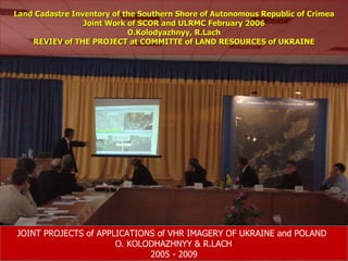
- 1. Land Cadastre Inventory of the Southern Shore of Autonomous Republic of Crimea Joint Work of SCOR and ULRMC February 2006 O.Kolodyazhnyy, R.Lach REVIEV of THE PROJECT at COMMITTE of LAND RESOURCES of UKRAINE JOINT PROJECTS of APPLICATIONS of VHR IMAGERY OF UKRAINE and POLAND O. KOLODHAZHNYY & R.LACH 2005 - 2009
- 2. Wydruk Nr 2, Landsat, Krym + zasięg archiwum i zasięg naszego kontraktu (1,5 m x 1m)
- 5. RMSE 9m) = CE ; 2,15 2 : 2,15 = 0,93 4,1 : 2,15 = 1,90 6,8 : 2,15 = 3,16 10,2 : 2,15 = 4,74 12,2 : 2,15 = 5,67 25,4 : 2,15 = 11,81
- 6. External Quality Control Block 16 – comparison of coordinates of control points RMSE=0.80
- 7. External Quality Control DTM control – terrain profile Lp Block X Y Z Z - DTM DZ Type of point vv 1 9 814659,12 266643,85 281,20 280,00 1,20 profil 1,44 2 9 814634,81 266666,77 281,18 280,00 1,18 profil 1,39 3 9 814605,97 266692,94 281,68 280,00 1,68 profil 2,82 4 9 814581,55 266715,77 281,77 280,00 1,77 profil 3,13 5 9 814567,51 266728,87 281,24 280,00 1,24 profil 1,54 6 9 814531,99 266761,90 279,52 280,00 -0,48 profil 0,23 7 9 814522,01 266770,91 279,33 280,00 -0,67 profil 0,45 8 9 814493,18 266797,46 278,04 280,00 -1,96 profil 3,84 9 9 814478,76 266810,60 277,90 280,00 -2,10 profil 4,41 10 9 814443,44 266843,48 276,94 280,00 -3,06 profil 9,36 11 9 814426,61 266859,37 276,84 280,00 -3,16 profil 9,99 12 9 814415,74 266869,44 277,10 280,00 -2,90 profil 8,41 13 9 814381,78 266900,91 277,83 280,00 -2,17 profil 4,71 14 9 814366,63 266915,06 278,64 280,00 -1,36 profil 1,85 15 9 814342,44 266937,67 278,42 280,00 -1,58 profil 2,50 16 9 814321,92 266956,27 278,79 280,00 -1,21 profil 1,46 … ..
- 10. Загальний вигляд області виконання робіт на знімку Landsat
- 14. Земельні ділянки на ортофото в прибережній зоні
- 15. Земельні ділянки на ортофото в гірській місцевості
- 17. Додавання нових об ’ єктів
- 18. Загальний вигляд системи представлення інформації з інвентаризації земель Південного берегу Криму на базі ПЗ Динамічний атлас
- 19. Приклад визначення інформації за номером кадастрової зони
- 20. Приклад визначення інформації за номером кадастрового кварталу
- 21. Приклад визначення інформації по земельній ділянці
- 22. Приклад отримання інформації по земельній ділянці з бази даних та приєднаної
- 23. Приклад отримання інформації по земельній ділянці з бази даних та приєднаної
- 26. Pożar w okolicach Chersona 22-23 sierpnia 2007r Dane z satelity IKONOS, pozyskane w dniu 7 września 2007
- 27. Згарище лісу біля села Хладківка в Херсонській області
- 28. Згарище лісу біля села Хладківка в Херсонській області
- 29. Згарище лісу біля села Нова Збурівка в Херсонській області
- 31. Зображення розливу мазуту в Керченській протоці за матеріалами радіолокаційної зйомки
- 34. Оцінка наслідків стихійного лиха 23-27 липня 2008 року. Перелік отриманих супутникових знімків
- 36. Flooding at July 23-27, 2008. City Galych . Assessment of flooded area by Landsat image (28.07.08) and archive image QuickBird ( 7.09.04 )
- 37. Jacqueline Mc Glade, President of European Environmental Agency