Public Hearing Usq Rezoning Bo A 12 4 08 Final
•
2 j'aime•526 vues

Union Square Zoning Propoal, December 4th Public Hearing

Recommandé
Contenu connexe
Tendances
Tendances (19)
En vedette
En vedette (20)
Similaire à Public Hearing Usq Rezoning Bo A 12 4 08 Final
Similaire à Public Hearing Usq Rezoning Bo A 12 4 08 Final (20)
Plus de Rob May
Public Hearing Usq Rezoning Bo A 12 4 08 Final
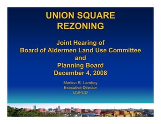
- 1. UNION SQUARE REZONING Joint Hearing of Board of Aldermen Land Use Committee and Planning Board December 4, 2008 Monica R. Lamboy Executive Director OSPCD
- 2. Outline • Background • Process • What Zoning Does • Districts – CCD – NB – AOD – TODs • Questions & Public Comment • Next Steps
- 3. Why Union Square? Background… • Historic City center • Distinctive character • Ongoing resurgence • Future rapid transit access • Strong arts community • Growth potential
- 4. Challenges Background… • Current laws impede development • Limited open space • Imbalance of vehicle, pedestrian, bicyclist • Significant infrastructure needs • Jobs/housing balance • Underdeveloped parcels, structures reduced in height
- 5. Union Square, Then and Now Background…
- 6. Related Efforts Background… • Rezoning Study • Green Line Extension • Transportation Study • Expedited Permitting (43D) • Brownfield Redevelopment • District Improvement Financing • Urban Renewal Plan • Business Improvement District
- 7. Process… Process and Outreach • Reviewed comments from previous versions • Prepared revised rezoning proposal • Worked with Focus Group (Feb-June) with reps from: AHOC Historic Preservation Commission Allen/Linden Street Neighborhood STEP Arts Council Union Square Main Streets Chamber of Commerce Union Square Neighbors Development Community Ward Street Neighborhood • Community meetings (June – Oct) • Architects meetings (July – Oct)
- 8. Process and Outreach Process… Community Meetings: June 24th – Community Meeting to Introduce Rezoning of Union Square July 8th – Corridor Commercial Districts and Neighborhood Business Districts July 14th – Business Environment and Pedestrian Activities July 16th – Transit-Oriented Districts July 21st – Arts Overlay District July 22nd – Spanish Language Meeting July 30th – Open Space July 30th – Architects Design Charette July 31st – Portuguese Language Meeting Aug. 5th – Haitian Creole Language Meeting Aug. 13th – Business Environment and Pedestrian Activities Sept. 17th – Second meeting of Architects Design Charette Early Oct. – Meeting with Focus Group Oct. 14th – Community Meeting to review final proposal to BOA Oct. 16th – Boynton Property Owners Meeting
- 9. Thanks to Focus Group! Abby Freedman Ken Kelly Ben Dryer Margo Grossberg Beth Driscoll Mary Regan Ed Marakovitz McFall Kerbey Ellin Reisner Mimi Graney Eric Fellinger (alternate) Stuart Dash Frank Martelli Ted Hatzis Fred Berman (observer) Trey Agnew Greg Jenkins Jean Martelli (observer) Jacky Amburn Vicky Choitz Jeff Meese Wig Zamore
- 10. Thanks to Architects! Community Design Resource Center of Boston—Brandy Brooks Perkins + Will—Patrick Cunningham KyAnn Anderson, Add Inc Peter Quinn, Peter Quinn Architects Josh Safdie, Boston Architectural Aristotle Bakalos, CBT College Jessica Bessette, Arrowstreet Andrew Steingiser, CBT Dennis Carlberg, Arrowstreet Frank Valdes, DiMella Shaffer Margelin Gace, Khalsa Design Inc. Kishore Varanasi, CBT Peter Wiederspahn, Northeastern, Jai Singh Khalsa, Khalsa Design, Inc. Wiederspahn Architecture,LLC
- 11. Vision for Union Square Process… • Vibrant Downtown • Transit Oriented • Variety of Housing • Compatible Development • Open Space
- 12. Process… Key Organizing Principles • Facilitate development in opportunity areas • Respect transition between commercial & residential • Balanced approach to circulation •Provide greater certainty for neighbors and applicants • Encourage sustainable development • Ensure design quality and compatibility
- 13. What Zoning Does • Use Standards • Building Design Standards • Site Design Standards • Parking Standards • Review Process
- 14. What Zoning Use Standards Does… • Use clusters A) Office / R&D / Institution B) Small Retail & Service C) Large Retail & Service D) Eating and Drinking E) Residential F) Other Accommodations G) Educational / Recreational H) Industrial I) Other Uses Arts related uses Pedestrian oriented uses • Affordable housing
- 15. What Zoning Building Design Standards Does… Green building incentives Definition of FAR Mechanical equipment height • Continuous streetwall Small commercial bays • Upper level setback • Mandatory design review
- 16. What Zoning Site Design Standards Does… • Buffer from residential areas • Usable open space Payment in lieu of open space Credit for public infrastructure Credit for parkland provision • Screening of service areas • Parking concealed from street
- 17. What Zoning Parking Standards Does… • Parking requirements simplified by use cluster • Parking requirements reduced Parking “freeze” for existing structures Payment In Lieu of Parking Leasing of Parking Parking Optimization Plan Compact Parking
- 18. Review Process What Zoning Does… • More mandatory development standards • Single board review Heavier review of new construction than change of use Structured parking excluded from linkage fee
- 19. Overall Rezoning Plan Dec 2008 • Commercial Corridor District (CCD) • Arts Overlay District (AOD) • Transit Oriented Districts (TOD) • Neighborhood Business District (NB)
- 20. Corridor Commercial District (CCD) Districts… Encourage Infill Development • Use Clusters • Scale similar to existing development • Commercial ground floor, street wall, small bays • Historic incentive • Reduced parking, parking “freeze”, payment in lieu of FAR – 3.0 Height – 55 ft parking
- 21. CCD Dimensional Requirements CCD Sample Building Envelope Historical structures that have been altered may be returned to their original form and design without variances
- 22. Visualization - CCD • Somerville Ave
- 23. Visualization - CCD • Somerville Ave
- 24. Neighborhood Business District (NB) Districts… Small-scale retail, services, and offices near residential areas. • Existing District • Reflects scale and use of historic built environment. FAR – 2.0 Height – 40 ft
- 25. Arts Overlay District Districts… Preserve, promote arts-related uses • Modest unit and FAR bonus for arts uses • Parking “freeze” • Design guidelines
- 26. Proposed AOD Districts… Citywide Benefits: Fine Arts & Crafts “Artist Studio Space” is established as use, with the following list of permitted arts uses, as well as accessory sales on site: “… creation, production, rehearsal or teaching of any visual art or craft, including but not limited to painting, drawing, graphic design, photography, video, film, sculpture, and pottery; of written works of fiction or nonfiction; or of any performing art, whether for live or recorded performance, including music, dance, and theater…” “Artist Live/Work Space” replaces current “Artist’s Housing” use. Emphasizes use as both Dwelling and Artist Studio Space.
- 27. Proposed AOD Districts… Citywide Benefits: Including Design Professions “Home Occupation” use is clarified and expanded to include crafts, performing arts, architects, and landscape architects (from current “artist, musician, photographer or writer”). “Arts-Related Uses” is defined, given an FAR and unit bonus in AOD, and designated as required use group in some TODs. • Artist Studio Space • Artist Live/Work Space • Arts-related educational facility • Crafts-related retail store • Museum/gallery • Retail sales of art and arts supplies • Office of creative design professional (e.g., architect, landscape architect, industrial designer) • Theater or performance space • Other bona fide arts-related uses, subject to SPGA approval.
- 28. TRANSIT ORIENTED DISTRICTS (TODs) - TOD 55 - TOD 70 - TOD 100 - TOD 135
- 29. Transit Oriented District 55 (TOD 55) Districts… Create buffer for residential neighborhoods • Mid-rise primarily residential environment •Reduced parking requirements FAR – 3.0 Height – 55 ft
- 30. Proposed TOD 55
- 31. Transit Oriented District 70 (TOD 70) Districts… Bookend Prospect Avenue corridor • Pedestrian oriented requirement supports street level activity • Upper level step back after 55 ft height • Green building incentive • 5% arts related uses • 15% affordable housing • 10 % usable open FAR – 4.0 Height – 70 ft space
- 32. Proposed TOD 70
- 33. Transit Oriented District 100 (TOD 100) Districts… Tie between Boynton Yards & Union Square • Pedestrian oriented requirement supports street level activity • Upper level step back after 55 ft height • Green building incentive • 5% arts related uses • 15% affordable housing • 10 % usable open space FAR – 4.0 Height – 100 ft
- 34. Proposed TOD 100
- 35. Visualization – TOD 100 • Kiley Barrel
- 36. Visualization – TOD 100 • Kiley Barrel
- 37. Visualization • Prospect St Bridge (TOD 100)
- 38. Visualization • Prospect St Bridge (TOD 100)
- 40. Transit Oriented District 135 (TOD 135) Districts… Transform Boynton Yards & McGrath • Allows modest industrial uses • Increased (15%) open space required • Green building incentive • 5% arts related uses • 17.5% affordable housing FAR – 5.5 Height – 135 ft
- 41. Proposed TOD 135
- 42. Visualization – TOD 135 • Boynton Yards
- 43. Visualization – TOD 135 • Boynton Yards
- 44. Visualization – TOD 135 • Pat’s Tow
- 45. Visualization – TOD 135 • Pat’s Tow
- 46. Development and Tax Capacity (2038): • 12 M net s.f. • 8.55 M s.f. of commercial development • 4.8 M s.f. of residential space • 3,750 total residential units created • 13,000 parking spaces • 200,000 s.f. of usable open space • 24,000 jobs •$36 M annual tax revenue Built Square Footage in Zoning Area (M SqFt) 10 9 8 7 6 5 4 3 2 1 0 2009 2013 2017 2021 2025 2029 2033 2037
- 47. Housing and Affordability: • Increase % of affordable housing (550 units est.) • Increased new housing of all types • Linkage fee from commercial development ($18 to $30 M) • Jobs, jobs, jobs
- 49. Visualization • Floor Area Ratio (FAR)
- 50. Visualization • Floor Area Ratio (FAR) within Zoning Envelope
- 51. Visualization – Prospect Hill
- 52. Visualization – Prospect Hill
- 55. NEXT STEPS Board of Aldermen • Public hearing of Land Use Committee & Planning Board • Planning Board recommendation to BoA • Closed public hearing of Land Use Committee & Planning Board • BoA decision
- 56. NEXT STEPS Transportation Study • Begin development with USQ Main Streets of alternatives for Transportation Study (December) • Community meeting for Transportation Study (tent. January) • Transportation Analysis • Data collection • Growth projections • Synchro analysis
- 57. CONTACT INFO Monica Lamboy, Executive Director mlamboy@somervillema.gov Madeleine Masters, Planning Director mmasters@somervillema.gov Rob May, Director of Economic Devt rmay@somervillema.gov Christopher DiIorio, Senior Planner cdiiorio@somervillema.gov Lori Massa, Planner lmassa@somervillema.gov Stephen Houdlette, Senior Econ Devt Spec shoudlette@somervillema.gov OSPCD 93 Highland Avenue Somerville, MA 02143 617-625-6600 x 2500 www.somervillema.gov
- 59. Existing Zoning CBD BA BB Minimum lot size (s.f.) NA NA NA Minimum lot area / dwelling unit 875 875 875 1-9 UNITS 10 OR MORE UNITS 1000 1000 1000 Maximum ground coverage (%) 80 80 80 Landscaped area, minimum percent 10 10 10 of lot Floor area ratio (FAR) (2) 2.0 2.0 2.0 Maximum height, stories/feet (3) 4/50 4/50 NA/50 Minimum Front Yards NA NA 15 Minimum Side Yards NA NA NA Minimum Rear Yard 10’ + 2’ per story 10’ + 2’ per story 10’ + 2’ per story Minimum Frontage NA NA NA
- 60. RM3 CCD Dimensional Requirements CBD BA BB Proposed CCD Minimum lot size (s.f.) NA NA NA NA Minimum lot area / dwelling unit 875 875 875 600 1-9 UNITS 10 OR MORE UNITS 1000 1000 1000 600 Maximum ground coverage (%) 80 80 80 80 Landscaped area, minimum 10 10 10 10 percent of lot Floor area ratio (FAR) (2) 2.0 2.0 2.0 3.0 Maximum height, stories/feet (3) 4/50 4/50 NA/50 NA/55 Minimum Front Yards NA NA 15 NA Minimum Side Yards NA NA NA NA Minimum Rear Yard 10’ + 2’ per story 10’ + 2’ per story 10’ + 2’ per story 20’ + outer 10’ landscaped Minimum Frontage NA NA NA 30’
- 61. Slide 60 RM3 20 feet, with the 10 closest to a residential zone landscaped. Rob May, 10/29/2008
- 62. RM13 Proposed TOD Dimensional Requirements (section 6.5.6) Dimensional and Use TOD-55 TOD-70 TOD-100 TOD-135 Standards Minimum lot size (s.f.) 15,000 25,000 25,000 50,000 Minimum lot area / dwelling 600 450 450 450 unit Maximum ground 80 80 80 80 coverage (%) Landscaped area, minimum 10 15 15 20 percent of lot (%) Floor area ratio (FAR) 3 3.5 / 4.0 Green 3.5 / 4.0 Green 4.5 / 5.5 Green Maximum height (ft) 55 55 / 70 Green 85 / 100 Green 120 / 135 Green Minimum front, side, 0 0 0 0 rear yard (ft) Minimum frontage (ft) 50 100 140 140
- 63. Slide 61 RM13 Revize 85 to 70 and 150 to 135 Rob May, 10/29/2008
- 64. CCD Parking Requirements (Section 9.17.1 and 6.1.22.6) •Parking requirements are Minimum Spaces Use Cluster reduced and defined by Office / R&D / Institutional Use 1 per 800 n.s.f use cluster 1 per 1200 n.s.f (2,3) Small Retail and Business (under •All at/above-grade 1,500 net square feet) structured parking shall be 1 per 800 n.s.f (3) Large Retail and Business (1,500 included in the calculation net square feet or more) of Floor Area Ratio 1 per 400 n.s.f (2,3) Eating and Drinking •Option for cash payment 1 per unit (4) Residential in lieu of providing the Other Accommodations 0.6 per guest room required parking, or a cash Educational/Recreational Services 1 per 400 n.s.f payment combined with a Light Industrial NA partial provision of the required parking Other None required
- 65. RM14 Dimensional Requirements (cont) *New Requirements for TOD* Dimensional and Use TOD-55 TOD-70 TOD-100 TOD-135 Standards A, B, C, D, E, F, A, B, C, D, E, F, A, B, C, D, E, F, A, B, C, D, E, F, Permitted Use Clusters G, I G, I G, I G, H, I Arts Related Uses none 5% of g.s.f. 5% of g.s.f. 5% of g.s.f. Requirement Inclusionary Housing 15% 15% 15% 17.5% Requirement Tapering Height NA 55' 55' N/A Upper Level Setback NA 15' 25' N/A Upper Level Maximum NA NA 36% N/A Floorplate Usable Open Space Requirement (can count NA 10% 10% 15% toward landscaping)
- 66. Slide 63 RM14 Rob stoped here. Rob May, 10/29/2008
- 67. Proposed TOD Parking (section 9.17.1): Minimum Spaces Use Cluster TOD(1) A Office / R&D / Institutional Use 1 per 1000 n.s.f Small Retail and Business (under 1,500 1 per 1500 n.s.f (2,3) B net square feet) Large Retail and Business (1,500 net 1 per 1000 n.s.f (3) C square feet or more) 1 per 500 n.s.f (2,3) D Eating and Drinking 1 per unit (4) E Residential F Other Accommodations 0.5 per guest room G Educational/Recreational Services 1 per 500 n.s.f H Light Industrial 1 per 1500 n.s.f I Other None required
- 69. Vision for Union Square • Vibrant Downtown Enhance and preserve character of area • Transit Oriented Focus on multi-modal development • Variety of Housing Artist live/work, family units, affordable mixed income • Compatible Development Creating local jobs in office, R&D, and creative industries • Open Space Improving green spaces and quality of life
- 70. Key Organizing Principles p.1 • Facilitate development in opportunity areas Redevelop underutilized areas Infill where appropriate Step down towards established neighborhoods • Respect transition b/t commercial & residential Increase setbacks and lower heights near residential Buffer zones between residential and higher intensity • Balanced approach to circulation Pedestrian-friendly uses and building design Reduce parking requirements Increase bicycle parking requirements
- 71. Key Organizing Principles p.2 • Ensure design quality and compatibility Design guidelines for each area Upper level step back requirements Encourage historic buildings to return to original height • Provide greater certainty Specific standards so developers know what is expected No waivers allowed Most intensive review for new construction • Encourage sustainable development Green building incentives Promote pedestrian and bicycle activity
- 72. Previous Rezoning Proposal • Initiated in 2005 with John & Abigail Adams grant • Version 1 - Some public meetings including November, December 2006 • Version 2 – Public hearing in April, May 2007; did not pass BOA consideration in October 2007 • Included: – Arts Overlay – PUD C / C-1
- 73. Improvements From Previous Proposal Permitting Process • More detailed development standards and design guidelines • Not a PUD, therefore no waivers of dimensional or use controls • More prescriptive ground floor uses to energize street • Emphasis on building design, with use flexibility for tenancy changes • Parking reflective of transit access Study Area • Expanded rezoning area for a more comprehensive review and proposal • Better balance of commercial and residential
- 74. Corridor Commercial District Purpose: To manage development along heavily traveled transportation corridors, especially where those corridors meet at commercial squares. Objectives: • Dovetail transportation and economic development • Preserve and complement historic structures/character • Encourage mid-rise commercial mixed use development • Discourage inappropriate auto-oriented uses • Promote pedestrian and bicycle activity
- 75. Proposed AOD (Section 6.1.23) Purpose: To preserve and enhance arts-related uses To preserve and enhance the traditional characteristics of the Union Square Central Business District To promote strong pedestrian scale and character
- 76. Transit Oriented Districts Purpose: To encourage mixed-use transit-oriented development with well- designed pedestrian access near transit connections and commercial squares. Objectives: • Facilitate a mix of uses that contribute to a vibrant business environment and increase street-level activities • Redevelop vacant or underutilized land with appropriate density mixed use development • Increase the supply of affordable housing • Encourage sustainable development and use of green building standards
- 77. TOD Subdistricts: TOD-55. This lower-density sub-district shall act as a mixed-use buffer between higher density development and existing lower-density residential neighborhoods. There are no special ground floor use requirements. TOD-70. This moderate-density sub-district shall complement nearby existing developments and serve as a gateway to higher-density districts. A moderate portion of ground floor uses must be dedicated to identified pedestrian-oriented uses. TOD-100. This moderate-density sub-district shall provide a taller, more commercial core. A portion of ground floor uses must be dedicated to identified pedestrian-oriented uses, and ground-floor residential uses are prohibited. TOD-135. This higher-density, tallest sub-district shall provide the largest economic development opportunities, while being strategically located to minimize impacts to existing neighborhoods. A moderate portion of ground floor uses must be dedicated to identified pedestrian-oriented uses.
- 78. TOD 55 Purpose: To allow for mixed-use development opportunities in close proximity to existing lower-density residential neighborhoods. Where mapped in commercial squares, development is anticipated to be a mix of commercial and residential uses. Where mapped on local serving streets, development is anticipated to be predominantly residential in nature.
- 79. TOD 70 Purpose: This moderate-density sub-district shall complement nearby existing developments and serve as a gateway to higher-density districts. Pedestrian oriented uses are often required in this sub-district along major public streets to encourage activity at the street level.
- 80. TOD 100 Purpose: To provide a taller, more commercial core, with opportunities for signature building tops as well as street-level facades that relate to nearby mid-rise development. Pedestrian-oriented uses are often required in this sub-district along major public streets to encourage activity at the street level.
- 81. TOD 135 Purpose: To provide the largest economic development opportunities, while being strategically located to minimize impacts to existing neighborhoods. To offset the density, increased provision of public open space is expected in this area.
- 82. Proposed TOD Use Regulations (section 6.5.5): Uses Allowed in TOD: A. Office / R&D / Institutional Use B. Small Retail and Business (1,500 net square feet or less) C. Large Retail and Business (More than 1,500 net square feet) D. Eating and Drinking E. Residential F. Other Accommodations G. Educational/Recreational Services H. Light Industrial (in TOD 135 only) I. Other Use
- 83. Proposed TOD Use Regulations (section 6.5.5): Certain sub-districts shall require a minimum dedication of gross floor area arts-related uses. (Any combination of defined arts uses (6.5.5.B) may apply subject to SPGA approval) A certain percentage of the total residential units in the subject development shall be provided as affordable units. A percentage of Pedestrian Oriented Uses will be required on the ground floor in several areas within the TOD district. A combination of the Use Clusters (section 7.13) A, B, C, Park and Transit shall make up the ground floor frontage of new construction. (35% or 65% Pedestrian Uses shall be required where mapped)
- 84. Proposed TOD Development Standards (section 6.5.7.A): Landscaping Requirements – (subject to existing provisions in zoning ordinance) Open spaces shall be contiguous to the extent practical in the opinion of the SPGA Usable Open Space requirements can be met by providing open space in unique locations, such as accessible roof decks or gardens. Payment In Lieu Provision: In TOD 85 and TOD 100 Ground coverage requirement of 80% may be exceeded if SPGA allows payment in lieu of providing the required landscaping and usable open space. For payments made in lieu of the landscaping and/or Usable Open Space required, the developer must designate, in coordination with the City and the Planning Director, a site to which those contributions shall be applied. Payments made to the City of Somerville shall be dedicated to land acquisition, design, construction, and maintenance of public open space in the catchment area defined in the Rules and Regs. This may include repayment of any debt incurred by the City for capital costs associated with land acquisition, design, and/or construction of public open space.
- 85. Proposed TOD Development Standards (cont): Transportation Analysis - Applicants shall provide a Transportation Study and a Transportation Demand Management (TDM) Plan tailored to the proposed site and mix of Use Clusters Upper Level Open Space - Area within Upper Level Setbacks may be used to provide private or usable (public) open space, including residential balconies, and shall not be counted toward Floor Area Ratio. Wind and Shadow Effects - Buildings shall be designed to minimize shadow and wind impacts to open space and residential areas especially between 10 am and 2 pm in the winter. Pedestrian Connections - Continuous pedestrian connections shall be supported between all major points of pedestrian activity on the Development Site. Pedestrian Oriented Requirements - To promote pedestrian activity, buildings shall be designed with separate front entrance doors to lobbies, cultural spaces, retail and business, and other sources of pedestrian activity.
- 86. Proposed TOD Development Standards (cont): Parking Design - Parking shall not face the street edge(s) of the parcel and shall be suitably screened both visually and acoustically from the street and abutters. Service Areas and Loading Spaces - Ground level mechanical equipment, utility and trash enclosures, loading docks and other utilitarian and service elements shall not abut the street edge(s) of the parcel and shall be screened from public view. Lighting - Lighting shall be appropriate to the historic and pedestrian-oriented character of surrounding neighborhoods and buildings, and shall enhance safety and security while minimizing glare and light trespass. Properties Adjoining Railroad Rights-of-Way - Properties directly adjoining railroad rights-of- way shall not be subject to additional City-imposed setbacks.
- 87. Proposed TOD Design Guidelines (section 6.5.7.B): Guidelines provide general standards for building massing, siting and articulation. It is understood that buildings and structures may not be able to comply with all of the design guidelines in the zoning ordinance. Proposed Guidelines address the following: - Streetwall completion - Sidewalks depths on major streets - Massing and height compatibility with abutting districts - Human scale in architecture - Commercial bay dimensions and materials - Exterior materials - Parking accessibility - Open Space siting - Signage - Public Art
- 88. Proposed TOD Parking (section 9.17): Floor area used for structured parking shall be excluded for purposes of calculating linkage All at-grade and/or above-grade structured parking shall be included in the calculation of Floor Area Ratio All parking serving a new Building in TODs shall be located in structures The minimum parking requirements may be reduced by the SPGA for a Development upon submission by the Applicant of a TDM Plan demonstrating that such reduction will not have adverse community impacts