2. Downloaded from specialpapers.gsapubs.org on March 12, 2012
spe483-01 page 50
50 F. El-Baz
eye and the brain, and the timely application of intellect based
on a store of knowledge.
Prior to the lunar missions, the Gemini astronauts captured
unique views of the features of Earth from orbit. Because of
their military training, the phrase “targets of opportunity” was
then coined to denote areas to be photographed. From Gemini 8
onward—through Apollo 7 and Apollo 9 Earth-orbital missions—
this activity was carried out through a program of 70 mm
Hasselblad weather and terrain photography. Extensive planning
and crew training were conducted by Richard (Dick) Underwood
of the Photographic Laboratory at the Manned Spacecraft Center
(MSC, later named the Lyndon B. Johnson Space Center [JSC])
in Houston, Texas. He was assisted in this task by others, par-
ticularly Paul D. Lowman of the Goddard Space Flight Center
(GSFC), Greenbelt, Maryland. The resulting photographs have
since been popularly used by the media, the general public, and
in geography classrooms (see, e.g., Lowman, 1966, 1972).
Training of the Moon-bound astronauts in orbital photogra-
phy followed the same scheme and took into account the mindset
of fighter pilots and their military instincts of dealing with objects
and places. Thus, lunar surface features to be photographed were
also labeled “targets of opportunity.” In addition, the astronauts
Figure 1. Locations of the six Apollo landing sites on the nearside of
were trained to make visual observations that were focused on the Moon. The background is a shaded-relief map by the U.S. Geologi-
the selection of “landing sites” or addition to our knowledge of cal Survey (USGS). Landing site locations are marked by the author,
the geologic features of the Moon. This enterprise required well- as modified from El-Baz (1975, p. 496).
planned, regularly scheduled, and mission-specific training ses-
sions that usually started over a year prior to each mission.
This chapter highlights the training activities of the Apollo composed mostly of engineers from Bell Telephone Laborato-
astronauts, particularly the Command Module Pilots (CMPs), in ries. Their mandate was to perform “systems analysis” for the
lunar orbital observations and photography. The CMPs were the National Aeronautics and Space Administration (NASA) head-
second in command after the commander of each mission. They quarters in Washington, D.C. Bellcomm was the brainchild of
piloted the Command Service Module (CSM) spacecraft during all James E. (Jim) Webb, the great first administrator of NASA from
separation and docking maneuvers, and they remained in lunar orbit 1961 to 1968. In 1962, he wrote to AT&T requesting assistance
as two of their crewmates explored the lunar surface. They belonged for NASA, particularly in communications during the space
to an elite club; most people spoke of the “Club of 12” who walked missions. The company was pleased to oblige as a service to
on the Moon, but there existed a more exclusive club of six men who the nation’s space effort. Top engineers from Bell Laboratories
soloed around the Moon. Orbiting above the farside of the Moon left in New Jersey were relocated to Washington, D.C., in offices
a unique impression on a CMP, who was alone and completely cut that were adjacent to those of the Apollo program director. They
off from Earth, without communications with a single soul. Most of began to add people from outside of the Bell system, including
them felt exhilarated by flying solo in a spacecraft around the farside geologists such as Noel W. Hinners, who hired me, and in turn, I
of the Moon, and often said: “You watch this panorama go by, and hired James W. Head III. Throughout the Apollo years, the work
it’s mind-boggling…One sight after another that is just absolutely of Bellcomm was compensated at cost plus $1 per year!
extraordinary” (personal commun., 2010). The establishment of such a behind-the-scenes organiza-
Very little has been written about the contributions of those tion at NASA headquarters was a stroke of genius. As Bell-
Apollo CMPs. They have significantly added to our understand- comm employees, we reported to an unseen boss in New Jersey.
ing of the Moon’s surface features, particularly along the paths NASA managers were not our bosses, and we could contradict
that led to the six Apollo landing sites (Fig. 1). This contribution them anytime verbally and in writing for the good of the pro-
will shed some light on the geologically significant additions gram. In the meantime, when we traveled to any of the NASA
made by these explorers from above, based on their specific centers, we had badges with a “headquarters” notation. This
training. The astronaut’s own perceptions of their contributions allowed us to work with people throughout the NASA struc-
to scientific knowledge of the Moon are extensively relayed in ture in order to uncover problems and to solve them in a timely
Chaikin (1994) and Chaikin and Kohl (2009). manner. Just to keep things straight, Bellcomm employees were
My involvement in the Apollo program began in March advised not to directly communicate with the astronauts and not
1967 as a geologist with Bellcomm, Inc. The latter, a division of to speak to the press in all its forms. In due time, I became the
the American Telephone and Telegraph Company (AT&T), was first to break both rules, by request of NASA.
3. Downloaded from specialpapers.gsapubs.org on March 12, 2012
spe483-01 page 51
Training Apollo astronauts in lunar orbital observations and photography 51
INTRODUCTION TABLE 1. LAUNCH DATES AND DURATION OF DISCUSSED
APOLLO MISSIONS
Mission Launch date Recovery date Duration
Geological study of the Moon began through the interpre- Apollo 8 12 December 1968 27 December 1968 147 h, 42 s
tation of photographs from Earth-based telescopes (Wilhelms, Apollo 10 18 May 1969 26 May 1969 192 h, 3 min
1987), and later those obtained by the unmanned Ranger Apollo 11 16 July 1969 24 July 1969 195 h, 18 min
Apollo 12 14 November 1969 24 November 1969 244 h, 36 min
(Trask, 1972), Surveyor (Wilhelms, 1993), and particularly, the Apollo 13 11 April 1970 17 April 1970 142 h, 54 min
five Lunar Orbiter missions (see Kosofsky and El-Baz, 1970; Apollo 14 31 January 1971 9 February 1971 216 h, 2 min
also, the recently enhanced farside images in Byrne, 2008). The Apollo 15 26 July 1971 7 August 1971 295 h, 12 min
Apollo 16 16 April 1972 27 April 1972 265 h, 51 min
interpretations were mostly performed by U.S. Geological Sur- Apollo 17 7 December 1972 19 December 1972 301 h, 52 min
vey (USGS) geologists, who were seconded to, or supported Apollo- 15 July 1975 24 July 1975 217 h, 28 min
by, NASA at the Astrogeology Branch in Flagstaff, Arizona, Soyuz
and Menlo Park, California. Donald A. (Don) Beattie, senior
geologist at the Lunar Exploration Office of NASA headquar-
ters, offered me his vast collection of lunar photographs for thereafter, on Apollo 10, the Lunar Excursion Module (LEM)
Apollo landing site selection (see Beattie and El-Baz, 1970). I separated from the Command Service Module (CSM) to simulate
expanded the collection of lunar photographs to the extent that the approach, orbit, and docking maneuvers to obtain close-up
the Bellcomm photo library became the main source of data for photographs for the first landing mission: Apollo 11.
NASA headquarters. Beattie also introduced me to the USGS Much was left to the initiative of the astronauts on these
group during meetings of the joint NASA-USGS geology group two Apollo lunar orbital missions. One of the most impressive
for Lunar Orbiter photographic site selection at the Langley views that transfixed the whole world was the “Earthrise” above
Research Center (LRC) in Hampton, Virginia. Somehow, I the lunar horizon as seen by the Apollo 8 crew (Table 2). It was
blended with these fellow geologists to be as one of them and Bill Anders, Lunar Module Pilot (LMP) of Apollo 8, who first
became their spokesman at NASA headquarters and its centers. captured the amazing view (Fig. 2). The Sun-lit half of our planet
Naturally, additional photographs from lunar orbit dur-
ing the Apollo missions were of great interest to the geological
community. Planning for this task was taken out of the USGS
mandate for training the astronauts in favor of keeping it within
JSC. As elaborated by Beattie (2001), JSC feared the loss of
influence on scientific tasks to the USGS and tried to keep
as much of it “in house” as possible. It became clear that the
Mapping Sciences Laboratory (later named Mapping Sciences
Branch) at JSC would greatly influence planning of Apollo mis-
sion photography, particularly from lunar orbit. Mapping Sci-
ences became a frequent weekly stop to discuss the charts to be
prepared for each mission to assist the Apollo astronauts in the
photography tasks (Sasser and El-Baz, 1969).
These charts were basically shaded-relief maps with orbit
tracks given in various colors and annotations of the photographic
targets of opportunity. They were produced for NASA, based
on the JSC plans, by the Aeronautical Chart and Information
Center (ACIC) in St. Louis, Missouri. The first map was for use Figure 2. The “Earthrise” as photographed in December 1968 by Wil-
liam A. (Bill) Anders, Apollo 8 Lunar Module Pilot, as the half-lit
by Apollo 8 and would be followed shortly by one for the Apollo Earth appeared above the lunar horizon. The photograph is considered
10 mission (Table 1). Apollo 8 was a daring, first lunar orbital by many as the “picture of the century” and is believed to have inspired
mission that completed 10 revolutions around the Moon. Shortly worldwide concern for Earth and its environment.
TABLE 2. CREW MEMBERS OF THE DISCUSSED APOLLO MISSIONS
Mission Commande r Command Module Pilot Lunar Module Pilot
Apollo 8 Frank F. Borman James A. (Jim) Lovell Jr. William A. (Bill) Anders
Apollo 10 Thomas P. (Tom) Stafford John W. Young Eugene A. (Gene) Cernan
Apollo 11 Neil A. Armstrong Michael (Mike) Collins Edwin E. (Buzz) Aldrin Jr.
Apollo 12 Charles (Pete) Conrad Jr. Richard F. (Dick) Gordon Jr. Alan L. (Al) Bean
Apollo 13 James A. (Jim) Lovell Jr. John L. (Jack) Swigert Jr. Fred W. Haise Jr.
Apollo 14 Alan B. (Al) Shepard Jr. Stuart A. (Stu) Roosa Edgar D. (Ed) Mitchell
Apollo 15 David R. (Dave) Scott Alfred M. (Al) Worden James B. (Jim) Irwin
Apollo 16 John W. Young Thomas K. (Ken) Mattingly II Charles M. (Charlie) Duke Jr.
Apollo 17 Eugene A. (Gene) Cernan Ronald E. (Ron) Evans Harrison H. (Jack) Schmitt
Apollo-Soyuz Thomas P. (Tom) Stafford Donald K. (Deke) Slayton Vance D. Brand
4. Downloaded from specialpapers.gsapubs.org on March 12, 2012
spe483-01 page 52
52 F. El-Baz
appeared in the black sky and framed the lunar horizon (Anders
et al., 1969). None of us had thought of planning to capture that
view. Our attention was so fixed on the lunar surface features that
we neglected to think about what might appear in the Moon’s sky.
Anders later relayed: “Earthrise! Totally unanticipated. Because
we were being trained to go to the Moon…It wasn’t going to the
Moon and looking back at the Earth” (personal commun., 2010).
The breathtaking view that he captured was central to the initia-
tion and popular appeal of the environmental movement world-
wide, as people first saw the Earth as a fragile “blue planet” in the
bleakness of space.
My Bellcomm colleague Alexander F. (Alex) Goetz flew
red and green filters on Apollo 8 to capture near-simultaneous,
multispectral images using the handheld Hasselblad camera.
However, Bill Anders took the photographs using color film
rather than the prescribed black-and-white magazines. Some- Figure 3. Details of the surface of Mare Tranquillitatis along the
where in the Apollo 8 photographic archives, there reside lots approach to the Apollo 11 landing site, as photographed by Apollo 10
under low-illumination conditions.
of red and green Moon shots that were of no use.
On Christmas Eve of 1968, Apollo 8 Commander Frank
Borman beamed a video while describing the lunar surface as (El-Baz, 1977). As stated later herein, such a device would be
“gunmetal grey…like Plaster of Paris.” Jim Lovell echoed the essential for visual observations on a mission to Mars for two
same sentiment: “The back side is more mountainous than the reasons: (1) It has been established that surface features of Mars
front side…someone said that it was like papier-mache. Well, are analogous to those of Earth’s hyperarid deserts, such as in
right, it’s all shades of gray. There is no color” (Chaikin and southwestern Egypt (El-Baz and Maxwell, 1982), and (2) the
Kohl, 2009, p. 41). surface of Mars, just like that of Earth deserts, displays great
This characterization did not survive for long, and it was variations in color that are indicative of the chemical composi-
dramatically different from later descriptions by the Apollo 10 tion of the exposed particulate materials.
Commander Tom Stafford of brown and chocolate-brown col- When preparations for Apollo 11 began, I was promoted
ors in the lunar maria (Stafford et al., 1971). It was realized to Supervisor of Lunar Science Planning at Bellcomm and had
that the astronauts were not fully prepared for what was being more responsibility in mission planning, in addition to oversee-
observed or well trained enough to describe the colors in an ing the work of six Ph.D. scientists and engineers. Rocco A.
accurate and useful manner. Petrone, the intrepid Apollo Program Director, called me in
I asked John Young and Gene Cernan (companions of Tom and gave me the lesson of a lifetime. When he became Launch
Stafford) about his descriptions of glorious color differences, Operations Director at Cape Canaveral, Florida (later named the
especially the brown shades in the lunar maria. They confirmed John F. Kennedy Space Center [KSC]), Jim Webb grouped new
these color variations, but both said that the differences were not managers to convey to them NASA’s philosophy. He explained
as stark as in the color video they reviewed after the mission. It to them that a manager’s responsibility was to motivate indi-
became clear that good characterization of lunar surfaces color viduals under his supervision as follows: “If you get from each
was of importance, particularly because photographic films one who works for you all that he thinks he is capable of doing,
did not record the colors as described by the astronauts. How- we will surely fail. But, if you are able to get from all of your
ever, Apollo 10 did an admirable job on orbital photography, employees more than what they think they are capable of doing,
as exemplified by the low-illumination views of the approach then we will succeed and will make it to the Moon.” Clearly,
to the Apollo 11 landing site that clearly depicted the gently this philosophy, which characterized the early years of NASA,
undulating mare surface (Fig. 3). was behind the unusual “can-do” attitude that resulted in the
The one knowledgeable astronaut in discussing color was incomparable success of the Apollo program.
Al Bean, who was preparing for assignment on Apollo 12. He Astronaut training in lunar geology began through an
told me about the Munsell Color System, and I began to seek agreement between NASA and the USGS. Dale Jackson, a for-
information on color and its sensing. I proposed to prepare a mer marine and experienced USGS geologist, led the activity,
color sheet with various shades of grays and browns for the which was based in Ellington Air Force Base near the site that
astronauts to take on the lunar journeys to compare with the was chosen for the JSC. At the outset, the “geology” training
observed surface colors. However, it was vetoed based on was not universally accepted by the astronauts. In time, it was
“weight limitations.” A color wheel was later designed for the deemed necessary for the astronauts to attend 100 h of class-
Apollo-Soyuz Test Project (ASTP) of 1975, and the astronauts room lectures and 10 field trips (Beattie, 2001). Most astronauts
were able to use it to relay the colors of desert surfaces using bemoaned the lectures but enjoyed the geologic excursions.
one side and seawater and ocean currents using the other side These were planned in places where they might encounter
5. Downloaded from specialpapers.gsapubs.org on March 12, 2012
spe483-01 page 53
Training Apollo astronauts in lunar orbital observations and photography 53
analogs of lunar features, such as the Hawaii volcanoes or sort. Neil Armstrong realized that the trajectory would lead to a
the Meteor Crater impact site in Arizona. This training, while dangerously rough crater with a boulder field. His backup pro-
adequate for the astronauts who would land on the Moon, did cedure was to take the controls and manually fly the craft down-
not take into account features and perspectives that would be track to land on a smooth site. As the whole world learned, by
encountered in the bird’s-eye view from lunar orbit. Thus, there the time he landed, there were only few seconds remaining
was a need to add such a component to astronaut training for before the spacecraft would run out of fuel and crash!
the Apollo astronauts, particularly those who would circle the Based on this experience, the Apollo 12 objective was
Moon for several days. stressed as “pinpoint” landing. Its landing site was selected
close to that of a previously landed Surveyor spacecraft, the
PROGRAM INITIATION location of which was visually confirmed by the seasoned
astronomer Ewen Whitaker using a small hand lens while he
Astronaut training for visual observations and photography examined a Lunar Orbiter image. (Based on a recommendation
had to be done within the structure and procedures of Mapping by NASA, Whitaker received a letter of thanks for a job well
Sciences at JSC. When it came time to train the Apollo 11 crew, done from President Richard M. Nixon.) One of Apollo 12’s
it was clear that the CMP of the mission, Mike Collins, would tasks became to return the camera lens of that Surveyor space-
spend more time in his capsule orbiting the Moon and could do craft to study the environmental effects of solar ray bombard-
more than was possible on Apollo 8 and 10 missions. As plan- ment under lunar conditions over a 2 yr period. The successful
ning at Mapping Sciences continued, its chief, James H. (Jim) “pinpoint” landing assured confidence in the ability to land on a
Sasser, wrote a letter requesting my participation in briefing the prescribed spot within rougher terrain on later missions.
astronauts on photographic targets of opportunity. My bosses Emphasis on the precise landing objective did not inhibit
obtained NASA headquarters approval of this “formal” break- inclusion of a whole new batch of photographic equipment on
ing of the Bellcomm rules. Apollo 12. I was able to brief the full crew on occasion and
Jim Sasser named the team that would participate in briefing spend more time with Dick Gordon, the CMP. He was very
the Apollo 11 crew members. In addition to himself, it included receptive and complied with the added requirements (includ-
Lewis (Lew) Wade (manager), Michael C. (Mike) McEwen ing a four-Hasselblad multispectral camera array) in high spirit.
(geologist), Richard (Dick) Underwood (photo-analyst), and He clearly understood that visual observations could add to our
me. As we followed the spacecraft tracks around the Moon, the knowledge, but he did not have enough of a background to do
rest of the team would describe the colors on the map sheets justice to the job. Instead, he enjoyed making fun of my “desert
with the orbital tracks and their numbers, and I would explain origins” and “camel-riding” expertise. However, he was briefed
the scientific objective of each target. My explanations would as much as his schedule allowed, which was many more ses-
be met with silent approval, or just “Oh yeah!” Mike Collins, sions than for earlier CMPs. This was certainly progress, but it
the CMP, both smart and sharp, kept these sessions on the was too slow to make a real difference.
lighter side by saying “Don’t you guys have enough pictures?” It was obvious that continuing to delineate the traces of
or “I will do all you ask if you tell me what you’re gonna do orbital tracks on the lunar surface and select so-called targets
with those photos.” of opportunity on either side of the spacecraft would limit any
On Apollo 11, we were seriously constrained by the time initiative by the astronauts. They would simply follow the pro-
allocated to scientific training in general. NASA engineers cedures just as they punched numbers based on the flight plan.
repeatedly reminded us that the objective was: “To land a man They would teach us nothing new. To counteract the passivity
on the Moon and bring him safely to the Earth.” They would of established procedures, I decided to find a way to teach the
underline the point by adding that the mandate did not include: astronauts what we knew and allow them to make their own
“And bring back some photos or rocks!” However, we knew additions. However, that would require many hours of training,
that after Apollo 11, the field would be wide open for science to above and beyond the time their schedules allowed or the time
become the central objective of lunar missions. they were willing to devote to such tasks.
One of the great lessons of the Apollo program was the In discussing with Mike McEwen of Mapping Sciences
importance of formal “backups.” Every crew member had an options for the prospective Apollo 13 crew, he relayed that most
assigned backup, and for each procedure there was a backup astronauts were fed-up with geologic training, which included
plan. If something did not work as expected, the backup proce- definitions of many rock types and their chemical composition.
dure was instantly implemented; in the most critical cases, there It was commonly said that an astronaut at that time, “would not
was a backup to the backup plan. This was dramatically illus- touch a geologist with a ten-foot pole” and some often said,
trated during the Apollo 11 landing. The selected site was the “when you’ve seen a rock you’ve seen them all.” When I con-
least cratered spot in the assigned area. An ellipse several kilo- vinced Mike that mine was a completely different approach, he
meters in length was denoted as free of rough craters, particu- promised to contact Ken Mattingly, the CMP of Apollo 13, on
larly near its center. We were certain that the trajectory would my behalf. He came back with an appointment for me to meet
lead the spacecraft to that flat, smooth spot. However, as the with Ken who had not minced words, and said that none of it
LEM descended, the view from its window was nothing of the would work out: “I have no desire to learn about the Moon…
6. Downloaded from specialpapers.gsapubs.org on March 12, 2012
spe483-01 page 54
54 F. El-Baz
I will grant you an hour, but I can assure you, it will be a waste
of time for the both of us.” He consented to a briefing for 1 h
before dinner on a specific date at Cape Canaveral (the Crew
Quarters at KSC). That appointment would either be a boom
or bust!
I prepared a mosaic of Lunar Orbiter IV images (20 × 24
inch prints), which completely covered the ground track of the
Apollo 13 mission on the lunar nearside, and marked on it the
first revolutions in distinct colors. The mosaic was taped along
the wall of the astronauts’ dining room—the only room that
was large enough to accommodate it. Ken Mattingly showed
up exactly on time and again declared that he did not think that
much could come out of the futile exercise. I informed him that
the objective was to allow him to identify the landmarks through
the sextant (telescope with crosshairs, with which all pilots Figure 4. Apollo 12 low-illumination photograph of the Fra Mauro For-
mation that emphasized the ruggedness of the Apollo 14 landing site
were familiar) to better delineate the spacecraft orbital position area. The prominent crater near the center (340 m across) was named
in real time. A larger number of accurate landmark sightings “Cone” by James A. (Jim) Lovell Jr., commander of Apollo 13 mission,
would provide better knowledge of the spacecraft position for during training for geological visual observations and photography.
ground controllers, which in turn would allow more precise
engine firings, which in turn would result in a more accurate
landing. The astronauts, particularly the CMPs, aspired, com- distinguished crater associated with the ejecta that was an objec-
peted, and publicly bragged about achieving this accuracy. tive of landing for Apollo 13 (and later on, Apollo 14), and said, “It
During that hour, not a word was uttered about geologi- looks like a cone” (see Fig. 4). Following my practice with Ken, I
cal formations or rock types. The theme was how to do his marked it “Cone Crater,” and thus began the naming of significant
job better by familiarity with the shapes of the features below, features within the lunar landing sites by the crews of each mission.
particularly ahead of a given landmark. Ken would look at a It is instructive to digress here to discuss the naming of
pair of craters ahead (east) of a landmark and say it looked like small-scale features. During the later Apollo missions, this prac-
a doublet, and I would place the designation “doublet” right tice proliferated, and the informal lunar feature names began to
on the map. Fifty minutes later, he felt quite familiar with all appear in mission reports and then in the international profes-
the landmarks along the spacecraft’s first ground tracks. So we sional literature. At the end of Apollo 17, NASA asked me to take
stopped looking at the images, and he went through the land- the case to the International Astronomical Union (IAU), the sci-
marks one by one, describing the terrain along their approach. entific body that approved feature names on extraterrestrial bod-
He delighted in using his own designations of lunar crater pat- ies (El-Baz, 1979a). We had learned that the IAU approval was
terns. By achieving a new familiarity with the setting of land- essential for adoption by the U.S. Board of Geographic Names
marks, Ken Mattingly’s first smile betrayed his feeling of a prior to placing the names on official U.S. government maps. I
momentous accomplishment. At the end of the session, his only pleaded the case during the IAU meeting of 1973 in Sydney, Aus-
comment was: “Well, when can you come back?” tralia. It took 11 d of campaigning to gain the approval of most of
Another session was set up for the following week, and the “astronaut-given” names in the Apollo landing sites. Naming
he invited me to dine with the whole crew: three prime crew procedures in the future should take established IAU rules into
members, three backup astronauts, and the Mission Scientist, account to limit potential problems.
Anthony W. (Tony) England. From that time forward, we had Visual observation and photography briefing sessions for
dinner first and the briefing session followed. That practice con- Ken Mattingly (Apollo 13) were continued in a conference room
tinued throughout the rest of the program. During each session, at Building 4 at JSC in Houston, during which Mike McEwen often
a new feature was added to the store of knowledge gained from joined me. The word spread, and when it reached the Director of
the previous one. Because the whole crew began to participate, Space and Life Sciences at JSC, it was ruled out as an “additional,
I added detailed views of the lunar surface. I was elected Secre- time-consuming activity.” By Ken’s own request, Mike and I then
tary of the Lunar Landing Site Selection Committee of NASA’s began to conduct the briefings during evening hours, on the crew’s
Group for Lunar Exploration Planning (GLEP) and brought to personal time, at JSC’s Building 17 (Mapping Sciences).
the crew the news that a landing site in the Fra Mauro Forma- Emphasis remained on the ability of the Command Mod-
tion had been approved for their mission. It would be the first ule Pilot to observe, describe, and photograph above and beyond
lunar landing in the relatively rugged lunar highlands (Fig. 4). what was already known. One approach I tried with Ken Mat-
Apollo 13 Commander Jim Lovell was fascinated by the tingly became a real hit with all crews on later missions; it
detailed views and asked many thoughtful questions. He was became known as “flyover exercises.” The astronauts often
the only Apollo astronaut who related to me his experience in flew T-38 jets solo between the various NASA centers, mostly
Earth photography during the Gemini program. He pointed to the between Houston and Cape Canaveral for launch operations, and
7. Downloaded from specialpapers.gsapubs.org on March 12, 2012
spe483-01 page 55
Training Apollo astronauts in lunar orbital observations and photography 55
Houston to Los Angeles for spacecraft assembly. The day before possible, such as craters, ridges, faults, and the like. (In a way,
such a flight, I would go to Houston armed with a Flyover Book, that exercise was our first experience with “comparative plan-
which would be made in exactly the same way as aircraft flight etology,” using photographs of comparable surface features on
plans for pilots—pages that flip like a stenographer notebook different planetary bodies. This developed more significantly
with a hard (metallic) backing. In addition to aeronautical charts, through comparisons of surface features on Mars to those in the
pages contained pictures, maps, and questions about interesting eastern Sahara of North Africa, particularly in southwest Egypt;
features or geologic provinces along the flight path (Fig. 5). see, for example, El-Baz and Maxwell, 1982.)
For these flyovers, we tried as much as possible to modify Ken Mattingly swiftly acquired much knowledge of the
the routes so as to pass over as many “Moon-like features” as lunar segment to be overflown during Apollo 13. The rest of the
Figure 5. Example of a page from a “flyover exercise” book that was designed by the author for train-
ing flights conducted by the astronauts. Specific targets were listed along the path of an aircraft flight
from Houston (bottom) to Los Angeles (top). In this example, regional volcanic and intrusive rocks
are marked, leaving room for interpretations by the pilots. Pages that followed included a number
of questions related to specified observation sites along the flight path (after El-Baz, 1977, p. 227).
8. Downloaded from specialpapers.gsapubs.org on March 12, 2012
spe483-01 page 56
56 F. El-Baz
crew were infected by his enthusiasm and began to speak with
confidence about lunar features and their probable origin. The
word spread throughout astronaut circles with a very positive
effect. One day, as I entered Building 4 at JSC, where the astro-
naut offices occupied its second floor, an upright, redheaded
man with a military demeanor was going out. He stopped me
at the glass door and shouted with a distinct drawl: “Hey, are
you Farak El Baez?” I was not about to correct his pronuncia-
tion and said: “Yes.” He continued: “I am Stu Roosa…I will
be the CMP on Apollo 14, and I want you to make me as smart
as Ken.” He hesitated for a few seconds and added: “Hell no, I
want you to make me smarter than Ken!”
To me, this was the first sign that the competitive spirit of
the Apollo astronauts had begun to shift from mastering the
maneuvering and precise docking and undocking of the space-
craft to the scientific knowledge of the Moon. Eureka!
As it turned out, Ken Mattingly was exposed to measles,
and John L. (Jack) Swigert, the backup CMP, had to replace
him. Then, an oxygen tank exploded in the body of the Apollo 13
Service Module, and the whole spacecraft stack was to swing
around the Moon only once and swiftly return to the Earth using
the only functioning engine, that of the LEM (Kranz, 2000).
Not many observations could be accomplished under such dra-
matic emergency conditions.
Rocco Petrone signaled me at the Mission Operations Con-
trol Center. He suggested starting to plan taking photographs
of the Service Module upon its separation from the Command
Module just prior to re-entry into Earth’s atmosphere. He had Figure 6. Apollo 14 Command Module Pilot, Stuart A. (Stu) Roosa,
instantly foreseen the need for detailed pictures of the results of right, as he examined enlargements of photographs obtained by Apollo
the explosion that crippled the Service Module. He also realized 12 during training for his mission’s visual observations and photogra-
that the flight engineers would be exceptionally busy with pro- phy tasks.
cedures to bring the astronauts home, and that I was responsible
for training the crew in photography. simulate that speed. Thus, we figured that to capture an object
Jack Swigert was the least trained of all the CMPs; a typi- in a stereo pair, an astronaut would click to take a picture and
cal “seat-of-the-pants-pilot,” he would require very clear, simple then utter (as Bob Peppin suggested): one potato, two potato,
instructions to do the job right. That required my spending the three potato, and click to take the next. The two photographs
next 30 h nonstop to produce a photography plan. Once in a while, from the spacecraft altitude of the same lunar surface fea-
I called upon Robert (Bob) Peppin, a young but experienced JSC ture separated by 3 s produced a perfect stereo pair for three-
flight planner, to make certain of my assumptions and check and dimensional viewing.
recheck the math. The calculations entailed the spacecraft veloc- Apollo 14 was to carry a metric camera to acquire high-
ity, the rotation rate, the separation speed, the azimuth of the Sun, resolution images of potential landing sites in the lunar high-
the window views, the lens coverage, and the film and camera lands for later missions, particularly Apollo 16. As CMP, Stu
speeds. Ready to issue instructions were relayed to Swigert near Roosa was the one to handle that “Hycon” camera.” The selec-
the end of the home trajectory. Although his hand was not per- tion of its photographic sites was mine to handle, as assigned
fectly steady, the pictures captured details of the affected top side by the Apollo Photographic Team (APT), which was headed
of the Service Module that could not have otherwise been known. by Frederick J. (Fred) Doyle of the USGS. When the Wash-
One whole side of the Service Module had been blown off by the ington Post asked NASA headquarters for details on the objec-
explosion of the oxygen tank. Since then, flight planners began to tive of the Hycon mapping camera, the question was relayed
place more value on photography and become a bit kinder to our to me as the expert. However, as a Bellcomm employee, I was
requests for flight plan time. not allowed to speak to the press. Pressured by the newspaper,
Apollo 14’s CMP Stu Roosa began to train regularly (Fig. 6) NASA made the request in writing to relieve me of that restric-
and used “flyovers” to master the scientific language. He estab- tion. The printed piece was well written and showed NASA at
lished that at 25,000 ft above the Earth, the T-38 would mimic the forefront of science and technology; the case opened the
the speed of the Apollo spacecraft relative to the lunar surface. gates for Bellcomm employees to freely speak to the press with
He sneaked me once into the backseat of a two-seater jet to the approval of NASA.
9. Downloaded from specialpapers.gsapubs.org on March 12, 2012
spe483-01 page 57
Training Apollo astronauts in lunar orbital observations and photography 57
It turned out that the Hycon camera was a dud and malfunc- sensors required more CMP training. Furthermore, on these
tioned shortly after it was turned on during the flight (El-Baz missions, the crews were scheduled to spend up to 6 d on and
and Head, 1971). Stu Roosa spent hours and much energy try- around the Moon. Thus, these J missions were to be long explo-
ing to fix the camera to no avail. However, he made up for the rations that required many hours of science training.
losses by handheld photography and very useful visual observa- The orbital observations and photography tasks were ele-
tions (El-Baz and Roosa, 1972a, 1972b). At the end of the mis- vated from being ad hoc demands by the crews to an experi-
sion, he and I wrote a paper that he presented at the Geological ment with its own mission objectives, and they appeared on
Society of America (GSA) Annual Meeting (Roosa and El-Baz, the crew-training schedules. I was named principal investigator
1971). This started a tradition where, from that time forward, of the Orbital Visual Observations and Photography Experi-
each crew made contributions to the GSA meetings based on ment on the last three Apollo missions, Apollo 15–17. Training
professional knowledge that amazed the convening geologists. sessions became regular events and were favored by the crews
because they appreciated learning new things at which they
SCIENCE TAKES THE LEAD could publicly compete.
The exposure of Ken Mattingly to measles right before
Apollo 11 landed safely and returned the first lunar rock and Apollo 13 added a quarantine period before each mission, as a
soil samples; Apollo 12 achieved a “pinpoint” landing; Apollo 13 precaution. On earlier missions, the returning astronauts were
was saved in spite of an onboard explosion; and Apollo 14 man- quarantined to make sure they did not carry “space bugs” to
aged to land in the relatively rugged highland terrain. All techni- Earth. On later missions, the crews had to be quarantined for
cal flying procedures were well accomplished. From that time 2 wk prior to the missions. Thus, last-minute training during
onward, scientific objectives of the missions occupied the driver’s that time had to be done at the Crew Quarters at KSC from
seat. Even NASA engineers and flight planners began to speak behind a glass wall (Fig. 7).
the language of lunar science. For the first time, I was invited At the Mission Operations Control Center, science no
to address the NASA Management Council, which included the longer had a back seat. Surface geology operations were sup-
administrator and all directors of the various NASA centers; the ported by a large crowd in a back room. Traverses by the rover
title of the address was the “Geology of the Moon.” and rock sampling were followed by a geology team from the
Preparations were under way for the upgraded “J missions” USGS headed by Leon T. (Lee) Silver on Apollo 15, William R.
(El-Baz, 1975), which included a whole new set of equipment (Bill) Muehlberger on Apollo 16, and Gordon (Gordie) Swann
and experiments that were proposed by scientific principal on Apollo 17. I was also elevated from nomadic existence to a
investigators (PIs). The additions included: (1) a lunar roving specific console position. The identifying call for incoming and
vehicle, which would allow the surface crew to travel up to 7 km outgoing communications with the flight plan engineers, the
away from the landing point. This “rover” was equipped with Flight Director (Flight), or the astronaut Capsule Communica-
a color movie camera, and to relieve the astronauts from the tor (Capcom) was dubbed “Visobs.”
burden of its operation, the camera was controlled by “captain
video” at the Mission Operations Control Center. (2) There was
also an instrument package in the orbiting CSM for geochemi-
cal sensing of chemical compositions by X-ray (Isidore “Izi”
Adler, PI) and a gamma-ray sensor (James “Jim” Arnold, PI),
a laser altimeter (William M. “Bill” Kaula, PI), and a lunar
sounder (Stanley “Stan” Ward and James “Jim” Phillips, PIs)
for elevation mapping. (3) Two highly advanced cameras were
included, metric (for topographic mapping) and panoramic (for
high-resolution imaging), which were handled by the Apollo
Photographic Team. Harold (Hal) Masursky of the USGS and
I handled mission operations of these cameras on behalf of the
team (Masursky et al., 1978).
To assure the proper acquisition of data, these PIs played
a significant role in planning mission operations. Naturally,
the orbital mission planning had to take into consideration the
competing spacecraft-attitude requirements of all the sensors Figure 7. For 2 wk prior to their mission, the Apollo 14–17 astronauts
in the Scientific Instrument Module (SIM) Bay. For example, were quarantined in the Crew Quarters at the John F. Kennedy Space
the geochemical sensors required a spacecraft attitude that was Center (KSC). As seen in this view, last-minute training was conducted
different from that necessitated by the cameras. Floyd (Rob) from behind a glass wall to eliminate the possibility of transmitting in-
fectious disease. Slide-projection facilities were rigged in the briefer side
Roberson of NASA headquarters and Nathaniel (Nat) Hardee of the room to review lunar images under the mission’s ground tracks.
of JSC helped in implementing the requirements of the vari- Seated are the Apollo 15 prime crew members, from the left, James B.
ous sensors into the flight plan. Due to such additions, all the (Jim) Irwin, David R. (Dave) Scott, and Alfred M. (Al) Worden.
10. Downloaded from specialpapers.gsapubs.org on March 12, 2012
spe483-01 page 58
58 F. El-Baz
Al Worden was assigned to be the CMP on Apollo 15. His
free spirit and unusual wit gave the training sessions a delight-
ful flair. Soon his crewmates, Dave Scott and Jim Irwin, would
join the sessions along with the backup crew and the astronaut
Mission Scientist, physicist Joseph P. (Joe) Allen. Joe was par-
ticularly supportive of the training program and impressed on
his fellow astronauts the significance of the scientific contribu-
tion of their explorations. His affable nature contributed to their
trust and adherence to his suggestions. As usual, dinner pre-
ceded the briefings, which continued late into the night. Once,
it was nearly midnight when Dave Scott looked at me in despair
and said: “I tell you Farouk, the pay of this job is not so great,
but at least the hours are long!”
Training sessions and flyover exercises for Al Worden and
his backup crew member Vance D. Brand occurred on a weekly
basis for nearly 18 mo. By the time the mission was ready, Wor-
den could describe the spacecraft path on both the farside and
nearside of the Moon without looking at the charts. On his sec-
ond orbit around the Moon, he conveyed to Mission Control:
“After the King’s [my nickname] training, I feel I’ve been here
before.”
Mastering feature locations, however, was no longer a
main issue; observations of scientific significance were. Wor-
den made more than his fair share of significant descriptions
from lunar orbit (El-Baz, 1971, 1972). At one of his assigned
sites in the dark mantle of southeastern Mare Serenitatis, he
described “a whole field of cinder cones, each with a summit
pit and a dark halo” (Fig. 8). During training exercises for the
mission near Flagstaff, Arizona, his crewmates walked through
a field of intentionally blasted craters in a basalt flow that
mimicked the lunar surface. At the same time, Worden flew
overhead to scan the terrain from above. During that flyover,
he became familiar with numerous cinder volcanoes in the
vicinity. His descriptions of the lunar features were analogous
to those explosive volcanic vents (El-Baz and Worden, 1972;
El-Baz et al., 1972a, 1972b).
Everyone took notice, including the surface geology oper-
ations team in the back room, because Worden’s descriptions
implied young volcanic activity. We did not expect young extru-
sive volcanic deposits. Crisp-appearing cinder cones with a
dark halo would signal volcanic activity younger than expected.
Jack Schmitt, the only geologist in the astronaut corps, came
out of the surface geology back room to discuss the implication Figure 8. Enhanced photograph of the dark mantle deposits along
southeastern Mare Serenitatis (darkest regions) that were described by
of Worden’s observation with me. Apollo 15 Command Module Pilot Alfred M. (Al) Worden (A). The
Jack was a backup crewmember and had played a major arrow points to the location of the cinder cone, at the center of the
part in motivating the surface crew to become real geology circle (diameter of both circles is 2.5 km), in a handheld photograph
enthusiasts, and he had recognized the value of the observation. by Worden (B).
Shortly thereafter, Rocco Petrone came to say, “Well Farouk,
your student may have picked a landing site for you,” which
was exactly what was on my mind. The observed location of rock,” perched on a pedestal-like exposure. Although the lunar
what might be relatively young volcanic cinder cones would rover allowed the surface crew to cover vast distances, it did not
warrant a visit on a later Apollo mission, Apollo 17. reach the rim of Hadley Rille (Fig. 9) to investigate this great
Meanwhile the surface crew collected a treasure trove of incision in the mare surface. A premission proposal for a “lunar
information. Jim Irwin made his own exciting discovery of a flying vehicle” to allow a crew member to sample the wall and
crystalline anorthositic rock, which was later dubbed “genesis the bottom of the rille was voted down. Thus, descriptions of the
11. Downloaded from specialpapers.gsapubs.org on March 12, 2012
spe483-01 page 59
Training Apollo astronauts in lunar orbital observations and photography 59
Figure 9. The Hadley Rille, just west of the Apollo 15 landing site, near the bend of this sinuous
depression that touches the base of the highlands of the Apennine Mountains.
interior of this “lava tube” had to be left to what Worden could time, it was correctly theorized that Earth and the Moon were
discern from orbit (Worden and El-Baz, 1971). formed at the same time and from the same batch of chemical ele-
Results of Apollo 15 illustrated without a doubt that the ments, albeit in different proportions (El-Baz, 1975). Because the
program had reached a mature stage (El-Baz, 1972). This Moon had not changed much during the past three billion years,
maturity was in large part due to the vision of Rocco Petrone its study would give us a window into the early history of Earth.
and his unstinting efforts on behalf of science. Although he
was an engineer, he often took evidence of “good science” to
brief members of the U.S. Congress. He requested impressive
photographs, studied them thoroughly, and took them along to
campaign for the program budgets with “Italian” passion and
great expertise. No wonder the science team of Apollo 15 held a
specific function to acknowledge and celebrate Rocco’s contri-
butions to the science returns, particularly from the J missions
starting with Apollo 15. In many ways, that was an expression
of thanks on behalf of all Apollo scientists.
The notion of a highly differentiated Moon that was Earth-like
in the prevalence of both acidic and basic rocks within its crust
was still alive then. Hal Masursky of the USGS had theorized that
bulbous features such as the Marius Hills (Fig. 10) would be com-
posed of granitic rocks. Furthermore, before the Apollo 14 mission
to the Fra Mauro site, the Cayley Formation had been interpreted
as the result of terra volcanism (Wilhelms, 1971). Don Wilhelms
and I picked up the basic notion and applied it to a segment of the
southern lunar highlands near the crater Descartes. Most geologists
were convinced of this, and the “proof” began to appear in writing
(see, e.g., Head and Goetz, 1972).
Don Wilhelms used the term “grooved and furrowed” to
describe the terrain in the Descartes region. To think of this ter-
rain as a manifestation of acidic rocks was an attempt at compar- Figure 10. The dome-like features of Marius Hills, which were be-
ative planetology. The interpretation established a clear analogy lieved to represent more acidic rocks than those of the surrounding
between Earth and the Moon in their geologic evolution. At the materials, were contenders for an Apollo surface exploration mission.
12. Downloaded from specialpapers.gsapubs.org on March 12, 2012
spe483-01 page 60
60 F. El-Baz
This strengthened the argument for additional lunar exploration
missions, an objective that was championed by Rocco Petrone.
He delighted in using “groovy highlands” in congressional and
press briefings. (In the late 1960s, the descriptive term “groovy”
had permeated American pop culture.)
The geological argument won in spite of the objections of
most principal investigators of the orbital experiments. These
objections were based on the fact that the Descartes highlands
were at such a low latitude (Fig. 1) that it would limit the cov-
erage of orbital sensors, including the metric and panoramic
cameras. However, the site was certified for the mission, and the
planning began. The assigned prime crew members were John
Young, Ken Mattingly, and Charlie Duke.
My relationship with Ken during preparations for Apollo 13 Figure 11. Low-illumination conditions emphasized variations in the lunar
helped greatly in his training for Apollo 16. He proved his abil- surface topography and depicted minute craters (smallest circular craters
ity as a meticulous, by-the-book performer. In many ways, this are 10 m across), as in this photograph close to the lunar terminator.
was assisted by the many flights he made in a light plane that
was flown by Richard A. (Dick) Laidley. The latter was a geol-
ogist-pilot at JSC who assisted me in the visual observations reflected by Earth. He later stated: “I will never forget the view of
training on Apollo 16 (Mattingly et al., 1973). Flying Ken in the Orientale [Basin] in Earth-shine as we approached the Moon.
a small aircraft allowed him to describe what he saw from low I was sure that we had captured ‘the picture of the year,’ yet,
altitude and voice real-time judgment as to what the observa- in spite of the long exposure times, the exposed film was black.
tions meant. Maybe someone can pull out these images to investigate them
Mattingly’s observations during the mission were the first with today’s new techniques” (personal commun., 2010). This
to hint that our idea of acidic rocks at the site were dead wrong. case illustrated that, in the Apollo era, the eye clearly saw more
Observations by his crewmates on the surface supported his own. than what we captured on film.
Exposures at the site were of the same nature as those of highland Ken made significant observations of some of the peculiar
rocks encountered on Apollo 14 and 15. This suggested that the features on the lunar surface; e.g., the 400 km spread of light-
lunar highlands were composed of the same suite of rocks. At colored swirls near the east limb of the Moon (El-Baz, 1973b).
the Mission Operations Control Center, both Don Wilhelms and These were reminiscent of Reiner Gamma, a feature that
I realized right there and then that the Apollo 16 site proved to be remains enigmatic, as explained by Hood and Williams (1988).
the only one that was selected for the wrong reason! However, these markings are more sinuous and somewhat
Meanwhile, Ken Mattingly was having a great time observ- irregular, particularly in Mare Marginis on the lunar east side
ing features beneath the spacecraft’s ground tracks, particularly (Fig. 12). Some possible causes have been proposed, including
on the lunar farside. He enjoyed the loneliness that allowed him
to concentrate on the meaning of what he saw without the chat-
ter of ground controllers. After the flight, his assessment of that
time was “the most exhilarating thing in the world…to be there
by yourself, totally responsible for this thing. Dead quiet. And
this spectacular, unreal world, nothing could be more exhilarat-
ing” (Chaikin and Kohl, 2009, p. 105).
Ken’s visual observations added a great deal to our knowledge
of lunar surface features. His comments were in part responsible
for our recognition of the largest and oldest basin (Al-Khwarizmi;
El-Baz, 1973a), which was later named South Pole–Aitken (Wil-
helms and El-Baz, 1977), on the farside of the Moon. Ken was
particularly astute in describing details of features under low-light
conditions (Fig. 11). He described the appearance of the lunar
surface at or near the terminator. Under such illumination condi-
tions, photographic films tended to oversaturate the image. He was
also proficient in visual observations under Earth-shine, where the
Moon’s surface was lit only by reflected light from Earth.
Figure 12. The light-colored swirls of unknown origin in the Mare Mar-
A case in point was when the Apollo 16 spacecraft approached ginis region on the east limb of the Moon. The photograph was taken by
the west limb of the Moon—Ken Mattingly was most impressed Command Module Pilot Thomas K. (Ken) Mattingly upon the space-
by the first sight of surface features from the faint light that was craft’s departure from lunar orbit during the Apollo 16 mission.
13. Downloaded from specialpapers.gsapubs.org on March 12, 2012
spe483-01 page 61
Training Apollo astronauts in lunar orbital observations and photography 61
the result of disturbances antipodal to large impacts, such as
the one that caused the Orientale Basin on the west limb of the
Moon. However, the probable origins of these features remain
a matter of controversy.
His attention to detail during the training periods allowed
Ken to understand and describe observations from orbit (Mat-
tingly and El-Baz, 1973a, 1973b). For example, regarding the
angle of repose of talus slopes, he recalled: “I remember when
you showed me a picture of vertical outcroppings that appeared
to have quite dissimilar heights above the mare surface, but
with talus piles that seemed to be of uniform dimensions. You
knew the answer, but it wasn’t until I looked out and saw that
condition in the context of a vast mare surface, that I recognized
the ‘bathtub ring’ effect.”
Similarly, because he was disappointed at the apparent
monotony of features on the farside of the Moon compared to
those on the nearside, he concentrated on unique features. At
one point, he observed the only exposure of probable igneous
intrusions (El-Baz, 1970) in the lunar highlands: “I was excited
by seeing what appeared to be a unique dark splotch halfway
down the inside of the crater. In this case, the low inclination of
the orbit paid off, because I could ponder what I had seen and
think about what I should look for on the next revolution to put
the observation into better context.”
During his mission, Ken relied a great deal on Hank Harts-
field, the Capcom, who was dedicated to communicate with the
CMP in real time. While the CSM orbited the nearside of the
Moon, Hank followed the flight plan to alert Ken to upcom-
ing items that required his attention. This allowed Ken to spend
more time observing, unlike when he orbited the farside of the
Moon. In this way, relieving the lone observer from housekeep-
ing tasks would pay off handsomely.
From the outset, we assumed that Apollo was planned up Figure 13. (Top) The Tsiolkovsky Basin (185 km in diameter) on the
to mission 20. However, when NASA decided to pursue the lunar farside as depicted in a Lunar Orbiter III photograph (see Kosof-
Apollo Applications Program (AAP) in Earth orbit (i.e., Sky- sky and El-Baz, 1970, p. 30). (Bottom) Handheld-camera photograph
by Alfred M. (Al) Worden, which documents the sharpness of the ba-
lab), Apollo 17 became the last mission to the Moon. Competi- sin’s central peak. If plans develop for future landings on the Moon,
tion between proponents of potential landing sites reached its this basin would undoubtedly be among those proposed for explora-
highest pitch. Hal Masursky continued to campaign for Marius tion to obtain samples of the farside mare deposits in its floor and of
Hills. Other members of the USGS campaigned for the rim of the deep lunar crust exposed in its central peak.
Tycho, the largest, deepest, and relatively young crater in the
southern highlands; a Surveyor spacecraft had safely landed
on its ejecta. Tycho would have given us a great swath of the were all campaigning for him to replace Joseph [Joe] Engle,
southern highlands to observe and photograph. However, it was of the already announced Apollo 17 crew, on the basis that he
voted down by James McDivitt, Gemini astronaut who became was the only geologist astronaut.) Furthermore, Ken Mattingly
director of the Apollo Spacecraft Program Office at JSC. He had proposed a set of communications satellites to allow the
exploded, “You will go to Tycho over my dead body,” because Mission Operations Control Center to communicate with the
of the total lack of topographic elevation data, high-resolution surface crew when they were hidden from view on the farside
photographs, or visual observations of the approach to the site. of the Moon.
Others invoked a landing on the lunar farside, specifically In the final analysis, the observations by Al Worden of cin-
on the mare floor of the Tsiolkovsky Basin (Fig. 13). Al Worden der cones in the Taurus Littrow region helped to win the site’s
had described it on Apollo 15 in glowing terms. He emphasized certification for the Apollo 17 mission. Approach engineers at
the unique appearance of its mare floor and underlined the fact JSC objected to the “box-canyon”–like setting of the site. This
that its prominent central peak would represent a sample of the characterization was previously invoked for the Apollo 15 site
deep lunar crust (see Guest and Murray, 1969). This proposi- (Fig. 9), but Rocco Petrone similarly insisted that the science
tion was supported by Jack Schmitt. (Jack knew then that we objectives must be the first consideration and that engineering
14. Downloaded from specialpapers.gsapubs.org on March 12, 2012
spe483-01 page 62
62 F. El-Baz
would have to find a way to achieve a safe landing, as was done At the landing site of the Apollo 17 mission, Jack Schmitt
on Apollo 15. had electrified the Mission Operations Control Center by locat-
Competition in geologic knowledge continued throughout ing and describing an exposure of orange-colored soil along the
the training period of Apollo 17. Commander Gene Cernan was rim of crater “Shorty” (Schmitt, 1974; Lucchitta and Schmitt,
not about to allow any “rock doctor” like Jack Schmitt, the mis- 1974). He even went on to hint that the color might be the result
sion’s LMP, to outperform him. Cernan was so taken by the of hydrothermal activity, i.e., relatively recent volcanic vent-
surface exploration that he attempted, to no avail, to cut short ing. This might have been tinted by Al Worden’s description
planned sleep cycles during the mission (Cernan and Davis, of cinder cones in the general locality (Fig. 8). Thus, the place
1999). He would later say: “You’re on the surface of the Moon, was abuzz by the possibility of lunar fumaroles that signaled
and it is time to rest or go to sleep, which is the biggest waste young volcanic activity. Without reservations, many of us made
of time in the world—who wants to go to the Moon to sleep?” declarations to the press of encountering young volcanism on
(Chaikin and Kohl, 2009, cover). Ron Evans, the CMP, was just the Moon. Why not? The tell-tale observation was made by an
as competitive in his own quiet, but determined way. He devel- experienced geologist!
oped a keen interest in the implications of many tiny features, I immediately communicated the discovery to Ron Evans
and that became a very useful capability during his mission and asked him to first focus on the rim of crater Shorty to ensure
(Evans and El-Baz, 1973). that he could discern the spot of “orange soil,” and second, to
The training of Ron Evans in visual observations and pho- see if he could identify similar occurrences along the space-
tography benefited greatly from the imagery by the mapping craft tracks. Sure enough, he was able to locate the color in
and panoramic cameras on earlier J missions. This was particu- the landing site, and then in numerous dark halo craters across
larly the case of photographs by Apollo 15; the similarity of its Mare Serenitatis, some 700 km away (El-Baz and Evans, 1973).
latitude to that of Apollo 17 (Fig. 1) meant that it covered much Either the perceived young lunar volcanism was widespread
of the same terrain, albeit under differing Sun angles. For his along the edges of the lunar basins, or the orange color was just
training, we were able to utilize a comparatively advanced light a common hue in the ejecta of small craters near the periphery
table that projected a strip of film transparencies on a screen of large basins. The latter turned out to be the case, and the color
that looked much like a television monitor (Fig. 14). This also was due to zircon-rich glassy beads in the ejecta blanket of the
allowed the images to be enlarged or the film to be rolled back small impact crater (El-Baz, 1973c). This observation clearly
and forth. In 1971, this was the pinnacle of high technology; no exemplified the utility of orbital views in placing detailed sur-
one had heard of digital imaging yet. face features within a regional lunar context.
In the aftermath of the Apollo program, the methodolo-
gies applied to training CMPs for lunar visual observations and
photography were applied to the crews of the Skylab missions.
Al Bean of mission Apollo 12 was responsible for the Skylab
astronaut-training program. He was able to apply some of the
Apollo-tested methods and called upon many of us to brief the
Skylab crews on lessons learned and expected contributions.
Skylab had the luxury of the length of the missions to acquire
many useful observations and repeat photographs of the same
area. This allowed documentation of such events as environ-
mental hazards or flash floods and oil spills as well as the detec-
tion of changes to urban areas or agricultural regions over time.
Furthermore, the Apollo-Soyuz Test Project (ASTP), an
Earth-orbital mission in July 1975, elevated observations and
photography as an experiment, for which I served as princi-
pal investigator. In addition to Tom Stafford, Commander of
Apollo 10, and Vance Brand, backup CMP of Apollo 15, the
ASTP crew included Donald K. (Deke) Slayton (El-Baz, 1977).
During the Apollo program, Deke had served as head of the
Figure 14. Apollo 17’s Command Module Pilot Ronald E. (Ron) Evans Astronaut Office and selected mission crews. In the early Apollo
(right) greatly benefited from photographic strips by the mapping and days, he was central to limiting our access to the crews and
panoramic cameras that were obtained on Apollo 15; the two missions questioned the value of the time that they spent on “science.”
covered much of the same regions of the lunar surface (see Fig. 1). As he completed the first flyover exercise during preparations
For the purpose of visual observations training, the film transparencies
of Apollo 15 were projected onto a screen in one of the dark rooms in for the ASTP, he confessed: “I flew over the damned things a
the Photographic Laboratory at the Lyndon B. Johnson Space Center thousand times and never saw them; I guess you’re right about
(JSC), Houston, Texas. Visobs training.” After being fully trained for his mission, he
15. Downloaded from specialpapers.gsapubs.org on March 12, 2012
spe483-01 page 63
Training Apollo astronauts in lunar orbital observations and photography 63
Figure 15. One side of the color wheel (12 cm across) that was designed by the author for astronaut use to describe and
compare desert colors during the Apollo-Soyuz Test Project (ASTP) of July 1975. Desert sands portray many hues, as
documented in these photographs by the author. (Left) Sand in southwestern Egypt, part of the Great Sahara of North
Africa. (Right) Redder sand in the eastern part of the Arabian Peninsula. Such a device would be most useful in establish-
ing the natural color of the surfaces on Mars, perhaps one side for the plains and the other for the highlands.
did a superb job in relaying visual observations of surface fea- CONCLUSION
tures from Earth orbit.
The ASTP mission put my design of a color wheel (Fig. 15) The Apollo program repeatedly proved that visual observa-
to very good use. The wheel had 54 shades of desert colors on tions from lunar orbit were critical to establishing the context
one side and a similar number of seawater colors on the other. of samples collected in situ on the lunar surface. These obser-
The color chips were arranged in two rows, one around the vations also assisted in modifying plans of surface activities
outer rim and the other along the inner circle. This made pos- before and during the missions, as well as the selection of land-
sible the inclusion of a large enough number of color shades to ing sites for later missions. However, it was clearly evident that
allow comparisons with the numerous Earth tones, for example, any astronaut can look, but one had to be well trained in order
the sand colors in Figure 15. It was also possible to attach the to see. Only a well-trained astronaut is able to communicate the
wheel to a spacecraft window by Velcro for hands-free viewing, observations to others in a precise and clearly useful language.
color comparisons, or simultaneous photography. Having been specifically and regularly trained for the task, the
Vance Brand was particularly adept at relaying the observed Apollo astronauts accomplished the task extremely well.
colors of desert surfaces. NASA had contracted Kodak, Inc., to This, however, required long-term dedication to the effort
produce an especially sensitive color film, based on a variety the of preparing individual astronauts for the task, each at the
company had produced for the U.S. Navy. Still, the film did not proper pace. Emphasis was placed on what the eyes could dis-
record the colors as observed by the astronauts. In critical cases, cern among complex features and on how the brain reacted to
through the expertise of Noel Lamar of the Photographic Labora- the constantly changing scenery. Ken Mattingly summed up the
tory of JSC, we were able to print photographs that better rep- process by stating: “The lessons you taught us about how to
resented the tones reported by Brand, utilizing the color wheel. see, rather than look, have stayed with me and proven to be
Such a color comparison device would be essential for a useful whenever I was overwhelmed by a mass of apparently
manned mission to Mars, because of the similarities between disorganized data. You provided the background that allowed
the deserts of Earth and the dust-covered plains of Mars (El- us to appreciate the complexity of the extraterrestrial geology
Baz and Maxwell, 1982). Analogs of the Martian features to problem.”
those of Earth’s desert are not limited to color similarities, but There is no question that NASA will some day prepare
also to the reasons behind the color difference. Desert colors to send astronauts either back to the Moon or onward to Mars
were shown to be indicative of both the origin of the particulate and beyond. Therefore, it is essential to recognize the value of
materials (El-Baz, 1979b) and their transportation during alter- extensive training of the astronauts in visual observations and
nating humid and dry periods (El-Baz and Prestel, 1982) by photography. When the human mind is well trained, it is able to
both water (in the past) and wind (at present). Such conditions acquire and then process and communicate useful (often criti-
could have been just as active on Mars. cal) information. This unique human characteristic significantly
16. Downloaded from specialpapers.gsapubs.org on March 12, 2012
spe483-01 page 64
64 F. El-Baz
adds to the quality and meaning of the data gathered by the El-Baz, F., 1972, Geologic conclusions from Apollo 15 photography, in Wat-
kins, C., ed., Lunar Science Conference III: Houston, Texas, Lunar Sci-
most advanced robotic sensors. ence Institute, contribution no. 88, p. 214–216.
El-Baz, F., 1973a, Al-Khwarizmi: A new found basin on the lunar far side: Sci-
ACKNOWLEDGMENTS ence, v. 180, no. 4091, p. 1173–1176, doi:10.1126/science.180.4091.1173.
El-Baz, F., 1973b, The Alhazen to Abul Wafa swirl belt: An extensive field of
light-colored sinuous markings, in Apollo 16 Preliminary Science Report:
All photographs of lunar surface features are courtesy of the Washington, D.C., National Aeronautics and Space Administration Spe-
cial Publication SP-315, chapter 29, part T, p. 29-93–29-97.
National Aeronautics and Space Administration (NASA). El-Baz, F., 1973c, Apollo 16 and 17 lunar orbital photography, in Chamber-
The photographs of people during training sessions at the J.F. lain, J.W., and Watkins, C., eds., Lunar Science Conference IV: Houston,
Kennedy Space Center (KSC), and in the Mission Operations Texas, Lunar Science Institute, p. 215–216.
El-Baz, F., 1975, The Moon after Apollo: Icarus, v. 25, no. 4, p. 495–537,
Control Center at the L.B. Johnson Space Center (JSC) were doi:10.1016/0019-1035(75)90033-0.
taken by NASA photographer Andrew R. (Pat) Patnesky. Pat El-Baz, F., 1977, Astronaut observation from the Apollo-Soyuz mission: Wash-
showed up unannounced and always worked without disturbing ington, D.C., Smithsonian Institution Press, Smithsonian Studies in Air
and Space, no. 1, 400 p.
the sessions; his dedication and professionalism are acknowl- El-Baz, F., 1979a, Naming Moon’s features created “ocean of storms”: Smith-
edged with thanks. All photographs were digitally enhanced by sonian, v. 9, no. 10, p. 96–104.
Heather McGrath. El-Baz, F., 1979b, Color of desert surfaces in the Arabian Peninsula, in El-Baz,
F., and Warner, D.M., eds., Apollo-Soyuz Test Project Summary Science
I am indebted to friends and colleagues from the Apollo Report. Volume II: Earth Observations and Photography: Washington,
era that have read the manuscript and made very useful D.C., U.S. Government Printing Office, National Aeronautics and Space
suggestions. Specifically, I wish to thank two lunar orbital Administration Special Publication SP-412, p. 285–299.
El-Baz, F., and Evans, R.E., 1973, Observations of Mare Serenitatis from lunar
explorers for reviewing and improving the manuscript: Thomas orbit and their interpretation, in Proceedings of the Fourth Lunar Sci-
Kenneth (T.K.) Mattingly (Apollo 16) and Alfred M. (Al) Wor- ence Conference: Geochimica et Cosmochimica Acta, v. 1, supplement 4,
den (Apollo 15). Thanks are due to two geologist colleagues: p. 139–147.
El-Baz, F., and Head, J.W., 1971, Hycon photography of the central highlands:
Donald A. (Don) Beattie (formerly of NASA headquarters, Part C. Orbital science photography, in Apollo 14 Preliminary Science
Washington, D.C.) and Michael C. (Mike) McEwen (formerly Report: Washington, D.C., U.S. Government Printing Office, National
of the L.B. Johnson Space Center, Houston, Texas). Thanks Aeronautics and Space Administration Special Publication SP-272,
p. 283–290.
are also due to Robert A. Craddock of the Center for Earth El-Baz, F., and Maxwell, T.A., ed., 1982, Desert landforms of southwest Egypt:
and Planetary Studies, National Air and Space Museum of A basis for comparison with Mars: Washington, D.C., National Aero-
the Smithsonian Institution and an anonymous reviewer, who nautics and Space Administration Scientific and Technical Information
Branch Contractor Report CR-3611, 372 p.
made useful suggestions that improved the manuscript. Jennifer El-Baz, F., and Prestel, D., 1982, Coatings on sand grains from southwest-
Stacy, administrative assistant of the Boston University Center ern Egypt, in El-Baz, F., and Maxwell, T.A., eds., Desert Landforms of
for Remote Sensing, helped greatly in the preparation of the Southwest Egypt: A Basis for Comparison with Mars: Washington, D.C.,
National Aeronautics and Space Administration Scientific and Technical
manuscript and the illustrations. Information Branch Contractor Report CR-3611, p. 175–188.
This chapter is dedicated to the memory of Dr. Rocco A. El-Baz, F., and Roosa, S.A., 1972a, Significant results from Apollo 14 lunar
Petrone (1926–2006), the Apollo Program Director, without orbital photography, in Proceedings of the Third Lunar Science Confer-
ence: Geochimica et Cosmochimica Acta, v. 1, supplement 3, p. 63–83.
whom none of the Apollo scientific objectives could have been El-Baz, F., and Roosa, S.A., 1972b, Apollo 14 in lunar orbit, in Watkins, C., ed.,
so well accomplished. Lunar Science Conference III: Houston, Texas, Lunar Science Institute,
contribution no. 88, p. 217–218.
El-Baz, F., and Worden, A.W., 1972, Visual observations from lunar orbit, in
REFERENCES CITED Apollo 15 Preliminary Science Report: Washington, D.C., U.S. Govern-
ment Printing Office, National Aeronautics and Space Administration
Anders, W., Lovell, J.A., and Borman, B., 1969, Visual observations, in Analy- Special Publication SP-289, p. 25-1–25-25.
sis of Apollo 8 Visual Observations: Washington, D.C., U.S. Government El-Baz, F., Worden, A.M., and Brand, V.D., 1972a, Apollo 15 observations, in
Printing Office, National Aeronautics and Space Administration Special Watkins, C., ed., Lunar Science Conference III: Houston, Texas, Lunar
Publication SP-01, chapter 1, p. 1–7. Science Institute, contribution no. 88, p. 219–220.
Beattie, D.A., 2001, Taking Science to the Moon: Lunar Experiments and the El-Baz, F., Worden, A.M., and Brand, V.D., 1972b, Astronaut observations
Apollo Program: Baltimore, Maryland, Johns Hopkins University Press, from lunar orbit and their geologic significance, in Proceedings of the
301 p. Third Lunar Science Conference: Geochimica et Cosmochimica Acta,
Beattie, D.A., and El-Baz, F., 1970, Apollo landing sites: Military Engineer, v. 1, supplement 3, p. 85–104.
v. 62, no. 410, p. 370–376. Evans, R.E., and El-Baz, F., 1973, Visual observations from lunar orbit on
Byrne, C.J., 2008, The Far Side of the Moon: A Photographic Survey: New Apollo 17, in Chamberlain, J.W., and Watkins, C., eds., Lunar Science
York, Springer, 215 p. + CD-Rom. Conference IV: Houston, Texas, Lunar Science Institute, p. 231–232.
Cernan, E., and Davis, D., 1999, The Last Man on the Moon; Astronaut Eugene Guest, J.E., and Murray, J.B., 1969, Nature and origin of Tsiolkovsky cra-
Cernan and America’s Race in Space: New York, Martin’s Press, 356 p. ter, lunar farside: Planetary and Space Science, v. 17, p. 121–141,
Chaikin, A., 1994, A Man on the Moon: The Voyages of the Apollo Astronauts: doi:10.1016/0032-0633(69)90128-7.
New York, Penguin Books, 670 p. Head, J.W., and Goetz, A.F.H., 1972, Descartes region: Evidence for Coper-
Chaikin, A., and Kohl, V., 2009, Voices from the Moon: Apollo Astronauts nican-age volcanism: Journal of Geophysical Research, v. 77, no. 8,
Describe Their Lunar Experiences: New York, Viking Studio, Penguin p. 1368–1374, doi:10.1029/JB077i008p01368.
Group, 202 p. Hood, L.L., and Williams, C.R., 1988, The lunar far side swirls, distribution and
El-Baz, F., 1970, Lunar igneous intrusions: Science, v. 167, no. 3914, p. 49–50, possible origins: Houston, Texas, Lunar and Planetary Institute, Lunar
doi:10.1126/science.167.3914.49. and Planetary Science Conference XIX, p. 503–504.
El-Baz, F., 1971, New geological findings in Apollo 15 lunar photography, in Kosofsky, L.J., and El-Baz, F., 1970, The Moon as Viewed by Lunar Orbiter:
Proceedings of the Third Lunar Science Conference: Geochimica et Cos- Washington, D.C., U.S. Government Printing Office, National Aeronau-
mochimica Acta, v. 1, supplement 3, p. 39–61. tics and Space Administration Special Publication SP-200, 152 p.
17. Downloaded from specialpapers.gsapubs.org on March 12, 2012
spe483-01 page 65
Training Apollo astronauts in lunar orbital observations and photography 65
Kranz, G., 2000, Failure Is Not an Option: New York, Simon and Schuster, 415 p. Sasser, J.H., and El-Baz, F., 1969, Aerial coverage, in Analysis of Apollo 8 Pho-
Lowman, P.D., Jr., 1966, New knowledge of Earth from astronaut’s photo- tography and Visual Observations: Washington, D.C., U.S. Government
graphs: National Geographic, v. 130, no. 8, p. 645–671. Printing Office, National Aeronautics and Space Administration Special
Lowman, P.D., Jr., 1972, The Third Planet; Terrestrial Geology in Orbital Pho- Publication SP-201, p. 9.
tographs: Feldmeilen, Switzerland, Weltflugbild Publishers, 170 p. Schmitt, H.H., 1974, Lunar mare color provinces as observed on Apollo 17: Geology,
Lucchitta, B.K., and Schmitt, H.H., 1974, Orange material in the Sulpi- v. 2, p. 55–56, doi:10.1130/0091-7613(1974)2<55:LMCPAO>2.0.CO;2.
cius Gallus formation at the southwestern edge of Mare Serenitatis, in Stafford, T.P., Cernan, E.A., and Young, J.W., 1971, Visual observations, in
Proceedings of the Fifth Lunar Science Conference: Geochimica et Analysis of Apollo 10 Photographs and Visual Observations: Washington,
Cosmochimica Acta, no. 1, supplement 5, p. 223–234. D.C., U.S. Government Printing Office, National Aeronautics and Space
Masursky, H., Colton, G.W., and El-Baz, F., 1978, Apollo over the Moon: A Administration Special Publication SP-232, chapter 1, p. 1–4.
View from Orbit: Washington, D.C., U.S. Government Printing Office, Trask, N.J., 1972, The contributions of Ranger photography to understanding
National Aeronautics and Space Administration Special Publication the geology of the Moon: U.S. Geological Survey Professional Paper
SP-362, 255 p. 599J, p. J1–J16.
Mattingly, T.K., and El-Baz, F., 1973a, Impressions of the lunar highlands from Wilhelms, D.E., 1971, Terra volcanics of the near side of the Moon, in Analy-
the Apollo command module: Houston, Texas, Lunar and Planetary Insti- sis of Apollo 10 Photography and Visual Observations: Washington,
tute, Lunar and Planetary Science Conference IV, p. 513–514. D.C., U.S. Government Printing Office, National Aeronautics and Space
Mattingly, T.K., and El-Baz, F., 1973b, Orbital observations of the lunar high- Administration Special Publication SP-226, p. 26–29.
lands on Apollo 16 and their interpretation, in Proceedings of the Fourth Wilhelms, D.E., 1987, The Geologic History of the Moon: U.S. Geological
Lunar Science Conference: Geochimica et Cosmochimica Acta, v. 1, Survey Professional Paper 1348, 302 p. + plates.
supplement 4, p. 49–56. Wilhelms, D.E., 1993, To a Rocky Moon: A Geologist’s History of Lunar
Mattingly, T.K., El-Baz, F., and Laidley, R.A., 1973, Observations and impres- Exploration: Tucson, Arizona, University of Arizona Press, 477 p.
sions from lunar orbit, in Apollo 16 Preliminary Science Report: Wash- Wilhelms, D.E., and El-Baz, F., 1977, Geologic Map of the East Side of the
ington, D.C., U.S. Government Printing Office, National Aeronautics Moon: U.S. Geological Survey Map I-948, 1 sheet, scale 1:5,000,000.
and Space Administration Special Publication SP-315, chapter 28, Worden, A.M., and El-Baz, F., 1971, Apollo 15 in lunar orbit: Significance of
p. 28-1–28-16. visual observations and photography, in Geological Society of America
Roosa, S.A., and El-Baz, F., 1971, Significant results of orbital photography Annual Meeting Abstracts with Program, v. 3, no. 7, p. 757–758.
and visual observations of Apollo 14: Geological Society of America
Annual Meeting Abstracts with Program, v. 3, no. 7, p. 687–688. MANUSCRIPT ACCEPTED BY THE SOCIETY 2 FEBRUARY 2011
Printed in the USA

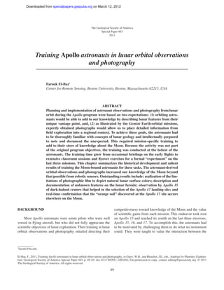
![Downloaded from specialpapers.gsapubs.org on March 12, 2012
spe483-01 page 50
50 F. El-Baz
eye and the brain, and the timely application of intellect based
on a store of knowledge.
Prior to the lunar missions, the Gemini astronauts captured
unique views of the features of Earth from orbit. Because of
their military training, the phrase “targets of opportunity” was
then coined to denote areas to be photographed. From Gemini 8
onward—through Apollo 7 and Apollo 9 Earth-orbital missions—
this activity was carried out through a program of 70 mm
Hasselblad weather and terrain photography. Extensive planning
and crew training were conducted by Richard (Dick) Underwood
of the Photographic Laboratory at the Manned Spacecraft Center
(MSC, later named the Lyndon B. Johnson Space Center [JSC])
in Houston, Texas. He was assisted in this task by others, par-
ticularly Paul D. Lowman of the Goddard Space Flight Center
(GSFC), Greenbelt, Maryland. The resulting photographs have
since been popularly used by the media, the general public, and
in geography classrooms (see, e.g., Lowman, 1966, 1972).
Training of the Moon-bound astronauts in orbital photogra-
phy followed the same scheme and took into account the mindset
of fighter pilots and their military instincts of dealing with objects
and places. Thus, lunar surface features to be photographed were
also labeled “targets of opportunity.” In addition, the astronauts
Figure 1. Locations of the six Apollo landing sites on the nearside of
were trained to make visual observations that were focused on the Moon. The background is a shaded-relief map by the U.S. Geologi-
the selection of “landing sites” or addition to our knowledge of cal Survey (USGS). Landing site locations are marked by the author,
the geologic features of the Moon. This enterprise required well- as modified from El-Baz (1975, p. 496).
planned, regularly scheduled, and mission-specific training ses-
sions that usually started over a year prior to each mission.
This chapter highlights the training activities of the Apollo composed mostly of engineers from Bell Telephone Laborato-
astronauts, particularly the Command Module Pilots (CMPs), in ries. Their mandate was to perform “systems analysis” for the
lunar orbital observations and photography. The CMPs were the National Aeronautics and Space Administration (NASA) head-
second in command after the commander of each mission. They quarters in Washington, D.C. Bellcomm was the brainchild of
piloted the Command Service Module (CSM) spacecraft during all James E. (Jim) Webb, the great first administrator of NASA from
separation and docking maneuvers, and they remained in lunar orbit 1961 to 1968. In 1962, he wrote to AT&T requesting assistance
as two of their crewmates explored the lunar surface. They belonged for NASA, particularly in communications during the space
to an elite club; most people spoke of the “Club of 12” who walked missions. The company was pleased to oblige as a service to
on the Moon, but there existed a more exclusive club of six men who the nation’s space effort. Top engineers from Bell Laboratories
soloed around the Moon. Orbiting above the farside of the Moon left in New Jersey were relocated to Washington, D.C., in offices
a unique impression on a CMP, who was alone and completely cut that were adjacent to those of the Apollo program director. They
off from Earth, without communications with a single soul. Most of began to add people from outside of the Bell system, including
them felt exhilarated by flying solo in a spacecraft around the farside geologists such as Noel W. Hinners, who hired me, and in turn, I
of the Moon, and often said: “You watch this panorama go by, and hired James W. Head III. Throughout the Apollo years, the work
it’s mind-boggling…One sight after another that is just absolutely of Bellcomm was compensated at cost plus $1 per year!
extraordinary” (personal commun., 2010). The establishment of such a behind-the-scenes organiza-
Very little has been written about the contributions of those tion at NASA headquarters was a stroke of genius. As Bell-
Apollo CMPs. They have significantly added to our understand- comm employees, we reported to an unseen boss in New Jersey.
ing of the Moon’s surface features, particularly along the paths NASA managers were not our bosses, and we could contradict
that led to the six Apollo landing sites (Fig. 1). This contribution them anytime verbally and in writing for the good of the pro-
will shed some light on the geologically significant additions gram. In the meantime, when we traveled to any of the NASA
made by these explorers from above, based on their specific centers, we had badges with a “headquarters” notation. This
training. The astronaut’s own perceptions of their contributions allowed us to work with people throughout the NASA struc-
to scientific knowledge of the Moon are extensively relayed in ture in order to uncover problems and to solve them in a timely
Chaikin (1994) and Chaikin and Kohl (2009). manner. Just to keep things straight, Bellcomm employees were
My involvement in the Apollo program began in March advised not to directly communicate with the astronauts and not
1967 as a geologist with Bellcomm, Inc. The latter, a division of to speak to the press in all its forms. In due time, I became the
the American Telephone and Telegraph Company (AT&T), was first to break both rules, by request of NASA.](data:image/gif;base64,R0lGODlhAQABAIAAAAAAAP///yH5BAEAAAAALAAAAAABAAEAAAIBRAA7)