Environmental Response Management Application (ERMA): From Portsmouth Response to NOAA's GeoPlatform Gulf Response

In 2007, a small UNH team put together a prototype emergency response web application using open source tools on a Mac Desktop and later a Mac Mini. That system, called Portsmouth Response, was designed to assist in the first hours of an environmental incident by providing easy access to basic GIS layers without requiring GIS experts. This system generalized and renamed to ERMA, begin deployed as prototypes in the Caribbean and participating in the Spill Of National Significance (SONS) drill in New England during March 2010. Before the team could evaluate the performance during the SONS drill, the Deepwater Horizon platform exploded in the Gulf of Mexico on April 20, 2010. Four days later, the ERMA team was called in for 24x7 support of NOAA and USCG operations to handle the incident. ERMA went from prototype system to being the system providing the Common Operational Picture (COP) is just a few weeks. In early June, NOAA setup a system to mirror the unrestricted datasets for the public on the GeoPlatform system. The presentation describes how ERMA is designed and how it was used during the Deepwater Horizon oil spill incident.

Recommandé
Recommandé
Contenu connexe
En vedette
En vedette (17)
Similaire à Environmental Response Management Application (ERMA): From Portsmouth Response to NOAA's GeoPlatform Gulf Response
Similaire à Environmental Response Management Application (ERMA): From Portsmouth Response to NOAA's GeoPlatform Gulf Response (20)
Dernier
Dernier (20)
Environmental Response Management Application (ERMA): From Portsmouth Response to NOAA's GeoPlatform Gulf Response
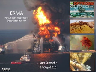
- 1. ERMAPortsmouth Response to Deepwater Horizon Kurt Schwehr 24-Sep-2010
- 2. GCN Award NOAA's ERMA/GeoPlatform Wins Award (OR&R) GeoPlatform, powered by NOAA's Environmental Response Management Application (ERMA), has won a Government Computer News Award. GeoPlatform was instrumental in the government's Deepwater Horizon oil spill response and restoration efforts. During the crisis, NOAA scaled up the capabilities of ERMA — a geographic information system tool that on its own could not handle the magnitude of the response — to handle more than 600 data layers and feeds, many of them updated in real time. The resulting GeoPlatform site's data ranges from oil spill trajectories to wildlife observations to the locations of research and response vessels. In addition to providing a common picture for all response organizations, the project potentially saved millions of dollars that would have been spent on a new solution. GeoPlatform/ERMA will be one of 20 projects honored at a ceremony in Virginia on Oct. 27.
- 3. Credits Rob Braswell, Allison Bailey, Jordan Chadwick, Phil Collins, ChanderGanesan, Stanley Glidden, George Graettinger, Michael Greer, Michele Jacobi, Nancy Kinner, Steven Knight, Bob St. Lawrence, Kathy Mandsager, Amy Merten, Aaron Racicot, Tracy Ross, Kari Sheets, Ben Shorr, Dane Springmeyer And many others from NOAA (especially OR&R, nowCoast, WOC), USCG, UNH (CRRC, CCOM, Morse Hall, …), and many more
- 4. Acknowledgement of Funding / Conflict of Interest Received approximately $65K from BP in 2004 for work on the Santa Barbara Basin slope failures Spent time at sea with BP staff Taken the Exxon Sedimentary Basin Analysis training
- 5. Back in 2006… How do you track your ships and assets during a spill? Spill Coordinator: “We call them on the VHF radio every 15-30 minutes” ???
- 6. Setting The typical situation… a ship spilling oil
- 7. MISLE Marine Information for Safety and Law Enforcement
- 8. Traditional Oil Spill – Exxon Valdez
- 10. CoscoBusan
- 11. CoscoBusan and the tug Revolution CoscoBusan, Nov 2007
- 12. Trouble close to homeLNG vessel adrift off Boston 11-12 Feb 2008
- 13. Can we evaluate the risk?
- 18. Despite risk analysis and planning… bad things WILL happen
- 20. When things go wrong… How will we respond?
- 23. The unjoy of PDFs
- 25. Solution? Provide a flexible system to assist in the first few hours
- 26. COP
- 27. EPA web system
- 28. Environmental Response Management Application
- 30. ERMA Data Flow
- 31. Open Source Tools / Open Protocols OpenLayers Open Street Map (OSM) gdal/ogr Mapserver FeatureServer PostgreSQL / PostGIS Apache/Django noaadata/libais for ship tracking Trac/SVN/git/Python/Perl/Fink/Debian Linux Nagios IRC – irc.freenode.net
- 32. The ability to hire component authors Chris Schmidt, author of OpenLayers and FeatureServer, wrote a Django interface to my AIS database.
- 33. ERMA ArchitectureFor Rapid Response
- 34. Initial prototype – Our backyard Portsmouth Response
- 40. Slide of Cocheco
- 42. Critical datasets for environmental response
- 45. Tides
- 46. Can we scale this to multiple sites? Caribbean – Puerto Rico
- 49. Can we transition ERMA to NOAA and participate in national drills? Spill of National Significance (SONS) New England, March 2010
- 51. “Hotwash” – We were not ready Faking data is difficult Location names caused trouble Little to no use of charts or the Coast Pilot Which vessels were involved? Few had AIS IT issues – printing challenges and overloaded wifi Communication was dominated by rumors and note passing like in high schools (before texting) Field personnel need mobile data input devices
- 52. Deepwater Horizon Explodes 20 Apr 2010
- 53. 25 Apr 2010
- 54. Raster Chart
- 56. Where does the live data come from?NOAA, USCG, Navy, EPA(Through a team of NOAA open source contractors and UNH) NAIS feed to Kurt’s libais C++ parser GeoRSS KML with ExtendedData GeoJSON WMS – Web Mapping Service Rutgers University Coastal Ocean Observation Lab Rutgers University Coastal Ocean Observation Lab
- 57. GeoRSS
- 60. Challenges of knowing which ships
- 61. Welcome to the parking lot
- 62. Can we release NAIS data in real time to the public??? Answer 1: Absolutely no way
- 64. Can we release NAIS data in real time to the public??? Answer 1: Absolutely no way Answer 2: Admiral Allen says “release it right now”
- 66. Spot
- 69. NOS nowCOAST Web Map Service (WMS) Supporting ERMA/GeoPlatform
- 71. nowCoast
- 73. Integrity MonitoringCCOM is watching
- 74. Nagios Tracking of System Status
- 75. What about community contributions? Simile Timeline Jim Meyers – oilspillstats.com
- 77. Are we ready for another oil spill as a community? Probably (for now)
- 79. Where to next? Mobile devices
- 81. Tablets, Cells, and other Mobile/Touch devices
- 83. Where to next? Mobile devices Command and Control
- 84. IMO AIS Binary Message – Area NoticeRTCM and IMO Circular 289
- 85. Where to next? Mobile devices Command and Control Better background data sets
- 87. Gulf of Mexico
- 89. Where to next? Mobile devices Command and Control Better background data sets Training, testing and continual vigilance collaboration
- 91. URLs http://schwehr.org/blog http://geoplatform.gov http://github.com/schwehr http://www.delicious.com/goatbar/deepwaterhorizon
Notes de l'éditeur
- This talk represents my opinions only. The material here has not been reviewed by NOAA or the USCG. I worked on the Deepwater Horizon incident from NH, but never visited the Gulf of Mexico during April – Sep 2010. As such, I am likely unaware of much of what transpired in the command centers and on the water. http://creativecommons.org/licenses/by-nc-sa/3.0/Background image from http://www.flickr.com/photos/deepwaterhorizonresponse/Top right is an image of the BP board game from the 1970’s posted on http://gcaptain.com2nd from the top is an AP image by Dave Martin, used without permission3rd from the top is an image from Getting Images/Sean Gardner, used without permissionBottom right image is a screen capture from the BP video feed during the attempted top kill.
- I don’t have a reference for this, but ERMA/GeoPlatform just won an award from the magazine Government Computer News http://gcn.com/
- Many people contributed to the code, material, time, and money to the development of ERMA and the data sources that drive the system. There are too many to name here.I am sure I have missed a number of key people. I apologize to anyone that I have missed. I have not had a chance to meet most of the people despite spending months of time with some of them on IRC chats at all hours.http://www.crrc.unh.edu/erma/index.html
- It is important to state any possible conflicts of interest. I would like to be as open as possible about my background so that readers can make their own judgment as to if I am biased. Much of my time recently has been funded by NOAA’s Office of Coast Survey (OCS), the Gateway/Neptune LNG terminals through Cornell, and NASA JPL. I have not received any funding through the USCG.
- Back in 2006, when I was just looking at working on the initial concepts of environmental response, I got the opportunity to talk to a spill coordinator. As an outsider, I knew almost nothing about how a response works. I was full of questions. Because I had started working with the maritime Automatic Identification System (AIS) through work with NOAA’s Stellwagen Bank National Marine Sanctuary (SBNMS) witt a feed to my desk of the USCG Research and Development Center (RDC) prototype AIS network, I wanted to know how, during a spill response, how managers keep track of ships as they move about during the whole process. The answer I got back is that they call the vessels on the VHF radio and ask them to tell where they are. Verbal communication of position is notoriously error prone and time consuming. This person said they thought that AIS was not important for tracking. His comment spurred me on to see how we might create a system that would work better for response personnel. Technologies like AIS should help responders focus more on handling the situation by automatically taing care of situational awareness and back channel communications.
- The typical response that people train for is a ship that has a problem that causes oil to be released into a waterway. The oil release might be large, but it has a finite volume that can be released and the ship is likely in shallow waters. We will see later that this caused trouble with the Deepwater Horizon.
- We have public access to the USCG Marine Information for Safety and Law Enforcement (MISLE) database for incidents that have a completed investigation. Here are the collisions, allisions, emergency response, and fire events from MISLE from 2001-2005. I have removed the actual oil spill data as it overwhelms the visualization with small events. This view gives us a sense of where the trouble spots are for vessels and where we might have to be responding to a spill. The majority of the information in MISLE is restricted and I have never seen an actual MISLE display at the USCG.http://en.wikipedia.org/wiki/MISLE
- The Valdez was the largest spill in US waters until the Deepwater Horizon. This is the sort of event that is in the minds of responders.http://en.wikipedia.org/wiki/Exxon_Valdez_oil_spill
- The CoscoBusan received a huge amount of press time due to occurring in the San Francisco Bay – a densely populated area. Quick response has the potential for many incidents to greatly reduce the environmental impact.http://en.wikipedia.org/wiki/COSCO_Busan_oil_spill 7-Nov-2007 53,500 USgal (203,000 l) of bunker fuelImage from USCG
- Even a “minor” bridge allision can do substantial damage to a ship. In this case, ripping into the fuel tanks of the ship.Photo from USCG
- With new requirement for many vessels to carry Automatic Identification System (AIS) transceivers, the community can now track vessels in real time and analyze what happened after the fact. Surprisingly in this case (2007), the USCG asked for a copy of my visualization. This surprised me as several USCG officers had previously informed me that they had this capability available to them through MISLE. This led me to question if MISLE was capable of handling emergency response. Not only can non-USCG staff not view the interface, it appeared to not have the capabilities required by the internal USCG users.USCG RDC AIS feed with 1 sample per minute viewed in Google Earth. Processed with my noaadata software.Image by Kurt Schwehr
- The risk of incidents exists throughout the world where ever there are ships or oil & gas work. Here is an example from close to home.LNG ship adrift off of Boston, MA. The ship had complete power failure. Thankfully the ship drifted away from shore.Visualization courtesy Mike Thompson, SBNMSPhoto from the USCG: http://www.ack.net/LNGTanker021208.html
- Can we find ways to evaluate the risk and use those risk analysis to reduce the risk?
- Mariners have been evaluating risk for as long as there have been ships at sea. Shown here is a “source data diagram” from a British Admiralty chart. Mariners are supposed to used the date of the survey to infer how confident they should be about how accurately the chart represents the current bathymetry in that particular area. It’s a start, but it nearly impossible for a mariner to make any quantitative assessment of risk of a planned route using a source data diagram. The inset photo shows NOAA Cdr Shep Smith verifying the “ship’s” position in a simulator room at Kings Point Maritime Academy. Photo by Kurt Schwehr
- Here is a visualization of tanker traffic coming in to Boston, MA through the Stellwagen Bank National Marine Sanctuary based on AIS ship traffic recorded for an entire year (2006). If we know where ships are traveling, we can evaluate the likely impact of those vessels and what the chances of an incident are.Data processing by Kurt Schwehr. Visualization by Michael Thompson.Hatch, L., C. Clark, R. Merrick, S. Van Parijs, D. Ponirakis, K. Schwehr, M. Thompson, D. Wiley, Characterizing the Relative Contributions of Large Vessels to Total Ocean Noise Fields: A Case Study Using the Gerry E. StuddsStellwagen Bank National Marine Sanctuary, Environmental Management, 42(5), 735-52, Nov 2008.http://vislab-ccom.unh.edu/~schwehr/papers/hatch2008-vessel-noise.pdf
- We can even drill down into the uses of a harbor using AIS data to get a deeper understanding. Top left is an overview of vessel traffic by type in the southern Chesapeake bay / Norfolk, VA area. We can use statistics such as k-means to find clusters of end points and verify if vessels are following the NOAA chart recommendations or coming up with their own alternate strategies for working in the harbor. We can then match the traffic end points with anchorages (normal or explosive) and cargo terminals.AIS data processing, statistical analysis and Google Earth visualization by Kurt Schwehr. This work is presented in:Calder, B., Schwehr, K., Traffic Analysis for the Calibration of Risk Assessment Methods, US Hydro 2009, May 11-14, Norfolk, VA.http://vislab-ccom.unh.edu/~schwehr/papers/2009ushydro-calder_schwehr_AIS_Traffic_Analysis.pdf
- We can then consider a system that evaluates the risk of any particular transit with respect to the vessel configuration, cargo type (e.g. the hazard level and damage potential), the traffic level in the harbor and the current environmental conditions (e.g. weather, tide, and bathymetry). Mariners, harbor masters, and commercial managers can evaluate the risk and determine if the risk level is acceptable. If not, they can take steps to mitigate risk (lightering of cargo, waiting for a change in water level, etc).Calder, B., Schwehr, K., Traffic Analysis for the Calibration of Risk Assessment Methods, US Hydro 2009, May 11-14, Norfolk, VA.
- Despite all these efforts, statistics tell us that we can not make shipping perfectly safe. At some level, the economics of risk reduction eventually will prevent progress. For example, we tolerate a large number of automobile fatalities per year.
- When things go wrong, we all have to rely on training and preparations to mitigate the event as best possible.In this image, a CCOM/JHC graduate participates in fire safety training as a part of the Seamanship course.
- How can we improve the process? We must understand the current methods and how well they work to improve them. The current methods are not necessarily bad. We may want to refine them or substitute new methods as our understanding of incident response improves. What is considered best practice will evolve over time.
- Right now, the USCG is working to upgrade its fleet such that responders can get to a situation faster. Shown here is a boat that can go 40 knots to get out where it needs to be fast. However, the crew needs to know where it should be before it can be effective and the support infrastructure should not keep the crew away from the tasks at hand, which are usually out the window. Too much time using a VHF radio or poor computer interfaces will hinder their work.An example of this kind of problem is vessels that have “EPIRB” distress beacons without a GPS in them. I have heard stories about an EPRIB without GPS being detected in the Gulf of Mexico when the vessel in distress was in the Atlantic. I need a reference for this incident. Panbo has an article talking about several EPIRB failures. We need to the emergency gear to be as reliable and accurate as possible and we need to be able to quickly get that information disseminated to those who can assist.http://en.wikipedia.org/wiki/Distress_radiobeaconhttp://www.panbo.com/archives/2008/05/epirb_failures_wheres_the_meat.html080303-RBM_BuildersTrials006.jpgU.S. Coast Guard photo by Lt. Mark Piberhttp://bymnews.com/photos/displayimage.php?album=167&pid=56701
- For an oil spill, the traditional method for distributing information to mariners and other responders in an area has been with PDF documents. These are not even Geospatial PDFs (http://en.wikipedia.org/wiki/Geospatial_PDF). A map such as this is very difficult to get into electronic chart plotters or other GIS systems.
- Here is another situation map with even more detail, but this is even harder to get into any electronically usable form.
- The worst problem with these kinds of documents is that they are typically printed. Note here that the oil on the water comes from an overflight that occurred on April 28. The situation map was then created on April 29. If the document was then distributed via email and handouts, people may be getting that information over the next 24-48 hours. At the rate that oil is likely to move around in the ocean, how long is this information likely to be relevant?http://www.flickr.com/photos/deepwaterhorizonresponse/4578070653/
- My take on environmental response is that we need to create an easy to use and easy to modify web mapping system that allows responders to see the situation right now, download data files into their personal GIS or charting system, and upload information that they collect or create. ArcIMS in the 2005/2006 time frame was really behind the times on web mapping. Users really wanted a much smoother and simpler system on the web.
- Here are the only images I have of the USCG systems for monitoring a response. The background image shows vessel positions coming from NAIS. Inset lower left is WebCOP (Common Operational Picture; possibly the same as http://proceedings.esri.com/library/userconf/feduc06/docs/joint_webcop.pdf; image source USCG). The top right is a USCG operations center (possibly a VTS). The tools are not designed to handle anything to do with environmental response. During the Deepwater Horizon Incident, I contacted the Houma, LA VTS center to ask for assistance identifying vessels working with the response. They had no information about response vessels.
- A key partner in any environmental response in the United States is the Environmental Protection Agency (EPA). Local EPA staff attended a UNH workshop organized by the Coastal Response Research Center (CRRC; http://www.crrc.unh.edu/workshops/phri/index.htm). The EPA had already been working hard to modernize at this point and had a web application for managing incidents. Here are images of the website showing a chemical plant explosion in Danvers, MA on 22-Nov-2006. The site has photos, reports and chemical analysis, but the EPA site has no map interface and there was no bridge between NOAA and the EPA for incidents that occur near the shore or offshore. A great start, but we need things to be geospatially displayed and we must bridge government organizations so that they can more effectively share data.
- Here is my simplified system diagram of ERMA in action. The goal is to bridge all the key data types into an ERMA data center and have it act as a hub of information focused on the response. We can leverage services such as nowCoast and act as a response focused skin to relevant data layers and merge them with other data sources that are not as important for the general nowCOAST user or are restricted from public dissemination.
- For ERMA, we attempted a fundamental paradigm shift. We focused on a system built around OpenSource software and open protocols to allow the system to be much more flexible and to allow us to see the code for any portion of the system. “Pay walls” can hinder an environmental response at the most time critical portions of the incident. We wanted to avoid any software license restrictions that might hamper the growth, scaling, or distribution of the ERMA architecture.A great example of the gained flexibility can be seen with Open Street Map (OSM). If during an incident, a bridge or roadway is damaged to the point were it blocks responders from passing, we can directly edit the OSM data to remove that road. If we were to add surface street routing of resources, then we could immediately use the updated roads to bypass that choke point. Here is a link to show this being done for the 2010 Haiti earthquake response:http://vimeo.com/9182869 In the future, will we collaborate with http://www.sahanafoundation.org/ and http://www.ushahidi.com/?I am sure this list leaves out some important open source projects that are being used as a part of ERMA.
- In a short time period, Chris created a very functional interface using Django for the ERMA team to manage the AIS vessel database. Prior to this interface, I had to personally modify vessel entries in the database using SQL to add/fix names and flag/unflag vessels as a part of the response effort.http://crschmidt.net/
- It is a lot easier to start out in our own back yard. UNH is just a few minutes drive from the Portsmouth Harbor. The harbor has just enough vessel traffic to make response a real possibility, but not so much going on that it would overload our initial development team.
- Here are two images of an early version of the Portsmouth Response web application. I started off focusing on S57 chart layers (using OGR to extract them) and gridded bathymetry (exported to GeoTIFF by Fledermaus). Legends turned out to be a rather challenging task to create from some of the ArcGIS source data.The current version is here: https://portsmouth.erma.unh.edu/erma.html
- A little bit newer version of Portsmouth Response with more complete bathymetry from CCOM/JHC and NOAA.
- We tried other layers that might assist with response efforts. Shown here ismultibeam backscatter image processed by Luciano Fonseca. This data set showed us that just because we put data in, it might not get used. A number of responders that I talked to were not familiar with backscatter and therefore were unable to use if for any sort of input into their response plans. Clearly, data documentation is essential. This goes beyond metadata. We need to train responders how to use the data.
- Next, we started adding AIS into the interface. The initial version used two AIS receivers that I setup at UNH’s Jackson Lab at Adams Point and the Coastal Marine Lab at New Castle. The current system has transitioned to using the USCG Nation AIS system (NAIS). There should be almost no need to call up a vessel and ask the crew to verbally announce their position.http://www.uscg.mil/acquisition/nais/
- However, one problem with AIS is that not all vessels are outfitted with AIS. Small pollution response vessels in the US are not currently required to carry any AIS equipment. We outfitted two Portsmouth Towing response vessels with Class B transceivers so that the command center can track them during boom deployment operations.Photo by Kurt Schwehr
- We also added Class B transceivers to the two CCOM/JHC vessels: R/V Coastal Surveyor and R/V Cocheco.
- Once vessels are outfitted with AIS, we can start to monitor behaviors. Here a tug is picking up a cargo vessel to transit up the river to the dock.
- Since Sept 11, 2001, response plans have become restricted from public distribution. ERMA provides a secure location for response staff to get a look at the plan for an area. After logging in to the system, responders can view staging areas and planned locations for deploying boats and skimmers.
- They can dig further into the response plans to get needed critical information.
- Here is one feature I particularly like. With help from NOAA’s CO-OPS, we pull tide station graphs directly from NOAA and allow users to view these graphs in ERMA by clicking the tide gauge icon.
- The next step was to try to take ERMA from our local site and deploy it to another area to investigate how we could optimize the process of cloning ERMA. There have been a number of recent groundings by large ships on the local reefs.
- This figure shows just one of the areas of growing pains that we encountered. My noaadata software was not designed to handle large areas with many AIS receive towers. Here, we turned on AIS stations for much of the south eastern United States and Puerto Rico. All we accomplished was to make a mess of the display.
- But we did get it working and started thinking about how to improve AIS display.
- The next step was to work towards transitioning ERMA from a research prototype into something maintained by NOAA’s Office of Response and Restoration (OR&R) and to have those responsible for response start to use ERMA during exercises. I got the opportunity to spend one day in the Portland, ME command center for the 2010 SONS drill.
- The SONS drill simulated a ship leaking oil in the New England area. The bottom left is a screenshot from people using ERMA to make decisions about how to best deal with oil in the water. Bottom right shows just one instance of a team (in this case Logistics) talking to the ERMA team about how they can use the web interface to plan. Top right shows a spontaneous discussion that started with two USCG responders based on what they saw on a large ERMA LCD monitor setup in the corner. The top left image shows the unified command team working to make some sort of decision. I noticed that there wasn’t a single computer display involved in the process and there were no announcements to the room as a result of what ever it was that they were deciding. There wasn’t even a Blackberry in use during the meeting.
- A “hotwash” is a the process of figuring out the areas that need improving, detailing them, and figuring out a strategy on how to move forward. Here are some of my observations from my SONS experience that I prepared to give back to NOAA based on what I saw. I was just an observer, so I might have missed some important processes, but my basic conclusion was that the integrated team (NOAA, USCG, commercial entities and ERMA) were just not ready for the rapid response required to contain a spill. It is really hard to create a test realistic enough to get people to act as if there is a real emergency going on. I’ve seen how hard it is for NASA with Operational Readiness Tests (ORTs). The pressure of a real spill was definitely not present in the atmosphere of the room. Watching people trying to get information from the field into GIS systems and ERMA was as expected. People taking notes from voice communication make mistakes or they might not know the proper spelling of challenging local names.http://schwehr.org/blog/archives/2010-03.html#e2010-03-25T19_00_16.txthttp://www.delicious.com/goatbar/sons
- Before we had a chance to do anything with peoples’ hotwash items, the Deepwater Horizon (DWH) blew up and sank in the Gulf of Mexico. This platform is actually a ship, but it is definitely not like the typical oil spill from a ship. We don’t know how much oil was down in the reservoir that the well tapped into. Unlike a ship with its fixed capacity, the spill will constantly increase in side until the situation on the sea floor is remedied. Additionally, SONS focused on shallow water issues. DWH was drilling in deep water that makes standard techniques very hard or impossible to apply.The explosion image is from the USCG Deepwater Horizonflickr streamDeepwater Nautilus – sister ship to show what the rig would look like beforehttp://en.wikipedia.org/wiki/File:Deepwater_Nautilus.jpgThe actual ship is here: http://en.wikipedia.org/wiki/File:Deepwater_Horizon.jpg
- By 25 April, we had a basic website up and going, but just barely. The team worked very hard to get something up and going as fast as possible. This is the first screen grab that I save from the incident.
- The ERMA team started adding data sources. Here is a NOAA Raster Nautical Chart (RNC) of the DWH site.
- And by July the team had a fully functioning site that had been cloned for the public and hosted by NOAA’s Web Operations Center (WOC).http://www.woc.noaa.gov/
- Aaron Racicot and Dane Springmeyer led the effort to integrate all sorts of new feeds into ERMA throughout the ongoing operations. For my, my first task was to rewrite my noaadata AIS parser and database manager. I used C++ behind the python interface and a more streamlined database design to allow for ERMA to handle the full rate NAIS feed covering the entire network of receivers. I then joined Aaron and Dane trying to parse new data types. I worked with the USCG OSC to pull GeoRSS and KML with ExtendedData into ERMA. Things like Self Locating Datum Marker Buoys (SLDMB) were new to me.http://en.wikipedia.org/wiki/Self-Locating_Datum_Marker_BuoyLeft two images are courtesy of the Rutgers University Coastal Ocean Observing Lab
- The great part about open standards is that many tools can read them. Here, I am using Google Maps to preview the USCG SLDMB feed that I was receiving as GeoRSS.
- Here is a look at two NAIS receiving stations. NAIS stations are spread throughout the United States and its territories.
- Stations like these give us a view of the approximately 3000 ships that operated with AIS during the DWH incident. White vessels are not marked as a part of the incident response (but may well be a part – I just wasn’t told about all vessels). Colored vessels are known to be a part of the DWH response.
- Trying to figure out which ships are involved with the oil spill response effort and what their roles are was challenging. In the initial phases, I got a lot of the ships by watching the news on TV, checking images posted to Flickr and talking on the phone to anyone I could get ahold of. This is one of the better response ship lists that I got. I got lists of hundreds of ships all without MMSI or basic vessel information. Most of these turned out to be smaller vessels without AIS. Many of the vessels had names that were ambiguous with several vessels in the area that match the name. I found a few response vessels with improper names and even response vessels with invalid MMSIs. These obstacles make tracking very challenging.
- During the middle of the response, the area around the well head was basically a giant parking lot out in the ocean. The Ocean Veritas is typical of this mass of vesses: Her speed over ground (SOG) was 0 knots.
- A ways into the response, I started getting pressure from some of the response managers for the DWH response to release the AIS data live to the public. I didn’t have permission from the USCG NAIS team to do this. There is currently a rule that the data should be restricted for the first 12 hours after it is collected. I started asking around and got a lot of people saying it would never happen.
- There is some precedentfor this kind of release. Here are hourly updates from the USCGC Healy ice breaker. I receive emails from the ship on the half hour and I pick up a geo-referenced image from the science web site on the hour. I worked with the Google Earth team and LDGO science team to upload this data into the built in Google Oceans “Ocean Expedition” layer. Additionally, much of the same AIS ship tracking data is available free or for a small fee through several AIS services.http://vislab-ccom.unh.edu/~schwehr/healy/http://mgds.ldeo.columbia.edu/healy/reports/aloftcon/
- A couple days later, I got a directive from Admiral Allen to release the flagged response vessels live to the public. An hour later, we had AIS positions of the response vessels updating every 2 minutes to the GeoPlatform public web interface.
- Here is the view of the response vessels in GeoPlatform from NAIS data updated every 2 minutes.
- We were also asked to track people and assets other ways. Here is data from Find Me Spot for NRDA teams. ERMA pulls data directly from the company’s servers and integrates the positions into the response platform. We also got other requests that were not as reasonable. Much of the USCG team in the Gulf of Mexico has a service from Good on their cell phones that lets the USCG track their people. The USCG asked me to track all of their staff by getting a feed from Good. This is one case where I declined to take the data. I was worried that this is personal data that is exposing to much information unrelated to the incident.http://www.findmespot.com/http://www.good.com/
- The USCG asked us to track emergency response aircraft. Here is an example of KML with ExtendedData showing the time series of response aircraft in the Orlando, FL area that we used to evalate the system.
- Here is a case of data overload. We received all the photos from an overflight of the coastline. There wasn’t a lot of other information to make these images useful. We need to do more to help people get the images they need without being overloaded with too many icons.
- The ERMA / nowCOAST integration is a great example of the power of Web Mapping Services (WMS). nowCOAST has spent years working to aggregate meteorological and marine environmental data from all over NOAA and other government agencies. It is a one stop experience for people who want to know about about the US coastal environment. It’s built on ESRI Arc software, but exposes layers through WMS. The nowCOAST and ERMA teams have worked together to pick the best layers that environmental response team members are likely to need. These layers are pulled into ERMA via the exposed WMS services and look like they are built right into ERMA.Shown here is a hurricane moving through the gulf in nowCOAST. GeoPlatform pulls the feeds into its interface so that you can visualize how the hurricane might impact cleanup operators for Deepwater Horizon.
- Here is an even better example showing hurricane Bonnie that threatened to seriously disrupt cleanup operations. Thankfully, this hurricane came into the area smaller than it could have been. Here, ERMA can be used to monitor ships as they pull out of the way of the storm.
- Along with storm tracks, significant wave heights are key to knowing if oil recovery will work in an area. For example, the vessel “A Whale” was tested in the area, but was only able to recover oil in very calm sea states.
- Here is an example of multistage integration. The CCOM VisLab created a tool called FlowVis2D with a new way to visualize current flow using the Navy NCOM model. The code produces a GeoTIFF that nowCOAST ingests and provides as a WMS. GeoPlatform uses that WMS feed to display the surface current in the area around the well head.Also shown here is a single beam 1980’s vintage bathymetric grid provided by NOAA’s AHB. This shows the poor coverage of publicly available bathymetric data in the Gulf of Mexico. I will get back to this in the future directions section of this presentation.
- To help reduce downtime for systems like ERMA that depend on distributed services running across many different servers, CCOM has started using Nagios to track systems and services.
- CCOM’s Nagios server uses SNMP to query the AIS server to track the number of vessels seen in the last 10 minutes in the Gulf of Mexico region. If the number of vessels drops below 1000, the system emails me that the NAIS service for ERMA is likely failing. The upper graph has day of the month as the x-axis. You can see daily variations in the number of vessels received. You can see in the right hand side of the lower graph a small gap that occurred during which we had the system down to apply security patches.http://schwehr.org/blog/archives/2010-06.html#e2010-06-17T10_35_25.txt
- The great thing about open systems is that you can work with the community to build functionality that the core team might not have the time to do. I put out a call for people to try to build Simile timelines of the events that happened in the oil spill. I am surprised that Twitter does not already include timelines. Jim primarily used http://twitter.com/oil_spill_2010 as a source of data.http://www.simile-widgets.org/timeline/
- http://oilspillstats.com/ created by Jim Meyer answering Kurt Schwehr’s request for a Simile Timeline visualizationhttp://schwehr.org/blog/archives/2010-05.html#e2010-05-13T09_42_07.txthttp://schwehr.org/blog/archives/2010-06.html#e2010-06-29T17_41_30.txt
- The long hall of the DWH incident has people tired, but the length of the incident has given systems and teams a chance to try to improve their processes. The problem is that every incident is unique, with its own challenges. As time goes on, we will loose the hard won skills that we acquired from the gulf incident.
- This is theone image I have of ERMA being in a DWH command center. If anyone has images of ERMA in use by incident response staff, I would really appreciate getting copies! The display in the background on the left is of ERMA.Photo: http://www.flickr.com/photos/deepwaterhorizonresponse/4755585221/Coast Guard photo by Petty Officer 3rd Class Walter Shinn
- I think everybody did a great job on ERMA for this spill and we pulled out a lot of stops. There were a lot of long days on little sleep. However, we can always do better. All those lesson learned can be turned into improvements that make the next time go much smoother. Probably the biggest improvement will be with mobile devices both for display of data and data entry.
- NASA Ames has been working with the Sonoma Air Attack group using Android phones to help manage getting data back from the teams in the field to the folks coordinating the efforts in the office. Seen here is a map with magnets representing all the assets that are deployed in the Sonoma area. Inset is an image from the airfield showing an observation plane on the left and a tanker on the right.I wrote a guest blog on the GeoCam team’s blog:http://disastercam.blogspot.com/2009/08/sonoma-air-attack-20090807.html
- Mobile devices are getting better network connections with 3G cell modems, wifi, and AIS receivers. Top left is Trey Smith doing training with the G-1 Android phone. Top right is an Ohmex tablet + AIS receiver combination. Bottom right is an iPhone running VNC to login to an AUV to control it’s underwater flight. Bottom right shows an example of the new category of slim tablets (e.g. the iPad) that provide more screen space but are still small and light weight.Area Notices on the iPad: http://schwehr.org/blog/archives/2010-07.html#e2010-07-20T21_28_15.txt
- Here, a pilot has taken a picture while out in a plane heading to a fire (inset image). The phone automatically sends the image back to a server with geotagging information included. The server builds a Google Earth visualization that the officer in charge is able to use to follow the fire from the office. The goal is to put as much of the task into the software and free up the team from having to verbally pass as much information.
- The Increment 2 AIS work of the USCG aims to provide transmit capability to the AIS receiver stations.
- This transmission capability will allow systems to send out locations of oil, area closures, and so forth. Ships in the area will be able to automatically display this information without bothering the mariners using the display. CCOM has participated in specification of the new AIS messages and run the Right whale AIS notice Project (RAP) for the Boston approaches.http://vislab-ccom.unh.edu/~schwehr/papers/2010-IMO-SN.1-Circ.289.pdfhttp://www.listenforwhales.org/http://vislab-ccom.unh.edu/~schwehr/papers/2009-mcgillivary-IEEEOceans-MTS.pdf
- Remember that postage stamp single beam bathymetry data?
- NOAA has been working hard to release hydrographic surveys as BAGs. These are great data products, but are primarily focused on shipping lanes. Trouble usually happens outside of shipping lanes.BAGs website: http://www.opennavsurf.org/http://www.youtube.com/watch?v=7fOTlqqQ5O4
- Here are some of the recent surveys in the LA, MI, AL area that were affected by the DWH oil.
- These surveys are great. However, we badly need an integrated high resolution product that covers the entire Gulf of Mexico. We also need the same kind of data for all US waters. We have gaps like this in much of the background data that will be used in the event of an incident.
- It takes hard work to stay prepared. It’s a difficult investment to justify when there haven’t been any large events in a while. We have to focus on government, industry, and research working together for the long term to keep the ocean a clean and sustainable place to do business.
- I work on the Chart of the Future where we are Charting the Future. Let’s all work towards keeping the ocean a great place to work and visit.
- Most of my source code is available on GitHub if you are a programmer. I have tried to document some of the development through posts on my blog.