
Recommended
More Related Content
Similar to AEJEE Volcanoes and Plate Boundaries
Similar to AEJEE Volcanoes and Plate Boundaries (20)
More from SERC at Carleton College
More from SERC at Carleton College (20)
AEJEE Volcanoes and Plate Boundaries
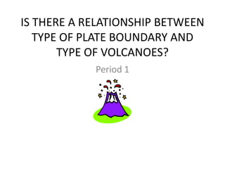
- 1. IS THERE A RELATIONSHIP BETWEEN TYPE OF PLATE BOUNDARY AND TYPE OF VOLCANOES? Period 1
- 2. PROCEDURE • Obtain Excel data file of almost 1500 volcanoes located around the world • Group descriptions into the major types of volcanoes – cinder, shield, and composite
- 3. SMALL EXAMPLE OF THE DATA LOCATI NUMBER RN SN VN NAME ON STATUS LATX NS VF LONGX EW ELEV TYPE TIMEFRAME Kars Holocen 0103-05- 01 03 -05- Plateau Turkey e? 40.75N * 42.9E 3000Cinder cone ? Ghegam Armeni Anthrop 0104-07- 01 04 -07- Ridge a ology 40.275N * 44.75E 3597Cinder cone D7 Holocen 42.5333 0201-124 02 01 -124 Gufa Ethiopia e 12.55N * 3E 600Cinder cone U Assab Volc Holocen 42.4333 0201-125 02 01 -125 Field Ethiopia e 12.95N * 3E 987Cinder cone U Holocen 0201-191 02 01 -191 Beru Ethiopia e 8.95N 39.75E 1100Cinder cone U Chyulu Anthrop - 37.8833 0202-13= 02 02 -13- Hills Africa-E ology 2.68333S * 3E 2188Cinder cone D3 Ngaoun dere Africa- Holocen 13.6666 0204-04- 02 04 -04- Plateau W e? 7.25N * 7E Cinder cone ? Biu Africa- Holocen 0204-05- 02 04 -05- Plateau W e? 10.75N * 12E Cinder cone ? Tin Zaouate ne Volc Holocen 19.8333 2.83333 0205-002 02 05 -002 Field Africa-N e 3N * 3E Cinder cone U In Ezzane Volc Holocen 10.8333 0205-003 02 05 -003 Field Africa-N e? 23N * 3E Cinder cone ? Holocen 0205-007 02 05 -007 Haruj Africa-N e 27.25N * 17.5E 1200Cinder cone U
- 4. USING AEJEE PLOT THE DATA
- 6. TEAM WORK • Randomly teams of three students will be given a specific area of the world that has a lot of volcanic activity. • It is the team’s responsibility to do the following: – ‘code’ the volcanoes and screen capture their area – Using Google Earth, map out the boundary and screen capture their area – Determine the type of plate boundary – Determine the main type of volcanic activity at this location
- 7. PRESENTATION • Create powerpoint slides that show the screen capture from AEJEE and Google Earth • Include a graphic that illustrates an example of this type of volcano from this area • As a class, create one sentence that shows the relationship between that specific plate boundary and the main type of volcanic eruption
- 8. GROUP 1 • Alexis • Daniel C • Ashton
- 10. GOOGLE EARTH NORTH AMERICAN PLATE – OCEANIC PACIFIC PLATE - OCEANIC
- 11. TYPE OF PLATE BOUNDARY • CONVERGENT • OCEANIC-OCEANIC • Composite – tall, steep sided volcanoes, explosive eruptions
- 12. TYPE OF VOLCANO: COMPOSITE MT. CLEVELAND
- 13. GROUP 2 • ASIA J • CARLOS M • JULIAN S
- 15. GOOGLE EARTH SOUTH AMERICAN PLATE - CONTINENTAL NAZCA PLATE - Oceanic
- 16. TYPE OF PLATE BOUNDARY CONVERGENT – OCEANIC/CONTINENTAL
- 17. MAIN TYPE OF VOLCANO LASCAR VOLCANO
- 18. GROUP 3 • Mary S • Tatiana R • Juan R
- 19. Central America
- 20. VIEW via GOOGLE EARTH NORTH AMERICAN PLATE - CONTINENTAL CARRIBEAN PLATE - CONTINENTAL COCOS OCEANIC PLATE
- 21. TYPE OF PLATE BOUNDARY • CONVERGENT PLATE BOUNDARY between the Cocos Plate on the west that is an oceanic plate and the Caribbean Plate on the east that is a continental plate
- 22. TYPE OF VOLCANO ARENAL VOLCANO, COSTA RICA is an example of the volcanoes here.
- 23. TEAM 4 • Taylor C • Joel C • Chanel S
- 24. East African Rift Zone
- 25. View from Google Earth AFRICAN PLATE AFRICAN PLATE
- 26. TYPE OF PLATE BOUNDARY
- 27. TYPE OF VOLCANO SHIELD VOLCANO MT. KILAMANJERO
- 28. GROUP 5 • Tyler F • Marcus B • Myles A
- 30. Google Earth Screen Shot Juan de North Fuca American Plate - Plate - Oceanic Continental
- 31. TYPE OF PLATE BOUNDARY
- 32. TYPE OF VOLCANO MT. ST. HELENS
- 33. GROUP 6 • Alexandra C • Caitlyn G • Terrance E
- 34. Caribbean
- 35. Google Earth OCEANIC OCEANIC
- 36. TYPE OF PLATE BOUNDARY
- 37. TYPE OF VOLCANO MT. PELEE
- 38. GROUP 7 • Austin • Ashley • Chandler
- 40. TYPE OF VOLCANO
- 41. TYPE OF PLATE BOUNDARY • NONE – HOT SPOT
- 42. GROUP 8 • Kira M • Cole P
- 43. Iceland
- 44. Google Earth EURASIAN PLATE NORTH AMERICAN PLATE
- 45. TYPE OF PLATE BOUNDARY DIVERGENT
- 46. TYPE OF VOLCANO Eyafjallajökull volcano
- 47. GROUP 9 • Gustavo • Brandon G • Ricky
- 48. Indonesia
- 49. GOOGLE EARTH OCEANIC OCEANIC
- 50. TYPE OF PLATE BOUNDARY
- 51. TYPE OF VOLCANO Mahameru (Semeru) above Mount Bromo, East Java COMPOSITE
- 52. GROUP 11 • COLE • KATRINA • COTY
- 53. Japan
- 54. GOOGLE EARTH CONTINENTAL North American OCEANIC Pacific Plate
- 55. TYPE OF VOLCANO MT. FUJI
- 56. TYPE OF PLATE BOUNDARY
- 57. GROUP 12 • Jeremy M • Bryce M • Andrew M
- 58. Juan De Fuca
- 59. GOOGLE EARTH JUAN PACIFIC DE PLATE FUCA
- 60. TYPE OF PLATE BOUNDARY
- 61. TYPE OF VOLCANO PILLOW LAVAS – develop on the ocean floor; if keep growing would be a shield volcano
- 62. GROUP 13 • Shannen • Callan
- 63. Mariana Trench
- 64. GOOGLE EARTH PACIFIC PLATE PHILIPPINE PLATE
- 65. TYPE OF PLATE BOUNDARY
- 66. TYPE OF VOLCANO PILLOW LAVA
- 67. CLASS FINDINGS • DIVERGENT PLATE BOUNDARIES are characterized by pillow lavas and shield volcanoes. This is because the magma is coming from the mantle and is low in silica. This produces short, broad volcanoes with quiet eruptions.
- 68. • CONVERGENT BOUNDARIES produce very explosive volcanic eruptions characterized by composite volcanoes such as Mt. Fuji and Mt. St. Helens. These volcanoes are the result of the subducting plate being melted and coming back to the surface as a composite volcanic eruption either in islands or mountains.