2. photo credit: greg bartley
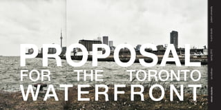
Work Presented on April 16th, 2012
In Draewall Gallery located in the Harm A. Weber Academic Center of Judson University
!"#$%&'()*+,-'./01+2'3+-45'6$+/+70)
3. [The Great Lakes : Local Asset - Global Resource]
Prologue
Application - Conservation - Globalization
ARC 652 [S2] – Cumulative Design II studio was a fourteen-week investigation, bringing renewed consideration to This studio visited Toronto, Ontario in late January in order to investigate the ongoing waterfront developments
the under-considered Great Lakes basin and its watershed. and to designate a site and strategy for this studio. Born from that trip, the studio of eleven students took on a
collective charrette for the development of a new urban district in the blighted port lands which bound the east
As accessible fresh water and fresh water networks quickly become one of the world’s most precious commodities, side of Toronto’s inner harbour. The collective urban proposal that resulted from the design charrette served as a
this studio built on many recent studies, research efforts, and on Canadian and US policy for the vision and future framework for each student to apply an aspect[s] of fresh water to an individual building design proposal within the
of the Great Lakes as a shared asset and opportunity. The premise was not simply to advocate for the fragile proposed district. This yielded the eleven individual projects included in this document.
preservation of fresh water as a jewel to remain set apart and untouched. Instead, we espoused a balanced
consideration of its use [application] and maintenance [conservation] in an increasingly global culture and geo- This graduate studio was largely student-directed, with the professor playing the role of shepherd and curator
political economy [globalization]. Its use is not limited to human consumption nor the economic possibilities of
fresh water as a raw material for the urbanizing world. Rather, students were challenged to consider all manners determined by the students, including its role in the urban district and its connection to fresh water. Some of the
in which accessible fresh water contributes to and enriches human, ecological, cultural and economic life today, in work draws a direct connection to fresh water in its program or function, while other projects draw inspirational
the region, while safeguarding its value for tomorrow, for the world. connections to water. Either way, each individual building has a purpose within the proposed district, within
Toronto, and as a participant in the Great Lakes fresh water basin.
Fresh water has an abundance of function, meaning and purpose in individual life, the life of a community, and in
I am so pleased with the effort, collaboration and individual energies put into the studio. The persistence,
ritual to symbol, from transportation to recreation, from heat sink to energy source, from boundary to amenity, and cooperation and trust, in me and each other, demonstrated by the eleven students was the greatest triumph of the
much more. The students were tasked with researching and investigating issues of fresh water, and they were studio… the work was also excellent. Thank you gentlemen!
then challenged to apply their discoveries to a collective urban proposal and ultimately an individual building design.
Professor
Spring 2012
2
4. .-$(0$&#)/!%/%*'( -!.'&)/!%/%*'( (%+'()!"*"'!+, !"#$%&'()!"*"'!+, global research
[World Surface Water]
5. The southwestern part of the United States has been experiencing severe freshwater Nearly a third of the world’s population depends on melting snow from the Tibetan
shortages for years. Several states have proposed having water shipped or piped from the great lakes basin to the
southwestern USA while other states such as California have spent millions of dollars building incredibly vast amounts of
pipes and dams in order to move water from its northern boarder where water is plentiful to its more arid regions in the south. lakes that previously did not exist, leading to ground saturation that cannot support these volumes of water; the soil then
Ocean, the riverbed is completely dry; the river has ceased to exist by the time it reaches its own river delta. America is are melting faster than they can be replenished, there is potential for them to melt completely in which case many of China’s
dealing with a continent worth of freshwater issues within its own boarder.
The areas of concern in this region are mostly dealing with a shortage of water. As a huge percentage of the amount of total The areas of concern in this region are mostly dealing with a sudden surplus of water. Because Asia has the highest density
fresh surface water, the Great Lakes are growing in importance as a commodity for our country and abroad. Because of of population and because of their massive impact on our economy and imported goods, it is important to keep in mind how
this, we should be at a heightened state of appreciation and conservation of this resource. these freshwater issues will impact us inadvertantly.
The earth is not running out of water, the earth still and always will have the same amount of water in its system, the problem
is that as our populations grow and our lifestyles change, we demand more water than the system can provide or replenish.
We don’t need to get more water, we need to learn to adapt our requirements to conserve and preserve the amount that is
available and using modern and historical technology and resources, utilize the water that is in the system in a healthy way.
Freshwater has become a source of increasing political confusion in the Middle East
and Africa. In Delhi, water demand has surpassed supply by 300 million gallons per day; economists agree that there will be
[Global Perspective]
Water has become a commodity that supports a $400 billion a year global industry : third largest behind only electricity
That creates a natural interdependence between countries.” Others predict that violence with break out over countries that and oil. When you have a demand that’s growing exponentially, and a supply that’s decreasing exponentially, whoever
cut off water supply to neighbor countries downriver by building dams or rerouting water for their own use. These issues makes the decisions around water suddenly becomes very powerful. Private corporations have decided that this is more
of controversy are especially prevalent on the Jordan River where Syrian, Israeli and Jordanian people all rely on this single important than oil. They’re going to make more money and become more powerful owning and distributing water than they
water source. can from anything else. Globally, we need to adapt our attitudes and lifestyles to the freshwater “crisis,” inform the world
to develop a new appreciation for this valuable commodity and partake in intentional peaceful political relationships rather
The areas of concern in this region are entirely dealing with a severe shortage of water. Because of the political implications than exacerbating the situation with political strife. The freshwater crisis has become a problem of extremes. Based on the
of water in this area, we need to be intentional and careful about our interactions in these areas and seek to help in water- region, there is either severe surplus or shortage of freshwater. Where shortage occurs resourcefulness and technology can
based situations to facilitate peace regionally and globally. be utilized to harvest water; where surplus occurs diversion and control tactics can be implimented to maintain the system.
4
6. global research
[Available Freshwater per Capita] [Major Habitat Types]
)*+,-$./0/12$3/1$-43,04 >6:41$?1/2@A40/1B$
"$%$'""" C*7<14
C/.3/140/$D,E/1B$
'#"""$%$'#(""
F/0:47<
'#(""$%$!#""" C/.3/140/$
!#"""$%$'!#""" )64204:$D,E/1
'!#"""$%$!"#""" G419/$G4H/B$
I67047/
1/9,674:$1/2/41-@
!"#"""$%$&"!#""" C163,-4:$D,E/1B$
F/0:47<
C163,-4:$)64204:$
D,E/1
J/1,-$?1/2@A40/1
:6-4:$1/2/41-@
[Freshwater use per Country]
;7<*201=$ The bottle water industry is dominated by three large transnational corporations: Coca-Cola, Pepsico, and Nestle. Nestle is
56.,7470 the world’s 53rd biggest corporation and the world’s largest producer of food and bottled water. It controls about one-third of
the global bottled water market. The company produces 75 different types of bottled water at 103 factories in 36 countries.
;7<*201=$47<$
*1+47$3163624:
891,-*:0*1/
891,-*:0*1/$ Because they purchase from a municipality they are not required to provide their sources or water consumption information.
56.,7470
56./20,-$ } Michigan has 44 licensed water bottlers, but only three pumped more than 1 million gallons of water in 2006. Nestle’s Ice
56.,7470 Mountain facility is by far the largest water bottler in Michigan.
} Michigan’s Stanwood plant bottled 226 million gallons of groundwater last year. Nestlé is seeking state permission to pump
70 million more gallons of water from the headwaters of two trout streams; currently the company pumps 270 million gallons
+*,:<,79$3163624:
of water a year from underground springs and from the city of Evart’s municipal water system.
7. [General Water Statistics]
!For every 1,000 gallons of seawater, the desalination process produces 300 to 500 gallons of pure water. Out of all the water on Earth, only 2.75 % is fresh water, including 2.05 % frozen in glaciers, 0.68 % as groundwater and
0.011 % of it as surface water in lakes and rivers.
The average energy needed to treat groundwater is 652 kWh per acre-foot while the average energy needed to desalinate
requires 5,800 to 33,000 kWh per acre-foot depending on the technology used. Americans use 100 gallons each per day.
Most of the world uses less than 5 gallons each per day.
[Cost]!The cost of desalination is $3.50 per 1,000 gallons and equates to $1 per cubic meter for seawater desalination and 900 million people have no access to clean water.
$0.6 per cubic meter for brackish water. Transport costs range from a few cents per cubic meter to over a dollar. A 100 m 3.3 million people die of water related health problems per year.
vertical lift is about as costly as a 100 km horizontal transport. Transport makes desalinated water prohibitively expensive in 70% of our water used for agriculture
highlands and continental interiors, but not elsewhere. 22% for industrial purposes
8% used in our homes
[Market] Desalination is a $5 billion market that is growing about 15% annually. Currently, the largest single desalination
plant in operation is the 456,000 m3 While the world’s population tripled in the 20th century, the use of renewable water resources has grown six-fold. Within
1,000,000 m3/day now under construction in the Middle East region. As of June 30, 2008, the cumulative contracted
capacity of desalination plants around the world stood at 62.8 million m3/day. consumption.
Virtual water is the amount of water that it takes to make our everyday products, water that we don’t see. Below are some
statistics.
1lb of beef = 1,857 gallons of water to produce.
1 cotton t-shirt = 766 gallons of water to produce.
1 cup of coffee = 37 gallons of water to produce.
1 cow = 816,600 gallons of water during its lifetime.
[Freshwater Conclusion]
Since only .011 % of the worlds freshwater is surface water and we have the second largest freshwater body system in
the world, we have an incredible amount of responsibility to maintain and use that water in intelligent ways. As a society of
consumers, we need to keep in mind the amount of virtual water being used by the products we are purchasing. We need
to strive to utilize historically successful water harvesting technologies while continually trying to develop new technologies to
resourcefully meet the needs of our growing population and demand.
Bottled water has become a trend in developed nations because of its convenience and the preconceived assumption that
it is somehow cleaner than tap water. This assumption is completely incorrect and the convenience has a severe cost in
production and waste.
In our attempts to conserve our freshwater resources, we need to understand how we address our shorelines and how
those changes will impact the water and ecosystems that it supports.
As the importance of water grows based on supply and demand, we need to understand that the Great Lakes Basin is not
6
9. [Great Lakes Basin :: Statistics]
Biodiversity refers to two things: - 20 percent of the world’s fresh water The problem is not within the cycle; population growth
1. The number of species of life in an area - 95 percent of the U.S. water supply and an increased need for goods is inevitable. The issues
2. Genetic diversity within populations of each species. - 6 quadrillion gallons of fresh water lie in the historical reaction to increasing industry and
- spread evenly across the continental U.S., the Great Lakes development. A greater understanding and sensitivity of
It is the number of plants, animals, fungi and microorganisms in the world, or a particular area, and all of the diverse would submerge the country under about 9.5 feet of water
interactions between them. - more than 95,000 square miles of surface water of the cycle, saving overharvesting of habitats and pollution.
- Great Lakes Region supports more than 33 million
Canadians and Americans
- Shared between 2 countries, 8 states and 2 provinces,
marshes, rocky shorelines, lakeplain prairies, savannas, forests, fens and other landscapes contain features that are either and over 15000 towns and cities
unique to or are best represented within the Great Lakes basin. These include animal and plant species as well as natural
imperiled, 30 as imperiled and 79 as rare.
[Areas Supporting Biodiversity]
Inland Terrestrial 8%
Inland Wetland 18%
Lakeplain 22%
Open Lake 5%
Tributaries 15%
Main reasons to Protect Biodiversity: Coastal Marsh 6%
1. Loss of diversity generally weakens entire natural systems. Healthy ecosystems tend to have many natural checks and Coastal Shore 26%
balances.
92% of the Great Lakes’ bio-diverse areas are directly
food and supports human economic activity.
8
10. 0!"+$!%&'('$&#)
[Shoreline :: Edge Condition and Length]
The G
almost 44% of the circumference of Earth; the distance between Chicago, Illinois and Perth, Australia.
regional research
Lake Edge Length
!"#$!%&'('$&#)
*&+$,%-&"-"($!
+*.!/.,0%-&"-"($!
Superior 2726 mi
Michigan 1638 mi
Huron 3827 mi
Erie 871 mi
Ontario 712 mi
11. [Ground :: Land Use]
Many urban developments armor the shoreline by dredging channels to create harbors which eliminates
marsh and wetland habitat. As cities over populate, their treatment facilities can’t handle the amount of water and resort to
dumping waste materials such as sawdust and sewage and a wide variety of chemicals, reduces oxygen concentrations and
alters the pH of the shallow-water marsh environment. Marina development and beach abuse removes aquatic vegetation
Field drainage full of chemicals has eliminated large areas of marsh and coastal wetlands. Heavy
agricultural runoff has led to the deposition of rich organic mud in the wet meadows and along the shoreline. Introducing
aggressive exotic plants have crowded out native plant species and reduced dependent insects and birds.
Forests themselves are positive contributors environment and ecosystems, yet the manner in which
forestry is handled can pose serious threats to forest ecosystems. Clear cutting, the dominant mode of logging in Canada,
can have devastating impacts on a region by removing wildlife habitat, causing loss of nutrient-rich topsoil and destroying Urban
aquatic ecosystems by siltation. Clear-cutting not only alters habitats, but removes the potential for the habitat to reestablish Intense Agriculture
following logging disturbance. Selective logging, followed by replanting and care for the future condition of the forest will Moderate Agriculture
Forest
[Edge Condition :: Erosion] [Edge Typology :: Bedrock] [Edge Typology :: Material]
Severe Rock 27%
Moderate Dunes 2%
Minimal Shale
Sandstone Wetlands 14%
10
12. 6#$5,#1%()(,%4"
[Port City :: Industry] [Concerns :: Pollution]
0$%(1-$#/+,2+)
3())1-$#/+,2+)
Population !"#$%&'()
1 dot = 2500 people
*&+%,+()
Areas of Concern
Shown in orange -"$)."$%/)
regional research
Limestone
Other Products
#$4,#1%()(,%4"
Cement
Iron Ore
Coal
Chemicals
Petrolium Product
Coke
Metal Product
/%5,21.%$.$),#
01_thunder bay
population_109,000
02_taconite harbor 08_chicago 14_saginaw river 20_cleveland 26_hamilton
population_360 population_2,695,600 population_51,500 population_396,800 population_504,600
5 bird or animal deformities or reproduction problems
03_two harbors 09_indiana harbor 15_st. clair 21_fairport 27_nanticoke 6 degradation of benthos
population_3,700 population_10,700 population_5800 population_3200 population_24,000 7 restrictions on dredging activities
8 eutrophication or undesirable algae
04_duluth/superior 10_gary 16_detroit 22_ashtabula 28_windsor 9 drinking water restrictions, taste and odor problems
population_86,300 population_102,700 population_951,300 population_21,000 population_216,500
10 beach closings
5/&#'&261.%$.$),#
05_marquette 11_burns harbor 17_toledo 23_conneaut 29_sarnia 11 degradation of aesthetics
population_21,400 population_770 population_313,600 population_12,300 population_71,400 12 added costs to agriculture or industry
13 degradation of phytoplankton and zooplankton
06_port inland 12_calcite 18_sandusky 24_toronto 30_clark - port dolomite
population_300 population_unknown population_25,700 population_2,503,300 population_2200
07_escanaba 13_stoneport 19_lorain 25_clarkson 31_sault st. marie The areas of concern are environmentally degraded areas
population_13,100 population_unknown population_64,000 population_738,000 population_75,000 within the great lakes basin
13. [Great Lakes Basin :: Transportation]
[Regional Transportation]
the lakes create a division between the US and Canada and congesting the boarder crossings. To help decongest the
crossings, a proposal for a high-speed rail line is in place to create a new tie between cities and relieve roadway congestion.
A secondary link could be a water crossing by public ferries.
[Duluth :: Montreal] [Chicago :: Toronto]
airports [international]
airports
highways and bridge crossings
high-speed rail [existing]
high-speed rail [proposed]
great lakes cruise
ferry crossings
[Regional Crossings]
12
14. 0!"+$!%&'('$&#)
The thermal mass of the lakes acts as the inverse of the surrounding air: as air cools quickly during the winter months, the
water maintains and slowly emits its heat, while as the air quickly warms during the summer months, the water maintains and land in the form of snow and ice, and the levels rise during the summer as all that snow and ice melt and are combined with that season’s
slowly radiates its coolness. The thermal differences shown to the right facilitate decreased precipitation levels of 10 to 20%
in the summer months while increasing precipitation even to 100% on the east side of each lake in the winter. Lake Superior
reaps the greatest of these effects rivaled only by lakes Michigan and Huron. water bottles! And that is only based on annual variations due to the seasons.
[Precipitation :: Winter] [Precipitation :: Spring] [Precipitation :: Fall]
regional research
!"#$!%&'('$&#)
*&+$,%-&"-"($!
+*.!/.,0%-&"-"($!
15. [Lake Levels :: Hydrographs]
The thermal mass of the lakes acts as the inverse of the surrounding air: as air cools quickly during the winter months, the
water maintains and slowly emits its heat, while as the air quickly warms during the summer months, the water maintains and fresh water in the Great Lakes system being in decline, history shows that the hydrologic cycle has always maintained the
slowly radiates its coolness. The thermal differences shown to the right facilitate decreased precipitation levels of 10 to 20% proper balance of evaporation and precipitation. To the right of the observed hydrographs are predictions for potential future
in the summer months while increasing precipitation even to 100% on the east side of each lake in the winter. Lake Superior scenarios: The green lines represent the scenario involving little human interaction with the great lakes system; the hydrologic
reaps the greatest of these effects rivaled only by lakes Michigan and Huron. cycle will simply continue to maintain an overall healthy balance. The pink lines represent potential human intervention to
preserve or replenish the fresh water of the great lakes. The purple lines represent the potential people have to abuse this
resource.
14
16. -*(#$*&".).$"/0
".-+(%$*&".).$"/0
[Local Water Quality]
The Toronto and Region Area of Concern (AOC) extends from the Rouge River in the east to the Etobicoke Creek in the A Marie Curtis Park East Beach G Ward’s Island Beach
west and includes six watersheds: Etobicoke Creek, Mimico Creek, Humber River, Don River, Highland Creek and Rouge under swim advisory 22% of the year under swim advisory 2% of the year
B Sunnyside Beach H Cherry Beach
under swim advisory 22% of the year under swim advisory 2% of the year
local research
and degradation of aesthetics. The damaging impact of storm water runoff is the largest contributor to these issues. The C Hanlan’s Point Beach I Woodbine Beach
large amounts of urbanized and non-permeable surfaces within the AOC contribute large amounts of highly toxic substances under swim advisory 1% of the year under swim advisory 0% of the year
into lake Ontario via watersheds. Toronto City Council adopted the Wet Weather Flow Master Plan (WWFMP) and a 25-Year D Gibralter Point Beach J Kew Balmy Beach
Implementation Plan in 2003. The goal of the WWFMP is to reduce and ultimately eliminate the adverse impacts of wet under swim advisory 1% of the year under swim advisory 14% of the year
E Centre Island Beach K Bluffer’s Beach Park
in North America allowing only 100 parts of E. Coli in 100 mL of water. The national standard is 200. In 2005, the City of under swim advisory 6% of the year under swim advisory 3% of the year
F Ward’s Island Beach Rouge Beach
have been awarded the exclusive eco-label of the Blue Flag Program. under swim advisory 2% of the year under swim advisory 28% of the year
!"#$%&'"('()$*
!"#!$%&'"("%)
#!+*,+%-&'"('()$*
*&+$%&'"("%)
17. [Local Edge Condition] [Precedent :: Lesson Learned]
The sediment comprising the Toronto Region shoreline is generally a mixture of sands, silts, clays, tills, and gravels, which [History and Background]
heyday of marine shipping, the waterfront was bustling with commercial activity and the growing demand for facilities led to
wind erosion and numerous other factors. Serious loss of property and threats to homes, roads and services can and have
occurred as a result of these processes. Integrated shoreline management is essential to efforts to achieve a waterfront that became less useful for industrial purposes, and new visions for their reuse became needed. The shoreline of Toronto has
changed dramatically over the past 100 years. The original water’s edge of Lake Ontario roughly followed the present-day
alignment of Front Street. Since the 1850s that shoreline has been extended almost one kilometre south into the harbour,
landside space for connections between water, rail and road that would connect Central Canada to the rest of the world.
sandy sloping beaches to 6 metre bluffs. The City of Toronto shoreline is largely altered due to development however some In 1999,Toronto was considered the front-runner in the race to host the Games, and a task force led by Robert Fung was
sandy beaches, such as Cherry Beach, remain. The Scarborough Sector is dominated by the Scarborough Bluffs which formed to evaluate post-Olympic economic pros and cons. Based on their report, the Federal, Provincial and Municipal
can reach heights up to 91.4 metres. In each of the sectors, shoreline work is required to reduce the risks associated with governments committed $1.5 billion for the necessary public infrastructure in order to lend credence to the bid. Despite that
measures that will serve to protect public safety and stabilize the shoreline. The coast of Toronto is also home to more than
without the Olympics. In 2001, they formally created the Toronto Waterfront Revitalization Corporation and charged it with
redeveloping the waterfront from end to end.
[ ]
3. Create an overall mid-rise built form that steps down to the water’s edge and only permits taller buildings along the
livability with an urban setting
[Key Desin Initiatives]
1. Create focal points around public open spaces.
3. Medium to Low-rise developments (Retain views from existing downtown & a gradual decrease to water edge)
4. A blended waterfront (Mixture of surfaces engaging water edge, variety of uses, & appeal to wide audience
[Key Desin Initiatives] Opportunities to increase and intensify water-related uses along the shore should be maximized. The
water’s edge should not only entice people to the water, but should engage them with it. Drawing upon the TWRC’s Marine
and even swimming (though this cannot be in open water in the Inner Harbour given health and safety issues) and other
activities. It is important that existing marina and dockside capacity be either maintained or expanded (see Harbourfront
Marina Map). Widening the landside areas at the Heads of Slips is expected to displace some boat mooring spaces. These
A Humber College coastal park
dockwall. However, these must be kept within the line proscribed by the Port Authority.
B Roger’s Centre edge condition: controlled rock
C Toronto City Centre Airport edge condition: natural sand + gravel
1. Ecology and process of nature to be a visual part of urban environment
D Don River Watershed edge condition: natural rock + sand + gravel 2. Research in water as an energy source
16
18. -*(#$*&".).$"/0
[Types] [Transfer Nodes]
".-+(%$*&".).$"/0
local research
[Transit Statistics]
TTC accounts for more than 80% of all transit ridership in the Greater
Toronto Area. TTC subways operate every 2 minutes 40 seconds during
!"#$%&'"('()$*
peak periods; at other times, they run every 5 minutes or better. Almost
all TTC bus and streetcar routes operate all day, every day.
} our subway lines
} 11 streetcar routes
} more than 140 bus routes
} 700 subway cars
#!+*,+%-&'"('()$*
} 248 streetcars
} 1,730 buses
19. [Toronto :: Power]
1#2+-3*)4-#
*%+,-#%&' !"#$%&'()&
*%+,-#%&'
*)#($"&./
0"&(%+),-
[Toronto :: Hot Spots]
The population according to the 2010 census for Ontario is approximently 13.2M people. The Population according to the 2010 F 2.//='2.&>5?';5*5$05'F.*?5*0 A !"##$%&'()*+',#-.&/)0.1#'2/34
census for Toronto is approximently 10M people in urban/metro areas. The average power needs for Ontario is 20,000MW
with 75% of the population of Ontario in Toronto, it is safe to say that the power needs for the city is approx. 15,000MW. 2 G5*0'65*+'B.&05*.9)/'7.0# B 2/55*'65*+1.//#
I H5-#*&'I#$0*# C 7).$0',)8*#$9#':)*+#0'704
!"#$%&'()$%%* L' IJ';58#* D ;5<<=';>5<?&5$'()*+
+%,%'&*-,.(/&0&#*-12(34353(67 L'"#%(M9K%'(N$%&:%FO >4>35(6C M I#$0#*1.//#'F<"&#<#$0'()*+ E (5*0'5@';5*5$05
8*&*-9,:2(; P&'$-,.*9, H4?;3(6C G K$.1#*&.0='5@';5*5$05
;5<5(="*0"*2(>?@A(BCD M-#Q%'-,.(!"#$%&' H4<55(6C "
! )
E1F'9%$%#*'-#()$%%* $
+%,%'&*-,.(/&0&#*-12(34GG3(67 # + (
8-'(RF&I(L%#Q(!9@(; <4355(6C %
8*&*-9,:2(3?
;5<5(="*0"*2(H5@3(BCD *
,+)+'(+%-''$)%.")/+0)
BD%'I&$()$%%* & '
+%,%'&*-,.(/&0&#*-12(?4>>J(67 !&,-*#9Q% ;4J35(6C
8*&*-9,:2(? 3HA(6C
;5<5(="*0"*2(<;@;(BCD
M9'*$&,F: !"#$%&'(")*+
C-,F()$%%*
B99($9K(*9(#&$#"$&*% M-#Q%'-,.(C-,F J(6C
18
21. Et ant iunt pe nobit rem niae dolutem Et ant iunt pe nobit rem niae dolutem
porectiant aut voluptatur alibus, porectiant aut voluptatur alibus,
conecti bernationem et minum conecti bernationem et minum
suntore stionem arum hiciate opta suntore stionem arum hiciate opta
qui dusaped qui blamet etur reiciis qui dusaped qui blamet etur reiciis
simenissint imus. Conet audaepe simenissint imus. Conet audaepe
lesequam reribusdam intiam simini lesequam reribusdam intiam simini
sed quam erferchillum ipsunt, solo sed quam erferchillum ipsunt, solo
volupta simus nectatinum quas volupta simus nectatinum quas
elent reri ipite plicte quiducipsae des elent reri ipite plicte quiducipsae des
volum et, seque sanimos re, ut ea volum et, seque sanimos re, ut ea
dolut rerupta earum et aborehenis dolut rerupta earum et aborehenis
parchitat. Perum fugitibusda volupta parchitat. Perum fugitibusda volupta
vendio dolorem aut audiasim ex erios vendio dolorem aut audiasim ex erios
et issi nonsequi volupta spersperum et issi nonsequi volupta spersperum
qui Perum fugitibusda volupta vendio qui Perum fugitibusda volupta vendio
dolorem aut audiasim ex erios et issi dolorem aut audiasim ex erios et issi
nonsequi volupta spersperum qui. nonsequi volupta spersperum qui.
Perum fugitibusda volupta vendio Perum fugitibusda volupta vendio
dolorem aut audiasim ex erios et issi dolorem aut audiasim ex erios et issi
nonsequi volupta spersperum qui. nonsequi volupta spersperum qui.
Perum fugitibusda volupta vendio Perum fugitibusda volupta vendio
dolorem aut audiasim ex erios et issi dolorem aut audiasim ex erios et issi
nonsequi volupta. Perum fugitibusda nonsequi volupta. Perum fugitibusda
volupta vendio dolorem aut audiasim volupta vendio dolorem aut audiasim
ex erios et issi nonsequi volupta ex erios et issi nonsequi volupta
spersperum qui Perum fugitibusda spersperum qui Perum fugitibusda
volupta vendio dolorem aut audiasim volupta vendio dolorem aut audiasim
ex erios et issi nonsequi volupta ex erios et issi nonsequi volupta
spersperum qui. Perum fugitibusda spersperum qui. Perum fugitibusda
volupta vendio dolorem aut audiasim volupta vendio dolorem aut audiasim
ex erios et issi nonsequi volupta ex erios et issi nonsequi volupta
spersperum qui. Perum fugitibusda spersperum qui. Perum fugitibusda
volupta vendio dolorem aut audiasim volupta vendio dolorem aut audiasim
ex erios et issi nonsequi volupta. Et ex erios et issi nonsequi volupta. Et
ant iunt pe nobit rem niae dolutem ant iunt pe nobit rem niae dolutem
porectiant aut voluptatur alibus. porectiant aut voluptatur alibus.
20
22. /!"*$!%&'('$&#)
[Building Location] [Proposed Circulation]
Transit Center
Marina Education
Symphony Market
Recreation / Fitness
Energy Plant
Park / Pavilion Water Treatment
&'/,".$!%&'('$&#)
Urban Farm
Watercraft
!"#$!%&'('$&#)
Pedestrian
Highway
Vehicular
Boulevard Commercial Typical
urban proposal
*+,!-,./%0&"0"($!
Commercial
Residential
Greenspace