SlideShare une entreprise Scribd logo
1  sur  22
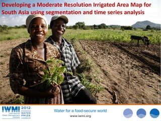
Developing a Moderate Resolution Irrigated Area Map for
South Asia using segmentation and time series analysis


                                                          Photo: David Brazier/IWMI
                   Water for a food-secure world
                           www.iwmi.org
Why Irrigated Area Mapping?
• Perspective of achieving food security by
  increasing irrigation
• Though 70-85 % of water used
• Especially with current situation of
  population, urbanization , climate change
  etc.
• Important to assess the spatial distribution,
  intensity, water use etc.
              Water for a food-secure world
                      www.iwmi.org
Is it new?
• Many products available globally - FAO, IWMI
• Also national products- CBIP, India
• Global Irrigated Area Map(GIAM) –
  developed by IWMI in 2006
• GIAM -Resolution of 10km and datasets from
  1990 -1999, AVHRR
• Very course product with detailed
  classification

              Water for a food-secure world
                      www.iwmi.org
Global Irrigated Area Mapping
• Product from IWMI - developed using multiple global
  datasets
• Different datasets were used at
          – Segmentation/Localization of landscape
          – Classification into different units
          – Time series analysis to identify irrigation
            intensity

•    Nominal resolution of 10KM
•    Datasets used were from 1990 – 2000

                  Water for a food-secure world
                          www.iwmi.org
Need/Opportunity to update GIAM
• Data available from 250m spatial resolution
• Highly capable HW/SW available for data intensive
  processes
• Good temporal coverage
• Extensive change in the landscape would have
  happened in 12 years
• New algorithms in image classification – „object based
  image analysis‟
• Updating the irrigated area map for South East Asia


                  Water for a food-secure world
                          www.iwmi.org
Datasets - comparison
Dataset -    GIAM      Resolution   Proposed       Resolution   Availability   Role
type         dataset                Dataset
NDVI         AVHRR     10KM         MODIS          250m         Free           Time series
/Reflectance                                                                   analysis

NDVI/Reflec SPOT       1KM          IRS P6 -       56m          Purchase       Single date
tance                               AWIFS                                      classification
                                                                               into objects

DEM          GTOPO     1KM          SRTM           90m          Free           conditional
                                                                               segmentation

Temperature AVHRR      10km         MODIS          1KM          Free           conditional
                                                                               segmentation

Precipitation CRU      0.5 degree   WorldClim      1KM          Free           conditional
                                                                               segmentation


                          Water for a food-secure world
                                    www.iwmi.org
Updated
                                                                  Level 1
        Methodology


Entire processing on minimum
Mapping unit – like admin
boundaries, climatic zones etc.


                                          Level 2


                                  Water for a food-secure world
                                          www.iwmi.org
Level1 – Segmentation and HR
       Land cover map


        Water for a food-secure world
                www.iwmi.org
Optimal segmentation
• Region growing algorithm – SPRING open source
  software
• Main parameters; “Similarity” and “Area”
• Objective function based on spatial auto correlation
  to determine best parameters
• Optimal segmentation > good classification
• Another factor > size of the image
• Bigger the size > more mix in clustering results
• Optimal size found from trial runs 250km by 200km

                 Water for a food-secure world
                         www.iwmi.org
Image classification steps


Original Image


                 Segmented Image


                                        ISOCLASS Classified
                                         Image


                                                              Recoded Image


                         Water for a food-secure world
                                   www.iwmi.org
Level 2 – Time series on MODIS
           250m NDVI


        Water for a food-secure world
                www.iwmi.org
MODIS Path/row for South Asia


        Water for a food-secure world
                www.iwmi.org
Class – flow diagram
                               Agriculture


                   Irrigated                         Rain fed            Water source


Surface water    Ground water          Conjunctive          Irrigation type


                                       Continuous
 Single crop     Double crop                                From MODIS
                                          crop
                                                            Irrigation intensity


                                                      Example class:
                                                      Irrigated, surface water, double crop


                     Water for a food-secure world
                                www.iwmi.org
Irrigated area calculated
   Country             Irrigated Area (million ha)
   Nepal                                              4
   Pakistan                                          21
   Sri Lanka                                        1.6
   India                                            169
   Bhutan                                           0.2
   Bangladesh                                        10
   Total irrigated area calculated for entire South Asia is
   206.74 million hectares.


            Water for a food-secure world
                    www.iwmi.org
India


        Water for a food-secure world
                www.iwmi.org
Pakistan


       Water for a food-secure world
               www.iwmi.org
Sri Lanka


            Water for a food-secure world
                    www.iwmi.org
Nepal


Water for a food-secure world
        www.iwmi.org
Bangladesh


Water for a food-secure world
        www.iwmi.org
Bhutan


Water for a food-secure world
        www.iwmi.org
Speeding up the localized approach
• Use of customizable open source tools
• Developing a R package to manage the segmentation
• Program in R to control
      • Dicing the imageries
      • Segmentation – SPRING software
      • Classification
      • Extracting the agc
      • Time series on agc
      • Localizing based on secondary datasets
      • Class assignment based on irrigation intensity
• Time consuming/Manual
      • Class assignment at both classification levels
      • Comments?

                    Water for a food-secure world
                            www.iwmi.org
Conclusions
•   High resolution global datasets available now
•   Introducing a localized approach to avoid mixes
•   Key is to identify MMU with homogeneous pattern
•   Scope for semi automating the process using R scripting
•   Can‟t avoid the manual interventions though…


                   Water for a food-secure world
                           www.iwmi.org

Contenu connexe

Similaire à Irrigated Area Mapping, South Asia

Reef water quality protection plan, bob speirs
Reef water quality protection plan, bob speirsReef water quality protection plan, bob speirs
Reef water quality protection plan, bob speirsInternational WaterCentre
 
Irrigation Management Reforms: The Asia Experience, by Madar Samad, IWMI
Irrigation Management Reforms: The Asia Experience, by Madar Samad, IWMIIrrigation Management Reforms: The Asia Experience, by Madar Samad, IWMI
Irrigation Management Reforms: The Asia Experience, by Madar Samad, IWMIGlobal Water Partnership
 
Sasumua: linking a landscape and institutional mosaic to climate change in Kenya
Sasumua: linking a landscape and institutional mosaic to climate change in KenyaSasumua: linking a landscape and institutional mosaic to climate change in Kenya
Sasumua: linking a landscape and institutional mosaic to climate change in KenyaCIFOR-ICRAF
 
8. Ricardo Monsivais - AES lac (parte 2)
8. Ricardo Monsivais - AES  lac (parte 2)8. Ricardo Monsivais - AES  lac (parte 2)
8. Ricardo Monsivais - AES lac (parte 2)Fundación Chile
 
14th Riversymposium, keynote presentation from Prof Barry Hart (2011)
14th Riversymposium, keynote presentation from Prof Barry Hart (2011)14th Riversymposium, keynote presentation from Prof Barry Hart (2011)
14th Riversymposium, keynote presentation from Prof Barry Hart (2011)International WaterCentre
 
Improving infield water management - Simon Turner (Agri Tech Ltd)
Improving infield water management - Simon Turner (Agri Tech Ltd)Improving infield water management - Simon Turner (Agri Tech Ltd)
Improving infield water management - Simon Turner (Agri Tech Ltd)Farming Futures
 
Improving Agricultural Water Productivity in the Indira Gandhi Nahar Pariyoja...
Improving Agricultural Water Productivity in the Indira Gandhi Nahar Pariyoja...Improving Agricultural Water Productivity in the Indira Gandhi Nahar Pariyoja...
Improving Agricultural Water Productivity in the Indira Gandhi Nahar Pariyoja...ICARDA
 

Similaire à Irrigated Area Mapping, South Asia (20)

RS & GIS applications to manage irrigated agriculture
RS & GIS applications to manage irrigated agricultureRS & GIS applications to manage irrigated agriculture
RS & GIS applications to manage irrigated agriculture
 
Msr apyouth
Msr apyouthMsr apyouth
Msr apyouth
 
Reef water quality protection plan, bob speirs
Reef water quality protection plan, bob speirsReef water quality protection plan, bob speirs
Reef water quality protection plan, bob speirs
 
Securing Water for Food, Livelihoods and Ecosystems to face Climate Change
Securing Water for Food, Livelihoods and Ecosystems to face Climate ChangeSecuring Water for Food, Livelihoods and Ecosystems to face Climate Change
Securing Water for Food, Livelihoods and Ecosystems to face Climate Change
 
Applications of remote sensing and modelling in flood risk analysis and irrig...
Applications of remote sensing and modelling in flood risk analysis and irrig...Applications of remote sensing and modelling in flood risk analysis and irrig...
Applications of remote sensing and modelling in flood risk analysis and irrig...
 
Launching next generation ict for weather and water information and advice to...
Launching next generation ict for weather and water information and advice to...Launching next generation ict for weather and water information and advice to...
Launching next generation ict for weather and water information and advice to...
 
Irrigation Management Reforms: The Asia Experience, by Madar Samad, IWMI
Irrigation Management Reforms: The Asia Experience, by Madar Samad, IWMIIrrigation Management Reforms: The Asia Experience, by Madar Samad, IWMI
Irrigation Management Reforms: The Asia Experience, by Madar Samad, IWMI
 
CPWF2‐V3: where we come from and where we are
CPWF2‐V3: where we come from and where we areCPWF2‐V3: where we come from and where we are
CPWF2‐V3: where we come from and where we are
 
Hydropower in Mekong countries: implications and opportunities
Hydropower in Mekong countries: implications and opportunitiesHydropower in Mekong countries: implications and opportunities
Hydropower in Mekong countries: implications and opportunities
 
Sasumua: linking a landscape and institutional mosaic to climate change in Kenya
Sasumua: linking a landscape and institutional mosaic to climate change in KenyaSasumua: linking a landscape and institutional mosaic to climate change in Kenya
Sasumua: linking a landscape and institutional mosaic to climate change in Kenya
 
Water accounting plus (WA+): A tool for basin-wide water accounting using rem...
Water accounting plus (WA+): A tool for basin-wide water accounting using rem...Water accounting plus (WA+): A tool for basin-wide water accounting using rem...
Water accounting plus (WA+): A tool for basin-wide water accounting using rem...
 
Agricultural water management planning in Cambodia
Agricultural water management planning in CambodiaAgricultural water management planning in Cambodia
Agricultural water management planning in Cambodia
 
Assessing Reef Health Using a Low Altitude Sensing Platform
Assessing Reef Health Using a Low Altitude Sensing PlatformAssessing Reef Health Using a Low Altitude Sensing Platform
Assessing Reef Health Using a Low Altitude Sensing Platform
 
8. Ricardo Monsivais - AES lac (parte 2)
8. Ricardo Monsivais - AES  lac (parte 2)8. Ricardo Monsivais - AES  lac (parte 2)
8. Ricardo Monsivais - AES lac (parte 2)
 
14th Riversymposium, keynote presentation from Prof Barry Hart (2011)
14th Riversymposium, keynote presentation from Prof Barry Hart (2011)14th Riversymposium, keynote presentation from Prof Barry Hart (2011)
14th Riversymposium, keynote presentation from Prof Barry Hart (2011)
 
Meine van Noordwijk - Sasumua: linking a landscape and institutional mosaic t...
Meine van Noordwijk - Sasumua: linking a landscape and institutional mosaic t...Meine van Noordwijk - Sasumua: linking a landscape and institutional mosaic t...
Meine van Noordwijk - Sasumua: linking a landscape and institutional mosaic t...
 
Anaerobic Digestion
Anaerobic DigestionAnaerobic Digestion
Anaerobic Digestion
 
T s3 gh3_nitin kaushal
T s3 gh3_nitin kaushalT s3 gh3_nitin kaushal
T s3 gh3_nitin kaushal
 
Improving infield water management - Simon Turner (Agri Tech Ltd)
Improving infield water management - Simon Turner (Agri Tech Ltd)Improving infield water management - Simon Turner (Agri Tech Ltd)
Improving infield water management - Simon Turner (Agri Tech Ltd)
 
Improving Agricultural Water Productivity in the Indira Gandhi Nahar Pariyoja...
Improving Agricultural Water Productivity in the Indira Gandhi Nahar Pariyoja...Improving Agricultural Water Productivity in the Indira Gandhi Nahar Pariyoja...
Improving Agricultural Water Productivity in the Indira Gandhi Nahar Pariyoja...
 

Plus de Sajid Pareeth

PhD defence presentation, 12 July 2016 @ FU-Berlin
PhD defence presentation, 12 July 2016 @ FU-BerlinPhD defence presentation, 12 July 2016 @ FU-Berlin
PhD defence presentation, 12 July 2016 @ FU-BerlinSajid Pareeth
 
Monitoring and retrieving historical daily surface temperature of sub-alpine ...
Monitoring and retrieving historical daily surface temperature of sub-alpine ...Monitoring and retrieving historical daily surface temperature of sub-alpine ...
Monitoring and retrieving historical daily surface temperature of sub-alpine ...Sajid Pareeth
 
Inter-sensor comparison of lake surface temperatures derived from MODIS, AVHR...
Inter-sensor comparison of lake surface temperatures derived from MODIS, AVHR...Inter-sensor comparison of lake surface temperatures derived from MODIS, AVHR...
Inter-sensor comparison of lake surface temperatures derived from MODIS, AVHR...Sajid Pareeth
 
An open source framework for processing daily satellite images (AVHRR) over l...
An open source framework for processing daily satellite images (AVHRR) over l...An open source framework for processing daily satellite images (AVHRR) over l...
An open source framework for processing daily satellite images (AVHRR) over l...Sajid Pareeth
 
Spatial Data Infrastructure in Europe
Spatial Data Infrastructure in EuropeSpatial Data Infrastructure in Europe
Spatial Data Infrastructure in EuropeSajid Pareeth
 
Feature Matching using SIFT algorithm
Feature Matching using SIFT algorithmFeature Matching using SIFT algorithm
Feature Matching using SIFT algorithmSajid Pareeth
 

Plus de Sajid Pareeth (6)

PhD defence presentation, 12 July 2016 @ FU-Berlin
PhD defence presentation, 12 July 2016 @ FU-BerlinPhD defence presentation, 12 July 2016 @ FU-Berlin
PhD defence presentation, 12 July 2016 @ FU-Berlin
 
Monitoring and retrieving historical daily surface temperature of sub-alpine ...
Monitoring and retrieving historical daily surface temperature of sub-alpine ...Monitoring and retrieving historical daily surface temperature of sub-alpine ...
Monitoring and retrieving historical daily surface temperature of sub-alpine ...
 
Inter-sensor comparison of lake surface temperatures derived from MODIS, AVHR...
Inter-sensor comparison of lake surface temperatures derived from MODIS, AVHR...Inter-sensor comparison of lake surface temperatures derived from MODIS, AVHR...
Inter-sensor comparison of lake surface temperatures derived from MODIS, AVHR...
 
An open source framework for processing daily satellite images (AVHRR) over l...
An open source framework for processing daily satellite images (AVHRR) over l...An open source framework for processing daily satellite images (AVHRR) over l...
An open source framework for processing daily satellite images (AVHRR) over l...
 
Spatial Data Infrastructure in Europe
Spatial Data Infrastructure in EuropeSpatial Data Infrastructure in Europe
Spatial Data Infrastructure in Europe
 
Feature Matching using SIFT algorithm
Feature Matching using SIFT algorithmFeature Matching using SIFT algorithm
Feature Matching using SIFT algorithm
 

Irrigated Area Mapping, South Asia

  • 1. Developing a Moderate Resolution Irrigated Area Map for South Asia using segmentation and time series analysis Photo: David Brazier/IWMI Water for a food-secure world www.iwmi.org
  • 2. Why Irrigated Area Mapping? • Perspective of achieving food security by increasing irrigation • Though 70-85 % of water used • Especially with current situation of population, urbanization , climate change etc. • Important to assess the spatial distribution, intensity, water use etc. Water for a food-secure world www.iwmi.org
  • 3. Is it new? • Many products available globally - FAO, IWMI • Also national products- CBIP, India • Global Irrigated Area Map(GIAM) – developed by IWMI in 2006 • GIAM -Resolution of 10km and datasets from 1990 -1999, AVHRR • Very course product with detailed classification Water for a food-secure world www.iwmi.org
  • 4. Global Irrigated Area Mapping • Product from IWMI - developed using multiple global datasets • Different datasets were used at – Segmentation/Localization of landscape – Classification into different units – Time series analysis to identify irrigation intensity • Nominal resolution of 10KM • Datasets used were from 1990 – 2000 Water for a food-secure world www.iwmi.org
  • 5. Need/Opportunity to update GIAM • Data available from 250m spatial resolution • Highly capable HW/SW available for data intensive processes • Good temporal coverage • Extensive change in the landscape would have happened in 12 years • New algorithms in image classification – „object based image analysis‟ • Updating the irrigated area map for South East Asia Water for a food-secure world www.iwmi.org
  • 6. Datasets - comparison Dataset - GIAM Resolution Proposed Resolution Availability Role type dataset Dataset NDVI AVHRR 10KM MODIS 250m Free Time series /Reflectance analysis NDVI/Reflec SPOT 1KM IRS P6 - 56m Purchase Single date tance AWIFS classification into objects DEM GTOPO 1KM SRTM 90m Free conditional segmentation Temperature AVHRR 10km MODIS 1KM Free conditional segmentation Precipitation CRU 0.5 degree WorldClim 1KM Free conditional segmentation Water for a food-secure world www.iwmi.org
  • 7. Updated Level 1 Methodology Entire processing on minimum Mapping unit – like admin boundaries, climatic zones etc. Level 2 Water for a food-secure world www.iwmi.org
  • 8. Level1 – Segmentation and HR Land cover map Water for a food-secure world www.iwmi.org
  • 9. Optimal segmentation • Region growing algorithm – SPRING open source software • Main parameters; “Similarity” and “Area” • Objective function based on spatial auto correlation to determine best parameters • Optimal segmentation > good classification • Another factor > size of the image • Bigger the size > more mix in clustering results • Optimal size found from trial runs 250km by 200km Water for a food-secure world www.iwmi.org
  • 10. Image classification steps Original Image Segmented Image ISOCLASS Classified Image Recoded Image Water for a food-secure world www.iwmi.org
  • 11. Level 2 – Time series on MODIS 250m NDVI Water for a food-secure world www.iwmi.org
  • 12. MODIS Path/row for South Asia Water for a food-secure world www.iwmi.org
  • 13. Class – flow diagram Agriculture Irrigated Rain fed Water source Surface water Ground water Conjunctive Irrigation type Continuous Single crop Double crop From MODIS crop Irrigation intensity Example class: Irrigated, surface water, double crop Water for a food-secure world www.iwmi.org
  • 14. Irrigated area calculated Country Irrigated Area (million ha) Nepal 4 Pakistan 21 Sri Lanka 1.6 India 169 Bhutan 0.2 Bangladesh 10 Total irrigated area calculated for entire South Asia is 206.74 million hectares. Water for a food-secure world www.iwmi.org
  • 15. India Water for a food-secure world www.iwmi.org
  • 16. Pakistan Water for a food-secure world www.iwmi.org
  • 17. Sri Lanka Water for a food-secure world www.iwmi.org
  • 18. Nepal Water for a food-secure world www.iwmi.org
  • 19. Bangladesh Water for a food-secure world www.iwmi.org
  • 20. Bhutan Water for a food-secure world www.iwmi.org
  • 21. Speeding up the localized approach • Use of customizable open source tools • Developing a R package to manage the segmentation • Program in R to control • Dicing the imageries • Segmentation – SPRING software • Classification • Extracting the agc • Time series on agc • Localizing based on secondary datasets • Class assignment based on irrigation intensity • Time consuming/Manual • Class assignment at both classification levels • Comments? Water for a food-secure world www.iwmi.org
  • 22. Conclusions • High resolution global datasets available now • Introducing a localized approach to avoid mixes • Key is to identify MMU with homogeneous pattern • Scope for semi automating the process using R scripting • Can‟t avoid the manual interventions though… Water for a food-secure world www.iwmi.org