SlideShare une entreprise Scribd logo
1  sur  12
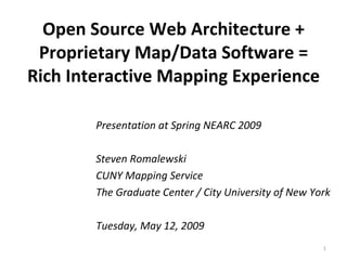
Open Source Web Architecture + Proprietary Map/Data Software = Rich Interactive Mapping Experience Presentation at Spring NEARC 2009 Steven Romalewski CUNY Mapping Service The Graduate Center / City University of New York Tuesday, May 12, 2009
Background  (pre-Google mapping experiences) Spring NEARC 2009 ,[object Object],[object Object],[object Object],[object Object]
Evaluating options  in a post-Google Maps world Spring NEARC 2009 ,[object Object],[object Object],[object Object],[object Object],[object Object],[object Object],[object Object],[object Object],[object Object]
A hybrid “geo stack” Spring NEARC 2009 ,[object Object],[object Object],[object Object],[object Object],[object Object],[object Object],[object Object],[object Object]
[object Object],[object Object],[object Object],[object Object],The Long Island Index interactive map  – visualize your community in new and powerful ways Page  Spring NEARC 2009 1 2 3 Map your village
See population or housing patterns in and around your community Page  Spring NEARC 2009
Map education statistics district-by-district –  NEW  for 2009! Page  Spring NEARC 2009
Add transportation routes, schools, environmental sites, special districts, and more Page  Spring NEARC 2009
The transparency slider 0% transparent 50% transparent 100% transparent reveals what’s underneath Page  Spring NEARC 2009
Compare aerial photos with Census and land use patterns 0% transparent 70% transparent 100% transparent Click on the red marker for a bird’s eye view Page  Spring NEARC 2009
Explore regional views of key demographic indicators Page  Spring NEARC 2009 You can zoom out to see the entire island, and then double-click on the list to zoom back in and see community-level detail.
For more info, contact: Spring NEARC 2009 Steven Romalewski CUNY Mapping Service at the Center for Urban Research The Graduate Center / CUNY 365 Fifth Ave., Room 6202 New York, NY  10016 Phone: 212-817-2033 www.urbanresearch.org [email_address]

Contenu connexe

Tendances

Google Earth Presentation
Google Earth PresentationGoogle Earth Presentation
Google Earth Presentationabc
 
From land use to human mobility
From land use to human mobilityFrom land use to human mobility
From land use to human mobilityPetter Holme
 
Courthouse usa 2maps pdf
Courthouse usa 2maps pdfCourthouse usa 2maps pdf
Courthouse usa 2maps pdfBilly Burle
 
Prof. Melinda Laituri, Colorado State University | Open Data for Secondary Ci...
Prof. Melinda Laituri, Colorado State University | Open Data for Secondary Ci...Prof. Melinda Laituri, Colorado State University | Open Data for Secondary Ci...
Prof. Melinda Laituri, Colorado State University | Open Data for Secondary Ci...Kathmandu Living Labs
 
2MAPS for Sustainable Development and Traffic Reduction
2MAPS for Sustainable Development and Traffic Reduction2MAPS for Sustainable Development and Traffic Reduction
2MAPS for Sustainable Development and Traffic ReductionBilly Burle
 
Sumit Dugar, Practical Action Consulting | Nepal Session | SotM Asia 2017
Sumit Dugar, Practical Action Consulting | Nepal Session | SotM Asia 2017Sumit Dugar, Practical Action Consulting | Nepal Session | SotM Asia 2017
Sumit Dugar, Practical Action Consulting | Nepal Session | SotM Asia 2017Kathmandu Living Labs
 
Ici town planner
Ici   town plannerIci   town planner
Ici town planner瑞田 吳
 
The importance of map
The importance of mapThe importance of map
The importance of maparceyes
 
Google Maps Presentation (LIS101)
Google Maps Presentation (LIS101)Google Maps Presentation (LIS101)
Google Maps Presentation (LIS101)Sideeq Sideeq
 
GeoWeb Concepts, Tools and Applications
GeoWeb Concepts, Tools and ApplicationsGeoWeb Concepts, Tools and Applications
GeoWeb Concepts, Tools and ApplicationsMatthew Dance
 
Mapping Edmonton Lecture to University of Alberta Human Geography and Plannin...
Mapping Edmonton Lecture to University of Alberta Human Geography and Plannin...Mapping Edmonton Lecture to University of Alberta Human Geography and Plannin...
Mapping Edmonton Lecture to University of Alberta Human Geography and Plannin...Matthew Dance
 
Cloud GIS - GIS in the Rockies 2011
Cloud GIS - GIS in the Rockies 2011Cloud GIS - GIS in the Rockies 2011
Cloud GIS - GIS in the Rockies 2011chelm
 
Geodatabase with GIS & RS
Geodatabase with GIS & RSGeodatabase with GIS & RS
Geodatabase with GIS & RSMohammed_82
 
Fayetteville Arkansas - Neighborhood Planning Areas
Fayetteville Arkansas - Neighborhood Planning AreasFayetteville Arkansas - Neighborhood Planning Areas
Fayetteville Arkansas - Neighborhood Planning AreasThomas L Brown
 
cf. city flows - A comparative visualization of bike sharing systems
cf. city flows - A comparative visualization of bike sharing systemscf. city flows - A comparative visualization of bike sharing systems
cf. city flows - A comparative visualization of bike sharing systemsTill Nagel
 
PPGIS: From desktop to the GeoWeb
PPGIS: From desktop to the GeoWebPPGIS: From desktop to the GeoWeb
PPGIS: From desktop to the GeoWebMatthew Dance
 
Geographical information system in transportation planning
Geographical information system in transportation planning Geographical information system in transportation planning
Geographical information system in transportation planning shayiqRashid
 
Achieving interoperability between the CARARE schema for monuments and sites ...
Achieving interoperability between the CARARE schema for monuments and sites ...Achieving interoperability between the CARARE schema for monuments and sites ...
Achieving interoperability between the CARARE schema for monuments and sites ...Kate Fernie
 

Tendances (20)

Google Earth Presentation
Google Earth PresentationGoogle Earth Presentation
Google Earth Presentation
 
From land use to human mobility
From land use to human mobilityFrom land use to human mobility
From land use to human mobility
 
Google Earth
Google EarthGoogle Earth
Google Earth
 
Courthouse usa 2maps pdf
Courthouse usa 2maps pdfCourthouse usa 2maps pdf
Courthouse usa 2maps pdf
 
Prof. Melinda Laituri, Colorado State University | Open Data for Secondary Ci...
Prof. Melinda Laituri, Colorado State University | Open Data for Secondary Ci...Prof. Melinda Laituri, Colorado State University | Open Data for Secondary Ci...
Prof. Melinda Laituri, Colorado State University | Open Data for Secondary Ci...
 
2MAPS for Sustainable Development and Traffic Reduction
2MAPS for Sustainable Development and Traffic Reduction2MAPS for Sustainable Development and Traffic Reduction
2MAPS for Sustainable Development and Traffic Reduction
 
Sumit Dugar, Practical Action Consulting | Nepal Session | SotM Asia 2017
Sumit Dugar, Practical Action Consulting | Nepal Session | SotM Asia 2017Sumit Dugar, Practical Action Consulting | Nepal Session | SotM Asia 2017
Sumit Dugar, Practical Action Consulting | Nepal Session | SotM Asia 2017
 
Ici town planner
Ici   town plannerIci   town planner
Ici town planner
 
The importance of map
The importance of mapThe importance of map
The importance of map
 
Google Maps Presentation (LIS101)
Google Maps Presentation (LIS101)Google Maps Presentation (LIS101)
Google Maps Presentation (LIS101)
 
GeoWeb Concepts, Tools and Applications
GeoWeb Concepts, Tools and ApplicationsGeoWeb Concepts, Tools and Applications
GeoWeb Concepts, Tools and Applications
 
Mapping Edmonton Lecture to University of Alberta Human Geography and Plannin...
Mapping Edmonton Lecture to University of Alberta Human Geography and Plannin...Mapping Edmonton Lecture to University of Alberta Human Geography and Plannin...
Mapping Edmonton Lecture to University of Alberta Human Geography and Plannin...
 
ccat
ccatccat
ccat
 
Cloud GIS - GIS in the Rockies 2011
Cloud GIS - GIS in the Rockies 2011Cloud GIS - GIS in the Rockies 2011
Cloud GIS - GIS in the Rockies 2011
 
Geodatabase with GIS & RS
Geodatabase with GIS & RSGeodatabase with GIS & RS
Geodatabase with GIS & RS
 
Fayetteville Arkansas - Neighborhood Planning Areas
Fayetteville Arkansas - Neighborhood Planning AreasFayetteville Arkansas - Neighborhood Planning Areas
Fayetteville Arkansas - Neighborhood Planning Areas
 
cf. city flows - A comparative visualization of bike sharing systems
cf. city flows - A comparative visualization of bike sharing systemscf. city flows - A comparative visualization of bike sharing systems
cf. city flows - A comparative visualization of bike sharing systems
 
PPGIS: From desktop to the GeoWeb
PPGIS: From desktop to the GeoWebPPGIS: From desktop to the GeoWeb
PPGIS: From desktop to the GeoWeb
 
Geographical information system in transportation planning
Geographical information system in transportation planning Geographical information system in transportation planning
Geographical information system in transportation planning
 
Achieving interoperability between the CARARE schema for monuments and sites ...
Achieving interoperability between the CARARE schema for monuments and sites ...Achieving interoperability between the CARARE schema for monuments and sites ...
Achieving interoperability between the CARARE schema for monuments and sites ...
 

En vedette

Colors
ColorsColors
Colorsa j
 
RW Listing Presentation
RW Listing PresentationRW Listing Presentation
RW Listing Presentationmark0723
 
California justice committee v bowen.complaint.signed
California justice committee v bowen.complaint.signedCalifornia justice committee v bowen.complaint.signed
California justice committee v bowen.complaint.signeda j
 
D E R R D D B C O M P A R I S O N S
D E R R  D D B  C O M P A R I S O N SD E R R  D D B  C O M P A R I S O N S
D E R R D D B C O M P A R I S O N Skshoffman
 
2009 MBCC Being Branded Concert
2009 MBCC Being Branded Concert2009 MBCC Being Branded Concert
2009 MBCC Being Branded ConcertARenee822
 
Travel Healthy April2010 Final Sunday11 Aril2010
Travel Healthy April2010 Final Sunday11 Aril2010Travel Healthy April2010 Final Sunday11 Aril2010
Travel Healthy April2010 Final Sunday11 Aril2010Subashri Shivkumar
 
Los angeles
Los angelesLos angeles
Los angelesa j
 
Proj Mgmt Capability
Proj Mgmt CapabilityProj Mgmt Capability
Proj Mgmt Capabilitysmcasas
 
Study: The Future of VR, AR and Self-Driving Cars
Study: The Future of VR, AR and Self-Driving CarsStudy: The Future of VR, AR and Self-Driving Cars
Study: The Future of VR, AR and Self-Driving CarsLinkedIn
 

En vedette (9)

Colors
ColorsColors
Colors
 
RW Listing Presentation
RW Listing PresentationRW Listing Presentation
RW Listing Presentation
 
California justice committee v bowen.complaint.signed
California justice committee v bowen.complaint.signedCalifornia justice committee v bowen.complaint.signed
California justice committee v bowen.complaint.signed
 
D E R R D D B C O M P A R I S O N S
D E R R  D D B  C O M P A R I S O N SD E R R  D D B  C O M P A R I S O N S
D E R R D D B C O M P A R I S O N S
 
2009 MBCC Being Branded Concert
2009 MBCC Being Branded Concert2009 MBCC Being Branded Concert
2009 MBCC Being Branded Concert
 
Travel Healthy April2010 Final Sunday11 Aril2010
Travel Healthy April2010 Final Sunday11 Aril2010Travel Healthy April2010 Final Sunday11 Aril2010
Travel Healthy April2010 Final Sunday11 Aril2010
 
Los angeles
Los angelesLos angeles
Los angeles
 
Proj Mgmt Capability
Proj Mgmt CapabilityProj Mgmt Capability
Proj Mgmt Capability
 
Study: The Future of VR, AR and Self-Driving Cars
Study: The Future of VR, AR and Self-Driving CarsStudy: The Future of VR, AR and Self-Driving Cars
Study: The Future of VR, AR and Self-Driving Cars
 

Similaire à Open Source Web Architecture + Proprietary Map/Data Software = Rich Interactive Mapping

Arnold webuquerque20110302
Arnold webuquerque20110302Arnold webuquerque20110302
Arnold webuquerque20110302lisaarn
 
Higher Education Profiling using Open Source GIS - A Primer on OpenStreetMap ...
Higher Education Profiling using Open Source GIS - A Primer on OpenStreetMap ...Higher Education Profiling using Open Source GIS - A Primer on OpenStreetMap ...
Higher Education Profiling using Open Source GIS - A Primer on OpenStreetMap ...CASA, UCL
 
OpenStreetMap and CycleStreets: collaborative map-making and cartography in t...
OpenStreetMap and CycleStreets: collaborative map-making and cartography in t...OpenStreetMap and CycleStreets: collaborative map-making and cartography in t...
OpenStreetMap and CycleStreets: collaborative map-making and cartography in t...CycleStreets
 
Web Mapping with Drupal
Web Mapping with DrupalWeb Mapping with Drupal
Web Mapping with DrupalRanel Padon
 
Mobile Social Location (Web 2.0 NYC edition)
Mobile Social Location (Web 2.0 NYC edition)Mobile Social Location (Web 2.0 NYC edition)
Mobile Social Location (Web 2.0 NYC edition)Matt Biddulph
 
GIS 2.0 and Neogeography
GIS 2.0 and NeogeographyGIS 2.0 and Neogeography
GIS 2.0 and NeogeographyJoshua Campbell
 
Spatial Technology Resources for Teachers
Spatial Technology Resources for TeachersSpatial Technology Resources for Teachers
Spatial Technology Resources for TeachersRebecca Nicholas
 
My GIS Timeline
My GIS TimelineMy GIS Timeline
My GIS Timelinejeffhobbs
 
Crowdsourced mapping for open collaboration: A story of Taiwan so far
Crowdsourced mapping for open collaboration: A story of Taiwan so farCrowdsourced mapping for open collaboration: A story of Taiwan so far
Crowdsourced mapping for open collaboration: A story of Taiwan so farDongpo Deng
 
OpenStreetMap - The Quality Issue
OpenStreetMap - The Quality IssueOpenStreetMap - The Quality Issue
OpenStreetMap - The Quality IssueCASA, UCL
 
What's New with the NCES SDDS and Web Mapping Tools - Blue Raster and Sanamet...
What's New with the NCES SDDS and Web Mapping Tools - Blue Raster and Sanamet...What's New with the NCES SDDS and Web Mapping Tools - Blue Raster and Sanamet...
What's New with the NCES SDDS and Web Mapping Tools - Blue Raster and Sanamet...Blue Raster
 
Bluemapia Mobile
Bluemapia MobileBluemapia Mobile
Bluemapia MobileMark Wilcox
 

Similaire à Open Source Web Architecture + Proprietary Map/Data Software = Rich Interactive Mapping (20)

paper24_SRomalewski
paper24_SRomalewskipaper24_SRomalewski
paper24_SRomalewski
 
Mapping
MappingMapping
Mapping
 
Arnold webuquerque20110302
Arnold webuquerque20110302Arnold webuquerque20110302
Arnold webuquerque20110302
 
Higher Education Profiling using Open Source GIS - A Primer on OpenStreetMap ...
Higher Education Profiling using Open Source GIS - A Primer on OpenStreetMap ...Higher Education Profiling using Open Source GIS - A Primer on OpenStreetMap ...
Higher Education Profiling using Open Source GIS - A Primer on OpenStreetMap ...
 
OpenStreetMap and CycleStreets: collaborative map-making and cartography in t...
OpenStreetMap and CycleStreets: collaborative map-making and cartography in t...OpenStreetMap and CycleStreets: collaborative map-making and cartography in t...
OpenStreetMap and CycleStreets: collaborative map-making and cartography in t...
 
Geocart workshop
Geocart workshopGeocart workshop
Geocart workshop
 
Web Mapping with Drupal
Web Mapping with DrupalWeb Mapping with Drupal
Web Mapping with Drupal
 
Mobile Social Location (Web 2.0 NYC edition)
Mobile Social Location (Web 2.0 NYC edition)Mobile Social Location (Web 2.0 NYC edition)
Mobile Social Location (Web 2.0 NYC edition)
 
GIS 2.0 and Neogeography
GIS 2.0 and NeogeographyGIS 2.0 and Neogeography
GIS 2.0 and Neogeography
 
Web GIS
Web GISWeb GIS
Web GIS
 
Spatial Technology Resources for Teachers
Spatial Technology Resources for TeachersSpatial Technology Resources for Teachers
Spatial Technology Resources for Teachers
 
Satellite Image Data Service
Satellite Image Data ServiceSatellite Image Data Service
Satellite Image Data Service
 
My GIS Timeline
My GIS TimelineMy GIS Timeline
My GIS Timeline
 
Osm Presentation
Osm PresentationOsm Presentation
Osm Presentation
 
Crowdsourced mapping for open collaboration: A story of Taiwan so far
Crowdsourced mapping for open collaboration: A story of Taiwan so farCrowdsourced mapping for open collaboration: A story of Taiwan so far
Crowdsourced mapping for open collaboration: A story of Taiwan so far
 
OpenStreetMap - The Quality Issue
OpenStreetMap - The Quality IssueOpenStreetMap - The Quality Issue
OpenStreetMap - The Quality Issue
 
What's New with the NCES SDDS and Web Mapping Tools - Blue Raster and Sanamet...
What's New with the NCES SDDS and Web Mapping Tools - Blue Raster and Sanamet...What's New with the NCES SDDS and Web Mapping Tools - Blue Raster and Sanamet...
What's New with the NCES SDDS and Web Mapping Tools - Blue Raster and Sanamet...
 
Bluemapia Mobile
Bluemapia MobileBluemapia Mobile
Bluemapia Mobile
 
625413IJSETR2860-47.pdf
625413IJSETR2860-47.pdf625413IJSETR2860-47.pdf
625413IJSETR2860-47.pdf
 
digital map
digital mapdigital map
digital map
 

Open Source Web Architecture + Proprietary Map/Data Software = Rich Interactive Mapping

  • 1. Open Source Web Architecture + Proprietary Map/Data Software = Rich Interactive Mapping Experience Presentation at Spring NEARC 2009 Steven Romalewski CUNY Mapping Service The Graduate Center / City University of New York Tuesday, May 12, 2009
  • 2.
  • 3.
  • 4.
  • 5.
  • 6. See population or housing patterns in and around your community Page Spring NEARC 2009
  • 7. Map education statistics district-by-district – NEW for 2009! Page Spring NEARC 2009
  • 8. Add transportation routes, schools, environmental sites, special districts, and more Page Spring NEARC 2009
  • 9. The transparency slider 0% transparent 50% transparent 100% transparent reveals what’s underneath Page Spring NEARC 2009
  • 10. Compare aerial photos with Census and land use patterns 0% transparent 70% transparent 100% transparent Click on the red marker for a bird’s eye view Page Spring NEARC 2009
  • 11. Explore regional views of key demographic indicators Page Spring NEARC 2009 You can zoom out to see the entire island, and then double-click on the list to zoom back in and see community-level detail.
  • 12. For more info, contact: Spring NEARC 2009 Steven Romalewski CUNY Mapping Service at the Center for Urban Research The Graduate Center / CUNY 365 Fifth Ave., Room 6202 New York, NY  10016 Phone: 212-817-2033 www.urbanresearch.org [email_address]