
Recommended
Recommended
More Related Content
Similar to Spatial Assessment of Phenological Observation
Similar to Spatial Assessment of Phenological Observation (20)
More from swenney
More from swenney (20)
Recently uploaded
Recently uploaded (20)
Spatial Assessment of Phenological Observation
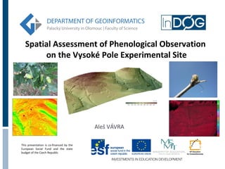
- 1. Spatial Assessment of Phenological Observation on the Vysoké Pole Experimental Site Aleš VÁVRA This presentation is co-financed by the European Social Fund and the state budget of the Czech Republic
- 2. Introduction Theory About phenology Phenology mapping Spatial aspect of phenology Case study Data collection in experimental area Phenological observation Spatial processing of data Second InDOG Doctoral Conference, 14th October – 17th October 2013, Olomouc
- 3. Phenology Phenology is the study of periodic cycle of plants life events and how these are influenced by seasonal and interannual variations of climate. Phenological phase of plants - Phenological phases (phenophase) is well recognizable and annually recurring state of the development of plants. We can observe several phenophases in the growing season on each plant. Phenology is part of the bioclimatology. Second InDOG Doctoral Conference, 14th October – 17th October 2013, Olomouc
- 4. Phenological observation Growing season - Timeframe in which the good climatic conditions (enough heat, plenty of rainfall) allow progress of the major life functions of plants. Usually lasts from March to November. (it depends on location and conditions) The most important phenological phases (at a wood plants): Bud burst - Inflorence emergency First leaves - Beginning of flowering Yellowing of leaves - End of flowering Leaves fallen - Fruit ripennes (vegetative) (generative) Second InDOG Doctoral Conference, 14th October – 17th October 2013, Olomouc
- 5. Applications of phenological observations The results can be applied in: Agriculture and forestry – research of vegetation cycles and determination of their time of sowing, harvesting, yields Climate models and predictions – creation of phenological models and comparison with climate models Human health – important for determining the onset, duration and location of pollen situations Second InDOG Doctoral Conference, 14th October – 17th October 2013, Olomouc
- 6. Phenological mapping Phenological mapping can express spatial aspect of data from observation Phenological observations are in direct relation to climatic influences - phenological maps can be compared with climate maps Based on phenological map, we can predict future phenologic development Several methods of phenological mapping, depend on: amount of observed phenological data spatial arrangement of input data scale of mapping Second InDOG Doctoral Conference, 14th October – 17th October 2013, Olomouc
- 7. Aims of case study Focused on comprehensive approach to phenological mapping of the landscape Practically verify integration of several methods of data collection for the study of landscape Processing and modelling with receive data and creation of time series datasets and maps Activities: Activity 1 - Small format photography Activity 2 - Continuous monitoring of abiotic factors using sensor networks Activity 3 - Phenological and landscape mapping Activity 4 - GIS modelling and data processing Second InDOG Doctoral Conference, 14th October – 17th October 2013, Olomouc
- 8. Experimental site Vysoké Pole Experimental site is the location of the Vysoké Pole village. The location lies at an altitude of 423 m, about 7 km northwest of the town Valašské Klobouky (Zlín Region). Site is using for research and study purposes, several methods of monitoring of landscape are using in this area Second InDOG Doctoral Conference, 14th October – 17th October 2013, Olomouc
- 9. Activity 1 - Small format photography Acquisition of perpendicular or oblique images with high spatial resolution in the visible and near-infrared part of the spectrum (0.5 to 0.9 µm) Using of two UAV devices - DRONE model PIXY and sixmultirotor system Hexakopter XL Outputs Photos of the area in visible and near infrared part of the spectra were taken from April to October Second InDOG Doctoral Conference, 14th October – 17th October 2013, Olomouc
- 10. Second InDOG Doctoral Conference, 14th October – 17th October 2013, Olomouc
- 11. Activity 2 - Continuous monitoring of abiotic factors using sensor networks Using of sensors, data loggers and wireless sensor networks in the field Important for calibration and verification of remote imagery and phenological mapping Using of static multispectral camera for continuous sensing of amount of biomass Outputs Time series datasets and trends of selected abiotic factors (temperature, precipitation, soil moisture) Support data for verification and correlation with phenological data Amount of biomass in different parts of growing season Second InDOG Doctoral Conference, 14th October – 17th October 2013, Olomouc
- 12. Multispectral camera image device SPAD-502 Senzors of soil moisture (Decagon EC 5 and VIRRIB) Rain gauge Control box interface Temperature senzor (Hobo) Second InDOG Doctoral Conference, 14th October – 17th October 2013, Olomouc
- 13. Activity 3 - Phenological and landscape mapping Overall landscape mapping for determination of current state and assessment of sustainability Phenological landscape mapping in area that focuses on comparing the seasonal development of selected plant communities at selected sites Outputs Current land use map in the scale 1:10 000, including the determination of the dominant species and evaluation of the degree of environmental stability index Phenological time series mapping of selected plant species, including photodocumentation Beech, Pine, Hawthorn, Blackthorn, Elder, Oak and Wild Cherry Second InDOG Doctoral Conference, 14th October – 17th October 2013, Olomouc
- 14. 26. 6. 17. 7. 10. 8. End of flower. (100%) Beg. of fructification 10% Fruit ripennes 10% 17. 9. Fruit ripennes 25% 11. 10. Fruit ripennes 50% Second InDOG Doctoral Conference, 14th October – 17th October 2013, Olomouc
- 15. Activity 4 - GIS modelling and data processing Creation of DEM and DTM, several characteristic of experimetnal site Elevation Slope Aspect Solar irradiation Second InDOG Doctoral Conference, 14th October – 17th October 2013, Olomouc
- 16. Activity 4 - GIS modelling and data processing Processing of data from small-format photography, NDVI and biomass Vegetation index NDVI may june august sept. Second InDOG Doctoral Conference, 14th October – 17th October 2013, Olomouc
- 17. Activity 4 - GIS modelling and data processing Processing of data from phenological observation Estimation of the onset of phenophase (end of flowering) for pine Second InDOG Doctoral Conference, 14th October – 17th October 2013, Olomouc
- 18. Activity 4 - GIS modelling and data processing Processing of data from phenological observation Average deviation of onset of selected phenophases for oak Second InDOG Doctoral Conference, 14th October – 17th October 2013, Olomouc
- 19. Benefits of case study Practical testing of methods of data collection in the field Buying and testing new devices and software for data collection and processing Educational benefit - involving students in research and practical exercises Cooperation with other organization and use the results for the practical development of the area Gaining experience for future projects and research Second InDOG Doctoral Conference, 14th October – 17th October 2013, Olomouc
- 20. Thank you for attention Aleš VÁVRA, 15. 10. 2013 KGI UP Olomouc ales.vavra@upol.cz This presentation is co-financed by the European Social Fund and the state budget of the Czech Republic