SlideShare une entreprise Scribd logo
1  sur  65
Télécharger pour lire hors ligne
Early Warning Forecast of an Oil Spill:
  BP Deepwater Horizon in the Gulf


 Teresa Howard, Casey Dietrich & Corey Trahan
        The University of Texas at Austin

               Texas GIS Forum
               October 27, 2011
NASA Terra MODIS
     May 17, 2010 at 1636 UTC
  Collected by the MAGIC DBRS,
Center for Space Research, UT-Austin


Deepwater Horizon Oil Spill on May 17, 2010 at 1136 am CDT
UT Center for Space Research DBRS Antennas at West Pickle Research
           1.5-meter S/L-Band   4.5-meter X-Band   2.4-meter X-Band
Nearshore Oil Transport : Motivation
Satellite imagery can only show current location of the slick
   - Where will the oil move?
   - What happens if a hurricane approaches?
Forecasts need to be accurate and fast
   - Share computed circulation with NOAA,
                  other spill modelers
   - Share oil transport with emergency managers
                  in real time ( http://adcirc.org/oilspill )
Nearshore Oil Transport : Methods
                                            WINDS
                         Provided by NCEP ( http://www.ncep.noaa.gov/ )
                        from WRF-NMM ( http://nomads.ncdc.noaa.gov/ ),
                            downloaded and converted to our format.


                    CURRENTS
Waves from SWAN ( http://swanmodel.sourceforge.net/ )
and circulation from ADCIRC ( http://www.adcirc.org/ ),
                                                                              INITIAL CONDITIONS
 with currents provided hourly to the tracking model.                   NESDIS ( http://www.nesdis.noaa.gov/ )
                                                                           provided slick extents, which were
                                                                     digitized and provided to the tracking model.


                                               OIL TRANSPORT
                              Waves from SWAN ( http://swanmodel.sourceforge.net/ )
                              and circulation from ADCIRC ( http://www.adcirc.org/ ),
                               with currents provided hourly to the tracking model.


                                                 EMERGENCY MANAGERS
                                    Animations posted online ( http://www.adcirc.org/oilspill/ ).
Prepare oil slick for particle tracking
1. Obtain oil slick extent vector polygons from NOAA NESDIS.

2. Intersect oil slick polygons with water depth boundaries:
   near coast, < 100 meters deep above the continental shelf,
   and deep ocean waters (> 100 m deep).

3. Convert oil slick polygons to raster of 50 meter grid elements
   with attribute initial water depth interval.

4. Convert grid elements to point vectors

5. Calculate x,y coordinates in longitude and latitude.

6. Output ASCII initial particle location file.
Validation : Mid-June
06/13   14   15   16    17      18     19     20   21   22   23

                  2010 / 06 / 13 / 1548 UTC
06/13   14   15   16    17       18      19      20      21         22   23

                  2010 / 06 / 14 / 1151 UTC ( + 20 hr / + 0.8 d )
06/13   14   15   16    17       18      19      20      21         22   23

                  2010 / 06 / 15 / 1151 UTC ( + 44 hr / + 1.8 d )
06/13   14   15   16    17       18      19      20      21         22   23

                  2010 / 06 / 16 / 0140 UTC ( + 58 hr / + 2.4 d )
06/13   14   15   16    17       18      19      20      21         22   23

                  2010 / 06 / 16 / 1555 UTC ( + 72 hr / + 3.0 d )
06/13   14   15   16    17       18      19      20      21         22   23

                  2010 / 06 / 17 / 1150 UTC ( + 92 hr / + 3.8 d )
06/13   14   15   16    17      18       19      20      21      22   23

                  2010 / 06 / 18 / 1109 UTC ( + 115 hr / + 4.8 d )
06/13   14   15   16    17      18       19      20      21      22   23

                  2010 / 06 / 18 / 1637 UTC ( + 121 hr / + 5.0 d )
06/13   14   15   16    17      18       19      20      21      22   23

                  2010 / 06 / 19 / 0341 UTC ( + 132 hr / + 5.5 d )
06/13   14   15   16    17      18       19      20      21      22   23

                  2010 / 06 / 19 / 1730 UTC ( + 148 hr / + 6.2 d )
06/13   14   15   16    17      18       19      20      21      22   23

                  2010 / 06 / 19 / 2330 UTC ( + 152 hr / + 6.3 d )
06/13   14   15   16    17      18       19      20      21      22   23

                  2010 / 06 / 20 / 1150 UTC ( + 164 hr / + 6.8 d )
06/13   14   15   16    17      18       19      20      21      22   23

                  2010 / 06 / 21 / 1613 UTC ( + 192 hr / + 8.0 d )
06/13   14   15   16    17      18       19      20      21      22   23

                  2010 / 06 / 22 / 0348 UTC ( + 204 hr / + 8.5 d )
Validation : Hurricane Alex (2010)
Made initial landfall in Belize
   and tracked over
   Yucatan Peninsula
Strengthened in southern
   Gulf of Mexico to
   Category 2 storm before
   making landfall in
   Mexico
Limited useable satellite
   imagery
Validation : Hurricane Alex (2010)
06/29   30    07/01    02     03         04   05   06

             2010 / 06 / 29 / 0044 UTC
06/29   30    07/01    02       03      04      05      06

             2010 / 06 / 29 / 1546 UTC ( + 15 hr / + 0.6 d )
06/29   30    07/01    02       03      04      05      06

             2010 / 06 / 29 / 2332 UTC ( + 23 hr / + 0.9 d )
06/29   30    07/01    02       03      04      05      06

             2010 / 06 / 30 / 1155 UTC ( + 35 hr / + 1.4 d )
06/29   30    07/01    02       03      04      05      06

             2010 / 06 / 30 / 2355 UTC ( + 47 hr / + 1.9 d )
06/29   30    07/01    02       03      04      05      06

             2010 / 07 / 02 / 1156 UTC ( + 83 hr / + 3.4 d )
06/29   30    07/01    02       03      04      05      06

             2010 / 07 / 02 / 1552 UTC ( + 87 hr / + 3.6 d )
06/29   30    07/01    02       03      04      05      06

             2010 / 07 / 03 / 1156 UTC ( + 107 hr / + 4.4 d )
06/29   30    07/01    02       03      04      05      06

             2010 / 07 / 04 / 1635 UTC ( + 136 hr / + 5.7 d )
06/29   30    07/01    02       03      04      05      06

             2010 / 07 / 05 / 0008 UTC ( + 136 hr / + 5.7 d )
www.adcirc.org/oilspill
Oil transport project participants

  JC Dietrich, CJ Trahan, CN Dawson                L Yu, A Lu
     Institute for Computational Engineering and      Department of Computer Science,
     Sciences,                                        Univ. of North Carolina at Charlotte
     University of Texas at Austin
                                                   K Vega, A Kubach
  MT Howard, G Wells
                                                      Texas Advanced Computing Center, University
     Center for Space Research,                       of Texas at Austin
     University of Texas at Austin
                                                   KM Dresback, RL Kolar
  JG Fleming                                          School of Civil Engineering and Environmental
                                                      Science,
     Seahorse Coastal Consulting, Morehead City,      University of Oklahoma
     North Carolina
  RJ Weaver, RA Luettich Jr                        C Kaiser
                                                      Dept. of Oceanography and Coastal Sciences,
     Institute of Marine Sciences,                    Louisiana State University
     Univ. of North Carolina at Chapel Hill
                                                   RR Twilley
  S Tanaka, JJ Westerink
     Dept. of Civil Engineering and Geological        Vice President for Research,
     Sciences,                                        University of Louisiana at Lafayette
     University of Notre Dame
Acknowledgements:
 University of North Carolina at Chapel Hill Institute of
   Marine Sciences
 University of Notre Dame Computational Hydraulics
   Laboratory
 University of Texas Computational Hydraulics Groups,
   ICES
 University of Texas Center for Space Research
 Texas Advanced Computing Center, University of Texas
 NOAA/NESDIS/Satellite Analysis Branch, Experimental
   Marine Pollution Surveillance Program
 Seahorse Coastal Consulting
Funding for this work was provided by:
 National Science Foundation TeraGrid
 National Science Foundation RAPID Grant—Office of
   Cyberinfrastructure
 Department of Homeland Security Science & Technology
   Directorate through the Center of Excellence for
   Natural Disasters, Coastal Infrastructure and
   Emergency Management (DIEM)
 NOAA IOOS Program
And now for something

    entirely different….
Texas Wildfires

                                                  Gordon Wells, Larry Teng,
                                                  Solar Smith & Teresa Howard
                                                  UT Center for Space Research


Photo by Frank Cianciolo                                     McDonald Observatory
Sr. Program Coordinator
McDonald Obs. / Bash Visitors Center
                                                             April 23, 2011, at 2201 CDT
University of Texas at Austin
Landsat 7 ETM+
                                                                   April 24, 2011 at 1221 CDT
   Active Fire Front                                               SWIR/VNIR Channels 7,4,2


Controlled Burn


                       McDonald
                       Observatory   Rock House Fire: Northern Margin
                                                (April 24, 2011)
NASA Terra MODIS
                                         April 15, 2011 at 1243 CDT
                                      Collected by the MAGIC DBRS,
                                    Center for Space Research, UT-Austin


Wildfires on April 15 at 1243 CDT
NASA Terra MODIS
                                                                                           April 15, 2011 at 1243 CDT
                                                                                        Collected by the MAGIC DBRS,
                                                                    Copper Mountain   Center for Space Research, UT-Austin
                                                                        Ranch

                                                                                             PK West

                                     Frying Pan
                                       Ranch


                                                                         Wildcat


                         Rockhouse
                                                     Pearce Ranch


                                            El Bonito


                                         La Sabina


Wildfires on April 15 at 1243 CDT
NASA Terra MODIS
      April 15, 2011 at 1243 CDT
   Collected by the MAGIC DBRS,
 Center for Space Research, UT-Austin


                                        Copper Mountain
                                            Ranch

                                                            PK West


                                                  Wildcat


Wildfires on April 15 at 1243 CDT
NASA Aqua MODIS
      April 15, 2011 at 1419 CDT
   Collected by the MAGIC DBRS,
 Center for Space Research, UT-Austin


                                        Copper Mountain
                                            Ranch

                                                            PK West


                                                  Wildcat


Wildfires on April 15 at 1419 CDT
Landsat 7 ETM+
                                                                                  April 24, 2011 at 1221 CDT
                                                                             Thermal/SWIR/VNIR Channels 7,4,2 + 6
                              Active fire
                             front (4/24)


Area of the controlled
   burn (4/23-24)


                                                                   Rock House Fire
                                                                      Burn Scar


                McDonald
               Observatory
                                   Hobby-Eberly
                                                  Rock House Fire: Northern Margin
                                    Telescope      Landsat 7 Enhanced Thematic Mapper-Plus (4/24/11)
Rock House Fire on May 2 at 1217 CDT


 McDonald
Observatory


                  Fort Davis


                                              Roper Ranch
                                             Fire Burn Scar


                                                               Landsat 5 Thematic Mapper
                                                                    May 2, 2011 at 1217 CDT
                                                                   SWIR/VNIR Channels 7,4,2
          Marfa                                                 Processed by the MAGIC DBRS,
                                                              Center for Space Research, UT-Austin
French SPOT 4 HRVIR
                                          April 29, 2011 at 1205 CDT
                                          SWIR/VNIR Channels 4,3,1
                                    Collected by U.S. Air Force Eagle Vision
                                       Processed by the MAGIC DBRS,
                                     Center for Space Research, UT-Austin


Deaton Cole Fire: Google Earth Display
SPOT 4 HRVIR (4/29: 1300) & Terra MODIS Firepoints (4/29: 1205)
NASA Aqua MODIS
                                                                                                   April 28, 2011 at 1508 CDT
                                                                                                Collected by the MAGIC DBRS,
                                                                                              Center for Space Research, UT-Austin


                                                                   Killough         Swenson

                                                                               Cooper
                                                                              Mountain

                                                                                                                      PK
                                                                                                                    Complex

                   Last Chance


                                                                                Wildcat


                                 Rock House


                                                                    Deaton
                                                                     Cole


                                              Bonito


                                                       La Sabina

April Burn Scars
Aqua MODIS Firepoints
September 9, 2011 at 1449 CDT
 Collected by the MAGIC DBRS
Center for Space Res., UT-Austin


                                             Magnolia

Values = Fire Radiative Power in Megawatts
French SPOT 4 HRVIR
                                                      September 12, 2011 at 1155 CDT
                                                         SWIR/VNIR Channels 4,3,2
                                                   Collected by U.S. Air Force Eagle Vision
                                                      Processed by the MAGIC DBRS,
                                                    Center for Space Research, UT-Austin


                                        Magnolia


Riley Road/Crown Ranch Fire Burn Scar
Bastrop County Complex Fire
GeoEye Ikonos-2 Pan/VNIR
September 8, 2011 at 1220 CDT
Intact and destroyed residences in Tahitian Village,       Texas Civil Air Patrol
Bastrop County.                                        September 16, 2011 at 1140 CDT
Residences destroyed by ground fire.       Texas Civil Air Patrol
                                       September 16, 2011 at 1141 CDT
http://magic.csr.utexas.edu/Event/11TxWildfires


Residence with a green yard destroyed       Texas Civil Air Patrol
by ground fire.                         September 16, 2011 at 1144 CDT
John Nielson-Gammon,
  State Climatologist
Normalized Difference Vegetation Index
                                                             NASA Terra MODIS
                                                             August 29, 2006


MODIS telemetry received and processed by the MAGIC DBRS
  Center for Space Research, University of Texas at Austin
Normalized Difference Vegetation Index
                                                             NASA Terra MODIS
                                                             August 29, 2007


MODIS telemetry received and processed by the MAGIC DBRS
  Center for Space Research, University of Texas at Austin
Normalized Difference Vegetation Index
                                                             NASA Terra MODIS
                                                             August 29, 2008


MODIS telemetry received and processed by the MAGIC DBRS
  Center for Space Research, University of Texas at Austin
Normalized Difference Vegetation Index
                                                             NASA Terra MODIS
                                                             August 29, 2009


MODIS telemetry received and processed by the MAGIC DBRS
  Center for Space Research, University of Texas at Austin
Normalized Difference Vegetation Index
                                                             NASA Terra MODIS
                                                             August 29, 2010


MODIS telemetry received and processed by the MAGIC DBRS
  Center for Space Research, University of Texas at Austin
Normalized Difference Vegetation Index
                                                             NASA Terra MODIS
                                                             August 29, 2011


MODIS telemetry received and processed by the MAGIC DBRS
  Center for Space Research, University of Texas at Austin
January - September Satellite Thermal Detections, 2002-2011
                               16000


                               14000


                               12000
Satellite Thermal Detections


                               10000


                                8000


                                6000


                                4000


                                2000


                                   0
                                          2002      2003       2004      2005       2006       2007      2008      2009       2010      2011


                                                                                        Year

                                       NASA MODIS thermal detections (Fire Radiative Power >1 megawatt) in Texas collected by the MAGIC DBRS,
                                                                            University of Texas at Austin

Contenu connexe

Similaire à Early warning forecast of an oil spill bp deepwater horizon in the gulf

Inter fellous freilich
Inter fellous freilichInter fellous freilich
Inter fellous freilichNASAPMC
 
FOGSS_2023_Welcome.pdf
FOGSS_2023_Welcome.pdfFOGSS_2023_Welcome.pdf
FOGSS_2023_Welcome.pdfWinnieChu21
 
ILOA Galaxy Forum SEA Thailand -- NEO and Space Debris, Kirdkao
ILOA Galaxy Forum SEA Thailand -- NEO and Space Debris, KirdkaoILOA Galaxy Forum SEA Thailand -- NEO and Space Debris, Kirdkao
ILOA Galaxy Forum SEA Thailand -- NEO and Space Debris, KirdkaoILOAHawaii
 
Embry Riddle Final
Embry Riddle FinalEmbry Riddle Final
Embry Riddle Finaljschrell
 
DSD-INT 2018 From global to local: Volvo Ocean Race 2018 - Minns
DSD-INT 2018 From global to local: Volvo Ocean Race 2018 - MinnsDSD-INT 2018 From global to local: Volvo Ocean Race 2018 - Minns
DSD-INT 2018 From global to local: Volvo Ocean Race 2018 - MinnsDeltares
 
General Discussion: Riset Dampak Perubahan Iklim Global Dengan Menggunakan Ar...
General Discussion: Riset Dampak Perubahan Iklim Global Dengan Menggunakan Ar...General Discussion: Riset Dampak Perubahan Iklim Global Dengan Menggunakan Ar...
General Discussion: Riset Dampak Perubahan Iklim Global Dengan Menggunakan Ar...widodopranowo
 
C4.06: Towards continental-scale operational ocean and coastal monitoring usi...
C4.06: Towards continental-scale operational ocean and coastal monitoring usi...C4.06: Towards continental-scale operational ocean and coastal monitoring usi...
C4.06: Towards continental-scale operational ocean and coastal monitoring usi...Blue Planet Symposium
 
20110728_IGARSS_GDPS(ryu)fin1.pptx
20110728_IGARSS_GDPS(ryu)fin1.pptx20110728_IGARSS_GDPS(ryu)fin1.pptx
20110728_IGARSS_GDPS(ryu)fin1.pptxgrssieee
 
Oman NWP performance during phet
Oman NWP performance during phetOman NWP performance during phet
Oman NWP performance during phetSultan AL-Yahyai
 
Satellite Hacking — Intro by Indianz (2012)
Satellite Hacking — Intro by Indianz (2012)Satellite Hacking — Intro by Indianz (2012)
Satellite Hacking — Intro by Indianz (2012)Jim Geovedi
 
Conceptual design and architecture of turkish communication satellite turksat...
Conceptual design and architecture of turkish communication satellite turksat...Conceptual design and architecture of turkish communication satellite turksat...
Conceptual design and architecture of turkish communication satellite turksat...Atılay Mayadağ
 
Andrew_Sitek_RESUME_FINAL
Andrew_Sitek_RESUME_FINALAndrew_Sitek_RESUME_FINAL
Andrew_Sitek_RESUME_FINALAndrew Sitek
 
2004-09-29 Status Report on CATT and FASTNET
2004-09-29 Status Report on CATT and FASTNET2004-09-29 Status Report on CATT and FASTNET
2004-09-29 Status Report on CATT and FASTNETRudolf Husar
 
Global environmental data for sustainable shipping
Global environmental data for sustainable shippingGlobal environmental data for sustainable shipping
Global environmental data for sustainable shippingTidetech Haire
 
1_Buck - Wavemil Steps IGARSS-11.ppt
1_Buck - Wavemil Steps IGARSS-11.ppt1_Buck - Wavemil Steps IGARSS-11.ppt
1_Buck - Wavemil Steps IGARSS-11.pptgrssieee
 

Similaire à Early warning forecast of an oil spill bp deepwater horizon in the gulf (20)

Inter fellous freilich
Inter fellous freilichInter fellous freilich
Inter fellous freilich
 
FOGSS_2023_Welcome.pdf
FOGSS_2023_Welcome.pdfFOGSS_2023_Welcome.pdf
FOGSS_2023_Welcome.pdf
 
ILOA Galaxy Forum SEA Thailand -- NEO and Space Debris, Kirdkao
ILOA Galaxy Forum SEA Thailand -- NEO and Space Debris, KirdkaoILOA Galaxy Forum SEA Thailand -- NEO and Space Debris, Kirdkao
ILOA Galaxy Forum SEA Thailand -- NEO and Space Debris, Kirdkao
 
Conclusive Results
Conclusive ResultsConclusive Results
Conclusive Results
 
Embry Riddle Final
Embry Riddle FinalEmbry Riddle Final
Embry Riddle Final
 
DSD-INT 2018 From global to local: Volvo Ocean Race 2018 - Minns
DSD-INT 2018 From global to local: Volvo Ocean Race 2018 - MinnsDSD-INT 2018 From global to local: Volvo Ocean Race 2018 - Minns
DSD-INT 2018 From global to local: Volvo Ocean Race 2018 - Minns
 
General Discussion: Riset Dampak Perubahan Iklim Global Dengan Menggunakan Ar...
General Discussion: Riset Dampak Perubahan Iklim Global Dengan Menggunakan Ar...General Discussion: Riset Dampak Perubahan Iklim Global Dengan Menggunakan Ar...
General Discussion: Riset Dampak Perubahan Iklim Global Dengan Menggunakan Ar...
 
Thailand Earth Observation System sattellite
Thailand Earth Observation System sattelliteThailand Earth Observation System sattellite
Thailand Earth Observation System sattellite
 
Msl landing
Msl landingMsl landing
Msl landing
 
C4.06: Towards continental-scale operational ocean and coastal monitoring usi...
C4.06: Towards continental-scale operational ocean and coastal monitoring usi...C4.06: Towards continental-scale operational ocean and coastal monitoring usi...
C4.06: Towards continental-scale operational ocean and coastal monitoring usi...
 
TASS Poster
TASS PosterTASS Poster
TASS Poster
 
Orbital Debris Mapping
Orbital Debris MappingOrbital Debris Mapping
Orbital Debris Mapping
 
20110728_IGARSS_GDPS(ryu)fin1.pptx
20110728_IGARSS_GDPS(ryu)fin1.pptx20110728_IGARSS_GDPS(ryu)fin1.pptx
20110728_IGARSS_GDPS(ryu)fin1.pptx
 
Oman NWP performance during phet
Oman NWP performance during phetOman NWP performance during phet
Oman NWP performance during phet
 
Satellite Hacking — Intro by Indianz (2012)
Satellite Hacking — Intro by Indianz (2012)Satellite Hacking — Intro by Indianz (2012)
Satellite Hacking — Intro by Indianz (2012)
 
Conceptual design and architecture of turkish communication satellite turksat...
Conceptual design and architecture of turkish communication satellite turksat...Conceptual design and architecture of turkish communication satellite turksat...
Conceptual design and architecture of turkish communication satellite turksat...
 
Andrew_Sitek_RESUME_FINAL
Andrew_Sitek_RESUME_FINALAndrew_Sitek_RESUME_FINAL
Andrew_Sitek_RESUME_FINAL
 
2004-09-29 Status Report on CATT and FASTNET
2004-09-29 Status Report on CATT and FASTNET2004-09-29 Status Report on CATT and FASTNET
2004-09-29 Status Report on CATT and FASTNET
 
Global environmental data for sustainable shipping
Global environmental data for sustainable shippingGlobal environmental data for sustainable shipping
Global environmental data for sustainable shipping
 
1_Buck - Wavemil Steps IGARSS-11.ppt
1_Buck - Wavemil Steps IGARSS-11.ppt1_Buck - Wavemil Steps IGARSS-11.ppt
1_Buck - Wavemil Steps IGARSS-11.ppt
 

Plus de Texas Natural Resources Information System

From creekology to rocket science the evolution of remote sensing gis in oilg...
From creekology to rocket science the evolution of remote sensing gis in oilg...From creekology to rocket science the evolution of remote sensing gis in oilg...
From creekology to rocket science the evolution of remote sensing gis in oilg...Texas Natural Resources Information System
 

Plus de Texas Natural Resources Information System (20)

Txgio presentation rgsm_gps_pearson_062012
Txgio presentation rgsm_gps_pearson_062012Txgio presentation rgsm_gps_pearson_062012
Txgio presentation rgsm_gps_pearson_062012
 
Usslsc cgsic regional austin 061312
Usslsc cgsic regional austin 061312Usslsc cgsic regional austin 061312
Usslsc cgsic regional austin 061312
 
Using gps technology at the texas general land
Using gps technology at the texas general landUsing gps technology at the texas general land
Using gps technology at the texas general land
 
Ussls austin civil utility - klein - 061312 - final
Ussls austin   civil utility - klein - 061312 - finalUssls austin   civil utility - klein - 061312 - final
Ussls austin civil utility - klein - 061312 - final
 
Tx dot gps applications fuegner
Tx dot gps applications   fuegnerTx dot gps applications   fuegner
Tx dot gps applications fuegner
 
Tnris 2012
Tnris 2012Tnris 2012
Tnris 2012
 
Nmc ussls charter 2012
Nmc ussls charter 2012Nmc ussls charter 2012
Nmc ussls charter 2012
 
Nationwide dgps (ndgps) lt mendoza
Nationwide dgps (ndgps)   lt mendozaNationwide dgps (ndgps)   lt mendoza
Nationwide dgps (ndgps) lt mendoza
 
Lyle tamucc 2
Lyle tamucc 2Lyle tamucc 2
Lyle tamucc 2
 
Dirks cgsic brief 2012
Dirks cgsic brief 2012Dirks cgsic brief 2012
Dirks cgsic brief 2012
 
Connected vehicle highway network applications
Connected vehicle highway network applicationsConnected vehicle highway network applications
Connected vehicle highway network applications
 
Cgsic presentation humphreys
Cgsic presentation humphreysCgsic presentation humphreys
Cgsic presentation humphreys
 
Cgsic navcen
Cgsic navcenCgsic navcen
Cgsic navcen
 
Gnss international policy regional cgsic (austin - jun2012)
Gnss international policy   regional cgsic (austin - jun2012)Gnss international policy   regional cgsic (austin - jun2012)
Gnss international policy regional cgsic (austin - jun2012)
 
From creekology to rocket science the evolution of remote sensing gis in oilg...
From creekology to rocket science the evolution of remote sensing gis in oilg...From creekology to rocket science the evolution of remote sensing gis in oilg...
From creekology to rocket science the evolution of remote sensing gis in oilg...
 
We are the music makers and we are the dreamers of dreams
We are the music makers and we are the dreamers of dreamsWe are the music makers and we are the dreamers of dreams
We are the music makers and we are the dreamers of dreams
 
Volunteered geographic information (vgi) for the national map
Volunteered geographic information (vgi) for the national mapVolunteered geographic information (vgi) for the national map
Volunteered geographic information (vgi) for the national map
 
Uav image recognition technology and applications
Uav image recognition technology and applicationsUav image recognition technology and applications
Uav image recognition technology and applications
 
Texas high water marks crowd sourcing history, culture, and geography
Texas high water marks   crowd sourcing history, culture, and geographyTexas high water marks   crowd sourcing history, culture, and geography
Texas high water marks crowd sourcing history, culture, and geography
 
Texas coastal atlas
Texas coastal atlasTexas coastal atlas
Texas coastal atlas
 

Dernier

Partners Life - Insurer Innovation Award 2024
Partners Life - Insurer Innovation Award 2024Partners Life - Insurer Innovation Award 2024
Partners Life - Insurer Innovation Award 2024The Digital Insurer
 
How to Troubleshoot Apps for the Modern Connected Worker
How to Troubleshoot Apps for the Modern Connected WorkerHow to Troubleshoot Apps for the Modern Connected Worker
How to Troubleshoot Apps for the Modern Connected WorkerThousandEyes
 
Artificial Intelligence Chap.5 : Uncertainty
Artificial Intelligence Chap.5 : UncertaintyArtificial Intelligence Chap.5 : Uncertainty
Artificial Intelligence Chap.5 : UncertaintyKhushali Kathiriya
 
Repurposing LNG terminals for Hydrogen Ammonia: Feasibility and Cost Saving
Repurposing LNG terminals for Hydrogen Ammonia: Feasibility and Cost SavingRepurposing LNG terminals for Hydrogen Ammonia: Feasibility and Cost Saving
Repurposing LNG terminals for Hydrogen Ammonia: Feasibility and Cost SavingEdi Saputra
 
A Year of the Servo Reboot: Where Are We Now?
A Year of the Servo Reboot: Where Are We Now?A Year of the Servo Reboot: Where Are We Now?
A Year of the Servo Reboot: Where Are We Now?Igalia
 
Automating Google Workspace (GWS) & more with Apps Script
Automating Google Workspace (GWS) & more with Apps ScriptAutomating Google Workspace (GWS) & more with Apps Script
Automating Google Workspace (GWS) & more with Apps Scriptwesley chun
 
Understanding Discord NSFW Servers A Guide for Responsible Users.pdf
Understanding Discord NSFW Servers A Guide for Responsible Users.pdfUnderstanding Discord NSFW Servers A Guide for Responsible Users.pdf
Understanding Discord NSFW Servers A Guide for Responsible Users.pdfUK Journal
 
From Event to Action: Accelerate Your Decision Making with Real-Time Automation
From Event to Action: Accelerate Your Decision Making with Real-Time AutomationFrom Event to Action: Accelerate Your Decision Making with Real-Time Automation
From Event to Action: Accelerate Your Decision Making with Real-Time AutomationSafe Software
 
Connector Corner: Accelerate revenue generation using UiPath API-centric busi...
Connector Corner: Accelerate revenue generation using UiPath API-centric busi...Connector Corner: Accelerate revenue generation using UiPath API-centric busi...
Connector Corner: Accelerate revenue generation using UiPath API-centric busi...DianaGray10
 
HTML Injection Attacks: Impact and Mitigation Strategies
HTML Injection Attacks: Impact and Mitigation StrategiesHTML Injection Attacks: Impact and Mitigation Strategies
HTML Injection Attacks: Impact and Mitigation StrategiesBoston Institute of Analytics
 
Powerful Google developer tools for immediate impact! (2023-24 C)
Powerful Google developer tools for immediate impact! (2023-24 C)Powerful Google developer tools for immediate impact! (2023-24 C)
Powerful Google developer tools for immediate impact! (2023-24 C)wesley chun
 
Top 5 Benefits OF Using Muvi Live Paywall For Live Streams
Top 5 Benefits OF Using Muvi Live Paywall For Live StreamsTop 5 Benefits OF Using Muvi Live Paywall For Live Streams
Top 5 Benefits OF Using Muvi Live Paywall For Live StreamsRoshan Dwivedi
 
Workshop - Best of Both Worlds_ Combine KG and Vector search for enhanced R...
Workshop - Best of Both Worlds_ Combine  KG and Vector search for  enhanced R...Workshop - Best of Both Worlds_ Combine  KG and Vector search for  enhanced R...
Workshop - Best of Both Worlds_ Combine KG and Vector search for enhanced R...Neo4j
 
MINDCTI Revenue Release Quarter One 2024
MINDCTI Revenue Release Quarter One 2024MINDCTI Revenue Release Quarter One 2024
MINDCTI Revenue Release Quarter One 2024MIND CTI
 
presentation ICT roal in 21st century education
presentation ICT roal in 21st century educationpresentation ICT roal in 21st century education
presentation ICT roal in 21st century educationjfdjdjcjdnsjd
 
Mastering MySQL Database Architecture: Deep Dive into MySQL Shell and MySQL R...
Mastering MySQL Database Architecture: Deep Dive into MySQL Shell and MySQL R...Mastering MySQL Database Architecture: Deep Dive into MySQL Shell and MySQL R...
Mastering MySQL Database Architecture: Deep Dive into MySQL Shell and MySQL R...Miguel Araújo
 
Boost PC performance: How more available memory can improve productivity
Boost PC performance: How more available memory can improve productivityBoost PC performance: How more available memory can improve productivity
Boost PC performance: How more available memory can improve productivityPrincipled Technologies
 
Manulife - Insurer Innovation Award 2024
Manulife - Insurer Innovation Award 2024Manulife - Insurer Innovation Award 2024
Manulife - Insurer Innovation Award 2024The Digital Insurer
 
Apidays New York 2024 - The value of a flexible API Management solution for O...
Apidays New York 2024 - The value of a flexible API Management solution for O...Apidays New York 2024 - The value of a flexible API Management solution for O...
Apidays New York 2024 - The value of a flexible API Management solution for O...apidays
 
TrustArc Webinar - Stay Ahead of US State Data Privacy Law Developments
TrustArc Webinar - Stay Ahead of US State Data Privacy Law DevelopmentsTrustArc Webinar - Stay Ahead of US State Data Privacy Law Developments
TrustArc Webinar - Stay Ahead of US State Data Privacy Law DevelopmentsTrustArc
 

Dernier (20)

Partners Life - Insurer Innovation Award 2024
Partners Life - Insurer Innovation Award 2024Partners Life - Insurer Innovation Award 2024
Partners Life - Insurer Innovation Award 2024
 
How to Troubleshoot Apps for the Modern Connected Worker
How to Troubleshoot Apps for the Modern Connected WorkerHow to Troubleshoot Apps for the Modern Connected Worker
How to Troubleshoot Apps for the Modern Connected Worker
 
Artificial Intelligence Chap.5 : Uncertainty
Artificial Intelligence Chap.5 : UncertaintyArtificial Intelligence Chap.5 : Uncertainty
Artificial Intelligence Chap.5 : Uncertainty
 
Repurposing LNG terminals for Hydrogen Ammonia: Feasibility and Cost Saving
Repurposing LNG terminals for Hydrogen Ammonia: Feasibility and Cost SavingRepurposing LNG terminals for Hydrogen Ammonia: Feasibility and Cost Saving
Repurposing LNG terminals for Hydrogen Ammonia: Feasibility and Cost Saving
 
A Year of the Servo Reboot: Where Are We Now?
A Year of the Servo Reboot: Where Are We Now?A Year of the Servo Reboot: Where Are We Now?
A Year of the Servo Reboot: Where Are We Now?
 
Automating Google Workspace (GWS) & more with Apps Script
Automating Google Workspace (GWS) & more with Apps ScriptAutomating Google Workspace (GWS) & more with Apps Script
Automating Google Workspace (GWS) & more with Apps Script
 
Understanding Discord NSFW Servers A Guide for Responsible Users.pdf
Understanding Discord NSFW Servers A Guide for Responsible Users.pdfUnderstanding Discord NSFW Servers A Guide for Responsible Users.pdf
Understanding Discord NSFW Servers A Guide for Responsible Users.pdf
 
From Event to Action: Accelerate Your Decision Making with Real-Time Automation
From Event to Action: Accelerate Your Decision Making with Real-Time AutomationFrom Event to Action: Accelerate Your Decision Making with Real-Time Automation
From Event to Action: Accelerate Your Decision Making with Real-Time Automation
 
Connector Corner: Accelerate revenue generation using UiPath API-centric busi...
Connector Corner: Accelerate revenue generation using UiPath API-centric busi...Connector Corner: Accelerate revenue generation using UiPath API-centric busi...
Connector Corner: Accelerate revenue generation using UiPath API-centric busi...
 
HTML Injection Attacks: Impact and Mitigation Strategies
HTML Injection Attacks: Impact and Mitigation StrategiesHTML Injection Attacks: Impact and Mitigation Strategies
HTML Injection Attacks: Impact and Mitigation Strategies
 
Powerful Google developer tools for immediate impact! (2023-24 C)
Powerful Google developer tools for immediate impact! (2023-24 C)Powerful Google developer tools for immediate impact! (2023-24 C)
Powerful Google developer tools for immediate impact! (2023-24 C)
 
Top 5 Benefits OF Using Muvi Live Paywall For Live Streams
Top 5 Benefits OF Using Muvi Live Paywall For Live StreamsTop 5 Benefits OF Using Muvi Live Paywall For Live Streams
Top 5 Benefits OF Using Muvi Live Paywall For Live Streams
 
Workshop - Best of Both Worlds_ Combine KG and Vector search for enhanced R...
Workshop - Best of Both Worlds_ Combine  KG and Vector search for  enhanced R...Workshop - Best of Both Worlds_ Combine  KG and Vector search for  enhanced R...
Workshop - Best of Both Worlds_ Combine KG and Vector search for enhanced R...
 
MINDCTI Revenue Release Quarter One 2024
MINDCTI Revenue Release Quarter One 2024MINDCTI Revenue Release Quarter One 2024
MINDCTI Revenue Release Quarter One 2024
 
presentation ICT roal in 21st century education
presentation ICT roal in 21st century educationpresentation ICT roal in 21st century education
presentation ICT roal in 21st century education
 
Mastering MySQL Database Architecture: Deep Dive into MySQL Shell and MySQL R...
Mastering MySQL Database Architecture: Deep Dive into MySQL Shell and MySQL R...Mastering MySQL Database Architecture: Deep Dive into MySQL Shell and MySQL R...
Mastering MySQL Database Architecture: Deep Dive into MySQL Shell and MySQL R...
 
Boost PC performance: How more available memory can improve productivity
Boost PC performance: How more available memory can improve productivityBoost PC performance: How more available memory can improve productivity
Boost PC performance: How more available memory can improve productivity
 
Manulife - Insurer Innovation Award 2024
Manulife - Insurer Innovation Award 2024Manulife - Insurer Innovation Award 2024
Manulife - Insurer Innovation Award 2024
 
Apidays New York 2024 - The value of a flexible API Management solution for O...
Apidays New York 2024 - The value of a flexible API Management solution for O...Apidays New York 2024 - The value of a flexible API Management solution for O...
Apidays New York 2024 - The value of a flexible API Management solution for O...
 
TrustArc Webinar - Stay Ahead of US State Data Privacy Law Developments
TrustArc Webinar - Stay Ahead of US State Data Privacy Law DevelopmentsTrustArc Webinar - Stay Ahead of US State Data Privacy Law Developments
TrustArc Webinar - Stay Ahead of US State Data Privacy Law Developments
 

Early warning forecast of an oil spill bp deepwater horizon in the gulf

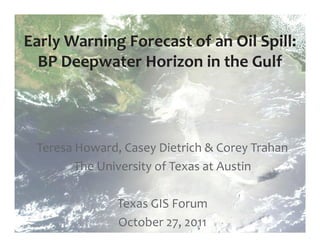
  • 1. Early Warning Forecast of an Oil Spill: BP Deepwater Horizon in the Gulf Teresa Howard, Casey Dietrich & Corey Trahan The University of Texas at Austin Texas GIS Forum October 27, 2011
  • 2. NASA Terra MODIS May 17, 2010 at 1636 UTC Collected by the MAGIC DBRS, Center for Space Research, UT-Austin Deepwater Horizon Oil Spill on May 17, 2010 at 1136 am CDT
  • 3. UT Center for Space Research DBRS Antennas at West Pickle Research 1.5-meter S/L-Band 4.5-meter X-Band 2.4-meter X-Band
  • 4.
  • 5.
  • 6. Nearshore Oil Transport : Motivation Satellite imagery can only show current location of the slick - Where will the oil move? - What happens if a hurricane approaches? Forecasts need to be accurate and fast - Share computed circulation with NOAA, other spill modelers - Share oil transport with emergency managers in real time ( http://adcirc.org/oilspill )
  • 7. Nearshore Oil Transport : Methods WINDS Provided by NCEP ( http://www.ncep.noaa.gov/ ) from WRF-NMM ( http://nomads.ncdc.noaa.gov/ ), downloaded and converted to our format. CURRENTS Waves from SWAN ( http://swanmodel.sourceforge.net/ ) and circulation from ADCIRC ( http://www.adcirc.org/ ), INITIAL CONDITIONS with currents provided hourly to the tracking model. NESDIS ( http://www.nesdis.noaa.gov/ ) provided slick extents, which were digitized and provided to the tracking model. OIL TRANSPORT Waves from SWAN ( http://swanmodel.sourceforge.net/ ) and circulation from ADCIRC ( http://www.adcirc.org/ ), with currents provided hourly to the tracking model. EMERGENCY MANAGERS Animations posted online ( http://www.adcirc.org/oilspill/ ).
  • 8. Prepare oil slick for particle tracking 1. Obtain oil slick extent vector polygons from NOAA NESDIS. 2. Intersect oil slick polygons with water depth boundaries: near coast, < 100 meters deep above the continental shelf, and deep ocean waters (> 100 m deep). 3. Convert oil slick polygons to raster of 50 meter grid elements with attribute initial water depth interval. 4. Convert grid elements to point vectors 5. Calculate x,y coordinates in longitude and latitude. 6. Output ASCII initial particle location file.
  • 11. 06/13 14 15 16 17 18 19 20 21 22 23 2010 / 06 / 13 / 1548 UTC
  • 12. 06/13 14 15 16 17 18 19 20 21 22 23 2010 / 06 / 14 / 1151 UTC ( + 20 hr / + 0.8 d )
  • 13. 06/13 14 15 16 17 18 19 20 21 22 23 2010 / 06 / 15 / 1151 UTC ( + 44 hr / + 1.8 d )
  • 14. 06/13 14 15 16 17 18 19 20 21 22 23 2010 / 06 / 16 / 0140 UTC ( + 58 hr / + 2.4 d )
  • 15. 06/13 14 15 16 17 18 19 20 21 22 23 2010 / 06 / 16 / 1555 UTC ( + 72 hr / + 3.0 d )
  • 16. 06/13 14 15 16 17 18 19 20 21 22 23 2010 / 06 / 17 / 1150 UTC ( + 92 hr / + 3.8 d )
  • 17. 06/13 14 15 16 17 18 19 20 21 22 23 2010 / 06 / 18 / 1109 UTC ( + 115 hr / + 4.8 d )
  • 18. 06/13 14 15 16 17 18 19 20 21 22 23 2010 / 06 / 18 / 1637 UTC ( + 121 hr / + 5.0 d )
  • 19. 06/13 14 15 16 17 18 19 20 21 22 23 2010 / 06 / 19 / 0341 UTC ( + 132 hr / + 5.5 d )
  • 20. 06/13 14 15 16 17 18 19 20 21 22 23 2010 / 06 / 19 / 1730 UTC ( + 148 hr / + 6.2 d )
  • 21. 06/13 14 15 16 17 18 19 20 21 22 23 2010 / 06 / 19 / 2330 UTC ( + 152 hr / + 6.3 d )
  • 22. 06/13 14 15 16 17 18 19 20 21 22 23 2010 / 06 / 20 / 1150 UTC ( + 164 hr / + 6.8 d )
  • 23. 06/13 14 15 16 17 18 19 20 21 22 23 2010 / 06 / 21 / 1613 UTC ( + 192 hr / + 8.0 d )
  • 24. 06/13 14 15 16 17 18 19 20 21 22 23 2010 / 06 / 22 / 0348 UTC ( + 204 hr / + 8.5 d )
  • 25. Validation : Hurricane Alex (2010) Made initial landfall in Belize and tracked over Yucatan Peninsula Strengthened in southern Gulf of Mexico to Category 2 storm before making landfall in Mexico Limited useable satellite imagery
  • 26. Validation : Hurricane Alex (2010)
  • 27. 06/29 30 07/01 02 03 04 05 06 2010 / 06 / 29 / 0044 UTC
  • 28. 06/29 30 07/01 02 03 04 05 06 2010 / 06 / 29 / 1546 UTC ( + 15 hr / + 0.6 d )
  • 29. 06/29 30 07/01 02 03 04 05 06 2010 / 06 / 29 / 2332 UTC ( + 23 hr / + 0.9 d )
  • 30. 06/29 30 07/01 02 03 04 05 06 2010 / 06 / 30 / 1155 UTC ( + 35 hr / + 1.4 d )
  • 31. 06/29 30 07/01 02 03 04 05 06 2010 / 06 / 30 / 2355 UTC ( + 47 hr / + 1.9 d )
  • 32. 06/29 30 07/01 02 03 04 05 06 2010 / 07 / 02 / 1156 UTC ( + 83 hr / + 3.4 d )
  • 33. 06/29 30 07/01 02 03 04 05 06 2010 / 07 / 02 / 1552 UTC ( + 87 hr / + 3.6 d )
  • 34. 06/29 30 07/01 02 03 04 05 06 2010 / 07 / 03 / 1156 UTC ( + 107 hr / + 4.4 d )
  • 35. 06/29 30 07/01 02 03 04 05 06 2010 / 07 / 04 / 1635 UTC ( + 136 hr / + 5.7 d )
  • 36. 06/29 30 07/01 02 03 04 05 06 2010 / 07 / 05 / 0008 UTC ( + 136 hr / + 5.7 d )
  • 38. Oil transport project participants JC Dietrich, CJ Trahan, CN Dawson L Yu, A Lu Institute for Computational Engineering and Department of Computer Science, Sciences, Univ. of North Carolina at Charlotte University of Texas at Austin K Vega, A Kubach MT Howard, G Wells Texas Advanced Computing Center, University Center for Space Research, of Texas at Austin University of Texas at Austin KM Dresback, RL Kolar JG Fleming School of Civil Engineering and Environmental Science, Seahorse Coastal Consulting, Morehead City, University of Oklahoma North Carolina RJ Weaver, RA Luettich Jr C Kaiser Dept. of Oceanography and Coastal Sciences, Institute of Marine Sciences, Louisiana State University Univ. of North Carolina at Chapel Hill RR Twilley S Tanaka, JJ Westerink Dept. of Civil Engineering and Geological Vice President for Research, Sciences, University of Louisiana at Lafayette University of Notre Dame
  • 39. Acknowledgements: University of North Carolina at Chapel Hill Institute of Marine Sciences University of Notre Dame Computational Hydraulics Laboratory University of Texas Computational Hydraulics Groups, ICES University of Texas Center for Space Research Texas Advanced Computing Center, University of Texas NOAA/NESDIS/Satellite Analysis Branch, Experimental Marine Pollution Surveillance Program Seahorse Coastal Consulting
  • 40. Funding for this work was provided by: National Science Foundation TeraGrid National Science Foundation RAPID Grant—Office of Cyberinfrastructure Department of Homeland Security Science & Technology Directorate through the Center of Excellence for Natural Disasters, Coastal Infrastructure and Emergency Management (DIEM) NOAA IOOS Program
  • 41. And now for something entirely different….
  • 42. Texas Wildfires Gordon Wells, Larry Teng, Solar Smith & Teresa Howard UT Center for Space Research Photo by Frank Cianciolo McDonald Observatory Sr. Program Coordinator McDonald Obs. / Bash Visitors Center April 23, 2011, at 2201 CDT University of Texas at Austin
  • 43. Landsat 7 ETM+ April 24, 2011 at 1221 CDT Active Fire Front SWIR/VNIR Channels 7,4,2 Controlled Burn McDonald Observatory Rock House Fire: Northern Margin (April 24, 2011)
  • 44. NASA Terra MODIS April 15, 2011 at 1243 CDT Collected by the MAGIC DBRS, Center for Space Research, UT-Austin Wildfires on April 15 at 1243 CDT
  • 45. NASA Terra MODIS April 15, 2011 at 1243 CDT Collected by the MAGIC DBRS, Copper Mountain Center for Space Research, UT-Austin Ranch PK West Frying Pan Ranch Wildcat Rockhouse Pearce Ranch El Bonito La Sabina Wildfires on April 15 at 1243 CDT
  • 46. NASA Terra MODIS April 15, 2011 at 1243 CDT Collected by the MAGIC DBRS, Center for Space Research, UT-Austin Copper Mountain Ranch PK West Wildcat Wildfires on April 15 at 1243 CDT
  • 47. NASA Aqua MODIS April 15, 2011 at 1419 CDT Collected by the MAGIC DBRS, Center for Space Research, UT-Austin Copper Mountain Ranch PK West Wildcat Wildfires on April 15 at 1419 CDT
  • 48. Landsat 7 ETM+ April 24, 2011 at 1221 CDT Thermal/SWIR/VNIR Channels 7,4,2 + 6 Active fire front (4/24) Area of the controlled burn (4/23-24) Rock House Fire Burn Scar McDonald Observatory Hobby-Eberly Rock House Fire: Northern Margin Telescope Landsat 7 Enhanced Thematic Mapper-Plus (4/24/11)
  • 49. Rock House Fire on May 2 at 1217 CDT McDonald Observatory Fort Davis Roper Ranch Fire Burn Scar Landsat 5 Thematic Mapper May 2, 2011 at 1217 CDT SWIR/VNIR Channels 7,4,2 Marfa Processed by the MAGIC DBRS, Center for Space Research, UT-Austin
  • 50. French SPOT 4 HRVIR April 29, 2011 at 1205 CDT SWIR/VNIR Channels 4,3,1 Collected by U.S. Air Force Eagle Vision Processed by the MAGIC DBRS, Center for Space Research, UT-Austin Deaton Cole Fire: Google Earth Display SPOT 4 HRVIR (4/29: 1300) & Terra MODIS Firepoints (4/29: 1205)
  • 51. NASA Aqua MODIS April 28, 2011 at 1508 CDT Collected by the MAGIC DBRS, Center for Space Research, UT-Austin Killough Swenson Cooper Mountain PK Complex Last Chance Wildcat Rock House Deaton Cole Bonito La Sabina April Burn Scars
  • 52. Aqua MODIS Firepoints September 9, 2011 at 1449 CDT Collected by the MAGIC DBRS Center for Space Res., UT-Austin Magnolia Values = Fire Radiative Power in Megawatts
  • 53. French SPOT 4 HRVIR September 12, 2011 at 1155 CDT SWIR/VNIR Channels 4,3,2 Collected by U.S. Air Force Eagle Vision Processed by the MAGIC DBRS, Center for Space Research, UT-Austin Magnolia Riley Road/Crown Ranch Fire Burn Scar
  • 54. Bastrop County Complex Fire GeoEye Ikonos-2 Pan/VNIR September 8, 2011 at 1220 CDT
  • 55. Intact and destroyed residences in Tahitian Village, Texas Civil Air Patrol Bastrop County. September 16, 2011 at 1140 CDT
  • 56. Residences destroyed by ground fire. Texas Civil Air Patrol September 16, 2011 at 1141 CDT
  • 57. http://magic.csr.utexas.edu/Event/11TxWildfires Residence with a green yard destroyed Texas Civil Air Patrol by ground fire. September 16, 2011 at 1144 CDT
  • 58. John Nielson-Gammon, State Climatologist
  • 59. Normalized Difference Vegetation Index NASA Terra MODIS August 29, 2006 MODIS telemetry received and processed by the MAGIC DBRS Center for Space Research, University of Texas at Austin
  • 60. Normalized Difference Vegetation Index NASA Terra MODIS August 29, 2007 MODIS telemetry received and processed by the MAGIC DBRS Center for Space Research, University of Texas at Austin
  • 61. Normalized Difference Vegetation Index NASA Terra MODIS August 29, 2008 MODIS telemetry received and processed by the MAGIC DBRS Center for Space Research, University of Texas at Austin
  • 62. Normalized Difference Vegetation Index NASA Terra MODIS August 29, 2009 MODIS telemetry received and processed by the MAGIC DBRS Center for Space Research, University of Texas at Austin
  • 63. Normalized Difference Vegetation Index NASA Terra MODIS August 29, 2010 MODIS telemetry received and processed by the MAGIC DBRS Center for Space Research, University of Texas at Austin
  • 64. Normalized Difference Vegetation Index NASA Terra MODIS August 29, 2011 MODIS telemetry received and processed by the MAGIC DBRS Center for Space Research, University of Texas at Austin
  • 65. January - September Satellite Thermal Detections, 2002-2011 16000 14000 12000 Satellite Thermal Detections 10000 8000 6000 4000 2000 0 2002 2003 2004 2005 2006 2007 2008 2009 2010 2011 Year NASA MODIS thermal detections (Fire Radiative Power >1 megawatt) in Texas collected by the MAGIC DBRS, University of Texas at Austin