
Recommended
More Related Content
What's hot
What's hot (20)
Viewers also liked
Viewers also liked (19)
Similar to Honors geo. ch 1 (p.p.) pt. 2
Similar to Honors geo. ch 1 (p.p.) pt. 2 (20)
More from tobin15
More from tobin15 (20)
Recently uploaded
Recently uploaded (20)
Honors geo. ch 1 (p.p.) pt. 2
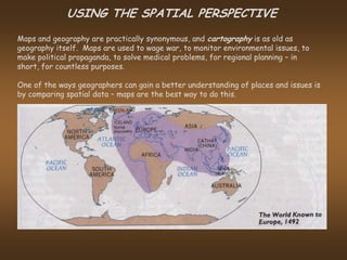
- 1. USING THE SPATIAL PERSPECTIVE Maps and geography are practically synonymous, and cartography is as old as geography itself. Maps are used to wage war, to monitor environmental issues, to make political propaganda, to solve medical problems, for regional planning – in short, for countless purposes. One of the ways geographers can gain a better understanding of places and issues is by comparing spatial data – maps are the best way to do this.
- 2. In recent years, the latest revolution in map use for the average American is the digital map, commonly used navigation devices, or as applications for smart phones and other hand-held devices. This technology allows an ordinary person to have at his/her disposal a road map and/or a satellite map. Thus, the concept of map use is not new, but technologies implementing them are new.
- 3. Maps are a primary tool used by scientists and govt. officials to track environmental issues, ranging from water availability in the U.S. to …
- 4. … average annual precipitation for the world, to …
- 5. … tracking deforestation, to …
- 6. … monitoring the ozone hole over Antarctica. Thus, maps are crucial in initiating awareness and as a catalyst for decision-making as the planet’s inhabitants grapple with a wide variety of environmental issues.
- 7. Maps can either show a wide variety of information (general purpose), ….
- 8. …. or focus on one particular area of interest (theme maps).
- 9. Maps can also be used for propaganda purposes, as this Nazi propaganda illustrates.
- 10. MAP SCALE Geographers can’t draw maps the same size as the land they show, and so they draw maps to scale. There are two types of scale: Large Scale (only a small area is shown, but the map can show many details) and Small Scale (a large area is shown, but the map can only indicate main features).
- 11. REGIONS on the MAP Maps demarcate regions using boundaries that may or may not be evident on the ground. And regions are not all of the same type: distinguish a formal region ….
- 12. …. from a functional region. Regions can be seen in a vertical order of hierarchy. Regions, therefore, are ways of organizing humans geographically.
- 13. MAPS in the MIND Mental maps are a fundamental part of our general knowledge. They develop over years of looking at wall maps, magazines, and newspapers. They are shaped by our cultural environment, which may distort our objectivity. Thus, environmental perception, shapes our mental maps. This is exhibited in studying different living preferences. Consider where California students would prefer to live. How would you explain their preferences versus ….
- 14. …. the living preferences of Pennsylvania students.