
Recommended
Recommended
More Related Content
What's hot
What's hot (20)
Similar to Tree stewards 02 11-2014
Similar to Tree stewards 02 11-2014 (20)
Recently uploaded
Recently uploaded (20)
Tree stewards 02 11-2014
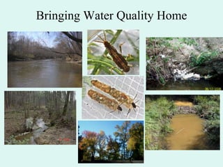
- 1. Bringing Water Quality Home
- 2. Stormwater is evil Native Trees are the solution
- 3. Topics • What is a watershed? Who cares? • Major pollutants – nutrients and sediment • Reedy Creek – poster child for urban watersheds • Best Management Practices to protect water quality – Trees, Trees, Trees
- 4. CREEK CONNECTIONS Box 10, Allegheny College, Meadville, PA 16335 http://creekconnections.allegheny.edu What is a Watershed
- 5. A Watershed Definition • The total land area that contributes water (or drains into) a particular waterway. • Can also be called a “Drainage Basin”
- 6. Flow: Groundwater Under the surface, GROUNDWATER is on the move Infiltration or percolation Source of illustration: http://www.epa.gov/region01/ge/thesite/groundwater.html
- 7. Flow: Surface Runoff Surface Runoff can also be called “Overland Flow” http://h2osparc.wq.ncs u.edu/info/phos.html Creek Connections photograph http://h2o.enr.state.nc.u s/nps/What_is_NPS/ur ban.htm Over forested land, fields, grasslands, even parking lots Source of illustration: http://www.epa.gov/region01/ge/thesite/groundwater.html
- 8. Watershed Boundary Any water within the boundary of your watershed or precipitation that falls within the boundary will flow into your waterway.
- 9. Watershed Impacts • Land and waterway interaction What we do on land affects our waterways Source of illustration: http://www.epa.gov/region01/ge/thesite/groundwater.html
- 10. Watershed Impacts • Land and waterway interaction Source of illustration: http://www.epa.gov/region01/ge/thesite/groundwater.html What YOU do on land affects our waterways
- 11. Watersheds – Who Cares? • All land is part of some watershed • Surface runoff and groundwater carry pollutants from the land • Land use determines water quality
- 12. Major pollutants carried by stormwater runoff • Bacteria • Toxic chemicals – petroleum, pesticides, herbicides, heavy metals, PCBs • Nutrients • Sediment
- 13. Nutrients in Aquatic Systems 1. Nitrogen (N) 2. Phosphorous (P) 3. Potassium (K)
- 14. Nutrients (continued) - Eutrophication Too many nutrients enter aquatic system Rapid growth of algae (bloom) Algal population crashes and dies Microbial decomposition uses up dissolved oxygen Fish kills, odors, taste problems in drinking water sources
- 15. Eutrophic pond below point source
- 16. Nutrient Enrichment in Streams • Removes habitat • Changes aquatic community
- 17. Nutrients (continued) Human Sources - Agricultural/suburban/urban runoff Loss of riparian areas and wetlands Air Deposition (nitrogen from fossil fuels) Wastewater effluent (sewage treatment and industrial plants)
- 18. Sediment - Injures fish and aquatic invertebrates - Carries phosphorous (nutrients) - Decreases light penetration (decreases SAV - Submerged Aquatic Vegetation) - Removes bottom habitat by filling in spaces between rocks
- 19. Effects of sedimentation Lots of space between rocks for aquatic insects and small fish. Little space under rocks. Rocks are “embedded” by sediment. Terrible habitat quality.
- 20. Sediment (continued) Human Sources - Stormwater runoff from urban/suburban areas - Runoff from construction sites, agricultural fields, etc. - Loss of riparian areas and wetlands - Bank erosion from channelization/stormwater volume
- 21. Real World – Reedy Creek
- 23. Less Visible Problems 1. Fecal Bacteria – Reedy Creek is on Virginia’s “dirty waters” list
- 24. 2. Nutrients
- 25. 3. Sediment
- 26. 4. Aquatic Life - Citizen data shows the community of aquatic animals is severely impaired. Too many “bad” bugs
- 27. Very Few “Good” Bugs
- 28. What are the causes? 1. Stormwater Volume – Reedy Creek is “flashy” due to rain water running off rooftops, streets, driveways, parking lots, etc.
- 29. Concrete channels make the problem of stormwater volume worse
- 30. Result of too much stormwater – Streambank Erosion
- 31. 2. Stormwater carries pollutants – Sediment – Fecal bacteria – Nutrients – Toxic chemicals – petroleum, pesticides, herbicides, detergen ts, etc.
- 33. Index of Biological Integrity vs. Impervious Cover 30 years? 20 years? 10 years?
- 35. I. Reduce Stormwater 1. Impervious surfaces 2. Semi-impervious surfaces 3. Slopes (Goal = no water leaves property)
- 37. Lawn Facts 1. Lawn covers 9.5% of the Chesapeake Bay watershed – more than all row crops 2. Lawn is often semi-impervious – pathetic topsoil, compaction, and poor management
- 38. Why native perennials and native grasses are better than turf grass
- 39. Lawn Reduction TREES And MORE TREES
- 40. Lawn Management 1. Mower Height – 3 inches or highest setting a. Deeper roots = Healthier lawn b. Reduced evaporation 2. Mowing Frequency – as little as possible 3. Improve soil with organic matter a. Grass clippings b. Mulched or composted leaves
- 41. II. Reduce Pollutants in Stormwater
- 42. Solutions
- 43. Fertilizers • Soil testing and use of minimal amounts of fertilizer • Slow-acting fertilizers are most environmentally friendly • Pay attention to the weather – do not fertilize with fast acting fertilizers immediately before rain is predicted.
- 44. Pesticides and Herbicides • Learn to live with pests – they are part of a balanced ecosystem • Hand-weeding and hand-picking pesky insects can be therapeutic • Plant something else • If spray you must: use least toxic, fastest degrading option and pay attention to the weather
- 45. III. Help Wildlife with Diverse Native Vegetation
- 47. Study Results • Native plants support 35x more caterpillar biomass than alien plants. • Native plants had 3x more insect species than alien plants.
- 48. Native Plant Selection: Good, Better, Best Best = Native Plant of Local Ecotype Local Ecotype: a collection of plants originating in a specific area and therefore carrying genetic adaptations to that specific environment (Source: Iowa Prairie Network) http://www.iowaprairienetwork.org/org/Positions/positionlocal_ecotype.shtml
- 49. Practical Considerations of Local Ecotype in Richmond Smooth Sumac Blackhaw Viburnum
- 50. BETTER (Next Best) Wild Native Plant of unknown geographic origin OR Wild native plant of known geographic origin that is “far” away
- 51. Good (?) Cultivars of Native Plants Cultivar = Assemblage of plants that (a) has been selected for a particular character or combination of characters, (b) is distinct, uniform and stable in those characters, and (c) when propagated by appropriate means, retains those characters. (Source: Wikipedia)
- 52. Cultivar Properties of Concern 1. Genetic diversity is low to non-existent a. Each plant is genetically identical if it is a clone propagated asexually (cuttings) b. Extremely limited genetic diversity if propagated by inbreeding 2. Unknown if full ecological value is retained. (Seed, nectar, leaf nutrition, pollinator attractants, etc.) 3. Geographic source often unknown – may not grow well in local environment 4. If cultivar sexually reproduces with native plants of the local ecotype it can potentially damage the gene pool of wild populations, especially if the same cultivar is planted widely.
- 53. Remove Foreign Invasive Species!
- 54. using trees to reduce stormwater runoff http://www.slideshare.net/watershedprotection/using-trees-to-reducestormwater-runoff-formatted-presentation?type=powerpoint
- 55. trees are the original “multi-taskers” save energy improve air quality provide habitat better quality of life neighborhood stability aesthetic values increase property value reduce noise good for business
- 56. Why integrate trees and stormwater? • Potential benefits of trees in stormwater treatment practices: infiltration, pollutant removal, stabilization, habitat, reduced mowing costs, landscaping value • Implementation of stormwater forestry practices has been limited - lack of collaboration among foresters and stormwater engineers (and city planners and transportation engineers and …. • Use of trees (non-structural practices) is more costeffective than use of structural practices
- 57. Stormwater forestry opportunities in a watershed Opportunities to build urban tree canopy that can enhance stormwater treatment and improve watershed health • • • • • • • • • Schools Parks Highway rights-of-way Vacant lots Streams and shorelines Utility corridors Street medians and roadways Parking lots Home lawns (education and incentives are key)
- 59. Residential landscapes can be functional and beautiful Use trees to: block winter winds, shade summer sun, accent important views, and screen private areas
- 60. Planting along local roads More shade means more time between repaving. 20% shade on a street improves pavement condition by 11%, which is a 60% savings for resurfacing over 30 years.
- 61. Reforesting stream buffers provides stream shading, bank stabilization, pollutant removal and other benefits
- 63. alternative sidewalk design Traditional sidewalk designs utilize individual tree pits (left) which confine roots; alternative designs cluster trees (right), which allows them to share rooting space. This reduces the need for tree roots to grow under pavement.
- 66. 12th street green street, portland oregon
- 67. Infiltration = 4 inches per hours
- 69. Seattle SEA Streets Seattle SEA (Street Edge Alternatives) Streets Project uses graded swales to reduce impervious cover by 11% over traditional streets. Project has decreased stormwater volume by 97 percent.
- 70. Growing Vine, Seattle Washington “beckoning cistern” by buster simpson
- 71. DEQ Links of Interest Probabilistic Monitoring http://www.deq.state.va.us/Programs/Water/WaterQualityInformationT MDLs/WaterQualityMonitoring/ProbabilisticMonitoring.aspx Water Quality Standards http://www.deq.state.va.us/Programs/Water/WaterQualityInformationT MDLs/WaterQualityStandards.aspx TMDLs http://www.deq.state.va.us/Programs/Water/WaterQualityInformationT MDLs/TMDL.aspx Citizen Monitoring http://www.deq.state.va.us/Programs/Water/WaterQualityInformationT MDLs/WaterQualityMonitoring/CitizenMonitoring.aspx
- 72. Watershed Organization Websites • Alliance for the Chesapeake Bayhttp://allianceforthebay.org/ • Center for Watershed Protection – http://cwp.org/ • Earth Sangha - http://earthsangha.org/ • James River Association http://www.jamesriverassociation.org/ • Reedy Creek Coalition – http://reedycreekcoalition.org/ • Rivanna River Streamwatch - http://streamwatch.org/
- 73. Contact Info Bill Shanabruch Regional Biologist DEQ – Piedmont Regional Office 804-527-5113 william.shanabruch@deq.virginia.gov
Editor's Notes
- In a forested watershed with minimal human impact, over 90% of the rainwater that falls on the watershed infiltrates into the ground. In many urban watersheds, over half of the rainfall enters the nearby stream and very quickly. This is because much of the land is covered by impervious surfaces that prevent water from infiltrating into the ground.
- Much of urban runoff should have infiltrated into the ground and replenished the groundwater. This loss is critical because it is groundwater that allows a stream to keep flowing during dry weather. Without groundwater, small streams dry up in the summer and prevent survival of aquatic animals such as insects and fish.Agricultural fields and lawns tend to be semi-impervious – that is some water can infiltrate but there is not near as much infiltration as compared to a forest or even a meadow.
- The term watershed can refer to a very small land area (on the order of acres) or to a very large area such as the Chesapeake Bay watershed which is over 64,000 square miles.
- Point source pollution comes from a localized site such as an industrial facility or wastewater treatment plant. It usually enters the stream as discharge from a pipe. Point source discharges are regulated by Virginia DEQ and require a permit.
- Nonpoint source pollution comes from a large area and usually enters a stream all along its length. Agricultural fields, lawns, and roads are examples of nonpoint sources of pollution.
- Anything on the land can be picked up by stormwater and carried to the nearest stream. Also, chemicals that dissolve easily in water can be carried down into the groundwater and enter streams years later.
- This picture shows eutrophication due to the explosive growth of phytoplankton. Phytoplankton is free-floating algae that can reach very high densities in slow moving waters like lakes, tidal rivers, and the Chesapeake Bay. When you hear about algal blooms in the James River and Chesapeake Bay, they are due to phytoplankton.
- The picture on the left shows a sucker that obtains much of its food from scraping the thin, slimy layer of algae off the rocks. There are also a variety of aquatic insects and snails that also eat the thin layer of algae off rocks. On the right, excess nutrients have promoted growth of nuisance, filamentous algae. The nuisance algae is not a food source for fish or macroinvertebrates and by covering the rocks it blocks the growth of the “good” algae. In addition, the nuisance algae blocks access to the nooks and crannies between rocks that small fish and macroinvertebrates use to hide from predators. As a result, a large growth of nuisance algae due to excess nutrients greatly alters the local ecology/food web.
- Riparian areas are the last line of defense from nonpoint source pollution. A wide, forested riparian area can greatly reduce the negative impacts of nutrients from areas further away from the stream.It is estimated that about 30% of the nitrogen that reaches the Chesapeake Bay is from air deposition. This is the nitrogen released from burning fossil fuels. So saving money by reducing energy usage is helping to “Save the Bay”.Wastewater treatment plants have been steadily decreasing the amount of nutrients discharged to surface waters through mandatory adoption of new technologies.
- The upper picture shows sediment-laden runoff from a construction site after a large rain. Most of the erosion and sediment control fences around the site were in good shape – but it only takes one small damaged area of sediment controls to create a huge pollution problem. For a fish or aquatic insect trying to get oxygen from the water, it must be like humans trying to breathe diesel exhaust.Beds of SAV are like underwater meadows and provide critical nursery habitat for blue crabs and lots of juvenile fish. The current acreage of SAV in the Bay is estimated to be about 10% of its original coverage. Part of the decrease in SAV beds is attributed to loss of light penetration due to suspended sediment.
- Erosion of stream channels can contribute as much as 50% of the total sediment in a stream. This in-stream erosion is usually the result of too much stormwater entering the stream.
- Although Reedy Creek is less than four miles long, it includes a remarkable variety of habitats. Clockwise from top left: channel in the “headwaters” of Reedy Creek above the mitigation wetland, mitigation wetland constructed about 15 years ago, section of concrete channel that covers nearly 1/3 of Reedy Creek, Forest Hill Park Lake prior to dredging about 5 years ago, steep section of Reedy Creek between Forest Hill Avenue and the lake, natural section of Reedy Creek below the concrete channel. The channel in this latter section of Reedy Creek has been extensively widened due to erosion of the banks by stormwater.
- Trash from roads and neighborhoods throughout the watershed gets washed down storm drains and travels into the creek. Much of the trash collects in large deposits in floodplain areas and Forest Hill Park Lake.
- Each blue dot on the plate represents one cell of a fecal bacterium in a water sample. To pass the Virginia water quality standards, there would have to be less than 10 blue dots on this plate and there are over 1,000. This sample came from a bacterial “hotspot” in Reedy Creek. Part of the problem was later found to be a leaky sanitary sewer pipe which has been fixed.
- A huge amount of filamentous algae fills the Reedy creek channel during the summer due to the combination of excess nutrients and lack of shade.
- Huge sediment bars have formed at various points along the Reedy Creek channel. Bars this large are a clear indication of high stormwater flows carrying sediment. The lack of vegetation on the bar means the sediment is very unstable. During each significant rain event, sediment from the bar is scoured away and replaced with sediment from upstream. This cycle prevents vegetation from being able to take root on the bar and this constant movement of large amounts of sediment downstream is what fills in Forest Hill Park Lake.
- The animal on the left is a “midge” larva. Midge larvae are generally very tolerant of pollution. The animal on the right is a lunged snail. Lunged snails are also tolerant of pollution because they can get the oxygen they need for survival by breathing air. Midges, lunged snails, and worms are among the most frequent aquatic macroinvertebrates found in Reedy Creek.
- Clockwise from the top left are: mayfly, giant stonefly, stonefly, caddisfly in case. Mayflies, stoneflies, and caddisflies are mostly sensitive to pollution and are commonly found in healthy streams. Reedy Creek sometimes has one type of mayfly that is partially tolerant of pollution. We have never observed a stonefly in Reedy Creek.
- This picture shows Midlothian Turnpike before the recent “upgrades”. Note the yellow gauge that was installed to let motorists know how deep the water rose during rain events.
- Concrete channels cut off Reedy Creek from its floodplain. All the stormwater that gushes into Reedy Creek is “trapped” in the channel. To make matters worse, the concrete channels are also much straighter than a natural stream channel which has bends to help reduce the speed and energy of the water. By the time stormwater leaves the concrete channels and enters a natural section of Reedy Creek the erosive power of the water can be extremely damaging.
- Here is a section of natural channel downstream of the major section of concrete channel. The power of the stormwater trapped in the concrete channel has been unleashed. The eroded bank is approximately 5 feet high above the bedrock in the foreground. Being a fish or macroinvertebrate in Reedy Creek must be like trying to live where a Class 5 Hurricane comes crashing through every month or two.
- Reedy Creek like many urban and suburban streams is in rough shape – but it need not be terminal!
- IBI = Index of Biotic Integrity. One can think of an IBI score as a direct measure of ecosystem health with a high score being good and a low score being bad. Each point on the graph represents the IBI score for a different stream in Fairfax County. The red line is the “best fit” line through the points and it shows that ecosystem health (IBI scores) steadily declines as the amount of impervious surface in the watershed increases.The red line represents decades of development and land use decisions without understanding the consequences for local streams. The challenge is start undoing the damage by implementing Low-Impact Development (LID) techniques and Best-Management Practices (BMPs) to reduce stormwater volume and pollutant levels. Planting native trees is probably the single most cost-effective BMP.
- Rain barrels and cisterns are ideal for gathering water from impervious rooftops to use later for watering trees, vegetable gardens, and other landscape plantings.Rain from impervious surfaces as well as semi-impervious lawn can be directed into rain gardens and Bayscapes designed to provide extra infiltration. Trees are excellent for infiltration because of their deep root systems.
- Poor management of lawns includes practices such as over-fertilizing with chemical fertilizers; bagging grass clippings instead of leaving them behind to build soil; and scalping the lawn way too low. Good management practices include getting a soil test to know how much fertilizer to add and then using organic fertilizers; cutting the grass with the highest mower setting (preferably about 3 inches) to promote deeper root development and moisture retention; and leaving the grass clippings on the lawn to decompose and improve the soil.
- Turf grasses (shown on the far left of the diagram) have very shallow root systems that only extend a few inches into the ground. By comparison, native perennials and native grasses have very deep root systems that can extend many feet into the soil. Due to their deep roots, native plants provide pathways for deep infiltration of rain water and seldom need watering or fertilization once they are established.
- Which cul de sac is doing a better job of infiltrating stormwater? Which one is more inviting and visually appealing?
- This slide and the several slides that follow demonstrate a very important concept. For many, many years we have been designing streets completely backwards with regard to stormwater. The typical street design in Richmond (and virtually everywhere) has vegetated strips along the road that are above the level of the road. All of the rain thathits the road is directed into a storm drain and into a nearby creek. In the design shown above, the vegetated strip between the road and sidewalk is lower than the level of the street and there are curb cuts that allow stormwater from the street to infiltrate into these vegetated strips. This is a simple concept that can greatly reduce runoff. Check out 9th Street along the Capitol for a local example of this approach.
- By using deep planting wells with soils that are highly efficient at infiltration, it is possible to handle most of the stormwater runoff from a road during a typical rain event.
- This picture shows a traffic “calming” structure similar to those that have popped up in Richmond over the last several years (Elwood, Midlothian, etc). In this design, stormwater controls have been built into the traffic project through the use of curb cuts and vegetated strips that are below street level. We need more of this integrated approach.
- These pictures show an alternative to traditional curb and gutter that works together with the basic topography of the area.
- Water harvesting as art?