

Recommandé
Contenu connexe
En vedette
Similaire à Islam of sea
Plus de Tuke Ingkhaninan
Plus de Tuke Ingkhaninan (20)
Dernier
Dernier (20)
Islam of sea
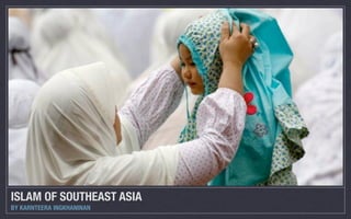
- 1. ISLAM OF SOUTHEAST ASIA BY KARNTEERA INGKHANINAN
- 2. SEA Review
- 3. SEA Review
- 4. SEA Review n Similarities in climate, plant, animals
- 5. SEA Review n Similarities in climate, plant, animals n Sea and jungle products desired by international traders
- 6. SEA Review n Similarities in climate, plant, animals n Sea and jungle products desired by international traders n cloves,nutmeg and mace on eastern islands of Indonesia
- 7. SEA Review n Similarities in climate, plant, animals n Sea and jungle products desired by international traders n cloves,nutmeg and mace on eastern islands of Indonesia n influenced by northwest and southeast monsoon winds, bringing traders
- 8. SEA Review n Similarities in climate, plant, animals n Sea and jungle products desired by international traders n cloves,nutmeg and mace on eastern islands of Indonesia n influenced by northwest and southeast monsoon winds, bringing traders n ameeting place for trade between India and China
- 11. Review: Mainland SEA n Long river, lowland plains, long coastline
- 12. Review: Mainland SEA n Long river, lowland plains, long coastline n Extensive lowland plains separated by forested hills and mountain ranges
- 13. Review: Mainland SEA n Long river, lowland plains, long coastline n Extensive lowland plains separated by forested hills and mountain ranges n Rice growing groups (i.e. the Thais, the Burmese, the Vietnamese)
- 14. Review: Mainland SEA n Long river, lowland plains, long coastline n Extensive lowland plains separated by forested hills and mountain ranges n Rice growing groups (i.e. the Thais, the Burmese, the Vietnamese) n Tribalgroups occupied the highlands, distinctive clothing
- 15. Review: Mainland SEA n Long river, lowland plains, long coastline n Extensive lowland plains separated by forested hills and mountain ranges n Rice growing groups (i.e. the Thais, the Burmese, the Vietnamese) n Tribalgroups occupied the highlands, distinctive clothing n part of maritime trading network, linking SEA to India and China
- 17. Review: Insular SEA n Islands vary from large to small
- 18. Review: Insular SEA n Islands vary from large to small n Interior parts were jungled and dissected by highlands
- 19. Review: Insular SEA n Islands vary from large to small n Interior parts were jungled and dissected by highlands n difficult for land travel
- 20. Review: Insular SEA n Islands vary from large to small n Interior parts were jungled and dissected by highlands n difficult for land travel n easier to move by boat
- 21. Review: Insular SEA n Islands vary from large to small n Interior parts were jungled and dissected by highlands n difficult for land travel n easier to move by boat n the land divides, the sea unites
- 22. Review: Insular SEA n Islands vary from large to small n Interior parts were jungled and dissected by highlands n difficult for land travel n easier to move by boat n the land divides, the sea unites n adjacent islands shared similar languages, religions, culture
- 24. Review: Insular SEA n a few deep trench
- 25. Review: Insular SEA n afew deep trench n mostly shallow ocean
- 26. Review: Insular SEA n afew deep trench n mostly shallow ocean n warm, not very saline
- 27. Review: Insular SEA n a few deep trench n mostly shallow ocean n warm, not very saline n nourishes fish, coral, seaweeds, etc
- 28. Review: Insular SEA n a few deep trench n mostly shallow ocean n warm, not very saline n nourishes fish, coral, seaweeds, etc n mostly free of hurricanes and typhoons, except for the Philippines
- 29. Review: Insular SEA n a few deep trench n mostly shallow ocean n warm, not very saline n nourishes fish, coral, seaweeds, etc n mostly free of hurricanes and typhoons, except for the Philippines n prone to volcanoes and earthquakes
- 30. Islam’s Arrival of SEA
- 31. Islam’s Arrival of SEA
- 32. Islam’s Arrival of SEA
- 33. Islam’s Arrival of SEA n Muslim-controlled Indian Ocean trade route n Malay Peninsula- important stop for ships n South from China, East from India n the port city of Malacca
- 34. Where were the muslims from?
- 35. Where were the muslims from? n Chinese muslim traders n developedlinks with Vietnam, Borneo, the Southern Philippines, Javanese coast n Indianmuslim traders from west from Bengal, Gujarat, Malabar
- 36. Why was Islam adopted?
- 37. Why was Islam adopted? n Ruler or chief to adopt Islam
- 38. Why was Islam adopted? n Ruler or chief to adopt Islam n Desire to attract traders
- 39. Why was Islam adopted? n Ruler or chief to adopt Islam n Desire to attract traders n to be associated with powerful Muslim kingdoms in Egypt, Turkey and India
- 40. Why was Islam adopted? n Ruler or chief to adopt Islam n Desire to attract traders n to be associated with powerful Muslim kingdoms in Egypt, Turkey and India n Attraction of Muslim teaching which aimed at direct contact with God
- 42. Adoption of Islam n Marco Polo in north Sumatra in 1292 n Inscription and graves found along trade routes n Ruler of Malacca adopted Islam around 1430 n Malay language used as a lingua franca in trading port n Being used by muslim teachers to communicate new concepts. n Modified Arabic script displaced Malay script n Arabic words were incorporated into Malay
- 43. Spread of Islam in SEA
- 44. Spread of Islam in SEA n Ports along Javanese Coast and Borneo n center for sponsoring teachers and spreading Islamic faith n 16th century christian missionaries tried to gain followers in the east n The Philippines - strong Islamic faith in Mindanao and the south n Became major religion but still christian minorities (i.e Jakarta)
- 45. • Answer the questions in your study guide
- 46. 105˚E 120˚E 135˚E 30˚N 11. Southeast Asia: Dominant Religions, CHINA circa 2000 Theravada Buddhism Islam TAIWAN Mahayana Buddhism Christianity MYANMAR Traditional Religions Hinduism (BURMA) LAOS After Ninian Smart, Atlas of World Religions, 1999; and Charles Fisher, South-East Asia: A Social, Economic and Political Geography, 1964. THAILAND • Answer the 15˚N CAMBODIA VIETNAM PHILIPPINES questions in your study guide THAILAND MALAYSIA BRUNEI MALAYSIA SINGAPORE 0˚ (Equator) INDONESIA INDONESIA Sumatra Molucca INDONESIA Kalimantan INDONESIA INDONESIA Sulawesi Papua INDONESIA Java INDONESIA TIMOR-LESTE Bali
- 47. Questions 105˚E 120˚E 30˚N 135˚E 11. Southeast Asia: Domina CHINA nt Religions, circa 2000 Theravada Buddhism Islam TAIWAN Mahayana Buddhism Christianity MYANMAR (BURMA) Traditional Religions Hinduism LAOS After Ninian Smart, Atlas of Worl d Religions, 1999; and Charles South-East Asia: A Social, Econ Fisher, omic and Political Geography, 1964. THAILAND 15˚N VIETNAM CAMBODIA PHILIPPINES THAILAND MALAYSIA BRUNEI MALAYSIA SINGAPORE 0˚ (Equator) INDONESIA Sumatra INDONESIA INDONESIA Kalimantan Molucca INDONESIA Sulawesi INDONESIA Papua INDONESIA Java INDONESIA Bali TIMOR-LESTE 0 500 1000 km 15˚S 0 500 1000 mi AUSTRALIA
- 48. Questions n According to the presentation, from what 105˚E 120˚E 30˚N 135˚E areas of the world did Islam arrive in 11. Southeast Asia: Domina CHINA nt Religions, circa 2000 Theravada Buddhism Islam Southeast Asia? TAIWAN Mahayana Buddhism Christianity MYANMAR (BURMA) Traditional Religions Hinduism LAOS After Ninian Smart, Atlas of Worl d Religions, 1999; and Charles South-East Asia: A Social, Econ Fisher, omic and Political Geography, 1964. n Why did rulers of chiefs in Southeast Asia THAILAND 15˚N VIETNAM CAMBODIA PHILIPPINES frequently adopt Islam? THAILAND MALAYSIA BRUNEI n What role did language play in the spread MALAYSIA SINGAPORE 0˚ (Equator) INDONESIA Sumatra of Islam? INDONESIA INDONESIA Kalimantan Molucca INDONESIA Sulawesi INDONESIA Papua INDONESIA Java INDONESIA n Inwhat parts of Southeast Asia did Islam Bali TIMOR-LESTE 0 500 1000 km take to hold most successfully? Why? 15˚S 0 500 1000 mi AUSTRALIA
- 49. Mapping Exercise
- 50. Mapping Exercise nComplete mapping exercises in your study guide n3sets of maps are shown on the wall of your classroom
- 51. Timeline showing conversion to Islam n Using the appropriate maps, write the following locations on the timeline, indicating the time period of their conversion to Islam. Saudi Arabia is done for you. n Eurasia: Expansion of Islam n Syria, Oman, Iran, Uzbekistan, Pakistan, India n Southeast Asia: Conversion to Islam n Singapore, Java, Sumatra, Interior Malay Peninsula, Exterior Malay Peninsula, Papua (Indonesia)
- 55. Answer questions
- 56. Answer questions n Use this map to answer the following questions n Describethe kind of trade being carried on in Southeast Asia around 1500 in terms of distance and activity. n According to this map, what city seemed to be the trading center of Southeast Asia? What are the factors that may have contributed to this? n Whattypes of products seem to have been traded throughout Southeast Asia? n How might trade be connected to the conversion to Islam?
- 59. Answer the questions n Use this map to answer the following questions n Why do you think, given the information found on this map, that coastal travel and inter-island travel might have been so extensive? n According to the map, why might trade have been limited to the coastal areas? n How might the geographic features shown on this map have encourage or discouraged the spread of Islam?
- 62. Answer the questions n What are the most common language and language family spoken among the islands of Southeast Asia? n How did the Austronesian malay language help in the spread of Islam? n The Trade Links of Melaka, circa 1500 map can also be used to track the areas in which Malay would also have been spoken. Compare the maps. It should be noted that people in the interior would be less likely to know malay and less link to trade routes than people living on the coasts. How might this explain why Islam was stronger along the coasts, and why many interior groups in Indonesia remained animist (despite Christian missionaries moving into those areas and beginning to make Christian converts during the colonial period)?
- 64. Linguistic Families and Preponderant Groups of SEA
- 65. Answer the questions 105˚E 30˚N 120˚E 135˚E 11. Southeast A CHINA si a: Dominant Rel igions, circa 2000 Theravada Budd hism Islam TAIWAN MYANMAR Mahayana Budd (BURMA) hism Christianity LAOS Traditional Relig ions Hinduism After Ninian Smart , Atlas of World Re South-East Asia: ligions, 1999; and A Social, Econom Charles Fisher, ic and Political Ge ography, 1964. THAILAND 15˚N CAMBODIA VIETNAM PHILIPPINES THAILAND MALAYSIA BRUNEI MALAYSIA SINGAPORE 0˚ (Equator) INDONESIA Sumatra INDONESIA INDONESIA Kalimantan Molucca INDONESIA Sulawesi INDONESIA Papua INDONESIA Java INDONESIA Bali TIMOR-LESTE 0 500 1000 km 15˚S 0 500 1000 mi AUSTRALIA
- 66. Answer the questions 105˚E 30˚N 120˚E 135˚E n Where in Southeast Asia is Islam the 11. Southeast A CHINA si a: Dominant Rel igions, circa 2000 Theravada Budd hism Islam predominant religion today? TAIWAN MYANMAR Mahayana Budd (BURMA) hism Christianity LAOS Traditional Relig ions Hinduism After Ninian Smart , Atlas of World Re South-East Asia: ligions, 1999; and A Social, Econom Charles Fisher, ic and Political Ge ography, 1964. THAILAND 15˚N CAMBODIA VIETNAM n Why do you think some areas lack PHILIPPINES THAILAND significant Muslim populations while MALAYSIA BRUNEI Muslim populations dominate other MALAYSIA SINGAPORE 0˚ (Equator) INDONESIA Sumatra INDONESIA areas? INDONESIA Kalimantan Molucca INDONESIA Sulawesi INDONESIA Papua INDONESIA Java INDONESIA Bali TIMOR-LESTE 0 500 1000 km 15˚S 0 500 1000 mi AUSTRALIA
- 67. 105˚E 120˚E 135˚E 30˚N 11. Southeast Asia: Dominant Religions, CHINA circa 2000 Theravada Buddhism Islam TAIWAN Mahayana Buddhism Christianity MYANMAR Traditional Religions Hinduism (BURMA) LAOS After Ninian Smart, Atlas of World Religions, 1999; and Charles Fisher, South-East Asia: A Social, Economic and Political Geography, 1964. THAILAND 15˚N VIETNAM Southeast Asia CAMBODIA PHILIPPINES Dominant Religions THAILAND circa 2000 MALAYSIA BRUNEI MALAYSIA SINGAPORE 0˚ (Equator) INDONESIA INDONESIA Sumatra Molucca INDONESIA Kalimantan INDONESIA INDONESIA Sulawesi Papua INDONESIA Java INDONESIA TIMOR-LESTE Bali
Notes de l'éditeur
- Beginning in the late 13th century, Islam became an increasingly important political, social, and economic presence in Southeast Asia. Before having a look at spreading of Islam in southeast asia, let’s review some information of Southeast asia, mainland, and insular southeast asia\n
- Virtually all of Southeast Asia lies between the tropics, and so there are similarities in climate as well as plant and animal life throughout the region. Temperatures are generally warm, although it is cooler in highland areas. Many sea and jungle products are unique to the region, and were therefore much desired by international traders in early times. For example, several small islands in eastern Indonesia were once the world’s only source of cloves, nutmeg, and mace. The entire region is affected by the monsoon winds, which blow regularly from the northwest and then reverse to blow from the southeast. These wind systems bring fairly predictable rainy seasons, and before steamships were invented, these wind systems also enabled traders from outside the region to arrive and leave at regular intervals. Because of this reliable wind pattern, Southeast Asia became a meeting place for trade between India and China, the two great markets of early Asia.\n
- Virtually all of Southeast Asia lies between the tropics, and so there are similarities in climate as well as plant and animal life throughout the region. Temperatures are generally warm, although it is cooler in highland areas. Many sea and jungle products are unique to the region, and were therefore much desired by international traders in early times. For example, several small islands in eastern Indonesia were once the world’s only source of cloves, nutmeg, and mace. The entire region is affected by the monsoon winds, which blow regularly from the northwest and then reverse to blow from the southeast. These wind systems bring fairly predictable rainy seasons, and before steamships were invented, these wind systems also enabled traders from outside the region to arrive and leave at regular intervals. Because of this reliable wind pattern, Southeast Asia became a meeting place for trade between India and China, the two great markets of early Asia.\n
- Virtually all of Southeast Asia lies between the tropics, and so there are similarities in climate as well as plant and animal life throughout the region. Temperatures are generally warm, although it is cooler in highland areas. Many sea and jungle products are unique to the region, and were therefore much desired by international traders in early times. For example, several small islands in eastern Indonesia were once the world’s only source of cloves, nutmeg, and mace. The entire region is affected by the monsoon winds, which blow regularly from the northwest and then reverse to blow from the southeast. These wind systems bring fairly predictable rainy seasons, and before steamships were invented, these wind systems also enabled traders from outside the region to arrive and leave at regular intervals. Because of this reliable wind pattern, Southeast Asia became a meeting place for trade between India and China, the two great markets of early Asia.\n
- Virtually all of Southeast Asia lies between the tropics, and so there are similarities in climate as well as plant and animal life throughout the region. Temperatures are generally warm, although it is cooler in highland areas. Many sea and jungle products are unique to the region, and were therefore much desired by international traders in early times. For example, several small islands in eastern Indonesia were once the world’s only source of cloves, nutmeg, and mace. The entire region is affected by the monsoon winds, which blow regularly from the northwest and then reverse to blow from the southeast. These wind systems bring fairly predictable rainy seasons, and before steamships were invented, these wind systems also enabled traders from outside the region to arrive and leave at regular intervals. Because of this reliable wind pattern, Southeast Asia became a meeting place for trade between India and China, the two great markets of early Asia.\n
- Virtually all of Southeast Asia lies between the tropics, and so there are similarities in climate as well as plant and animal life throughout the region. Temperatures are generally warm, although it is cooler in highland areas. Many sea and jungle products are unique to the region, and were therefore much desired by international traders in early times. For example, several small islands in eastern Indonesia were once the world’s only source of cloves, nutmeg, and mace. The entire region is affected by the monsoon winds, which blow regularly from the northwest and then reverse to blow from the southeast. These wind systems bring fairly predictable rainy seasons, and before steamships were invented, these wind systems also enabled traders from outside the region to arrive and leave at regular intervals. Because of this reliable wind pattern, Southeast Asia became a meeting place for trade between India and China, the two great markets of early Asia.\n
- Virtually all of Southeast Asia lies between the tropics, and so there are similarities in climate as well as plant and animal life throughout the region. Temperatures are generally warm, although it is cooler in highland areas. Many sea and jungle products are unique to the region, and were therefore much desired by international traders in early times. For example, several small islands in eastern Indonesia were once the world’s only source of cloves, nutmeg, and mace. The entire region is affected by the monsoon winds, which blow regularly from the northwest and then reverse to blow from the southeast. These wind systems bring fairly predictable rainy seasons, and before steamships were invented, these wind systems also enabled traders from outside the region to arrive and leave at regular intervals. Because of this reliable wind pattern, Southeast Asia became a meeting place for trade between India and China, the two great markets of early Asia.\n
- There are some differences in the physical environment of mainland and island Southeast Asia. The first feature of mainland geography is the long rivers that begin in the highlands separating Southeast Asia from China and northwest India. A second feature is the extensive lowland plains separated by forested hills and mountain ranges. These fertile plains are highly suited to rice-growing ethnic groups, such as the Thais, the Burmese, and the Vietnamese, who developed settled cultures that eventually provided the basis for modern states. The highlands were occupied by tribal groups, who displayed their sense of identity through distinctive styles in clothing, jewelry, and hairstyles. A third feature of mainland Southeast Asia is the long coastline. Despite a strong agrarian base, the communities that developed in these regions were also part of the maritime trading network that linked Southeast Asia to India and to China.\n
- There are some differences in the physical environment of mainland and island Southeast Asia. The first feature of mainland geography is the long rivers that begin in the highlands separating Southeast Asia from China and northwest India. A second feature is the extensive lowland plains separated by forested hills and mountain ranges. These fertile plains are highly suited to rice-growing ethnic groups, such as the Thais, the Burmese, and the Vietnamese, who developed settled cultures that eventually provided the basis for modern states. The highlands were occupied by tribal groups, who displayed their sense of identity through distinctive styles in clothing, jewelry, and hairstyles. A third feature of mainland Southeast Asia is the long coastline. Despite a strong agrarian base, the communities that developed in these regions were also part of the maritime trading network that linked Southeast Asia to India and to China.\n
- There are some differences in the physical environment of mainland and island Southeast Asia. The first feature of mainland geography is the long rivers that begin in the highlands separating Southeast Asia from China and northwest India. A second feature is the extensive lowland plains separated by forested hills and mountain ranges. These fertile plains are highly suited to rice-growing ethnic groups, such as the Thais, the Burmese, and the Vietnamese, who developed settled cultures that eventually provided the basis for modern states. The highlands were occupied by tribal groups, who displayed their sense of identity through distinctive styles in clothing, jewelry, and hairstyles. A third feature of mainland Southeast Asia is the long coastline. Despite a strong agrarian base, the communities that developed in these regions were also part of the maritime trading network that linked Southeast Asia to India and to China.\n
- There are some differences in the physical environment of mainland and island Southeast Asia. The first feature of mainland geography is the long rivers that begin in the highlands separating Southeast Asia from China and northwest India. A second feature is the extensive lowland plains separated by forested hills and mountain ranges. These fertile plains are highly suited to rice-growing ethnic groups, such as the Thais, the Burmese, and the Vietnamese, who developed settled cultures that eventually provided the basis for modern states. The highlands were occupied by tribal groups, who displayed their sense of identity through distinctive styles in clothing, jewelry, and hairstyles. A third feature of mainland Southeast Asia is the long coastline. Despite a strong agrarian base, the communities that developed in these regions were also part of the maritime trading network that linked Southeast Asia to India and to China.\n
- There are some differences in the physical environment of mainland and island Southeast Asia. The first feature of mainland geography is the long rivers that begin in the highlands separating Southeast Asia from China and northwest India. A second feature is the extensive lowland plains separated by forested hills and mountain ranges. These fertile plains are highly suited to rice-growing ethnic groups, such as the Thais, the Burmese, and the Vietnamese, who developed settled cultures that eventually provided the basis for modern states. The highlands were occupied by tribal groups, who displayed their sense of identity through distinctive styles in clothing, jewelry, and hairstyles. A third feature of mainland Southeast Asia is the long coastline. Despite a strong agrarian base, the communities that developed in these regions were also part of the maritime trading network that linked Southeast Asia to India and to China.\n
- There are some differences in the physical environment of mainland and island Southeast Asia. The first feature of mainland geography is the long rivers that begin in the highlands separating Southeast Asia from China and northwest India. A second feature is the extensive lowland plains separated by forested hills and mountain ranges. These fertile plains are highly suited to rice-growing ethnic groups, such as the Thais, the Burmese, and the Vietnamese, who developed settled cultures that eventually provided the basis for modern states. The highlands were occupied by tribal groups, who displayed their sense of identity through distinctive styles in clothing, jewelry, and hairstyles. A third feature of mainland Southeast Asia is the long coastline. Despite a strong agrarian base, the communities that developed in these regions were also part of the maritime trading network that linked Southeast Asia to India and to China.\n
- The islands of maritime Southeast Asia can range from the very large (for instance, Borneo, Sumatra, Java, Luzon) to tiny pinpoints on the map (Indonesia is said to comprise 17,000 islands). Because the interior of these islands were jungle clad and frequently dissected by highlands, land travel was never easy. Southeast Asians found it easier to move by boat between different areas, and it is often said that the land divides and the sea unites. The oceans that connected coasts and neighboring islands created smaller zones where people shared similar languages and were exposed to the same religious and cultural influences. The modern borders created by colonial powers—for instance, between Malaysia and Indonesia—do not reflect logical cultural divisions.\n
- The islands of maritime Southeast Asia can range from the very large (for instance, Borneo, Sumatra, Java, Luzon) to tiny pinpoints on the map (Indonesia is said to comprise 17,000 islands). Because the interior of these islands were jungle clad and frequently dissected by highlands, land travel was never easy. Southeast Asians found it easier to move by boat between different areas, and it is often said that the land divides and the sea unites. The oceans that connected coasts and neighboring islands created smaller zones where people shared similar languages and were exposed to the same religious and cultural influences. The modern borders created by colonial powers—for instance, between Malaysia and Indonesia—do not reflect logical cultural divisions.\n
- The islands of maritime Southeast Asia can range from the very large (for instance, Borneo, Sumatra, Java, Luzon) to tiny pinpoints on the map (Indonesia is said to comprise 17,000 islands). Because the interior of these islands were jungle clad and frequently dissected by highlands, land travel was never easy. Southeast Asians found it easier to move by boat between different areas, and it is often said that the land divides and the sea unites. The oceans that connected coasts and neighboring islands created smaller zones where people shared similar languages and were exposed to the same religious and cultural influences. The modern borders created by colonial powers—for instance, between Malaysia and Indonesia—do not reflect logical cultural divisions.\n
- The islands of maritime Southeast Asia can range from the very large (for instance, Borneo, Sumatra, Java, Luzon) to tiny pinpoints on the map (Indonesia is said to comprise 17,000 islands). Because the interior of these islands were jungle clad and frequently dissected by highlands, land travel was never easy. Southeast Asians found it easier to move by boat between different areas, and it is often said that the land divides and the sea unites. The oceans that connected coasts and neighboring islands created smaller zones where people shared similar languages and were exposed to the same religious and cultural influences. The modern borders created by colonial powers—for instance, between Malaysia and Indonesia—do not reflect logical cultural divisions.\n
- The islands of maritime Southeast Asia can range from the very large (for instance, Borneo, Sumatra, Java, Luzon) to tiny pinpoints on the map (Indonesia is said to comprise 17,000 islands). Because the interior of these islands were jungle clad and frequently dissected by highlands, land travel was never easy. Southeast Asians found it easier to move by boat between different areas, and it is often said that the land divides and the sea unites. The oceans that connected coasts and neighboring islands created smaller zones where people shared similar languages and were exposed to the same religious and cultural influences. The modern borders created by colonial powers—for instance, between Malaysia and Indonesia—do not reflect logical cultural divisions.\n
- The islands of maritime Southeast Asia can range from the very large (for instance, Borneo, Sumatra, Java, Luzon) to tiny pinpoints on the map (Indonesia is said to comprise 17,000 islands). Because the interior of these islands were jungle clad and frequently dissected by highlands, land travel was never easy. Southeast Asians found it easier to move by boat between different areas, and it is often said that the land divides and the sea unites. The oceans that connected coasts and neighboring islands created smaller zones where people shared similar languages and were exposed to the same religious and cultural influences. The modern borders created by colonial powers—for instance, between Malaysia and Indonesia—do not reflect logical cultural divisions.\n
- A second feature of maritime Southeast Asia is the seas themselves. Apart from a few deep underwater trenches, the oceans are shallow, which means they are rather warm and not very saline. This is an ideal environment for fish, coral, seaweeds, and other products. Though the seas in some areas are rough, the region as a whole, except for the Philippines, is generally free of hurricanes and typhoons. However, there are many active volcanoes and the island world is very vulnerable to earthquake activity.\n\n\n\n\n\n\n\n
- A second feature of maritime Southeast Asia is the seas themselves. Apart from a few deep underwater trenches, the oceans are shallow, which means they are rather warm and not very saline. This is an ideal environment for fish, coral, seaweeds, and other products. Though the seas in some areas are rough, the region as a whole, except for the Philippines, is generally free of hurricanes and typhoons. However, there are many active volcanoes and the island world is very vulnerable to earthquake activity.\n\n\n\n\n\n\n\n
- A second feature of maritime Southeast Asia is the seas themselves. Apart from a few deep underwater trenches, the oceans are shallow, which means they are rather warm and not very saline. This is an ideal environment for fish, coral, seaweeds, and other products. Though the seas in some areas are rough, the region as a whole, except for the Philippines, is generally free of hurricanes and typhoons. However, there are many active volcanoes and the island world is very vulnerable to earthquake activity.\n\n\n\n\n\n\n\n
- A second feature of maritime Southeast Asia is the seas themselves. Apart from a few deep underwater trenches, the oceans are shallow, which means they are rather warm and not very saline. This is an ideal environment for fish, coral, seaweeds, and other products. Though the seas in some areas are rough, the region as a whole, except for the Philippines, is generally free of hurricanes and typhoons. However, there are many active volcanoes and the island world is very vulnerable to earthquake activity.\n\n\n\n\n\n\n\n
- A second feature of maritime Southeast Asia is the seas themselves. Apart from a few deep underwater trenches, the oceans are shallow, which means they are rather warm and not very saline. This is an ideal environment for fish, coral, seaweeds, and other products. Though the seas in some areas are rough, the region as a whole, except for the Philippines, is generally free of hurricanes and typhoons. However, there are many active volcanoes and the island world is very vulnerable to earthquake activity.\n\n\n\n\n\n\n\n
- A second feature of maritime Southeast Asia is the seas themselves. Apart from a few deep underwater trenches, the oceans are shallow, which means they are rather warm and not very saline. This is an ideal environment for fish, coral, seaweeds, and other products. Though the seas in some areas are rough, the region as a whole, except for the Philippines, is generally free of hurricanes and typhoons. However, there are many active volcanoes and the island world is very vulnerable to earthquake activity.\n\n\n\n\n\n\n\n
- Now, lets have a look at how islam arrived Southeast Asia Region\nIslam first entered Southeast Asia through merchants of the Muslim-controlled Indian Ocean trade route. Muslim trader traveled from as far as Yemen along the coast and eventually reached Southeast Asia. Geographically, Southeast Asia, particularly the Malay Peninsula, was an important stop for ships sailing south from China or east from India. The port city of Malacca, in present-day Malaysia, had become an important world-trading center by the 15th century. \nhttp://www.ucalgary.ca/applied_history/tutor/imageislam/malacca1500.gif\n
- Now, lets have a look at how islam arrived Southeast Asia Region\nIslam first entered Southeast Asia through merchants of the Muslim-controlled Indian Ocean trade route. Muslim trader traveled from as far as Yemen along the coast and eventually reached Southeast Asia. Geographically, Southeast Asia, particularly the Malay Peninsula, was an important stop for ships sailing south from China or east from India. The port city of Malacca, in present-day Malaysia, had become an important world-trading center by the 15th century. \nhttp://www.ucalgary.ca/applied_history/tutor/imageislam/malacca1500.gif\n
- Now, lets have a look at how islam arrived Southeast Asia Region\nIslam first entered Southeast Asia through merchants of the Muslim-controlled Indian Ocean trade route. Muslim trader traveled from as far as Yemen along the coast and eventually reached Southeast Asia. Geographically, Southeast Asia, particularly the Malay Peninsula, was an important stop for ships sailing south from China or east from India. The port city of Malacca, in present-day Malaysia, had become an important world-trading center by the 15th century. \nhttp://www.ucalgary.ca/applied_history/tutor/imageislam/malacca1500.gif\n
- Muslim traders from western China also settled in coastal towns on the Chinese coast, and Chinese Muslims developed important links with communities in central Vietnam, Borneo, the southern Philippines, and the Javanese coast. \n\nMuslim traders from various parts of India (e.g. Bengal, Gujarat, Malabar) came to Southeast Asia in large numbers and they, too, provided a vehicle for the spread of Islamic ideas.\n\n
- As a result of its multiple origins, the Islam that reached Southeast Asia was very varied. The normal pattern was for a ruler or chief to adopt Islam—sometimes because of a desire to attract traders, or to be associated with powerful Muslim kingdoms like Mamluk Egypt, and then Ottoman Turkey and Mughal India, or because of the attraction of Muslim teaching. Mystical Islam (Sufism), which aimed at direct contact with Allah with the help of a teacher using techniques such as meditation and trance, was very appealing.\n
- As a result of its multiple origins, the Islam that reached Southeast Asia was very varied. The normal pattern was for a ruler or chief to adopt Islam—sometimes because of a desire to attract traders, or to be associated with powerful Muslim kingdoms like Mamluk Egypt, and then Ottoman Turkey and Mughal India, or because of the attraction of Muslim teaching. Mystical Islam (Sufism), which aimed at direct contact with Allah with the help of a teacher using techniques such as meditation and trance, was very appealing.\n
- As a result of its multiple origins, the Islam that reached Southeast Asia was very varied. The normal pattern was for a ruler or chief to adopt Islam—sometimes because of a desire to attract traders, or to be associated with powerful Muslim kingdoms like Mamluk Egypt, and then Ottoman Turkey and Mughal India, or because of the attraction of Muslim teaching. Mystical Islam (Sufism), which aimed at direct contact with Allah with the help of a teacher using techniques such as meditation and trance, was very appealing.\n
- As a result of its multiple origins, the Islam that reached Southeast Asia was very varied. The normal pattern was for a ruler or chief to adopt Islam—sometimes because of a desire to attract traders, or to be associated with powerful Muslim kingdoms like Mamluk Egypt, and then Ottoman Turkey and Mughal India, or because of the attraction of Muslim teaching. Mystical Islam (Sufism), which aimed at direct contact with Allah with the help of a teacher using techniques such as meditation and trance, was very appealing.\n
- The first confirmed mention of a Muslim community came from Marco Polo, the well-known traveler, who stopped in north Sumatra in 1292. Inscriptions and graves with Muslim dates have been found in others coastal areas along the trade routes. A major development was the decision of the ruler of Melaka, on the west coast of the Malay Peninsula, to adopt Islam around 1430. Melaka was a key trading center, and the Malay language which was spoken in the Malay Peninsula and east Sumatra, was used as a lingua franca in trading ports throughout the Malay-Indonesian archipelago. Malay is not a difficult language to learn, and it was already understood by many people along the trade routes that linked the island world. Muslim teachers therefore had a common language through which they could communicate new concepts through oral presentations and written texts. A modified Arabic script displaced the previous Malay script. Arabic words were incorporated into Malay, particularly in regard to spiritual beliefs, social practices, and political life.\n\n
- Meanwhile, other ports along the Javanese coast and in Borneo also emerged as centers for sponsoring teachers and spreading the Islamic faith. Christian missionaries arrived in Southeast Asia in the sixteenth century, trying to gain followers in eastern Indonesia, where Islam was less established. The Spanish pushed back Muslims from the northern Philippines, but never conquered the island of Mindanao and other areas in the south, where Muslims remained strong. Although Islam became the majority religion in island Southeast Asia, there were still significant Christian minorities, especially in places controlled by Europeans, like Dutch-ruled Batavia\n(present-day Jakarta).\n
- \n
- \n
- \n
- \n
- \n
- \n
- \n
- \n
- \n
- \n
- \n
- \n
- \n
- \n
- \n
- \n
- \n