SlideShare a Scribd company logo
1 of 28
01/29/15 1
Collecting digital cartographic data inCollecting digital cartographic data in
Utrecht: storage and accessibilityUtrecht: storage and accessibility
Marco van EgmondMarco van Egmond
Map Curators’ Group of theMap Curators’ Group of the
British Cartographic Society, Cambridge 2010British Cartographic Society, Cambridge 2010
01/29/15 2
01/29/15 3
Cartographic documentsCartographic documents
in digital formatin digital format
• Increasing number;
born-digital +
scanned digital
images:
– Floppy disks
– CDs/DVDs
– Internet
Growing ‘virtual’
collection:
Role of the map
librarian?
01/29/15 4
Content of the paperContent of the paper
I. Various forms of digital cartographic
data
II. Archiving and accessibility in Utrecht
III. Problems and restrictions
IV. Future developments and solutions
01/29/15 5
Content of the paperContent of the paper
I. Various forms of digital cartographic
data
II. Archiving and accessibility in Utrecht
III. Problems and restrictions
IV. Future developments and solutions
01/29/15 6
Forms of digital cartographic dataForms of digital cartographic data
• Floppy disks
• CDs/DVDs
01/29/15 7
Forms of digital cartographic dataForms of digital cartographic data
• Maps from the internet
– Examples: Zorgatlas National Institute for Public Health
and the Environment (RIVM); portals of provinces
01/29/15 8
Forms of digital cartographic dataForms of digital cartographic data
• Maps from the internet
– Examples: Social atlases Almere, Steenwijkerland
01/29/15 9
Forms of digital cartographic dataForms of digital cartographic data
• Maps from the
internet
– Browse and search:
• Oddens’ Bookmarks
• Google Images
• Map History/History
of Cartography
• Digmap
• Google Maps <->
Google Books
01/29/15 10
Forms of digital cartographic dataForms of digital cartographic data
• Disadvantages with maps from the internet
– ‘Dead’ links
– Volatile character of the data/sites
• Utrecht: downloading files on special server
– Ready-to-use
– Durable storage
01/29/15 11
Forms of digital cartographic dataForms of digital cartographic data
01/29/15 12
Forms of digital cartographic dataForms of digital cartographic data
• Digitized analogue
maps
– Recent maps,
usually copyrighted
– Files on server only
for education and
research purposes
01/29/15 13
Forms of digital cartographic dataForms of digital cartographic data
• Cartographic
databases
(f.i. Topographical
Survey)
01/29/15 14
Content of the paperContent of the paper
I. Various forms of digital cartographic
data
II. Archiving and accessibility in Utrecht
III. Problems and restrictions
IV. Future developments and solutions
01/29/15 15
Preservation and accessibilityPreservation and accessibility
• Central storage
of data
• Approach and
management
from a distance
• Consultation in
a.o. the map
library
01/29/15 16
Preservation ofPreservation of
floppydisks and CDs/DVDsfloppydisks and CDs/DVDs
• Floppydisks ->
VFD files
• CDs/DVDs ->
ISO files
• Files on server:
readable
through Virtual
PC software
01/29/15 17
Content of the paperContent of the paper
I. Various forms of digital cartographic
data
II. Archiving and accessibility in Utrecht
III. Problems and restrictions
IV. Future developments and solutions
01/29/15 18
Problems and restrictions accessibilityProblems and restrictions accessibility
• Surpassed
analogue
collection
• 250.000 digital
files
• simple geographic
and thematic file
structure:
– Continent >
Country > Theme
01/29/15 19
Problems and restrictions accessibilityProblems and restrictions accessibility
01/29/15 20
Problems and restrictions accessibilityProblems and restrictions accessibility
01/29/15 21
Problems and restrictions accessibilityProblems and restrictions accessibility
01/29/15 22
Problems and restrictionsProblems and restrictions
• Legal implications
– Agreements with copyright owners
– Home copies ≠ publishing
– Preservation copies
• Disadvantageous position online electronic
library
• ‘Opt out’ solution?
01/29/15 23
Content of the paperContent of the paper
I. Various forms of digital cartographic
data
II. Archiving and accessibility in Utrecht
III. Problems and restrictions
IV. Future developments and solutions
01/29/15 24
Future developments and solutionsFuture developments and solutions
• Local initiatives:
– Geoloket, Delft
– Geodesk, Wageningen
• National level:
– Geoloketten
• Cooperation?
• Possibillities for
cataloguing?
01/29/15 25
Future developments and solutionsFuture developments and solutions
• Central storage of
data on a national
or international
level
• Cataloguing by
participating
institutes
• Netherlands:
Archives, Royal
Library, DANS
• UK: Edina
01/29/15 26
Future developments and solutionsFuture developments and solutions
• Changing role of map librarian and map collection
– Information manager
– Map collections junctions in cartographic information
supply
– Collection and archiving of digital cartographic data task
of a map library
– Cataloguing of the data deserves national or
international effort
– Better legal conditions
01/29/15 27
Future developments and solutionsFuture developments and solutions
01/29/15 28
Thank you for your attention!Thank you for your attention!
Collecting digital cartographic data inCollecting digital cartographic data in
Utrecht: storage and accessibilityUtrecht: storage and accessibility

More Related Content

What's hot

Cultural Heritage & H2020
Cultural Heritage & H2020Cultural Heritage & H2020
Cultural Heritage & H2020locloud
 
Semantic MediaWik as Co-Creation Tool - Digital Humanities Austria #DHA2015
Semantic MediaWik as Co-Creation Tool - Digital Humanities Austria #DHA2015Semantic MediaWik as Co-Creation Tool - Digital Humanities Austria #DHA2015
Semantic MediaWik as Co-Creation Tool - Digital Humanities Austria #DHA2015Bernhard Krabina
 
2018 03-03 culture hack-bucharest-marco streefkerk
2018 03-03 culture hack-bucharest-marco streefkerk2018 03-03 culture hack-bucharest-marco streefkerk
2018 03-03 culture hack-bucharest-marco streefkerkMarco Streefkerk
 
Developing a national digital library stapel - meijers 20160302
Developing a national digital library   stapel - meijers 20160302Developing a national digital library   stapel - meijers 20160302
Developing a national digital library stapel - meijers 20160302Enno Meijers
 
Preserving Collaborative Documents in Contemporary Events
Preserving Collaborative Documents in Contemporary EventsPreserving Collaborative Documents in Contemporary Events
Preserving Collaborative Documents in Contemporary EventsChengjen Lee
 
Navarrete From Networked Museums to Isolated Consumers
Navarrete From Networked Museums to Isolated Consumers Navarrete From Networked Museums to Isolated Consumers
Navarrete From Networked Museums to Isolated Consumers Trilce Navarrete
 
E-learning: choosing an online approach to records management training
E-learning: choosing an online approach to records management trainingE-learning: choosing an online approach to records management training
E-learning: choosing an online approach to records management trainingFARO
 
Investigating the PROMISE of a Belgian web archive
Investigating the PROMISE of a Belgian web archive Investigating the PROMISE of a Belgian web archive
Investigating the PROMISE of a Belgian web archive Sally Chambers
 
The Vienna History Wiki – a Collaborative Knowledge Platform for the City of...
The Vienna History Wiki –  a Collaborative Knowledge Platform for the City of...The Vienna History Wiki –  a Collaborative Knowledge Platform for the City of...
The Vienna History Wiki – a Collaborative Knowledge Platform for the City of...Bernhard Krabina
 
The current status of TDM in Europe
The current status of TDM in EuropeThe current status of TDM in Europe
The current status of TDM in EuropeLIBER Europe
 
Linking the 20th century paper history to the sum of all knowledge
Linking the 20th century paper history to the sum of all knowledgeLinking the 20th century paper history to the sum of all knowledge
Linking the 20th century paper history to the sum of all knowledgeJoachim Neubert
 
20th Century Press Archives goes Wikidata
20th Century Press Archives goes Wikidata20th Century Press Archives goes Wikidata
20th Century Press Archives goes WikidataJoachim Neubert
 
Open data and reuse: Issues and challenges for cultural institutions
Open data and reuse: Issues and challenges for cultural institutionsOpen data and reuse: Issues and challenges for cultural institutions
Open data and reuse: Issues and challenges for cultural institutionsAna Alvarez Lacambra
 
Swiss Open Geodata: Opportunities and Threats
Swiss Open Geodata: Opportunities and ThreatsSwiss Open Geodata: Opportunities and Threats
Swiss Open Geodata: Opportunities and ThreatsRalph Straumann
 
Wikidata as opportunity for special collections: the 20th Century Press Archi...
Wikidata as opportunity for special collections: the 20th Century Press Archi...Wikidata as opportunity for special collections: the 20th Century Press Archi...
Wikidata as opportunity for special collections: the 20th Century Press Archi...Joachim Neubert
 

What's hot (17)

Cultural Heritage & H2020
Cultural Heritage & H2020Cultural Heritage & H2020
Cultural Heritage & H2020
 
Semantic MediaWik as Co-Creation Tool - Digital Humanities Austria #DHA2015
Semantic MediaWik as Co-Creation Tool - Digital Humanities Austria #DHA2015Semantic MediaWik as Co-Creation Tool - Digital Humanities Austria #DHA2015
Semantic MediaWik as Co-Creation Tool - Digital Humanities Austria #DHA2015
 
2018 03-03 culture hack-bucharest-marco streefkerk
2018 03-03 culture hack-bucharest-marco streefkerk2018 03-03 culture hack-bucharest-marco streefkerk
2018 03-03 culture hack-bucharest-marco streefkerk
 
Developing a national digital library stapel - meijers 20160302
Developing a national digital library   stapel - meijers 20160302Developing a national digital library   stapel - meijers 20160302
Developing a national digital library stapel - meijers 20160302
 
Preserving Collaborative Documents in Contemporary Events
Preserving Collaborative Documents in Contemporary EventsPreserving Collaborative Documents in Contemporary Events
Preserving Collaborative Documents in Contemporary Events
 
Navarrete From Networked Museums to Isolated Consumers
Navarrete From Networked Museums to Isolated Consumers Navarrete From Networked Museums to Isolated Consumers
Navarrete From Networked Museums to Isolated Consumers
 
E-learning: choosing an online approach to records management training
E-learning: choosing an online approach to records management trainingE-learning: choosing an online approach to records management training
E-learning: choosing an online approach to records management training
 
Investigating the PROMISE of a Belgian web archive
Investigating the PROMISE of a Belgian web archive Investigating the PROMISE of a Belgian web archive
Investigating the PROMISE of a Belgian web archive
 
The Vienna History Wiki – a Collaborative Knowledge Platform for the City of...
The Vienna History Wiki –  a Collaborative Knowledge Platform for the City of...The Vienna History Wiki –  a Collaborative Knowledge Platform for the City of...
The Vienna History Wiki – a Collaborative Knowledge Platform for the City of...
 
The current status of TDM in Europe
The current status of TDM in EuropeThe current status of TDM in Europe
The current status of TDM in Europe
 
Linking the 20th century paper history to the sum of all knowledge
Linking the 20th century paper history to the sum of all knowledgeLinking the 20th century paper history to the sum of all knowledge
Linking the 20th century paper history to the sum of all knowledge
 
20th Century Press Archives goes Wikidata
20th Century Press Archives goes Wikidata20th Century Press Archives goes Wikidata
20th Century Press Archives goes Wikidata
 
Open data and reuse: Issues and challenges for cultural institutions
Open data and reuse: Issues and challenges for cultural institutionsOpen data and reuse: Issues and challenges for cultural institutions
Open data and reuse: Issues and challenges for cultural institutions
 
International Image Interoperability Framework (IIIF)
International Image Interoperability Framework (IIIF)International Image Interoperability Framework (IIIF)
International Image Interoperability Framework (IIIF)
 
Swiss Open Geodata: Opportunities and Threats
Swiss Open Geodata: Opportunities and ThreatsSwiss Open Geodata: Opportunities and Threats
Swiss Open Geodata: Opportunities and Threats
 
Wikidata as opportunity for special collections: the 20th Century Press Archi...
Wikidata as opportunity for special collections: the 20th Century Press Archi...Wikidata as opportunity for special collections: the 20th Century Press Archi...
Wikidata as opportunity for special collections: the 20th Century Press Archi...
 
Experiment, Document & Decide: A Collaborative Approach to Preservation Plann...
Experiment, Document & Decide: A Collaborative Approach to Preservation Plann...Experiment, Document & Decide: A Collaborative Approach to Preservation Plann...
Experiment, Document & Decide: A Collaborative Approach to Preservation Plann...
 

Viewers also liked

Data, Data, Everywhere. Now integrate & interact with it!
Data, Data, Everywhere. Now integrate & interact with it!Data, Data, Everywhere. Now integrate & interact with it!
Data, Data, Everywhere. Now integrate & interact with it!British Cartographic Society
 
Mapping the Olympics: the example of the ‘Atlas of world sport’
Mapping the Olympics: the example of the ‘Atlas of world sport’Mapping the Olympics: the example of the ‘Atlas of world sport’
Mapping the Olympics: the example of the ‘Atlas of world sport’British Cartographic Society
 
Automated schematization using open standards, by Nottingham Uni
Automated schematization using open standards, by Nottingham UniAutomated schematization using open standards, by Nottingham Uni
Automated schematization using open standards, by Nottingham UniBritish Cartographic Society
 
How do you fit millions of people into an event safely?, by Intergraph
How do you fit millions of people into an event safely?, by IntergraphHow do you fit millions of people into an event safely?, by Intergraph
How do you fit millions of people into an event safely?, by IntergraphBritish Cartographic Society
 
Peter Levi - The process of digitizing 12,000 maps
Peter Levi - The process of digitizing 12,000 mapsPeter Levi - The process of digitizing 12,000 maps
Peter Levi - The process of digitizing 12,000 mapsBritish Cartographic Society
 
Beyond Google: mapping a new world of open data and open access
Beyond Google: mapping a new world of open data and open accessBeyond Google: mapping a new world of open data and open access
Beyond Google: mapping a new world of open data and open accessBritish Cartographic Society
 

Viewers also liked (9)

Using Sound to Augment 'the Image'
Using Sound to Augment 'the Image'Using Sound to Augment 'the Image'
Using Sound to Augment 'the Image'
 
Data, Data, Everywhere. Now integrate & interact with it!
Data, Data, Everywhere. Now integrate & interact with it!Data, Data, Everywhere. Now integrate & interact with it!
Data, Data, Everywhere. Now integrate & interact with it!
 
Mapping the Olympics: the example of the ‘Atlas of world sport’
Mapping the Olympics: the example of the ‘Atlas of world sport’Mapping the Olympics: the example of the ‘Atlas of world sport’
Mapping the Olympics: the example of the ‘Atlas of world sport’
 
Automated schematization using open standards, by Nottingham Uni
Automated schematization using open standards, by Nottingham UniAutomated schematization using open standards, by Nottingham Uni
Automated schematization using open standards, by Nottingham Uni
 
How do you fit millions of people into an event safely?, by Intergraph
How do you fit millions of people into an event safely?, by IntergraphHow do you fit millions of people into an event safely?, by Intergraph
How do you fit millions of people into an event safely?, by Intergraph
 
Smoothing coarse resolution rasters, by BGS
Smoothing coarse resolution rasters, by BGSSmoothing coarse resolution rasters, by BGS
Smoothing coarse resolution rasters, by BGS
 
Peter Levi - The process of digitizing 12,000 maps
Peter Levi - The process of digitizing 12,000 mapsPeter Levi - The process of digitizing 12,000 maps
Peter Levi - The process of digitizing 12,000 maps
 
Imaging of geochemical data, by BGS NI
Imaging of geochemical data, by BGS NIImaging of geochemical data, by BGS NI
Imaging of geochemical data, by BGS NI
 
Beyond Google: mapping a new world of open data and open access
Beyond Google: mapping a new world of open data and open accessBeyond Google: mapping a new world of open data and open access
Beyond Google: mapping a new world of open data and open access
 

Similar to Collecting Digital Cartographic Data in Utrecht

DURAARK at IGeLU 2014
DURAARK at IGeLU 2014DURAARK at IGeLU 2014
DURAARK at IGeLU 2014panitzm
 
GA 2015 Digital Earth Workshop
GA 2015 Digital Earth WorkshopGA 2015 Digital Earth Workshop
GA 2015 Digital Earth WorkshopKarl Donert
 
Visualising Urban Geographies - Stuart Nichol
Visualising Urban Geographies - Stuart NicholVisualising Urban Geographies - Stuart Nichol
Visualising Urban Geographies - Stuart NicholJISC GECO
 
3D content in Europeana: the challenges of providing access
3D content in Europeana: the challenges of providing access3D content in Europeana: the challenges of providing access
3D content in Europeana: the challenges of providing accessCARARE
 
Barcelona oldmapsonline
Barcelona oldmapsonlineBarcelona oldmapsonline
Barcelona oldmapsonlinePetr Pridal
 
Extrablatt: The Latest News on Newspaper Digitisation in Europe
Extrablatt: The Latest News on Newspaper Digitisation in EuropeExtrablatt: The Latest News on Newspaper Digitisation in Europe
Extrablatt: The Latest News on Newspaper Digitisation in Europecneudecker
 
Sharing 3D Cultural Heritage
Sharing 3D Cultural HeritageSharing 3D Cultural Heritage
Sharing 3D Cultural HeritageCARARE
 
Francesca Schulze - Europeana Licensing 062013
Francesca Schulze - Europeana Licensing 062013Francesca Schulze - Europeana Licensing 062013
Francesca Schulze - Europeana Licensing 062013Europeana Licensing
 
Open City Data & Open Culture Data
Open City Data & Open Culture DataOpen City Data & Open Culture Data
Open City Data & Open Culture DataMartin Kliehm
 
Мартин Клиим. Open City Data.
Мартин Клиим. Open City Data.Мартин Клиим. Open City Data.
Мартин Клиим. Open City Data.zabej
 
Rolf Källman Models for national collaboration Vancouver sept 2012
Rolf Källman Models for national collaboration Vancouver sept 2012Rolf Källman Models for national collaboration Vancouver sept 2012
Rolf Källman Models for national collaboration Vancouver sept 2012Digisam
 
Change in the Library
Change in the LibraryChange in the Library
Change in the LibraryCILIP
 
Project "The Digital City Revives, A Case Study of Web Archaeology"
Project "The Digital City Revives, A Case Study of Web Archaeology"Project "The Digital City Revives, A Case Study of Web Archaeology"
Project "The Digital City Revives, A Case Study of Web Archaeology"Tjarda de Haan
 
Project re:DDS - November 12, 2012
Project re:DDS - November 12, 2012Project re:DDS - November 12, 2012
Project re:DDS - November 12, 2012Tjarda de Haan
 

Similar to Collecting Digital Cartographic Data in Utrecht (20)

DURAARK at IGeLU 2014
DURAARK at IGeLU 2014DURAARK at IGeLU 2014
DURAARK at IGeLU 2014
 
Metadata
MetadataMetadata
Metadata
 
GA 2015 Digital Earth Workshop
GA 2015 Digital Earth WorkshopGA 2015 Digital Earth Workshop
GA 2015 Digital Earth Workshop
 
Luca Martinelli Europeana
Luca Martinelli EuropeanaLuca Martinelli Europeana
Luca Martinelli Europeana
 
Europeana en CARARE
Europeana en CARAREEuropeana en CARARE
Europeana en CARARE
 
Visualising Urban Geographies - Stuart Nichol
Visualising Urban Geographies - Stuart NicholVisualising Urban Geographies - Stuart Nichol
Visualising Urban Geographies - Stuart Nichol
 
3D content in Europeana: the challenges of providing access
3D content in Europeana: the challenges of providing access3D content in Europeana: the challenges of providing access
3D content in Europeana: the challenges of providing access
 
Barcelona oldmapsonline
Barcelona oldmapsonlineBarcelona oldmapsonline
Barcelona oldmapsonline
 
Extrablatt: The Latest News on Newspaper Digitisation in Europe
Extrablatt: The Latest News on Newspaper Digitisation in EuropeExtrablatt: The Latest News on Newspaper Digitisation in Europe
Extrablatt: The Latest News on Newspaper Digitisation in Europe
 
Sharing 3D Cultural Heritage
Sharing 3D Cultural HeritageSharing 3D Cultural Heritage
Sharing 3D Cultural Heritage
 
Francesca Schulze - Europeana Licensing 062013
Francesca Schulze - Europeana Licensing 062013Francesca Schulze - Europeana Licensing 062013
Francesca Schulze - Europeana Licensing 062013
 
Ariadne overview
Ariadne overviewAriadne overview
Ariadne overview
 
CARIS Lake Survey Using publicly available data
CARIS Lake Survey Using publicly available dataCARIS Lake Survey Using publicly available data
CARIS Lake Survey Using publicly available data
 
Open City Data & Open Culture Data
Open City Data & Open Culture DataOpen City Data & Open Culture Data
Open City Data & Open Culture Data
 
Мартин Клиим. Open City Data.
Мартин Клиим. Open City Data.Мартин Клиим. Open City Data.
Мартин Клиим. Open City Data.
 
Rolf Källman Models for national collaboration Vancouver sept 2012
Rolf Källman Models for national collaboration Vancouver sept 2012Rolf Källman Models for national collaboration Vancouver sept 2012
Rolf Källman Models for national collaboration Vancouver sept 2012
 
Change in the Library
Change in the LibraryChange in the Library
Change in the Library
 
Project "The Digital City Revives, A Case Study of Web Archaeology"
Project "The Digital City Revives, A Case Study of Web Archaeology"Project "The Digital City Revives, A Case Study of Web Archaeology"
Project "The Digital City Revives, A Case Study of Web Archaeology"
 
Project re:DDS - November 12, 2012
Project re:DDS - November 12, 2012Project re:DDS - November 12, 2012
Project re:DDS - November 12, 2012
 
Ec Preservation Policies Manuela Speiser
Ec Preservation Policies Manuela SpeiserEc Preservation Policies Manuela Speiser
Ec Preservation Policies Manuela Speiser
 

More from British Cartographic Society

Consequences of the modern mapping paradigm - Kenneth Field
Consequences of the modern mapping paradigm - Kenneth FieldConsequences of the modern mapping paradigm - Kenneth Field
Consequences of the modern mapping paradigm - Kenneth FieldBritish Cartographic Society
 
Water, Water Everywhere... - by Richard Carpenter, UKHO
Water, Water Everywhere... - by Richard Carpenter, UKHOWater, Water Everywhere... - by Richard Carpenter, UKHO
Water, Water Everywhere... - by Richard Carpenter, UKHOBritish Cartographic Society
 
Designing mapping databases for the future: UKMap - the next generation - by ...
Designing mapping databases for the future: UKMap - the next generation - by ...Designing mapping databases for the future: UKMap - the next generation - by ...
Designing mapping databases for the future: UKMap - the next generation - by ...British Cartographic Society
 
Utility detection and mapping, setting the standards for the future - by Grah...
Utility detection and mapping, setting the standards for the future - by Grah...Utility detection and mapping, setting the standards for the future - by Grah...
Utility detection and mapping, setting the standards for the future - by Grah...British Cartographic Society
 
Future mapping to reconstruct the past - by Jason Peters, Posthumous Plans
Future mapping to reconstruct the past - by Jason Peters, Posthumous PlansFuture mapping to reconstruct the past - by Jason Peters, Posthumous Plans
Future mapping to reconstruct the past - by Jason Peters, Posthumous PlansBritish Cartographic Society
 
Mapping using the convergence of Survey and GIS - by Mike Cooper, Leica Geosy...
Mapping using the convergence of Survey and GIS - by Mike Cooper, Leica Geosy...Mapping using the convergence of Survey and GIS - by Mike Cooper, Leica Geosy...
Mapping using the convergence of Survey and GIS - by Mike Cooper, Leica Geosy...British Cartographic Society
 
What can lessons from the last 30 years tell us about future mapping? - by To...
What can lessons from the last 30 years tell us about future mapping? - by To...What can lessons from the last 30 years tell us about future mapping? - by To...
What can lessons from the last 30 years tell us about future mapping? - by To...British Cartographic Society
 
Cartography and Geospatial Intelligence (GEOINT): Actionable Knowledge for Hu...
Cartography and Geospatial Intelligence (GEOINT): Actionable Knowledge for Hu...Cartography and Geospatial Intelligence (GEOINT): Actionable Knowledge for Hu...
Cartography and Geospatial Intelligence (GEOINT): Actionable Knowledge for Hu...British Cartographic Society
 
The Walker's Map: Designing GPS-enabled mapping for the urban recreational wa...
The Walker's Map: Designing GPS-enabled mapping for the urban recreational wa...The Walker's Map: Designing GPS-enabled mapping for the urban recreational wa...
The Walker's Map: Designing GPS-enabled mapping for the urban recreational wa...British Cartographic Society
 
Saving lives at sea: current activities and the use of GIS to understand a we...
Saving lives at sea: current activities and the use of GIS to understand a we...Saving lives at sea: current activities and the use of GIS to understand a we...
Saving lives at sea: current activities and the use of GIS to understand a we...British Cartographic Society
 
Mapping birds, biodiversity and business: the role of GIS in conservation
Mapping birds, biodiversity and business: the role of GIS in conservationMapping birds, biodiversity and business: the role of GIS in conservation
Mapping birds, biodiversity and business: the role of GIS in conservationBritish Cartographic Society
 
A series of deployments as seen through the maps, how they’ve changed and evo...
A series of deployments as seen through the maps, how they’ve changed and evo...A series of deployments as seen through the maps, how they’ve changed and evo...
A series of deployments as seen through the maps, how they’ve changed and evo...British Cartographic Society
 
A century of geographical names: toponymic evolution in Somalia
A century of geographical names: toponymic evolution in SomaliaA century of geographical names: toponymic evolution in Somalia
A century of geographical names: toponymic evolution in SomaliaBritish Cartographic Society
 
A common mapping symbology across national security stakeholders during the 2...
A common mapping symbology across national security stakeholders during the 2...A common mapping symbology across national security stakeholders during the 2...
A common mapping symbology across national security stakeholders during the 2...British Cartographic Society
 

More from British Cartographic Society (20)

Cartography and Web GIS - Jack Dangermond
Cartography and Web GIS - Jack DangermondCartography and Web GIS - Jack Dangermond
Cartography and Web GIS - Jack Dangermond
 
Consequences of the modern mapping paradigm - Kenneth Field
Consequences of the modern mapping paradigm - Kenneth FieldConsequences of the modern mapping paradigm - Kenneth Field
Consequences of the modern mapping paradigm - Kenneth Field
 
Water, Water Everywhere... - by Richard Carpenter, UKHO
Water, Water Everywhere... - by Richard Carpenter, UKHOWater, Water Everywhere... - by Richard Carpenter, UKHO
Water, Water Everywhere... - by Richard Carpenter, UKHO
 
Designing mapping databases for the future: UKMap - the next generation - by ...
Designing mapping databases for the future: UKMap - the next generation - by ...Designing mapping databases for the future: UKMap - the next generation - by ...
Designing mapping databases for the future: UKMap - the next generation - by ...
 
Utility detection and mapping, setting the standards for the future - by Grah...
Utility detection and mapping, setting the standards for the future - by Grah...Utility detection and mapping, setting the standards for the future - by Grah...
Utility detection and mapping, setting the standards for the future - by Grah...
 
Future mapping to reconstruct the past - by Jason Peters, Posthumous Plans
Future mapping to reconstruct the past - by Jason Peters, Posthumous PlansFuture mapping to reconstruct the past - by Jason Peters, Posthumous Plans
Future mapping to reconstruct the past - by Jason Peters, Posthumous Plans
 
Mapping using the convergence of Survey and GIS - by Mike Cooper, Leica Geosy...
Mapping using the convergence of Survey and GIS - by Mike Cooper, Leica Geosy...Mapping using the convergence of Survey and GIS - by Mike Cooper, Leica Geosy...
Mapping using the convergence of Survey and GIS - by Mike Cooper, Leica Geosy...
 
What can lessons from the last 30 years tell us about future mapping? - by To...
What can lessons from the last 30 years tell us about future mapping? - by To...What can lessons from the last 30 years tell us about future mapping? - by To...
What can lessons from the last 30 years tell us about future mapping? - by To...
 
Cartography and Geospatial Intelligence (GEOINT): Actionable Knowledge for Hu...
Cartography and Geospatial Intelligence (GEOINT): Actionable Knowledge for Hu...Cartography and Geospatial Intelligence (GEOINT): Actionable Knowledge for Hu...
Cartography and Geospatial Intelligence (GEOINT): Actionable Knowledge for Hu...
 
The Walker's Map: Designing GPS-enabled mapping for the urban recreational wa...
The Walker's Map: Designing GPS-enabled mapping for the urban recreational wa...The Walker's Map: Designing GPS-enabled mapping for the urban recreational wa...
The Walker's Map: Designing GPS-enabled mapping for the urban recreational wa...
 
Mapping the Swiss Way esri-ch
Mapping the Swiss Way esri-chMapping the Swiss Way esri-ch
Mapping the Swiss Way esri-ch
 
Freight Journey Planner for Transport for London
Freight Journey Planner for Transport for LondonFreight Journey Planner for Transport for London
Freight Journey Planner for Transport for London
 
Mapping - for Solutions to Poverty
Mapping - for Solutions to PovertyMapping - for Solutions to Poverty
Mapping - for Solutions to Poverty
 
Saving lives at sea: current activities and the use of GIS to understand a we...
Saving lives at sea: current activities and the use of GIS to understand a we...Saving lives at sea: current activities and the use of GIS to understand a we...
Saving lives at sea: current activities and the use of GIS to understand a we...
 
Mapping birds, biodiversity and business: the role of GIS in conservation
Mapping birds, biodiversity and business: the role of GIS in conservationMapping birds, biodiversity and business: the role of GIS in conservation
Mapping birds, biodiversity and business: the role of GIS in conservation
 
A series of deployments as seen through the maps, how they’ve changed and evo...
A series of deployments as seen through the maps, how they’ve changed and evo...A series of deployments as seen through the maps, how they’ve changed and evo...
A series of deployments as seen through the maps, how they’ve changed and evo...
 
A century of geographical names: toponymic evolution in Somalia
A century of geographical names: toponymic evolution in SomaliaA century of geographical names: toponymic evolution in Somalia
A century of geographical names: toponymic evolution in Somalia
 
GIS as an artistic medium - rendering the sublime
GIS as an artistic medium - rendering the sublimeGIS as an artistic medium - rendering the sublime
GIS as an artistic medium - rendering the sublime
 
A common mapping symbology across national security stakeholders during the 2...
A common mapping symbology across national security stakeholders during the 2...A common mapping symbology across national security stakeholders during the 2...
A common mapping symbology across national security stakeholders during the 2...
 
3 d visualisation of information
3 d visualisation of information3 d visualisation of information
3 d visualisation of information
 

Recently uploaded

Barangay Council for the Protection of Children (BCPC) Orientation.pptx
Barangay Council for the Protection of Children (BCPC) Orientation.pptxBarangay Council for the Protection of Children (BCPC) Orientation.pptx
Barangay Council for the Protection of Children (BCPC) Orientation.pptxCarlos105
 
MULTIDISCIPLINRY NATURE OF THE ENVIRONMENTAL STUDIES.pptx
MULTIDISCIPLINRY NATURE OF THE ENVIRONMENTAL STUDIES.pptxMULTIDISCIPLINRY NATURE OF THE ENVIRONMENTAL STUDIES.pptx
MULTIDISCIPLINRY NATURE OF THE ENVIRONMENTAL STUDIES.pptxAnupkumar Sharma
 
Judging the Relevance and worth of ideas part 2.pptx
Judging the Relevance  and worth of ideas part 2.pptxJudging the Relevance  and worth of ideas part 2.pptx
Judging the Relevance and worth of ideas part 2.pptxSherlyMaeNeri
 
ANG SEKTOR NG agrikultura.pptx QUARTER 4
ANG SEKTOR NG agrikultura.pptx QUARTER 4ANG SEKTOR NG agrikultura.pptx QUARTER 4
ANG SEKTOR NG agrikultura.pptx QUARTER 4MiaBumagat1
 
USPS® Forced Meter Migration - How to Know if Your Postage Meter Will Soon be...
USPS® Forced Meter Migration - How to Know if Your Postage Meter Will Soon be...USPS® Forced Meter Migration - How to Know if Your Postage Meter Will Soon be...
USPS® Forced Meter Migration - How to Know if Your Postage Meter Will Soon be...Postal Advocate Inc.
 
ISYU TUNGKOL SA SEKSWLADIDA (ISSUE ABOUT SEXUALITY
ISYU TUNGKOL SA SEKSWLADIDA (ISSUE ABOUT SEXUALITYISYU TUNGKOL SA SEKSWLADIDA (ISSUE ABOUT SEXUALITY
ISYU TUNGKOL SA SEKSWLADIDA (ISSUE ABOUT SEXUALITYKayeClaireEstoconing
 
ACC 2024 Chronicles. Cardiology. Exam.pdf
ACC 2024 Chronicles. Cardiology. Exam.pdfACC 2024 Chronicles. Cardiology. Exam.pdf
ACC 2024 Chronicles. Cardiology. Exam.pdfSpandanaRallapalli
 
DATA STRUCTURE AND ALGORITHM for beginners
DATA STRUCTURE AND ALGORITHM for beginnersDATA STRUCTURE AND ALGORITHM for beginners
DATA STRUCTURE AND ALGORITHM for beginnersSabitha Banu
 
Procuring digital preservation CAN be quick and painless with our new dynamic...
Procuring digital preservation CAN be quick and painless with our new dynamic...Procuring digital preservation CAN be quick and painless with our new dynamic...
Procuring digital preservation CAN be quick and painless with our new dynamic...Jisc
 
Visit to a blind student's school🧑‍🦯🧑‍🦯(community medicine)
Visit to a blind student's school🧑‍🦯🧑‍🦯(community medicine)Visit to a blind student's school🧑‍🦯🧑‍🦯(community medicine)
Visit to a blind student's school🧑‍🦯🧑‍🦯(community medicine)lakshayb543
 
Field Attribute Index Feature in Odoo 17
Field Attribute Index Feature in Odoo 17Field Attribute Index Feature in Odoo 17
Field Attribute Index Feature in Odoo 17Celine George
 
HỌC TỐT TIẾNG ANH 11 THEO CHƯƠNG TRÌNH GLOBAL SUCCESS ĐÁP ÁN CHI TIẾT - CẢ NĂ...
HỌC TỐT TIẾNG ANH 11 THEO CHƯƠNG TRÌNH GLOBAL SUCCESS ĐÁP ÁN CHI TIẾT - CẢ NĂ...HỌC TỐT TIẾNG ANH 11 THEO CHƯƠNG TRÌNH GLOBAL SUCCESS ĐÁP ÁN CHI TIẾT - CẢ NĂ...
HỌC TỐT TIẾNG ANH 11 THEO CHƯƠNG TRÌNH GLOBAL SUCCESS ĐÁP ÁN CHI TIẾT - CẢ NĂ...Nguyen Thanh Tu Collection
 
Gas measurement O2,Co2,& ph) 04/2024.pptx
Gas measurement O2,Co2,& ph) 04/2024.pptxGas measurement O2,Co2,& ph) 04/2024.pptx
Gas measurement O2,Co2,& ph) 04/2024.pptxDr.Ibrahim Hassaan
 
call girls in Kamla Market (DELHI) 🔝 >༒9953330565🔝 genuine Escort Service 🔝✔️✔️
call girls in Kamla Market (DELHI) 🔝 >༒9953330565🔝 genuine Escort Service 🔝✔️✔️call girls in Kamla Market (DELHI) 🔝 >༒9953330565🔝 genuine Escort Service 🔝✔️✔️
call girls in Kamla Market (DELHI) 🔝 >༒9953330565🔝 genuine Escort Service 🔝✔️✔️9953056974 Low Rate Call Girls In Saket, Delhi NCR
 
ENGLISH 7_Q4_LESSON 2_ Employing a Variety of Strategies for Effective Interp...
ENGLISH 7_Q4_LESSON 2_ Employing a Variety of Strategies for Effective Interp...ENGLISH 7_Q4_LESSON 2_ Employing a Variety of Strategies for Effective Interp...
ENGLISH 7_Q4_LESSON 2_ Employing a Variety of Strategies for Effective Interp...JhezDiaz1
 
THEORIES OF ORGANIZATION-PUBLIC ADMINISTRATION
THEORIES OF ORGANIZATION-PUBLIC ADMINISTRATIONTHEORIES OF ORGANIZATION-PUBLIC ADMINISTRATION
THEORIES OF ORGANIZATION-PUBLIC ADMINISTRATIONHumphrey A Beña
 
Computed Fields and api Depends in the Odoo 17
Computed Fields and api Depends in the Odoo 17Computed Fields and api Depends in the Odoo 17
Computed Fields and api Depends in the Odoo 17Celine George
 

Recently uploaded (20)

Barangay Council for the Protection of Children (BCPC) Orientation.pptx
Barangay Council for the Protection of Children (BCPC) Orientation.pptxBarangay Council for the Protection of Children (BCPC) Orientation.pptx
Barangay Council for the Protection of Children (BCPC) Orientation.pptx
 
YOUVE_GOT_EMAIL_PRELIMS_EL_DORADO_2024.pptx
YOUVE_GOT_EMAIL_PRELIMS_EL_DORADO_2024.pptxYOUVE_GOT_EMAIL_PRELIMS_EL_DORADO_2024.pptx
YOUVE_GOT_EMAIL_PRELIMS_EL_DORADO_2024.pptx
 
MULTIDISCIPLINRY NATURE OF THE ENVIRONMENTAL STUDIES.pptx
MULTIDISCIPLINRY NATURE OF THE ENVIRONMENTAL STUDIES.pptxMULTIDISCIPLINRY NATURE OF THE ENVIRONMENTAL STUDIES.pptx
MULTIDISCIPLINRY NATURE OF THE ENVIRONMENTAL STUDIES.pptx
 
Judging the Relevance and worth of ideas part 2.pptx
Judging the Relevance  and worth of ideas part 2.pptxJudging the Relevance  and worth of ideas part 2.pptx
Judging the Relevance and worth of ideas part 2.pptx
 
ANG SEKTOR NG agrikultura.pptx QUARTER 4
ANG SEKTOR NG agrikultura.pptx QUARTER 4ANG SEKTOR NG agrikultura.pptx QUARTER 4
ANG SEKTOR NG agrikultura.pptx QUARTER 4
 
USPS® Forced Meter Migration - How to Know if Your Postage Meter Will Soon be...
USPS® Forced Meter Migration - How to Know if Your Postage Meter Will Soon be...USPS® Forced Meter Migration - How to Know if Your Postage Meter Will Soon be...
USPS® Forced Meter Migration - How to Know if Your Postage Meter Will Soon be...
 
ISYU TUNGKOL SA SEKSWLADIDA (ISSUE ABOUT SEXUALITY
ISYU TUNGKOL SA SEKSWLADIDA (ISSUE ABOUT SEXUALITYISYU TUNGKOL SA SEKSWLADIDA (ISSUE ABOUT SEXUALITY
ISYU TUNGKOL SA SEKSWLADIDA (ISSUE ABOUT SEXUALITY
 
ACC 2024 Chronicles. Cardiology. Exam.pdf
ACC 2024 Chronicles. Cardiology. Exam.pdfACC 2024 Chronicles. Cardiology. Exam.pdf
ACC 2024 Chronicles. Cardiology. Exam.pdf
 
DATA STRUCTURE AND ALGORITHM for beginners
DATA STRUCTURE AND ALGORITHM for beginnersDATA STRUCTURE AND ALGORITHM for beginners
DATA STRUCTURE AND ALGORITHM for beginners
 
Procuring digital preservation CAN be quick and painless with our new dynamic...
Procuring digital preservation CAN be quick and painless with our new dynamic...Procuring digital preservation CAN be quick and painless with our new dynamic...
Procuring digital preservation CAN be quick and painless with our new dynamic...
 
YOUVE GOT EMAIL_FINALS_EL_DORADO_2024.pptx
YOUVE GOT EMAIL_FINALS_EL_DORADO_2024.pptxYOUVE GOT EMAIL_FINALS_EL_DORADO_2024.pptx
YOUVE GOT EMAIL_FINALS_EL_DORADO_2024.pptx
 
Visit to a blind student's school🧑‍🦯🧑‍🦯(community medicine)
Visit to a blind student's school🧑‍🦯🧑‍🦯(community medicine)Visit to a blind student's school🧑‍🦯🧑‍🦯(community medicine)
Visit to a blind student's school🧑‍🦯🧑‍🦯(community medicine)
 
Field Attribute Index Feature in Odoo 17
Field Attribute Index Feature in Odoo 17Field Attribute Index Feature in Odoo 17
Field Attribute Index Feature in Odoo 17
 
HỌC TỐT TIẾNG ANH 11 THEO CHƯƠNG TRÌNH GLOBAL SUCCESS ĐÁP ÁN CHI TIẾT - CẢ NĂ...
HỌC TỐT TIẾNG ANH 11 THEO CHƯƠNG TRÌNH GLOBAL SUCCESS ĐÁP ÁN CHI TIẾT - CẢ NĂ...HỌC TỐT TIẾNG ANH 11 THEO CHƯƠNG TRÌNH GLOBAL SUCCESS ĐÁP ÁN CHI TIẾT - CẢ NĂ...
HỌC TỐT TIẾNG ANH 11 THEO CHƯƠNG TRÌNH GLOBAL SUCCESS ĐÁP ÁN CHI TIẾT - CẢ NĂ...
 
OS-operating systems- ch04 (Threads) ...
OS-operating systems- ch04 (Threads) ...OS-operating systems- ch04 (Threads) ...
OS-operating systems- ch04 (Threads) ...
 
Gas measurement O2,Co2,& ph) 04/2024.pptx
Gas measurement O2,Co2,& ph) 04/2024.pptxGas measurement O2,Co2,& ph) 04/2024.pptx
Gas measurement O2,Co2,& ph) 04/2024.pptx
 
call girls in Kamla Market (DELHI) 🔝 >༒9953330565🔝 genuine Escort Service 🔝✔️✔️
call girls in Kamla Market (DELHI) 🔝 >༒9953330565🔝 genuine Escort Service 🔝✔️✔️call girls in Kamla Market (DELHI) 🔝 >༒9953330565🔝 genuine Escort Service 🔝✔️✔️
call girls in Kamla Market (DELHI) 🔝 >༒9953330565🔝 genuine Escort Service 🔝✔️✔️
 
ENGLISH 7_Q4_LESSON 2_ Employing a Variety of Strategies for Effective Interp...
ENGLISH 7_Q4_LESSON 2_ Employing a Variety of Strategies for Effective Interp...ENGLISH 7_Q4_LESSON 2_ Employing a Variety of Strategies for Effective Interp...
ENGLISH 7_Q4_LESSON 2_ Employing a Variety of Strategies for Effective Interp...
 
THEORIES OF ORGANIZATION-PUBLIC ADMINISTRATION
THEORIES OF ORGANIZATION-PUBLIC ADMINISTRATIONTHEORIES OF ORGANIZATION-PUBLIC ADMINISTRATION
THEORIES OF ORGANIZATION-PUBLIC ADMINISTRATION
 
Computed Fields and api Depends in the Odoo 17
Computed Fields and api Depends in the Odoo 17Computed Fields and api Depends in the Odoo 17
Computed Fields and api Depends in the Odoo 17
 

Collecting Digital Cartographic Data in Utrecht

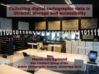
  • 1. 01/29/15 1 Collecting digital cartographic data inCollecting digital cartographic data in Utrecht: storage and accessibilityUtrecht: storage and accessibility Marco van EgmondMarco van Egmond Map Curators’ Group of theMap Curators’ Group of the British Cartographic Society, Cambridge 2010British Cartographic Society, Cambridge 2010
  • 3. 01/29/15 3 Cartographic documentsCartographic documents in digital formatin digital format • Increasing number; born-digital + scanned digital images: – Floppy disks – CDs/DVDs – Internet Growing ‘virtual’ collection: Role of the map librarian?
  • 4. 01/29/15 4 Content of the paperContent of the paper I. Various forms of digital cartographic data II. Archiving and accessibility in Utrecht III. Problems and restrictions IV. Future developments and solutions
  • 5. 01/29/15 5 Content of the paperContent of the paper I. Various forms of digital cartographic data II. Archiving and accessibility in Utrecht III. Problems and restrictions IV. Future developments and solutions
  • 6. 01/29/15 6 Forms of digital cartographic dataForms of digital cartographic data • Floppy disks • CDs/DVDs
  • 7. 01/29/15 7 Forms of digital cartographic dataForms of digital cartographic data • Maps from the internet – Examples: Zorgatlas National Institute for Public Health and the Environment (RIVM); portals of provinces
  • 8. 01/29/15 8 Forms of digital cartographic dataForms of digital cartographic data • Maps from the internet – Examples: Social atlases Almere, Steenwijkerland
  • 9. 01/29/15 9 Forms of digital cartographic dataForms of digital cartographic data • Maps from the internet – Browse and search: • Oddens’ Bookmarks • Google Images • Map History/History of Cartography • Digmap • Google Maps <-> Google Books
  • 10. 01/29/15 10 Forms of digital cartographic dataForms of digital cartographic data • Disadvantages with maps from the internet – ‘Dead’ links – Volatile character of the data/sites • Utrecht: downloading files on special server – Ready-to-use – Durable storage
  • 11. 01/29/15 11 Forms of digital cartographic dataForms of digital cartographic data
  • 12. 01/29/15 12 Forms of digital cartographic dataForms of digital cartographic data • Digitized analogue maps – Recent maps, usually copyrighted – Files on server only for education and research purposes
  • 13. 01/29/15 13 Forms of digital cartographic dataForms of digital cartographic data • Cartographic databases (f.i. Topographical Survey)
  • 14. 01/29/15 14 Content of the paperContent of the paper I. Various forms of digital cartographic data II. Archiving and accessibility in Utrecht III. Problems and restrictions IV. Future developments and solutions
  • 15. 01/29/15 15 Preservation and accessibilityPreservation and accessibility • Central storage of data • Approach and management from a distance • Consultation in a.o. the map library
  • 16. 01/29/15 16 Preservation ofPreservation of floppydisks and CDs/DVDsfloppydisks and CDs/DVDs • Floppydisks -> VFD files • CDs/DVDs -> ISO files • Files on server: readable through Virtual PC software
  • 17. 01/29/15 17 Content of the paperContent of the paper I. Various forms of digital cartographic data II. Archiving and accessibility in Utrecht III. Problems and restrictions IV. Future developments and solutions
  • 18. 01/29/15 18 Problems and restrictions accessibilityProblems and restrictions accessibility • Surpassed analogue collection • 250.000 digital files • simple geographic and thematic file structure: – Continent > Country > Theme
  • 19. 01/29/15 19 Problems and restrictions accessibilityProblems and restrictions accessibility
  • 20. 01/29/15 20 Problems and restrictions accessibilityProblems and restrictions accessibility
  • 21. 01/29/15 21 Problems and restrictions accessibilityProblems and restrictions accessibility
  • 22. 01/29/15 22 Problems and restrictionsProblems and restrictions • Legal implications – Agreements with copyright owners – Home copies ≠ publishing – Preservation copies • Disadvantageous position online electronic library • ‘Opt out’ solution?
  • 23. 01/29/15 23 Content of the paperContent of the paper I. Various forms of digital cartographic data II. Archiving and accessibility in Utrecht III. Problems and restrictions IV. Future developments and solutions
  • 24. 01/29/15 24 Future developments and solutionsFuture developments and solutions • Local initiatives: – Geoloket, Delft – Geodesk, Wageningen • National level: – Geoloketten • Cooperation? • Possibillities for cataloguing?
  • 25. 01/29/15 25 Future developments and solutionsFuture developments and solutions • Central storage of data on a national or international level • Cataloguing by participating institutes • Netherlands: Archives, Royal Library, DANS • UK: Edina
  • 26. 01/29/15 26 Future developments and solutionsFuture developments and solutions • Changing role of map librarian and map collection – Information manager – Map collections junctions in cartographic information supply – Collection and archiving of digital cartographic data task of a map library – Cataloguing of the data deserves national or international effort – Better legal conditions
  • 27. 01/29/15 27 Future developments and solutionsFuture developments and solutions
  • 28. 01/29/15 28 Thank you for your attention!Thank you for your attention! Collecting digital cartographic data inCollecting digital cartographic data in Utrecht: storage and accessibilityUtrecht: storage and accessibility