Tennessee
•
1 j'aime•511 vues

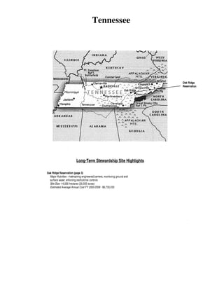
The Oak Ridge Reservation in Tennessee encompasses 14,000 hectares and contains residual radioactive contamination from past nuclear weapons production activities. Major long-term stewardship activities include maintaining engineered barriers, monitoring ground and surface water, and enforcing institutional controls. Remediation is ongoing but as of 2006, residual contamination will remain in soil, groundwater, sediments, burial grounds, and subsurface structures. The estimated annual long-term stewardship cost from 2000-2006 was $6.7 million.

Recommandé
Contenu connexe
Tendances
Tendances (13)
En vedette
En vedette (17)
Similaire à Tennessee
Similaire à Tennessee (20)
Plus de Jim Werner
Plus de Jim Werner (20)
Dernier
Dernier (20)
Tennessee
- 1. Tennessee OakRidge Reservation Long-Term Stewardship Site Highlights Oak Ridge Reservation (page 3) Major Activities- maintaining engineered barriers; monitoring ground and surtace water; enforcing institutional controls Site Size -14,000 hectares (35,000 acres) Estimated Average Annual Cost FY 2000-2006- $6,733,000
- 3. Table of Contents Table of Contents Oak Ridge Reservation ................................................................... 3 Tennessee I
- 4. National Defense Authorization Act (NDAA) Long-Term Stewardship Report Tennessee 2
- 5. Oak Ridge Reservation OAK RIDGE RESERVATION 1.0 SITE SUMMARY 1.1 Site Description and Mission The Oak Ridge Reservation (ORR), which occupies approximately 14,000 hectares (35,000 acres), is located almost entirely within the city limits of Oak Ridge in eastern Tennessee, approximately 40 kilometers (25 miles) west of Knoxville. The Reservation was established in the early 1940s by the Manhattan District of the U.S. Army Corps of Engineers. Soon after the war, the U.S. Atomic Energy Commission was formed to transfer the nuclear enterprise to civilian control. Some 20 years later, other energy programs were merged with the nuclear program to ultimately become the U.S. Department of Energy (DOE). The Reservation is composed of three primary areas: the Oak Ridge National Laboratory, the East Tennessee Technology Park, and theY -12 Plant. Work performed in each area contributed to the Reservation's major role in the enrichment of uranium or the production of plutonium for the first nuclear weapons. • LONG-TERM STEWARDSHIP HIGHLIGHTS Major Long-Term Stewardship Activities -maintaining engineered barriers; monitoring ground and sutface water; enforcing institutional controls Total Site Area- 14,000 hectares (35,000 acres) *Estimated Volume of Residual Contaminants- soil 1.1 million cubic meters (1.5 million cubic yards); groundwater unknown; sutface water/sediments 166,300 cubic meters (217,500 cubic yards); engineered units 4.2 million cubic meters (5.5 million cubic yards); facilities 1,500 cubic meters (2,000 cubic yards) Portions Requiring Long-Term Stewardship as of 2006-6 Average Annual Long-Term Stewardship Cost FY 2000-2006- $6,733,000 Landlord- U.S. Department of Energy *The estimated volume indicates only the known amounts of residual contaminants. For certain portions discussed for this site, exact volume is not known at this point. For specific discussions, please see Section 3.0. Oak Ridge National Laboratory occupies approximately 1,350 hectares (3,300 acres) within the Oak Ridge Reservation in Melton and Bethel Valleys. The Laboratory's original mission was to produce and chemically separate the first gram quantities of plutonium to support the production of the atomic bomb. Now, Oak Ridge National Laboratory is a multiprogram science, technology, and energy laboratory with distinctive capabilities in materials science and engineering, neutron science and technology, energy production and end-use technologies, mammalian genetics, and ecological research. In support of the missions of DOE, Oak Ridge National Laboratory conducts basic and applied research and development to create scientific knowledge and technological solutions that strengthen the nation's leadership in key areas of science; increase the availability of clean, abundant energy; restore and protect the environment; and contribute to national security. East Tennessee Technology Park (formerly called K-25) occupies 405 hectares (1,000 acres) within the Oak Ridge Reservation adjacent to the Clinch River. The K-25 facility was used to enrich uranium through the gaseous diffusion process. In 1987, the facility was shut down due to a decrease in demand for enriched uranium. The facility is now involved in reindustrialization, environmental restoration, and waste management activities. • Y -12 Plant occupies approximately 300 hectares (800 acres) within the Bear Creek Valley. The original mission of theY -12 Plant was uranium enrichment and nuclear weapons production. Currently, theY -12 Plant is refocusing its technical capabilities and expertise to serve DOE and DOE-approved customers. The Y-12 Plant continues to serve as a key manufacturing technology center for the development and demonstration of unique materials, components, and services of importance to DOE and the nation. Tennessee 3
- 6. National Defense Authorization Act (NDAA) Long-Term Stewanlship Report Portion/Watershed Boundary 0 2 Specific focus areas for theY -12 Plant in coming years include: ( 1) weapons dismantlement and storage; (2) enriched uranium materials warehousing and management; (3) nuclear weapons process technology and development support; (4) Y-12 Plant management/landlord activities, including taking standby or shutdown facilities into a safe, legally compliant condition; (5) identifying and managing the decontamination and decommissioning of facilities; (6) providing unique capabilities and technologies not found in the private sector on DOE-approved tasks; (7) transferring technology developed at DOE facilities to enhance our industrial competitive edge in worldwide markets; and (8) maintaining and supporting the National Security Office for DOE. The Reservation has approximately 400 hectares (1,100 acres) of unlined radioactive and mixed-waste burial grounds, inactive tanks, surplus facilities, and unlined ponds. As a result of past operations, approximately 1,500 hectares (4,000 acres) ofland in parts of the three primary areas and in other areas of the Reservation have been or have the potential to be contaminated. Contamination is found in the soil, groundwater, surface water, and two major rivers, the Clinch River bordering the Oak Ridge Reservation and the Tennessee River further downstream. However, approximately 12,500 hectares (31,000 acres) of land on the Reservation are 1 Tennessee All maps shown for ORR reflect the current, as of year 2000, contamination at the site. 4
- 7. Oak Ridge Reservation uncontaminated. DOE has begun remediation of the Reservation. The first phase of remediation involves stabilizing the plants in support of their existing missions and will not be completed until after 2010. Additional remediation may be needed as the missions change. The current mission of the Oak Ridge Reservation is to continue research at the Oak Ridge National Laboratory, continue national defense related activities at theY -12 Plant, and remediate the East Tennessee Technology Park to allow for reindustrialization. Concurrently, environmental remediation will continue, in addition to required long-term stewardship activities. The long-term stewardship activities consist of maintaining barriers to the spread of contamination (engineered barriers), monitoring ground and surface water, operation and maintenance of the wastewater treatment units, and enforcing institutional controls. 1.2 Site Cleanup and Accomplishments Remediation at the Oak Ridge Reservation is based on five watersheds: Melton Valley and Bethel Valley at Oak Ridge National Laboratory, East Tennessee Technology Park, and Bear Creek and Upper East Fork Poplar Creek at the Y-12 Plant and is conducted in accordance with the Comprehensive Environmental Response, Compensation, and Liability Act (CERCLA). All remedial decisions to leave waste in place are considered interim because the State of Tennessee is opposed to leaving waste in place in perpetuity without a set-aside longterm stewardship funding mechanism; however, DOE cannot commit to this funding mechanism. Remediation levels for the Oak Ridge Reservation are expected to support the following uses: approximately five percent restricted access, five percent controlled industrial (defined as industrial use on the surface), 15 percent unrestricted industrial (defined as industrial use to three meters (10 feet) in depth), and 75 percent unrestricted. In 2006, most of the remediation activities identified below will be partially completed; however, very few will be fully completed. The following remediation discussion represents current DOE assumptions since most of the Record of Decisions (RODs) have not yet been signed. OAK RIDGE NATIONAL LABORATORY ACCOMPLISHMENTS Oak Ridge National Laboratory • A CERCLA ROD for Melton Valley is nearing signature, rendering most of the Melton Valley discussion less likely to change than other portions in this document. Under this ROD the large burial grounds in Melton Valley will be hydraulically isolated through caps and upgradient and downgradient collection trenches for shallow groundwater. Some transuranic waste will be excavated and disposed at the Waste Isolation Pilot Project (WIPP). The liquid lowlevel waste seepage pits and trenches will be grouted or vitrified in situ and capped. The most contaminated areas of onsite sediment will be dredged and disposed at the Environmental Management Waste Management Facility (EMWMF), which will be constructed in Bear Creek Valley. Signature of the CERCLA ROD for Bethel Valley is a year or two away; however, the proposed plan is currently undergoing public review. In the main plant area of Oak Ridge National Laboratory (Central Bethel Tennessee Removed sludge and liquid (nearly 1,900 cubic meters (2,500 cubic yards)) from aging gunite lowlevel waste tanks • Removed sludge and liquid from several low-level waste steel tanks and surface impoundments. Grouted steel tanks • Demolished the Waste Evaporation Facility • Collected contaminated shallow groundwater in several places, and established plans for future monitoring BY 2006 OAK RIDGE NATIONAL LABORATORY WILL HAVE: • • • • Demolished approximately 36 buildings Filled pipelines and gunite tanks with grout Collected deep groundwater Capped several of the large burial grounds in Melton Valley • Removed contaminated sediment from the Intermediate Holding Pond • Completed decontamination and decommissioning of the molten salt reactor experiment 5
- 8. National Defense Authorization Act (NDAA) Long-Term Stewardship Report Valley), contaminated soil will most likely be excavated to a depth of 0.6 meters (two feet) and disposed of in the EMWMF. Contaminated sediments are assumed to also be excavated and disposed of in the EMWMF in Bear Creek Valley. Small disposal areas of solid low-level waste will most likely remain in place with clean soil or caps placed on top. Surface features of contaminated buildings will be demolished and the material disposed either in the EMWMF or at offsite disposal sites. Subsurface features are expected to be partially decontaminated and backfilled. Pipelines and tanks may be grouted in place after removal of sludge. Migration of groundwater most likely will be controlled through interceptor trenches, sumps, and groundwater extraction wells. For the industrial areas outside the main plant area (East Bethel Valley), contaminated soils, pipelines, tanks, and subsurface features of buildings are expected to be removed to a depth of three meters (ten feet), if required. Contamination remaining at the Oak Ridge National Laboratory will include all present burial grounds, subsurface soil and groundwater, subsurface tanks, piping, and substructures, and some contaminated sediments in Melton Valley. East Tennessee Technology Park Except for the decision to demolish buildings, most remedial decisions at East Tennessee Technology Park are in the early planning stages; therefore, the information provided in this report concerning East Tennessee Technology Park has greater uncertainty than the information provided on the Oak Ridge National Laboratory and theY -12 Plant. To bring East Tennessee Technology Park to assumed unrestricted industrial remediation levels, the contaminated soil would be removed to a depth of three meters (ten feet), if needed. The contaminated surface and subsurface features of buildings and facilities, including inactive infrastructure, may be removed when no longer useable. Contaminated scrap will be removed. Contaminated waste, such as that in the burial grounds, may be removed, treated (if necessary), and disposed at the EMWMF. Remaining contamination is assumed to include that in deep soils (greater than three meters (ten feet)) and in the groundwater. EAST TENNESSEE TECHNOLOGY PARK ACCOMPliSHMENTS • Demolished seven buildings under CERCLA; longterm monitoring required • Removed sludges from two ponds; future monitoring required • Collected and treated shallow groundwater; longterm monitoring required BY 2006 EAST TENNESSEE TECHNOLOGY PARK WILL HAVE: • Demolished approximately 80 buildings • Excavated all contaminated soil, scrap, and debris outside of the main fence • Completed excavation of the Old Contaminated Burial Ground • Completed decommissioning of K-31/33 buildings Y-12 Plant The first significant remedial decision for Upper East Fork Poplar Creek is one to two years away. A proposed plan is currently being generated. Plans presented in this report could change. In the main plant area (referred to as Upper East Fork Poplar Creek), soil and sediment contributing to exceedances of surface water standards, or future worker risk, are expected to be removed, treated, and disposed in the EMWMF . Some soil may be treated in place to remove mercury. Scrap will be removed from the site. Contaminated groundwater will be intercepted at the edge of the plant prior to offsite migration; however, institutional controls are in place and will remain in place for contaminated groundwater that has already moved offsite in Union Valley. A large process building, Alpha-4, may be decontaminated for future use as a warehouse. A remedial decision for part of Bear Creek Valley (the adjacent waste disposal area for Y-12) has just been signed. However, remaining remedial decisions on the burial grounds are years away. Therefore, parts of the discussion are still uncertain and subject to change. In Bear Creek Valley, contaminated soil leaching uranium Tennessee 6
- 9. Oak Ridge Reservation to groundwater and ultimately surface water will be excavated from the Boneyard/Burnyard and disposed in the EMWMF. Shallow groundwater near the S-3 Ponds and the burial grounds will be treated through in-situ reactive trenches. The burial grounds (future decision) are assumed to be hydraulically isolated through capping and in-situ treatment. The groundwater that has migrated past the burial grounds is expected to naturally attenuate. Contamination remaining at Y-12 is expected to include burial grounds, subsurface soil and groundwater, and subsurface features, such as pipelines. The EMWMF will be constructed in Bear Creek Valley. By 2002, this facility will provide a permanent disposal location for the low-level waste and mixed wastes generated by CERCLA actions. The 28-hectare (68acre) cell will be constructed above grade with leachate collection and monitoring systems. Y-12PLANT ACCOMPLISHMENTS • • • • • • • Removed surface debris from the White Wing Scrapyard and Kerr Hollow Quarry Remediated shallow groundwater at S-3 ponds via in-situ passive treatment; long-term monitoring required Removed contaminated soil from the firing range Treated and capped S-3 ponds, improving the quality of Bear Creek Capped large areas of burial grounds under RCRA Received regulatory approval to construct an onsite waste disposal facility Reduced effluent mercury levels to historically low levels BY 2006 THE Y-12 PLANT WILL HAVE: 2.0 SITE· WIDE LONG· TERM STEWARDSHIP • 2.1 Long-Term Stewardship Activities • • Completed excavation of hot spots and residual capping at the Boneyard/Bumyard Completed remediation of offsite properties Removed or treated mercury soil/sediment sites in the plant DOE or a successor is expected to maintain ownership of most of the contaminated areas of the Reservation once remediation is complete and, therefore, will be responsible for long-term stewardship. To ensure that unacceptable exposures to residual contamination do not occur, DOE and the other Federal Facility Agreement parties (i.e., U.S. Environmental Protection Agency (EPA) and Tennessee Department of Environment and Conservation (TDEC)) are committed to maintaining the needed institutional controls for as long as they are necessary. This commitment is documented in each ROD where wastes are left in place. Land use controls include: ( 1) proprietary controls, which rely on property law; (2) governmental controls, which rely on regulatory authorities; and (3) physical controls. The proprietary controls for the Reservation consist of restrictions and notices on added deeds or the original acquisition records. Governmental controls use the regulatory authority of a governmental unit to impose restrictions on citizens or sites under its jurisdiction. DOE maintains a permit program that controls excavation and penetration activities on the Reservation, including groundwater use. To provide easy access to this information, notices will be filed on the original acquisition records and with the City of Oak Ridge and the county or counties wherein the property is located (Anderson and/or Roane) on the residual contamination locations and associated risk levels. Physical controls will include limited, passive engineering measures, as well as measures to prevent human intervention, for restricting access. For the Reservation, this includes access controls (i.e., fences/gates), signs, and personnel training. These land use controls are not mutually exclusive and will be "layered" to enhance the overall reliability and the health and safety of the public and the environment. Access to contamination off the Reservation (Poplar Creek and Clinch River) is currently controlled through deed restrictions or use advisories and signs that are enforced under an interagency agreement between DOE, EPA, TDEC, Tennessee Valley Authority, and the U.S. Army Corps of Engineers. The approved ROD for Union Valley groundwater resulted in license agreements with property owners requiring them to notify DOE of any changes in surface water or groundwater use. Tennessee 7
- 10. National Defense Authorization Act (NDAA) Long-Term Stewardship Report DOE and the State of Tennessee developed a unique approach to funding long-term stewardship of the EMWMF. DOE signed a Consent Order with the State of Tennessee and agreed to deposit $14 million (in $1 million annual installments) into a pooled investment fund established by Tennessee state law (T.C.A. Section 9-4-603). After payment of the final installment, interest for the fund will be used to pay for surveillance and maintenance of the facility. The fund will terminate upon written agreement that surveillance and maintenance for the facility are no longer required. Upon termination, the balance of the fund will be returned. Engineered controls include caps on burial grounds in Melton Valley (part of Oak Ridge National Laboratory), West Bethel Valley, and Bear Creek Valley. These caps will be maintained, patrolled, and replaced, as needed. Other engineered controls include the collection and treatment of radioactive groundwater in Melton Valley and in Bethel Valley. The wastewater treatment plants will be operated and maintained and their equipment will be replaced periodically, as needed. Ongoing monitoring activities include surface water, groundwater, and ecological monitoring (bio-survey). CERCLA five-year reviews will be conducted for all remediated sites where the decision is to leave waste in place. These reviews evaluate the implementation and effectiveness of the remedial action (including institutional controls). The five-year reviews will be conducted consistent with the EPA Comprehensive FiveYear Review Guidance (EPA 540R-98-050). Record-keeping activities will mostly follow current procedures. DOE, in accordance with the Federal Facility Agreement with EPA and TDEC, requires that information used in decision-making be maintained in the administrative record. These documents include remedial investigations, feasibility studies, proposed plans, and RODs. Associated correspondence, data, and some post-ROD information are also included. Most post-ROD information, including design reports, monitoring plans, monitoring results, and action completion reports, are kept in a separate system. These information collection systems will be reviewed to determine a way to capture information relevant to long-term stewardship and to store the information in retrievable form for the long term. 2.2 Long-Term Stewardship Technology Development and Deployment The role of technology development in long-term stewardship is to develop, demonstrate, and improve technologies that will ensure the post-closure long-term protection of the environment and the public. Technologies are needed to enhance the reliability and reduce the cost of planned engineered controls and to decrease the time for long-term management of residual wastes. The long-term stewardship life-cycle baseline scope for the OakRidge Reservation Environmental Management program was reviewed to identify key (mission critical) engineered systems, recurring actions, and high-cost activities. It was determined that key engineered systems for long-term stewardship include hydraulic isolation ofburied wastes and reactive barriers for treatment of contaminated surface and groundwater. Major hydraulic isolation components include caps and stormwater diversion trenches. Major reactive barrier components include reactive media and collection and treatment trenches. Long-term reliable operation and maintenance of these systems, coupled with periodic replacement, as needed, is a key component of the long-term stewardship strategy. Assessments to predict the long term performance of these systems is needed to support the remedy selection process, design effective monitoring systems, and plan for periodic system replacement. Monitoring of surface water, groundwater, sediments and biota is a recurring long-term stewardship activity. The projected cost of monitoring is excessive if DOE assumes that existing technology will be used in the future. A workshop was held to further examine technology development needs because of the humid eastern environment (precipitation and hydrology). Principle cap failure modes were identified as bio-intrusion, subsidence, and erosion. Mechanisms for trench failure (plugging and clogging) were identified as erosion, siltation, microbial interferences, and chemical reactions. Technology development to extend the life of Tennessee 8
- 11. Oak Ridge Reservation hydraulic isolation by addressing these potential failure modes is needed. The use of remote monitoring techniques, possibly incorporating satellite technology, was also identified as a technology development need. The failure of reactive barriers is related to both treatment and hydraulic considerations. Hydraulic-related factors reduce the permeability in the capture zone and include plugging, bio-fouling, and gas buildup. Treatment-related factors include media fouling, media life, and remobilization of contaminants. Limited information is available in these areas, and technology development is needed to sustain reactive barrier performance over the long-term periods required by stewardship. Systems need to be developed to reduce long-term stewardship costs. Reliable, remote-time, automated monitoring systems are available, but technology development of contaminant-specific (radionuclides, organic chemical and metals) sensors is needed. Technology for in-situ biological monitoring is needed to supplement and eventually replace traditional analytical monitoring. Innovative groundwater well design and replacement technology is needed to minimize costs and enhance worker safety. Technologies are also needed to shorten the period that long-term stewardship is required. This may include technologies that enhance the natural attenuation processes to accelerate remediation of contaminated soil and water or technologies that limit the need for hydraulic isolation of buried residual wastes by irreversibly treating the waste to nontoxic forms. Cost-effective development of in-situ treatment or excavation and ex -situ treatment of contaminated soils, buried wastes, and contaminated water requiring treatment should also be considered. 2.3 Assumptions and Uncertainties No final remedial decisions and few interim remedial decisions have been made for the Oak Ridge Reservation. Only partial remedial decisions in Bear Creek and Melton Valley are anticipated to be made in fiscal year (FY) 2000. Other decisions for most of the Y-12 Plant, all of East Tennessee Technology Park (except building demolition), and much of Oak Ridge National Laboratory are one to five years away. The ultimate strategies selected may be different than the assumptions used to perform this analysis. 2.4 Estimated Site-Wide Long-Term Stewardship Costs Site Long-Term Stewardship Costs (Constant Year 2000 Dollars) Year(s) Amount ·. Year(s) Amount Year(s) Amount FY 2000 $6,394,000 FY2008 $9,620,000 FY 2036-2040 $40,724,000 FY 2001 $6,394,000 FY 2009 $9,807,000 FY 2041-2045 $50,600,000 FY 2002 $6,394,000 FY 2010 $9,805,000 FY 2046-2050 $79,936,000 FY 2003 $6,356,000 FY 2011-2015 $49,296,000 FY 2051-2055 $85,546,000 FY 2004 $6,470,000 FY 2016-2020 $47,924,000 FY 2056-2060 $40,724,000 FY2005 $7,618,000 FY 2021-2025 $44,312,000 FY 2061-2065 $44,867,000 FY 2006 $7,508,000 FY 2026-2030 $43,526,000 FY 2066-2070 $40,757,000 FY 2007 $7,596,000 FY 2031-2035 $44,264,000 Tennessee 9
- 12. National Defense Authorization Act (NDAA) Long-Term Stewardship Report Long-term stewardship costs include maintaining engineered barriers and monitoring and treating ground and surface water. DOE assumes, for planning purposes, that each cap will be replaced every 50 years, which results in a peak in long-term stewardship costs in various years depending on when the caps were installed. Other engineered controls, such as pumps, piping, trenches, and wells, are replaced at different frequencies. Residual contamination will be monitored, as necessary, to identify changing conditions and reported at least every five years during the CERCLA five-year review process. However, monitoring efforts and their associated costs will decrease over time. Although costs are only estimated to FY 2070, DOE anticipates that long-term stewardship activities will continue in perpetuity at most areas. 3.0 PORTION OVERVIEW The Oak Ridge Reservation consists of six "portions" that will require some long-term stewardship activities as of 2006. For purposes of this report, a "portion" is defined as a geographically contiguous and distinct area (which may involve residually contaminated facilities, engineered units, soil, groundwater, and/or surface water/sediment) for which cleanup, disposal, or stabilization will have been completed and long-term stewardship will be required as of 2006. Each portion is listed in the table below, with further explanations in Sections 3.1 through 3.6. Each portion, except for the offsite portion, corresponds to a watershed. The offsite portion includes contaminated surface water bodies that have left the Reservation (Poplar Creek, Clinch River). Offsite sources of contamination (Atomic City Auto Parts in Oak Ridge and the David Witherspoon sites in Knoxville) are planned to be completely restored with no long-term stewardship requirements. For the Oak Ridge Reservation, remedial decisions are made at the watershed scale. The overall strategy is to group contaminated units by watershed because: (1) surface water drainage basins result in shared contaminant plumes, and (2) watershed areas have relatively homogeneous present or potential future land use. The five watersheds include the following: • • • Bear Creek Valley - includes the Y-12 Plant waste disposal area Bethel Valley- is the main plant area of the Oak Ridge National Laboratory Upper East Fork Poplar Creek- primarily includes the Y -12 Plant and Chestnut Ridge to the south East Tennessee Technology Park - incorporates the entire East Tennessee Technology Park plant site Melton Valley - includes most of the burial grounds at the Oak Ridge National Laboratory • -: Long• Term. Stewardship Information ·. Portion ,. Long-Term Stewardship Start Year long-Term Stewardship End Year Bear Creek Watershed 2000 In Perpetuity Bethel Valley Watershed 2000 In Perpetuity Upper East Fork Poplar Creek Watershed 2000 In Perpetuity East Tennessee Technology Park Watershed 2000 In Perpetuity Melton Valley Watershed 2000 In Perpetuity Offsite 1997 In Perpetuity Tennessee 10
- 13. Oak Ridge Reservation 3.1 Bear Creek Watershed Portion BEAR CREEK WATERSHED PORTION HIGHLIGHTS The Bear Creek Watershed Portion is several miles long within the Bear Creek Valley and extends from Major Long-Term Stewardship Activities- monitoring the western end of the Y-12 Plant to the boundary of and maintaining engineered units; monitoring groundwater contamination on the west. The Y -12 groundwater; enforcing institutional controls Portion Size- 1,942 hectares (4,800 acres) Plant began operations in 1943 to enrich uranium for Estimated Volume of Residual Contaminants- soil nuclear weapons as part of the Manhattan Project. 15,000 cubic meters (19,000 cubic yards); Now, the Y-12 Plant is a major manufacturing, groundwater unknown; engineered units 2,440,000 development engineering, and technology center cubic meters (3,191,000 cubic yards) supporting DOE and other government programs. The Long-Term Stewardship Start-End Years- 2000-in auxiliary facilities at theY -12 Plant, including many of perpetuity the former waste disposal areas, are in the Bear Creek Average Annual Long-Term Stewardship Costs FY watershed. They contain radiologically contaminated 2000-2006- $2,002,000 and nonradiologically contaminated wastes generated primarily by Y-12 Plant operations. This region is considered one portion because the multiple disposal areas within Bear Creek Valley are releasing contaminants into common ground and surface water migration pathways. None of the disposal areas are currently active and most (burial grounds, hazardous chemical disposal area and S-3 ponds) have been capped with either a soil cover or engineered multilayer cap under a Resource Conservation Recovery Act (RCRA) closure program. Two leachate collection systems were installed during capping operations to collect leachate at potentially contaminated caps. The former waste disposal areas contain large volumes, greater than 400,000 cubic meters (500,000 cubic yards), of contaminated soil and buried solid waste, primarily uranium and other metals. Several contaminants have been identified in soil, groundwater, surface water, and sediment in the Bear Creek watershed. Contaminants include radionuclides and metals in soil and uranium, nitrates and volatile organic compounds (VOCs) in ground and surface water. Much of the contamination, particularly in soil and somewhat less so in groundwater, is contained within or near the boundaries of the waste disposal areas. The highest concentration of contaminants in groundwater occurs at the former waste disposal areas for the plant, but concentrations causing unacceptable risk have been detected up to a mile west of the area. The Bear Creek Valley watershed is divided into three functional areas which will be remediated in accordance with CERCLA: the Oil Landfarm Area, Burial Grounds, and the S-3 Ponds. The contaminated media for this portion (soil, groundwater, and engineered units) are discussed in the following paragraphs. Surface water and sediment will be restored to recreational use, the highest use possible given the size of the stream. Long-term stewardship activities will not be required for Bear Creek Valley surface water and sediment; therefore, these media are not discussed. In addition, the EMWMF will be built in Bear Creek Valley. Access to eastern Bear Creek Valley, which contains the waste disposal areas and the EMWMF, will be restricted and will require longterm stewardship. 3.1.1 Soil Due to past disposal operations, contaminated soils are associated with three functional areas: the S-3 Ponds, the Burial Grounds, and the Oil Landfarrn Area. The S-3 Ponds were four unlined ponds used for industrial waste treatment and contain contaminated soils underneath the closed ponds. The Burial Grounds consist of trenches used for disposal of liquid and solid wastes and contain contaminated soils between the trenches. The contaminated soils under the S-3 Ponds and between the trenches in the Burial Grounds will be discussed in Section 3.1.3 on engineered units. Tennessee 11
- 14. National Defense Authorization Act (NDAA) Long-Term Stewardship Report ~ Groundwater Contamination ~ Soil Contamination 0 1 2 CREEK Bear Creek Watershed The Oil Landfarm Area includes the Oil Landfarm and the Boneyard/Burnyard. The Oil Landfarm is a former land-farming plot used for biological degradation of approximately 4,000 cubic meters (5,000 cubic yards) of industrial waste oil and machine coolants between 1973 and 1982. The Boneyard/Burnyard consists of three areas: Boneyard (used for contaminated, noncombustible material disposal), Burnyard (used for contaminated, combustible material disposal), and the Hazardous Chemical Disposal Area. Soils in the Oil Landfarm Area are contaminated with uranium, polychlorinated biphenyls (PCBs), metals, and other radionuclides. Highly contaminated soil (i.e., hot spots) will be excavated from the Boneyard/Burnyard and disposed in the EMWMF. Residual materials that pose lower long-term risk will be contained onsite through appropriate hydraulic isolation measures, including soil covers or caps. These are primarily uranium and organic chemical contaminated soils. Approximately 20 hectares (40 acres) of contaminated soil will remain. The contaminated soil could be as deep as six meters (20 feet) or as shallow as two meters (six feet). At an average of four meters (12 feet), the volume is estimated to be 15,000 cubic meters (19,000 cubic yards). By 2006, soil remediation will be completed in the Oil Landfarm Area. Tennessee 12
- 15. Oak Ridge Reset·vation Soil Long-Term Stewardship Activities To ensure that unacceptable exposures to residual contamination in Bear Creek Valley do not occur, DOE will maintain necessary land use restrictions and governmental controls. The contaminated area of Bear Creek Valley will be designated for controlled industrial use (restrictions below two feet), with areas of restricted waste disposal use, including the residual soil contamination in all three functional areas. Requirements for institutional controls in Bear Creek were documented in the first ROD, and more details will be provided in a future land use control implementation plan. As other RODs are signed, additional institutional controls may be added. Institutional controls, such as restricting access and prohibiting soil excavation, have been in place since the waste has been in place but will begin in 2000 under CERCLA now that a significant ROD has been signed. These controls will be implemented through a permit program maintained by DOE. In addition, residual contamination will be monitored as often as necessary to identify changing conditions and reported at least every five years in accordance with the CERCLA five-year review process. Monitoring efforts will decrease over time as site conditions stabilize and less frequent monitoring is required, resulting in long-term stewardship cost decreases over time. However, the cap planned for the soil in the Boneyard/Burnyard is assumed to be replaced every 50 years, as needed. 3.1.2 Groundwater The groundwater in Bear Creek Valley is contaminated with uranium, nitrates, PCBs, and volatile organic compounds (i.e., trichloroethene and degradation products) released from historic waste disposal operations. A relatively continuous zone of groundwater contamination exists throughout the three functional areas: the Burial Grounds, Oil Landfarm, and S-3 Ponds areas. The contaminated groundwater plume is approximately 40 hectares (100 acres) and extends from all waste disposal units down the valley to the west. The plume is not expected to reach beyond the west end of the Burial Grounds. The groundwater flow is governed by the valley's geology. The rock formations are extensively fractured (karstified), which substantially increases the permeability. The fracture width generally decreases with depth, restricting the depth of active groundwater circulation. However, the shallow interval (top 30 meters (100 feet)) is well connected and, therefore, rapidly transports water to Bear Creek. Most groundwater flow occurs in this interval during and immediately following precipitation. The final groundwater remediation strategy has been deferred from all negotiations. There has been significant disagreement on the strategy, so the Federal Facility Agreement parties agreed to implement actions to prevent source contaminant releases and monitor the effects on groundwater before negotiating a final groundwater strategy. The groundwater contamination conditions are complex since the geology is karstic and contaminant flow paths are difficult to track. The sources of groundwater contamination are well identified, but contamination is deep, and secondary sources (free product) have been found hundreds of feet deep. For cost estimating purposes, DOE is assuming that remediation will be by natural attenuation with no active restoration and installing of hydraulic barriers to isolate contaminant sources (i.e., the Burial Grounds). Groundwater Long-Term Stewardship Activities Based on the assumed remedial strategy, DOE will monitor the groundwater to ensure that the remedy is effective and contaminants are being attenuated as expected. DOE assumes, for costing purposes, that any necessary groundwater interception/treatment trenches and wells will be replaced at 50-year intervals. To ensure that unacceptable exposures to residual contamination do not occur, DOE would need to maintain necessary land use restrictions under this strategy, such as prohibiting any use of onsite groundwater. Long-term stewardship activities will be described in a future decision, which is expected well after 2006 (assumed to be no earlier than Tennessee 13
- 16. National Defense Authm·ization Act (NDAA) Long· Term Stewardship Report 2010). Such a strategy allows for evaluation of the impact of previous actions on the groundwater quality. 3.1.3 Engineered Units This portion contains three engineered units: the Bear Creek Burial Grounds, S-3 Ponds, and the EMWMF, which, together, occupy a 56-hectare (138-acre) area. The Bear Creek Burial Grounds and S-3 Ponds were used for historical disposal of Y -12 Plant waste. The EMWMF will be used for disposal of Oak Ridge Reservation CERCLA wastes. The Bear Creek Burial Grounds are approximately three kilometers (two miles) west of the Y -12 Plant and were primarily used to dispose of uranium turnings and industrial wastes contaminated with uranium from nuclear weapons production. The burial grounds, which operated from approximately 1955 to 1993, consist of several principal waste disposal units, each with a series of trenches. Since 1989, several waste disposal units have been closed with a RCRA-approved cap. The remaining burial grounds are assumed to be contained in place. The material eventually capped in place would include uranium chips in solvents, trash and debris contaminated with radioactivity, waste oils, beryllium metals, and unstable materials, such as picric acid. The volume of soil and debris remaining in place is estimated at 917,000 cubic meters (1.2 million cubic yards). The S-3 Ponds were four unlined ponds located adjacent to the west end of the Y-12 Plant. Constructed in 1951, these impoundments covered approximately 122 by 122 meters (400 by 400 feet). The ponds were approximately five meters (17 feet) deep and, while in operation, each pond had a storage capacity of 9,464 cubic meters (12,378 cubic yards). The ponds were used to dispose of liquid wastes and sludge, including nitric acid and uranium, from Y-12 Plant operations. In-situ treatment of wastewater in the S-3 Ponds consisted of neutralization and biodenitrification processes that began in 1983 and continued until September 1984. After biodenitrification, the ponds' contents were allowed to settle and form a sludge layer ranging from 0.6-to-1.5 meters (two-to-five feet) thick. The volume of neutralized sediment and underlying contaminated soil above the water table is estimated at 23,000 cubic meters (30,000 cubic yards). In 1988, the S-3 Ponds were closed, in accordance with RCRA, by placing a multilayer cap over the area and covering it with asphalt to create a parking lot. While the source has been contained, remediation efforts are underway to control the migration of contaminated groundwater from past pond releases. These efforts will be completed before 2006. Institutional controls are already in place to maintain the cap and prevent access to residual contamination. The EMWMF is being constructed for disposal of mixed (hazardous and low-level) wastes generated during CERCLA remediation of the Oak Ridge Reservation. The EMWMF, with two additional expansions, is anticipated to contain 1,500,000 cubic meters (2,000,000 cubic yards) of waste when filled and closed. A wide variety of materials is expected to be placed in the cell, including radioactively contaminated demolition debris; radioactively contaminated soil; soils after treatment for mercury removal; lightly contaminated trash; personal protective equipment; and materials from East Tennessee Technology Park burial grounds, which would include uranium, thorium, beryllium, other metals, and organic contaminated soil and debris. A Waste Acceptance Criteria Attainment Plan is under development that would control the types of contamination that can be disposed. For instance, RCRA material must be treated first; and highly mobile contaminants, such as Technetium-99, are limited. The EMWMF, estimated to cover 28 hectares (68 acres), will contain a bottom barrier, a leachate collection system, and an intruder barrier final cap. The EMWMF will be accepting waste by 2002 and is not anticipated to be closed until around 2015. TDEC is planning on administering the long-term surveillance and monitoring program through a trust fund that has been set up. Engineered Units Long-Term Stewardship Activities Long-term stewardship activities, such as monitoring, maintenance, replacement, and surveillance, will be Tennessee 14
- 17. Oak Ridge Reservation required to ensure that the engineered controls remain protective of human health and the environment. Regular monitoring will occur in accordance with agreements reached during closure. Effectiveness of the remedial actions and these long-term stewardship activities will be validated and verified through the CERCLA five-year review process. The engineered caps and other items are expected to be replaced as needed. Institutional controls, such as a permit program requiring DOE approval before any penetration in the area, have been in place since the waste has been in place, but CERCLA will also require these controls once a ROD is signed. The EMWMF will be fenced with access controls. DOE is committed to maintaining necessary land use controls to ensure that unacceptable exposures to residual contamination do not occur. Specific land use control requirements for Bear Creek were incorporated in the first ROD, and the details will be described in a land use control implementation plan. Future Bear Creek Valley RODs may augment the land use controls. The areas of Bear Creek Valley that are contaminated will be designated for controlled industrial (restrictions below 0.6 meter (two feet)), with areas of restricted waste disposal use for the Burial Grounds and the EMWMF. 3.1.4 Estimated Long-Term Stewardship Costs for Bear Creek Watershed Long-term stewardship activities for the Bear Creek Watershed Portion are anticipated to include monitoring and maintaining engineered units, monitoring groundwater, and enforcing institutional controls. For cost estimating purposes, DOE is assuming that groundwater remediation will be by natural attenuation with no active restoration and installing of hydraulic barriers to isolate contaminant sources (i.e., the Burial Grounds). Also, for cost estimating purposes, DOE assumes that engineered caps, trenches, and groundwater wells will be replaced at 50year intervals, resulting in peaks in long-term stewardship costs around the years 2040-2050 for existing caps and 2060 for new caps. Regular monitoring will occur in accordance with agreements reached during closure. Effectiveness of the remedial actions and long-term stewardship activities will be validated and verified through the CERCLA five-year review process. However, monitoring efforts are expected to decrease over time as environmental conditions stabilize, resulting in decreasing cost over time. Although costs are reported until FY 2070, long-term stewardship is anticipated to be required beyond FY 2070. Currently, the environmental remediation project costs for the Reservation are not estimated by portion (watersheds), but rather, by three major areas (Oak Ridge National Laboratory, Y-12 Plant, and East Tennessee Technology Park). The estimated long-term stewardship costs for the Bear Creek Watershed Portion are a percentage of the Y-12 Plant's long-term stewardship costs. Long-Term Stewardship Costs (Constant Year Dollars) F¥2000F¥2010 F¥2011F¥2020 F¥2021F¥2030 F¥2031· F¥2040 F¥2041F¥2050 $22,006,000 $18,101,000 $12,469,000 $10,728,000 $29,050,000 3.2 F¥2051F¥2060 $8,198,000 F¥2061F¥2070 Estimated Total $11,359,000 $111,911,000 Bethel Valley Watershed Portion This portion encompasses a 702-hectare (1,734-acre) area of Bethel Valley in the southwest region of the Oak Ridge Reservation and contains the main plant area for the Oak Ridge National Laboratory. The Bethel Valley portion is a contiguous area of contamination that lies within the valley. Within Bethel Valley, there are three areas: East Bethel Valley, Central Bethel Valley, and West Bethel Valley. • East Bethel Valley is the Laboratory maintenance area, which contains a single facility and a volatile organic compound (VOC) contaminated groundwater plume. There are no contaminated soil, surface Tennessee 15
- 18. National Defense Authorization Act (NDAA) Long-Term Stewardship Report water, sediment, or engineered units. • Central Bethel Valley includes the Laboratory area, which contains active and inactive buildings, former burial grounds, underground liquid low level waste tanks, underground pipelines, and associated underground and above-ground utilities. Contaminated soil, surface water, sediment, and groundwater have resulted from Laboratory activities. The most significant release offsite results from subsurface spills of strontium in the Laboratory area, which have contaminated groundwater and surface water. Strontium contamination resulting from Bethel Valley flows offsite through Melton Valley and can be detected in the Clinch River. BETHEL VALLEY WATERSHED PORTION HIGHLIGHTS Major Long-Term Stewardship Activities- monitoring and maintaining engineered units; monitoring groundwater; enforcing institutional controls Portion Size- 702 hectares (1,734 acres) *Estimated Volume of Residual Contaminants - soil 765,000 cubic meters (1 million cubic yards); groundwater unknown; engineered units 115,000 cubic meters (150,000 cubic yards); facilities unknown Long-Term Stewardship Start-End Years- 2000-in perpetuity Average Annual Long-Term Stewardship Costs FY 2000-2006- $1,124,000 *The estimated volume indicates only the known amounts of residual contaminants. West Bethel Valley contains a burial ground area. Groundwater and soil are contaminated as a result of disposal activities in this area of the valley. These areas will be remediated and will be subject to long-term stewardship in accordance with CERCLA. The assumptions below are from a proposed plan and could be modified when decisions are made in the next year. The contaminated media for this portion (soil, groundwater, engineered units, facilities) are discussed in the following paragraphs. Surface water and sediments would be restored to recreational use, the highest use possible given the size of the streams. Contaminated sediments would be excavated and disposed in the EMWMF. No institutional controls or other long-term stewardship activities would be required in Bethel Valley surface water and sediment once established goals have been met. 3.2.1 Soil Contaminated soil through Central Bethel Valley releases contaminants into common ground and surface water paths. Bethel Valley is underlain by bedrock which has innumerable small-scale folds, faults, and fractures that play a major role in groundwater flow. The bedrock is covered with a mantle of soils that tend to retain the fractures and bedding planes of the parent bedrock but have a higher porosity and permeability than the parent rock. The primary contaminants of concern in the soil are cesium-137, strontium-90, and cobalt-60. • East Bethel Valley has no soils that are known to be significantly contaminated. • Central Bethel Valley has soil that is primarily contaminated with radionuclides (e.g., cesium-137), although there is also some mercury contamination. The surface soil is contaminated as a result of spills, fallout, and runoff. Contamination leaked out of Oak Ridge National Laboratory buildings as a result of pipeline leaks and breaks, tank leaks, migration of surface contamination through the soil, and movement of contaminated groundwater through pipelines and natural channels. An extensive amount, approximately 765,000 cubic meters (one million cubic yards), of contaminated soil will remain in Central Bethel Valley because remediation efforts will focus only on the top 0.6 meters (two feet). Although considerable sampling has occurred, there is still a high degree of uncertainty on the extent and depth of contamination. Tennessee 16
- 19. Oak Ridge Reservation ORNL ESSS::J - 0 Soil Contamination Engineered Units 1 2 Miles Bethel Valley Watershed • West Bethel Valley soils are associated with the burial ground and will be addressed as part of the engineered unit. The proposed remediation strategy is to generally remove (down to 0.6 meters (two feet)) contamination in the surface soil and dispose of the soil in the EMWMF in Bear Creek Valley. Contamination in subsurface soil, such as in secondarily contaminated areas along seepage discharge routes from source units, will remain in place unless significantly contributing to groundwater contamination, in which case it will be removed. In general, high levels of cesium-137 contamination will remain, although strontium-90 levels will be reduced. However, the soil remediation levels are dependent on the final land use identified for the area. The Oak Ridge National Laboratory main plant area (Central Bethel Valley) is assumed to be remediated to a controlled industrial land use (clean to a depth of0.6 meters (two feet)). The remainder of the developed area outside the main plant area (East Bethel Valley) is assumed to be remediated to unrestricted industrial land use (clean to a depth of three meters (ten feet)). The burial grounds/landfill in West Bethel Valley are assumed to be a waste management area (although some limited surface use may be appropriate). The remainder of the watershed (which has only small isolated areas of contamination and no current industrial use) will be remediated to unrestricted land use in West Bethel Valley. By 2006, soil remediation is anticipated to be only partially complete. Tennessee 17
- 20. National Defense Authorization Act (NDAA) Long-Term Stewardship Report Soil Long-Term Stewardship Activities In Central Bethel Valley, 0.6 meters (two feet) of clean surface soil would prevent access to contamination. DOE will maintain a permit program to control unauthorized penetration into residual contamination. Likewise, three meters (ten feet) of clean soil in East Bethel Valley and a cap on the burial ground in West Bethel Valley with the same permit program will control access in those areas. DOE is committed to maintaining the necessary land use controls, including institutional controls, for as long as they are necessary to ensure that unacceptable exposures to residual contamination do not occur. Specific requirements for institutional controls in Bethel Valley will be documented in the ROD; additional detail will be provided in a future land use control implementation plan to be developed after the watershed ROD is signed. The land use controls will include a DOE-administered permit program that will require the appropriate safeguards and precautions whenever disturbance of the remediated area is needed. The controls will also include fences and signs, primarily in Central Bethel Valley. Regular monitoring will occur in accordance with agreements reached during closure. Effectiveness of the remedial actions and long-term stewardship activities will be validated and verified through the CERCLA five-year review process. If selected, the engineered controls, such as multilayer caps or soil covers, will require periodic surveillance and maintenance. DOE assumes, for planning purposes, that each cap will be replaced every 50 years. 3.2.2 Groundwater The groundwater in Bethel Valley is contaminated with numerous radionuclides and volatile organic compounds. A relatively continuous zone of groundwater contamination, 17 hectares (42 acres), exists through the plant area in Central Bethel Valley. Contaminated groundwater originates from source areas and typically follows shallow pathways to nearby surface water bodies and basement sumps. The groundwater contamination migrates through the subsurface along natural channels, as well as via pipelines and their bedding material. Groundwater is not expected to migrate along deep pathways outside the current zone of groundwater contamination. Some early actions to control one of the most contaminated areas have resulted in decreased contamination of nearby surface water bodies. Collected groundwater from early actions is currently treated at a wastewater process treatment plant onsite. The proposed remedial action would continue these activities and would add deep groundwater extraction in Central Bethel Valley. East Bethel Valley contains a plume of volatile organic compounds thought to be due to a spill in the maintenance area. To date, neither the extent of contamination nor the spill source have been identified. The proposed action is enhanced in-situ biodegradation. Central Bethel Valley groundwater is contaminated primarily from subsurface pipeline leaks. Additional contamination has resulted from the migration of contaminants from tank, building, and impoundment leaks, as well as contaminated soil. The contamination is primarily radionuclides (strontium-90 and tritium) volatile organic compounds, and some metals. However, the groundwater system is not clearly understood. There are multiple sources and complex flow paths. Multiple groundwater collection activities are proposed for this contamination. West Bethel Valley groundwater is contaminated primarily with strontium-90 as a result of materials in the burial ground. Groundwater contamination is reasonably well understood because there is only a single, well identified source (burial ground) and a fairly old and stable plume of strontium contamination. Monitoring is all that is proposed for this plume. As mentioned above, the contaminated groundwater conditions are complex. Tennessee Consequently, the final 18
- 21. Oak Ridge Reservation groundwater remediation strategy has been deferred by the Federal Facility Agreement parties. For costestimating purposes, DOE assumes that the actions mentioned above are implemented through interim decisions, but no active restoration will occur. The completed source control actions (i.e., tank sludge removal, pond sludge removal) and those proposed in the next remedy (deep soil removal, pipeline grouting) are expected to reduce contamination concentrations and flux in the groundwater but not restore the groundwater to drinking water standards. In-situ biodegradation in East Bethel Valley and deep groundwater extraction in Central Bethel Valley will also reduce contaminant levels. The final remedial decision on groundwater will not be made until source control actions are complete and their effectiveness monitored. A more informed decision for final groundwater remediation can be made sometime after 2006. Groundwater Long-Term Stewardship Activities DOE will monitor groundwater in accordance with interim decisions. Effectiveness of the remedial actions and long-term stewardship activities will be validated and verified through the CERCLA five-year review process. DOE assumes, for costing purposes, that any necessary groundwater interception/treatment trenches and wells will be replaced at 50-year intervals. To ensure that unacceptable exposures to residual contamination do not occur, DOE will maintain land use restrictions, including institutional controls, for as long as they are necessary. Specific requirements for institutional controls in Bethel Valley will be documented in the ROD, with the details to be presented in a future land use control implementation plan to be developed after the watershed ROD is signed. The land use controls will include a DOE-administered permit program that will require the appropriate safeguards and precautions to prevent inappropriate use of the groundwater. The engineered controls for groundwater contamination include pump and treat and shallow collection in existing sumps for groundwater contaminated with radionuclides. Groundwater collected will be treated at one or more water treatment plants prior to release. Each of the engineered controls will receive periodic surveillance and maintenance. 3.2.3 Engineered Units The West and Central areas of Bethel Valley have 61 multiple and low-level waste engineered units (five burial grounds/landfills, 13 gunite tanks, and 43 steel tanks), which occupy three hectares (eight acres). All of these units have released, or have the potential to release, contaminants into the environment. Depending on their location, these units contribute to commingled groundwater contamination. East Bethel Valley does not contain any engineered units. The burial grounds in West Bethel Valley and Central Bethel Valley contain a total of 109,000 cubic meters (142,000 cubic yards) of residual contamination. • West Bethel Valley has a burial ground area that contains demolition debris contaminated with radionuclides, fly ash, contaminated soil, and alpha waste. Procedures were to bury waste in unlined trenches and cover with soil. Considerable radioactive (alpha) contaminants from other sites were buried in West Bethel Valley. Most of this material was covered with concrete. As discussed previously, releases of strontium to the groundwater have occurred. The proposed remediation strategy is to cap the material in place. Remediation of the burial grounds is not anticipated until around 2006. • Central Bethel Valley contains a minor burial ground and some landfills, gunite and steel underground tanks, and pipelines. The burial ground consists of unlined trenches covered by soil, and covered landfills. These are some of the older burial areas at the Oak Ridge National Laboratory and, therefore, portions have been removed. There is slight contamination from minor quantities of radioactive waste Tennessee 19
- 22. National Defense Authorization Act {NDAA) Long-Term Stewardship Heport (low-level waste) under the burial area, but it is not impacting nearby surface water. The estimated volume of contamination in Central Bethel Valley burial ground/landfills is 17,200 cubic meters (22,450 cubic yards). The proposed remedial action is to cover and cap the burial sites in place; however, the State of Tennessee prefers that the waste eventually be removed. Regardless, the burial areas will not be remediated until after 2006. Thirteen gunite tanks (gunite is a concrete, sand, and water mixture that was sprayed over a wire mesh and steel reinforcing frame) and 43 steel tanks (totaling 5,800 cubic meters (7,600 cubic yards) capacity) were used in Bethel Valley to store wastewater and provide settling and storage capacity for low-level waste. These tanks have been sources of groundwater contamination, typically as a result of line leaks outside of the tanks. Groundwater underneath the tanks is contaminated with strontium and uranium. Removal of99 percent of the sludge and liquid waste and 95 percent of the contamination remaining in the tanks was completed in November 2000. The sludge and liquids were transferred to new stainless steel tanks. By 2006, the shells (and residual sludge in the tanks) will be filled with grout. Slight radioactive contamination of the shells will exist. Eventually, the waste will be treated onsite and shipped to the Waste Isolation Pilot Plant in New Mexico for disposal. Roughly 17,000 meters (56,000 feet) of inactive pipelines exist in Central Bethel Valley. These pipelines were used to transport process wastes from buildings to waste treatment facilities. Transported waste included radionuclides, organics, and transuranic waste. As these pipelines aged, numerous leaks occurred. The proposed remedial action is to flush out the materials in the pipelines and then fill them with grout in place. Residual contamination is expected to be minimal, although residuals from historic releases will exist in the surrounding soils. Engineered Units Long-Term Stewardship Activities The required long-term stewardship activities will include monitoring and maintaining engineered barriers and enforcing institutional controls. Each of the engineered controls (i.e., multilayer caps) will require periodic surveillance and maintenance. DOE assumes, for planning purposes, that caps will be replaced every 50 years. DOE is committed to maintaining the necessary land use controls, including institutional controls, for as long as they are necessary to ensure that unacceptable exposures to residual contamination do not occur. Specific requirements for Bethel Valley will be documented in the ROD, with the details of land use controls to be developed in a future land use control implementation plan. Land use controls include a DOE-administered permit program that requires the appropriate safeguards and precautions whenever disturbance of a remediated area is needed. Regular monitoring will occur in accordance with agreements reached during closure. Effectiveness of the remedial actions and long-term stewardship activities will be validated and verified through the CERCLA five-year review process. 3.2.4 Facilities Approximately 57 inactive buildings and other structures, generally of concrete block construction, are contaminated due to past operations. These buildings occupy an estimated two hectares (five acres) and are being remediated in accordance with CERCLA regulations. All but one of the inactive buildings are located in Central Bethel Valley. More buildings will become inactive in the future. Some buildings contain reactors, hot cells, and other areas that are highly contaminated with radioactive material. Activities in the experimental reactors and in the laboratories contributed to contaminated walls, floors, and equipment. The proposed remedy is decontamination and demolition of the building surface features. The contaminated Tennessee 20
- 23. Oak Ridge Reservation material will be disposed either in the EMWMF or offsite. Some of the buildings have below-ground basements. These subsurface structures will be remediated by removal of loose contamination, followed by backfilling. For industrial areas outside the main plant area (East Bethel Valley), contaminated subsurface features of buildings will be removed to a depth of three meters (ten feet), if required. The demolition work at the Oak Ridge National Laboratory will be underway but not completed by 2006. The only residual surface contamination would be at the Graphite Reactor. The Graphite Reactor will not be removed because it is designated as a National Historical Landmark. The Graphite Reactor operated untill963. At shutdown, boron-steel rods were inserted into the roughly 30-by-46 meter ( 100-by-150 foot) reactor to ensure the reactor would not go critical. The fuel was removed in 1966. A negative pressure is maintained throughout the reactor and the exhaust is vented. Residual fixed (painted or grouted) contamination remains, as listed in the following table (Graphite Reactor Contaminants of Concern). However, the volume of residual fixed contamination is minor. Thin layers of contamination that are under paint could be anywhere, and, since the contamination is fixed in place, there are no specific target remediation levels. The additional CERCLA action is to remove the need for permanent negative pressure by grouting the reactor core. Graphite Reactor Contaminants of Concern Plutonium-239 Strontium-90 Carbon-14 Asbestos Iron-55 Lead Cesium-137 Facilities Long-Term Stewardship Activities Upon completion of the demolition activities, land use restrictions will be required. The permit program used to prevent access to subsurface (greater than 0.6 meters (two feet)) soil will be used to prevent access to slightly contaminated subsurface structures. The only facility requiring unique institutional controls will be the Graphite Reactor. The Graphite Reactor will continue to be an historic monument and open to the public for tours. DOE Orders for levels of public exposure and maintenance/monitoring of the facility will continue to be followed. To ensure that unacceptable exposure to residual subsurface contamination does not occur, DOE will maintain necessary land use restrictions. Specific requirements for Bethel Valley will be documented in the ROD, with details specified in a future land use control implementation plan to be developed after the watershed ROD is signed. The land use controls will include a DOE-administered permit program that requires appropriate safeguards and precautions whenever disturbance of a remediated area is needed. Controls also may include fences and signs for residual subsurface contamination. Regular monitoring will occur in accordance with agreements reached during closure. Effectiveness of the remedial actions and long-term stewardship activities will be validated and verified through the CERCLA five-year review process. 3.2.5 Estimated Long-Term Stewardship Costs for Bethel Valley Watershed DOE anticipates that long-term stewardship activities for the Bethel Valley Watershed Portion will include monitoring and maintaining engineered units, monitoring groundwater, and enforcing institutional controls. For cost-estimating purposes, DOE assumes that the groundwater remedial actions are implemented through interim decisions, but no active restoration will occur. DOE assumes, for planning purposes, that engineered caps will be replaced every 50 years, resulting in a peak in long-term stewardship costs in the years 2051-2055. Regular monitoring will occur in accordance with agreements reached in the ROD. Monitoring efforts and costs are expected to decrease over time as site conditions stabilize. Although costs are only estimated to FY 2070, DOE anticipates that long-term stewardship activities will be required in perpetuity at most areas. Tennessee 21
- 24. National Defense Authorization Act (NDAA) Long-Term Steardship Report Currently, the environmental remediation project costs for the Reservation are not estimated by portion (watersheds), but rather, by three major areas (Oak Ridge National Laboratory, Y -12 Plant, and East Tennessee Technology Park). The estimated long-term stewardship costs for the Bethel Valley Watershed Portion is based on a percentage of the Oak Ridge National Laboratory's long-term stewardship costs. Long-Term Stewardship Costs (Constant Year200f! Dollan) FY2000~ FY2010 FY20IIFY2()20 FY2021• FY2030 $17,308,000 $28,825,000 $29,704,000 3.3 FY2031•FY 2040 $30,005,000 FY2(J41 ~· FY2050. FY205[fi'Yi061J< $34,561,000 $53,252,000 · ... FY206J;;<.·. Estimated .. FY207.0. •.•· .·· Total $29,713,000 $223,368,000 Upper East Fork Poplar Creek Watershed Portion This portion includes theY -12 Plant and the ridge south UPPER EAST FORK POPLAR CREEK of the Plant. The Y-12 Plant encompasses about 300 WATERSHED PORTION HIGHLIGHTS hectares (800 acres) near the northeast corner of the Oak Ridge Reservation. It is separated from the City of Major Long-Term Stewardship Activities - monitoring Oak Ridge by a wooded ridge. The Y-12 Plant began and maintaining engineered units; monitoring operations in 1943 to enrich uranium and produce groundwater; enforcing institutional controls Portion Size- 300 hectares (800 acres) nuclear weapons as part ofthe Manhattan Project. Now *Estimated Volume of Residual Contaminants - soil the Y-12 Plant is a major manufacturing, development unknown; groundwater unknown; engineered units engineering, and technology center supporting DOE and 250,000 cubic meters (330,000 cubic yards) other energy agency programs. Historic operations at Long-Term Stewardship Start-End Years- 2000-in the Y -12 Plant resulted in contaminated soil, perpetuity groundwater, surface water, and sediment. The Average Annual Long-Term Stewardship Costs FY predominant contaminants of concern are mercury, 2000-2006- $1,001,000 PCBs, and uranium. This region is considered one *The estimated volume indicates only the known amounts of residual contaminants. portion because multiple areas within the plant are releasing contaminants into common ground and surface water migration pathways. Releases from contaminated soil and sediments to ground and surface water have resulted in offsite contamination (e.g., mercury in surface waters and VOCs in groundwater). The Y -12 plant has an ongoing Defense Program mission that is assumed to continue for the foreseeable future. Therefore, the projected future land use for the Y-12 Plant site will be controlled industrial use (restrictions below 0.6 meters (two feet)) in the West/South Central Y-12 Plant area (Defense Program) and unrestricted industrial use (restrictions below three meters (ten feet)) in the East/North Central Y -12 Plant area. These future anticipated land uses are based on DOE's estimates of which portion of the plant will no longer be needed to fulfill the government's mission. Access to the controlled industrial area will be restricted to workers and controlled by signs and fences. Chestnut Ridge, to the south of the Plant, contains several small disposal areas and large industrial waste landfills. The remediation program anticipates leaving some of the small units in place because the operating Plant will continue to use the adjacent landfills. Eventually (well after 2006), DOE will close the landfills in place under state regulations. Each of the contaminated media (soil and groundwater) is discussed separately in the following sections. The groundwater discussion includes the Union Valley plume which is moving offsite, east of the Y -12 Plant. A mercury-contaminated building within theY -12 Plant, Alpha 4, will be completely decontaminated and will not require long-term stewardship activities. Therefore, facilities are not discussed in this section. Surface water and sediments will be restored to their highest beneficial and classified use, and no institutional controls will be required. Therefore, surface water and sediment are not discussed in this section. The engineered units currently Tennessee 22
- 25. Oak Ridge Reservation D Sediment Disposal Basin FCAP ~ ~ Groundwater Contamination ISSSSJ Soil Contamination 0.25 0.5 Miles Upper East Fork Poplar Creek Watershed in the remediation program scope are associated with the Chestnut Ridge area. 3.3.1 Soil Although soil contamination, 136 hectares (336 acres), is spread throughout the Y-12 Plant, contamination is most extensive in the western part of theY -12 Plant. Due to past operations, the predominant contaminants of concern are uranium and mercury, although other contaminants, such as PCBs, cesium, beryllium, and radium, are present. Early actions have been completed to excavate contaminated soils from the Y -12 Firing Range and Basin 9822. However, final decisions on the remediation strategy for soil are expected in late 2001 or 2002. The anticipated remedial action is the removal, treatment, and disposal (in the EMWMF) of soil contributing to future worker (industrial) risk. Some soil will be treated in place to remove mercury. Scrap will be removed from the site. By 2006, approximately two-thirds of the soil will be remediated. It is expected that uranium-238 and mercury in surface soils will remain at levels acceptable for industrial use. Mercury will remain below 0.6 meters (two feet), especially under buildings. The residual contamination will be scattered and an approximation of volume is not possible. Tennessee 23
- 26. National Defense Authorization Act (NDAA) Long-Term Stewards hill Report Soil Long-Term Stewardship Activities Due to the residual contamination, long-term stewardship activities, such as access restrictions, institutional controls, and monitoring, will be required. Specific requirements for the Upper East Fork Poplar Creek portion will be documented in the ROD, with the details developed in a future land use control implementation plan to be developed after the CERCLA ROD is signed. The Y-12 Plant has an ongoing Defense Program mission that is assumed to continue for the foreseeable future. Access to the controlled industrial area is assumed to be restricted to workers through signs and fences. The excavation of soils will be limited to a depth of 0.6 meters (two feet) within the controlled area and to a depth of three meters (ten feet) in the unrestricted industrial area. These controls will be implemented through a permit program maintained by DOE. Regular monitoring will occur in accordance with agreements reached during closure. Effectiveness of the remedial actions and long-term stewardship activities will be validated and verified through the CERCLA five-year review process. Monitoring efforts will decrease over time as site conditions stabilize. 3.3.2 Groundwater Groundwater contamination caused by multiple historic releases associated with the Y-12 Plant, extends over the southern half of the Upper East Fork Poplar Creek Portion, 162 hectares (400 acres). The contaminated area, consisting of a series of interconnected carbon tetrachloride groundwater plumes under the southern portion of the Y-12 Plant, extends offsite into Union Valley. Shallow (less than 30 meters (100 feet) deep) and deeper (greater than 30 meters (100 feet) deep) aquifers contain contaminants; however, most contaminants are transported through the shallow aquifer. The design of a groundwater extraction and treatment system to treat the contaminated groundwater plume that extends offsite is in progress as part of an interim action. By 2006, offsite migration into West Union Valley will have been halted by the East End Volatile Organic Compound Plume pump-and-treat activity. However, the predominant contaminants of concern, carbon tetrachloride, trichloroethylene (TCE), tetrachloroethylene (PCE), 1-2 dichloroethylene (DCE), arsenic, and nitrate, will remain onsite. Data indicate that dense non-aqueous phase liquids (DNAPLs), such as organic solvents, may also be present. The final groundwater remediation has been deferred from all negotiations. There has been significant disagreement on the strategy, so the Federal Facility Agreement parties agreed to implement actions to prevent source contaminant releases and monitor the effects on groundwater before negotiating a final groundwater strategy. The groundwater contamination conditions are complex since the geology is karstic (fractures) and flow paths of contaminants are difficult to track. The sources of groundwater contamination are not well identified, contamination is deep, and secondary sources (free products) are assumed to be found hundreds of feet deep. For cost-estimating purposes, DOE assumes that, beyond 2015, a passive groundwater containment system on the eastern end of the Y-12 Plant will be the only groundwater action. The final remedial decision on groundwater will not be made until well after 2006 (assumed to be no earlier than 2010); however, interim remedial decisions to extract groundwater at the east end of the Plant are scheduled to begin this year (2000). Groundwater Long-Term Stewardship Activities Based on the interim action and the proposed remedial action, the required long-term stewardship activities will include surveillance and maintenance of the engineered controls, groundwater monitoring, and enforcing of institutional controls. Upper East Fork Poplar Creek engineered controls include extraction and ex-situ treatment of the East End groundwater plume. The groundwater monitoring wells will be flushed every 10 years and replaced at 50-year intervals. The controls will be in place with no end date planned. The exception is that the existing water treatment system is planned to be converted to a passive system by 2015. Groundwater will continue to be monitored. Tennessee 24
- 27. Oak Ridge Reservation DOE is committed to maintaining necessary land use controls to ensure that unacceptable exposures to residual contamination do not occur. A ROD has been signed to implement deed restrictions in the contaminated portion of Union Valley, where contamination has migrated from the Plant. Specific requirements for groundwater under the Y-12 Plant will be documented in other ROD(s) and detailed in future land use control implementation plan(s) to be developed after CERCLA ROD(s) are signed. These controls will be implemented through a permit program maintained by DOE. Regular monitoring will occur in accordance with agreements reached during closure. Effectiveness of the remedial actions and long-term stewardship activities will be validated and verified through the CERCLA five-year review process. 3.3.3 Engineered Units The engineered units associated with the Upper East Fork Poplar Creek portion are located on Chestnut Ridge. The largest units are the five landfills (two construction/demolition landfills and three industrial landfills) used for Y-12 operations. These landfills are not associated with the remediation activities on the Reservation and will be closed eventually (after 2006) under State solid waste regulations. The landfills occupy approximately 20 hectares (45 acres) of land and have the potential to contain 1,656,000 cubic meters (2, 168,000 cubic yards) of waste (non-hazardous). Once the landfills are closed, they will be capped in accordance with TDEC solid waste regulations. On the same ridge as the landfills are several hazardous waste units, including two quarries (Rogers and Kerr Hollow), a coal ash pond (known as the Filled Coal Ash Pond), a Gully soil pile, and three capped areas. The Rogers quarry is approximately four hectares (ten acres) and the Kerr Hollow quarry is one hectare (three acres). The Rogers quarry contains coal ash, ammunition, and classified material from the Y-12 Plant, which are covered at the bottom by gravel. The Kerr Hollow quarry contains reactive material and plant debris, some of which was removed in an early remedial action. The exact volume of residual contamination is unknown in both quarries. The Filled Coal Ash Pond is four hectares (nine acres) with 188,300 cubic meters (246,300 cubic yards) of coal ash that was closed in place under a CERCLA ROD. The Gully soil pile of less than 0.4 hectare (one acre) contains less than 8,000 cubic meters ( 10,000 cubic yards) of plant (mercury) soil with a vegetative cover. The three capped areas include (1) a two-hectare (four-acre) area, known as the Sediment Disposal Basin, which contains 8,000 cubic meters (10,000 cubic yards) of soils, sludges, methanol, metals, and other organics; (2) a two-hectare (six-acre) area, called the Security Pits, with 15,000 cubic meters (20,000 cubic yards) of classified uranium contaminated material, beryllium, thorium and volatile organic compounds in trenches and auger holes; and (3) a 0.4-hectare (one-acre) area, called the United Nuclear Corporation Landfill, which contains 31,000 cubic meters (40,000 cubic yards) of uranium contaminated soils and debris. The hazardous waste units are assumed to be capped in place. Engineered Units Long-Term Stewardship Activities The required long-term stewardship activities will include maintaining caps, monitoring groundwater, and enforcing institutional controls. Caps are assumed to require periodic replacement and will be maintained in accordance with closure decisions or appropriate regulations. Specific requirements for the Chestnut Ridge sites will be documented in a future ROD and detailed in a land use control implementation plan. The land will remain under DOE ownership and current land use controls will be maintained. The closure plan for the industrial landfills under state regulations will include long-term stewardship requirements, such as monitoring and maintenance of the engineered cap for 30 years. 3.3.4 Estimated Long-Term Stewardship Costs for Upper East Fork Poplar Creek Watershed The Upper East Fork Poplar Creek Watershed is anticipated to require long-term stewardship activities, including Tennessee 25
- 28. National Defense Authot·ization Act (NDAA) Long-Term Stewardship Report monitoring and maintaining engineered units, monitoring groundwater, and enforcing institutional controls. For cost estimating purposes, DOE assumes that the engineered caps and the horizontal well will be replaced at 50year intervals. The groundwater monitoring wells will be flushed every ten years and replaced at 50-year intervals, resulting in a peak in long-term stewardship costs around the year 2050. These controls will be in place, with no end date planned. The exception is that the existing water treatment system is planned to be converted to a passive system by 2015, resulting in a cost reduction. Regular monitoring will occur in accordance with agreements reached in the ROD. Effectiveness of the remedial actions and long-term stewardship activities will be validated and verified through the CERCLA five-year review process. Monitoring efforts and costs will decrease over time as a result of stabilizing site conditions. Although costs are only estimated to FY 2070, DOE anticipates that long-term stewardship activities will be required in perpetuity at most areas. Currently, the environmental remediation project costs for the Reservation are not estimated by portion (watersheds), but rather, by three major areas (Oak Ridge National Laboratory, Y-12 Plant, and East Tennessee Technology Park). The estimated long-term stewardship costs for the Upper East Fork Poplar Creek Watershed Portion are based on a percentage of the Y-12 Plant's long-term stewardship costs. Long-Term Stewardship Costs (Constant Year 2000 Dollars) F¥2000-FY 2010 $11,005,000 3.4 F¥2011F¥2020 F¥2021F¥2030 F¥2031F¥2040 $9,050,000 $6,235,000 $5,364,000 F¥2041-FY 2050 $14,525,000 F¥2051F¥2060 F¥2061F¥2070 Estimated Total $4,099,000 $5,679,000 $55,957,000 East Tennessee Technology Park Watershed Portion East Tennessee Technology Park (formerly known as EAST TENNESSEE TECHNOLOGY PARK the K-25 Site) was built in 1943, during World War II, WATERSHED PORTION HIGHLIGHTS as part of the Manhattan Project to supply enriched Major Long-Term Stewardship Activities -monitoring uranium for nuclear weapons production. The K-25 groundwater; enforcing institutional controls building was the first diffusion facility for large-scale Portion Size- 405 hectares (1,000 acres) separation of uranium-235. Now, East Tennessee Estimated Volume of Residual Contaminants- soil Technology Park is an inactive gaseous diffusion plant. unknown; groundwater unknown As a result of past process activities, soil and Long-Term Stewardship Start-End Years- 2000-in groundwater are contaminated. The soil is perpetuity contaminated primarily with radionuclides, and the Average Annual Long-Term Stewardship Costs FY groundwater with volatile organic compounds. Solid 2000-2006- $481,000 waste was disposed in burial grounds in several locations. Contamination moving from the subsurface to buried storm drains has exited to adjacent surface water bodies. Although the surface water is relatively clean, as a result of early remediation actions, the sediment and fish in adjacent ponds are contaminated with PCBs, metals, and radionuclides. The East Tennessee Technology Park facility is identified as a portion because it has multiple, interrelated contaminated areas with commingled plumes. A single land-use decision (unrestricted industrial) is anticipated for most of the portion and will necessitate a single set of land use controls. East Tennessee Technology Park is likely to be divided into two portions for decision making: the area outside the fence (Zone 1) and the area inside the fence (Zone 2). Surface facilities will be removed, the surface water and sediment restored to its highest classified use (recreational), and subsurface features decontaminated to limit the need for institutional controls. All engineered units (i.e., burial grounds) currently containing contamination will be removed, treated, and disposed at the Environmental Management Waste Facility and offsite. Therefore, no institutional controls will be needed for facilities, surface water bodies, or engineered units. Consequently, Tennessee 26
- 29. Oak Ridge Reservation , .................. __ .. _ .. i ·..... ...... _, .. -·· .,.,..· ......-.. J .. ~ .I _ .. -··-· .1 / ./ / EEK WATERSHED ......·· / E2222J Groundwater Contamination ~ Soil Contamination 0.5 Miles East Tennessee Technology Park Watershed these contaminated media are not addressed in this section. Currently, DOE is reindustrializing portions of the East Tennessee Technology Park. DOE retains responsibility for all residual contamination and will complete the remediation of the Plant. 3.4.1 Soil Approximately 400 hectares (1,000 acres) of potentially contaminated soil are located in the East Tennessee Technology Park within two zones, either outside or within the current fence (Zone 1 and Zone 2, respectively). In both zones there are two dominant types of soil contamination. Shallow soil is contaminated by radionuclides (uranium and small amounts of metals) as a result of surface spills, fallout, and surface runoff. Some areas of the surface have PCB contamination from electrical switch yards, beryllium contamination around buildings that used this metal, and chromium contamination around cooling towers. Much of this contamination is below applicable risk levels, although there are some unacceptable risks to future users of the site. Subsurface soil was contaminated as a result of subsurface leaks in pipelines and tanks or from burial grounds. This soil tends to be contaminated with more mobile contaminants, such as volatile organic compounds. The contamination levels are high in some areas, especially near the historic waste processing areas in Zone 2 (inside the fence) as a result of waste pipeline leaks. In Zone 1 (outside the fence) operational processes did not transport waste through the subsurface. In general, Zone 1 soils (outside the fence) are less contaminated than Zone 2 soils (inside the fence). Tennessee 27
- 30. National Defense Authorization Act (NDAA) Long-Term SteHtnlship Repm·t However, there continue to be uncertainties related to the extent of contamination, especially the depth of soil contamination. Consequently, the CERCLA decision-making process is in its early stages, and a remedial decision is not likely until 2004. However, there is a verbal understanding between the Federal Facility Agreement parties that the top three meters (ten feet) of soil are likely to be remediated to industrial use criteria. If similar strategies for remediation (excavation of contamination to three meters (ten feet)) are used in both zones, it is likely that no significant volumes of contaminated soil will remain in Zone 1 (except perhaps under the K-1070-A burial ground), while significant volumes of contaminated soil (volatile organic compounds) will remain at depths in Zone 2. Soil Long-Term Stewardship Activities Based on the assumption that contaminated soils in the top three meters (ten feet) will be removed and residual contamination will remain, below three meters (ten feet) in some locations, long-term stewardship activities such as institutional controls, will be required. Institutional controls for East Tennessee Technology Park include subsurface land (below three meters (ten feet)) restrictions, implemented through notices placed on the original acquisition records for DOE and through a permit program maintained by DOE (excavation permits below three meters (ten feet)). Specific requirements for East Tennessee Technology Park will be documented in future RODs, while the details will be developed in future land use control implementation plans. DOE will continue to ensure that the East Tennessee Technology Park area is not used for residential or agricultural purposes but rather for industrial use. 3.4.2 Groundwater Groundwater monitoring at the East Tennessee Technology Park shows contamination in approximately 10 hectares (20 acres) of the site. Leaks of waste transfer pipelines, underground storage tanks, and impoundments have resulted in the release of radionuclides and volatile organic compounds. Contamination has also moved into groundwater from disposal practices, especially at the K-1070-A and K-1070-C/D burial grounds. The most frequently detected contaminants are trichloroethylene (TCE), tetrachloroethylene (PCE), various dichloroethylene (DCE) isomers, methylene chloride, and chloroform. Contamination in groundwater migrates though the bedrock and vadose zone. However, there is evidence of natural biodegradation occurring in some of the plumes at the East Tennessee Technology Park. All plumes are similar in nature and often commingled underneath the East Tennessee Technology Park. Contamination of groundwater primarily exists under the plant, but some volatile organic compound contamination from a burial ground has been found outside the fence but within the DOE property boundary. No known contamination is leaving the site at levels above regulatory limits. The final groundwater remediation strategy has been deferred from all negotiations. There is significant disagreement on the strategy, so the Federal Facility Agreement parties have agreed to implement actions to prevent source contaminant releases and monitor the effects on groundwater before negotiating a final groundwater strategy. For cost-estimating purposes, the strategy is assumed to be natural attenuation, with no active restoration. Final groundwater remedial decisions will not be made until after 2006 (assumed to be no earlier than 2010). Groundwater Long-Term Stewardship Activities Based on the assumed remedial strategy, DOE will monitor groundwater to assess natural attenuation and to ensure that groundwater does not migrate offsite nor cause a problem in nearby surface water bodies, including Mitchell Branch and the K-1007 and K-901-A Ponds. To ensure that unacceptable exposures to residual contamination do not occur, DOE will maintain land use restrictions. Specific requirements for East Tennessee Technology Park will be documented in future RODs and will be detailed in future land use control Tennessee 28
- 31. Oak Ridge Reservation implementation plans. Institutional controls for East Tennessee Technology Park will likely include groundwater use restrictions (i.e., notices placed on the original acquisition records for DOE and a permit program maintained by DOE). In addition, the effectiveness of any remedial actions and residual groundwater contamination will be monitored as frequently as needed to identify changing conditions and will be reported at least every five years during the five-year review process. 3.4.3 Estimated Long-Term Stewardship Costs for East Tennessee Technology Park Watershed Long-term stewardship activities that are anticipated for the East Tennessee Technology Park Portion include monitoring groundwater and enforcing institutional controls. The current costs assume no active groundwater restoration (only natural attenuation), and there are no appreciable anticipated changes in requirements over time. Although costs are only estimated to FY 2070, DOE anticipates that long-term stewardship activities will be required in perpetuity at most areas. l.on!f·Terin Stewardship Costs (Constant Year 2000 Dollars) · .. FY2000· F¥2010 $5,334,000 3.5 FYZOll~FY FY202L~ 2020 FY2030 F¥2031F¥2040 F¥2041F¥2050 FY2051· FY2060 P¥2061F¥2070 Estimated Total $3,489,000 $3,524,000 $3,317,000 $3,371,000 $3,488,000 $25,898,000 $3,375,000 Melton Valley Watershed Portion While Oak Ridge National Laboratory's main plant is located in Bethel Valley, most of its active and inactive waste management areas are in neighboring Melton Valley. Contamination in Melton Valley originated from operations of the Oak Ridge National Laboratory and other facilities over a 50-year period. Oak Ridge National Laboratory's historic missions of plutonium production and chemical separation during World War II and development of nuclear technology during the postwar era produced a diverse legacy of waste. In addition, from 1955 to 1963, Oak Ridge National Laboratory served as a major disposal site (known as the Southern Regional Burial Ground) for wastes from over 50 offsite government-sponsored installations, research institutions, and other isotope users. Transport from waste disposal areas to surface water via subsurface flow paths (e.g., leachate migration) is the predominant contaminant migration pathway. The contaminated areas in Melton Valley may be grouped for descriptive purposes as follows: • • • • • MELTON VALLEY WATERSHED PORTION HIGHLIGHTS Major Long-Term Stewardship Activities - maintaining engineered barriers; monitoring groundwater; enforcing institutional controls Portion Size- 648 hectares (1,600 acres) *Estimated Volume of Residual Contaminants- soil 420,000 cubic meters (550,000 cubic yards); groundwater unknown; surface water/ sediment 166,300 cubic meters (217,500 cubic yards); engineered units 2,627,000 cubic meters (3,815,000 cubic yards); facilities 1,500 cubic meters (2,000 cubic yards) Long-Term Stewardship Start-End Years- 2000-in perpetuity Average Annual Long-Term Stewardship Costs FY 2000-2006- $1,124,000 *The estimated volume indicates only the known amounts of residual contaminants. inactive waste disposal sites containing buried radiological and chemical wastes; inactive liquid waste seepage pits and trenches; several inactive wastewater impoundments; abandoned underground liquid waste transfer pipelines and associated historic leak and spill sites; secondary contamination of soil adjacent to contaminant sources; contaminated floodplain soil and sediment; Tennessee 29
- 32. National Defense Authorization Act (NDAA) Long-Term Stewardship Report • various inactive facilities and structures with no designated future use (excess); and deep-injected radiological waste and grout mixtures associated with four formerly used hydrofracture test/waste disposal facilities. In general, the major problems in the watershed include (1) continuing contaminant releases (e.g., strontium-90, tritium, cesium-137) from sources to groundwater and surface water; (2) the presence of high inventories of short half-life radiological waste and lesser quantities oflong half-life material, particularly within the burial grounds; and (3) widespread distribution of radiological contaminants in soil and groundwater. Contamination is present in soil, groundwater, surface water/sediments, engineered units, and facilities. Approval of a ROD for the Melton Valley watershed should occur in FY 2000. However, the ROD will not address two inactive reactors (Homogeneous Reactor Experiment and Molten Salt Reactor Experiment), active units, and contaminated units that are within Melton Valley but outside the Melton Valley watershed ROD area. The selected remedy will isolate, treat, or remove most of the known sources of contamination in the watershed and significantly reduce the release of contaminants from source areas into streams that carry contamination offsite. The eastern portion of Melton Valley, which contains the reactor sites, will be remediated to a condition that allows industrial use with limited restrictions. Much of the central and western portion of Melton Valley, occupied by the waste disposal sites, will continue to be a waste management area with wastes contained in place and access restricted. The Melton Valley Watershed ROD establishes two different remediation areas related to reasonably anticipated future land uses. However, the land use control objectives for the areas are similar. Acceptable uses of the remediation areas within the Melton Valley watershed include: industrial activities associated with ongoing Oak Ridge National Laboratory operations; remediation activities, including environmental monitoring of ground and surface water; surveillance and maintenance activities, including inspections or walkdowns of waste management areas; and routine security patrols. The land use controls are implemented through the permit program and through engineered controls, such as DOE excavation fences/gates, signs, and caps. 3.5.1 Soil Soil in Melton Valley is treated as a single medium because the contaminants, causes of contamination, and remedial action objectives (e.g., mitigate further impact to groundwater, protect surface water, and protect postremediation workers) are similar throughout the valley. (Note: Soil in this context does not include floodplain soil, which is combined with the surface water/sediment discussion.) Two hundred and twenty-five hectares (555 acres) of soil in Melton Valley are contaminated primarily with radionuclides, such as cesium-137 and cobalt-60. Causes of soil contamination include: material spills on the surface; • contaminated biological material, including leaves and animal droppings; pipeline leaks; • contaminated seepage during operation of the Seepage Pits and Trenches; and migration of contaminated seepage and groundwater originating as leachate in primary source areas, such as waste burial trenches. Surface-contaminated areas range in size from small hot spots for material spills to areas less than 0.4 hectare (one acre) for most pipeline leaks. The primary subsurface contamination will be along contaminant migration pathways between sources and surface water. The many contaminated soil areas within the watershed release Tennessee 30