SlideShare une entreprise Scribd logo
1  sur  20
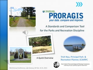
A Standards and Comparison Tool
for the Parks and Recreation Discipline
Trish Nau, Principal Park &
Recreation Planner, ECWRPC
WLIA Annual Conference, Lake Geneva, WI Feb. 13-15, 2013
A Quick Overview
• PRORAGIS, is short for Park and Recreation
Operating Ratio and Geographic Information
System.
• It is a national database that allows park and
recreation agencies to benchmark with others,
develop program planning, while enhancing
overall community operations.
WLIA Annual Conference, Lake Geneva, WI Feb. 13-15, 2013
http://www.nrpa.org/PRORAGIS/
» Launched in January 2011.
» Searchable, online database whereby the user
(public park and recreation department) fills in
valuable information on their profile and controls
that data.
» The data is used to generate a variety of reports
and users have access to GIS mapping tools.
» PRORAGIS is a merger of two preceding NRPA
products: the 2009 Operating Ratio Study and the
NRPA GIS Model.
WLIA Annual Conference, Lake Geneva, WI Feb. 13-15, 2013
» 2008, the American Park and Recreation Society (APRS) branch of
NRPA sought a means of updating the facility and area standards that
had become guidelines by the 1980’s. A project was funded and launched by
APRS/NRPA to standardize the park, trails and facility terminology for Geographic
Information Systems (GIS).
» 2009, NRPA funded and conducted an Operating Ratio
Internet Survey to get a database that answers basic operation and
management questions - could be compared with peers through the
use of ratios as a performance measure, e.g., acres per 1,000 residents
and similar. (10 acres per 1,000 is what ECWRPC uses)
» In the spring of 2010, NRPA and APRS determined that developing an
online profile that was updateable, real-time, and available for
members on a 24/7/365 basis was preferable to an annual survey with
reports that could age. It was also determined that benefit could be found by
using the new GIS Model as part of the on-line profile.
WLIA Annual Conference, Lake Geneva, WI Feb. 13-15, 2013
» Comparison survey of peers
» Master planning of parks
» Comprehensive jurisdiction planning
» Strategic planning
» Business and revenue-generation planning
» Marketing of facilities, programs, and tourist
attractions
» Justification of departmental budgets (ROI)
WLIA Annual Conference, Lake Geneva, WI Feb. 13-15, 2013
» Operating sections
˃ Jurisdiction Information
˃ Department Details
˃ Programs Information
˃ Budget/Funding
˃ Personnel Information
˃ Facilities
˃ Land Information
» GIS Elements
˃ Parks
˃ Trails
˃ Facilities
WLIA Annual Conference, Lake Geneva, WI Feb. 13-15, 2013
Breakdown:
WLIA Annual Conference, Lake Geneva, WI Feb. 13-15, 2013
Only 3 Wisconsin Counties have
completed their profiles so far
More entities probably have
completed their reports than shown –
municipal level
WLIA Annual Conference, Lake Geneva, WI Feb. 13-15, 2013
» Create points, lines and polygons representing your
parks, facilities and trails on the fly.
» Upload your park, facility and trail data from the
preformatted excel spreadsheet; search for features
and associate each record with a point, line or
polygon using GIS application tools.
or
» Upload your GIS data in the NRPA schema as a
zipped file geodatabase. (easiest, less time)
» View your assets and print a map
Manage your parks, facilities, and trails:
» Many Attributes listed: parks, facilities, and trails
WLIA Annual Conference, Lake Geneva, WI Feb. 13-15, 2013
Excel Format for
Departments with no GIS
WLIA Annual Conference, Lake Geneva, WI Feb. 13-15, 2013
Lat/Long
Coordinates
WLIA Annual Conference, Lake Geneva, WI Feb. 13-15, 2013
Park / Facility Polygons Trail Arcs
25+ Fields
WLIA Annual Conference, Lake Geneva, WI Feb. 13-15, 2013
» Conversion models should be written
to ease the data import process (select and calculate)
ECWRPC has written some models for
County data conversions but not NRPA
as of yet.
WLIA Annual Conference, Lake Geneva, WI Feb. 13-15, 2013
http://www.nrpa.org/proragis/
WLIA Annual Conference, Lake Geneva, WI Feb. 13-15, 2013
» Inform your parks departments that
PRORAGIS is a great resource
» Provide the GIS data / assist with importing – Open
Data Sharing/Open Records
» A great benchmark for comparison
» Participating in PRORAGIS helps your department,
helps your county/municipality, and helps NRPA be
a better advocate for parks and recreation
nationwide
» Justification for needs of your community
» Participation is free* and voluntary
WLIA Annual Conference, Lake Geneva, WI Feb. 13-15, 2013
*Free profile and data entry, fee or membership to NRPA to
access database information of others.
WLIA Annual Conference, Lake Geneva, WI Feb. 13-15, 2013
http://www.nrpa.org/proragis/
http://www.nrpa.connect.org/PRORAGIS
Webinars and Assistance
WLIA Annual Conference, Lake Geneva, WI Feb. 13-15, 2013
http://www.nrpa.org/proragis/
» Trish Nau, Principal Recreation Planner
» ECWRPC
» 400 Ahnaip Street, Suite 100
» Menasha, WI 54952
» tnau@eastcentralrpc.org
» www.eastcentralrpc.org
WLIA Annual Conference, Lake Geneva, WI Feb. 13-15, 2013

Contenu connexe

Tendances

All You Need is GIS
All You Need is GIS All You Need is GIS
All You Need is GIS MVRPC
 
Mvrpcgis p&z 2016
Mvrpcgis p&z 2016Mvrpcgis p&z 2016
Mvrpcgis p&z 2016MVRPC
 
Geospatial Information Status Data
Geospatial Information Status DataGeospatial Information Status Data
Geospatial Information Status DataMgs Zulfikar Rasyidi
 
The power of maps
The power of mapsThe power of maps
The power of mapsIRC
 
2015 GIS Colorado Track: Migrating the City’s Intranet to Geocortex by Bruce ...
2015 GIS Colorado Track: Migrating the City’s Intranet to Geocortex by Bruce ...2015 GIS Colorado Track: Migrating the City’s Intranet to Geocortex by Bruce ...
2015 GIS Colorado Track: Migrating the City’s Intranet to Geocortex by Bruce ...GIS in the Rockies
 
Mapping Extension Community and Economic Projects and News using Open Source ...
Mapping Extension Community and Economic Projects and News using Open Source ...Mapping Extension Community and Economic Projects and News using Open Source ...
Mapping Extension Community and Economic Projects and News using Open Source ...bahanson
 
Summer 2013
Summer 2013Summer 2013
Summer 2013Esri
 
City bench iswc_2015
City bench iswc_2015City bench iswc_2015
City bench iswc_2015Ali Intizar
 
2017 GIS in Conservation Track: Using Python and Selenium to Make Geographica...
2017 GIS in Conservation Track: Using Python and Selenium to Make Geographica...2017 GIS in Conservation Track: Using Python and Selenium to Make Geographica...
2017 GIS in Conservation Track: Using Python and Selenium to Make Geographica...GIS in the Rockies
 
2010 Gist
2010 Gist2010 Gist
2010 Gistfjudson
 

Tendances (19)

All You Need is GIS
All You Need is GIS All You Need is GIS
All You Need is GIS
 
Mvrpcgis p&z 2016
Mvrpcgis p&z 2016Mvrpcgis p&z 2016
Mvrpcgis p&z 2016
 
GIS in Utah
GIS in UtahGIS in Utah
GIS in Utah
 
Utah Reorganizes its GIS Around Web Services
Utah Reorganizes its GIS Around Web ServicesUtah Reorganizes its GIS Around Web Services
Utah Reorganizes its GIS Around Web Services
 
WV DOT Transportatino GIS User Day (2010)
WV DOT Transportatino GIS User Day (2010)WV DOT Transportatino GIS User Day (2010)
WV DOT Transportatino GIS User Day (2010)
 
Overview of geographic information systems (gis)
Overview of geographic information systems (gis)Overview of geographic information systems (gis)
Overview of geographic information systems (gis)
 
Geospatial Information Status Data
Geospatial Information Status DataGeospatial Information Status Data
Geospatial Information Status Data
 
Resume for Web
Resume for WebResume for Web
Resume for Web
 
GIS@NIH
GIS@NIHGIS@NIH
GIS@NIH
 
GIS TECH 201 - Mapping Mashups
GIS TECH 201 - Mapping MashupsGIS TECH 201 - Mapping Mashups
GIS TECH 201 - Mapping Mashups
 
The power of maps
The power of mapsThe power of maps
The power of maps
 
Creating An Online Atlas
Creating An Online AtlasCreating An Online Atlas
Creating An Online Atlas
 
2015 GIS Colorado Track: Migrating the City’s Intranet to Geocortex by Bruce ...
2015 GIS Colorado Track: Migrating the City’s Intranet to Geocortex by Bruce ...2015 GIS Colorado Track: Migrating the City’s Intranet to Geocortex by Bruce ...
2015 GIS Colorado Track: Migrating the City’s Intranet to Geocortex by Bruce ...
 
WAGIS Poster 36x48
WAGIS Poster 36x48WAGIS Poster 36x48
WAGIS Poster 36x48
 
Mapping Extension Community and Economic Projects and News using Open Source ...
Mapping Extension Community and Economic Projects and News using Open Source ...Mapping Extension Community and Economic Projects and News using Open Source ...
Mapping Extension Community and Economic Projects and News using Open Source ...
 
Summer 2013
Summer 2013Summer 2013
Summer 2013
 
City bench iswc_2015
City bench iswc_2015City bench iswc_2015
City bench iswc_2015
 
2017 GIS in Conservation Track: Using Python and Selenium to Make Geographica...
2017 GIS in Conservation Track: Using Python and Selenium to Make Geographica...2017 GIS in Conservation Track: Using Python and Selenium to Make Geographica...
2017 GIS in Conservation Track: Using Python and Selenium to Make Geographica...
 
2010 Gist
2010 Gist2010 Gist
2010 Gist
 

En vedette

Getting a Handle on Open Source Web Mapping Technologies - Robert Roth
Getting a Handle on Open Source Web Mapping Technologies - Robert RothGetting a Handle on Open Source Web Mapping Technologies - Robert Roth
Getting a Handle on Open Source Web Mapping Technologies - Robert RothWisconsin Land Information Association
 
Implementing arc gis 10.1 for the wisconsin dnr nhi portal levi felling
Implementing arc gis 10.1 for the wisconsin dnr nhi portal   levi fellingImplementing arc gis 10.1 for the wisconsin dnr nhi portal   levi felling
Implementing arc gis 10.1 for the wisconsin dnr nhi portal levi fellingWisconsin Land Information Association
 
Тактики і стратегії боротьби з поширеністю тютюнокуріння (березень 2011)
Тактики і стратегії боротьби з поширеністю тютюнокуріння (березень 2011)Тактики і стратегії боротьби з поширеністю тютюнокуріння (березень 2011)
Тактики і стратегії боротьби з поширеністю тютюнокуріння (березень 2011)SmokeFreeKyiv
 

En vedette (6)

Regional Projects: Working Together
Regional Projects: Working TogetherRegional Projects: Working Together
Regional Projects: Working Together
 
Getting a Handle on Open Source Web Mapping Technologies - Robert Roth
Getting a Handle on Open Source Web Mapping Technologies - Robert RothGetting a Handle on Open Source Web Mapping Technologies - Robert Roth
Getting a Handle on Open Source Web Mapping Technologies - Robert Roth
 
Implementing arc gis 10.1 for the wisconsin dnr nhi portal levi felling
Implementing arc gis 10.1 for the wisconsin dnr nhi portal   levi fellingImplementing arc gis 10.1 for the wisconsin dnr nhi portal   levi felling
Implementing arc gis 10.1 for the wisconsin dnr nhi portal levi felling
 
WEDC - Statewide Economic Development Program
WEDC - Statewide Economic Development ProgramWEDC - Statewide Economic Development Program
WEDC - Statewide Economic Development Program
 
Тактики і стратегії боротьби з поширеністю тютюнокуріння (березень 2011)
Тактики і стратегії боротьби з поширеністю тютюнокуріння (березень 2011)Тактики і стратегії боротьби з поширеністю тютюнокуріння (березень 2011)
Тактики і стратегії боротьби з поширеністю тютюнокуріння (березень 2011)
 
Wisconsin Land Survey Network
Wisconsin Land Survey NetworkWisconsin Land Survey Network
Wisconsin Land Survey Network
 

Similaire à Gis in parks and recreation the proragis website - trish nau

Introduction to New Jersey's State Broadband Initiative and Broadband Data Map
Introduction to New Jersey's State Broadband Initiative and Broadband Data MapIntroduction to New Jersey's State Broadband Initiative and Broadband Data Map
Introduction to New Jersey's State Broadband Initiative and Broadband Data MapConnectingNJ
 
CaBA Learning Workshops - Mapping, Modelling and Data Management
CaBA Learning Workshops - Mapping, Modelling and Data ManagementCaBA Learning Workshops - Mapping, Modelling and Data Management
CaBA Learning Workshops - Mapping, Modelling and Data ManagementCaBASupport
 
The Gila-Salt-Verde River System: Improving River Forecasts and Emergency Man...
The Gila-Salt-Verde River System: Improving River Forecasts and Emergency Man...The Gila-Salt-Verde River System: Improving River Forecasts and Emergency Man...
The Gila-Salt-Verde River System: Improving River Forecasts and Emergency Man...Douglas B. Blatchford, PE, PH, CEM, CFM
 
20131030 baid nssi_briefing
20131030 baid nssi_briefing20131030 baid nssi_briefing
20131030 baid nssi_briefingProper Printshop
 
Rivero - Data Value Chain
Rivero - Data Value ChainRivero - Data Value Chain
Rivero - Data Value ChainCarlos Rivero
 
Data and information management for M&E of national adaptation
Data and information management for M&E of national adaptationData and information management for M&E of national adaptation
Data and information management for M&E of national adaptationNAP Global Network
 
Health Datapalooza 2013: Apps Expo Health Landscape
Health Datapalooza 2013: Apps Expo Health LandscapeHealth Datapalooza 2013: Apps Expo Health Landscape
Health Datapalooza 2013: Apps Expo Health LandscapeHealth Data Consortium
 
ONS Local presents Suffolk County Council's Cost of Living Dashboard
ONS Local presents Suffolk County Council's Cost of Living DashboardONS Local presents Suffolk County Council's Cost of Living Dashboard
ONS Local presents Suffolk County Council's Cost of Living DashboardOffice for National Statistics
 
20140506-NCAMPO-GIS - NC Pedestrian and Bicycle Infrastructure Network
20140506-NCAMPO-GIS - NC Pedestrian and Bicycle Infrastructure Network20140506-NCAMPO-GIS - NC Pedestrian and Bicycle Infrastructure Network
20140506-NCAMPO-GIS - NC Pedestrian and Bicycle Infrastructure NetworkKristy Jackson
 
Portfolio_YuPoChiu
Portfolio_YuPoChiuPortfolio_YuPoChiu
Portfolio_YuPoChiuBrian Chiu
 
Open Source Leadership Management Dashboard Powerpoint
Open Source Leadership Management Dashboard Powerpoint Open Source Leadership Management Dashboard Powerpoint
Open Source Leadership Management Dashboard Powerpoint Joe Barbano
 
Paul Davidson – Opening up public data to improve transparancy and efficiency
Paul Davidson – Opening up public data to improve transparancy and efficiencyPaul Davidson – Opening up public data to improve transparancy and efficiency
Paul Davidson – Opening up public data to improve transparancy and efficiencyCorvé Open Government Preconference 2010
 
wq session ppt 4-12-13
wq session ppt 4-12-13wq session ppt 4-12-13
wq session ppt 4-12-13Patrick Hegge
 

Similaire à Gis in parks and recreation the proragis website - trish nau (20)

Rivero - VIPER
Rivero - VIPERRivero - VIPER
Rivero - VIPER
 
Introduction to New Jersey's State Broadband Initiative and Broadband Data Map
Introduction to New Jersey's State Broadband Initiative and Broadband Data MapIntroduction to New Jersey's State Broadband Initiative and Broadband Data Map
Introduction to New Jersey's State Broadband Initiative and Broadband Data Map
 
Innovations in Data for Decision Making
Innovations in Data for Decision MakingInnovations in Data for Decision Making
Innovations in Data for Decision Making
 
CaBA Learning Workshops - Mapping, Modelling and Data Management
CaBA Learning Workshops - Mapping, Modelling and Data ManagementCaBA Learning Workshops - Mapping, Modelling and Data Management
CaBA Learning Workshops - Mapping, Modelling and Data Management
 
The Gila-Salt-Verde River System: Improving River Forecasts and Emergency Man...
The Gila-Salt-Verde River System: Improving River Forecasts and Emergency Man...The Gila-Salt-Verde River System: Improving River Forecasts and Emergency Man...
The Gila-Salt-Verde River System: Improving River Forecasts and Emergency Man...
 
20131030 baid nssi_briefing
20131030 baid nssi_briefing20131030 baid nssi_briefing
20131030 baid nssi_briefing
 
Rivero - Data Value Chain
Rivero - Data Value ChainRivero - Data Value Chain
Rivero - Data Value Chain
 
INS Tunisia Dissemination strategy, 2015
INS Tunisia Dissemination strategy, 2015 INS Tunisia Dissemination strategy, 2015
INS Tunisia Dissemination strategy, 2015
 
ngis-value-chain
ngis-value-chainngis-value-chain
ngis-value-chain
 
Data and information management for M&E of national adaptation
Data and information management for M&E of national adaptationData and information management for M&E of national adaptation
Data and information management for M&E of national adaptation
 
Health Datapalooza 2013: Apps Expo Health Landscape
Health Datapalooza 2013: Apps Expo Health LandscapeHealth Datapalooza 2013: Apps Expo Health Landscape
Health Datapalooza 2013: Apps Expo Health Landscape
 
ONS Local presents Suffolk County Council's Cost of Living Dashboard
ONS Local presents Suffolk County Council's Cost of Living DashboardONS Local presents Suffolk County Council's Cost of Living Dashboard
ONS Local presents Suffolk County Council's Cost of Living Dashboard
 
20140506-NCAMPO-GIS - NC Pedestrian and Bicycle Infrastructure Network
20140506-NCAMPO-GIS - NC Pedestrian and Bicycle Infrastructure Network20140506-NCAMPO-GIS - NC Pedestrian and Bicycle Infrastructure Network
20140506-NCAMPO-GIS - NC Pedestrian and Bicycle Infrastructure Network
 
NCompass Live: Accessing Census Data
NCompass Live: Accessing Census Data NCompass Live: Accessing Census Data
NCompass Live: Accessing Census Data
 
Portfolio_YuPoChiu
Portfolio_YuPoChiuPortfolio_YuPoChiu
Portfolio_YuPoChiu
 
Open Source Leadership Management Dashboard Powerpoint
Open Source Leadership Management Dashboard Powerpoint Open Source Leadership Management Dashboard Powerpoint
Open Source Leadership Management Dashboard Powerpoint
 
LinkedIn-Presentations
LinkedIn-PresentationsLinkedIn-Presentations
LinkedIn-Presentations
 
Paul Davidson – Opening up public data to improve transparancy and efficiency
Paul Davidson – Opening up public data to improve transparancy and efficiencyPaul Davidson – Opening up public data to improve transparancy and efficiency
Paul Davidson – Opening up public data to improve transparancy and efficiency
 
U.S Census Bureau Data Tools Handout
U.S Census Bureau Data Tools HandoutU.S Census Bureau Data Tools Handout
U.S Census Bureau Data Tools Handout
 
wq session ppt 4-12-13
wq session ppt 4-12-13wq session ppt 4-12-13
wq session ppt 4-12-13
 

Plus de Wisconsin Land Information Association

Workshop using open source software for mobile data collection workshop - a...
Workshop   using open source software for mobile data collection workshop - a...Workshop   using open source software for mobile data collection workshop - a...
Workshop using open source software for mobile data collection workshop - a...Wisconsin Land Information Association
 
Mapping spatial patterns of whai finder usage to measure community outreach e...
Mapping spatial patterns of whai finder usage to measure community outreach e...Mapping spatial patterns of whai finder usage to measure community outreach e...
Mapping spatial patterns of whai finder usage to measure community outreach e...Wisconsin Land Information Association
 
Lakesheds and riverscapes extending wisconsin's hydro database with landsca...
Lakesheds and riverscapes   extending wisconsin's hydro database with landsca...Lakesheds and riverscapes   extending wisconsin's hydro database with landsca...
Lakesheds and riverscapes extending wisconsin's hydro database with landsca...Wisconsin Land Information Association
 
Lake habitat mapping with side scan sonar in nine wisconsin lakes - christine...
Lake habitat mapping with side scan sonar in nine wisconsin lakes - christine...Lake habitat mapping with side scan sonar in nine wisconsin lakes - christine...
Lake habitat mapping with side scan sonar in nine wisconsin lakes - christine...Wisconsin Land Information Association
 
Integrating sanitary televising data with utility gis data within the city of...
Integrating sanitary televising data with utility gis data within the city of...Integrating sanitary televising data with utility gis data within the city of...
Integrating sanitary televising data with utility gis data within the city of...Wisconsin Land Information Association
 
Integrating high accuracy gps with esri's arc gis for windows mobile field so...
Integrating high accuracy gps with esri's arc gis for windows mobile field so...Integrating high accuracy gps with esri's arc gis for windows mobile field so...
Integrating high accuracy gps with esri's arc gis for windows mobile field so...Wisconsin Land Information Association
 
City of ashland an analysis of mobile gis through amazon elastic cloud comp...
City of ashland   an analysis of mobile gis through amazon elastic cloud comp...City of ashland   an analysis of mobile gis through amazon elastic cloud comp...
City of ashland an analysis of mobile gis through amazon elastic cloud comp...Wisconsin Land Information Association
 

Plus de Wisconsin Land Information Association (20)

Airphoto anomilies
Airphoto anomiliesAirphoto anomilies
Airphoto anomilies
 
A wikimap of landscape values in the bad river watershed carl sack
A wikimap of landscape values in the bad river watershed   carl sackA wikimap of landscape values in the bad river watershed   carl sack
A wikimap of landscape values in the bad river watershed carl sack
 
Workshop using open source software for mobile data collection workshop - a...
Workshop   using open source software for mobile data collection workshop - a...Workshop   using open source software for mobile data collection workshop - a...
Workshop using open source software for mobile data collection workshop - a...
 
Wigicc's role in wisconsin jon schwitchtenberg
Wigicc's role in wisconsin   jon schwitchtenbergWigicc's role in wisconsin   jon schwitchtenberg
Wigicc's role in wisconsin jon schwitchtenberg
 
Wi 590 nutrient management web application lisa morrison
Wi 590 nutrient management web application   lisa morrisonWi 590 nutrient management web application   lisa morrison
Wi 590 nutrient management web application lisa morrison
 
Surveying and land records management dean roth
Surveying and land records management   dean rothSurveying and land records management   dean roth
Surveying and land records management dean roth
 
Mapping spatial patterns of whai finder usage to measure community outreach e...
Mapping spatial patterns of whai finder usage to measure community outreach e...Mapping spatial patterns of whai finder usage to measure community outreach e...
Mapping spatial patterns of whai finder usage to measure community outreach e...
 
Local gis in the statewide voter registration system sarah whitt
Local gis in the statewide voter registration system   sarah whittLocal gis in the statewide voter registration system   sarah whitt
Local gis in the statewide voter registration system sarah whitt
 
Li dar quality control a client's perspective - tyler grosshuesch
Li dar quality control   a client's perspective - tyler grosshueschLi dar quality control   a client's perspective - tyler grosshuesch
Li dar quality control a client's perspective - tyler grosshuesch
 
Li dar meets wisconsinview jc nelson
Li dar meets wisconsinview   jc nelsonLi dar meets wisconsinview   jc nelson
Li dar meets wisconsinview jc nelson
 
Lakesheds and riverscapes extending wisconsin's hydro database with landsca...
Lakesheds and riverscapes   extending wisconsin's hydro database with landsca...Lakesheds and riverscapes   extending wisconsin's hydro database with landsca...
Lakesheds and riverscapes extending wisconsin's hydro database with landsca...
 
Lake habitat mapping with side scan sonar in nine wisconsin lakes - christine...
Lake habitat mapping with side scan sonar in nine wisconsin lakes - christine...Lake habitat mapping with side scan sonar in nine wisconsin lakes - christine...
Lake habitat mapping with side scan sonar in nine wisconsin lakes - christine...
 
Integrative mapping strategies jeremy bixby
Integrative mapping strategies   jeremy bixbyIntegrative mapping strategies   jeremy bixby
Integrative mapping strategies jeremy bixby
 
Integrating sanitary televising data with utility gis data within the city of...
Integrating sanitary televising data with utility gis data within the city of...Integrating sanitary televising data with utility gis data within the city of...
Integrating sanitary televising data with utility gis data within the city of...
 
Integrating high accuracy gps with esri's arc gis for windows mobile field so...
Integrating high accuracy gps with esri's arc gis for windows mobile field so...Integrating high accuracy gps with esri's arc gis for windows mobile field so...
Integrating high accuracy gps with esri's arc gis for windows mobile field so...
 
Geo moose project update brian fischer
Geo moose project update   brian fischerGeo moose project update   brian fischer
Geo moose project update brian fischer
 
Elevation hydrology tools kent pena
Elevation hydrology tools   kent penaElevation hydrology tools   kent pena
Elevation hydrology tools kent pena
 
Developing mobile apps pick your poison - levi felling
Developing mobile apps   pick your poison - levi fellingDeveloping mobile apps   pick your poison - levi felling
Developing mobile apps pick your poison - levi felling
 
City of ashland an analysis of mobile gis through amazon elastic cloud comp...
City of ashland   an analysis of mobile gis through amazon elastic cloud comp...City of ashland   an analysis of mobile gis through amazon elastic cloud comp...
City of ashland an analysis of mobile gis through amazon elastic cloud comp...
 
Open source web mapping system launch and demonstration andy swartz
Open source web mapping system launch and demonstration   andy swartzOpen source web mapping system launch and demonstration   andy swartz
Open source web mapping system launch and demonstration andy swartz
 

Dernier

Finology Group – Insurtech Innovation Award 2024
Finology Group – Insurtech Innovation Award 2024Finology Group – Insurtech Innovation Award 2024
Finology Group – Insurtech Innovation Award 2024The Digital Insurer
 
TrustArc Webinar - Stay Ahead of US State Data Privacy Law Developments
TrustArc Webinar - Stay Ahead of US State Data Privacy Law DevelopmentsTrustArc Webinar - Stay Ahead of US State Data Privacy Law Developments
TrustArc Webinar - Stay Ahead of US State Data Privacy Law DevelopmentsTrustArc
 
08448380779 Call Girls In Civil Lines Women Seeking Men
08448380779 Call Girls In Civil Lines Women Seeking Men08448380779 Call Girls In Civil Lines Women Seeking Men
08448380779 Call Girls In Civil Lines Women Seeking MenDelhi Call girls
 
Boost Fertility New Invention Ups Success Rates.pdf
Boost Fertility New Invention Ups Success Rates.pdfBoost Fertility New Invention Ups Success Rates.pdf
Boost Fertility New Invention Ups Success Rates.pdfsudhanshuwaghmare1
 
Raspberry Pi 5: Challenges and Solutions in Bringing up an OpenGL/Vulkan Driv...
Raspberry Pi 5: Challenges and Solutions in Bringing up an OpenGL/Vulkan Driv...Raspberry Pi 5: Challenges and Solutions in Bringing up an OpenGL/Vulkan Driv...
Raspberry Pi 5: Challenges and Solutions in Bringing up an OpenGL/Vulkan Driv...Igalia
 
Bajaj Allianz Life Insurance Company - Insurer Innovation Award 2024
Bajaj Allianz Life Insurance Company - Insurer Innovation Award 2024Bajaj Allianz Life Insurance Company - Insurer Innovation Award 2024
Bajaj Allianz Life Insurance Company - Insurer Innovation Award 2024The Digital Insurer
 
04-2024-HHUG-Sales-and-Marketing-Alignment.pptx
04-2024-HHUG-Sales-and-Marketing-Alignment.pptx04-2024-HHUG-Sales-and-Marketing-Alignment.pptx
04-2024-HHUG-Sales-and-Marketing-Alignment.pptxHampshireHUG
 
Handwritten Text Recognition for manuscripts and early printed texts
Handwritten Text Recognition for manuscripts and early printed textsHandwritten Text Recognition for manuscripts and early printed texts
Handwritten Text Recognition for manuscripts and early printed textsMaria Levchenko
 
Automating Google Workspace (GWS) & more with Apps Script
Automating Google Workspace (GWS) & more with Apps ScriptAutomating Google Workspace (GWS) & more with Apps Script
Automating Google Workspace (GWS) & more with Apps Scriptwesley chun
 
Driving Behavioral Change for Information Management through Data-Driven Gree...
Driving Behavioral Change for Information Management through Data-Driven Gree...Driving Behavioral Change for Information Management through Data-Driven Gree...
Driving Behavioral Change for Information Management through Data-Driven Gree...Enterprise Knowledge
 
Apidays Singapore 2024 - Building Digital Trust in a Digital Economy by Veron...
Apidays Singapore 2024 - Building Digital Trust in a Digital Economy by Veron...Apidays Singapore 2024 - Building Digital Trust in a Digital Economy by Veron...
Apidays Singapore 2024 - Building Digital Trust in a Digital Economy by Veron...apidays
 
How to Troubleshoot Apps for the Modern Connected Worker
How to Troubleshoot Apps for the Modern Connected WorkerHow to Troubleshoot Apps for the Modern Connected Worker
How to Troubleshoot Apps for the Modern Connected WorkerThousandEyes
 
How to Troubleshoot Apps for the Modern Connected Worker
How to Troubleshoot Apps for the Modern Connected WorkerHow to Troubleshoot Apps for the Modern Connected Worker
How to Troubleshoot Apps for the Modern Connected WorkerThousandEyes
 
Scaling API-first – The story of a global engineering organization
Scaling API-first – The story of a global engineering organizationScaling API-first – The story of a global engineering organization
Scaling API-first – The story of a global engineering organizationRadu Cotescu
 
Histor y of HAM Radio presentation slide
Histor y of HAM Radio presentation slideHistor y of HAM Radio presentation slide
Histor y of HAM Radio presentation slidevu2urc
 
Workshop - Best of Both Worlds_ Combine KG and Vector search for enhanced R...
Workshop - Best of Both Worlds_ Combine  KG and Vector search for  enhanced R...Workshop - Best of Both Worlds_ Combine  KG and Vector search for  enhanced R...
Workshop - Best of Both Worlds_ Combine KG and Vector search for enhanced R...Neo4j
 
What Are The Drone Anti-jamming Systems Technology?
What Are The Drone Anti-jamming Systems Technology?What Are The Drone Anti-jamming Systems Technology?
What Are The Drone Anti-jamming Systems Technology?Antenna Manufacturer Coco
 
Mastering MySQL Database Architecture: Deep Dive into MySQL Shell and MySQL R...
Mastering MySQL Database Architecture: Deep Dive into MySQL Shell and MySQL R...Mastering MySQL Database Architecture: Deep Dive into MySQL Shell and MySQL R...
Mastering MySQL Database Architecture: Deep Dive into MySQL Shell and MySQL R...Miguel Araújo
 
Tech Trends Report 2024 Future Today Institute.pdf
Tech Trends Report 2024 Future Today Institute.pdfTech Trends Report 2024 Future Today Institute.pdf
Tech Trends Report 2024 Future Today Institute.pdfhans926745
 
Understanding Discord NSFW Servers A Guide for Responsible Users.pdf
Understanding Discord NSFW Servers A Guide for Responsible Users.pdfUnderstanding Discord NSFW Servers A Guide for Responsible Users.pdf
Understanding Discord NSFW Servers A Guide for Responsible Users.pdfUK Journal
 

Dernier (20)

Finology Group – Insurtech Innovation Award 2024
Finology Group – Insurtech Innovation Award 2024Finology Group – Insurtech Innovation Award 2024
Finology Group – Insurtech Innovation Award 2024
 
TrustArc Webinar - Stay Ahead of US State Data Privacy Law Developments
TrustArc Webinar - Stay Ahead of US State Data Privacy Law DevelopmentsTrustArc Webinar - Stay Ahead of US State Data Privacy Law Developments
TrustArc Webinar - Stay Ahead of US State Data Privacy Law Developments
 
08448380779 Call Girls In Civil Lines Women Seeking Men
08448380779 Call Girls In Civil Lines Women Seeking Men08448380779 Call Girls In Civil Lines Women Seeking Men
08448380779 Call Girls In Civil Lines Women Seeking Men
 
Boost Fertility New Invention Ups Success Rates.pdf
Boost Fertility New Invention Ups Success Rates.pdfBoost Fertility New Invention Ups Success Rates.pdf
Boost Fertility New Invention Ups Success Rates.pdf
 
Raspberry Pi 5: Challenges and Solutions in Bringing up an OpenGL/Vulkan Driv...
Raspberry Pi 5: Challenges and Solutions in Bringing up an OpenGL/Vulkan Driv...Raspberry Pi 5: Challenges and Solutions in Bringing up an OpenGL/Vulkan Driv...
Raspberry Pi 5: Challenges and Solutions in Bringing up an OpenGL/Vulkan Driv...
 
Bajaj Allianz Life Insurance Company - Insurer Innovation Award 2024
Bajaj Allianz Life Insurance Company - Insurer Innovation Award 2024Bajaj Allianz Life Insurance Company - Insurer Innovation Award 2024
Bajaj Allianz Life Insurance Company - Insurer Innovation Award 2024
 
04-2024-HHUG-Sales-and-Marketing-Alignment.pptx
04-2024-HHUG-Sales-and-Marketing-Alignment.pptx04-2024-HHUG-Sales-and-Marketing-Alignment.pptx
04-2024-HHUG-Sales-and-Marketing-Alignment.pptx
 
Handwritten Text Recognition for manuscripts and early printed texts
Handwritten Text Recognition for manuscripts and early printed textsHandwritten Text Recognition for manuscripts and early printed texts
Handwritten Text Recognition for manuscripts and early printed texts
 
Automating Google Workspace (GWS) & more with Apps Script
Automating Google Workspace (GWS) & more with Apps ScriptAutomating Google Workspace (GWS) & more with Apps Script
Automating Google Workspace (GWS) & more with Apps Script
 
Driving Behavioral Change for Information Management through Data-Driven Gree...
Driving Behavioral Change for Information Management through Data-Driven Gree...Driving Behavioral Change for Information Management through Data-Driven Gree...
Driving Behavioral Change for Information Management through Data-Driven Gree...
 
Apidays Singapore 2024 - Building Digital Trust in a Digital Economy by Veron...
Apidays Singapore 2024 - Building Digital Trust in a Digital Economy by Veron...Apidays Singapore 2024 - Building Digital Trust in a Digital Economy by Veron...
Apidays Singapore 2024 - Building Digital Trust in a Digital Economy by Veron...
 
How to Troubleshoot Apps for the Modern Connected Worker
How to Troubleshoot Apps for the Modern Connected WorkerHow to Troubleshoot Apps for the Modern Connected Worker
How to Troubleshoot Apps for the Modern Connected Worker
 
How to Troubleshoot Apps for the Modern Connected Worker
How to Troubleshoot Apps for the Modern Connected WorkerHow to Troubleshoot Apps for the Modern Connected Worker
How to Troubleshoot Apps for the Modern Connected Worker
 
Scaling API-first – The story of a global engineering organization
Scaling API-first – The story of a global engineering organizationScaling API-first – The story of a global engineering organization
Scaling API-first – The story of a global engineering organization
 
Histor y of HAM Radio presentation slide
Histor y of HAM Radio presentation slideHistor y of HAM Radio presentation slide
Histor y of HAM Radio presentation slide
 
Workshop - Best of Both Worlds_ Combine KG and Vector search for enhanced R...
Workshop - Best of Both Worlds_ Combine  KG and Vector search for  enhanced R...Workshop - Best of Both Worlds_ Combine  KG and Vector search for  enhanced R...
Workshop - Best of Both Worlds_ Combine KG and Vector search for enhanced R...
 
What Are The Drone Anti-jamming Systems Technology?
What Are The Drone Anti-jamming Systems Technology?What Are The Drone Anti-jamming Systems Technology?
What Are The Drone Anti-jamming Systems Technology?
 
Mastering MySQL Database Architecture: Deep Dive into MySQL Shell and MySQL R...
Mastering MySQL Database Architecture: Deep Dive into MySQL Shell and MySQL R...Mastering MySQL Database Architecture: Deep Dive into MySQL Shell and MySQL R...
Mastering MySQL Database Architecture: Deep Dive into MySQL Shell and MySQL R...
 
Tech Trends Report 2024 Future Today Institute.pdf
Tech Trends Report 2024 Future Today Institute.pdfTech Trends Report 2024 Future Today Institute.pdf
Tech Trends Report 2024 Future Today Institute.pdf
 
Understanding Discord NSFW Servers A Guide for Responsible Users.pdf
Understanding Discord NSFW Servers A Guide for Responsible Users.pdfUnderstanding Discord NSFW Servers A Guide for Responsible Users.pdf
Understanding Discord NSFW Servers A Guide for Responsible Users.pdf
 

Gis in parks and recreation the proragis website - trish nau

  • 1. A Standards and Comparison Tool for the Parks and Recreation Discipline Trish Nau, Principal Park & Recreation Planner, ECWRPC WLIA Annual Conference, Lake Geneva, WI Feb. 13-15, 2013 A Quick Overview
  • 2. • PRORAGIS, is short for Park and Recreation Operating Ratio and Geographic Information System. • It is a national database that allows park and recreation agencies to benchmark with others, develop program planning, while enhancing overall community operations. WLIA Annual Conference, Lake Geneva, WI Feb. 13-15, 2013 http://www.nrpa.org/PRORAGIS/
  • 3. » Launched in January 2011. » Searchable, online database whereby the user (public park and recreation department) fills in valuable information on their profile and controls that data. » The data is used to generate a variety of reports and users have access to GIS mapping tools. » PRORAGIS is a merger of two preceding NRPA products: the 2009 Operating Ratio Study and the NRPA GIS Model. WLIA Annual Conference, Lake Geneva, WI Feb. 13-15, 2013
  • 4. » 2008, the American Park and Recreation Society (APRS) branch of NRPA sought a means of updating the facility and area standards that had become guidelines by the 1980’s. A project was funded and launched by APRS/NRPA to standardize the park, trails and facility terminology for Geographic Information Systems (GIS). » 2009, NRPA funded and conducted an Operating Ratio Internet Survey to get a database that answers basic operation and management questions - could be compared with peers through the use of ratios as a performance measure, e.g., acres per 1,000 residents and similar. (10 acres per 1,000 is what ECWRPC uses) » In the spring of 2010, NRPA and APRS determined that developing an online profile that was updateable, real-time, and available for members on a 24/7/365 basis was preferable to an annual survey with reports that could age. It was also determined that benefit could be found by using the new GIS Model as part of the on-line profile. WLIA Annual Conference, Lake Geneva, WI Feb. 13-15, 2013
  • 5. » Comparison survey of peers » Master planning of parks » Comprehensive jurisdiction planning » Strategic planning » Business and revenue-generation planning » Marketing of facilities, programs, and tourist attractions » Justification of departmental budgets (ROI) WLIA Annual Conference, Lake Geneva, WI Feb. 13-15, 2013
  • 6. » Operating sections ˃ Jurisdiction Information ˃ Department Details ˃ Programs Information ˃ Budget/Funding ˃ Personnel Information ˃ Facilities ˃ Land Information » GIS Elements ˃ Parks ˃ Trails ˃ Facilities WLIA Annual Conference, Lake Geneva, WI Feb. 13-15, 2013 Breakdown:
  • 7. WLIA Annual Conference, Lake Geneva, WI Feb. 13-15, 2013 Only 3 Wisconsin Counties have completed their profiles so far More entities probably have completed their reports than shown – municipal level
  • 8. WLIA Annual Conference, Lake Geneva, WI Feb. 13-15, 2013
  • 9. WLIA Annual Conference, Lake Geneva, WI Feb. 13-15, 2013 » Create points, lines and polygons representing your parks, facilities and trails on the fly. » Upload your park, facility and trail data from the preformatted excel spreadsheet; search for features and associate each record with a point, line or polygon using GIS application tools. or » Upload your GIS data in the NRPA schema as a zipped file geodatabase. (easiest, less time) » View your assets and print a map Manage your parks, facilities, and trails:
  • 10. » Many Attributes listed: parks, facilities, and trails WLIA Annual Conference, Lake Geneva, WI Feb. 13-15, 2013 Excel Format for Departments with no GIS
  • 11. WLIA Annual Conference, Lake Geneva, WI Feb. 13-15, 2013 Lat/Long Coordinates
  • 12. WLIA Annual Conference, Lake Geneva, WI Feb. 13-15, 2013 Park / Facility Polygons Trail Arcs 25+ Fields
  • 13. WLIA Annual Conference, Lake Geneva, WI Feb. 13-15, 2013 » Conversion models should be written to ease the data import process (select and calculate) ECWRPC has written some models for County data conversions but not NRPA as of yet.
  • 14. WLIA Annual Conference, Lake Geneva, WI Feb. 13-15, 2013 http://www.nrpa.org/proragis/
  • 15. WLIA Annual Conference, Lake Geneva, WI Feb. 13-15, 2013
  • 16. WLIA Annual Conference, Lake Geneva, WI Feb. 13-15, 2013
  • 17. » Inform your parks departments that PRORAGIS is a great resource » Provide the GIS data / assist with importing – Open Data Sharing/Open Records » A great benchmark for comparison » Participating in PRORAGIS helps your department, helps your county/municipality, and helps NRPA be a better advocate for parks and recreation nationwide » Justification for needs of your community » Participation is free* and voluntary WLIA Annual Conference, Lake Geneva, WI Feb. 13-15, 2013 *Free profile and data entry, fee or membership to NRPA to access database information of others.
  • 18. WLIA Annual Conference, Lake Geneva, WI Feb. 13-15, 2013 http://www.nrpa.org/proragis/ http://www.nrpa.connect.org/PRORAGIS Webinars and Assistance
  • 19. WLIA Annual Conference, Lake Geneva, WI Feb. 13-15, 2013 http://www.nrpa.org/proragis/
  • 20. » Trish Nau, Principal Recreation Planner » ECWRPC » 400 Ahnaip Street, Suite 100 » Menasha, WI 54952 » tnau@eastcentralrpc.org » www.eastcentralrpc.org WLIA Annual Conference, Lake Geneva, WI Feb. 13-15, 2013

Notes de l'éditeur

  1. Access site online if you can… show