SlideShare une entreprise Scribd logo
1  sur  36
Télécharger pour lire hors ligne
ATTRA is the national sustainable agriculture information service operated by the National Center for
AppropriateTechnology,throughagrantfromtheRuralBusiness-CooperativeService,U.S.Department
of Agriculture. These organizations do not recommend or endorse products, companies, or individuals.
NCAT has offices in Fayetteville, Arkansas (P.O. Box 3657, Fayetteville, AR 72702), Butte, Montana,
and Davis, California.
By Barbara C. Bellows
NCAT Agriculture Specialist
March 2003
SOIL SYSTEMS GUIDE
PROTECTING RIPARIAN AREAS:
FARMLAND MANAGEMENT
STRATEGIES
Riparian areas include streams, streambanks, and wetlands adjacent to streams. These areas have
a water table high enough to interact with plant roots and affect their growth throughout most of the
year. Plant species that thrive in riparian areas are adapted to wet and flooded conditions. They are
also adapted to regrow root systems in sedi-
ments deposited through soil erosion
(Schneider, 1998).
Healthy riparian areas are critically im-
portant ecological zones. They provide:
• Water quality protection
• Structural support for streambanks
• Water capture and storage
• Flood control
• Stabilization of water flow in streams
and rivers
• Habitat for aquatic and terrestrial wild-
life
• Aesthetic and recreational benefits
Unfortunately, various land use prac-
tices have degraded riparian areas, result-
ing in impaired environmental conditions,
decreased agronomic production, and a multiplicity of social costs. Both agricultural and non-agricul-
tural land use practices are responsible for the degradation of riparian areas. These degrading land
use practices include:
Abstract: This publication is designed to help farmers, watershed managers, and environmentalists understand what
healthy riparian areas look like, how they operate, and why they are important for the environment and society. It also
provides information on the costs and benefits of riparian management and discusses how watershed residents can work
together to protect this vital resource. Tables included in the publication are designed to help you evaluate riparian
protection strategies from the perspective of your local environment, surrounding land use practices, and land management
objectives.
IntrIntrIntrIntrIntroductionoductionoductionoductionoduction
Photo by USDA NRCS
//PROTECTING RIPARIAN AREAS: FARMLAND MANAGEMENT STRATEGIESPAGE 2
TTTTTable of Contentsable of Contentsable of Contentsable of Contentsable of Contents
Introduction ................................................................................ 1
Upland Land Management and Riparian Health ............................... 3
What do Riparian Areas Look Like?................................................ 5
Water and Sediment Capture by Riparian Areas............................... 6
Table 1. Vegetation Indicators for Riparian Areas........................ 8
Water Decontamination by Riparian Soils ....................................... 9
Table 2. Soil Indicators for Riparian Areas............................... 10
Riparian Areas and Habitat Preservation....................................... 11
Table 3. Streambank and Channel Indicators............................ 12
Land Management Practices to Protect Riparian Areas ................... 13
Table 4. Indicators of Aquatic and Riparian Wildlife ................. 14
Community Watershed Collaboration to Protect Riparian Areas ...... 16
Summary.................................................................................. 17
References ................................................................................ 17
Appendix 1: Impacts of Local Ecology on Riparian ........................
Characteristics................................................................... 22
Table A.1. Effect of Stream Order on Natural Riparian ..................
Characteristics................................................................... 23
Table A.2. Effect of Rainfall and Temperature on Riparian..............
Characteristics................................................................... 24
Appendix 2: Guidelines for Riparian Area Revegetation............. 27
Appendix 3: Limited Ability of Riparian Areas to Control Phosphorus
Movement into Streams...................................................... 29
Appendix 4: Recommended Buffer Widths ............................... 30
Appendix 5: Economic Costs and Benefits of Riparian Buffer ..........
Protection ......................................................................... 32
Table A.3. Incentive Programs for Riparian Protection .............. 34
//PROTECTING RIPARIAN AREAS: FARMLAND MANAGEMENT STRATEGIES PAGE 3
• Artificial stream widening and straightening
• Road and building construction close to
streams
• Replacement of wooded or grassy areas with
roads, houses, and parking lots resulting in
increased runoff into streams
• Unrestricted grazing or loitering of livestock
in or near streams
• Crop production activities including plowing,
planting, and fertilizer, manure, and pesticide
applications close to streams
This publication is designed to assist farm-
ers, ranchers, watershed managers, homeowners,
and community members in understanding the
importance of riparian areas and guide them in
implementing land management practices to im-
prove riparian health. Tables included provide
tools to monitor the conditions of riparian areas
during land restoration processes.
Attached appendices provide detailed infor-
mation on subjects addressed in this publi-
cation.
Upland LUpland LUpland LUpland LUpland Landandandandand
Management andManagement andManagement andManagement andManagement and
Riparian HealthRiparian HealthRiparian HealthRiparian HealthRiparian Health
Water flows from upland areas through ri-
parian areas and eventually into streams.
Healthy riparian areas are able to absorb, hold,
and use much of the water that flows off from
healthy upland areas. Healthy riparian areas
are also able to chemically and biologically bind
or detoxify many contaminants contained in
this water. However, if upland areas are de-
graded or covered with roads, parking lots, and
rooftops that do not allow the water to seep into
the soil, even the healthiest riparian area will
be unable to absorb and filter large volumes of
water, nutrients, and contaminants flowing
through it. Therefore, the first step in riparian
protection is ensuring that land management
practices across the watershed conserve soil and
water resources.
Water moves across the landscape in two
ways: as groundwater flow and as runoff. Sub-
surface or groundwater flow is water that has
soaked into the soil and travels underground
through pores in the soil. Runoff is water that
moves over the surface of the soil. When
groundwater or runoff water moves, it absorbs
nutrients or contaminants and transports them
into riparian areas and potentially into streams.
Runoff water can also transport eroded soil par-
ticles.
Groundwater flowGroundwater flowGroundwater flowGroundwater flowGroundwater flow. In most undisturbed
watersheds, a majority of the water flows into
riparian areas and streams as groundwater
rather than as runoff. As rain falls or snow
melts, leaves and other plant residues on the soil
surface catch this water. Pores created by grow-
ing plants, decaying plant roots, and animal
burrows help the water seep into the soil (Cohen,
1997). Once it seeps into the soil, the resulting
groundwater moves relatively slowly under-
ground through soil particles until it reaches ri-
parian areas and associated streams.
RunoffRunoffRunoffRunoffRunoff is favored when rain falls faster than
the ground can absorb it. Water cannot be effec-
tively absorbed when soils:
• Are compacted at the surface
• Are bare, so that the impact of rain drops on
the soil forms a surface crust
Plants in riparian areas filter ground and surface
water moving into streams.
(from Huel, 1998. ©Agriculture and Agri-Food Canada)
Above ground vegetation
traps sediment and
pollutants
Fertilizer and
pesticide residue
Flood
water level
Stream
water level
Runoff reaches
stream carrying little
sediment, pesticide
and fertilizer residue,
making it healthier for
plant and
animal
life
Residue from
fertilizer and
pesticides are
trapped by
root systems
Healthy streambank vegetation
//PROTECTING RIPARIAN AREAS: FARMLAND MANAGEMENT STRATEGIESPAGE 4
• Have pores that have become plugged by
eroded sediments
• Have a clay texture that does not allow for
rapid water movement into the soil
• Are hydrophobic or have a surface crust,
typical of many arid or semi-arid soils (Fed-
eral Interagency Stream Restoration Working
Group, 2001).
Runoff is also heavy when the soil does not
have the capacity to hold additional rainwater
or snowmelt entering the soil. This
occurs when:
• Soils have been replaced by im-
permeable surfaces such as
roads, parking lots, or rooftops
and insufficient natural or arti-
ficial wetlands are present to
capture water not able to be ab-
sorbed by soil
• Soils are rocky or have an impen-
etrable stony layer close to the
surface
• Soils are thin because the topsoil
has been eroded off
• Soils have a compacted layer of
“pan” within their profile that
acts as a barrier to downward
water movement
• Groundwater levels are high
• Rain keeps falling on soils that
are already saturated
Stream flashing
When runoff is heavy, such as following an
intense storm or a rapid snowmelt, stream
levels can rise rapidly, often to flood stage.
This rise in water levels is often very short
term, lasting only a day or two, after which
water levels decrease dramatically. The rapid
rise and fall of water levels caused by runoff
is referred to as stream flashing.
Contaminant movement by waterContaminant movement by waterContaminant movement by waterContaminant movement by waterContaminant movement by water..... Run-
off water flowing over the soil surface can pick
up and erode soil sediments. These sediments
may carry nutrients, pathogens, pesticides, and
other contaminants, depending on the land-use
practices in the area they came from. Both runoff
water and groundwater can also absorb nutri-
ents or become contaminated with pesticides or
pathogens in the soil. Streams are polluted when
contaminated water is able to move directly into
them.
Impact of runoff and erImpact of runoff and erImpact of runoff and erImpact of runoff and erImpact of runoff and erosion on riparosion on riparosion on riparosion on riparosion on ripar-----
ian areas.ian areas.ian areas.ian areas.ian areas. Under healthy watershed conditions
water infiltration across the landscape results
in minimal runoff and erosion reaching ripar-
ian areas. Healthy riparian areas have a dense
growth of vegetation that catches any eroded
sediment and prevents it from entering streams.
They also have a diversity of plants that facilitate
water infiltration and take up many nutrients car-
ried into riparian areas by runoff and groundwa-
ter. Riparian areas also have a unique soil envi-
ronment that provides favorable conditions for
the chemical and biological degradation of many
soil contaminants.
However, when upland watershed condi-
tions are degraded, heavy runoff can flow over
or through riparian plants and move directly
into river channels. Severe erosion in upland
areas can degrade riparian areas by burying
plants under sediments. Fine sediments brought
in by erosion can degrade stream habitat by fill-
ing in stream pools, altering the shape of stream
channels, and covering rocky stream bottoms,
thereby eliminating important food producing,
shelter and spawning areas (Wohl and Caline,
1996). Runoff and erosion also bring in seeds of
non-native or non-riparian plant species. Inva-
Runoff from poorly vegetated areas carries erodedRunoff from poorly vegetated areas carries erodedRunoff from poorly vegetated areas carries erodedRunoff from poorly vegetated areas carries erodedRunoff from poorly vegetated areas carries eroded
sediments into streamssediments into streamssediments into streamssediments into streamssediments into streams
//PROTECTING RIPARIAN AREAS: FARMLAND MANAGEMENT STRATEGIES PAGE 5
sive and non water-loving plant species can re-
duce habitat for native species and lower the wa-
ter table by crowding out more functional and
palatable riparian species. They can also create a
fire risk by increasing fuel loads (Allen et al, 2000).
As runoff and erosion from upland areas con-
tinue to destroy the integrity of riparian areas,
streamside areas loose their ability to buffer and
protect streams, resulting in damage to aquatic
habitat, increased costs for treating drinking wa-
ter, and loss of aesthetic appeal.
Soil and water conservation practices.Soil and water conservation practices.Soil and water conservation practices.Soil and water conservation practices.Soil and water conservation practices.
Water infiltration is enhanced by land-use prac-
tices that provide coverage of the soil surface
with vegetation or residues throughout the year.
Conservation tillage, contour farming, cover
cropping, agroforestry, and rotational grazing
are all practices that protect soil quality while
promoting water flow into the soil. For more
information on these soil and water conserva-
tion practices, please see the following ATTRA
publications:
Sustainable Soil Management
Conservation Tillage
Pursuing Conservation Tillage for Organic Crop
Production
Rye as a Cover Crop
Protecting Water Quality on Organic Farms
Sustainable Pasture Management
Rotational Grazing
Nutrient Cycling in Pastures
What do Riparian AreasWhat do Riparian AreasWhat do Riparian AreasWhat do Riparian AreasWhat do Riparian Areas
Look LikLook LikLook LikLook LikLook Like?e?e?e?e?
Healthy riparian areasHealthy riparian areasHealthy riparian areasHealthy riparian areasHealthy riparian areas. Characteristics of
healthy riparian areas differ across the country
and across the landscape. In mountainous or
hilly areas, streams run through rocky gorges
with scattered trees growing out of the thin soil.
In prairie landscapes, streams flow through
thick, silty soil, with banks covered by reeds,
sedges, and willows. Despite these local differ-
ences, healthy riparian areas have certain simi-
larities:
• A thick growth of vegetation, representing
a diversity of grasses, forbs, shrubs, and trees,
covers the streambanks and provides shade
over the stream
• Except where streams cut through rocky ter-
rain, land surrounding streambanks re-
mains wet throughout most of the year
• Streambanks are more vertical than flat-
tened out
• Streamflow levels vary only moderately
throughout the year
• Stream water is relatively clear but contains
leaves, twigs, or logs from streambanks that
create pools and other habitat for fish and
other aquatic organisms
• A diversity of fish, aquatic life, mammals,
and birds live in and around riparian areas
Appendix 1 describes regional differences in
the structures and functions of riparian areas.
Degraded riparian areasDegraded riparian areasDegraded riparian areasDegraded riparian areasDegraded riparian areas. In contrast, de-
graded riparian areas have some or all of the
following characteristics:
• Patchy or scrubby plant growth with bare
ground showing in many places
• Vegetation dominated by upland plants in-
cluding noxious weeds
• Soil that is compacted, shows rills or gullies,
or has bare trails and pathways along the
streambanks
• Streambanks that are eroded, severely un-
dercut, or sloughing
• Streams that flood regularly in the spring
and become dry during the summer
• Streamwater that is muddy or murky and
may contain toxic levels of various nutrients
or contaminants
• Few mammals or birds living or feeding in
the area
• Limited numbers and diversity of fish and
other aquatic species
These characteristics of degraded riparian
areas reflect their inability to protect water qual-
ity, stabilize water quantity, and provide criti-
cal habitat for both land animals and aquatic
species.
//PROTECTING RIPARIAN AREAS: FARMLAND MANAGEMENT STRATEGIESPAGE 6
WWWWWater and Sedimentater and Sedimentater and Sedimentater and Sedimentater and Sediment
Capture by RiparianCapture by RiparianCapture by RiparianCapture by RiparianCapture by Riparian
AreasAreasAreasAreasAreas
Riparian areas protect water quality by cap-
turing, storing, and treating water that flows
through their soils. A thick growth of diverse
vegetation, plant residues covering the soil sur-
face, and porous, non-compacted soil facilitate
water capture. High streambanks with high
water tables provide water storage capacity.
Vigorously growing plants take up nutrients
transported into riparian areas, while active popu-
lations of both aerobic and anaerobic soil organ-
isms degrade many contaminants that flow into
these areas. Chemicals in soil minerals and soil
organic matter also capture or facilitate biologi-
cal detoxification of contaminants. Understand-
ing these components of healthy riparian areas
can help guide land management practices that
protect riparian areas and water quality.
Structure of riparian vegetationStructure of riparian vegetationStructure of riparian vegetationStructure of riparian vegetationStructure of riparian vegetation. Healthy
riparian vegetation captures water and facilitates
water infiltration into the soil. Riparian areas that
include a diversity of plant species are most ef-
fective in slowing the flow of water and storing it
for future use. These species are not arranged in
a random manner. Rather, they are organized in
a natural structure consisting of three roughly
parallel ecosystem bands, each consisting of spe-
cies adapted to survive in the specific moisture
regime of that area and able to perform specific
ecological functions:
• The first band of vegetation, found at the edge
of the water, consists of deep-rooted sedges
and rushes.
• The second band of vegetation, found in the
wet ground near the edge of the bank, con-
sists of shrubs, trees, moisture loving grasses,
and water-tolerant broad-leaved plants (Huel,
1998).
• The drier third band of vegetation, found
where the riparian zone merges into the up-
lands, includes a mixture of riparian and
upland plant species (Huel, 1998).
Plants in the first band are water-loving and
have deep, strong roots that stabilize streambanks
against erosion (Clark, 1998). Plants in the sec-
ond and third bands catch water and facilitate its
absorption. They also take up nutrients trans-
ported into the area by runoff and groundwater
and provide habitat for terrestrial animals. If land
management practices reduce the riparian zones
to only one or two of these bands, some or all of
the environmental and habitat benefits of these
areas will be lost. The first zone is both the most
ecologically important and requires the greatest
protection against degradation.
The dominance of water-loving plant species
in the first zone serves as an indicator of riparian
health. These plants are critical for promoting
water recharge and increasing water table height
(Martin and Chambers, 2001). It is not essential
for native plant species to dominate in riparian
areas for these areas to provide environmental
benefits. But water-loving plants that provide
functions similar to native species need to be
present. However, water-tolerant exotic species
— such as leafy spurge, purple loosestrife, or
salt cedar —grow very aggressively and over-
whelm species that are native to the area and
more palatable to wildlife and livestock. In this
way, exotic species decrease the ability of ripar-
ian areas to maintain high water table levels, re-
tain streambank stability, provide forage to live-
stock, and support wildlife habitat (Huel, 1998).
Trees, brush, and grasses protect
streambanks against erosion and water
quality degradation
PhotobyUSDANRCS
//PROTECTING RIPARIAN AREAS: FARMLAND MANAGEMENT STRATEGIES PAGE 7
The importance of water-loving plants in riparian areas
In the past, land management programs implemented in some arid areas recommended clearing
native, water-loving plants from riparian areas in order to reduce water-use competition and en-
courage the production of agronomic crops or forage grasses. However, the removal of these
plants eliminated many of the ecological benefits provided by riparian areas, including stream
stabilization, shading, and wildlife habitat (NRC, 2002). As a result, farmers and ranchers along
these unprotected streams lost land to streambank erosion and were faced with greater challenges
in reducing non-point source pollution.
Streambank stabilizationStreambank stabilizationStreambank stabilizationStreambank stabilizationStreambank stabilization. A diversity of plants work together to hold streambank soils in
place and protect them from erosion and undercutting by floodwaters, transported woody debris, or
ice jams. The deep, penetrating roots of sedges, rushes, grasses, and other herbaceous plants provide
structural support for streambanks, while the thicker, harder roots of woody plants protect streambanks
against bank scouring by floods and ice jams (Winward, 2000).
When riparian areas restore themselves natu-
rally — following a fire, for instance —woody
species are often the first plants to become es-
tablished. These woody plants stabilize stream
channels against the forces of erosion while nur-
turing the growth of water-loving grasses, sedges,
rushes, and forbs (Elmore and Beschta, 2000).
The herbaceous plants then stabilize streambanks
with their thick, deep roots, while their stems
trap sediments carried by runoff water and
stream-scouring floodwater.
An eroded streambank that
recovered when it was protected
from grazing and allowed to
become stabilized by vegetation
Photos by D. Redhege, Kerr Center
for Sustainable Agriculture
The types of vegetation that naturally domi-
nate in riparian areas differ across locations.
Grassy vegetation is more important for hold-
ing together streambanks developed from sedi-
ments, while trees and shrubs dominate on the
steep, rocky banks of more rapidly moving and
narrower headwater streams (Sovell et al., 2000).
However, water-tolerant or water-loving plants
are more effective for holding streambanks in
place than are plants more adapted to upland
conditions, because they have deeper and stron-
//PROTECTING RIPARIAN AREAS: FARMLAND MANAGEMENT STRATEGIESPAGE 8
Table1.VegetationIndicatorsforRiparianAreas
Indicator
Environmental
Functionof
Plants
PlantSpecies
Diversity
Diversityof
PlantAges
PlantVigorand
Reproduction
Palatable
Vegetation
PlantandLitter
Cover
PlantLitter
Movementand
PlantLodging
Widthof
RiparianArea
HealthyRiparianAreas
•effectivewaterinfiltration
•effectivecaptureofsediments
•structuralsupportofstreambanks
•reducesstreamvelocityduringfloods
•shadeforreducingwaterlossandmoderating
temperatures
•habitatforwildlife,birds,andaquaticspecies
•predominantlynative,water-lovingriparian
vegetation
•combinationofsedges,rushes,grasses,
herbacousplants,shrubsandtrees
•bothyoungandmaturetreesandshrubsare
present
•healthyplantgrowthandreproduction
•plantgrowthexceeds80%ofpotential
production
•diversityofplantspeciesandplantages
providespalatablevegetationthroughoutthe
growingseason
•treeshaveanopenorpark-likeappearance
•fullvegetationcoveragethroughouttheyear
•litterlayerpresentparticularlyduringwinterand
spring
•provideswoodydebristhatservesasshelterfor
fishandhabitatforaquaticinsects
•uniformdistributionoflitter
•plantsremainstandingfollowingheavyrainfalls
orsnowmelts
•riparianvegetationatleasttwochannelwidths
oneachsideofstream
ModeratelyDegradedRiparianAreas
•vegetationprovidessomebutnotall
environmentalfunctions
•somenon-nativeplantspeciesand
noxiousweeds
•presenceofsomedrought-tolerent
vegetation,similartothatinadjacent
uplandareas
•fewyoungtreesandshrubspresent
•somedeadordecadentplantspresent
•capabilitytoproduceseedsortillersis
somewhatlimited
•plantgrowthis30-80%ofpotential
production
•moderatedecreaseinpercentageof
palableplantspeciespresent
•somebrowsingonpalatabletree
species
•sparsevegetationcoverage,especially
duringthedryseason
•litterlayerthinnerthanexpectedfor
location
•reducedamountofwoodydebrisadded
tostreamflow
•onlysmallsizelitterisdisplaced
•scatteredconcentrationoflitternear
obstructions
•flatteningofgrassesinisolatedareas
•naturalvegetationextendsthewidthof
halfthechanneloneithersideofstream
DegradedRiparianAreas
•vegetationpresentineffectiveinproviding
mostenvironmentalfunctionsofriparian
areas
•onlynon-nativespecies
•noxiousorinvasiveweedspresent
•smallnumberofplantspecies
•treesandshrubsareabsent
•presenceofpredominantlydrought-tolerent
vegetation,similartothatinadjacentupland
areas
•reducedplantestablishmentandsurvival
•alltreesareoldandinpoorhealth
•capabilitytoproduceseedortillersis
severelylimited
•plantgrowthispoor,lessthan30%of
potentialproduction
•grazinghasremovedallofthepalatable
vegetation
•palatablespeciesofshrubsandtreesare
heavilybrowsed
•willowsandotherpalatabletreespecies
havea“mushroom-like”appearance
•baresoiloveralargepercentageofthesoil
surface
•litterlayerlargelyabsent
•limitedamountofwoodydebrisaddedto
streamflow
•litterisconcentratedaroundrocks,tree
trunks,andotherobstructions
•plantsareflattenedbyheavyflowsofrunoff
waterfollowingrainstormsorsnowmelts
•naturalvegetationlessthanathirdofwidth
ofthechanneloneachsideofstream
Sources:Belskyetal.,1999;FederalInteragencyStreamRestorationWorkingGroup,2001;Hillard,C.andS.Reedyk.2000;Naimanetal.,1992;Huel,1998;Prichard,1998;RenwickandEden,1999;
Winward,2000.
//PROTECTING RIPARIAN AREAS: FARMLAND MANAGEMENT STRATEGIES PAGE 9
ger root systems. For example, Kentucky blue-
grass (Poa pratensis) and redtop (Agrostis
stolonifera) provide good livestock forage, but
their root systems are not deep enough to stabi-
lize streambank sediments (Winward, 2000).
Thus, these plants often serve as indicators of
disturbed or degraded riparian areas. Similarly,
trees that are not water tolerant do not develop
as extensive root systems in riparian areas as do
water tolerant species. As a result, these trees
are unable to effectively stabilize streambanks
and are likely to be undercut and fall into streams.
For guidelines on how to revegetate degraded
riparian areas, please see Appendix 2.
Table 1 provides a list of indicators that com-
pare vegetation characteristics in healthy ripar-
ian areas to those in degraded areas.
WWWWWater storage within streambanksater storage within streambanksater storage within streambanksater storage within streambanksater storage within streambanks.
Healthy riparian areas that are well-vegetated
have highly permeable soils and high stream
banks. They have a water table that extends
underground and outward from the
streambanks and provides a large amount of
groundwater storage (Prichard, 1998). In con-
trast, degraded riparian areas have a low wa-
ter table, sloping banks, and wide, shallow
streams, with limited storage capacity.
A riparian area with a diversity of vegeta-
tion is able to trap 80 to 90% of the sediments
transported from fields (Naiman and Decamps,
1997). The new sediments, along with lush plant
growth, facilitates both water infiltration into
riparian soils and increased water storage. As
vegetation grows, its stems and roots collect
more soil, while its leaves shade the soil and
protect it against water loss through evapora-
tion. The seasonal death and decomposition of
plants provides additional organic matter to the
soil and further facilitates water infiltration and
storage. Organic matter holds water like a
sponge and stimulates the growth of soil organ-
isms involved in the formation soil aggregates
and enhancing soil porosity.
Streambank build-up. Sediment trapping by
riparian vegetation increases the height of
streambanks, particularly along low-gradient
channels (Platts, 1990, Ohmart, 1996). Water
tables rise simultaneously in riparian areas as
streambanks build up, water absorption is in-
creased, and water loss through evaporation de-
creases. Under healthy riparian conditions, wa-
ter tables rise until they reach the height of
plants’ root zone on the former flood plains
(Elmore and Beschta, 2000). These riparian soils
remain wet throughout most of the year.
Water recharge. The large water storage ca-
pacity of riparian areas buffers the movement
of water from upland areas into streams. In-
stead of allowing water to flow directly into
streams following a rainstorm or snowmelt,
healthy riparian areas hold and store water.
Throughout the year, this water seeps slowly
into adjacent streams, providing water recharge
and moderating stream flow.
Flood control. The ability of the porous, well-
aggregated streambank soils to store vast quan-
tities of water also decreases the potential for
flooding. In addition, plants growing in ripar-
ian areas control flooding by daily taking up and
transpiring thousands of gallons of water per
acre (Elmore and Beschta, 2000). If water levels
do reach flood stage, streambank vegetation sta-
bilizes streambanks and helps prevent streams
from widening or changing course.
Table 2 (next page) compares streambank and
channel conditions in healthy and degraded ri-
parian areas.
WWWWWater Decontaminationater Decontaminationater Decontaminationater Decontaminationater Decontamination
by Riparian Soilsby Riparian Soilsby Riparian Soilsby Riparian Soilsby Riparian Soils
Riparian areas contain a combination of wet
and dry soil zones that facilitate a variety of bio-
logical and chemical reactions. These reactions
reduce the availability of some nutrients and de-
crease the toxicity of some contaminants
(Edwards, 2000). The presence of slowly decom-
posing plant residues in these wet soils further
facilitates water purification processes. Some
organic matter particles have a high ability to
chemically capture and hold many potential con-
taminants, while others serve as sources of food
and energy for soil organisms involved in con-
taminant detoxification (Cohen, 1997).
//PROTECTING RIPARIAN AREAS: FARMLAND MANAGEMENT STRATEGIESPAGE 10
Table2.SoilIndicatorsforRiparianAreas
Indicator
Organicmatter
Diverse
microbial
community
structure
Minimal
compaction
Good
infiltration
Limitedrunoff
Limited
erosion
HealthyRiparianAreas
•soilcoveredbygrowingplantsandplant
residuesthroughouttheyear
•organicmatterhasaccumulatedinthesoil
profile
•highsoilbiologicalactivity
•topsoilsaredeep
•soilsarewellaggregated
•organicmatterdecomposesrapidly
•effectivelossofnitrogenthroughdenitrification
•goodsoilaggregationbymicrobialslimes
•soilissoft,highorganicmattercontent
•goodwaterinfiltration
•goodsoilaggregation
•healthyplantgrowth
•vegetationcoverageoverthesoilsurface
•goodsoilaggregation
•relativelythicktopsoil
•goodwaterinfiltration
•deeptopsoilwithgoodwaterholdingcapacity
•highamountoforganicmatterinsoilandgood
soilaggregation
•completevegetationcoveroverthesoilsurface
•noindicationofsoilmovement
•streamisnotmuddiedbyrunoffwater
ModeratelyDegradedRiparianAreas
•soilorganicmattercontentsomewhat
reduced
•somelossoftopsoil
•moderatelevelsofsoilbiologicalactivity
•soilpatchesbareofvegetation
•relativelyhighremovalofresiduesfrom
soilsystem
•moderatetopoorsoilaggregation
•moderatedecompositionoforganic
matter
•soilissomewhathard,especiallyduring
thedryseason
•waterinfiltrationislimitedinsomeareas
•plantshavedifficultygettingwaterand
nutrientsfromthesoil
•somelossofvegetationcoverage
•somerunoff,erosion,orpondingof
waterobserved
•soilcompactiononsurfaceorwithin
profile
•infiltrationissomewhatrestricted
•waterholdingcapacityofsoilis
somewhatlimited
•somesoilcompactionorrelativelyhigh
watertable
•somesmallrillspresent
•waterbecomesmuddyonlyafterheavy
rains
DegradedRiparianAreas
•lowsoilfertilityandlowconcentrationof
organicmatter
•soilisbareinmanyareas
•limitedtopsoil
•limitedsoilbiologicalactivity
•limitedreturnofplantresiduestothesoil
system
•soilsarestickyorgrainy,notwellaggregated
•peatbuildsupinriparianareasbecausearea
istoowetororganicmatterremains
undecomposedbecauseareasaretoodry
•ineffectivedenitrification
•poorsoilaggregation
•soilishard
•littleornosoiloggregation
•littleornowaterinfitration
•numerousareasbareofvegetation
•lossofsoilaggregation
•soiliscompacted
•runoffanderosionobservedevenfollowing
lighttomoderatestorms
•infiltrationisrestricted
•highsoilsurfacecompaction
•limitedwaterholdingcapacityofsoil
•rillsandgulliespresent
•soilisscouredwherewaterflowsoverthe
surface
•soilbuildupbehindrocks
•streamismuddiedbyrunoffwater
Sources:Belskyetal.,1999;FederalInteragencyStreamRestorationWorkingGroup,2001;Naimanetal.,1992;Prichard,1998;RenwickandEden,1999;Winward,2000.
//PROTECTING RIPARIAN AREAS: FARMLAND MANAGEMENT STRATEGIES PAGE 11
The hyporheic zoneThe hyporheic zoneThe hyporheic zoneThe hyporheic zoneThe hyporheic zone. Healthy riparian soils
have a unique ecological zone composed of
water-saturated oxygen-poor soils adjacent
to soils that are drier and oxygen-rich. Re-
ferred to as the hyporheic zone, this transi-
tion area between aerobic and anaerobic con-
ditions promotes biological transformations,
such as denitrification and pesticide detoxifi-
cation, and chemical transformations that in-
fluence the availability of phosphorus and iron
(Cohen, 1997).
DenitrificationDenitrificationDenitrificationDenitrificationDenitrification occurs when soil organisms
that grow under aerobic conditions transform
organic nitrogen into nitrate, followed by the
transformation of nitrate into atmospheric ni-
trogen by bacteria that thrive under anaerobic
conditions. This process is important environ-
mentally when the amount of nitrogen moving
across the watershed into riparian areas is
greater than the amount that can be used for
riparian plant growth. The overapplication of
nitrogen-containing fertilizers and manure on
agricultural and residential landscapes is the
primary source of nitrogen pollution of water-
ways. The amount of nitrogen entering streams
is reduced when riparian areas are able to cap-
ture and remove nitrogen from runoff water.
Natural riparian forests can denitrify and re-
lease 25 to 35 pounds of nitrogen per acre per
year (Cole, 1981).
Phosphorus availabilityPhosphorus availabilityPhosphorus availabilityPhosphorus availabilityPhosphorus availability. Overapplication
of fertilizer and manure can also overload the
soil with phosphorus. Iron, aluminum, and
calcium in the soil can bind excess phosphorus.
In flooded soils, iron binds less phosphorus than
it does in drier, aerobic soils. This decreased
binding ability increases the availability of phos-
phorus both for plant uptake and for movement
into surface water (Green and Kaufman, 1989).
Since riparian areas have a limited ability to hold
excess phosphorus, they are relatively ineffec-
tive in protecting streams against poor phospho-
rus management practices on upland areas.
Thus, good upland management is necessary to
protect against phosphorus pollution.
For additional information on the ability of ri-
parian areas to control phosphorus move-
ment into streams, please see Appendix 3.
Detoxification of contaminants.Detoxification of contaminants.Detoxification of contaminants.Detoxification of contaminants.Detoxification of contaminants. Ripar-
ian soils have a high concentration of peat, a par-
tially decomposed organic material formed un-
der primarily anaerobic conditions. Under wet,
anaerobic conditions organic materials decom-
pose more slowly than under aerobic conditions,
since many more decomposing soil organisms
require oxygen than thrive without it. Peat is a
highly reactive material that has the ability to cap-
ture and hold many chemicals—nutrients, pesti-
cides, heavy metals, and other contaminants—
that flow off the uplands and into riparian areas
(Cohen, 1997).
Other microorganisms found in the aerobic
and anaerobic areas of the riparian zone are able
to degrade toxic contaminants such as pesti-
cides. Habitat competition by other soil micro-
organisms decreases populations of human and
animal pathogens, such as E. coli,
cryptosporidium, or giardia, that may be trans-
ported into streams from septic systems or ma-
nure piles (Stehman et al., 1996).
Table 3 (next page) compares soil charac-
teristics in healthy riparian areas to those in de-
graded areas.
Riparian Areas andRiparian Areas andRiparian Areas andRiparian Areas andRiparian Areas and
Habitat PreserHabitat PreserHabitat PreserHabitat PreserHabitat Preservationvationvationvationvation
Riparian areas provide food and habitat for a
diversity of soil, aquatic, and terrestrial organ-
isms. A multistoried plant canopy of annual
and perennial grasses and forbs, as well as juve-
nile and mature shrubs and trees, provides a
varied aboveground habitat for birds and wild-
life and a belowground habitat for burrowing
animals and soil organisms. Exposed roots and
irregular streambanks provide breeding areas
for many aquatic species, as well as habitat for
algae and macroinvertebrates that are used as
food by fish and other aquatic life. In addition,
overhanging branches of riparian trees and
sloughed off residues of riparian plants provide
aquatic life with shade and habitat.
Aquatic habitatAquatic habitatAquatic habitatAquatic habitatAquatic habitat. Healthy riparian areas
protect fish habitat by minimizing the movement
of eroded sediments into streams. Heavy silt
loads disrupt reproductive behavior and destroy
feeding and spawing areas for many aquatic
species (Thompson, 1984). For example, trout
require gravel for reproduction and egg laying,
while various gamefish need relatively clear
//PROTECTING RIPARIAN AREAS: FARMLAND MANAGEMENT STRATEGIESPAGE 12
Table3.StreambankandChannelIndicators
Indicator
Streambank
Stability
Stream
ChannelShape
Frequencyof
Riffles
RiparianWater
Table
Channel
Alternation
HealthyRiparianAreas
•banksareatelevationofactivefloodplain
•littleornostreambankerosion
•manystrong,finerootsholdstreambankin
place
•channelisrelativelynarrow
•banksarerelativelystraightwithdeepundercut
thatprovidesshadeforaquaticspecies
•streamhaspoolsandmeanders
•relativelyfrequentoccurrenceofriffles
•distancebetweenrifflesisnomorethan7
timesthemeasurementofthewidthofthe
stream
•watertableremainshighandstablethroughout
theyear
•waterlovingvegetationpredominates
•riparianareaprovidesaninterfacebetweenwet
anddryenvironments
•streamhasnotbeensubjecttochannelization,
streamalteration,ordredging
ModeratelyDegradedRiparianAreas
•somestreambankerosion
•somedeeprootedriparianplants
replacedbymoreshallowrootedor
woodyplantspecies
•channeliswiderthanundernatural
conditions
•banksarebrokendowninisolatedareas
•somelossofpoolsandmeanders
•occassionalriffles
•bottomcontoursprovidesomeaquatic
habitat
•distancebetweenrifflesisnomorethan
20timesthemeasurementofthewidth
ofthestream
•watertableisnotatbankfullevel
•soilsurfacemaydryoutduringthedry
season
•somedroughttolerentuplandplants
presentintheriparianzone
•somechannelizationpresent,usuallyin
areasofbridgesorinurbanareas
•evidenceofdredgingorchannelization
havingoccurredover20yearsago
•drainageoutletsfromagriculturallands
DegradedRiparianAreas
•streambanksarehigh
•bendserodedbyflowingwater
•plantrootseithernotpresentoruabletohold
banksagainstscouring
•treesarefallingintostream
•channelisshallowandwide
•banksarelaidback
•banksaretrampledwherelivestockenterthe
watertodrinkorcrossthestream
•lossofpoolsandmeanders
•waterisgenerallyflat
•ifrifflesarepresent,theyareshallowand
providepooraquatichabitat
•distancebetweenrifflesisgreaterthan20
timesthemeasurementofthewidthofthe
stream
•watertableisloworvariesgreatlythroughout
theyear
•droughttolerantoruplandvegetationhas
replacedriparianvegetation
•watertableistoolowtofacilitatechemical
andbiologicalinteractionsbetweenwetand
dryconditions
•extensivechannelization,especiallyinurban
areas
•banksshoredwithgabionorcement
•instreamhabitatgreatlyalteredorremoved
entirely
Sources:Belskyetal.,1999;FederalInteragencyStreamRestorationWorkingGroup,2001;Huel,1998;Naimanetal.,1992;Prichard,1998;RenwickandEden,1999;Winward,2000.
//PROTECTING RIPARIAN AREAS: FARMLAND MANAGEMENT STRATEGIES PAGE 13
water to see prey and detect visual clues used in
their social and reproductive behavior (Cohen,
1997).
The ability of riparian areas to stabilize
stream flow levels throughout the year is also
critical to the survival of many fish and other
aquatic species. Fish need enough water in
streams to navigate and find food. If a stream
becomes polluted, decreasing water levels may
concentrate pollutants to levels that are too toxic
for fish. High water levels caused by stream
flashing can rapidly increase water tempera-
tures, which can be fatal to some fish and other
aquatic organisms. Stable water levels provide
the moderate water temperatures required for
the growth of fish and the aquatic organisms
that they use for food (Wenger, 1999; Cohen,
1997).
Large woody debris that falls into streams
traps sediments and creates pools that provide
protected, shaded habitats for aquatic species
(Stuart et al., 1994). For trout, vegetation cover
provides food and places to hide from preda-
tors (Burgess, 1985). For many aquatic organ-
isms, leaves, twigs, and insects falling from over-
hanging trees are an important food source
(Hillard and Reedyk, 2000). In naturally forested
areas, retaining at least 50% of the tree canopy is
critical for providing moderated temperatures re-
quired for good fish habitat (Whitaker-Hoagland,
1998).
TTTTTerererererrestrial wildlife habitat.restrial wildlife habitat.restrial wildlife habitat.restrial wildlife habitat.restrial wildlife habitat. Riparian ar-
eas are the main source of moisture for plants
and wildlife within watersheds, especially in
arid regions or during the dry season in more
temperate climates. Riparian areas with a high
density and diversity of foliage, both vertically
and horizontally, can provide habitat and food
for a diversity of birds and other terrestrial wild-
life, including many endangered and threatened
species (NRCS/RCA,
1996). Many animals
also use these moist ar-
eas as travel corridors be-
tween feeding areas
(Henry et al., 1999).
Many bird species
depend on riparian areas
for food, shelter, and
nesting sites. Some bird
species require riparian
areas for nesting, al-
though they may forage
for food outside of these areas. Other bird spe-
cies prefer nesting in riparian areas even if they
can nest elsewhere. However, degradation of
riparian areas reduces populations of these spe-
cies (Bureau of Land Management and Partners
in Flight, 2000).
Appendix 4 provides guidelines for adequate
buffer widths to meet various environmental
objectives.
Riparian vegetation growth, soil fertility and
porosity, water quality, and stream flow condi-
tions all affect the ability of fish and wildlife to
thrive in streams and their associated riparian
areas. Table 4 compares habitat conditions pro-
vided by healthy riparian areas to those of de-
graded areas.
LLLLLand Managementand Managementand Managementand Managementand Management
Practices to PrPractices to PrPractices to PrPractices to PrPractices to Protectotectotectotectotect
Riparian AreasRiparian AreasRiparian AreasRiparian AreasRiparian Areas
Key components of riparian protection are
maintaining good soil and water conservation
practices across the landscape and preserving,
as much as possible, the integrity of the three
natural riparian zones. Specific land manage-
ment practices that protect riparian areas in-
clude:
• Maintaining a vegetative cover over the soil
throughout the year
• Minimizing animal trampling or vehicle traf-
fic on wet soils
• Avoiding overuse of fertilizers or manure
that may be transported into riparian areas
• Avoiding applying or dis-
posing of toxic chemicals on
soils
• Protecting against loss of
plant diversity and vitality in
riparian areas
• Protecting against the es-
tablishment of exotic or non
water-loving species in riparian
areas
• Avoiding practices that ar-
tificially alter stream flow
Photo by USDA NRCS
//PROTECTING RIPARIAN AREAS: FARMLAND MANAGEMENT STRATEGIESPAGE 14
Table4.IndicatorsofAquaticandRiparianWildlife
Indicator
Waterquality
andquantity
Water
Temperature
StreamPools
Sediment
Load
Nutrientand
Pathogen
Concentration
Waterfowl
Habitat
HealthyRiparianAreas
•adequatewatersupplyandquantitythroughout
theyear
•presenceofmacroinvertebrateindicatorsof
goodwaterqualitysuchascaddisfliesand
mayflies
•watercontainsfewcontaminantsuchas
pesticides,heavymetals,orexcessnutrients
•streamsidevegetationcoolsstreams
•undercutstreambanksprovideshade
•presenceofaquaticspeciesusedforfishfood
•numerousbothdeepandshallowstreampools
•woodydebrispresenttoformpools
•complexchannelstructures
•lowamountofsedimentsinstreams
•waterisclearorteacolored
•naturalconcentrationsofnutrientsand
pathogensfromwildlifeinarea
•littleornoevidenceoflivestockaccessto
streams
•nativeplantcommunitiesaredominant
vegetation
•landusedelayeduntilchickshaveleftthenest
•landisrestedforseveralyearstoallowfor
homing,largerclutches,andearliernesting
•sufficientblocksoflandareprotectedtoprovide
corridorsofmovementandforaging
ModeratelyDegradedRiparianAreas
•watertablesfluctuatethroughoutthe
year
•somecontaminantspresentinthe
water
•somereductioninstreamsidevegetation
•decreaseintheavailabilityofaquatic
speciesusedforfood
•decreaseinstreampools
•woodyvegetationreplacedby
herbaceousvegetation
•sedimentlevelsinstreamsincreasing
•nutrientandpathogenlevelssomewhat
elevated
•manurepresentbutnotconcentrated
onornearstreambanks
•somenon-nativespeciesarepresent
•landisusedforgrazingorother
agriculturaluseseachyear
•landisinsufficientlyrestedtoprovide
vegetationcoverfornesting
DegradedRiparianAreas
•streamsdryupduringthedryseason
•presenceofmancroinvertebrateindicatorsof
poorwaterquality
•watercontainstoxiclevelsofsediments,
pesticides,heavymetals,ornutrients
•excessiveaquaticweedgrowthinstreams
•streamtemperaturesarehigh
•lackofstreamsidevegetation
•lowdissolovedoxygenlevels
•coolwateraquaticspeciesreplacedbywarm
waterspecies
•lackofaquaticspeciestoprovidefoodforfish
•lossofstreampools
•lowamountsofwoodydebrisduetolossof
trees
•channelstraighteningormodificationto
simplifychannelstructure
•streammuddylookingbecauseofsediment
load
•floatingalgalmatsorscummaybepresent
•highconcentrationsofnutrietsandpathogens
inwater
•extensiveamountsofmanureonbanksandin
streams
•non-nativespeciesaredominantvegetation
•landisgrazedormowedwhilewaterfowlare
nesting
•vegetationregrowthdoesnotprovidesufficient
coverfornesting
continuedonpage15continuedonpage15continuedonpage15continuedonpage15continuedonpage15
//PROTECTING RIPARIAN AREAS: FARMLAND MANAGEMENT STRATEGIES PAGE 15
Table4.IndicatorsofAquaticandRiparianWildlife(cont’d.)
Indicator
FishHabitat
Insectand
Invertebrate
Habitat
Mammal
Diversity
Macro-
invertebrate
Diversity
BirdDiversity
FishDiversity
HealthyRiparianAreas
•fishcoverprovidedbywoodydebris,
overhangingvegetation,bankcobbles,pools,
riffles,andundercutbanks
•watertemperaturesmoderatedbyvegetation
cover
•minimalsoillossandpollution
•goodsupplyofaquaticinsectspeciesforfish
toeat
•habitatprovidedbywoodyfinedebris,
submergedlogs,leafpacks,undercutbanks
andcobbles
•trails,tracks,feedingareas,andrestingareas
arepresent
•predominatelypollutionintolerentspeciessuch
ascaddisflies,mayflies,stonefliesandriffle
beetles
•presenceofbirdnests
•speciesthatareobligatedependentonriparian
areasarepresent,forexampleCommon
Yellowthrout,SongSparrow,andWillow
Flycatcher
•predominanceofnativespecies
•pollutionintolerentspecies,suchastrout,
smallmouthbassandsunfisharepresent
ModeratelyDegradedRiparianAreas
•decreaseinthetypesoffishcover
available
•somesoillossandpollution
•waterlevelsareunstable
•decreaseintheamountofhabitatsites
available
•predominantlymoderatelytolerent
speciessuchasdamselflies,
dragonflies,aquaticsowbugs,blackfish
andcrayfish
•decreasingpresenceofobligatebird
species
•presenceofripariandependentbird
speciessuchasgoldfinch,bank
swallow,grosbeak,orred-headed
woodpecker
DegradedRiparianAreas
•littleornofishcoverprovided
•watercontaminatedbysedimentsand
pollution
•streamsareephemeral
•fewornohabitatsitespresent
•ifmacroinvertebratesarepresent,
predominantlypollutiontolerantspeciessuch
asmidges,craneflies,horseflies,leeches,
aquaticearthworms,andtubificidworms
•lackofbirdnest
•ifbirdsarepresent,speciesaresimilarto
uplandareas
•nativespeciesarenotpresent
•pollutiontolerentspeciessuchascarp
predominate
Sources:Belskyetal.,1999;BureauofLandManagementandPartnersinFlight,2000;FederalInteragencyStreamRestorationWorkingGroup,2001;Huel,1998;Mosleyetal.,1998;Prichard,1998;
Sovelletal.,2000;Winward,2000.
//PROTECTING RIPARIAN AREAS: FARMLAND MANAGEMENT STRATEGIESPAGE 16
Community WCommunity WCommunity WCommunity WCommunity Watershedatershedatershedatershedatershed
Collaboration to PrCollaboration to PrCollaboration to PrCollaboration to PrCollaboration to Protectotectotectotectotect
Riparian AreasRiparian AreasRiparian AreasRiparian AreasRiparian Areas
Watershed councils lay the cultural founda-
tions for a lasting way of life. They establish
the tradition of responsible speech, of civil
democracy, and of making decisions based
on factual information and well-articulated val-
ues. They embody the long-term perspec-
tive of sustainability, seeking not quick fixes
but deeper understanding and new alterna-
tives.
Alan T. During (quoted in Wood et al.,1997)
Farmers, ranchers, and conservationists of-
ten become embroiled in debates over the use of
riparian areas. If you are a farmer or rancher,
you may be concerned about the loss of access
to grazing land and watering areas as well as
costs associated with management practices,
such as the installation and maintenance of
fences. If you are a conservationist or environ-
mentalist, you may be concerned about the loss
of habitat for birds, wildlife, and aquatic spe-
cies that depend on this diverse and fragile eco-
system. If you are a downstream water user,
you are no doubt concerned about the contami-
nation of drinking and recreational waters with
nutrients, pathogens, and pesticides.
Pinpointing sources and causes of riparian
degradation and the associated degradation of
water quality is very contentious. Farmers and
ranchers often assert that livestock grazing in
riparian areas cause less damage than construc-
tion activities, septic tanks, and industrial dis-
charges. Conservationists often counter this as-
sertion by contending that agriculture is the pri-
mary source of nonpoint pollution in many ar-
eas, and they maintain that excluding agricul-
tural practices from riparian areas is the best
method for protecting wildlife habitat and wa-
ter quality.
To work together in restoring riparian ar-
eas, community members need to understand
that riparian areas are only protected if all land
users across the watershed work together. Get-
ting this cooperation is often difficult since wa-
tershed users can easily blame others for causing
water pollution and riparian degradation. Mean-
while, those involved in implementing good wa-
tershed and riparian management practices of-
ten go unnoticed and under-compensated.
Why is this so? Most watershed and riparian
degradation is non-point source pollution, which
by definition means that it is difficult to identify
specific land use practices responsible for this
pollution. Secondly, good upland and riparian
grazing management practices in one part of the
watershed cannot, in most cases, compensate for
poor land management practices in other parts
of the watershed. Thirdly, and possibly most
importantly, land users who implement soil and
water conservation practices often are asked to
bear the costs of implementing changes while
obtaining few of the benefits. This disparity be-
tween those who pay and those who benefit of-
ten discourages farmers and other landowners
from implementing soil conservation and ripar-
ian management practices.
For more information on the economic costs
and benefits of riparian buffer protection,
please see Appendix 5.
The Bureau of Land Management, the U.S.
Forest Service, and the Natural Resources Con-
servation Service understand that programs de-
signed to promote soil and water conservation
practices are often contentious. In their joint
letter announcing the initiation of a program to
help restore riparian areas (PLF, 2002), the agen-
cies state that riparian restoration:
will not happen by regulation, changes in the
law, more money, or any of the normal
bureaucratic approaches. It will only occur
through the integration of ecological, eco-
nomic, and social factors and participation of
affected interests.
For watershed and riparian management
programs to be effective, they should include
the following elements (Wood et al., 1997):
• Active involvement by community members
from across the watershed who represent a
broad array of perspectives and problems
• Collaborative identification of program ob-
jectives, such as protecting high value re-
sources and solving problems that most
threaten the sustainability of the watershed
• Education and outreach
//PROTECTING RIPARIAN AREAS: FARMLAND MANAGEMENT STRATEGIES PAGE 17
• Community access to and sharing of factual
information on watershed economic, envi-
ronmental, and social conditions
• Willingness to discuss and address critical but
often contentious resource issues such as
population growth, overconsumption, en-
dangered species, and pollution
• Willingness to examine and implement long-
term ecological solutions to watershed prob-
lems rather than look to “technological
quick-fixes”
• Willingness of landowners and land man-
agers to work together to develop a water-
shed or regional level coordinated approach
to watershed management that will address
upstream-downstream concerns and the
need for management practices to be coor-
dinated throughout the watershed to pro-
tect aquatic environments and provide con-
tinuous corridors for wildlife movement
• Baseline assessments and on-going monitor-
ing of watershed and riparian conditions
• A combination of positive incentives (eco-
nomic, personal values, prestige) and disin-
centives (regulations and policies) motivate
involvement more than either one or the
other alone (Alexander, 1993).
SummarSummarSummarSummarSummaryyyyy
There is much scientific literature to docu-
ment the importance of watershed and ripar-
ian management practices to the preservation
of water quality, riparian vegetation, and the
wildlife of riparian and aquatic areas. How-
ever, for farmers to be willing and able to ad-
equately protect these vulnerable environments,
these environmental benefits need to be balanced
with economic benefits that farmers, ranchers,
and other landowners may obtain from chang-
ing their land management practices. Down-
stream water users—including people who
drink, cook, and bathe with water, people who
use lakes and streams to boat, swim, and fish,
and people who gain property value from the
proximity of their home to a lake or river—also
need to be willing to place a value on clean water
and protected riparian habitats. As all commu-
nity members become aware of the multiple ben-
efits provided by good watershed management,
they can work together to develop a consensus
Allen, Mike, Cathy Walker, and Luke Pen.
2000. Wetlands and Weeds. Water Notes
for Wetlands Management. Water and
Rivers Commission. Government of
Western Australia. Accessed at: <http://
www.wrc.wa.gov.au/public/WaterNotes
/pdf/1.pdf>
Alexander, S.V. 1993. Effective education
programs change behavior—Lessons
learned from the Nonpoint Source Pro-
gram. p. 337–351. In: Riparian Ecosys-
tems in the Humid U.S.: Functions, Values
and Management. National Association of
Conservation Districts. Washington, D.C.
Belsky, A.J., A. Matzke, and S. Uselman. 1999.
Survey of livestock influences on stream
and riparian ecosystems in the western
United States. Journal of Soil and Water
Conservation. Vol. 54, No. 1. p. 419–431.
Berton, V. 1998. Ten Years of SARE. Sustain-
able Agiculture Research and Education
Program, CREES, U.S. Department of
Agriculture. Washington, D.C. p. 82–83.
Briggs, M. 1993. Evaluating degraded riparian
ecosystems to determine the potential
effectiveness of revegetation. In: B.A.
Roundy, E. D. McArthur, J.S. Haley, and
D.K Mann. 1995. Proceedings: Wildland
Shrub and Arid Land Restoration Sympo-
sium. General Technical Report INT-GTR-
315. U.S. Department of Agriculture,
Forest Service, Intermountain Research
Station, Ogden, UT.
Bureau of Land Management and Partners in
Flight. 2000. Birds as indicators of ripar-
ian vegetation condition in the western
U.S. The Aurora Project. Accessed at:
<http://www.mtnvisions.com/Aurora/
monitor.html>.
Burgess, S.A. 1985. Some effects of stream
habitat improvement on the aquatic and
riparian community of a small mountain
stream. p. 223–246. In: J.A. Gore (ed.)
The restoration of rivers and streams.
Butterworth Publishers, Boston, MA.
on a set of sustainable land management objec-
tives.
ReferencesReferencesReferencesReferencesReferences
//PROTECTING RIPARIAN AREAS: FARMLAND MANAGEMENT STRATEGIESPAGE 18
Clark, E.A. 1998. Landscape variables affecting
livestock impacts on water quaity in the
humid temperate zone. Canadian Journal
of Plant Sciences, Vol. 78. p. 181–190.
Cohen, R. 1997. Fact Sheets: Functions and
Values of Riparian Areas. Massachusetts
Department of Fisheries, Wildlife and
Environmental Law Enforcement.
Acessed at: <http://www.state.ma.us/
dfwele/river/rivfstoc.htm>.
Cole, D.W. 1981. Nitrogen upatake and trans-
location by forest ecosystems. p. 219–232.
In: F.E. Clark and T. Rosswall (eds.)
Terrestrial Nitrogen Cycles. Ecological
Bulletin. Vol. 33.
CRJC. 2001. Riparian Buffers for the Connecti-
cut River Watershed. Connecticut River
Joint Commission. Accessed at: <http://
www.crjc.org>.
Dillaha, T.A., J.H. Sherrard, D. Lee, S.
Mostaghimi, and V.O. Shanholtz. 1988.
Evaluation of vegetated filter strips as a
best management practice for feedlots.
Journal of the Water Pollution Control
Federation, Vol. 60. p. 1231–1238.
Edwards, R. 2000. The Hidden River in Ripar-
ian Areas. p. 103–104. In: Summit 2000:
Washington Private Forests Forum.
University of Washington, College of
Forest Resources. Seattle, WA. Elec-
tronic Proceedings. Accessed at: <http://
www.cfr.washington.edu/outreach/
summit/proceedings.html>.
Elmore, W. 1992. Riparian responses to grazing
practices. In: R.J. Naiman (ed.) Water-
shed Management: Balancing
Sustainability and Environmental Change.
Springer-Verlag. New York.
Elmore, W., and R.L. Beschta. 2000. Riparian
Areas: Perceptions in Management.
Aurora Project. A production of the
Bureau of Land Management and the
U.S. Department of Interior. Accessed
at: <http://www.mtnvisions.com/
Aurora/percepmn.html>.
Federal Interagency Stream Restoration Work-
ing Group. 2001. Stream Corridor Resto-
ration: Principles, Processes, and Prac-
tices. Part 653 of the National Engineering
Handbook. USDA-Natural Resources
Conservation Service. Accessed at:
<http://www.usda.gov/
stream_restoration/newtofc.htm>.
Gebhardt, K.A., C. Bohn, S. Jensen, and W.S.
Platts. 1989. Use of hydrology in riparian
classification. p. 53–60. In: R.E.
Gresswell, B.A. Barton, and J.L. Kershner
(eds.) Practical Approaches to Riparian
Resource Management: An Education
Workshop. U.S. Bureau of Land Man-
agement, Billings, MT.
Green, D.M., and J.B. Kauffman. 1989. Nutri-
ent cycling at the land-water interface: The
importance of the riparian zone. In: R.E.
Gresswell, B.A. Barton, and J.L. Kershner
(eds.) Practical Approaches to Riparian
Resource Management: An Education
Workshop. U.S. Bureau of Land Manage-
ment. Billings, MT. p. 61–68.
Gilliam, J.W. 1994. Riparian wetlands and
water quality. Journal of Environmental
Quality. Vol. 23. p. 896–900.
Henery, A.C., Jr., D.A. Hosack, C.W. Johnson,
D. Rol, and G. Bentrup. 1999. Conserva-
tion corridors in the United States: Ben-
efits and planning guidelines. Journal of
Soil and Water Conservation. Vol. 54, No.
4. p. 645–650.
Hillard, C., and S. Reedyk. 2000. Riparian
Area Management. Water Quality Mat-
ters. April. Agriculture and Agri-Food
Canada. Accessed at: <http://
www.agr.gc.ca/pfra/water/facts/
ripariane.pdf>.
Huel, D. 1998. Streambank Stewardship: A
Saskatchewan Riparian Project.
Saskatchewan Wetland Conservation
Corporation. Regina,Saskatchewan.
Accessed at: <http://www.wetland.sk.ca
/pdfs/landowner/streamstew_FULL
.pdf>.
Lentz, R. 1998. Cattle, grass, and streams: Can
they exist together as a sustainable ecosys-
tem? North Central Region SARE 1998
Annual Report. Project FNC97-177. Ac-
cessed at: <http://www.sare.org/
projects/san_db_viewer.asp?id=459>.
//PROTECTING RIPARIAN AREAS: FARMLAND MANAGEMENT STRATEGIES PAGE 19
Luginbuhl, J.M., J.T. Green, Jr., M.H. Poore,
and A.P. Conrad. 2000. Use of goats to
manage vegetation in cattle pastures in the
Appalachian region of North Carolina.
Sheep and Goat Research Journal. Vol. 16,
No. 3. p. 124–130.
Macon, D. 2002. Grazing for Change: Range
and Watershed Management Success
Stories in California. California
Cattlemen’s Association, Sacramento, CA.
Martin, D.W., and J.C. Chambers. 2001. Restor-
ing degraded riparian meadows: biomass
and species responses. Journal of Range
Management. Vol. 54, No. 3. p. 284–291.
Mosley, M., R.D. Harmel, R. Blackwell, and T.
Bidwell. 1998. Grazing and riparian area
management. p. 47–53. In: M.S. Cooper
(ed.) Riparian Area Management Hand-
book. Oklahoma Cooperative Extension
Service, Division of Agricultural Services
and Natural Resources at Oklahoma State
University and the Oklahoma Conserva-
tion Commission. Accessed at: <http://
pearl.agcomm.okstate.edu/e952/e-
952.pdf >.
Naiman, R.J., and H. Decamps. 1997. The
ecology of interfaces: Riparian zones.
Annual Review of Ecology and Systemat-
ics. Vol. 28. p. 621–658.
Naiman, R.J., T.J. Beechie, L.E. Brenda, D.R.
Berg, P.A. Bisson, L.H. MacDonald, M.D.
O’Commor, P.L. Olson, and E.A. Steel.
1992. Fundamental elements of ecologi-
cally healthy watersheds in the Pacific
Northwest Coastal ecoregion. p. 127–
188. In: R.J. Naiman (ed.) Watershed
Management: Balancing Sustainability
and Environmental Change, Springer-
Verlag. New York.
Nakao, M., and B. Sohngen. 2000. The effect of
site quality on the costs of reducing soil
erosion with riparian buffers. Journal of
Soil and Water Conservation. Vol. 55,
No. 2. p. 231–237.
National Research Council. 2002. Riparian
Areas: Functions and Strategies for
Management. National Academy Press,
Washington, D.C. Accessed at: <http://
books.nap.edu/books/0309082951/html/
index.html>.
NRCS. 1998. Riparian Herbaceous Cover.
Natural Resources Conservation Service
Conservation Practice Standard. Code
390. Accessed at: <http://www.ftw.
nrcs.usda.gov/practice_stds.html>.
NRCS/RCA. 1996. Riparian Areas: Environ-
mental Uniqueness, Fuctions, and Values.
Issue Brief 11. United States Department
of Agriculture, Natural Resources Conser-
vation Service, Washington, D.C. 4 p.
Nelson, N., L. Fowler, and J. Dorfman. 2001.
Protecting Farmland in Developing Com-
munities: A Case Study of the Tax Impli-
cations of Agricultural Conservation
Easements. University of Georgia, Insti-
tute of Ecology, Office of Public Service
and Outreach, Athens, GA. Accessed at:
<http://outreach.ecology.uga.edu/
publications.html>.
Ohmart, R.D. 1996. Historical and present
impacts of livestock grazing on fish and
wildlife resources in western riparian
habitats. p. 245–279. In: P.R. Krausman
(ed.) Rangeland Wildlife. The Society for
Range Management, Denver, CO.
Osborne, L.L. and D.A. Kovacic. 1993. Ripar-
ian vegetated buffer strips in water-quality
restoration and stream management.
Freshwater Biology. Volume 29. p. 243–
258.
Paine, L.K., and C.A. Ribic. 2001. Comparison
of riparian plant communities under four
land management systems in southwest-
ern Wisconsin. Agriculture, Ecosystems
and Environment. Vol. 92, No. 1. p. 93–
105.
Palone, R.S., and A.H. Todd (eds.) 1997.
Chesapeake Bay Riparian Handbook: A
Guide for Establishing and Maintaining
Riparian Forest Buffers. NA–TP–02–97.
USDA Forest Service. Radnor, PA.
Platts, W.S. 1990. Fish, wildlife and livestock:
Protection of riparian areas. In: Western
Wildlands. Summer. p. 16–19.
PLF. 2002. Management of Riparian Areas and
Wetlands. Public Lands Foundation.
Accessed at: <http://www.publicland.
org/riparian.htm>.
//PROTECTING RIPARIAN AREAS: FARMLAND MANAGEMENT STRATEGIESPAGE 20
Prichard, D. 1998. Riparian Area Management:
A User Guide to Assessing Proper Func-
tioning Condition and the Supporting
Science for Lotic Areas. Technical Refer-
ence 1737-15. U.S. Department of the
Interior, Bureau of Land Management,
National Applied Resource Sciences
Center, Denver, CO. 126 p.
Qui, Z., and T. Prato. 1998. Economic evalua-
tion of riparian buffers in an agricultural
watershed. Journal of the American
Water Resources Association. Vol. 34,
No. 4. p. 877–890.
Renwick, M.E., and S. Eden. 1999. Minnesota
Rivers: A Primer. Water Resources
Center, University of Minnesota, St. Paul,
MN. Accessed at: < http://www.
shorelandmanagement.org/depth/
rivers.pdf>.
Schneider, R.L. 1998. Stand by Your Stream:
Streamside Management—Do’s and
Don’ts. Department of Natural Re-
sources, Cornell Cooperative Extension.
Ithaca, NY. 2 p.
Shepard, R. 2001. Highland Cattle in Oak
Savanah Restoration. 2001 Report on the
Multi-Agency Land and Water Education
Grant Program. University of Wisconsin-
Extension. Accessed at: <clean-
water.uwex.edu/malweg/pdfs/
savanna.pdf>.
Sopuck, T. 2001. Is win-win possible with
grazing livestock and riparian areas? The
Manitoba Habitat Heritage Corporation.
Accessed at: <http://www.gov.mb.ca/
agriculture/livestock/ livestockopt/
papers/sopuck.pdf >.
Sovell, L.A., B. Vondracek, J.A. Frost, and K.G.
Mumford. 2000. Impacts of rotational
grazing and riparian buffers on
physiochemical and biological characteris-
tics of southeastern Minnesota, USA,
streams. Environmental Management.
Vol. 26, No. 6. p. 629–641.
Stehman, S.M., C. Rossiter, P. McDonough, and
S. Wade. 1996. Potential pathogens in
manure. p. 47–55. In: J.S. Popow (ed.)
Animal Agriculture and the Environ-
ment: Nutrients, Pathogens, and Commu-
nity Relations. Northeast Regional Agri-
cultural Engineering Service, Ithaca, NY.
Stoodley, S.H. 1998. Economic Feasibility of
Riparian Buffer Implementation–Case
Study: Sugar Creek, Caddo County,
Oklahoma. Ph.D. Dissertation. Okla-
homa State University, Stillwater, OK.
Accessed at: <http://biosystems.
okstate.edu/waterquality/publicat.htm>.
Stuart, G.W., C.A. Dolloff, and D.S. Corbett.
1994. Riparian area functions and values:
A forest perspective. p. 81–89. In: Ripar-
ian Ecosystems in the Humid U.S.: Func-
tion, Values and Management. National
Association of Conservation Districts,
Washington, D.C.
Swift, L. W. Jr. 1986. Filter strip width for
forest roads in the Southern Appalachians.
Southern Journal of Applied Forestry.
Volume 10. p. 27–34.
Thompson, C.S. 1984. Stream relocation in
surface mine areas—effects on fish and
invertebrates. p. 345–355. In: D.H.
Graves (ed.) Procedings of the 1984
Symposium on Surface Mining, Hydrol-
ogy, Sedimentology, and Reclamation.
University of Kentucky OES Publications.
Lexington, KY.
Undersander, D. and B. Pillsbury. 1999. Graz-
ing Streamside Pastures. University of
Wisconsin Extension, Madison, WI. 16 p.
Uusi-Kamppa, J., E. Tutola, H. Hartikainen, and
T. Ylaranta. 1997. The interactions of
buffer zones and phosphorus runoff. p.
43–53. In: N.E. Haycock, T.P. Burt, KW.T.
Goulding, and G. Pinay (eds.) Buffer
Zones: Their Processes and Potential in
Water Protection. Qwest Environmental,
Hertfordshire, UK.
//PROTECTING RIPARIAN AREAS: FARMLAND MANAGEMENT STRATEGIES PAGE 21
Washington State Department of Ecology.
2002a. Technical Information About
Tamarix (Salt Cedar). Water Quality
Program. Accessed at: <http://
www.ecy.wa.gov/programs/wq/plants/
weeds/aqua013.html>.
Washington State Department of Ecology.
2002b. Technical Information about
Lythrum salicaria (Purple Loosestrife).
Water Quality Program. Accessed at:
<http://www.ecy.wa.gov/programs/
wq/plants/weeds/aqua009.html>.
Wenger, S. 1999. A Review of the Scientific
Literature on Riparian Buffer Width,
Extent and Vegetation. Office of Public
Service and Outreach, Institute of Ecol-
ogy, University of Georgia. Athens, GA.
Accessed at: <http://outreach.ecology.
uga.edu/tools/buffers/lit_review.pdf >.
Wenger, S., and L. Fowler. 2000. Protecting
Stream and River Corridors: Creating
Effective Local Riparian Buffer Ordi-
nances. Carl Vinson Institute of Govern-
ment, The University of Georgia, Athens,
GA. Accessed at: <http://outreach.
ecology.uga.edu/publications.html>.
Whitaker-Hoagland, J., M. Howery, A. Stacey,
R. Smith, S. Tully, R. Masters, D. Leslie,
Jr., and S. Stoodley. 1998. Managing
riparian areas for wildlife. p. 55–61. In:
M.S. Cooper (ed.) Riparian Area Manage-
ment Handbook. Oklahoma Cooperative
Extension Service. Division of Agricul-
tural Services and Natural Resources.
Oklahoma State University and Oklahoma
Conservation Commission. Accessed at:
<http://pearl.agcomm.okstate.edu/e952/
e-952.pdf >.
Winward, A.H. 2000. Monitoring the Vegeta-
tion Reources in Riparian Areas. General
Technical Report RMRS-GTR-47. United
States Department of Agriculture-Forest
Service. Rocky Mountain Research Sta-
tion. Ogden, UT. 49 p.
By Barbara C. Bellows
NCAT Agriculture Specialist
Edited by Paul Williams
Formatted by Gail M. Hardy
March 2003
The electronic version of Protecting
Riparian Areas: Farmland Management
Strategies is located at:
HTML
http://www.attra.ncat.org/attra-pub/
riparian.html
PDF
http://www.attra.ncat.org/attra-pub/PDF/
riparian.pdf
IP186/232IP186/232IP186/232IP186/232IP186/232
Winward, A.H. 1989. Appendix III. Calculat-
ing ecological satus and resource value
ratings in riparian areas. p. 10–11. In:
W.P. Clary and B.F. Webster. 1989. Man-
aging grazing of riparian areas in the
Intermountain Region. Gen. Tech. Rep.
INT-263. U.S. Department of Agriculture,
Forest Service, Intermountain Research
Station, Ogden, UT.
Wohl, N.E. and R.F. Caline. 1996. Relations
among riparian grazing, sediment loads,
macroinvertebrates, and fishes in three
central Pennsylvania streams. Canadian
Journal of Fisheries and Aquatic Sci-
ences. Vol. 53 (supplement 1). p. 260–
266.
Wood, C.A., J.E. Williams, and M.P. Dombeck.
1997. Learning to live within the limits of
the land: Lessons from the water restora-
tion case studies. p. 445–458. In: J.E.
Williams, C.A. Wood, and M.P. Dombeck
(eds.) Watershed Restoration Principles
and Practices. American Fisheries Society,
Bethesda, MD.
//PROTECTING RIPARIAN AREAS: FARMLAND MANAGEMENT STRATEGIESPAGE 22
Appendix 1: Impacts of Local Ecology on Riparian
Characteristics
Differences in Local EcologyDifferences in Local EcologyDifferences in Local EcologyDifferences in Local EcologyDifferences in Local Ecology
…different riparian areas have their own unique attributes and can and do
function quite differently. As a result, most areas need to be evaluated
against their own capability and potential. Even for similar areas, human
influence may have introduced components that have changed the area’s
capability and potential. Assessments, to be correct, must consider these
factors and the uniqueness of each area. (Prichard, 1998)
Streams and their adjacent riparian areas exhibit differences in their hydrology,
geology, and biology, not only on a regional basis but also as a stream moves from its
headwaters to its outlet (Renwick and Eden, 1999). These differences are important to
understand when choosing appropriate vegetation and land management practices for
riparian restoration or when monitoring the conditions of streambanks and their sur-
rounding riparian areas.
Stream orderStream orderStream orderStream orderStream order refers to changes in stream shape and flow from its origin as a head-
water, or first order stream, to where it flows into a lake or ocean as a higher order
stream.
The effects of stream order on riparian geology and vegetation are examined in
Table A.1.
Stream order designations. Lower numbers refer to headwaters and tributaries
while higher numbers refer to larger downstream rivers.
Schueler, T. - No additional reference, as used on the web page of the Chester County Water Resource
Authority, West Chester, PA. <http://www.chesco.org/water/Resource_Library/1st_order.html>.
Continued on page 24
//PROTECTING RIPARIAN AREAS: FARMLAND MANAGEMENT STRATEGIES PAGE 23
Table A.1. Effect of Stream Order on Natural Riparian
Characteristics
Stream Order
Headwater or low
order streams
• steep slopes
• hilly to mountainous
terrain
• impermeable gravelly or
rocky soils
• relatively narrow
• rapidly flowing
• cool water
• predominantly runoff
flows
• flooding common
• occurs as infrequent,
mass wasting
processes
• boulders and large
woody debris
• moisture-loving woody
species
Transition or mid-order
streams
• moderate to steep
gradient (between 1 to 6
degrees)
• hilly
• sandy or silty soils on
banks
• boulders and gravel on
stream bottom
• some meanders present
• combination of runoff and
groundwater flows
• large amounts of woody
debris
• combination of trees and
grasses
Outlet or high-order
streams
• shallow bank slopes
• rolling
• deep soils with fine
sediments
• slow moving
• uniform width and depth
• continuously changing
meanders
• wide basins
• predominantly
groundwater flows
• stream flow levels are
moderated
• occurs more frequently,
but each incident tends
to cause incremental
changes
• wider streams are better
able to contain
floodwaters
• sand bars, pools and
riffles
• sedges, rushes, and
grasses
Sources: Naiman et al., 1992; Undersander and Pillsbury, 1999; Federal Interagency Stream
Restoration Working Group, 2001; Sovell et al, 2000; Gebhardt et al., 1989; Moseley et al., 1998
Stream
Characteristics
Stream slope
Riparian
terrain
Streambanks
Stream
shape and
flow
Hydrology
Streambank
erosion
Stream
structure
debris
Vegetation
//PROTECTING RIPARIAN AREAS: FARMLAND MANAGEMENT STRATEGIESPAGE 24
Regional differencesRegional differencesRegional differencesRegional differencesRegional differences in climate have a large impact both on riparian characteristics and
how wildlife and grazing animals use these areas. The Table A.2 examines how regional differ-
ences in rainfall and temperature affect the structure and function of riparian areas.
Appendix 1, continued from page 22
Appendix 1
continued on
page 25
Table A.2. Effect of Rainfall and
Temperature on Riparian Characteristics
Rainfall
Vegetation
Soil
characteristics
Seasonality
Streamflow
Animal use
Arid
• riparian vegetation is
much more diverse than
upland vegetation
• woody vegetation is
shrubby and relatively
sparse
• microbial soil crusts are
an important component
of soil vegetation cover
• alkaline
• short, distinct wet or
monsoon season and
long dry season
• distinct changes in
stream height based on
rainfall
• animals dependent on
lush vegetation except
during the short, wet
period
Moist
• riparian vegetation is
relatively similar to upland
vegetation
• combination of trees,
shrubs, grasses, and
herbaceous plants
• neutral to acid pH
• relatively moist throughout
the year
• stream levels relatively
stable throughout the year
• animals feed more evenly
between riparian and upland
areas
Sources: Naiman et al., 1992; Huel, 1998; Prichard, 1998; Winward, 2000.
Mild Winter
• ground does not freeze
completely or
throughout the winter
• water infiltration can
occur throughout the
year
• streamflow moderated
by on-going water
infiltration
• animals less dependent
on riparian vegetation
during winter
• animal trampling can
compact moist,
unfrozen soil
Cold Winter
• ground freezes throughout
the winter
• distinct snow melt period
common with
accompanying ground
saturation and runoff
• flooding common following
snowmelt
• animals more dependent
on riparian vegetation
during winter
• frozen soil can withstand
impact of animal
trampling
Seasonality
Streamflow
Animal use
Temperature
//PROTECTING RIPARIAN AREAS: FARMLAND MANAGEMENT STRATEGIES PAGE 25
Appendix 1, continued from page 24
Continued on page 26
Riparian Management in theRiparian Management in theRiparian Management in theRiparian Management in theRiparian Management in the
ConteConteConteConteContext of Local Conditionsxt of Local Conditionsxt of Local Conditionsxt of Local Conditionsxt of Local Conditions
Understanding how characteristics of riparian areas differ depending on local or regional
conditions is important in the management, monitoring, and regeneration of riparian areas.
Unfortunately, several examples exist of agencies or landowners who inadvertently harmed
riparian conditions by using practices that were not appropriate for their locations.
Case 1Case 1Case 1Case 1Case 1. Soil conservation practices implemented in the 1930s did not take into account
the ecological role of native vegetation and sought to protect streams by planting fast-grow-
ing trees, such as box elder, along streambanks. Unfortunately, the dense, woody vegetation
did not permit the growth of understory vegetation. Without a deep-rooted grass cover, the
streambanks in these riparian areas were severely undercut. In the absence of grasses and
forbs covering the riparian soil surface, runoff water did not infiltrate into the soil where soil
chemicals and organisms could filter out or transform contaminants. Instead, water running
off the surrounding watersheds flowed directly into streams, forming rills and gullies and
picking up additional sediments as it moved between trees planted in the riparian zones (Sovell
et al., 2000).
This situation may have provided the context for results obtained from a Sustainable
Agriculture Research and Education (SARE) funded project in Minnesota (Lentz, 1998) that
monitored three areas along a stream.
This area was entirely fenced free of livestock in 1967. In 1988 the area was divided into
three sections: the upper section was grazed three days per month, the middle section was
grazed heavily once a year in early summer, and the lower section was never grazed.
Ten years later, both the upper and middle sections, where grazing was allowed, have
developed into prime trout habitat with the return of many native grasses and forbs, while
the ungrazed lower section is heavily wooded and grass free, with broad shallow water and
extreme bank erosion.
These results appear to portray riparian grazing as better for the environment than
natural wooded systems. However, other riparian grazing research, conducted in similar
ecosystems, reported a high species richness in woody buffer strips (Paine and Ribic, 2001).
Thus, non-native, fast-growing tree species that restricted understory growth probably domi-
nated the lower section of the streambank in the Minnesota research.
Case 2Case 2Case 2Case 2Case 2. Streambanks in the Pacific Northwest were originally dominated by willows
and other shrubs (Elmore, 1992). To restore these areas, a three-paddock rotation system was
implemented. Each paddock in this system was subject to spring grazing one year, fall grazing
the next year, and total rest the following year. This system of livestock grazing favored the
growth of forage grasses but did not provide sufficient rest for woody plants to become estab-
lished. Livestock access to mature trees during times when they were setting shoots and
budding hindered the ability of the trees to grow and reproduce. Livestock ate or trampled
the shoots of young trees. The lack of native woody species caused streamflows to become
erratic, decreased water infiltration and water filtering, and increased streambank erosion.
Case 3Case 3Case 3Case 3Case 3. In other areas of the Pacific Northwest, some restoration projects recommended
adding pieces of wood to streams to provide fish and wildlife habitat. Unfortunately, this
“restoration” activity was used in some streams that historically flowed through meadows
//PROTECTING RIPARIAN AREAS: FARMLAND MANAGEMENT STRATEGIESPAGE 26
Appendix 1, continued from page 25
and did not previously contain much wood debris. In previously forested areas, where trees
have been removed, these restoration projects added wood debris without considering restor-
ing the riparian forest (NRC, 2002). This practice provides aquatic habitat on a short-term basis,
but it does not address more fundamental riparian concerns, such as streambank erosion, stream
shading, habitat for terrestrial species, and food for aquatic species.
These examples raise questions that you may want to ask when choosing or evaluating a
riparian management practice:
• Does the practice favor the growth of either native vegetation or vegetation that grows
under similar conditions and serves similar roles to native vegetation? For example, are
you using practices that favor the growth of grasses and other herbaceous plants on mead-
owland, or are you planting riparian forests on land that under natural conditions did
not support trees?
• Does the riparian management practice provide long-term solutions to environmental con-
cerns, or is it just designed to provide short-term relief?
• If a new practice protects riparian areas better than an existing practice, do you know
whether the existing practice is natural or introduced? Also, do you know whether the
new practice is appropriate for the local conditions? For example, the intensive rotational
grazing practices described by the SARE-funded project in Minnesota may provide sig-
nificant watershed protection benefits. But the woody treatment was probably the remnant
of an inappropriately designed “restoration” project rather than a natural “control.”
//PROTECTING RIPARIAN AREAS: FARMLAND MANAGEMENT STRATEGIES PAGE 27
Appendix 2: Guidelines for Riparian Area
Revegetation
Often practices that protect riparian areas from grazing, plowing, trampling or other
direct impacts will allow riparian vegetation to regrow and healthy riparian conditions to
become reestablished. However, if riparian areas have become seriously degraded because
of poor upland management practices, removal of riparian vegetation, or aggressive growth
of invasive plant species, these areas may need to be revegetated.
Revegetation and restoration of riparian areas is particularly difficult in areas where
invasive species have become prominent. By understanding the ecology of invasive species,
farmers, ranchers, and conservationists can manipulate farming, grazing, and other land
management practices to produce environmental conditions unfavorable for the growth of
these species. For example, herbicides or inundation for 36 months can kill salt cedar (Tamarix
spp.). Cutting is not effective, since this tree is able to resprout from its roots. This exotic tree
is an aggressive colonizer of riparian areas in the arid west, often displacing native willows
and cottonwoods and drying up springs and marshy areas because of its high water con-
sumption (Washington State Dept. of Ecology, 2002a). Similarly, herbicides can control the
aggressively growing purple loosestrife (Lythrum salicaria), which also cannnot be controlled by
cutting, since it grows back from stems and adventitious roots. No native herbivores or patho-
gens are known to suppress this plant. Mulching with black plastic or organic mulches can
provide some control (Washington State Dept. of Ecology, 2002b). While herbicides may be
effective in killing existing noxious plant species, the die-back of these plants may open up
bare ground to invasion by other noxious species. Herbicides also can degrade water quality
and kill riparian and aquatic species.
Managed grazing can be used to control the spread of some noxious plants. Grazing
invasive species when they are producing seed or spreading vegetatively can limit their spread.
Sheep, goats, and certain species of cattle (e.g., Scottish Highland) can be used to control
noxious brush species (Shepard, R. 2001; Luginbuhl et al., 2000).
In areas where invasive weeds can be controlled, the following guidelines can assist you
in developing restoration and revegetation methods that are consistent with the ecological
conditions of the area:
• Determine the natural environmental conditions and native vegetation of upland and
riparian zones in the area.
• If seed sources for native plants are still present in the area, allow these plants to reestab-
lish naturally for one year.
• Exclude riparian areas from cropping, grazing, or other invasive land-use practices, es-
pecially if these areas are highly degraded (see indicators in Tables 1, 2, 3, and 4).
• If riparian areas are only moderately degraded, you may be able to integrate grazing and
other land use practices with riparian restoration practices. Select land use practices
that favor the growth and reproduction of critical native species.
• Be aware that weed growth will surge for some time after riparian areas are allowed to
naturally regenerate. If seed sources for native plants are present and invasive plants are
not present in significant numbers, native plants will be able to compete with weeds as
soil conditions improve and the water table rises.
• If riparian areas are unable to reestablish functional vegetation on their own, revegetate
these areas using native species and proper land preparation practices.
Continued on page 28
//PROTECTING RIPARIAN AREAS: FARMLAND MANAGEMENT STRATEGIESPAGE 28
• Understand how vegetation species change naturally over time (local natural succession
processes) and plant riparian areas with species naturally found in areas just recovering
from a flood or a fire (early succession) rather than the type of plants found after recov-
ery processes have stabilized (climax vegetation). Plants characteristic of early succes-
sion will catch sediments, causing streambank build-up and the enhancement of ripar-
ian water storage. These conditions will then facilitate the survival of latter succession,
water-loving riparian species.
• Allow new plants to become well established and for succession processes to become
established before grazing livestock or using other land management practice in the reveg-
etated area. This establishment period may take several years, especially in arid areas or
areas that were severely degraded.
• Restore upland areas in conjunction with the restoration of riparian areas. This will
reduce the potential for riparian area degradation from water runoff, soil erosion, and
preferential foraging by livestock and wildlife.
• Allow natural streamflow processes to occur—some flooding helps riparian areas to re-
generate by depositing nutrient-rich soil and producing conditions suitable for the rees-
tablishment of riparian species (Briggs, 1993; Naiman et al., 1992).
Appendix 2, continued from page 27
//PROTECTING RIPARIAN AREAS: FARMLAND MANAGEMENT STRATEGIES PAGE 29
Appendix 3: Limited Ability of Riparian Areas to
Control Phosphorus Movement into Streams
Improper management of phosphorus-containing fertilizers or manure across a watershed
can stress the capabilities of riparian areas to protect against stream pollution and unbalanced
algae growth that causes oxygen depletion and fish kills. Phosphorus attached to eroded
sediments may be trapped by riparian vegetation only to be transported into streams later. As
phosphorus accumulates in riparian areas, plants take it up, then die back and decompose.
The mineralized phosphorus can then be transported by ground water flows into the adjacent
stream. Alternatively, phosphorus-laden sediments may be washed into streams during floods
(Naiman and Decamps, 1997; Uusi-Kamppa et al., 1997).
Runoff water often transports dissolved phosphorus through riparian areas directly into
streams. Following intense storms or sudden snowmelts, runoff flows rapidly over the surface
of the soil, often forming sheets or rivulets of water. These concentrated flows cannot be
slowed sufficiently by streamside vegetation to be effectively absorbed by riparian soils. Even if
water flow is slow enough to allow for soil infiltration, soils that already have an excess of
phosphorus will not be able to hold any additional phosphorus transported into the area (Gilliam,
1994). The best protection against phosphorus movement into streams is to:
• Minimize runoff and erosion from adjacent areas
• Do not apply phosphorus fertilizers or manure at rates in excess of those needed for crop
production or forage growth
• Monitor soil test levels of phosphorus in both upland and riparian soils to ensure that this
nutrient is not building up in the soil to excessive levels
• Remove excess phosphorus from the soil through successive harvests without additional
phosphorus fertilization
//PROTECTING RIPARIAN AREAS: FARMLAND MANAGEMENT STRATEGIESPAGE 30
Appendix 4: Recommended Buffer Widths
Farmers and ranchers often want to
know the minimum buffer width that they
can use to obtain the environmental benefits
afforded by a healthy riparian system. For
land managers interested in balancing farm
profitability with environmental protection,
this distance is vitally important. If more land
is placed into riparian buffers than is neces-
sary to protect water quality or preserve
aquatic habitat, potential profits are sacri-
ficed. However, if the buffer width is insuf-
ficient to provide environmental benefits,
then farmers lose profits while the larger
public gains little from their efforts. The
question of buffer width has been at the heart
of wetland, water quality, and wildlife pro-
tection discussions for many years. The
Natural Resources Conservation Service
(NRCS) prescribes a minimum width of 15
feet on either side of streams and waterways
within its Conservation Practice Standard
390—Riparian Forest Buffer (NRCS, 1998).
NRCS Conservation Standard 391—Ripar-
ian Herbaceous Cover states that:
Riparian widths will vary depending
on the requirements of wildlife species
and associated environmental con-
cerns.
The appropriate width for a riparian
buffer depends on a combination of manage-
ment and environmental factors, and the pri-
ority given to these sometimes conflicting fac-
tors. Ideally, riparian buffers are maintained
to provide all the environmental benefits dis-
cussed above. Government programs, and
many landowners, tend to prioritize environ-
mental concerns and weigh implementation
costs against farm profits to identify prac-
tices that provide the greatest environmen-
tal benefit for the least cost. Under this sce-
nario, a relatively small buffer area may be
sufficient if the highest priority is reducing
the transport of nitrogen into streams and
good soil conservation practices are used on
the adjacent fields. If protecting an endan-
gered bird species is the prime concern, and
the riparian area is surrounded by degraded
uplands, a much wider and more diversified
riparian buffer may be required.
The publication A Review of the Scientific
Literature on Riparian Buffer Width, Extent and
Vegetation (Wenger, 1999) provides an excel-
lent overview of the hydrological, soil, topo-
graphic, and climate factors that need to be
considered in assessing appropriate riparian
buffer width. While this review focuses on
the environmental conditions found in Geor-
gia, its guidelines illustrate how different ri-
parian use priorities affect buffer width and
vegetation requirements. For example:
• A minimum of 100 feet of buffer width is
required to effectively trap sediments,
with wider buffers required on sloping
lands
• The amount of sediment captured by ri-
parian buffers declines by 7% to 38% as
the slope increases from 11% to 16%
(Dillaha et al., 1988). To account for this
decreasing efficiency of riparian buffers in
capturing sediments from steeper slopes,
Swift (1986) recommends buffer widths
based on the following formula:
43 feet + (1.39 feet) x (%slope)
• Buffers 197 feet wide provide the great-
est efficiency in the removal of eroded
sediments
• Fifty foot buffers are usually sufficient to
provide nitrogen control through plant
uptake and denitrification
• Fifty feet is the minimum width for buff-
ers to effectively trap and transform con-
taminants, including metals, pesticides,
and biological pathogens, into less harm-
ful forms
• Native forest buffers 35 to 100 feet wide
are required to protect aquatic habitat:
logging should be limited within this
buffer zone to ensure that streams are ad-
equately shaded, woody debris is avail-
able for habitat, and sediment inputs into
streams are minimized.
Continued on page 31
//PROTECTING RIPARIAN AREAS: FARMLAND MANAGEMENT STRATEGIES PAGE 31
• Native forest buffers 300 feet wide are necessary to provide habitat for diverse terrestrial
riparian wildlife
• A generalized buffer width recommendation for the protection of water quality is 100 feet,
plus an additional 2 feet for each 1% of land slope. Buffers should also be extended to the
edge of the floodplain.
Wildlife have specific habitat requirements for foraging, raising their young, and hiding
from predators. The following list provides suggested buffer widths for different wildlife and
bird species (CRJC, 2001):
In his review, however, Wenger (1999) notes that buffer width recommendations have the
following limitations:
• While buffers are effective when water flow is uniform across a slope (sheet flow), their
effectiveness in trapping sediment greatly decreases when water flow is concentrated into
channels or small streams.
• The effectiveness of buffers to trap phosphorus declines over time. As phosphorus con-
centrations build up in riparian area, these areas may release more phosphorus into streams
than they capture. Forested buffers leak more phosphorus than do grassed buffers (Osborne
and Kovacic, 1993).
• To be most effective, buffers must extend along all streams, including intermittent and
ephemeral channels.
Wildlife dependent on wetlands or watercourse Desired Width
Bald eagle, nesting heron, cavity nesting ducks 600’
Pileated woodpecker 450’
Bobcat, red fox, fisher, otter, muskrat 330’
Beaver, dabbling ducks, mink 300’
Amphibians and reptiles 100-330’
Belted kingfisher 100-200’
Songbirds
Scarlet tanager, American resdstart, rufous-sided towhee 660’
Brown thrasher, hairy woodpecker, red-eyed vireo 130’
Blue jay, black capped chickadee, downy woodpecker 50’
Cardinal 40’
Cold water fisheries 100-300’
Appendix 4 continued from page 30
//PROTECTING RIPARIAN AREAS: FARMLAND MANAGEMENT STRATEGIESPAGE 32
Appendix 5: Economic Costs and Benefits of
Riparian Buffer Protection
A comprehensive study of riparian areas
by the National Research Council (2002) con-
cluded that:
The future success of at least five
national policy objectives—protection
of water quality, protection of wet-
lands, protection of threatened and
endangered species, reduction of flood
damage, and beneficial management of
federal public lands—depends on the
restoration of riparian areas.
Despite documented and wide-ranging
benefits provided by riparian buffers, few
state or federal regulations either prohibit po-
tentially degrading land-use practices in ri-
parian areas or provide incentives to protect
the integrity of these fragile ecosystems (NRC,
2002).
Good riparian buffer management pro-
vides society with many economic benefits.
Maintaining the function of riparian areas
to reduce non-point source pollution can
substantially reduce community costs for
clean water (Qui and Prato, 1998). In Fairfax
County, Virginia, the retention of forested
riparian buffers reduced costs caused by
water runoff following storms by $57 mil-
lion (Palone and Todd, 1997). In addition,
surveys of residents of the watershed indi-
cated that they placed an economic value
on many environmental contributions pro-
vided by buffers, such as the protection of
habitat for endangered species and ensuring
the survival of important fish species, such
as salmon (Wenger and Fowler, 2000). In
Georgia, riparian buffers have been incorpo-
rated into town and county planning ordi-
nances. Besides providing environmental
benefits, buffers were shown to also reduce
the cost of treating drinking water, provide
recreation and tourism benefits, attract new
businesses and residents, and “protect the
long-term economic health of a community”
(Nelson et al., 2001).
For farmers and ranchers, protecting ripar-
ian areas involves the actual costs of estab-
lishing and maintaining them as well as the
potential costs associated with loosing access
to these areas (Nakao and Sohngen, 2000).
Potential economic benefits landowners may
obtain from riparian buffer establishment in-
clude:
• Value of trees or forages that can be har-
vested from riparian area
• Potentially cleaner water for livestock and
for irrigating crops
• Protection from regulatory fines and
other expenses
Farmers may obtain additional benefits if
land management changes are made on a
whole-farm basis. For example, ranchers in
Manitoba, Canada, experienced greater
weight gain from their cattle and obtained bet-
ter pasture forage growth after implementing
rotational grazing and riparian buffer manage-
ment practices, as well as installing alterna-
tive watering systems (Sopuck, 2001). Eco-
nomic studies of rotational grazing practices
report increased profitability compared to con-
ventional systems. On dairy farms, these sav-
ings are attributed to lower costs for fertilizer,
seed, machinery, and labor (Berton, 1998) while
on beef farms, savings come from increased
land carrying capacity, decreased parasite
problems, and lower animal handling ex-
penses (Macon, 2002).
The Conservation Reserve Program (CRP)
and the Wildlife Habitat Incentives Program
(WHIP) are designed to provide farmers with
economic incentives for riparian protection.
These programs, administered through the
Natural Resources Conservation Service
(NRCS) and the Farm Service Agency (FSA),
provide farmers with technical assistance for
planting forests or vegetation in riparian ar-
eas and economic assistance for installing
stream fencing and alternative watering sys-
tems, and for revegetating streambanks.
Continued on page 33
//PROTECTING RIPARIAN AREAS: FARMLAND MANAGEMENT STRATEGIES PAGE 33
Appendix 5 continued from page 32
Farmers also obtain annual payments to maintain riparian areas and keep them out of production.
Unfortunately, payments provided under these programs are often less than farmers could earn
from growing crops or raising animals in riparian areas. The environmental and conservation
objectives of NRCS or FSA may also limit a farmer’s access to these programs. In addition,
farmers enrolled in crop subsidy programs may see decreased subsidy payments and additional
regulations if they enroll in CRP or WHIP (Stoodley, 1998).
Table A.3 (next page) provides a list of federal and non-government programs that assist
farmers in the protection of riparian buffer areas.
Protecting Riparian Areas: Farmland Management Strategies

Contenu connexe

Tendances

Eight Tools of Watershed Protection
Eight Tools of Watershed ProtectionEight Tools of Watershed Protection
Eight Tools of Watershed Protectionwatershedprotection
 
What Is the objective of watershed management
What Is the objective of watershed managementWhat Is the objective of watershed management
What Is the objective of watershed managementLife Green Systems
 
Role of different departments in watershed management
Role of different departments in watershed managementRole of different departments in watershed management
Role of different departments in watershed managementAbdullah Khan
 
WATERSHED MANAGEMENT - INTRODUCTION
WATERSHED MANAGEMENT - INTRODUCTIONWATERSHED MANAGEMENT - INTRODUCTION
WATERSHED MANAGEMENT - INTRODUCTIONGovindaRajuluBadana1
 
Watershed Management 099
Watershed Management 099Watershed Management 099
Watershed Management 099ZIA KHALIQ
 
Watershed Management
Watershed ManagementWatershed Management
Watershed ManagementAKHIL BHARTI
 
Land capability classification
Land  capability classificationLand  capability classification
Land capability classificationShaheenPraveen1
 
Watershed management
Watershed  managementWatershed  management
Watershed managementGhassan Hadi
 
Watershed management: Role of Geospatial Technology
Watershed management: Role of Geospatial TechnologyWatershed management: Role of Geospatial Technology
Watershed management: Role of Geospatial Technologyamritpaldigra30
 
Dry land agriculture
Dry land agricultureDry land agriculture
Dry land agricultureAnkush Singh
 
Presentation on remote sensing &amp; gis and watershed copy
Presentation on remote sensing &amp; gis and watershed   copyPresentation on remote sensing &amp; gis and watershed   copy
Presentation on remote sensing &amp; gis and watershed copydivya sahgal
 
Stormwater Planters
Stormwater PlantersStormwater Planters
Stormwater PlantersSotirakou964
 

Tendances (20)

Eight Tools of Watershed Protection
Eight Tools of Watershed ProtectionEight Tools of Watershed Protection
Eight Tools of Watershed Protection
 
What Is the objective of watershed management
What Is the objective of watershed managementWhat Is the objective of watershed management
What Is the objective of watershed management
 
Role of different departments in watershed management
Role of different departments in watershed managementRole of different departments in watershed management
Role of different departments in watershed management
 
Erosion control measures
Erosion control measuresErosion control measures
Erosion control measures
 
WATERSHED MANAGEMENT - INTRODUCTION
WATERSHED MANAGEMENT - INTRODUCTIONWATERSHED MANAGEMENT - INTRODUCTION
WATERSHED MANAGEMENT - INTRODUCTION
 
Watershed management
Watershed managementWatershed management
Watershed management
 
Watershed Management 099
Watershed Management 099Watershed Management 099
Watershed Management 099
 
What is watershed
What is watershedWhat is watershed
What is watershed
 
WATERSHED MANAGEMENT
WATERSHED MANAGEMENTWATERSHED MANAGEMENT
WATERSHED MANAGEMENT
 
Watershed Management
Watershed ManagementWatershed Management
Watershed Management
 
Land capability classification
Land  capability classificationLand  capability classification
Land capability classification
 
Watershed management
Watershed  managementWatershed  management
Watershed management
 
Watershed management: Role of Geospatial Technology
Watershed management: Role of Geospatial TechnologyWatershed management: Role of Geospatial Technology
Watershed management: Role of Geospatial Technology
 
Dry land agriculture
Dry land agricultureDry land agriculture
Dry land agriculture
 
Watershed management
Watershed managementWatershed management
Watershed management
 
Presentation on remote sensing &amp; gis and watershed copy
Presentation on remote sensing &amp; gis and watershed   copyPresentation on remote sensing &amp; gis and watershed   copy
Presentation on remote sensing &amp; gis and watershed copy
 
Stormwater Planters
Stormwater PlantersStormwater Planters
Stormwater Planters
 
watershed management
 watershed management watershed management
watershed management
 
Watershed characteristics
Watershed characteristicsWatershed characteristics
Watershed characteristics
 
The watershed approach
The watershed approachThe watershed approach
The watershed approach
 

En vedette

Health Impact Assessment - Hermosa Beach - February 2014 - Draft
Health Impact Assessment - Hermosa Beach - February 2014 - DraftHealth Impact Assessment - Hermosa Beach - February 2014 - Draft
Health Impact Assessment - Hermosa Beach - February 2014 - DraftStopHermosaBeachOil
 
Td svar uppgifter_6ed
Td svar uppgifter_6edTd svar uppgifter_6ed
Td svar uppgifter_6edAetasSerenus
 
Gimnazia №67
Gimnazia №67 Gimnazia №67
Gimnazia №67 marina423
 
Activity10 timeline history of the internet
Activity10  timeline history of the internetActivity10  timeline history of the internet
Activity10 timeline history of the internetMaDominiqueLauren
 
Qüestionari de Negoci
Qüestionari de NegociQüestionari de Negoci
Qüestionari de NegociAshish Thakur
 
Job environment (for new employee)
Job  environment (for new employee) Job  environment (for new employee)
Job environment (for new employee) Md Ali Hossain
 
Tocciel
ToccielTocciel
ToccielPBrey
 
Cost Benefit Anaylsis - Hermosa Beach - February 2014 - Draft
Cost Benefit Anaylsis - Hermosa Beach - February 2014 - DraftCost Benefit Anaylsis - Hermosa Beach - February 2014 - Draft
Cost Benefit Anaylsis - Hermosa Beach - February 2014 - DraftStopHermosaBeachOil
 
Konsultupphandling enligt abk09
Konsultupphandling enligt abk09Konsultupphandling enligt abk09
Konsultupphandling enligt abk09Interaktiva Möten
 

En vedette (20)

Introduccion a Cassandra CQL3
Introduccion a Cassandra CQL3Introduccion a Cassandra CQL3
Introduccion a Cassandra CQL3
 
Health Impact Assessment - Hermosa Beach - February 2014 - Draft
Health Impact Assessment - Hermosa Beach - February 2014 - DraftHealth Impact Assessment - Hermosa Beach - February 2014 - Draft
Health Impact Assessment - Hermosa Beach - February 2014 - Draft
 
Evaluation 2
Evaluation 2Evaluation 2
Evaluation 2
 
Td svar uppgifter_6ed
Td svar uppgifter_6edTd svar uppgifter_6ed
Td svar uppgifter_6ed
 
Ftd1
Ftd1Ftd1
Ftd1
 
Gimnazia №67
Gimnazia №67 Gimnazia №67
Gimnazia №67
 
Activity10 timeline history of the internet
Activity10  timeline history of the internetActivity10  timeline history of the internet
Activity10 timeline history of the internet
 
Qüestionari de Negoci
Qüestionari de NegociQüestionari de Negoci
Qüestionari de Negoci
 
Job environment (for new employee)
Job  environment (for new employee) Job  environment (for new employee)
Job environment (for new employee)
 
Tocciel
ToccielTocciel
Tocciel
 
Utbildning interaktiva moten
Utbildning interaktiva motenUtbildning interaktiva moten
Utbildning interaktiva moten
 
Coolidge dam jan05 casehis f
Coolidge dam jan05 casehis fCoolidge dam jan05 casehis f
Coolidge dam jan05 casehis f
 
Fuzzy adaptive GSA
Fuzzy adaptive GSAFuzzy adaptive GSA
Fuzzy adaptive GSA
 
Agree or disagree
Agree or disagreeAgree or disagree
Agree or disagree
 
Irfan view effects
Irfan view effectsIrfan view effects
Irfan view effects
 
Vneyrochka
VneyrochkaVneyrochka
Vneyrochka
 
Html class-02
Html class-02Html class-02
Html class-02
 
Ftd2
Ftd2Ftd2
Ftd2
 
Cost Benefit Anaylsis - Hermosa Beach - February 2014 - Draft
Cost Benefit Anaylsis - Hermosa Beach - February 2014 - DraftCost Benefit Anaylsis - Hermosa Beach - February 2014 - Draft
Cost Benefit Anaylsis - Hermosa Beach - February 2014 - Draft
 
Konsultupphandling enligt abk09
Konsultupphandling enligt abk09Konsultupphandling enligt abk09
Konsultupphandling enligt abk09
 

Similaire à Protecting Riparian Areas: Farmland Management Strategies

Protecting Riparian Areas: Farmland Management Strategies
Protecting Riparian Areas: Farmland Management StrategiesProtecting Riparian Areas: Farmland Management Strategies
Protecting Riparian Areas: Farmland Management StrategiesElisaMendelsohn
 
Class viii land soil-water-natural-vegetation-and-wildlife-resources
Class viii land soil-water-natural-vegetation-and-wildlife-resourcesClass viii land soil-water-natural-vegetation-and-wildlife-resources
Class viii land soil-water-natural-vegetation-and-wildlife-resourcesssuser862a42
 
Pasi_Wetlands manual-- a new-old green infrastruture
Pasi_Wetlands manual-- a new-old green infrastruturePasi_Wetlands manual-- a new-old green infrastruture
Pasi_Wetlands manual-- a new-old green infrastrutureNidhi Pasi, PhD
 
Forests and Water Quality
Forests and Water QualityForests and Water Quality
Forests and Water QualityPSURNR3xt
 
Ground water| Facts of Ground water
Ground water| Facts of Ground waterGround water| Facts of Ground water
Ground water| Facts of Ground waterMian Muhammad Zafar
 
Chapter 3 Natural resources
Chapter 3 Natural resourcesChapter 3 Natural resources
Chapter 3 Natural resourcesAnjanaBastin
 
Water management practices
Water management practices Water management practices
Water management practices JAISONPS1
 
Arizona Manual on Rainwater Harvesting for Landscape
Arizona Manual on Rainwater Harvesting for LandscapeArizona Manual on Rainwater Harvesting for Landscape
Arizona Manual on Rainwater Harvesting for LandscapeD6Z
 
Arizona Manual on Rainwater Harvesting for Landscape
Arizona Manual on Rainwater Harvesting for LandscapeArizona Manual on Rainwater Harvesting for Landscape
Arizona Manual on Rainwater Harvesting for LandscapeK9T
 
Waterfall, patricia h. (universidad de arizona) harvesting rainwater
Waterfall, patricia h. (universidad de arizona)   harvesting rainwaterWaterfall, patricia h. (universidad de arizona)   harvesting rainwater
Waterfall, patricia h. (universidad de arizona) harvesting rainwaterPlan Huerta
 
Developing Australia's Tropical Water Resources
Developing Australia's Tropical Water ResourcesDeveloping Australia's Tropical Water Resources
Developing Australia's Tropical Water ResourceseWater
 
Watershed management
Watershed  managementWatershed  management
Watershed managementPramoda Raj
 
GWRM-Theory 4a.pdf
GWRM-Theory 4a.pdfGWRM-Theory 4a.pdf
GWRM-Theory 4a.pdfWageYado
 
WATER: Restoring river catchment function using payments for ecosystem services
WATER: Restoring river catchment function using payments for ecosystem servicesWATER: Restoring river catchment function using payments for ecosystem services
WATER: Restoring river catchment function using payments for ecosystem servicesWestcountry Rivers Trust
 
Riparian-Ecology-ppt-report . powerpoint presentation
Riparian-Ecology-ppt-report . powerpoint presentationRiparian-Ecology-ppt-report . powerpoint presentation
Riparian-Ecology-ppt-report . powerpoint presentationMarkAnthonyTelanPito
 
8th geography 2.land,soil, water,,natural vegetation...
8th geography 2.land,soil, water,,natural vegetation...8th geography 2.land,soil, water,,natural vegetation...
8th geography 2.land,soil, water,,natural vegetation...chandkec
 

Similaire à Protecting Riparian Areas: Farmland Management Strategies (20)

Protecting Riparian Areas: Farmland Management Strategies
Protecting Riparian Areas: Farmland Management StrategiesProtecting Riparian Areas: Farmland Management Strategies
Protecting Riparian Areas: Farmland Management Strategies
 
Wasteland classification
Wasteland classificationWasteland classification
Wasteland classification
 
Class viii land soil-water-natural-vegetation-and-wildlife-resources
Class viii land soil-water-natural-vegetation-and-wildlife-resourcesClass viii land soil-water-natural-vegetation-and-wildlife-resources
Class viii land soil-water-natural-vegetation-and-wildlife-resources
 
Pasi_Wetlands manual-- a new-old green infrastruture
Pasi_Wetlands manual-- a new-old green infrastruturePasi_Wetlands manual-- a new-old green infrastruture
Pasi_Wetlands manual-- a new-old green infrastruture
 
Forests and Water Quality
Forests and Water QualityForests and Water Quality
Forests and Water Quality
 
Ground water| Facts of Ground water
Ground water| Facts of Ground waterGround water| Facts of Ground water
Ground water| Facts of Ground water
 
Chapter 3 Natural resources
Chapter 3 Natural resourcesChapter 3 Natural resources
Chapter 3 Natural resources
 
Water management practices
Water management practices Water management practices
Water management practices
 
Arizona Manual on Rainwater Harvesting for Landscape
Arizona Manual on Rainwater Harvesting for LandscapeArizona Manual on Rainwater Harvesting for Landscape
Arizona Manual on Rainwater Harvesting for Landscape
 
Arizona Manual on Rainwater Harvesting for Landscape
Arizona Manual on Rainwater Harvesting for LandscapeArizona Manual on Rainwater Harvesting for Landscape
Arizona Manual on Rainwater Harvesting for Landscape
 
Waterfall, patricia h. (universidad de arizona) harvesting rainwater
Waterfall, patricia h. (universidad de arizona)   harvesting rainwaterWaterfall, patricia h. (universidad de arizona)   harvesting rainwater
Waterfall, patricia h. (universidad de arizona) harvesting rainwater
 
Developing Australia's Tropical Water Resources
Developing Australia's Tropical Water ResourcesDeveloping Australia's Tropical Water Resources
Developing Australia's Tropical Water Resources
 
Watershed management
Watershed  managementWatershed  management
Watershed management
 
McLellan - The Watershed Approach
McLellan - The Watershed ApproachMcLellan - The Watershed Approach
McLellan - The Watershed Approach
 
GWRM-Theory 4a.pdf
GWRM-Theory 4a.pdfGWRM-Theory 4a.pdf
GWRM-Theory 4a.pdf
 
WATER: Restoring river catchment function using payments for ecosystem services
WATER: Restoring river catchment function using payments for ecosystem servicesWATER: Restoring river catchment function using payments for ecosystem services
WATER: Restoring river catchment function using payments for ecosystem services
 
AN OVERVIEW.pptx
AN OVERVIEW.pptxAN OVERVIEW.pptx
AN OVERVIEW.pptx
 
Riparian-Ecology-ppt-report . powerpoint presentation
Riparian-Ecology-ppt-report . powerpoint presentationRiparian-Ecology-ppt-report . powerpoint presentation
Riparian-Ecology-ppt-report . powerpoint presentation
 
8th geography 2.land,soil, water,,natural vegetation...
8th geography 2.land,soil, water,,natural vegetation...8th geography 2.land,soil, water,,natural vegetation...
8th geography 2.land,soil, water,,natural vegetation...
 
Stormwater Basins.docx
Stormwater Basins.docxStormwater Basins.docx
Stormwater Basins.docx
 

Plus de Gardening

Huerto Ecológico, Tecnologías Sostenibles, Agricultura Organica
Huerto Ecológico, Tecnologías Sostenibles, Agricultura OrganicaHuerto Ecológico, Tecnologías Sostenibles, Agricultura Organica
Huerto Ecológico, Tecnologías Sostenibles, Agricultura OrganicaGardening
 
City Farming, Backyard Farming & Urban Farming
City Farming, Backyard Farming & Urban FarmingCity Farming, Backyard Farming & Urban Farming
City Farming, Backyard Farming & Urban FarmingGardening
 
Pesticides are Hurting Your Child’s Education
Pesticides are Hurting Your Child’s EducationPesticides are Hurting Your Child’s Education
Pesticides are Hurting Your Child’s EducationGardening
 
Edible Schoolyards & Gardening with Children
Edible Schoolyards & Gardening with ChildrenEdible Schoolyards & Gardening with Children
Edible Schoolyards & Gardening with ChildrenGardening
 
Companion Planting Increases Garden Production
Companion Planting Increases Garden ProductionCompanion Planting Increases Garden Production
Companion Planting Increases Garden ProductionGardening
 
Classical Art Gardening Posters
Classical Art Gardening PostersClassical Art Gardening Posters
Classical Art Gardening PostersGardening
 
Designing Organic Edible Landscaping
Designing Organic Edible LandscapingDesigning Organic Edible Landscaping
Designing Organic Edible LandscapingGardening
 
Xeriscape Gardening Technology
Xeriscape Gardening TechnologyXeriscape Gardening Technology
Xeriscape Gardening TechnologyGardening
 
City Chickens for your Organic Garden
City Chickens for your Organic GardenCity Chickens for your Organic Garden
City Chickens for your Organic GardenGardening
 
City Beekeeping ~ Honey for Health
City Beekeeping ~ Honey for HealthCity Beekeeping ~ Honey for Health
City Beekeeping ~ Honey for HealthGardening
 
Garden Wicking Beds = Water Wise Gardening
Garden Wicking Beds = Water Wise GardeningGarden Wicking Beds = Water Wise Gardening
Garden Wicking Beds = Water Wise GardeningGardening
 
Self Watering Container Gardens for Drought Gardening
Self Watering Container Gardens for Drought GardeningSelf Watering Container Gardens for Drought Gardening
Self Watering Container Gardens for Drought GardeningGardening
 
Worm Wicking Beds for Drought Gardening
Worm Wicking Beds for Drought Gardening Worm Wicking Beds for Drought Gardening
Worm Wicking Beds for Drought Gardening Gardening
 
A Brief Overview of Nutrient Cycling in Pastures
A Brief Overview of Nutrient Cycling in PasturesA Brief Overview of Nutrient Cycling in Pastures
A Brief Overview of Nutrient Cycling in PasturesGardening
 
Adding Value through Sustainable Agriculture Entrepreneurship
Adding Value through Sustainable Agriculture EntrepreneurshipAdding Value through Sustainable Agriculture Entrepreneurship
Adding Value through Sustainable Agriculture EntrepreneurshipGardening
 
Adding Value to Farm Products: An Overview
Adding Value to Farm Products: An OverviewAdding Value to Farm Products: An Overview
Adding Value to Farm Products: An OverviewGardening
 
Agricultural Business Planning Templates and Resources
Agricultural Business Planning Templates and ResourcesAgricultural Business Planning Templates and Resources
Agricultural Business Planning Templates and ResourcesGardening
 
Agriculture, Climate Change and Carbon Sequestration
Agriculture, Climate Change and Carbon SequestrationAgriculture, Climate Change and Carbon Sequestration
Agriculture, Climate Change and Carbon SequestrationGardening
 
Agroforestry Overview
Agroforestry OverviewAgroforestry Overview
Agroforestry OverviewGardening
 
Alternative Agronomic Crops
Alternative Agronomic CropsAlternative Agronomic Crops
Alternative Agronomic CropsGardening
 

Plus de Gardening (20)

Huerto Ecológico, Tecnologías Sostenibles, Agricultura Organica
Huerto Ecológico, Tecnologías Sostenibles, Agricultura OrganicaHuerto Ecológico, Tecnologías Sostenibles, Agricultura Organica
Huerto Ecológico, Tecnologías Sostenibles, Agricultura Organica
 
City Farming, Backyard Farming & Urban Farming
City Farming, Backyard Farming & Urban FarmingCity Farming, Backyard Farming & Urban Farming
City Farming, Backyard Farming & Urban Farming
 
Pesticides are Hurting Your Child’s Education
Pesticides are Hurting Your Child’s EducationPesticides are Hurting Your Child’s Education
Pesticides are Hurting Your Child’s Education
 
Edible Schoolyards & Gardening with Children
Edible Schoolyards & Gardening with ChildrenEdible Schoolyards & Gardening with Children
Edible Schoolyards & Gardening with Children
 
Companion Planting Increases Garden Production
Companion Planting Increases Garden ProductionCompanion Planting Increases Garden Production
Companion Planting Increases Garden Production
 
Classical Art Gardening Posters
Classical Art Gardening PostersClassical Art Gardening Posters
Classical Art Gardening Posters
 
Designing Organic Edible Landscaping
Designing Organic Edible LandscapingDesigning Organic Edible Landscaping
Designing Organic Edible Landscaping
 
Xeriscape Gardening Technology
Xeriscape Gardening TechnologyXeriscape Gardening Technology
Xeriscape Gardening Technology
 
City Chickens for your Organic Garden
City Chickens for your Organic GardenCity Chickens for your Organic Garden
City Chickens for your Organic Garden
 
City Beekeeping ~ Honey for Health
City Beekeeping ~ Honey for HealthCity Beekeeping ~ Honey for Health
City Beekeeping ~ Honey for Health
 
Garden Wicking Beds = Water Wise Gardening
Garden Wicking Beds = Water Wise GardeningGarden Wicking Beds = Water Wise Gardening
Garden Wicking Beds = Water Wise Gardening
 
Self Watering Container Gardens for Drought Gardening
Self Watering Container Gardens for Drought GardeningSelf Watering Container Gardens for Drought Gardening
Self Watering Container Gardens for Drought Gardening
 
Worm Wicking Beds for Drought Gardening
Worm Wicking Beds for Drought Gardening Worm Wicking Beds for Drought Gardening
Worm Wicking Beds for Drought Gardening
 
A Brief Overview of Nutrient Cycling in Pastures
A Brief Overview of Nutrient Cycling in PasturesA Brief Overview of Nutrient Cycling in Pastures
A Brief Overview of Nutrient Cycling in Pastures
 
Adding Value through Sustainable Agriculture Entrepreneurship
Adding Value through Sustainable Agriculture EntrepreneurshipAdding Value through Sustainable Agriculture Entrepreneurship
Adding Value through Sustainable Agriculture Entrepreneurship
 
Adding Value to Farm Products: An Overview
Adding Value to Farm Products: An OverviewAdding Value to Farm Products: An Overview
Adding Value to Farm Products: An Overview
 
Agricultural Business Planning Templates and Resources
Agricultural Business Planning Templates and ResourcesAgricultural Business Planning Templates and Resources
Agricultural Business Planning Templates and Resources
 
Agriculture, Climate Change and Carbon Sequestration
Agriculture, Climate Change and Carbon SequestrationAgriculture, Climate Change and Carbon Sequestration
Agriculture, Climate Change and Carbon Sequestration
 
Agroforestry Overview
Agroforestry OverviewAgroforestry Overview
Agroforestry Overview
 
Alternative Agronomic Crops
Alternative Agronomic CropsAlternative Agronomic Crops
Alternative Agronomic Crops
 

Dernier

Q-Factor General Quiz-7th April 2024, Quiz Club NITW
Q-Factor General Quiz-7th April 2024, Quiz Club NITWQ-Factor General Quiz-7th April 2024, Quiz Club NITW
Q-Factor General Quiz-7th April 2024, Quiz Club NITWQuiz Club NITW
 
How to Fix XML SyntaxError in Odoo the 17
How to Fix XML SyntaxError in Odoo the 17How to Fix XML SyntaxError in Odoo the 17
How to Fix XML SyntaxError in Odoo the 17Celine George
 
Q-Factor HISPOL Quiz-6th April 2024, Quiz Club NITW
Q-Factor HISPOL Quiz-6th April 2024, Quiz Club NITWQ-Factor HISPOL Quiz-6th April 2024, Quiz Club NITW
Q-Factor HISPOL Quiz-6th April 2024, Quiz Club NITWQuiz Club NITW
 
Team Lead Succeed – Helping you and your team achieve high-performance teamwo...
Team Lead Succeed – Helping you and your team achieve high-performance teamwo...Team Lead Succeed – Helping you and your team achieve high-performance teamwo...
Team Lead Succeed – Helping you and your team achieve high-performance teamwo...Association for Project Management
 
DIFFERENT BASKETRY IN THE PHILIPPINES PPT.pptx
DIFFERENT BASKETRY IN THE PHILIPPINES PPT.pptxDIFFERENT BASKETRY IN THE PHILIPPINES PPT.pptx
DIFFERENT BASKETRY IN THE PHILIPPINES PPT.pptxMichelleTuguinay1
 
Grade 9 Quarter 4 Dll Grade 9 Quarter 4 DLL.pdf
Grade 9 Quarter 4 Dll Grade 9 Quarter 4 DLL.pdfGrade 9 Quarter 4 Dll Grade 9 Quarter 4 DLL.pdf
Grade 9 Quarter 4 Dll Grade 9 Quarter 4 DLL.pdfJemuel Francisco
 
Oppenheimer Film Discussion for Philosophy and Film
Oppenheimer Film Discussion for Philosophy and FilmOppenheimer Film Discussion for Philosophy and Film
Oppenheimer Film Discussion for Philosophy and FilmStan Meyer
 
Reading and Writing Skills 11 quarter 4 melc 1
Reading and Writing Skills 11 quarter 4 melc 1Reading and Writing Skills 11 quarter 4 melc 1
Reading and Writing Skills 11 quarter 4 melc 1GloryAnnCastre1
 
How to Make a Duplicate of Your Odoo 17 Database
How to Make a Duplicate of Your Odoo 17 DatabaseHow to Make a Duplicate of Your Odoo 17 Database
How to Make a Duplicate of Your Odoo 17 DatabaseCeline George
 
4.16.24 Poverty and Precarity--Desmond.pptx
4.16.24 Poverty and Precarity--Desmond.pptx4.16.24 Poverty and Precarity--Desmond.pptx
4.16.24 Poverty and Precarity--Desmond.pptxmary850239
 
ClimART Action | eTwinning Project
ClimART Action    |    eTwinning ProjectClimART Action    |    eTwinning Project
ClimART Action | eTwinning Projectjordimapav
 
ESP 4-EDITED.pdfmmcncncncmcmmnmnmncnmncmnnjvnnv
ESP 4-EDITED.pdfmmcncncncmcmmnmnmncnmncmnnjvnnvESP 4-EDITED.pdfmmcncncncmcmmnmnmncnmncmnnjvnnv
ESP 4-EDITED.pdfmmcncncncmcmmnmnmncnmncmnnjvnnvRicaMaeCastro1
 
BIOCHEMISTRY-CARBOHYDRATE METABOLISM CHAPTER 2.pptx
BIOCHEMISTRY-CARBOHYDRATE METABOLISM CHAPTER 2.pptxBIOCHEMISTRY-CARBOHYDRATE METABOLISM CHAPTER 2.pptx
BIOCHEMISTRY-CARBOHYDRATE METABOLISM CHAPTER 2.pptxSayali Powar
 
Measures of Position DECILES for ungrouped data
Measures of Position DECILES for ungrouped dataMeasures of Position DECILES for ungrouped data
Measures of Position DECILES for ungrouped dataBabyAnnMotar
 
4.16.24 21st Century Movements for Black Lives.pptx
4.16.24 21st Century Movements for Black Lives.pptx4.16.24 21st Century Movements for Black Lives.pptx
4.16.24 21st Century Movements for Black Lives.pptxmary850239
 
INTRODUCTION TO CATHOLIC CHRISTOLOGY.pptx
INTRODUCTION TO CATHOLIC CHRISTOLOGY.pptxINTRODUCTION TO CATHOLIC CHRISTOLOGY.pptx
INTRODUCTION TO CATHOLIC CHRISTOLOGY.pptxHumphrey A Beña
 
week 1 cookery 8 fourth - quarter .pptx
week 1 cookery 8  fourth  -  quarter .pptxweek 1 cookery 8  fourth  -  quarter .pptx
week 1 cookery 8 fourth - quarter .pptxJonalynLegaspi2
 
ROLES IN A STAGE PRODUCTION in arts.pptx
ROLES IN A STAGE PRODUCTION in arts.pptxROLES IN A STAGE PRODUCTION in arts.pptx
ROLES IN A STAGE PRODUCTION in arts.pptxVanesaIglesias10
 

Dernier (20)

Q-Factor General Quiz-7th April 2024, Quiz Club NITW
Q-Factor General Quiz-7th April 2024, Quiz Club NITWQ-Factor General Quiz-7th April 2024, Quiz Club NITW
Q-Factor General Quiz-7th April 2024, Quiz Club NITW
 
How to Fix XML SyntaxError in Odoo the 17
How to Fix XML SyntaxError in Odoo the 17How to Fix XML SyntaxError in Odoo the 17
How to Fix XML SyntaxError in Odoo the 17
 
Q-Factor HISPOL Quiz-6th April 2024, Quiz Club NITW
Q-Factor HISPOL Quiz-6th April 2024, Quiz Club NITWQ-Factor HISPOL Quiz-6th April 2024, Quiz Club NITW
Q-Factor HISPOL Quiz-6th April 2024, Quiz Club NITW
 
Team Lead Succeed – Helping you and your team achieve high-performance teamwo...
Team Lead Succeed – Helping you and your team achieve high-performance teamwo...Team Lead Succeed – Helping you and your team achieve high-performance teamwo...
Team Lead Succeed – Helping you and your team achieve high-performance teamwo...
 
prashanth updated resume 2024 for Teaching Profession
prashanth updated resume 2024 for Teaching Professionprashanth updated resume 2024 for Teaching Profession
prashanth updated resume 2024 for Teaching Profession
 
DIFFERENT BASKETRY IN THE PHILIPPINES PPT.pptx
DIFFERENT BASKETRY IN THE PHILIPPINES PPT.pptxDIFFERENT BASKETRY IN THE PHILIPPINES PPT.pptx
DIFFERENT BASKETRY IN THE PHILIPPINES PPT.pptx
 
Grade 9 Quarter 4 Dll Grade 9 Quarter 4 DLL.pdf
Grade 9 Quarter 4 Dll Grade 9 Quarter 4 DLL.pdfGrade 9 Quarter 4 Dll Grade 9 Quarter 4 DLL.pdf
Grade 9 Quarter 4 Dll Grade 9 Quarter 4 DLL.pdf
 
Oppenheimer Film Discussion for Philosophy and Film
Oppenheimer Film Discussion for Philosophy and FilmOppenheimer Film Discussion for Philosophy and Film
Oppenheimer Film Discussion for Philosophy and Film
 
Reading and Writing Skills 11 quarter 4 melc 1
Reading and Writing Skills 11 quarter 4 melc 1Reading and Writing Skills 11 quarter 4 melc 1
Reading and Writing Skills 11 quarter 4 melc 1
 
How to Make a Duplicate of Your Odoo 17 Database
How to Make a Duplicate of Your Odoo 17 DatabaseHow to Make a Duplicate of Your Odoo 17 Database
How to Make a Duplicate of Your Odoo 17 Database
 
4.16.24 Poverty and Precarity--Desmond.pptx
4.16.24 Poverty and Precarity--Desmond.pptx4.16.24 Poverty and Precarity--Desmond.pptx
4.16.24 Poverty and Precarity--Desmond.pptx
 
ClimART Action | eTwinning Project
ClimART Action    |    eTwinning ProjectClimART Action    |    eTwinning Project
ClimART Action | eTwinning Project
 
ESP 4-EDITED.pdfmmcncncncmcmmnmnmncnmncmnnjvnnv
ESP 4-EDITED.pdfmmcncncncmcmmnmnmncnmncmnnjvnnvESP 4-EDITED.pdfmmcncncncmcmmnmnmncnmncmnnjvnnv
ESP 4-EDITED.pdfmmcncncncmcmmnmnmncnmncmnnjvnnv
 
BIOCHEMISTRY-CARBOHYDRATE METABOLISM CHAPTER 2.pptx
BIOCHEMISTRY-CARBOHYDRATE METABOLISM CHAPTER 2.pptxBIOCHEMISTRY-CARBOHYDRATE METABOLISM CHAPTER 2.pptx
BIOCHEMISTRY-CARBOHYDRATE METABOLISM CHAPTER 2.pptx
 
Measures of Position DECILES for ungrouped data
Measures of Position DECILES for ungrouped dataMeasures of Position DECILES for ungrouped data
Measures of Position DECILES for ungrouped data
 
4.16.24 21st Century Movements for Black Lives.pptx
4.16.24 21st Century Movements for Black Lives.pptx4.16.24 21st Century Movements for Black Lives.pptx
4.16.24 21st Century Movements for Black Lives.pptx
 
INTRODUCTION TO CATHOLIC CHRISTOLOGY.pptx
INTRODUCTION TO CATHOLIC CHRISTOLOGY.pptxINTRODUCTION TO CATHOLIC CHRISTOLOGY.pptx
INTRODUCTION TO CATHOLIC CHRISTOLOGY.pptx
 
week 1 cookery 8 fourth - quarter .pptx
week 1 cookery 8  fourth  -  quarter .pptxweek 1 cookery 8  fourth  -  quarter .pptx
week 1 cookery 8 fourth - quarter .pptx
 
ROLES IN A STAGE PRODUCTION in arts.pptx
ROLES IN A STAGE PRODUCTION in arts.pptxROLES IN A STAGE PRODUCTION in arts.pptx
ROLES IN A STAGE PRODUCTION in arts.pptx
 
Paradigm shift in nursing research by RS MEHTA
Paradigm shift in nursing research by RS MEHTAParadigm shift in nursing research by RS MEHTA
Paradigm shift in nursing research by RS MEHTA
 

Protecting Riparian Areas: Farmland Management Strategies

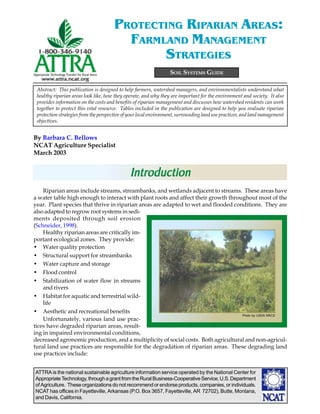
  • 1. ATTRA is the national sustainable agriculture information service operated by the National Center for AppropriateTechnology,throughagrantfromtheRuralBusiness-CooperativeService,U.S.Department of Agriculture. These organizations do not recommend or endorse products, companies, or individuals. NCAT has offices in Fayetteville, Arkansas (P.O. Box 3657, Fayetteville, AR 72702), Butte, Montana, and Davis, California. By Barbara C. Bellows NCAT Agriculture Specialist March 2003 SOIL SYSTEMS GUIDE PROTECTING RIPARIAN AREAS: FARMLAND MANAGEMENT STRATEGIES Riparian areas include streams, streambanks, and wetlands adjacent to streams. These areas have a water table high enough to interact with plant roots and affect their growth throughout most of the year. Plant species that thrive in riparian areas are adapted to wet and flooded conditions. They are also adapted to regrow root systems in sedi- ments deposited through soil erosion (Schneider, 1998). Healthy riparian areas are critically im- portant ecological zones. They provide: • Water quality protection • Structural support for streambanks • Water capture and storage • Flood control • Stabilization of water flow in streams and rivers • Habitat for aquatic and terrestrial wild- life • Aesthetic and recreational benefits Unfortunately, various land use prac- tices have degraded riparian areas, result- ing in impaired environmental conditions, decreased agronomic production, and a multiplicity of social costs. Both agricultural and non-agricul- tural land use practices are responsible for the degradation of riparian areas. These degrading land use practices include: Abstract: This publication is designed to help farmers, watershed managers, and environmentalists understand what healthy riparian areas look like, how they operate, and why they are important for the environment and society. It also provides information on the costs and benefits of riparian management and discusses how watershed residents can work together to protect this vital resource. Tables included in the publication are designed to help you evaluate riparian protection strategies from the perspective of your local environment, surrounding land use practices, and land management objectives. IntrIntrIntrIntrIntroductionoductionoductionoductionoduction Photo by USDA NRCS
  • 2. //PROTECTING RIPARIAN AREAS: FARMLAND MANAGEMENT STRATEGIESPAGE 2 TTTTTable of Contentsable of Contentsable of Contentsable of Contentsable of Contents Introduction ................................................................................ 1 Upland Land Management and Riparian Health ............................... 3 What do Riparian Areas Look Like?................................................ 5 Water and Sediment Capture by Riparian Areas............................... 6 Table 1. Vegetation Indicators for Riparian Areas........................ 8 Water Decontamination by Riparian Soils ....................................... 9 Table 2. Soil Indicators for Riparian Areas............................... 10 Riparian Areas and Habitat Preservation....................................... 11 Table 3. Streambank and Channel Indicators............................ 12 Land Management Practices to Protect Riparian Areas ................... 13 Table 4. Indicators of Aquatic and Riparian Wildlife ................. 14 Community Watershed Collaboration to Protect Riparian Areas ...... 16 Summary.................................................................................. 17 References ................................................................................ 17 Appendix 1: Impacts of Local Ecology on Riparian ........................ Characteristics................................................................... 22 Table A.1. Effect of Stream Order on Natural Riparian .................. Characteristics................................................................... 23 Table A.2. Effect of Rainfall and Temperature on Riparian.............. Characteristics................................................................... 24 Appendix 2: Guidelines for Riparian Area Revegetation............. 27 Appendix 3: Limited Ability of Riparian Areas to Control Phosphorus Movement into Streams...................................................... 29 Appendix 4: Recommended Buffer Widths ............................... 30 Appendix 5: Economic Costs and Benefits of Riparian Buffer .......... Protection ......................................................................... 32 Table A.3. Incentive Programs for Riparian Protection .............. 34
  • 3. //PROTECTING RIPARIAN AREAS: FARMLAND MANAGEMENT STRATEGIES PAGE 3 • Artificial stream widening and straightening • Road and building construction close to streams • Replacement of wooded or grassy areas with roads, houses, and parking lots resulting in increased runoff into streams • Unrestricted grazing or loitering of livestock in or near streams • Crop production activities including plowing, planting, and fertilizer, manure, and pesticide applications close to streams This publication is designed to assist farm- ers, ranchers, watershed managers, homeowners, and community members in understanding the importance of riparian areas and guide them in implementing land management practices to im- prove riparian health. Tables included provide tools to monitor the conditions of riparian areas during land restoration processes. Attached appendices provide detailed infor- mation on subjects addressed in this publi- cation. Upland LUpland LUpland LUpland LUpland Landandandandand Management andManagement andManagement andManagement andManagement and Riparian HealthRiparian HealthRiparian HealthRiparian HealthRiparian Health Water flows from upland areas through ri- parian areas and eventually into streams. Healthy riparian areas are able to absorb, hold, and use much of the water that flows off from healthy upland areas. Healthy riparian areas are also able to chemically and biologically bind or detoxify many contaminants contained in this water. However, if upland areas are de- graded or covered with roads, parking lots, and rooftops that do not allow the water to seep into the soil, even the healthiest riparian area will be unable to absorb and filter large volumes of water, nutrients, and contaminants flowing through it. Therefore, the first step in riparian protection is ensuring that land management practices across the watershed conserve soil and water resources. Water moves across the landscape in two ways: as groundwater flow and as runoff. Sub- surface or groundwater flow is water that has soaked into the soil and travels underground through pores in the soil. Runoff is water that moves over the surface of the soil. When groundwater or runoff water moves, it absorbs nutrients or contaminants and transports them into riparian areas and potentially into streams. Runoff water can also transport eroded soil par- ticles. Groundwater flowGroundwater flowGroundwater flowGroundwater flowGroundwater flow. In most undisturbed watersheds, a majority of the water flows into riparian areas and streams as groundwater rather than as runoff. As rain falls or snow melts, leaves and other plant residues on the soil surface catch this water. Pores created by grow- ing plants, decaying plant roots, and animal burrows help the water seep into the soil (Cohen, 1997). Once it seeps into the soil, the resulting groundwater moves relatively slowly under- ground through soil particles until it reaches ri- parian areas and associated streams. RunoffRunoffRunoffRunoffRunoff is favored when rain falls faster than the ground can absorb it. Water cannot be effec- tively absorbed when soils: • Are compacted at the surface • Are bare, so that the impact of rain drops on the soil forms a surface crust Plants in riparian areas filter ground and surface water moving into streams. (from Huel, 1998. ©Agriculture and Agri-Food Canada) Above ground vegetation traps sediment and pollutants Fertilizer and pesticide residue Flood water level Stream water level Runoff reaches stream carrying little sediment, pesticide and fertilizer residue, making it healthier for plant and animal life Residue from fertilizer and pesticides are trapped by root systems Healthy streambank vegetation
  • 4. //PROTECTING RIPARIAN AREAS: FARMLAND MANAGEMENT STRATEGIESPAGE 4 • Have pores that have become plugged by eroded sediments • Have a clay texture that does not allow for rapid water movement into the soil • Are hydrophobic or have a surface crust, typical of many arid or semi-arid soils (Fed- eral Interagency Stream Restoration Working Group, 2001). Runoff is also heavy when the soil does not have the capacity to hold additional rainwater or snowmelt entering the soil. This occurs when: • Soils have been replaced by im- permeable surfaces such as roads, parking lots, or rooftops and insufficient natural or arti- ficial wetlands are present to capture water not able to be ab- sorbed by soil • Soils are rocky or have an impen- etrable stony layer close to the surface • Soils are thin because the topsoil has been eroded off • Soils have a compacted layer of “pan” within their profile that acts as a barrier to downward water movement • Groundwater levels are high • Rain keeps falling on soils that are already saturated Stream flashing When runoff is heavy, such as following an intense storm or a rapid snowmelt, stream levels can rise rapidly, often to flood stage. This rise in water levels is often very short term, lasting only a day or two, after which water levels decrease dramatically. The rapid rise and fall of water levels caused by runoff is referred to as stream flashing. Contaminant movement by waterContaminant movement by waterContaminant movement by waterContaminant movement by waterContaminant movement by water..... Run- off water flowing over the soil surface can pick up and erode soil sediments. These sediments may carry nutrients, pathogens, pesticides, and other contaminants, depending on the land-use practices in the area they came from. Both runoff water and groundwater can also absorb nutri- ents or become contaminated with pesticides or pathogens in the soil. Streams are polluted when contaminated water is able to move directly into them. Impact of runoff and erImpact of runoff and erImpact of runoff and erImpact of runoff and erImpact of runoff and erosion on riparosion on riparosion on riparosion on riparosion on ripar----- ian areas.ian areas.ian areas.ian areas.ian areas. Under healthy watershed conditions water infiltration across the landscape results in minimal runoff and erosion reaching ripar- ian areas. Healthy riparian areas have a dense growth of vegetation that catches any eroded sediment and prevents it from entering streams. They also have a diversity of plants that facilitate water infiltration and take up many nutrients car- ried into riparian areas by runoff and groundwa- ter. Riparian areas also have a unique soil envi- ronment that provides favorable conditions for the chemical and biological degradation of many soil contaminants. However, when upland watershed condi- tions are degraded, heavy runoff can flow over or through riparian plants and move directly into river channels. Severe erosion in upland areas can degrade riparian areas by burying plants under sediments. Fine sediments brought in by erosion can degrade stream habitat by fill- ing in stream pools, altering the shape of stream channels, and covering rocky stream bottoms, thereby eliminating important food producing, shelter and spawning areas (Wohl and Caline, 1996). Runoff and erosion also bring in seeds of non-native or non-riparian plant species. Inva- Runoff from poorly vegetated areas carries erodedRunoff from poorly vegetated areas carries erodedRunoff from poorly vegetated areas carries erodedRunoff from poorly vegetated areas carries erodedRunoff from poorly vegetated areas carries eroded sediments into streamssediments into streamssediments into streamssediments into streamssediments into streams
  • 5. //PROTECTING RIPARIAN AREAS: FARMLAND MANAGEMENT STRATEGIES PAGE 5 sive and non water-loving plant species can re- duce habitat for native species and lower the wa- ter table by crowding out more functional and palatable riparian species. They can also create a fire risk by increasing fuel loads (Allen et al, 2000). As runoff and erosion from upland areas con- tinue to destroy the integrity of riparian areas, streamside areas loose their ability to buffer and protect streams, resulting in damage to aquatic habitat, increased costs for treating drinking wa- ter, and loss of aesthetic appeal. Soil and water conservation practices.Soil and water conservation practices.Soil and water conservation practices.Soil and water conservation practices.Soil and water conservation practices. Water infiltration is enhanced by land-use prac- tices that provide coverage of the soil surface with vegetation or residues throughout the year. Conservation tillage, contour farming, cover cropping, agroforestry, and rotational grazing are all practices that protect soil quality while promoting water flow into the soil. For more information on these soil and water conserva- tion practices, please see the following ATTRA publications: Sustainable Soil Management Conservation Tillage Pursuing Conservation Tillage for Organic Crop Production Rye as a Cover Crop Protecting Water Quality on Organic Farms Sustainable Pasture Management Rotational Grazing Nutrient Cycling in Pastures What do Riparian AreasWhat do Riparian AreasWhat do Riparian AreasWhat do Riparian AreasWhat do Riparian Areas Look LikLook LikLook LikLook LikLook Like?e?e?e?e? Healthy riparian areasHealthy riparian areasHealthy riparian areasHealthy riparian areasHealthy riparian areas. Characteristics of healthy riparian areas differ across the country and across the landscape. In mountainous or hilly areas, streams run through rocky gorges with scattered trees growing out of the thin soil. In prairie landscapes, streams flow through thick, silty soil, with banks covered by reeds, sedges, and willows. Despite these local differ- ences, healthy riparian areas have certain simi- larities: • A thick growth of vegetation, representing a diversity of grasses, forbs, shrubs, and trees, covers the streambanks and provides shade over the stream • Except where streams cut through rocky ter- rain, land surrounding streambanks re- mains wet throughout most of the year • Streambanks are more vertical than flat- tened out • Streamflow levels vary only moderately throughout the year • Stream water is relatively clear but contains leaves, twigs, or logs from streambanks that create pools and other habitat for fish and other aquatic organisms • A diversity of fish, aquatic life, mammals, and birds live in and around riparian areas Appendix 1 describes regional differences in the structures and functions of riparian areas. Degraded riparian areasDegraded riparian areasDegraded riparian areasDegraded riparian areasDegraded riparian areas. In contrast, de- graded riparian areas have some or all of the following characteristics: • Patchy or scrubby plant growth with bare ground showing in many places • Vegetation dominated by upland plants in- cluding noxious weeds • Soil that is compacted, shows rills or gullies, or has bare trails and pathways along the streambanks • Streambanks that are eroded, severely un- dercut, or sloughing • Streams that flood regularly in the spring and become dry during the summer • Streamwater that is muddy or murky and may contain toxic levels of various nutrients or contaminants • Few mammals or birds living or feeding in the area • Limited numbers and diversity of fish and other aquatic species These characteristics of degraded riparian areas reflect their inability to protect water qual- ity, stabilize water quantity, and provide criti- cal habitat for both land animals and aquatic species.
  • 6. //PROTECTING RIPARIAN AREAS: FARMLAND MANAGEMENT STRATEGIESPAGE 6 WWWWWater and Sedimentater and Sedimentater and Sedimentater and Sedimentater and Sediment Capture by RiparianCapture by RiparianCapture by RiparianCapture by RiparianCapture by Riparian AreasAreasAreasAreasAreas Riparian areas protect water quality by cap- turing, storing, and treating water that flows through their soils. A thick growth of diverse vegetation, plant residues covering the soil sur- face, and porous, non-compacted soil facilitate water capture. High streambanks with high water tables provide water storage capacity. Vigorously growing plants take up nutrients transported into riparian areas, while active popu- lations of both aerobic and anaerobic soil organ- isms degrade many contaminants that flow into these areas. Chemicals in soil minerals and soil organic matter also capture or facilitate biologi- cal detoxification of contaminants. Understand- ing these components of healthy riparian areas can help guide land management practices that protect riparian areas and water quality. Structure of riparian vegetationStructure of riparian vegetationStructure of riparian vegetationStructure of riparian vegetationStructure of riparian vegetation. Healthy riparian vegetation captures water and facilitates water infiltration into the soil. Riparian areas that include a diversity of plant species are most ef- fective in slowing the flow of water and storing it for future use. These species are not arranged in a random manner. Rather, they are organized in a natural structure consisting of three roughly parallel ecosystem bands, each consisting of spe- cies adapted to survive in the specific moisture regime of that area and able to perform specific ecological functions: • The first band of vegetation, found at the edge of the water, consists of deep-rooted sedges and rushes. • The second band of vegetation, found in the wet ground near the edge of the bank, con- sists of shrubs, trees, moisture loving grasses, and water-tolerant broad-leaved plants (Huel, 1998). • The drier third band of vegetation, found where the riparian zone merges into the up- lands, includes a mixture of riparian and upland plant species (Huel, 1998). Plants in the first band are water-loving and have deep, strong roots that stabilize streambanks against erosion (Clark, 1998). Plants in the sec- ond and third bands catch water and facilitate its absorption. They also take up nutrients trans- ported into the area by runoff and groundwater and provide habitat for terrestrial animals. If land management practices reduce the riparian zones to only one or two of these bands, some or all of the environmental and habitat benefits of these areas will be lost. The first zone is both the most ecologically important and requires the greatest protection against degradation. The dominance of water-loving plant species in the first zone serves as an indicator of riparian health. These plants are critical for promoting water recharge and increasing water table height (Martin and Chambers, 2001). It is not essential for native plant species to dominate in riparian areas for these areas to provide environmental benefits. But water-loving plants that provide functions similar to native species need to be present. However, water-tolerant exotic species — such as leafy spurge, purple loosestrife, or salt cedar —grow very aggressively and over- whelm species that are native to the area and more palatable to wildlife and livestock. In this way, exotic species decrease the ability of ripar- ian areas to maintain high water table levels, re- tain streambank stability, provide forage to live- stock, and support wildlife habitat (Huel, 1998). Trees, brush, and grasses protect streambanks against erosion and water quality degradation PhotobyUSDANRCS
  • 7. //PROTECTING RIPARIAN AREAS: FARMLAND MANAGEMENT STRATEGIES PAGE 7 The importance of water-loving plants in riparian areas In the past, land management programs implemented in some arid areas recommended clearing native, water-loving plants from riparian areas in order to reduce water-use competition and en- courage the production of agronomic crops or forage grasses. However, the removal of these plants eliminated many of the ecological benefits provided by riparian areas, including stream stabilization, shading, and wildlife habitat (NRC, 2002). As a result, farmers and ranchers along these unprotected streams lost land to streambank erosion and were faced with greater challenges in reducing non-point source pollution. Streambank stabilizationStreambank stabilizationStreambank stabilizationStreambank stabilizationStreambank stabilization. A diversity of plants work together to hold streambank soils in place and protect them from erosion and undercutting by floodwaters, transported woody debris, or ice jams. The deep, penetrating roots of sedges, rushes, grasses, and other herbaceous plants provide structural support for streambanks, while the thicker, harder roots of woody plants protect streambanks against bank scouring by floods and ice jams (Winward, 2000). When riparian areas restore themselves natu- rally — following a fire, for instance —woody species are often the first plants to become es- tablished. These woody plants stabilize stream channels against the forces of erosion while nur- turing the growth of water-loving grasses, sedges, rushes, and forbs (Elmore and Beschta, 2000). The herbaceous plants then stabilize streambanks with their thick, deep roots, while their stems trap sediments carried by runoff water and stream-scouring floodwater. An eroded streambank that recovered when it was protected from grazing and allowed to become stabilized by vegetation Photos by D. Redhege, Kerr Center for Sustainable Agriculture The types of vegetation that naturally domi- nate in riparian areas differ across locations. Grassy vegetation is more important for hold- ing together streambanks developed from sedi- ments, while trees and shrubs dominate on the steep, rocky banks of more rapidly moving and narrower headwater streams (Sovell et al., 2000). However, water-tolerant or water-loving plants are more effective for holding streambanks in place than are plants more adapted to upland conditions, because they have deeper and stron-
  • 8. //PROTECTING RIPARIAN AREAS: FARMLAND MANAGEMENT STRATEGIESPAGE 8 Table1.VegetationIndicatorsforRiparianAreas Indicator Environmental Functionof Plants PlantSpecies Diversity Diversityof PlantAges PlantVigorand Reproduction Palatable Vegetation PlantandLitter Cover PlantLitter Movementand PlantLodging Widthof RiparianArea HealthyRiparianAreas •effectivewaterinfiltration •effectivecaptureofsediments •structuralsupportofstreambanks •reducesstreamvelocityduringfloods •shadeforreducingwaterlossandmoderating temperatures •habitatforwildlife,birds,andaquaticspecies •predominantlynative,water-lovingriparian vegetation •combinationofsedges,rushes,grasses, herbacousplants,shrubsandtrees •bothyoungandmaturetreesandshrubsare present •healthyplantgrowthandreproduction •plantgrowthexceeds80%ofpotential production •diversityofplantspeciesandplantages providespalatablevegetationthroughoutthe growingseason •treeshaveanopenorpark-likeappearance •fullvegetationcoveragethroughouttheyear •litterlayerpresentparticularlyduringwinterand spring •provideswoodydebristhatservesasshelterfor fishandhabitatforaquaticinsects •uniformdistributionoflitter •plantsremainstandingfollowingheavyrainfalls orsnowmelts •riparianvegetationatleasttwochannelwidths oneachsideofstream ModeratelyDegradedRiparianAreas •vegetationprovidessomebutnotall environmentalfunctions •somenon-nativeplantspeciesand noxiousweeds •presenceofsomedrought-tolerent vegetation,similartothatinadjacent uplandareas •fewyoungtreesandshrubspresent •somedeadordecadentplantspresent •capabilitytoproduceseedsortillersis somewhatlimited •plantgrowthis30-80%ofpotential production •moderatedecreaseinpercentageof palableplantspeciespresent •somebrowsingonpalatabletree species •sparsevegetationcoverage,especially duringthedryseason •litterlayerthinnerthanexpectedfor location •reducedamountofwoodydebrisadded tostreamflow •onlysmallsizelitterisdisplaced •scatteredconcentrationoflitternear obstructions •flatteningofgrassesinisolatedareas •naturalvegetationextendsthewidthof halfthechanneloneithersideofstream DegradedRiparianAreas •vegetationpresentineffectiveinproviding mostenvironmentalfunctionsofriparian areas •onlynon-nativespecies •noxiousorinvasiveweedspresent •smallnumberofplantspecies •treesandshrubsareabsent •presenceofpredominantlydrought-tolerent vegetation,similartothatinadjacentupland areas •reducedplantestablishmentandsurvival •alltreesareoldandinpoorhealth •capabilitytoproduceseedortillersis severelylimited •plantgrowthispoor,lessthan30%of potentialproduction •grazinghasremovedallofthepalatable vegetation •palatablespeciesofshrubsandtreesare heavilybrowsed •willowsandotherpalatabletreespecies havea“mushroom-like”appearance •baresoiloveralargepercentageofthesoil surface •litterlayerlargelyabsent •limitedamountofwoodydebrisaddedto streamflow •litterisconcentratedaroundrocks,tree trunks,andotherobstructions •plantsareflattenedbyheavyflowsofrunoff waterfollowingrainstormsorsnowmelts •naturalvegetationlessthanathirdofwidth ofthechanneloneachsideofstream Sources:Belskyetal.,1999;FederalInteragencyStreamRestorationWorkingGroup,2001;Hillard,C.andS.Reedyk.2000;Naimanetal.,1992;Huel,1998;Prichard,1998;RenwickandEden,1999; Winward,2000.
  • 9. //PROTECTING RIPARIAN AREAS: FARMLAND MANAGEMENT STRATEGIES PAGE 9 ger root systems. For example, Kentucky blue- grass (Poa pratensis) and redtop (Agrostis stolonifera) provide good livestock forage, but their root systems are not deep enough to stabi- lize streambank sediments (Winward, 2000). Thus, these plants often serve as indicators of disturbed or degraded riparian areas. Similarly, trees that are not water tolerant do not develop as extensive root systems in riparian areas as do water tolerant species. As a result, these trees are unable to effectively stabilize streambanks and are likely to be undercut and fall into streams. For guidelines on how to revegetate degraded riparian areas, please see Appendix 2. Table 1 provides a list of indicators that com- pare vegetation characteristics in healthy ripar- ian areas to those in degraded areas. WWWWWater storage within streambanksater storage within streambanksater storage within streambanksater storage within streambanksater storage within streambanks. Healthy riparian areas that are well-vegetated have highly permeable soils and high stream banks. They have a water table that extends underground and outward from the streambanks and provides a large amount of groundwater storage (Prichard, 1998). In con- trast, degraded riparian areas have a low wa- ter table, sloping banks, and wide, shallow streams, with limited storage capacity. A riparian area with a diversity of vegeta- tion is able to trap 80 to 90% of the sediments transported from fields (Naiman and Decamps, 1997). The new sediments, along with lush plant growth, facilitates both water infiltration into riparian soils and increased water storage. As vegetation grows, its stems and roots collect more soil, while its leaves shade the soil and protect it against water loss through evapora- tion. The seasonal death and decomposition of plants provides additional organic matter to the soil and further facilitates water infiltration and storage. Organic matter holds water like a sponge and stimulates the growth of soil organ- isms involved in the formation soil aggregates and enhancing soil porosity. Streambank build-up. Sediment trapping by riparian vegetation increases the height of streambanks, particularly along low-gradient channels (Platts, 1990, Ohmart, 1996). Water tables rise simultaneously in riparian areas as streambanks build up, water absorption is in- creased, and water loss through evaporation de- creases. Under healthy riparian conditions, wa- ter tables rise until they reach the height of plants’ root zone on the former flood plains (Elmore and Beschta, 2000). These riparian soils remain wet throughout most of the year. Water recharge. The large water storage ca- pacity of riparian areas buffers the movement of water from upland areas into streams. In- stead of allowing water to flow directly into streams following a rainstorm or snowmelt, healthy riparian areas hold and store water. Throughout the year, this water seeps slowly into adjacent streams, providing water recharge and moderating stream flow. Flood control. The ability of the porous, well- aggregated streambank soils to store vast quan- tities of water also decreases the potential for flooding. In addition, plants growing in ripar- ian areas control flooding by daily taking up and transpiring thousands of gallons of water per acre (Elmore and Beschta, 2000). If water levels do reach flood stage, streambank vegetation sta- bilizes streambanks and helps prevent streams from widening or changing course. Table 2 (next page) compares streambank and channel conditions in healthy and degraded ri- parian areas. WWWWWater Decontaminationater Decontaminationater Decontaminationater Decontaminationater Decontamination by Riparian Soilsby Riparian Soilsby Riparian Soilsby Riparian Soilsby Riparian Soils Riparian areas contain a combination of wet and dry soil zones that facilitate a variety of bio- logical and chemical reactions. These reactions reduce the availability of some nutrients and de- crease the toxicity of some contaminants (Edwards, 2000). The presence of slowly decom- posing plant residues in these wet soils further facilitates water purification processes. Some organic matter particles have a high ability to chemically capture and hold many potential con- taminants, while others serve as sources of food and energy for soil organisms involved in con- taminant detoxification (Cohen, 1997).
  • 10. //PROTECTING RIPARIAN AREAS: FARMLAND MANAGEMENT STRATEGIESPAGE 10 Table2.SoilIndicatorsforRiparianAreas Indicator Organicmatter Diverse microbial community structure Minimal compaction Good infiltration Limitedrunoff Limited erosion HealthyRiparianAreas •soilcoveredbygrowingplantsandplant residuesthroughouttheyear •organicmatterhasaccumulatedinthesoil profile •highsoilbiologicalactivity •topsoilsaredeep •soilsarewellaggregated •organicmatterdecomposesrapidly •effectivelossofnitrogenthroughdenitrification •goodsoilaggregationbymicrobialslimes •soilissoft,highorganicmattercontent •goodwaterinfiltration •goodsoilaggregation •healthyplantgrowth •vegetationcoverageoverthesoilsurface •goodsoilaggregation •relativelythicktopsoil •goodwaterinfiltration •deeptopsoilwithgoodwaterholdingcapacity •highamountoforganicmatterinsoilandgood soilaggregation •completevegetationcoveroverthesoilsurface •noindicationofsoilmovement •streamisnotmuddiedbyrunoffwater ModeratelyDegradedRiparianAreas •soilorganicmattercontentsomewhat reduced •somelossoftopsoil •moderatelevelsofsoilbiologicalactivity •soilpatchesbareofvegetation •relativelyhighremovalofresiduesfrom soilsystem •moderatetopoorsoilaggregation •moderatedecompositionoforganic matter •soilissomewhathard,especiallyduring thedryseason •waterinfiltrationislimitedinsomeareas •plantshavedifficultygettingwaterand nutrientsfromthesoil •somelossofvegetationcoverage •somerunoff,erosion,orpondingof waterobserved •soilcompactiononsurfaceorwithin profile •infiltrationissomewhatrestricted •waterholdingcapacityofsoilis somewhatlimited •somesoilcompactionorrelativelyhigh watertable •somesmallrillspresent •waterbecomesmuddyonlyafterheavy rains DegradedRiparianAreas •lowsoilfertilityandlowconcentrationof organicmatter •soilisbareinmanyareas •limitedtopsoil •limitedsoilbiologicalactivity •limitedreturnofplantresiduestothesoil system •soilsarestickyorgrainy,notwellaggregated •peatbuildsupinriparianareasbecausearea istoowetororganicmatterremains undecomposedbecauseareasaretoodry •ineffectivedenitrification •poorsoilaggregation •soilishard •littleornosoiloggregation •littleornowaterinfitration •numerousareasbareofvegetation •lossofsoilaggregation •soiliscompacted •runoffanderosionobservedevenfollowing lighttomoderatestorms •infiltrationisrestricted •highsoilsurfacecompaction •limitedwaterholdingcapacityofsoil •rillsandgulliespresent •soilisscouredwherewaterflowsoverthe surface •soilbuildupbehindrocks •streamismuddiedbyrunoffwater Sources:Belskyetal.,1999;FederalInteragencyStreamRestorationWorkingGroup,2001;Naimanetal.,1992;Prichard,1998;RenwickandEden,1999;Winward,2000.
  • 11. //PROTECTING RIPARIAN AREAS: FARMLAND MANAGEMENT STRATEGIES PAGE 11 The hyporheic zoneThe hyporheic zoneThe hyporheic zoneThe hyporheic zoneThe hyporheic zone. Healthy riparian soils have a unique ecological zone composed of water-saturated oxygen-poor soils adjacent to soils that are drier and oxygen-rich. Re- ferred to as the hyporheic zone, this transi- tion area between aerobic and anaerobic con- ditions promotes biological transformations, such as denitrification and pesticide detoxifi- cation, and chemical transformations that in- fluence the availability of phosphorus and iron (Cohen, 1997). DenitrificationDenitrificationDenitrificationDenitrificationDenitrification occurs when soil organisms that grow under aerobic conditions transform organic nitrogen into nitrate, followed by the transformation of nitrate into atmospheric ni- trogen by bacteria that thrive under anaerobic conditions. This process is important environ- mentally when the amount of nitrogen moving across the watershed into riparian areas is greater than the amount that can be used for riparian plant growth. The overapplication of nitrogen-containing fertilizers and manure on agricultural and residential landscapes is the primary source of nitrogen pollution of water- ways. The amount of nitrogen entering streams is reduced when riparian areas are able to cap- ture and remove nitrogen from runoff water. Natural riparian forests can denitrify and re- lease 25 to 35 pounds of nitrogen per acre per year (Cole, 1981). Phosphorus availabilityPhosphorus availabilityPhosphorus availabilityPhosphorus availabilityPhosphorus availability. Overapplication of fertilizer and manure can also overload the soil with phosphorus. Iron, aluminum, and calcium in the soil can bind excess phosphorus. In flooded soils, iron binds less phosphorus than it does in drier, aerobic soils. This decreased binding ability increases the availability of phos- phorus both for plant uptake and for movement into surface water (Green and Kaufman, 1989). Since riparian areas have a limited ability to hold excess phosphorus, they are relatively ineffec- tive in protecting streams against poor phospho- rus management practices on upland areas. Thus, good upland management is necessary to protect against phosphorus pollution. For additional information on the ability of ri- parian areas to control phosphorus move- ment into streams, please see Appendix 3. Detoxification of contaminants.Detoxification of contaminants.Detoxification of contaminants.Detoxification of contaminants.Detoxification of contaminants. Ripar- ian soils have a high concentration of peat, a par- tially decomposed organic material formed un- der primarily anaerobic conditions. Under wet, anaerobic conditions organic materials decom- pose more slowly than under aerobic conditions, since many more decomposing soil organisms require oxygen than thrive without it. Peat is a highly reactive material that has the ability to cap- ture and hold many chemicals—nutrients, pesti- cides, heavy metals, and other contaminants— that flow off the uplands and into riparian areas (Cohen, 1997). Other microorganisms found in the aerobic and anaerobic areas of the riparian zone are able to degrade toxic contaminants such as pesti- cides. Habitat competition by other soil micro- organisms decreases populations of human and animal pathogens, such as E. coli, cryptosporidium, or giardia, that may be trans- ported into streams from septic systems or ma- nure piles (Stehman et al., 1996). Table 3 (next page) compares soil charac- teristics in healthy riparian areas to those in de- graded areas. Riparian Areas andRiparian Areas andRiparian Areas andRiparian Areas andRiparian Areas and Habitat PreserHabitat PreserHabitat PreserHabitat PreserHabitat Preservationvationvationvationvation Riparian areas provide food and habitat for a diversity of soil, aquatic, and terrestrial organ- isms. A multistoried plant canopy of annual and perennial grasses and forbs, as well as juve- nile and mature shrubs and trees, provides a varied aboveground habitat for birds and wild- life and a belowground habitat for burrowing animals and soil organisms. Exposed roots and irregular streambanks provide breeding areas for many aquatic species, as well as habitat for algae and macroinvertebrates that are used as food by fish and other aquatic life. In addition, overhanging branches of riparian trees and sloughed off residues of riparian plants provide aquatic life with shade and habitat. Aquatic habitatAquatic habitatAquatic habitatAquatic habitatAquatic habitat. Healthy riparian areas protect fish habitat by minimizing the movement of eroded sediments into streams. Heavy silt loads disrupt reproductive behavior and destroy feeding and spawing areas for many aquatic species (Thompson, 1984). For example, trout require gravel for reproduction and egg laying, while various gamefish need relatively clear
  • 12. //PROTECTING RIPARIAN AREAS: FARMLAND MANAGEMENT STRATEGIESPAGE 12 Table3.StreambankandChannelIndicators Indicator Streambank Stability Stream ChannelShape Frequencyof Riffles RiparianWater Table Channel Alternation HealthyRiparianAreas •banksareatelevationofactivefloodplain •littleornostreambankerosion •manystrong,finerootsholdstreambankin place •channelisrelativelynarrow •banksarerelativelystraightwithdeepundercut thatprovidesshadeforaquaticspecies •streamhaspoolsandmeanders •relativelyfrequentoccurrenceofriffles •distancebetweenrifflesisnomorethan7 timesthemeasurementofthewidthofthe stream •watertableremainshighandstablethroughout theyear •waterlovingvegetationpredominates •riparianareaprovidesaninterfacebetweenwet anddryenvironments •streamhasnotbeensubjecttochannelization, streamalteration,ordredging ModeratelyDegradedRiparianAreas •somestreambankerosion •somedeeprootedriparianplants replacedbymoreshallowrootedor woodyplantspecies •channeliswiderthanundernatural conditions •banksarebrokendowninisolatedareas •somelossofpoolsandmeanders •occassionalriffles •bottomcontoursprovidesomeaquatic habitat •distancebetweenrifflesisnomorethan 20timesthemeasurementofthewidth ofthestream •watertableisnotatbankfullevel •soilsurfacemaydryoutduringthedry season •somedroughttolerentuplandplants presentintheriparianzone •somechannelizationpresent,usuallyin areasofbridgesorinurbanareas •evidenceofdredgingorchannelization havingoccurredover20yearsago •drainageoutletsfromagriculturallands DegradedRiparianAreas •streambanksarehigh •bendserodedbyflowingwater •plantrootseithernotpresentoruabletohold banksagainstscouring •treesarefallingintostream •channelisshallowandwide •banksarelaidback •banksaretrampledwherelivestockenterthe watertodrinkorcrossthestream •lossofpoolsandmeanders •waterisgenerallyflat •ifrifflesarepresent,theyareshallowand providepooraquatichabitat •distancebetweenrifflesisgreaterthan20 timesthemeasurementofthewidthofthe stream •watertableisloworvariesgreatlythroughout theyear •droughttolerantoruplandvegetationhas replacedriparianvegetation •watertableistoolowtofacilitatechemical andbiologicalinteractionsbetweenwetand dryconditions •extensivechannelization,especiallyinurban areas •banksshoredwithgabionorcement •instreamhabitatgreatlyalteredorremoved entirely Sources:Belskyetal.,1999;FederalInteragencyStreamRestorationWorkingGroup,2001;Huel,1998;Naimanetal.,1992;Prichard,1998;RenwickandEden,1999;Winward,2000.
  • 13. //PROTECTING RIPARIAN AREAS: FARMLAND MANAGEMENT STRATEGIES PAGE 13 water to see prey and detect visual clues used in their social and reproductive behavior (Cohen, 1997). The ability of riparian areas to stabilize stream flow levels throughout the year is also critical to the survival of many fish and other aquatic species. Fish need enough water in streams to navigate and find food. If a stream becomes polluted, decreasing water levels may concentrate pollutants to levels that are too toxic for fish. High water levels caused by stream flashing can rapidly increase water tempera- tures, which can be fatal to some fish and other aquatic organisms. Stable water levels provide the moderate water temperatures required for the growth of fish and the aquatic organisms that they use for food (Wenger, 1999; Cohen, 1997). Large woody debris that falls into streams traps sediments and creates pools that provide protected, shaded habitats for aquatic species (Stuart et al., 1994). For trout, vegetation cover provides food and places to hide from preda- tors (Burgess, 1985). For many aquatic organ- isms, leaves, twigs, and insects falling from over- hanging trees are an important food source (Hillard and Reedyk, 2000). In naturally forested areas, retaining at least 50% of the tree canopy is critical for providing moderated temperatures re- quired for good fish habitat (Whitaker-Hoagland, 1998). TTTTTerererererrestrial wildlife habitat.restrial wildlife habitat.restrial wildlife habitat.restrial wildlife habitat.restrial wildlife habitat. Riparian ar- eas are the main source of moisture for plants and wildlife within watersheds, especially in arid regions or during the dry season in more temperate climates. Riparian areas with a high density and diversity of foliage, both vertically and horizontally, can provide habitat and food for a diversity of birds and other terrestrial wild- life, including many endangered and threatened species (NRCS/RCA, 1996). Many animals also use these moist ar- eas as travel corridors be- tween feeding areas (Henry et al., 1999). Many bird species depend on riparian areas for food, shelter, and nesting sites. Some bird species require riparian areas for nesting, al- though they may forage for food outside of these areas. Other bird spe- cies prefer nesting in riparian areas even if they can nest elsewhere. However, degradation of riparian areas reduces populations of these spe- cies (Bureau of Land Management and Partners in Flight, 2000). Appendix 4 provides guidelines for adequate buffer widths to meet various environmental objectives. Riparian vegetation growth, soil fertility and porosity, water quality, and stream flow condi- tions all affect the ability of fish and wildlife to thrive in streams and their associated riparian areas. Table 4 compares habitat conditions pro- vided by healthy riparian areas to those of de- graded areas. LLLLLand Managementand Managementand Managementand Managementand Management Practices to PrPractices to PrPractices to PrPractices to PrPractices to Protectotectotectotectotect Riparian AreasRiparian AreasRiparian AreasRiparian AreasRiparian Areas Key components of riparian protection are maintaining good soil and water conservation practices across the landscape and preserving, as much as possible, the integrity of the three natural riparian zones. Specific land manage- ment practices that protect riparian areas in- clude: • Maintaining a vegetative cover over the soil throughout the year • Minimizing animal trampling or vehicle traf- fic on wet soils • Avoiding overuse of fertilizers or manure that may be transported into riparian areas • Avoiding applying or dis- posing of toxic chemicals on soils • Protecting against loss of plant diversity and vitality in riparian areas • Protecting against the es- tablishment of exotic or non water-loving species in riparian areas • Avoiding practices that ar- tificially alter stream flow Photo by USDA NRCS
  • 14. //PROTECTING RIPARIAN AREAS: FARMLAND MANAGEMENT STRATEGIESPAGE 14 Table4.IndicatorsofAquaticandRiparianWildlife Indicator Waterquality andquantity Water Temperature StreamPools Sediment Load Nutrientand Pathogen Concentration Waterfowl Habitat HealthyRiparianAreas •adequatewatersupplyandquantitythroughout theyear •presenceofmacroinvertebrateindicatorsof goodwaterqualitysuchascaddisfliesand mayflies •watercontainsfewcontaminantsuchas pesticides,heavymetals,orexcessnutrients •streamsidevegetationcoolsstreams •undercutstreambanksprovideshade •presenceofaquaticspeciesusedforfishfood •numerousbothdeepandshallowstreampools •woodydebrispresenttoformpools •complexchannelstructures •lowamountofsedimentsinstreams •waterisclearorteacolored •naturalconcentrationsofnutrientsand pathogensfromwildlifeinarea •littleornoevidenceoflivestockaccessto streams •nativeplantcommunitiesaredominant vegetation •landusedelayeduntilchickshaveleftthenest •landisrestedforseveralyearstoallowfor homing,largerclutches,andearliernesting •sufficientblocksoflandareprotectedtoprovide corridorsofmovementandforaging ModeratelyDegradedRiparianAreas •watertablesfluctuatethroughoutthe year •somecontaminantspresentinthe water •somereductioninstreamsidevegetation •decreaseintheavailabilityofaquatic speciesusedforfood •decreaseinstreampools •woodyvegetationreplacedby herbaceousvegetation •sedimentlevelsinstreamsincreasing •nutrientandpathogenlevelssomewhat elevated •manurepresentbutnotconcentrated onornearstreambanks •somenon-nativespeciesarepresent •landisusedforgrazingorother agriculturaluseseachyear •landisinsufficientlyrestedtoprovide vegetationcoverfornesting DegradedRiparianAreas •streamsdryupduringthedryseason •presenceofmancroinvertebrateindicatorsof poorwaterquality •watercontainstoxiclevelsofsediments, pesticides,heavymetals,ornutrients •excessiveaquaticweedgrowthinstreams •streamtemperaturesarehigh •lackofstreamsidevegetation •lowdissolovedoxygenlevels •coolwateraquaticspeciesreplacedbywarm waterspecies •lackofaquaticspeciestoprovidefoodforfish •lossofstreampools •lowamountsofwoodydebrisduetolossof trees •channelstraighteningormodificationto simplifychannelstructure •streammuddylookingbecauseofsediment load •floatingalgalmatsorscummaybepresent •highconcentrationsofnutrietsandpathogens inwater •extensiveamountsofmanureonbanksandin streams •non-nativespeciesaredominantvegetation •landisgrazedormowedwhilewaterfowlare nesting •vegetationregrowthdoesnotprovidesufficient coverfornesting continuedonpage15continuedonpage15continuedonpage15continuedonpage15continuedonpage15
  • 15. //PROTECTING RIPARIAN AREAS: FARMLAND MANAGEMENT STRATEGIES PAGE 15 Table4.IndicatorsofAquaticandRiparianWildlife(cont’d.) Indicator FishHabitat Insectand Invertebrate Habitat Mammal Diversity Macro- invertebrate Diversity BirdDiversity FishDiversity HealthyRiparianAreas •fishcoverprovidedbywoodydebris, overhangingvegetation,bankcobbles,pools, riffles,andundercutbanks •watertemperaturesmoderatedbyvegetation cover •minimalsoillossandpollution •goodsupplyofaquaticinsectspeciesforfish toeat •habitatprovidedbywoodyfinedebris, submergedlogs,leafpacks,undercutbanks andcobbles •trails,tracks,feedingareas,andrestingareas arepresent •predominatelypollutionintolerentspeciessuch ascaddisflies,mayflies,stonefliesandriffle beetles •presenceofbirdnests •speciesthatareobligatedependentonriparian areasarepresent,forexampleCommon Yellowthrout,SongSparrow,andWillow Flycatcher •predominanceofnativespecies •pollutionintolerentspecies,suchastrout, smallmouthbassandsunfisharepresent ModeratelyDegradedRiparianAreas •decreaseinthetypesoffishcover available •somesoillossandpollution •waterlevelsareunstable •decreaseintheamountofhabitatsites available •predominantlymoderatelytolerent speciessuchasdamselflies, dragonflies,aquaticsowbugs,blackfish andcrayfish •decreasingpresenceofobligatebird species •presenceofripariandependentbird speciessuchasgoldfinch,bank swallow,grosbeak,orred-headed woodpecker DegradedRiparianAreas •littleornofishcoverprovided •watercontaminatedbysedimentsand pollution •streamsareephemeral •fewornohabitatsitespresent •ifmacroinvertebratesarepresent, predominantlypollutiontolerantspeciessuch asmidges,craneflies,horseflies,leeches, aquaticearthworms,andtubificidworms •lackofbirdnest •ifbirdsarepresent,speciesaresimilarto uplandareas •nativespeciesarenotpresent •pollutiontolerentspeciessuchascarp predominate Sources:Belskyetal.,1999;BureauofLandManagementandPartnersinFlight,2000;FederalInteragencyStreamRestorationWorkingGroup,2001;Huel,1998;Mosleyetal.,1998;Prichard,1998; Sovelletal.,2000;Winward,2000.
  • 16. //PROTECTING RIPARIAN AREAS: FARMLAND MANAGEMENT STRATEGIESPAGE 16 Community WCommunity WCommunity WCommunity WCommunity Watershedatershedatershedatershedatershed Collaboration to PrCollaboration to PrCollaboration to PrCollaboration to PrCollaboration to Protectotectotectotectotect Riparian AreasRiparian AreasRiparian AreasRiparian AreasRiparian Areas Watershed councils lay the cultural founda- tions for a lasting way of life. They establish the tradition of responsible speech, of civil democracy, and of making decisions based on factual information and well-articulated val- ues. They embody the long-term perspec- tive of sustainability, seeking not quick fixes but deeper understanding and new alterna- tives. Alan T. During (quoted in Wood et al.,1997) Farmers, ranchers, and conservationists of- ten become embroiled in debates over the use of riparian areas. If you are a farmer or rancher, you may be concerned about the loss of access to grazing land and watering areas as well as costs associated with management practices, such as the installation and maintenance of fences. If you are a conservationist or environ- mentalist, you may be concerned about the loss of habitat for birds, wildlife, and aquatic spe- cies that depend on this diverse and fragile eco- system. If you are a downstream water user, you are no doubt concerned about the contami- nation of drinking and recreational waters with nutrients, pathogens, and pesticides. Pinpointing sources and causes of riparian degradation and the associated degradation of water quality is very contentious. Farmers and ranchers often assert that livestock grazing in riparian areas cause less damage than construc- tion activities, septic tanks, and industrial dis- charges. Conservationists often counter this as- sertion by contending that agriculture is the pri- mary source of nonpoint pollution in many ar- eas, and they maintain that excluding agricul- tural practices from riparian areas is the best method for protecting wildlife habitat and wa- ter quality. To work together in restoring riparian ar- eas, community members need to understand that riparian areas are only protected if all land users across the watershed work together. Get- ting this cooperation is often difficult since wa- tershed users can easily blame others for causing water pollution and riparian degradation. Mean- while, those involved in implementing good wa- tershed and riparian management practices of- ten go unnoticed and under-compensated. Why is this so? Most watershed and riparian degradation is non-point source pollution, which by definition means that it is difficult to identify specific land use practices responsible for this pollution. Secondly, good upland and riparian grazing management practices in one part of the watershed cannot, in most cases, compensate for poor land management practices in other parts of the watershed. Thirdly, and possibly most importantly, land users who implement soil and water conservation practices often are asked to bear the costs of implementing changes while obtaining few of the benefits. This disparity be- tween those who pay and those who benefit of- ten discourages farmers and other landowners from implementing soil conservation and ripar- ian management practices. For more information on the economic costs and benefits of riparian buffer protection, please see Appendix 5. The Bureau of Land Management, the U.S. Forest Service, and the Natural Resources Con- servation Service understand that programs de- signed to promote soil and water conservation practices are often contentious. In their joint letter announcing the initiation of a program to help restore riparian areas (PLF, 2002), the agen- cies state that riparian restoration: will not happen by regulation, changes in the law, more money, or any of the normal bureaucratic approaches. It will only occur through the integration of ecological, eco- nomic, and social factors and participation of affected interests. For watershed and riparian management programs to be effective, they should include the following elements (Wood et al., 1997): • Active involvement by community members from across the watershed who represent a broad array of perspectives and problems • Collaborative identification of program ob- jectives, such as protecting high value re- sources and solving problems that most threaten the sustainability of the watershed • Education and outreach
  • 17. //PROTECTING RIPARIAN AREAS: FARMLAND MANAGEMENT STRATEGIES PAGE 17 • Community access to and sharing of factual information on watershed economic, envi- ronmental, and social conditions • Willingness to discuss and address critical but often contentious resource issues such as population growth, overconsumption, en- dangered species, and pollution • Willingness to examine and implement long- term ecological solutions to watershed prob- lems rather than look to “technological quick-fixes” • Willingness of landowners and land man- agers to work together to develop a water- shed or regional level coordinated approach to watershed management that will address upstream-downstream concerns and the need for management practices to be coor- dinated throughout the watershed to pro- tect aquatic environments and provide con- tinuous corridors for wildlife movement • Baseline assessments and on-going monitor- ing of watershed and riparian conditions • A combination of positive incentives (eco- nomic, personal values, prestige) and disin- centives (regulations and policies) motivate involvement more than either one or the other alone (Alexander, 1993). SummarSummarSummarSummarSummaryyyyy There is much scientific literature to docu- ment the importance of watershed and ripar- ian management practices to the preservation of water quality, riparian vegetation, and the wildlife of riparian and aquatic areas. How- ever, for farmers to be willing and able to ad- equately protect these vulnerable environments, these environmental benefits need to be balanced with economic benefits that farmers, ranchers, and other landowners may obtain from chang- ing their land management practices. Down- stream water users—including people who drink, cook, and bathe with water, people who use lakes and streams to boat, swim, and fish, and people who gain property value from the proximity of their home to a lake or river—also need to be willing to place a value on clean water and protected riparian habitats. As all commu- nity members become aware of the multiple ben- efits provided by good watershed management, they can work together to develop a consensus Allen, Mike, Cathy Walker, and Luke Pen. 2000. Wetlands and Weeds. Water Notes for Wetlands Management. Water and Rivers Commission. Government of Western Australia. Accessed at: <http:// www.wrc.wa.gov.au/public/WaterNotes /pdf/1.pdf> Alexander, S.V. 1993. Effective education programs change behavior—Lessons learned from the Nonpoint Source Pro- gram. p. 337–351. In: Riparian Ecosys- tems in the Humid U.S.: Functions, Values and Management. National Association of Conservation Districts. Washington, D.C. Belsky, A.J., A. Matzke, and S. Uselman. 1999. Survey of livestock influences on stream and riparian ecosystems in the western United States. Journal of Soil and Water Conservation. Vol. 54, No. 1. p. 419–431. Berton, V. 1998. Ten Years of SARE. Sustain- able Agiculture Research and Education Program, CREES, U.S. Department of Agriculture. Washington, D.C. p. 82–83. Briggs, M. 1993. Evaluating degraded riparian ecosystems to determine the potential effectiveness of revegetation. In: B.A. Roundy, E. D. McArthur, J.S. Haley, and D.K Mann. 1995. Proceedings: Wildland Shrub and Arid Land Restoration Sympo- sium. General Technical Report INT-GTR- 315. U.S. Department of Agriculture, Forest Service, Intermountain Research Station, Ogden, UT. Bureau of Land Management and Partners in Flight. 2000. Birds as indicators of ripar- ian vegetation condition in the western U.S. The Aurora Project. Accessed at: <http://www.mtnvisions.com/Aurora/ monitor.html>. Burgess, S.A. 1985. Some effects of stream habitat improvement on the aquatic and riparian community of a small mountain stream. p. 223–246. In: J.A. Gore (ed.) The restoration of rivers and streams. Butterworth Publishers, Boston, MA. on a set of sustainable land management objec- tives. ReferencesReferencesReferencesReferencesReferences
  • 18. //PROTECTING RIPARIAN AREAS: FARMLAND MANAGEMENT STRATEGIESPAGE 18 Clark, E.A. 1998. Landscape variables affecting livestock impacts on water quaity in the humid temperate zone. Canadian Journal of Plant Sciences, Vol. 78. p. 181–190. Cohen, R. 1997. Fact Sheets: Functions and Values of Riparian Areas. Massachusetts Department of Fisheries, Wildlife and Environmental Law Enforcement. Acessed at: <http://www.state.ma.us/ dfwele/river/rivfstoc.htm>. Cole, D.W. 1981. Nitrogen upatake and trans- location by forest ecosystems. p. 219–232. In: F.E. Clark and T. Rosswall (eds.) Terrestrial Nitrogen Cycles. Ecological Bulletin. Vol. 33. CRJC. 2001. Riparian Buffers for the Connecti- cut River Watershed. Connecticut River Joint Commission. Accessed at: <http:// www.crjc.org>. Dillaha, T.A., J.H. Sherrard, D. Lee, S. Mostaghimi, and V.O. Shanholtz. 1988. Evaluation of vegetated filter strips as a best management practice for feedlots. Journal of the Water Pollution Control Federation, Vol. 60. p. 1231–1238. Edwards, R. 2000. The Hidden River in Ripar- ian Areas. p. 103–104. In: Summit 2000: Washington Private Forests Forum. University of Washington, College of Forest Resources. Seattle, WA. Elec- tronic Proceedings. Accessed at: <http:// www.cfr.washington.edu/outreach/ summit/proceedings.html>. Elmore, W. 1992. Riparian responses to grazing practices. In: R.J. Naiman (ed.) Water- shed Management: Balancing Sustainability and Environmental Change. Springer-Verlag. New York. Elmore, W., and R.L. Beschta. 2000. Riparian Areas: Perceptions in Management. Aurora Project. A production of the Bureau of Land Management and the U.S. Department of Interior. Accessed at: <http://www.mtnvisions.com/ Aurora/percepmn.html>. Federal Interagency Stream Restoration Work- ing Group. 2001. Stream Corridor Resto- ration: Principles, Processes, and Prac- tices. Part 653 of the National Engineering Handbook. USDA-Natural Resources Conservation Service. Accessed at: <http://www.usda.gov/ stream_restoration/newtofc.htm>. Gebhardt, K.A., C. Bohn, S. Jensen, and W.S. Platts. 1989. Use of hydrology in riparian classification. p. 53–60. In: R.E. Gresswell, B.A. Barton, and J.L. Kershner (eds.) Practical Approaches to Riparian Resource Management: An Education Workshop. U.S. Bureau of Land Man- agement, Billings, MT. Green, D.M., and J.B. Kauffman. 1989. Nutri- ent cycling at the land-water interface: The importance of the riparian zone. In: R.E. Gresswell, B.A. Barton, and J.L. Kershner (eds.) Practical Approaches to Riparian Resource Management: An Education Workshop. U.S. Bureau of Land Manage- ment. Billings, MT. p. 61–68. Gilliam, J.W. 1994. Riparian wetlands and water quality. Journal of Environmental Quality. Vol. 23. p. 896–900. Henery, A.C., Jr., D.A. Hosack, C.W. Johnson, D. Rol, and G. Bentrup. 1999. Conserva- tion corridors in the United States: Ben- efits and planning guidelines. Journal of Soil and Water Conservation. Vol. 54, No. 4. p. 645–650. Hillard, C., and S. Reedyk. 2000. Riparian Area Management. Water Quality Mat- ters. April. Agriculture and Agri-Food Canada. Accessed at: <http:// www.agr.gc.ca/pfra/water/facts/ ripariane.pdf>. Huel, D. 1998. Streambank Stewardship: A Saskatchewan Riparian Project. Saskatchewan Wetland Conservation Corporation. Regina,Saskatchewan. Accessed at: <http://www.wetland.sk.ca /pdfs/landowner/streamstew_FULL .pdf>. Lentz, R. 1998. Cattle, grass, and streams: Can they exist together as a sustainable ecosys- tem? North Central Region SARE 1998 Annual Report. Project FNC97-177. Ac- cessed at: <http://www.sare.org/ projects/san_db_viewer.asp?id=459>.
  • 19. //PROTECTING RIPARIAN AREAS: FARMLAND MANAGEMENT STRATEGIES PAGE 19 Luginbuhl, J.M., J.T. Green, Jr., M.H. Poore, and A.P. Conrad. 2000. Use of goats to manage vegetation in cattle pastures in the Appalachian region of North Carolina. Sheep and Goat Research Journal. Vol. 16, No. 3. p. 124–130. Macon, D. 2002. Grazing for Change: Range and Watershed Management Success Stories in California. California Cattlemen’s Association, Sacramento, CA. Martin, D.W., and J.C. Chambers. 2001. Restor- ing degraded riparian meadows: biomass and species responses. Journal of Range Management. Vol. 54, No. 3. p. 284–291. Mosley, M., R.D. Harmel, R. Blackwell, and T. Bidwell. 1998. Grazing and riparian area management. p. 47–53. In: M.S. Cooper (ed.) Riparian Area Management Hand- book. Oklahoma Cooperative Extension Service, Division of Agricultural Services and Natural Resources at Oklahoma State University and the Oklahoma Conserva- tion Commission. Accessed at: <http:// pearl.agcomm.okstate.edu/e952/e- 952.pdf >. Naiman, R.J., and H. Decamps. 1997. The ecology of interfaces: Riparian zones. Annual Review of Ecology and Systemat- ics. Vol. 28. p. 621–658. Naiman, R.J., T.J. Beechie, L.E. Brenda, D.R. Berg, P.A. Bisson, L.H. MacDonald, M.D. O’Commor, P.L. Olson, and E.A. Steel. 1992. Fundamental elements of ecologi- cally healthy watersheds in the Pacific Northwest Coastal ecoregion. p. 127– 188. In: R.J. Naiman (ed.) Watershed Management: Balancing Sustainability and Environmental Change, Springer- Verlag. New York. Nakao, M., and B. Sohngen. 2000. The effect of site quality on the costs of reducing soil erosion with riparian buffers. Journal of Soil and Water Conservation. Vol. 55, No. 2. p. 231–237. National Research Council. 2002. Riparian Areas: Functions and Strategies for Management. National Academy Press, Washington, D.C. Accessed at: <http:// books.nap.edu/books/0309082951/html/ index.html>. NRCS. 1998. Riparian Herbaceous Cover. Natural Resources Conservation Service Conservation Practice Standard. Code 390. Accessed at: <http://www.ftw. nrcs.usda.gov/practice_stds.html>. NRCS/RCA. 1996. Riparian Areas: Environ- mental Uniqueness, Fuctions, and Values. Issue Brief 11. United States Department of Agriculture, Natural Resources Conser- vation Service, Washington, D.C. 4 p. Nelson, N., L. Fowler, and J. Dorfman. 2001. Protecting Farmland in Developing Com- munities: A Case Study of the Tax Impli- cations of Agricultural Conservation Easements. University of Georgia, Insti- tute of Ecology, Office of Public Service and Outreach, Athens, GA. Accessed at: <http://outreach.ecology.uga.edu/ publications.html>. Ohmart, R.D. 1996. Historical and present impacts of livestock grazing on fish and wildlife resources in western riparian habitats. p. 245–279. In: P.R. Krausman (ed.) Rangeland Wildlife. The Society for Range Management, Denver, CO. Osborne, L.L. and D.A. Kovacic. 1993. Ripar- ian vegetated buffer strips in water-quality restoration and stream management. Freshwater Biology. Volume 29. p. 243– 258. Paine, L.K., and C.A. Ribic. 2001. Comparison of riparian plant communities under four land management systems in southwest- ern Wisconsin. Agriculture, Ecosystems and Environment. Vol. 92, No. 1. p. 93– 105. Palone, R.S., and A.H. Todd (eds.) 1997. Chesapeake Bay Riparian Handbook: A Guide for Establishing and Maintaining Riparian Forest Buffers. NA–TP–02–97. USDA Forest Service. Radnor, PA. Platts, W.S. 1990. Fish, wildlife and livestock: Protection of riparian areas. In: Western Wildlands. Summer. p. 16–19. PLF. 2002. Management of Riparian Areas and Wetlands. Public Lands Foundation. Accessed at: <http://www.publicland. org/riparian.htm>.
  • 20. //PROTECTING RIPARIAN AREAS: FARMLAND MANAGEMENT STRATEGIESPAGE 20 Prichard, D. 1998. Riparian Area Management: A User Guide to Assessing Proper Func- tioning Condition and the Supporting Science for Lotic Areas. Technical Refer- ence 1737-15. U.S. Department of the Interior, Bureau of Land Management, National Applied Resource Sciences Center, Denver, CO. 126 p. Qui, Z., and T. Prato. 1998. Economic evalua- tion of riparian buffers in an agricultural watershed. Journal of the American Water Resources Association. Vol. 34, No. 4. p. 877–890. Renwick, M.E., and S. Eden. 1999. Minnesota Rivers: A Primer. Water Resources Center, University of Minnesota, St. Paul, MN. Accessed at: < http://www. shorelandmanagement.org/depth/ rivers.pdf>. Schneider, R.L. 1998. Stand by Your Stream: Streamside Management—Do’s and Don’ts. Department of Natural Re- sources, Cornell Cooperative Extension. Ithaca, NY. 2 p. Shepard, R. 2001. Highland Cattle in Oak Savanah Restoration. 2001 Report on the Multi-Agency Land and Water Education Grant Program. University of Wisconsin- Extension. Accessed at: <clean- water.uwex.edu/malweg/pdfs/ savanna.pdf>. Sopuck, T. 2001. Is win-win possible with grazing livestock and riparian areas? The Manitoba Habitat Heritage Corporation. Accessed at: <http://www.gov.mb.ca/ agriculture/livestock/ livestockopt/ papers/sopuck.pdf >. Sovell, L.A., B. Vondracek, J.A. Frost, and K.G. Mumford. 2000. Impacts of rotational grazing and riparian buffers on physiochemical and biological characteris- tics of southeastern Minnesota, USA, streams. Environmental Management. Vol. 26, No. 6. p. 629–641. Stehman, S.M., C. Rossiter, P. McDonough, and S. Wade. 1996. Potential pathogens in manure. p. 47–55. In: J.S. Popow (ed.) Animal Agriculture and the Environ- ment: Nutrients, Pathogens, and Commu- nity Relations. Northeast Regional Agri- cultural Engineering Service, Ithaca, NY. Stoodley, S.H. 1998. Economic Feasibility of Riparian Buffer Implementation–Case Study: Sugar Creek, Caddo County, Oklahoma. Ph.D. Dissertation. Okla- homa State University, Stillwater, OK. Accessed at: <http://biosystems. okstate.edu/waterquality/publicat.htm>. Stuart, G.W., C.A. Dolloff, and D.S. Corbett. 1994. Riparian area functions and values: A forest perspective. p. 81–89. In: Ripar- ian Ecosystems in the Humid U.S.: Func- tion, Values and Management. National Association of Conservation Districts, Washington, D.C. Swift, L. W. Jr. 1986. Filter strip width for forest roads in the Southern Appalachians. Southern Journal of Applied Forestry. Volume 10. p. 27–34. Thompson, C.S. 1984. Stream relocation in surface mine areas—effects on fish and invertebrates. p. 345–355. In: D.H. Graves (ed.) Procedings of the 1984 Symposium on Surface Mining, Hydrol- ogy, Sedimentology, and Reclamation. University of Kentucky OES Publications. Lexington, KY. Undersander, D. and B. Pillsbury. 1999. Graz- ing Streamside Pastures. University of Wisconsin Extension, Madison, WI. 16 p. Uusi-Kamppa, J., E. Tutola, H. Hartikainen, and T. Ylaranta. 1997. The interactions of buffer zones and phosphorus runoff. p. 43–53. In: N.E. Haycock, T.P. Burt, KW.T. Goulding, and G. Pinay (eds.) Buffer Zones: Their Processes and Potential in Water Protection. Qwest Environmental, Hertfordshire, UK.
  • 21. //PROTECTING RIPARIAN AREAS: FARMLAND MANAGEMENT STRATEGIES PAGE 21 Washington State Department of Ecology. 2002a. Technical Information About Tamarix (Salt Cedar). Water Quality Program. Accessed at: <http:// www.ecy.wa.gov/programs/wq/plants/ weeds/aqua013.html>. Washington State Department of Ecology. 2002b. Technical Information about Lythrum salicaria (Purple Loosestrife). Water Quality Program. Accessed at: <http://www.ecy.wa.gov/programs/ wq/plants/weeds/aqua009.html>. Wenger, S. 1999. A Review of the Scientific Literature on Riparian Buffer Width, Extent and Vegetation. Office of Public Service and Outreach, Institute of Ecol- ogy, University of Georgia. Athens, GA. Accessed at: <http://outreach.ecology. uga.edu/tools/buffers/lit_review.pdf >. Wenger, S., and L. Fowler. 2000. Protecting Stream and River Corridors: Creating Effective Local Riparian Buffer Ordi- nances. Carl Vinson Institute of Govern- ment, The University of Georgia, Athens, GA. Accessed at: <http://outreach. ecology.uga.edu/publications.html>. Whitaker-Hoagland, J., M. Howery, A. Stacey, R. Smith, S. Tully, R. Masters, D. Leslie, Jr., and S. Stoodley. 1998. Managing riparian areas for wildlife. p. 55–61. In: M.S. Cooper (ed.) Riparian Area Manage- ment Handbook. Oklahoma Cooperative Extension Service. Division of Agricul- tural Services and Natural Resources. Oklahoma State University and Oklahoma Conservation Commission. Accessed at: <http://pearl.agcomm.okstate.edu/e952/ e-952.pdf >. Winward, A.H. 2000. Monitoring the Vegeta- tion Reources in Riparian Areas. General Technical Report RMRS-GTR-47. United States Department of Agriculture-Forest Service. Rocky Mountain Research Sta- tion. Ogden, UT. 49 p. By Barbara C. Bellows NCAT Agriculture Specialist Edited by Paul Williams Formatted by Gail M. Hardy March 2003 The electronic version of Protecting Riparian Areas: Farmland Management Strategies is located at: HTML http://www.attra.ncat.org/attra-pub/ riparian.html PDF http://www.attra.ncat.org/attra-pub/PDF/ riparian.pdf IP186/232IP186/232IP186/232IP186/232IP186/232 Winward, A.H. 1989. Appendix III. Calculat- ing ecological satus and resource value ratings in riparian areas. p. 10–11. In: W.P. Clary and B.F. Webster. 1989. Man- aging grazing of riparian areas in the Intermountain Region. Gen. Tech. Rep. INT-263. U.S. Department of Agriculture, Forest Service, Intermountain Research Station, Ogden, UT. Wohl, N.E. and R.F. Caline. 1996. Relations among riparian grazing, sediment loads, macroinvertebrates, and fishes in three central Pennsylvania streams. Canadian Journal of Fisheries and Aquatic Sci- ences. Vol. 53 (supplement 1). p. 260– 266. Wood, C.A., J.E. Williams, and M.P. Dombeck. 1997. Learning to live within the limits of the land: Lessons from the water restora- tion case studies. p. 445–458. In: J.E. Williams, C.A. Wood, and M.P. Dombeck (eds.) Watershed Restoration Principles and Practices. American Fisheries Society, Bethesda, MD.
  • 22. //PROTECTING RIPARIAN AREAS: FARMLAND MANAGEMENT STRATEGIESPAGE 22 Appendix 1: Impacts of Local Ecology on Riparian Characteristics Differences in Local EcologyDifferences in Local EcologyDifferences in Local EcologyDifferences in Local EcologyDifferences in Local Ecology …different riparian areas have their own unique attributes and can and do function quite differently. As a result, most areas need to be evaluated against their own capability and potential. Even for similar areas, human influence may have introduced components that have changed the area’s capability and potential. Assessments, to be correct, must consider these factors and the uniqueness of each area. (Prichard, 1998) Streams and their adjacent riparian areas exhibit differences in their hydrology, geology, and biology, not only on a regional basis but also as a stream moves from its headwaters to its outlet (Renwick and Eden, 1999). These differences are important to understand when choosing appropriate vegetation and land management practices for riparian restoration or when monitoring the conditions of streambanks and their sur- rounding riparian areas. Stream orderStream orderStream orderStream orderStream order refers to changes in stream shape and flow from its origin as a head- water, or first order stream, to where it flows into a lake or ocean as a higher order stream. The effects of stream order on riparian geology and vegetation are examined in Table A.1. Stream order designations. Lower numbers refer to headwaters and tributaries while higher numbers refer to larger downstream rivers. Schueler, T. - No additional reference, as used on the web page of the Chester County Water Resource Authority, West Chester, PA. <http://www.chesco.org/water/Resource_Library/1st_order.html>. Continued on page 24
  • 23. //PROTECTING RIPARIAN AREAS: FARMLAND MANAGEMENT STRATEGIES PAGE 23 Table A.1. Effect of Stream Order on Natural Riparian Characteristics Stream Order Headwater or low order streams • steep slopes • hilly to mountainous terrain • impermeable gravelly or rocky soils • relatively narrow • rapidly flowing • cool water • predominantly runoff flows • flooding common • occurs as infrequent, mass wasting processes • boulders and large woody debris • moisture-loving woody species Transition or mid-order streams • moderate to steep gradient (between 1 to 6 degrees) • hilly • sandy or silty soils on banks • boulders and gravel on stream bottom • some meanders present • combination of runoff and groundwater flows • large amounts of woody debris • combination of trees and grasses Outlet or high-order streams • shallow bank slopes • rolling • deep soils with fine sediments • slow moving • uniform width and depth • continuously changing meanders • wide basins • predominantly groundwater flows • stream flow levels are moderated • occurs more frequently, but each incident tends to cause incremental changes • wider streams are better able to contain floodwaters • sand bars, pools and riffles • sedges, rushes, and grasses Sources: Naiman et al., 1992; Undersander and Pillsbury, 1999; Federal Interagency Stream Restoration Working Group, 2001; Sovell et al, 2000; Gebhardt et al., 1989; Moseley et al., 1998 Stream Characteristics Stream slope Riparian terrain Streambanks Stream shape and flow Hydrology Streambank erosion Stream structure debris Vegetation
  • 24. //PROTECTING RIPARIAN AREAS: FARMLAND MANAGEMENT STRATEGIESPAGE 24 Regional differencesRegional differencesRegional differencesRegional differencesRegional differences in climate have a large impact both on riparian characteristics and how wildlife and grazing animals use these areas. The Table A.2 examines how regional differ- ences in rainfall and temperature affect the structure and function of riparian areas. Appendix 1, continued from page 22 Appendix 1 continued on page 25 Table A.2. Effect of Rainfall and Temperature on Riparian Characteristics Rainfall Vegetation Soil characteristics Seasonality Streamflow Animal use Arid • riparian vegetation is much more diverse than upland vegetation • woody vegetation is shrubby and relatively sparse • microbial soil crusts are an important component of soil vegetation cover • alkaline • short, distinct wet or monsoon season and long dry season • distinct changes in stream height based on rainfall • animals dependent on lush vegetation except during the short, wet period Moist • riparian vegetation is relatively similar to upland vegetation • combination of trees, shrubs, grasses, and herbaceous plants • neutral to acid pH • relatively moist throughout the year • stream levels relatively stable throughout the year • animals feed more evenly between riparian and upland areas Sources: Naiman et al., 1992; Huel, 1998; Prichard, 1998; Winward, 2000. Mild Winter • ground does not freeze completely or throughout the winter • water infiltration can occur throughout the year • streamflow moderated by on-going water infiltration • animals less dependent on riparian vegetation during winter • animal trampling can compact moist, unfrozen soil Cold Winter • ground freezes throughout the winter • distinct snow melt period common with accompanying ground saturation and runoff • flooding common following snowmelt • animals more dependent on riparian vegetation during winter • frozen soil can withstand impact of animal trampling Seasonality Streamflow Animal use Temperature
  • 25. //PROTECTING RIPARIAN AREAS: FARMLAND MANAGEMENT STRATEGIES PAGE 25 Appendix 1, continued from page 24 Continued on page 26 Riparian Management in theRiparian Management in theRiparian Management in theRiparian Management in theRiparian Management in the ConteConteConteConteContext of Local Conditionsxt of Local Conditionsxt of Local Conditionsxt of Local Conditionsxt of Local Conditions Understanding how characteristics of riparian areas differ depending on local or regional conditions is important in the management, monitoring, and regeneration of riparian areas. Unfortunately, several examples exist of agencies or landowners who inadvertently harmed riparian conditions by using practices that were not appropriate for their locations. Case 1Case 1Case 1Case 1Case 1. Soil conservation practices implemented in the 1930s did not take into account the ecological role of native vegetation and sought to protect streams by planting fast-grow- ing trees, such as box elder, along streambanks. Unfortunately, the dense, woody vegetation did not permit the growth of understory vegetation. Without a deep-rooted grass cover, the streambanks in these riparian areas were severely undercut. In the absence of grasses and forbs covering the riparian soil surface, runoff water did not infiltrate into the soil where soil chemicals and organisms could filter out or transform contaminants. Instead, water running off the surrounding watersheds flowed directly into streams, forming rills and gullies and picking up additional sediments as it moved between trees planted in the riparian zones (Sovell et al., 2000). This situation may have provided the context for results obtained from a Sustainable Agriculture Research and Education (SARE) funded project in Minnesota (Lentz, 1998) that monitored three areas along a stream. This area was entirely fenced free of livestock in 1967. In 1988 the area was divided into three sections: the upper section was grazed three days per month, the middle section was grazed heavily once a year in early summer, and the lower section was never grazed. Ten years later, both the upper and middle sections, where grazing was allowed, have developed into prime trout habitat with the return of many native grasses and forbs, while the ungrazed lower section is heavily wooded and grass free, with broad shallow water and extreme bank erosion. These results appear to portray riparian grazing as better for the environment than natural wooded systems. However, other riparian grazing research, conducted in similar ecosystems, reported a high species richness in woody buffer strips (Paine and Ribic, 2001). Thus, non-native, fast-growing tree species that restricted understory growth probably domi- nated the lower section of the streambank in the Minnesota research. Case 2Case 2Case 2Case 2Case 2. Streambanks in the Pacific Northwest were originally dominated by willows and other shrubs (Elmore, 1992). To restore these areas, a three-paddock rotation system was implemented. Each paddock in this system was subject to spring grazing one year, fall grazing the next year, and total rest the following year. This system of livestock grazing favored the growth of forage grasses but did not provide sufficient rest for woody plants to become estab- lished. Livestock access to mature trees during times when they were setting shoots and budding hindered the ability of the trees to grow and reproduce. Livestock ate or trampled the shoots of young trees. The lack of native woody species caused streamflows to become erratic, decreased water infiltration and water filtering, and increased streambank erosion. Case 3Case 3Case 3Case 3Case 3. In other areas of the Pacific Northwest, some restoration projects recommended adding pieces of wood to streams to provide fish and wildlife habitat. Unfortunately, this “restoration” activity was used in some streams that historically flowed through meadows
  • 26. //PROTECTING RIPARIAN AREAS: FARMLAND MANAGEMENT STRATEGIESPAGE 26 Appendix 1, continued from page 25 and did not previously contain much wood debris. In previously forested areas, where trees have been removed, these restoration projects added wood debris without considering restor- ing the riparian forest (NRC, 2002). This practice provides aquatic habitat on a short-term basis, but it does not address more fundamental riparian concerns, such as streambank erosion, stream shading, habitat for terrestrial species, and food for aquatic species. These examples raise questions that you may want to ask when choosing or evaluating a riparian management practice: • Does the practice favor the growth of either native vegetation or vegetation that grows under similar conditions and serves similar roles to native vegetation? For example, are you using practices that favor the growth of grasses and other herbaceous plants on mead- owland, or are you planting riparian forests on land that under natural conditions did not support trees? • Does the riparian management practice provide long-term solutions to environmental con- cerns, or is it just designed to provide short-term relief? • If a new practice protects riparian areas better than an existing practice, do you know whether the existing practice is natural or introduced? Also, do you know whether the new practice is appropriate for the local conditions? For example, the intensive rotational grazing practices described by the SARE-funded project in Minnesota may provide sig- nificant watershed protection benefits. But the woody treatment was probably the remnant of an inappropriately designed “restoration” project rather than a natural “control.”
  • 27. //PROTECTING RIPARIAN AREAS: FARMLAND MANAGEMENT STRATEGIES PAGE 27 Appendix 2: Guidelines for Riparian Area Revegetation Often practices that protect riparian areas from grazing, plowing, trampling or other direct impacts will allow riparian vegetation to regrow and healthy riparian conditions to become reestablished. However, if riparian areas have become seriously degraded because of poor upland management practices, removal of riparian vegetation, or aggressive growth of invasive plant species, these areas may need to be revegetated. Revegetation and restoration of riparian areas is particularly difficult in areas where invasive species have become prominent. By understanding the ecology of invasive species, farmers, ranchers, and conservationists can manipulate farming, grazing, and other land management practices to produce environmental conditions unfavorable for the growth of these species. For example, herbicides or inundation for 36 months can kill salt cedar (Tamarix spp.). Cutting is not effective, since this tree is able to resprout from its roots. This exotic tree is an aggressive colonizer of riparian areas in the arid west, often displacing native willows and cottonwoods and drying up springs and marshy areas because of its high water con- sumption (Washington State Dept. of Ecology, 2002a). Similarly, herbicides can control the aggressively growing purple loosestrife (Lythrum salicaria), which also cannnot be controlled by cutting, since it grows back from stems and adventitious roots. No native herbivores or patho- gens are known to suppress this plant. Mulching with black plastic or organic mulches can provide some control (Washington State Dept. of Ecology, 2002b). While herbicides may be effective in killing existing noxious plant species, the die-back of these plants may open up bare ground to invasion by other noxious species. Herbicides also can degrade water quality and kill riparian and aquatic species. Managed grazing can be used to control the spread of some noxious plants. Grazing invasive species when they are producing seed or spreading vegetatively can limit their spread. Sheep, goats, and certain species of cattle (e.g., Scottish Highland) can be used to control noxious brush species (Shepard, R. 2001; Luginbuhl et al., 2000). In areas where invasive weeds can be controlled, the following guidelines can assist you in developing restoration and revegetation methods that are consistent with the ecological conditions of the area: • Determine the natural environmental conditions and native vegetation of upland and riparian zones in the area. • If seed sources for native plants are still present in the area, allow these plants to reestab- lish naturally for one year. • Exclude riparian areas from cropping, grazing, or other invasive land-use practices, es- pecially if these areas are highly degraded (see indicators in Tables 1, 2, 3, and 4). • If riparian areas are only moderately degraded, you may be able to integrate grazing and other land use practices with riparian restoration practices. Select land use practices that favor the growth and reproduction of critical native species. • Be aware that weed growth will surge for some time after riparian areas are allowed to naturally regenerate. If seed sources for native plants are present and invasive plants are not present in significant numbers, native plants will be able to compete with weeds as soil conditions improve and the water table rises. • If riparian areas are unable to reestablish functional vegetation on their own, revegetate these areas using native species and proper land preparation practices. Continued on page 28
  • 28. //PROTECTING RIPARIAN AREAS: FARMLAND MANAGEMENT STRATEGIESPAGE 28 • Understand how vegetation species change naturally over time (local natural succession processes) and plant riparian areas with species naturally found in areas just recovering from a flood or a fire (early succession) rather than the type of plants found after recov- ery processes have stabilized (climax vegetation). Plants characteristic of early succes- sion will catch sediments, causing streambank build-up and the enhancement of ripar- ian water storage. These conditions will then facilitate the survival of latter succession, water-loving riparian species. • Allow new plants to become well established and for succession processes to become established before grazing livestock or using other land management practice in the reveg- etated area. This establishment period may take several years, especially in arid areas or areas that were severely degraded. • Restore upland areas in conjunction with the restoration of riparian areas. This will reduce the potential for riparian area degradation from water runoff, soil erosion, and preferential foraging by livestock and wildlife. • Allow natural streamflow processes to occur—some flooding helps riparian areas to re- generate by depositing nutrient-rich soil and producing conditions suitable for the rees- tablishment of riparian species (Briggs, 1993; Naiman et al., 1992). Appendix 2, continued from page 27
  • 29. //PROTECTING RIPARIAN AREAS: FARMLAND MANAGEMENT STRATEGIES PAGE 29 Appendix 3: Limited Ability of Riparian Areas to Control Phosphorus Movement into Streams Improper management of phosphorus-containing fertilizers or manure across a watershed can stress the capabilities of riparian areas to protect against stream pollution and unbalanced algae growth that causes oxygen depletion and fish kills. Phosphorus attached to eroded sediments may be trapped by riparian vegetation only to be transported into streams later. As phosphorus accumulates in riparian areas, plants take it up, then die back and decompose. The mineralized phosphorus can then be transported by ground water flows into the adjacent stream. Alternatively, phosphorus-laden sediments may be washed into streams during floods (Naiman and Decamps, 1997; Uusi-Kamppa et al., 1997). Runoff water often transports dissolved phosphorus through riparian areas directly into streams. Following intense storms or sudden snowmelts, runoff flows rapidly over the surface of the soil, often forming sheets or rivulets of water. These concentrated flows cannot be slowed sufficiently by streamside vegetation to be effectively absorbed by riparian soils. Even if water flow is slow enough to allow for soil infiltration, soils that already have an excess of phosphorus will not be able to hold any additional phosphorus transported into the area (Gilliam, 1994). The best protection against phosphorus movement into streams is to: • Minimize runoff and erosion from adjacent areas • Do not apply phosphorus fertilizers or manure at rates in excess of those needed for crop production or forage growth • Monitor soil test levels of phosphorus in both upland and riparian soils to ensure that this nutrient is not building up in the soil to excessive levels • Remove excess phosphorus from the soil through successive harvests without additional phosphorus fertilization
  • 30. //PROTECTING RIPARIAN AREAS: FARMLAND MANAGEMENT STRATEGIESPAGE 30 Appendix 4: Recommended Buffer Widths Farmers and ranchers often want to know the minimum buffer width that they can use to obtain the environmental benefits afforded by a healthy riparian system. For land managers interested in balancing farm profitability with environmental protection, this distance is vitally important. If more land is placed into riparian buffers than is neces- sary to protect water quality or preserve aquatic habitat, potential profits are sacri- ficed. However, if the buffer width is insuf- ficient to provide environmental benefits, then farmers lose profits while the larger public gains little from their efforts. The question of buffer width has been at the heart of wetland, water quality, and wildlife pro- tection discussions for many years. The Natural Resources Conservation Service (NRCS) prescribes a minimum width of 15 feet on either side of streams and waterways within its Conservation Practice Standard 390—Riparian Forest Buffer (NRCS, 1998). NRCS Conservation Standard 391—Ripar- ian Herbaceous Cover states that: Riparian widths will vary depending on the requirements of wildlife species and associated environmental con- cerns. The appropriate width for a riparian buffer depends on a combination of manage- ment and environmental factors, and the pri- ority given to these sometimes conflicting fac- tors. Ideally, riparian buffers are maintained to provide all the environmental benefits dis- cussed above. Government programs, and many landowners, tend to prioritize environ- mental concerns and weigh implementation costs against farm profits to identify prac- tices that provide the greatest environmen- tal benefit for the least cost. Under this sce- nario, a relatively small buffer area may be sufficient if the highest priority is reducing the transport of nitrogen into streams and good soil conservation practices are used on the adjacent fields. If protecting an endan- gered bird species is the prime concern, and the riparian area is surrounded by degraded uplands, a much wider and more diversified riparian buffer may be required. The publication A Review of the Scientific Literature on Riparian Buffer Width, Extent and Vegetation (Wenger, 1999) provides an excel- lent overview of the hydrological, soil, topo- graphic, and climate factors that need to be considered in assessing appropriate riparian buffer width. While this review focuses on the environmental conditions found in Geor- gia, its guidelines illustrate how different ri- parian use priorities affect buffer width and vegetation requirements. For example: • A minimum of 100 feet of buffer width is required to effectively trap sediments, with wider buffers required on sloping lands • The amount of sediment captured by ri- parian buffers declines by 7% to 38% as the slope increases from 11% to 16% (Dillaha et al., 1988). To account for this decreasing efficiency of riparian buffers in capturing sediments from steeper slopes, Swift (1986) recommends buffer widths based on the following formula: 43 feet + (1.39 feet) x (%slope) • Buffers 197 feet wide provide the great- est efficiency in the removal of eroded sediments • Fifty foot buffers are usually sufficient to provide nitrogen control through plant uptake and denitrification • Fifty feet is the minimum width for buff- ers to effectively trap and transform con- taminants, including metals, pesticides, and biological pathogens, into less harm- ful forms • Native forest buffers 35 to 100 feet wide are required to protect aquatic habitat: logging should be limited within this buffer zone to ensure that streams are ad- equately shaded, woody debris is avail- able for habitat, and sediment inputs into streams are minimized. Continued on page 31
  • 31. //PROTECTING RIPARIAN AREAS: FARMLAND MANAGEMENT STRATEGIES PAGE 31 • Native forest buffers 300 feet wide are necessary to provide habitat for diverse terrestrial riparian wildlife • A generalized buffer width recommendation for the protection of water quality is 100 feet, plus an additional 2 feet for each 1% of land slope. Buffers should also be extended to the edge of the floodplain. Wildlife have specific habitat requirements for foraging, raising their young, and hiding from predators. The following list provides suggested buffer widths for different wildlife and bird species (CRJC, 2001): In his review, however, Wenger (1999) notes that buffer width recommendations have the following limitations: • While buffers are effective when water flow is uniform across a slope (sheet flow), their effectiveness in trapping sediment greatly decreases when water flow is concentrated into channels or small streams. • The effectiveness of buffers to trap phosphorus declines over time. As phosphorus con- centrations build up in riparian area, these areas may release more phosphorus into streams than they capture. Forested buffers leak more phosphorus than do grassed buffers (Osborne and Kovacic, 1993). • To be most effective, buffers must extend along all streams, including intermittent and ephemeral channels. Wildlife dependent on wetlands or watercourse Desired Width Bald eagle, nesting heron, cavity nesting ducks 600’ Pileated woodpecker 450’ Bobcat, red fox, fisher, otter, muskrat 330’ Beaver, dabbling ducks, mink 300’ Amphibians and reptiles 100-330’ Belted kingfisher 100-200’ Songbirds Scarlet tanager, American resdstart, rufous-sided towhee 660’ Brown thrasher, hairy woodpecker, red-eyed vireo 130’ Blue jay, black capped chickadee, downy woodpecker 50’ Cardinal 40’ Cold water fisheries 100-300’ Appendix 4 continued from page 30
  • 32. //PROTECTING RIPARIAN AREAS: FARMLAND MANAGEMENT STRATEGIESPAGE 32 Appendix 5: Economic Costs and Benefits of Riparian Buffer Protection A comprehensive study of riparian areas by the National Research Council (2002) con- cluded that: The future success of at least five national policy objectives—protection of water quality, protection of wet- lands, protection of threatened and endangered species, reduction of flood damage, and beneficial management of federal public lands—depends on the restoration of riparian areas. Despite documented and wide-ranging benefits provided by riparian buffers, few state or federal regulations either prohibit po- tentially degrading land-use practices in ri- parian areas or provide incentives to protect the integrity of these fragile ecosystems (NRC, 2002). Good riparian buffer management pro- vides society with many economic benefits. Maintaining the function of riparian areas to reduce non-point source pollution can substantially reduce community costs for clean water (Qui and Prato, 1998). In Fairfax County, Virginia, the retention of forested riparian buffers reduced costs caused by water runoff following storms by $57 mil- lion (Palone and Todd, 1997). In addition, surveys of residents of the watershed indi- cated that they placed an economic value on many environmental contributions pro- vided by buffers, such as the protection of habitat for endangered species and ensuring the survival of important fish species, such as salmon (Wenger and Fowler, 2000). In Georgia, riparian buffers have been incorpo- rated into town and county planning ordi- nances. Besides providing environmental benefits, buffers were shown to also reduce the cost of treating drinking water, provide recreation and tourism benefits, attract new businesses and residents, and “protect the long-term economic health of a community” (Nelson et al., 2001). For farmers and ranchers, protecting ripar- ian areas involves the actual costs of estab- lishing and maintaining them as well as the potential costs associated with loosing access to these areas (Nakao and Sohngen, 2000). Potential economic benefits landowners may obtain from riparian buffer establishment in- clude: • Value of trees or forages that can be har- vested from riparian area • Potentially cleaner water for livestock and for irrigating crops • Protection from regulatory fines and other expenses Farmers may obtain additional benefits if land management changes are made on a whole-farm basis. For example, ranchers in Manitoba, Canada, experienced greater weight gain from their cattle and obtained bet- ter pasture forage growth after implementing rotational grazing and riparian buffer manage- ment practices, as well as installing alterna- tive watering systems (Sopuck, 2001). Eco- nomic studies of rotational grazing practices report increased profitability compared to con- ventional systems. On dairy farms, these sav- ings are attributed to lower costs for fertilizer, seed, machinery, and labor (Berton, 1998) while on beef farms, savings come from increased land carrying capacity, decreased parasite problems, and lower animal handling ex- penses (Macon, 2002). The Conservation Reserve Program (CRP) and the Wildlife Habitat Incentives Program (WHIP) are designed to provide farmers with economic incentives for riparian protection. These programs, administered through the Natural Resources Conservation Service (NRCS) and the Farm Service Agency (FSA), provide farmers with technical assistance for planting forests or vegetation in riparian ar- eas and economic assistance for installing stream fencing and alternative watering sys- tems, and for revegetating streambanks. Continued on page 33
  • 33. //PROTECTING RIPARIAN AREAS: FARMLAND MANAGEMENT STRATEGIES PAGE 33 Appendix 5 continued from page 32 Farmers also obtain annual payments to maintain riparian areas and keep them out of production. Unfortunately, payments provided under these programs are often less than farmers could earn from growing crops or raising animals in riparian areas. The environmental and conservation objectives of NRCS or FSA may also limit a farmer’s access to these programs. In addition, farmers enrolled in crop subsidy programs may see decreased subsidy payments and additional regulations if they enroll in CRP or WHIP (Stoodley, 1998). Table A.3 (next page) provides a list of federal and non-government programs that assist farmers in the protection of riparian buffer areas.