
Recommended
Recommended
More Related Content
What's hot
What's hot (20)
Similar to DOW Public Meeting Slides 2.5.20
Similar to DOW Public Meeting Slides 2.5.20 (20)
More from Heritage Wind
More from Heritage Wind (20)
Recently uploaded
Recently uploaded (20)
DOW Public Meeting Slides 2.5.20
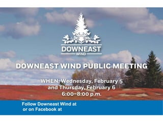
- 1. Follow Downeast Wind at www.downeastwindfarm.com or on Facebook at www.facebook.com/DowneastWind/
- 2. 6:00pm - Welcome and Introductions 6:05pm - Project Overview and Development 6:20pm - Sound 6:35pm - Shadow Flicker 6:45pm - Project Visibility from Scenic Resources 6:55pm - Environmental/Wildlife 7:10pm - Safety 7:20pm - Audience Q&A 8:00pm - Closing Program
- 4. Confidential Downeast Wind Project Highlights Name Downeast Wind Location Town of Columbia and Washington County, Maine ISO Hub/Zone Maine Hub Technology Wind Turbine Vestas V150 4.2 MW Nameplate Capacity 126 MW Net Capacity Factor 38% COD October 2022 • 100% site control, including TROW • Strong wind and good constructability drive competitive LCOE • One of the few utility-scale, competitive and permittable sites in ISO-NE not requiring major transmission project upgrades • Minimal environmental risks • Strong local support; project will provide income diversity and stability for landowners, at a time when blueberry prices and wood fiber are at an all-time low. 4
- 5. Downeast Wind Public Outreach Outreach Dates Open House May 17, 2016 Local Business Project Network reception June 8, 2016 Safety coordination meeting - Regional Fire, Safety, First Responders May 15, 2017 Public Open House and BBQ October 16, 2017 Community Mapping Meeting December 15, 2017 Schoodic Lake Project Information Meeting February 6, 2018 Public Information Meeting & Survey on Project Impacts/Benefits (23 respondents). February 7, 2018 Community Update Meeting February 8, 2018 Public Meeting: Survey of public feedback for Community Benefits and investments August 9, 2018 Columbia Approval for underground utilities October 15, 2018 5/21-29/19 Individual meetings with Schoodic Lake owners for lake owner improvement investments May 21-29, 2019 Public Open House June 11, 2019 Door to door outreach to get feedback on TIF and Community Benefits June 11-14, 2019 3
- 6. Downeast Wind Public Outreach (continued) Outreach Dates December 2019 Public Information Meeting December 19, 2019 Post-Meeting Survey of Public Meeting Attendees January 2020 Washington County Commission Public Hearing Presentation on TIF Agreement January 9, 2020 February 2020 Public Information Meetings February 5 & 6, 2020 Schoodic Lake Visual Simulation Open House (upcoming) February 12 & 13, 2020 Ongoing outreach: • Annual Airball Kids Basketball Tournament (March 2016-present) • Attendance at Columbia Selectmen Meetings, Annual Town Meetings, and Washington County Commissioner Meetings. • Windblade Challenge and Narraguagus School educational events. • Events were publicized with direct mailing to local stakeholder, local flyers, ads in newspapers, and display on 4 Corners Shop ‘n Save Sign. 3
- 7. Confidential Project Evolution • Original concept used the edge of the esker and open barrens along Baseline Road in Columbia and Cherryfield. • Project moved to western Columbia, and north with Phase 2 into T-18. • Original Project sought to maximize the generation within the leased space ~200 MW, 55-57 turbines. • Current Project design • 30 Turbines, 126 MW • Turbines relocated to reduce view shed on Schoodic Lake and reduce use of grassland habitat. 7
- 8. Confidential Previous Project Layout (#18) 8
- 9. Confidential Current Project Layout (#34) 9
- 10. Confidential Project Design Elements • 30 4.2 MW Turbines, 125M (410 ft) Hub Height, 200M (656 ft) Tip Height. • Consolidation of turbines north and south of Schoodic Lake to reduce visual impact and use of grassland habitat. • Radar-activated lighting system, no blinking lights when no local air traffic (As expected requirement of MDEP) • Reduced and controlled lighting on other facilities. • All setbacks and sound standards meet Town of Columbia and MDEP sound and setback standards. • Schoodic Lake dwellings: • No Turbine closer than 3,500 ft (.66 miles). • Nearest visible turbine 7,500 ft (1.4 miles) from nearest dwellings.
- 11. Confidential Decommissioning. An applicant must demonstrate adequate financial capacity to decommission the proposed wind energy development if required at any time during construction or operation of the development, or upon termination of development operations. This must include a demonstration that this financial capacity will be unaffected by any future changes in the applicant’s financial condition. 1. Full decommissioning plan must be submitted and approved. 2. Site restoration and turbine removal to minimum of 2 ft depth. 3. Plan and Financial assurance must be re-valuated every 2 years. 4. Decommissioning obligations transfer to any new or future project owner. Chapter 382: WIND ENERGY ACT STANDARDS Decommissioning
- 12. Confidential Taxes and Community Benefits $19.8M – 30 yrs Town of Columbia: • $280,000 payment at time of construction for use for town infrastructure. • $246,000 first full-year payment (not including onetime payments). • $280,000 average annual payment over 20 years. • $7.4M in payments for life of project. • Will not have any impact on state aid and revenue share. WaCoCBAdistribution 23T Annualpayment 328,440.00$ Scholarship fund 50,000.00$ SmBus Loan Fund 75,000.00$ Health Infraimprovements 113,440.00$ Emergencyrecusecapital 50,000.00$ Health and emergency 20,000.00$ Watershed 20,000.00$ Road use agreements: road improvements as a result of repair and restoration of roads post construction. Washington County: • $500,000 payment at time of construction for use for county infrastructure. • $350,000 to Schoodic Lake for property improvements. • $428,700 first full-year payment (not including onetime payments). • $482,000 average annual payment over 20 years. • $12.4M in payments for life of project. • Will not have any impact on state aid and revenue share. THESE ARE DIRECT BENEFITS TO THE COMMUNITIES AND LOCAL RESIDENTS
- 13. Confidential Economic Development 13 Downeast Wind is likely to bring more than $240 million in direct economic benefits to the region over 30 years. Local Vendor and jobs fair prior to construction. Downeast Wind will produce enough clean energy to power 36,000 Maine homes. During development and construction phases: o $215,000 in annual landowner payments o 104 direct construction jobs - $5M in payroll earnings* o 171 local induced jobs - $8.4 M in payroll earnings* o $85.3M in local spending through installation* Through operations (30 years): o $4.2M in annual landowner payments o 10 onsite jobs - $500,000 annual payroll* o 84 induced jobs created by local revenue and spending impacts - $4.2M annual payroll * (induced impact) total local and regional jobs to be created and/or maintained through direct and “multiplier effects” (economic activity induced by local spending of new wages generated by the project)* *Calculated by NREL The Jobs and Economic Development Impact (JEDI) models
- 14. Confidential Next Steps 14 • Public information meetings, gather public comment and feedback. • Finalize project design • Schoodic Lake Visual Sim Open House February 12 & 13 • Complete tax and Community Benefit agreements with town and county. • Prepare and submit Maine Site Law Permit Application Q1 2020. • MDEP Project Public Meeting. • Interconnect process complete Q4 2020. • Permit process complete Q1-2 2021. • Construction Q4 2021-Q4 2022
- 15. Confidential Comments from Social Media: 15 • There are other places to locate this project far away from where people live. • The project will have a negative impact on property values. • Project roads will be 40 yards wide. • Power will be sold out of state. • This project is only being done because the company receives large subsidies and federal dollars up front to build the project.
- 17. Confidential Agenda • Setbacks • Meteorological Siting • Sound • Shadow Flicker 17
- 18. Confidential Creating the Layout—Setbacks Example 5-square-mile project area: 18 3
- 19. Confidential Creating the Layout—Setbacks Example 5-square-mile project area: 19 Apply municipal and infrastructure features—roads, electricity, power lines, etc.
- 20. Confidential Creating the Layout—Setbacks Example 5-square-mile project area: 20 Apply environmental features: streams, wetlands, bird flyways, etc.
- 21. Confidential Creating the Layout—Setbacks Example 5-square-mile project area: 21 Apply setbacks from property lines, homes, barns, structures, etc.
- 22. •Site Suitability •Turbulence •Wakes Why We Study Wind Data 22
- 23. Confidential Meteorological Data On-site wind data 23
- 24. Confidential Takeaways • A turbine is sited due to a combination of physical, environmental, and meteorological reasons. • Moving one turbine impacts every other turbine in the project 24
- 25. Confidential Sound R. Scott Bodwell, P.E Bodwell EnviroAcoustics, LLC
- 26. Sound & Decibels 26 • Sound is a wave • Amplitude • Determines how loud • Wavelength • Determines frequency 𝜆 = 𝑐/𝑓, where c = speed of sound
- 27. Confidential Sound & Decibels 27 • Sound Pressure Level describes the amplitude of the sound. • Sound Pressure range: 20 to 20,000,000 micropascals. • Compressed using a logarithmic function to convert to sound pressure level denoted by dB or decibel. • Sound Pressure Level range: 0 to 120 dB 20 µPa Sound Pressure (p) 20,000,000 µPa 0 dB Sound Pressure Level (Lp) 120 dB 𝐿 𝑝 = 20 × log10( 𝑝 𝑝 𝑟𝑒𝑓)
- 28. Confidential Common Sound Pressure Levels 28 Image Source: Minnesota Pollution Control Agency http://www.nonoise.org/library/sndbasic/sndbasic.htm
- 29. Confidential Decibel Addition 29 • Two of equal sources added together increase the sound level by 3 dB: 30 dB + 30 dB = 33 dB = 10 x log[10^(30/10) + 10^(30/10)] = 33 dB • If the sound level difference is more than 9 dB, there is minimal change: 30 dB + 40 dB = 40.4 dB dB Change Perception 3 dB Just Perceptible 5 dB Noticeable 10 dB Twice as Loud 20 dB Four Times as Loud
- 30. Confidential Sound Metrics 30 Energy Based: LAeq (time-based energy average/equivalent sound level - commonly applied by noise standards) Percentiles: LA10 = 10% above (high range) LA90 = 90% above (low range)
- 32. Sound Over Distance 32 Sound Source: Expressed as Sound Power Level, LwA At Distance: Measured as Sound Pressure Level, dBA 6 dB per doubling of distance
- 33. Wind Turbine Sound 33 WIND TURBINE SOUND POWER LEVELS • Wind Turbine Testing per IEC 61400-11 • Establish Turbine Sound Power Level & Uncertainty • Purpose – for community sound level assessments • Prominent – mid frequencies 40 50 60 70 80 90 100 110 16 31.5 63 125 250 500 1000 2000 4000 8000 All SoundPowerLevel,dBA Frequency, Hz Vestas Wind Turbine Sound Power Levels 14 m/s 7 m/s 10 m/s
- 34. Noise Standards 34 Maine Department of Environmental Protection Chapter 375.10 – Control of Noise Major Rulemaking – Adopted 1989 SOUND LEVEL LIMITS – ALL DEVELOPMENTS • Limits apply at “protected locations” – noise sensitive areas such as residential properties and conservation areas • Quiet area limits – 55 dBA daytime/45 dBA nighttime (within 500 feet of sleeping quarters) • 5 dBA penalty applied to specific types of sound – tonal and impulse (short duration repetitive or SDR)
- 35. Noise Standards 35 Maine DEP Chapter 375.10 – Control of Noise Section I – Wind Energy Facilities Major Rulemaking – Adopted 2012 SOUND LEVEL LIMITS – ALL PROTECTED LOCATIONS • Reduced nighttime sound limit to 42 dBA nighttime • 5 dBA penalty if types of sounds produced • Based on annual sound levels of operating wind project in Maine • Meet nighttime noise guidelines of World Health Organization TOWN OF COLUMBIA – WIND TURBINE ORDINANCE • Applies Maine DEP 375.10 Section I by reference
- 36. Noise Standards 36 Maine DEP 375.10 Section I – Wind Energy Facilities SOUND LEVEL PREDICTION MODEL • International sound propagation standard • Turbine and Model uncertainty • Full rated sound level all turbines • Terrain-based (three dimensional) • Predictable Worst Case • No foliage attenuation • All receptors downwind • Proven methodology by wind turbine sound testing in Maine
- 37. Noise Standards 37 Maine DEP 375.10 Section I – Wind Energy Facilities TECHNICAL SUBMISSIONS • Location of all proposed sound sources – wind turbines and substation • Mapping of all protected locations – parcels/dwellings, conservation areas, residential subdivisions • Compliance evaluation of sound levels from construction and operations • Sound performance data and rated sound power for proposed wind turbines • Assessment of tonal and short duration repetitive sounds • Sound Complaint Protocol
- 38. Noise Standards 38 Maine DEP 375.10 Section I – Wind Energy Facilities OPERATIONS SOUND TESTING • Measure under conditions when wind turbine sound is most prominent – Full Sound Output & Low Ambient Sound • Specific measurements for tonal sounds – 1/3 Octave Band • SDR sounds - amplitude modulation based on 50 ms sound levels • Year 1 and every 5 years 10-Meter Wind Sensor
- 39. Noise Standards 39 Maine DEP 375.10 Section I – Operations Sound Testing HIGH WIND LOW WIND HIGH WIND STABLE ATMOSPHERE - NIGHTTIME •High Upper Winds •Low Surface Wind UNSTABLE ATMOSPHERE - EXCLUDE •High Upper Winds •High Surface Wind
- 40. Noise Standards 40 Maine DEP 375.10 Section I – Operations Sound Testing SOUND TEST REPORT • Wind turbine operations data – hub wind speed & direction, and kW power output • Surface wind speed measurements • Numerous sound metrics • Analysis of tonal and SDR sounds 30 35 40 45 50 55 2340 2345 2350 2355 2360 2365 2370 2375 2380 2385 2390 2395 2400
- 41. Sound at Downeast 41 Apex Internal Modeling to be verified by 3rd party for permit application submission
- 42. Confidential Takeaways • Sound is a pressure wave with a variety of frequencies and amplitudes • Specifically regulated by Maine DEP to protect noise sensitive land uses • Rigorous protocols for sound modeling, operations testing and sound complaints • Detailed Sound Level Assessment reports with predictive sound model based on international standards • Modeling and sound testing proven at numerous wind projects in Maine 42
- 44. •Shadow Flicker is caused by sunlight passing through the rotor sweep area of the wind turbine •Modern Wind Turbines have a light flickering frequency below 1Hz. •The amount of shadow flicker diminishes rapidly with distance from the turbine, and should be minimal at 10RD from a turbine What is Shadow Flicker? 44
- 45. Confidential Why do the Lengths of Shadows Change? 45 L 0H Image Source: Mamia, I. & Appelbaum, J. Renew. Sustain. Energy Rev. 55, 713–718 (2016). 𝐿 = 𝐻/tan(𝛼) Where, L is the Total Shadow Length H is the height of the object α is the sun elevation angle Geometry of the Sun!
- 46. Confidential Angle between the Earth and Sun 46 𝐿 = 𝐻/tan(𝛼) sin 𝛼 = cos 𝛿 cos 𝜙 cos 𝜔 + sin 𝛿 sin 𝜙 Where,α is the sun elevation angle δ is the declination of the earth axis φ is the latitude ω is the sun hour 𝛿 = 23.45 sin 360 284 + 𝑛 365 n is the day of the year Image Source: Illinois Institute of Technology, D. Maslanka
- 51. Confidential What Does this Assume? • No Clouds or Fog • Turbine Continuously Operates • Turbine Perpendicular to the sun at all times • No trees or buildings obscuring the shadow • House windows in all directions • Sun very diffuse at low angles 51
- 52. Confidential Shadow Flicker at Downeast 52 50 hrs 40 hrs 30 hrs 20 hrs 10 hrs Annual Shadow Flicker (8760 hrs) Apex Internal Modeling to be verified by 3rd party for permit application submission
- 53. Confidential Takeaways • We understand how to model where shadow flicker could occur very accurately • Shadow flicker is very specific to certain times of day and months of the year. 53
- 54. Comments from Social Media: • Homes and camps will always experience flashing shadows and light. • People will not be able to come out of their homes and camps. • People will become sick and disoriented from the project shadow flicker. 54
- 56. Visual Impact Assessment Yarmouth, Maine Completed over 25 VIAs 35 years of experience in Maine • Visual Impact Assessment • GIS Mapping and Analysis • 3D Computer Modeling • Mitigation Planning • Scenic Inventories and Assessment • Site Planning and Design • Master Planning • Recreation Planning • Permitting
- 57. Standard of Scenic Impact: determine whether the development significantly compromises views from a scenic resource of state or national significance such that the development has an unreasonable adverse effect on the scenic character or existing uses related to scenic character of the scenic resource. MAINE Wind Energy Act 57
- 58. • Significance of scenic resource • Existing character of surrounding area • Scope / scale of potential effect on scenic resource. • Expectations of the typical viewer. • Extent, nature and duration of public use. • Potential effect on continued use and enjoyment Evaluation Criteria 58
- 59. • Review project data • Research – SRSNS, recreational use data, locally sensitive resources • Viewshed Mapping • Fieldwork/Photography – leaf on and leaf off • 3D Computer Modeling • Model Overlays • Photosimulations • Visual Impact Assessment • Appendices: Mapping, Study Area Photos, Photosimulations VIA Methodology 59
- 60. Scenic Resources of State or National Significance 60 An area or place owned by the public or to which the public has a legal right of access that is… A) National Natural Landmarks, federally designated wilderness areas, and other outstanding natural and cultural features, such as the Orono Bog or Meddybemps Heath. There are 14 NNL in Maine, designated primarily for their scientific (and not scenic) value. NONE IN THE PROJECT AREA B) A property on the National Register of Historic Places pursuant to the National Historic Preservation Act of 1966, as amended (e.g., the Rockland Breakwater Light, Fort Knox). 16 NRHP Structures and 1 Historic District WITHIN 8 MILES, NONE WILL HAVE PROJECT VISIBILITY C) A National Park or State Park, There are 3 units of the National Park System and 32 designated State Parks in Maine. NONE IN THE PROJECT AREA D) Great Ponds that have been rated as Outstanding or Significant Lakes and ponds previously identified as having highly significant scenic value in the Maine’s Finest Lakes study, or designated as “outstanding” or “significant” from a scenic perspective in the Wildlands Lakes Assessment. Two rated great ponds within 8 miles: Mopang Lake and Upper Cranberry Lake. NO PROJECT VIEWS FROM EITHER POND.
- 61. Scenic Resources of State or National Significance 61 E) A Scenic River or Stream identified as having unique or outstanding scenic attributes, listed in Appendix G of the Maine Rivers Study. Machias River, rated an ‘A’ River, including Scenic Resources. Schoodic Brook is identified in the MRS, but not listed in Appendix G. NO PROJECT VIEWS FROM EITHER WATERBODY F) A scenic viewpoint located on state public reserved land or on a trail that is used exclusively for pedestrian use, such as the Appalachian Trail, that the Department of Conservation designates by rule adopted in accordance with section 3457. Great Heath is Public Reserve Land but there are no designated scenic viewpoints NONE IN THE PROJECT AREA G) A scenic turnout on a scenic highway constructed by the Dept of Transportation. There are two Scenic Byways within 8 miles: Blackwoods and Bold Coast. NO PROJECT VIEWS FROM EITHER BYWAY H) Scenic viewpoints located in the Coastal Area that are ranked as having statewide significance or national importance in terms of scenic quality . NONE IN THE PROJECT AREA
- 63. VIEWSHED ANALYSIS Landcover with Blades
- 64. National Register Historic Places 16 Structures and 1 Historic District 64
- 65. National Register of Historic Places Col. Samuel Campbell House Gen Alexander Campbell House Cherryfield Academy Patten Building Cherryfield Historic District Ruggles House Union Church Columbia Union Church Union Church Columbia Falls Gallison Memorial Library
- 66. NRHP: Columbia Union Church Project screened by intervening vegetation
- 67. Columbia Union Church Proposed Downeast Wind turbines Columbia Union Church NRHP: Columbia Union Church
- 68. NRHP: Columbia Union Church View of from front of church looking southwest
- 69. NRHP: Columbia Union Church View of from front of church looking west
- 70. NRHP: Columbia Union Church Computer Overlay
- 71. NRHP: Columbia Union Church View of Project Area from Epping Road in front of church
- 72. Great Ponds Rated for Scenic Resources and Scenic Rivers and Streams 72
- 73. UPPER CRANBERRY LAKE: Great Pond rated as ‘Outstanding’ for scenic resources. MOPANG LAKE: Great Pond rated as ‘Significant’ for scenic resources.
- 74. UPPER CRANBERRY LAKE: Viewpoint 1 No Project views.
- 75. MOPANG LAKE: Viewpoint 1 No Project views.
- 76. MOPANG LAKE: Enlargement of Viewpoint 1 No Project views.
- 77. MOPANG LAKE: Viewpoint 2 No Project views.
- 78. MOPANG LAKE: Viewpoint 3 No Project views.
- 79. MACHIAS RIVER No Project views.
- 80. SCHOODIC BROOK Project screened by intervening vegetation
- 81. View looking north 8 turbines will be visible 1.5 to 3.6 miles View looking south 7 turbines will be visible 2.1 to 4.25 miles SCHOODIC LAKE – Not a SRSNS
- 82. How do we know? If Aspect ratio to the tree is greater than aspect ratio to tower the tree obstructs the view of the tower. Aspect Ration Tree line = (E-B)/F Aspect Ration Tower = (D-B)/G.
- 84. Downeast Wind Project Environmental Studies
- 85. Agency Feedback and Considerations • Project contains Upland Sandpiper (USPA) habitat and they were observed during surveys. • Possible foraging stopover for Whimbrels (WHIM) to use blueberry barrens along Maine’s coastal plain (July 15 – September 15). No observations of WHIM during surveys. • Like other Maine locations, the Coastal Plain is an important migration route for passerines, which migrate at night. • Proximity of an eagle nest and potential use of the site by bald eagles • Fatalities of bats during operation documented in Maine and throughout US. 85
- 86. Studies Completed to Date 86 Study Dates Upland Sandpiper/ Grassland Bird Surveys June – Sept 2016, April – Oct 2017 Nocturnal Migration Radar Survey Fall 2015, Spring 2016, Fall 2016 Acoustic Bat Activity Surveys Fall 2015, Spring 2016, Fall 2016, Spring 2017 Diurnal Raptor Migration Surveys Fall 2015, Spring 2016, Fall 2016, Spring 2017, Spring 2019 Eagle/Avian Use Surveys Sept 2015 – Sept 2016 Aerial Bald Eagle Nest/Heron Rookery Survey Spring 2016, Spring 2017, Spring 2019 Schoodic Lake Eagle Nest Survey April 2019 – August 2019 Breeding Bird Surveys May and June 2016 Vernal Pool Surveys April and May 2019 Botanical Surveys Summer 2016 and Spring/Summer 2019
- 87. Studies Recently Completed or in Progress 87 Study Dates Wetland Surveys September - December 2019 Eagle/Avian Use Surveys January 2019 – December 2019 Analysis of Dwellings and Structures December 2019 Archaeological, Cultural and Historic Resource Assessment November 2019 – February 2020 Soil Survey October – December 2019 Visual Assessment November 2019 – February 2020 Flicker Assessment December 2019 – January 2020 Noise Assessment November 2019 – January 2020
- 88. Agency Feedback and Considerations In direct response to agency concerns: o Project size reduced from 57 turbine locations, 200 MW to 30 turbine locations,126 MW. o Turbines in open barrens that are used by UPSA and WHIM reduced from 25 in 2016, to 10 in 2018, to currently 6, 3 of which are in marginal habitat. Avoids large, expansive habitats and areas with high levels of UPSA use. No impact on areas with the most UPSA observations. Removes turbines from path between WHIM observed locations and Harrington Flats. o Turbines pushed to fringes of the barrens to avoid habitat. No northern turbines in open barrens. o All turbines directly south of Schoodic Lake removed. Also reduced visual impact from Schoodic Lake. Current Layout includes alternative turbine locations to allow final shifts to avoid conflicts. 88
- 89. Previous Project Layout (#18) 89
- 90. Confidential Current Project Layout (#34) 90
- 91. Additional Minimization for UPSA and WHIM • Project access roads and collection lines have been sited away from suitable UPSA breeding habitat to the extent practicable. • Curtailment during courtship behaviors in the rotor swept zone for turbines located in UPSA habitat. • May 15 – June 15 from 30 minutes before sunrise to 10 AM and 4 PM to 30 minutes after sunset • Turbines have been located outside of the WHIM flight path from Harrington Bay to the blueberry barrens near Schoodic Lake (where the MDIF&W has documented whimbrel use). 91
- 92. Minimization: Nocturnal Avian Migrants • Implement FAA-approved flashing lighting on turbines • No nighttime lighting on nacelles • Motion activated lighting will likely be installed on the substation and O&M • Unguyed permanent met towers due to the known mortality risk associated with guyed communication towers 92
- 93. Bald Eagles • No eagle carcasses have been found at wind projects in Maine to date. • As of 2018, 55 bald eagles carcasses found at wind project comprising the 57,000 wind turbines in the US since the early 1990s. • Eagle use surveys were completed for 2 years as per USFWS recommendation. • Eagle use at the Project was comparable to other wind projects in Maine. • Known eagle nests were taken into consideration for Project siting. • 1 mile setback of turbines 93
- 94. Bald Eagles 94
- 95. Bat Fatality Minimization Measures Highest risk to bats during the fall migration and three species of bats most likely to be impacted: • Eastern red bat, silver-haired bat and hoary bat. Exploring the possibility of combining curtailment and acoustic deterrents to aim for the highest reduction in bat fatalities or bat acoustic monitoring to determine periods of most risk and focus operational avoidance strategies during that period. Acoustic deterrents are effective in reducing bat fatalities, and the combination of curtailment and deterrents has been shown to reduce fatalities by over 70%. 95
- 96. Mitigation Concept 96 • The potential sites are located near the Project and proximal to already preserved land to add to the value of the mitigation land. • Identified natural communities within the mitigation area include grassland, scrub-shrub/barren habitat, early successional forest, deciduous forest, coniferous forest, mixed deciduous-coniferous forest, emergent wetland, scrub-shrub wetland, and riparian habitat. • The habitat quality at the sites and proximity to already preserved habitat more than offsets any potential habitat loss. • Sites will benefit both birds and bats and other wildlife. • Project proposes to put this land into a conservation easement and complete a land management plan.
- 97. Summary • Project design avoids impacts to grassland birds and plans to mitigate for any potential habitat loss or displacement. • Measures taken to reduce threat to avian migration. • Project designed to avoid eagle nests and fatality threat to eagles is very low. • Propose to use a combination of curtailment and the most advanced technology available (deterrents) to reduce threats to bats. • Conservation easement will create net benefit for wildlife. 97
- 98. Comments from Social Media: • Project will damage waterbodies, water quality and wild runs of Atlantic Salmon. • Roadways and excavation will cause erosion into Pleasant River and Schoodic Lake. • Harm the Great Heath and local bogs: Salmon, Bog Bedstraw, Canadian Mountain Rice Grass, Jacobs Ladder. 98
- 99. Wind 101- Safety
- 100. 100 Safety
- 101. 101 410 feet up
- 102. 102 Emergency Drills
- 104. 104 Apex Equipment
- 105. 105 Emergency Response- Patient Care • Rescue Trained o Advanced First Aid o AED/CPR o Ropes • Towers Rescue Equipped • We Will Bring PT to You • GPS For All Towers • Self Rescue
- 106. 106 Environmental Response • Safety Data Sheets (SDS) • Spill Control Plans • Evaluate Local Footprint • Covered Containment Areas
- 107. 107 Emergency Response- Turbine Fires • Extremely Rare • Sterile Zone • 200-300ft • Stage Away From the Turbine • Hit the Hot Spots
- 108. 108 Emergency Response- Transformers • Local Utility • No Water On the Hot Stuff • Pressurized Oil
- 109. 109 Safety and Community Relationships
- 110. 110 Moving Forward With Apex • Strengthen the Relationships o Fire/PD o Hospitals o Community • Mutual Training o Equipment o Response Plans • Annual Drills o Announced o Unannounced
- 111. 111 Remote Operations Center- “The ROCC” • Located In Charlottesville, VA o Apex Head Quarters • 24/7/365 Monitoring o Wind o Turbines o Comms • Talented Staff o Veterans o Always Vigilant!
- 112. 112 Apex- Safety, A Core Value • Our Employees • Award Winning Approach • Our Contractors • Pride in Influencing the Industry • Our Owners • Managing Risk • Our Land Owners • Relationships • Quarterly Meetings • Our Community • Constant Engagement • Our Emergency Responders • Enhance Mutual Aid • Drills and Collaboration
- 114. Question & AnswerPlease raise your hands and wait to be recognized before asking your question to ensure all attendees have an opportunity to ask questions and deliver comments on the project. If questions remain after 8:00pm Project Developer Paul Williamson will remain afterwards to directly answer any Downeast Wind Public Meeting
- 115. 115 Contact ROBERT GEE Public Engagement Organizer cell: 207-631-1502 robert.gee@apexcleanenergy.com Linda Belfiore Development Associate PO Box 219 Columbia, ME 04623 (207) 598-5434 Paul Williamson Senior Development Manager Apex Clean Energy, Inc. 207-242-3521 paul.williamson@apexcleanenergy.com Downeast Wind LLC PO Box 219 Columbia, ME 04623