
Recommandé
Contenu connexe
Similaire à Exploring Sakhalin By Car
Similaire à Exploring Sakhalin By Car (11)
Exploring Sakhalin By Car
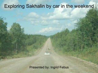
- 1. Exploring Sakhalin by car in the weekend Presented by: Ingrid Febus
- 2. Areas we are going to explore • Okhotskoye – Lesnoye • Aniva Bay – Taranay • Korsakov – LNG and beyond • Bikov Rapids • Dolinks coastal area • Cholmsk – Nevelsk • The Big Circle • Tichaya • Cape Velican
- 3. Okhotskoye - Lesnoye • Duration: half day • Distance: +/- 100 km return • Driving time: 2 hours • Driving conditions: Easy • GPS necessary: No • What to see and do – Frozen sea in winter – Buy King crab in Okhotskoye – BBQ on beach or at the warm lakes in summer – Watch salmon in Lesnoye (July – August) – See migrating swans in spring (April)
- 5. Route directions Okhotskoye • Leave Zima and turn left at main road towards Korsakov • Follow the main road past the Police check point (mind your speed) and take the exit on your left at the sign Okhotskoye • Nice picnic spots on the lakes on your left and right before you reach the coast • Stop to buy delicious King crab, prawns or cucumber fish at the fish stalls on your left in Okhotskoye • Continue on the road along the beach to reach warm lakes on your right hand side
- 23. Route directions Lesnoye • Follow road to Okhotskoye • If you reach the big lake on your right, turn left and follow sign to Lesnoye • Follow the road for 6 km until you reach Lesnoye • Follow the main road to the village (in Salmon season there is a checkpoint just before the village, but you are allowed to continue) and cross the bridge • Turn right after the bridge and follow the road along the river until the road turns left along the coast. Park here and walk to the beach or river • Turn left after bridge to see wooden houses
- 38. Aniva Bay-Taranay • Duration: Half day • Distance: between 110 – 150 km return • Driving time: 2 to 3 hours • Driving conditions: Easy, partly dirt road • GPS necessary: No • What to see and do – Beach – Salmon (July – August) – Fishing – Visit the yearly salmon festival
- 40. Route directions • Leave Zima and turn left on the main road towards the airport • Turn right after the Rosneft petrol station • Turn left and cross the railroad and follow the signs from here • There are two roads to Aniva, take the first one and follow it to the end to go to the beach • Return to town and turn left at the roundabout to exit Aniva and drive towards Taranay • Pass Taranay and keep driving until you reach a river
- 49. Korsakov – LNG Plant and beyond • Duration: Half day or more • Distance: 80 – 110 or 190 km return • Driving time: 2 - 4 hours • Driving conditions: Easy (last part dirt road) • GPS necessary: No • What to see and do – Explore Korsakov – Eat shaslick – LNG Plant – Enjoy beach and lake
- 51. Route directions Korsakov - LNG • Follow the main road South until you reach Korsakov • In Korsakov drive past Rosneft petrol station and stay on the main road along coast until the first traffic light, and turn left. • Immediately first right and first left. Follow this road (keep right at fork, do not go uphill) until you leave town. • On the other side of town you turn right at crossing to stay on main tarmac road and cross the bridge (the gravel road on your left goes to Okhotskoye) • Follow this road to the coast and the LNG – Plant • View point with Japanese monument on hill on your left before you reach LNG – Plant (concrete steps) • On your way back drive around in Korsakov to find your way to the highest point (past the main square in town) to have a nice view over the harbour
- 52. Route directions Korsakov and beyond • Follow the main road South until you reach Korsakov • Enjoy Korsakov and the LNG – Plant • Drive past the LNG – Plant and follow the graded road • Beautiful and quiet picnic spots on the beach • If the road bends inlands, you can turn left after about 6 km (there is a bus stop on your right) • Follow this bumpy road for about 5 km and turn left at fork in road (iron pole next to road and cross concrete bridge) • Turn left again at the next fork for a stop a the lake (N46 37.509 E143 17.223)
- 71. Bikov Rapids • Duration: 3/4 day • Distance: +/- 140 km return • Driving time: 3 - 4 hours • Driving conditions: Easy (last part dirt road) • GPS necessary: No (but easier to find rapids) • What to see and do – View Rapids – Beautiful picnic spots and scenery – Short, but steep descent to river
- 73. Route directions • Drive north to Dolinsk • In Dolinsk turn left and cross railroad tracks via bridge • Follow this road to Bikov (25 km) and turn left to cross river via bridge, follow road • In front you see a big abandoned building on the hill, turn right • 2nd road left (before pipe over road) and drive between garages on your right and apartment block on your left • Follow road uphill and turn right • From here you follow the river approximately 2 km • Small road on your right to park the car (you can hear the rapids). Walk to the rim and descent to river
- 74. GPS Information • Turn left in Dolinsk N47 19.781 E142 47.352 • Bykov Rapids N47 20.240 E142 30.938
- 93. Dolinsk coastal area • Duration: Half day or more • Distance: 180 km return • Driving time: 3 hours • Driving conditions: Easy • GPS necessary: No • What to see and do – Search for amber – Seals (during Salmon season) – Salmon – Camping
- 95. Route directions • Drive North until you reach the coast • Turn right and drive past houses until you reach the beach and look for seals on the rocks • Search for amber (you have to be very lucky to find it) • Turn back and drive further North to find nice camping spots along the beach • Good river for salmon fishing in the right season (July – August)
- 107. Cholmsk-Nevelsk • Duration: Full day • Distance: +/- 230 km roundtrip • Driving time: 6 hours • Driving conditions: Easy, partly dirt road • GPS necessary: No • What to see and do – Picnic spots on beach and along the river – Cholmsk boulevard – Datcha’s on the beach – Scenic coastal and mountain route – See Stellar Sea Lions in right season (April – May)
- 109. Route Directions • Take road towards Aniva and follow signs to Cholmsk • All tarmac road until Cholmsk • Before you reach Cholmsk you can make photo stop at monument and lookout on right hand side of the road on highest point when you cross mountain pass • In Cholmsk you can stop at the boulevard and walk around • If you continue on the main road, you should turn right immediately after the bridge over the railroad to take the coastal road to Nevelsk (don’t drive uphill) • Follow road to Nevelsk where you can make a stop and look at the changed coast line after the earth quake (south side of town) • Drive back 5 km to turn right to take beautiful mountain road back to Yuzhno
- 143. The Big Circle • Duration: Long day • Distance: +/- 375 km roundtrip • Driving time: 7 hours • Driving conditions: Easy, partly dirt road • GPS necessary: No • What to see and do – Have a coffee in Vzmorye – Scenic coastline on East and West coast – Picnic or BBQ on the beach – See salmon in right season (Aug. – Sept.) – See Japanese Arches in Vzmorye and/or Tomari
- 145. Route directions • Easy to find on the map • Start driving North (this part of the road is included in more trips and therefore more familiar) to have more time on the West coast • Coffee (and photo) stop at Vzmorye train station • A good spot to see salmon (in season): – After you turn left to cross the island from the east coast to the west coast. Turn left immediately after you have crossed the third railroad crossing and park the car after about 100 meters next to the river.
- 146. • See Japanese arch in Vzmory – After you have seen the sign of Vzmorye, turn right immediately after you cross a small river, as soon as you see the first houses. • See Japanese arches in Tomari – Turn left (if you come from the north) just before you reach the bridge, just before you drive into town.
- 162. Tichaya • Duration: Long day or weekend (camping) • Distance: +/- 300 km return • Driving time: 5 – 6 hours • Driving conditions: Easy • GPS necessary: No • What to see and do – Spectacular coastal scenery – Abundant birdlife – Beautiful hiking trails – Great camping spot (can be busy)
- 164. Route directions • Drive north via Dolinsk to East coast • Follow coastal road and have an optional stop at Vzmorye train station to buy coffee and/or crab • 24 km past Vzmorye you reach Tichaya • Turn right immediately after the Tichaya sign • Follow dirt road past quarry (stay in valley, don’t drive uphill) until you reach the beach • Walk to the left past fisherman, walk along beach • Find rope on the cliffs on your left and climb up for amazing views • With low tide, walk through cliff gorge at the end of beach. Climb over rocks along water line and around cliffs until you reach next small beach. Climb cliff with rope and walk back over cliff rim to the first rope mentioned before to return back to beach • More beautiful walks if you turn right on the beach
- 177. Cape Velican • Duration: Full day • Distance: +/- 200 km roundtrip • Driving time: 6-7 hours • Driving conditions: Difficult • GPS necessary: Yes • What to see and do – Beautiful picnic spots on beach and lake – Rock formations on East coast – LNG plant – Swimming possibilities for die hards – Spectacular views
- 180. Route directions – GPS information 1. Drive to Okhotskoe and follow the road along the coast until the end. From here follow GPS coordinates given below 2. Turn right N46 48.068 E143 25.258 3. T-crossing turn left N46 44.614 E143 24.624 4. Straight on N46 44.027 E143 25.734 5. Straight on N46 40.887 E143 26.081 6. Sharp left turn uphill N46 40.855 E143 26.084 (from point 2 to 6 is 16 km) This is a difficult narrow and bumpy road that you follow until you reach the beach 7. Entry to beach N46 37.814 E143 30.976 8. Cape Velican N46 37.754 E143 30.982 9. Return to point 6 and turn left 10. T-crossing turn right N46 38.914 E143 22.976 11. T-crossing left N46 36.848 E143 18.305 12. Next fork turn right, follow this road for about 5 km and turn right at T-junction N46 34.116 E143 18.252 13. Follow this road to Korsakov
- 193. The End Presentation available via Outpost website: www.globaloutpostservices.com/sakhalin (tab further information)
Notes de l'éditeur
- Thank you for coming and welcome. Would like to share the good times we have when we are exploring Sakhalin. There are short trips and longer trips and trips that can be combined. We can not cover all possibilities, but maybe this is a start of more to come? The presentation will be available on the outpost website. The link will be mentioned at the end. The text can be distributed easily if you leave your name and email address tonight.