Monitoring crisis events from HAPS
•
2 likes•808 views

Presentation by Liduin Bos (Deltares) at the Data Science Symposium 2018, during Delft Software Days - Edition 2018. Thursday 15 November 2018, Delft.

Recommended
More Related Content
What's hot
What's hot (20)
Similar to Monitoring crisis events from HAPS
Similar to Monitoring crisis events from HAPS (20)
More from Deltares
More from Deltares (20)
Recently uploaded
Recently uploaded (20)
Monitoring crisis events from HAPS
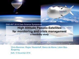
- 1. Delft, 15 November 2018 High Altitude Pseudo-Satellites for monitoring and crisis management a feasibility study DSD-INT 2018 Data Science Symposium Chris Bremmer, Rogier Westerhoff, Marco de Kleine, Liduin Bos- Burgering
- 2. Content Introduction - Back…to the future HAPS in general: Specs Satellites vs HAPS Platform types Sensors and resolution HAPS applications Future prospects / timeline Conclusions Room for discussion 15 November 2018
- 3. Back… to the Future •First stratospheric flights using pressurized balloons 1930s •First aircrafts able to reach stratospheric altitudes 1950-1960 •First experimental projects for HAPS research 1969 •Launch projects aimed to analyze potential HAPS applications 1990-2000 •Launch projects performed by a.o. Google, Facebook, Airbus and WorldView 2014-2018 15 November 2018 Source: Rodrigez et al. (2017) – HAPS4ESA When was the first stratospheric flight reported with a HAPS forerunner? Any guesses?
- 4. HAPS - general Fast developing ESA: HAPS4ESA conference 2017 Maritime security/border surveillance and Air quality High variety of sensors: 30-50 km field-of-view Fills gaps between: Airplanes Satellites Drones 15 November 2018
- 5. HAPS - Specs 15 November 2018 Quasi-stationary airships or aircrafts Altitude: ~20 km Solar powered
- 6. Satellites or HAPS? HAPS Satellites Altitude ~20 km >~180 km Telecommunications link budget Low High Power consumption Low High Signal latency Less More Round-trip delay Less More Deployment in terms of development and launch Rapidly deployable and comparatively less expensive Significant time and monetary resources Landing for maintenance or mounting of a different payload Possible Impossible 15 November 2018
- 7. HAPS platform types Characteristics Airplane Airship Balloon Density >Air <Air <Air Payload Capacity <100kg/<500 W <500 kg/<5 – 6 kW <20 kg/< 100W Flight Time 1 – 3 month 1 year 1 – 3 month Size/Volume Small Very Big (need to find a hangar) Small Throughput High Very High Medium – High Cost per HAPS €€ €€€ € 15 November 2018 HAPS platforms Zephyr-SZephyr-T Stratobus HA2 ELAHA15 AlphaLink Stratollite Aquila Loon Solara50
- 8. HAPS sensors and resolution 15 November 2018 Image size: ~10 km Revisit: <3 hours Resolution: <1 m (15 cm) Band: sensor dependent Radiometry: sensor dependent Coverage: ~10 km3 source: Gonzalo, 2017
- 9. HAPS - Applications 15 November 2018 Dike monitoring Avalanche monitoring Feeding emergency response system: Volcanic hazards Earthquakes Flooding Droughts Morphological changes in the Wadden Sea Evapo(transpi)ration of agricultural areas Droplet size distribution in thunderstorm clouds Shipping control …
- 10. National application: 15 November 2018 Water management and safety in the Netherlands (WMCN)
- 11. Time line – Deltares and platform development 15 November 2018 Application study including stakeholders Preparation demonstration case
- 12. Conclusions HAPS are seriously explored in the space sector and will be deployed within 3 – 4 years Hyperspectral possible already – SAR very promising Opportunities for Deltares in flood management and environmental monitoring: Incorporate HAPS-data stream in operational flood forecasting Dedicated field survey for validation of models Follow-up scenarios: A. Wait and see B. Review for RWS C. Prepare for RWS-demonstration – Airbus or ESA D. Go international 15 November 2018
- 13. ESA follow-up 15 November 2018 Haps4esa.org
- 14. Room for questions and discussion 15 November 2018
- 15. Video 15 November 2018 Video not included in SlideShare publication. Contact us if you’re interested.
- 16. Sensors Type of sensor Altitude IFOV Diameter footprint Resolution Optical 20 km 300-7,500 km2 10 - 35 km 15 cm Radar 20 km 15,000 km2 70 km Not yet known Communication 20 km 125,000 km2 200 km - 15 November 2018
- 17. 15 November 2018