Drought - Disaster management
•Download as PPTX, PDF•
1 like•1,525 views

This presentation comprises of Concepts of Disaster Management related to Droughts.

Recommended
More Related Content
What's hot
What's hot (20)
Similar to Drought - Disaster management
Similar to Drought - Disaster management (20)
More from Dhruv Saxena
More from Dhruv Saxena (8)
Recently uploaded
Recently uploaded (20)
Drought - Disaster management
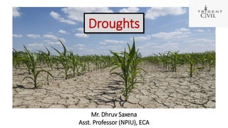
- 1. Droughts Mr. Dhruv Saxena Asst. Professor (NPIU), ECA
- 2. Contents 1.Introduction 2.Types of Droughts 3.Occurrence of Droughts in The World 4.Droughts and Indian Scenario 5.Historical Droughts in India 6.Causes of Droughts 7.Impacts of Droughts 8.Various Indicators for Assessment of Droughts 9.Drought Relief 10.Institutional Response to droughts 11.Mitigation of Droughts 12.Conclusions
- 3. Introduction Definition of Drought Common accepted definition is: • A temporary reduction in water or moisture availability significantly below the normal or expected level for a specified period • A period of dry weather of sufficient length and severity to cause at least partial crop failure • Actual moisture supply at a given place consistently falls short of the climatically expected moisture supply
- 4. Introduction • It is temporary aberration in aridity which is permanent feature of climate … National Institute of Disaster Management, India • It is often referred to as a "creeping phenomenon" and its impacts vary from region to region….. National Drought Mitigation center, USA Droughts according to apex research institutes
- 5. Types of Droughts Droughts Meteorological Droughts Significant decrease from normal precipitation over an area Hydrological Droughts Depletion of surface water and fall in water tables Agricultural Droughts Soil moisture and rainfall is inadequate to support crops
- 6. Meteorological Droughts Moderate Droughts Rainfall deficiency over 20% of area is between 26% and 50% Severe Droughts Rainfall deficiency over 20% of area is > 50% Areas affected Drought prone areas Those areas that experience meteorological drought in 20% of years Chronic Drought prone areas Those areas that experience meteorological drought > 40% of years Types of Droughts Classification of Areas affected
- 7. Occurrence of Droughts in the world Pattern of intensity of drought globally Pattern of global frequency of droughts in duration of 2000-2008
- 8. Rainfall distribution Droughts and Indian Scenario • 33 % area receives rainfall < 750mm -chronically drought prone • 35 % area receive rainfall = 750-1125 mm- drought prone • Total 68 % area of the country prone to drought Seasonal Spells Rainfall (%) Pre-Monsoon(March-May) 10.4 % SouthWest Monsoon(Jun-Sept) 73.3% NorthEast Monsoon(Oct-Dec) 13.3% Winter Rains (January-Feb) 3.0 % Country’s Vulnerability to Drought
- 9. Droughts and Indian Scenario Drought map according to IMD (Indian Meteorological Department) Pattern of drought occurrence (year 2012)
- 10. Historical droughts in India S. N. Year Affected area People affected 1 1966 Bihar and Orissa 50 million 2 1969 Rajasthan, Gujarat, TN, UP, AP, Haryana, Karnataka, and MP 15 million 3 1970 Bihar and Rajasthan 17.2 million 4 1972 Rajasthan, Himachal and Uttar Pradesh 50 million 5 1979 Eastern Rajasthan, HP, Punjab and UP 200 million 6 1982 Rajasthan, Himachal Pradesh and Punjab 100 million 7 1983 TN, West Bengal, Kerala, Rajasthan, Karnataka, Bihar and Orissa 100 million 8 1987 Entire North, West and Eastern India 300 million 9 2000 Rajasthan, Gujarat, Orissa, Andhra and MP Over 100 million 10 2002 Rajasthan, Karnataka, AP and TN Over 300 million
- 11. Causes of droughts 1. Natural Causes: I. Prevalence of High air pressure system over particular geographical area II. High level of Sunlights = bright sunlight causes the drying of water vapour present in atmosphere III. Wind carrying continental air mass rather then oceanic air mass = continental air mass is drier than oceanic air mass, which triggers rainfall seldom IV. Absence of obstruction in the way of water vapour carrying clouds = Presence of obstruction can facilitate cooling of water vapour, hence condensing the same.
- 12. 1. Natural Causes: V. Absence of humidity to help condense the water vapour = humidity helps converting vapour to water drops VI. Erratic distribution of Monsoon = Alteration in the pattern of monsoon distribution causes the uneven rainfall over a particular geographical area VII.Disruption in the pattern of trade winds and oceanic currents = Trade winds and oceanic wind affect the pattern of monsoon globally VIII.Occurrence of El-Nino Causes of droughts
- 13. 2. Human activities: I. Global warming = It will lead to disruption of water cycle over a large geographical area at global scale. II. Deforestation = reduction of the forest cover causes the drier area which can not attract the water vapour to condense. III. Excessive irrigation over a particular area = Excessive irrigation can leads to water logging which can be attributed to salination of ground. Hence reduction in crop yield will take place. IV. Soil erosion = It reduces the water holding capacity of the ground which will lead the futility of ground. V. Absence of rain water harvesting = Inexistence of rain water harvesting will lead to water shortage in the time of need. Causes of droughts
- 14. Impacts of droughts A.Direct Impact A. Reduced agricultural production B. Depleted water level C. Higher mortality rate for humans and wildlife D. Damage to livestock B. Indirect Impact A. Reduced income for farmers B. Increased unemployment C. Increased rate of inflation D. Decreased purchase capacity Impacts of droughts
- 15. Impacts of droughts 1. Economic Impacts 1. Reduced GDP and GNP 2. Reduced purchase power parity 3. Reduced Exports 4. Reduced forex reserves 5. Decreased value of currency 6. Increased inflation rate 2. Environmental Impacts 1. Reduced ground water level 2. Reduced forest cover 3. Disruption in ecosystem 4. Loss of biodiversity 3. Social Impacts 1. Migration of rural population 2. Disruption in socio-economic condition of families 3. Malnutrition due to starvation
- 16. Various indicators for assessment of drought 1. Meteorological drought indicators Rainfall deciles Monthly aggregated data of precipitation (rain and snow) are compared with average values extracted from long term observations. The method uses precipitation deciles, which are created with ranked observed precipitation. Standardized Precipitation Index (SPI) The SPI calculation is done with monthly precipitation, which is fitted to a two parameter gamma probability distribution. This distribution is then transformed into a normal distribution. Because of the normalized distribution, wetter and drier climates can be represented and compared in the same way.
- 17. 1. Meteorological drought indicators (Continued...) Cumulative Precipitation Anomaly (CPA) The Cumulative Precipitation Anomaly (CPA) measures the shortage of precipitation compared to the long-term mean. The timescale of this method is not fixed and can vary from monthly to annual precipitation. A disadvantage of the CPA is that the mean precipitation is often not the same as the median. Effective Drought Index (EDI) A method to calculate drought on a daily time scale is the Effective Drought Index (EDI). It was developed to calculate daily water accumulation with a weighting function of time passage. Rainfall Anomaly Index (RAI) The RAI is calculated on weekly, monthly or annual time scale. The choice of time scale is done based on the distribution of precipitation Various indicators for assessment of drought
- 18. Various indicators for assessment of drought 2. Soil moisture drought indicators Palmer drought severity index The Palmer Drought Severity Index (PDSI) was developed by Palmer (1965) to provide a index based on drought severity, that allowed the comparison of droughts with different time and spatial scales. The PDSI takes into account precipitation, evapotranspiration, and soil moisture, although it is still classified by many authors as a meteorological drought indicator. Palmer Z-index The Palmer Moisture Anomaly Z-index (Z-index) is used for the calculation of soil moisture droughts. The soil moisture anomaly for the current month is calculated as the Z-index. The Z-index is derived from the calculation of the PDSI. Thus, the Z-index suffers from the same advantages and disadvantages as the PDSI.
- 19. Various indicators for assessment of drought 2. Soil moisture drought indicators (Continued…) Soil Moisture Deficit Index (SMDI) The Soil Moisture Deficit Index (SMDI) has recently been developed by Narasimhan & Srinivasan (2005).They developed a drought index, which could detect short-term dry conditions, has no dependency on the season, and which has no reference to a climate region. The SMDI is used for the calculation of agricultural droughts and is used on a weekly time scale. Crop Moisture Index (CMI) The Crop Moisture Index (CMI) was developed by Palmer (1968) as a meteorological-driven drought indicator. The CMI monitors short-term soil moisture changes in observed or simulated data, and is classified as a soil moisture drought indicator
- 20. Various indicators for assessment of drought 3. Hydrological drought indicators Surface Water Supply Index (SWSI) It was developed to deal with accumulation of snow, and the delayed runoff caused by this process. The SWSI is suitable for the calculation of hydrological droughts. It incorporates climatologic and hydrological characteristics into a single index value, which has the same classification as the Palmer indices. Groundwater Resource Index For the calculation of groundwater droughts, the Groundwater Resource Index (GRI) can be used. The GRI is based on a normal distribution of the simulated groundwater storage in at a site. Base Flow Index (BFI) The Base Flow Index (BFI) was proposed for a low flow study in the United Kingdom and is calculated on a daily time step. The BFI has not been used in drought analysis on a global scale.
- 21. Drought Relief Multi-sectoral and multi-dimensional relief and response are to be given at the onset of droughts. 1. Contingency crop planning Dissemination of information to farmers Suggestion of cropping to farmers region wise and season wise Advocate crop diversity Provision of Agro –advisory agency which can render advise to farmers at no benefit and cost 2. Support to farmers Agriculture Input Support Energy Support Extension support Tax free Credits to farmers Incentives for production of allied products such as animal husbandry and milk production etc.
- 22. Drought Relief 3. Relief employment 1. NREGS (National Rural Employments Guarantee Scheme) 2. Local Area Development Programs (MP-LAD and MLA-LAD funds) 3. Relief employment by District disaster management committee 4. Water resources managements Provision of water for basic need of human Provision of water for basic need of Cattle Reservoir management Repair of existing water supply systems Special measures for drinking water Construction of temporary water pipe line Mobilization of water from local reservoir with help of local transport system such as bullock carts etc
- 23. 5. Food security Provision of food Providing nutritional food with help of ICDS (Integrated Child Development Schemes) Mid Day meal Programs Cattle camps and fodder supply Transferring equivalent cash to the beneficiary to help buying grains with help of DBT (Direct Benefit Transfer) scheme Low cost grain supply with help of PDS (Public distribution system) 6. Gratuitous Assistance Tax waivers and concessions Reduction of interest rate for affected people Drought Relief
- 24. Institutional Response to droughts 1. Central Government Ministry of Agriculture is responsible for response of union govt Drought management division of the department of agriculture looks for relief measures Calamity Relief Fund (CRF) and National Calamity Contingency Fund (NCCF) is used IMD (Indian Meteorological Department) and NIDM (National Institute of Disaster management) coordinates for Technical inputs National Crisis management Committee holds decision over policy decision 2. State Government Department of Disaster management is responsible for state govt decisions and their execution Relief commissioner issues directions and instructions District administration coordinates with Gram Panchayats and NGO to reach grass root level
- 25. Mitigation of droughts Mitigation means the action taken before or at the onset of disaster to reduce the adverse impacts of the same. National Rainfed Area Authority (NRAA) was set up to look for drought mitigation in long term basis. NRAA issues knowledge inputs for systemic upgradation and management of country’s dry land and rainfed agriculture. Watershed development in India Integrated watershed management program ==== Low cost and locally available technology for water conservation, soil moisture conservation, biomass production, increase land productivity and pasture development. Drought –Prone Areas Program (DPAP) and desert development program (DDP) = meant to drought proofing and combating desertification in arid and semi arid areas.
- 26. Implementation of mitigation measures : Water harvesting and conservation Artificial recharge of ground water Contour bunding, Contour trenching, Contour cultivation Bench terracing, Graded bunding Gully plugging Check dams (Nalla Bunding Construction),Anicut, inject wells Gabion structure Traditional methods (Rural) Dug well recharge Tanka/Kund/Kundis/Bavadi/Khadin Spring water harvesting Traditional methods (urban) Rooftops drain Paved unpaved area drains Mitigation of Droughts
- 27. Implementation of mitigation measures : Innovative Irrigation methodology Drip and sprinkler irrigation system Prevention of evaporation loss of the reservoir Integrating small reservoir and major reservoir Integrating basin planning Afforestation Crop insurance Community participation in drought mitigation Mitigation of Droughts
- 28. Conclusions 1. Drought is Creeping phenomena which imposes adverse impact on each nook and corner of the socio-economic fabric of the society. 2. India has large arid and semi arid area which comes under drought. 3. Researchers have developed various indicators to assess the impact of droughts. 4. In India, we have established institutional frame work to combat drought 5. Institutional frame work consists central and federal structure of the organizations. i.e. National Disaster Response Center 6. However, a struggle was faced while implementing the mitigation measures. 7. A need was felt to motivate research into policy formulation as well as technical aspects to strengthen the capacity building to combat natural calamity like droughts
- 29. Thank you !!