SlideShare une entreprise Scribd logo
1  sur  36
Télécharger pour lire hors ligne
Surface Conditions Report, June 5, 2017
Eyes Over Puget Sound
Field log Climate Water column Aerial photos - Streams
Publication No. 17-03-070
Up-to-date observations of water quality conditions in Puget Sound and coastal bays
Start here
Dr. Christopher
Krembs (Editor)
Personalimpressions p. 3
We have a new marine technician: AllisonBrownlee!
Climateinfluences p. 5
The spring has generally beenwet. River flows are all above
normal due to snow melt and warmer air temperatures.
Watercolumn p. 8
Recordwinter andspring rains have createdsignificantly fresher
conditions.
Aerialphotography p. 10
Yellow-greenbloomsinbays near the KitsapPeninsula. Blooms
in green, brown, andred brownnear estuaries of the Skagit,
Stillaguamish, and PuyallupRivers. Redblooms inrivers of
Willapa Bay.
Streams p. 34
Coldand wet conditions inthe first half of 2017 have set the
stage for a favorable supply of freshwater to the marine
environment.
LONG-TERMMARINEMONITORINGUNIT
Skip Albertson
Julia Bos
Editorial assistanceprovided by: Allison Brownlee, CarolMaloy
Marine conditionsfrom 6-5-2017 at a glance
Field log Climate Water column Aerial photos - Streams
Tyler Burks
Mya Keyzers
Allison Brownlee
pH
sensor
Niskin
bottle
Personal Field Impression
Field log Weather Water column Aerial photos - Streams
Personal Field Impression 6-5-2017
Field log Climate Water column Aerial photos - StreamsField log Weather Water column Aerial photos - StreamsField log Climate Water column Aerial photos - Streams
What types of data do we collect below the surface?
We have a new marine technician! AllisonBrownlee has come fromthe City of San
Diego where she collectedandanalyzedoceanographicdata for their expansive ocean
monitoringprogram. Allisonjoins Mya Keyzers inthe marine waters fieldcrew who
monitor Puget Sound and the coastal estuaries by bothsea plane and boat!
Surrounding the sensors arewater-sampling
Niskin bottles that we can programto
collect water samples at discrete depths.
We analyzefor:
• Nutrients
• Chlorophylla
• TN (Total nitrogen)
• TOC (Total organic carbon)
• POC (Particulate organic
carbon)
• PN (Particulate organic
nitrogen)
• Dissolved oxygen
• Salinity
We usea SeaBird CTD (Conductivity,
Temperature, Depth) profiler with
added sensors to measurea suite of
water column parameters:
• Temperature
• Salinity/Conductivity
• Dissolved oxygen
• PAR(Light)
• Transmissivity
• Fluorometry
• Turbidity
• pH
Critter of the Month – The Tube-Dwelling Anemone
Dany Burgess & Angela Eagleston
Marine Sediment Monitoring Team
Fun Facts!
• The only tube anemone
found in Puget Sound
• Secretes a thread-like
material to create its own
black, slimy tube
• Main predator is the giant
nudibranch (photo below)
• Can live up to 10 years
Learn moreabout the tube-dwelling anemone and other critters on Ecology’s EcoConnectblog here
Pachycerianthusfimbriatus
Puget Sound is blooming with
plankton right now, and this month’s
flower-like critter is a reminder that
the benthos has “blooms” of its
own!Meet the tube-dwelling
anemone, a delicate blossomat the
bottom of Puget Sound.
Photo courtesy of Mike Munroe Photo courtesy of John Yasaki
Personal Field ImpressionEyes Under Puget Sound 6-5-2017
Field log Weather Water column Aerial photos - StreamsField log Climate Water column Aerial photos - Streams
Climate Influences leading to 6-5-2017
Climate and naturalinfluences,includingweather,rivers,and the adjacent ocean,can
affect our marine waters. Graphics are basedonprovisional dataandare subject to
change. http://www.ecy.wa.gov/programs/eap/mar_wat/weather.html,page 26.
higher No datalowerexpected
*UpwellingAnomalies (PFEL)
PDO = PacificDecadal Oscillation
NPGO = North Pacific GyreOscillation
ENSO = El Niño Southern Oscillation
Field log Weather Water column Aerial photos - StreamsField log Climate Water column Aerial photos - Streams
Summary:
Air temperatures havebeen
slightly warmer after a cool
winter/spring.
Precipitationlevels havebeen
near normal, capping a wet
spring.
Sunshine levels havebeen
abovenormal except near the
coast(opposite of cloud
cover).
River flows areall above
normal due to snow melt and
warmer temperatures.
Downwelling has been strong,
though normalin May. ENSO
and PDO aretrending warmer.
We usea boatand
a chartered float plane
equipped with a CTD
packageto access our
monthly monitoring
stations.
We communicate data
and environmental
marine conditions using:
1. Marine Water
Condition Index
(MWCI)
2. Eyes OverPuget
Sound (EOPS)
3. Anomaliesand
sourcedata
Field log Climate Water column Aerial photos - Streams
Ourlong-termmarinemonitoringstationsinWashington
Starthere
Isl.
.
Station network of ambient
water quality monitoring stations
San Juan Isl.
Field log Climate Water column Aerial photos - Streams
HowwellisPugetSoundexchangingitswater?
Year 2016 had record-breaking globaltemperatures. The year 2017 is looking much better. Fraser River flows
are normal or higher than normal in June and similar to the year 2014. This means that water renewalin Puget
Sound has returned to normal conditions this early summer.
Fraser River Flow
0
2000
4000
6000
8000
10000
12000
Dec-13
Jan-14
Feb-14
Mar-14
Apr-14
May-14
Jun-14
Jul-14
Aug-14
Sep-14
Oct-14
Nov-14
Dec-14
Jan-15
Feb-15
Mar-15
Apr-15
May-15
Jun-15
Jul-15
Aug-15
Sep-15
Oct-15
Nov-15
Dec-15
Jan-16
Feb-16
Mar-16
Apr-16
May-16
Jun-16
Jul-16
Aug-16
Sep-16
Oct-16
Nov-16
Dec-16
Jan-17
Feb-17
Mar-17
Apr-17
May-17
Discharge(m3s-1)
Higher than normal
Lower than normal
Expected
FraserRiver
Physical conditionstracked in historicalcontext
Field log Climate Water column Aerial photos - Streams
With the onset of 2017,the remarkably high watertemperatures from2015 & 2016 disappearedexcept in
SouthHoodCanal deepwater. Recordwinterand spring rains havecreatedsignificantly fresher conditions.
Badweather fromJanuary throughApril causedus to miss quite a few stations. Inaddition,our rigorous
QA/QC caught some sensor issues in oxygen,resulting in data gaps.
Near Normal Temperature LowerSalinity
Region
1 2 3 4 5 6 7 8 9 10 11 12 1 2 3 4 5 6 7 8 9 10 11 12 1 2 3 4 1 2 3 4 5 6 7 8 9 10 11 12 1 2 3 4 5 6 7 8 9 10 11 12 1 2 3 4 1 2 3 4 5 6 7 8 9 10 11 12 1 2 3 4 5 6 7 8 9 10 11 12 1 2 3 4
Whidbey Basin
Hood Canal
Central Sound
South Sound
Grays Harbor
Willapa Bay
North Sound
San Juan
2015 20152016 2017 20172015 20162016 2017
DO Data Gaps
a) PacificDecadalOscillationIndex(PDO,temperature) (explanation)
b) UpwellingIndex(anomalies)(Upwelling,low oxygen) (explanation)
c) NorthPacificGyreOscillationIndex(NPGO, productivity) (explanation)
Field log Climate Water column Aerial photos - Streams
Theoceanaffectswaterquality: OceanClimateIndices
NPGO(x10)
PDO/UpwellingIndex
Three-year running average of PDO, Upwelling, and NPGO indices scores
.
Ocean boundaryconditions long-term variability: (a)water is still warm (PDO), (b) upwellingoflow
oxygen and high nutrient ocean water are low (UpwellingIndex anomaly),and (c) surface productivity
alongthe coast is near normal (NPGO).
-25
-20
-15
-10
-5
0
5
10
15
20
25
-1.5
-1
-0.5
0
0.5
1
1.5
1945 1950 1955 1960 1965 1970 1975 1980 1985 1990 1995 2000 2005 2010 2015
Summary: Aerial photography6-5-2017
Jellyfishaggregations insome finger inlets of SouthSound. Unusual yellow-greenblooms inbays
near the Kitsap Peninsula. Blooms ingreen, brownandred brownnear estuaries of the Skagit,
Stillaguamishand Puyallup Rivers. Redblooms insome rivers of Willapa Bay at the coast.
Field log Climate Water column Aerial photos - Streams
Start here
Mixing and Fronts:
Tidal eddies near Hope Island, numerous internalwaves in
Whidbey Basin.
Debris:
Macro-algaein Dyes Inlet, Colvos Passage, and Pickering
Passage.
Visible blooms:
Red-brown blooms in Commencement and PortTownsend
Bays. Yellow green blooms in Oyster Bay and parts of Liberty
bay. Red bloom in rivers feeding Willapa Bay. Dark green water
in Puget Sound suggesting high productivity.
Jellyfish:
Some patches in Budd, Eld, Totten, and Sinclair Inlets.
BloomDebrisFront
Suspendedsediment:
Glacial flour near the Skagit and Puyallup rivers.
Plume
South Fork Palix River,BayCenter,WillapaBay
Humpback Whale in Case Inlet
click me to see me swim
Courtesy of Graunke, Kyle,Ecology
Strait of
Juan de Fuca
San Juan Islands
Padilla Bay
Main Basin
Hood Canal
South Sound
Whidbey Basin
Field log Climate Water column Aerial photos - Streams
Sunny, then increasinglycloudyand
hazytowards the end of the flight
Flight Information:
Aerial photography
and navigation guide
Flight route2
Tide data(Seattle):
Time Height (ft) High/Low
02:35 AM 11.09 H
09:37 AM 0.69 L
4:29 PM 9.23 H
9:30 PM 5.40 L
6 11
4
1
Observation Maps:
Central and NorthSound
South Sound
12
7
5
1819
1617
14
3
9
8 10
13
15
20
A.
B.
A. Jellyfish patches and small bloom. B. Aquaculture and effects on surface layer during incoming tide.
Location: A. Eld Inlet,B. Totten Inlet (South Sound),1:02 PM.
1 Aerial photography 6-5-2017 Navigate
Field log Climate Water column Aerial photos - Streams
Bloom
Debris
jellyfish
Bloom
jellyfish
mixing
aquaculture
Plume
Bright yellow-greenbloom.
Location: Oyster Bay/Dyes Inlet (Central Sound), 1:27 PM.
2 NavigateAerial photography 6-5-2017
Field log Climate Water column Aerial photos - Streams
Bloom
boat
Debris
3 NavigateAerial photography 6-5-2017
Macro algae accumulating along tidal front.
Location: Off WindyPoint/Dyes Inlet (Central Sound),1:29 PM.
Field log Climate Water column Aerial photos - Streams
boat
Debris
4 Navigate
Field log Climate Water column Aerial photos - Streams
Aerial photography 6-5-2017
Bright yellow-greenbloom.
Location: Off Keyport Saltwater Park,Liberty Bay (Central Sound), 1:32 PM.
Bloom
boat
5 NavigateAerial photography 6-5-2017
Field log Climate Water column Aerial photos - Streams
Bloom and freshwater plume near Skunk Island.
Location: Port Hadlock, Port Townsend Bay (Central Sound),1:46 PM.
Skunk Island
boat
Bloom
fire
Bloom extending intoKilisut Harbor.
Location: Port Townsend Bay(Central Sound),1:49 PM.
6 NavigateAerial photography 6-5-2017
Field log Climate Water column Aerial photos - Streams
Rat Island
marker
Bloom
Bloom
Debris
boat
Bloom
Skagit sediment plume extendinginto Penn Cove.
Location: Penn Cove (WhidbeyBasin),1:54 PM.
7 NavigateAerial photography 6-5-2017
Field log Climate Water column Aerial photos - Streams
Bloom
boat
A train of internal waves traveling towards Skagit Bay.
Location: Entrance to Skagit Bay (WhidbeyBasin), 1:59 PM.
8 NavigateAerial photography 6-5-2017
Field log Climate Water column Aerial photos - Streams
boat
Polnell Point
Camano Island
Plume
Internal waves
Fed by meltwater in the mountains, the Skagit River is the largest freshwater contributor to Puget Sound.
Location: North Fork Skagit River, Skagit Bay (WhidbeyBasin),2:01 PM.
9 NavigateAerial photography 6-5-2017
Field log Climate Water column Aerial photos - Streams
Snow in the
mountains
Meltwater in
rivers
Glacial flour andfreshwater
Estuary
boat
10 NavigateAerial photography 6-5-2017
Patches of algae bloom in shallow, highly stratifiedwater of Skagit Bay.
Location: Skagit Bay (WhidbeyBasin ),2:02 PM.
Field log Climate Water column Aerial photos - Streams
Wiley slough
Mount Baker
Skagit River
Bloom
Suspendedsediment
NavigateAerial photography 6-5-2017
Bloom in shallow stratifiedwater of the Stillaguamish River Estuary.
Location: Port Susan (WhidbeyBasin),2:06 PM.
Field log Climate Water column Aerial photos - Streams
11
Stillaguamish River
Bloom
Suspendedsediment
NavigateAerial photography 6-5-2017
Internal waves running northward and curving into shallow waters of Camano Island.
Location: Port Susan (WhidbeyBasin),2:08 PM.
Field log Climate Water column Aerial photos - Streams
12
Internal waves
NavigateAerial photography 6-5-2017
Tidal front and macro-algae at the entrance and inside of Colvos Passage.
Location:Point Vashon,Point Southworth,Colvos Passage (CentralSound),2:30 PM.
Field log Climate Water column Aerial photos - Streams
13
Point Southworth
Point Vashon,
Debris
Debris
Debris
Bloom
NavigateAerial photography 6-5-2017
Internal waves in sediment-richwater of Puyallup River extendinginto Quartermaster Harbor.
Location: Vashon Island (Central Sound),2:36 PM.
Field log Climate Water column Aerial photos - Streams
14
Internal waves
Plume
Bloom
NavigateAerial photography 6-5-2017
Puyallup River plume rich in glacial flour extendingfrom Commencement Bay into Puget Sound.
Location: Commencement Bay(Central Sound),2:36 PM.
Field log Climate Water column Aerial photos - Streams
15
Dash Point
Mount Rainier
Puyallup River
Plume
Bloom
NavigateAerial photography 6-5-2017
Red-brown bloom in sediment-richfreshwater plume from the Puyallup River.
Location: Point Defiance (Central Sound), 2:37 PM.
Field log Climate Water column Aerial photos - Streams
16
Point Defiance
Plume
Bloom
ferry
boat boat
NavigateAerial photography 6-5-2017
Sediment plume from the Puyallup River at the entrance to Colvos Passage.
Location: Point Defiance (Central Sound),2:38 PM.
Field log Climate Water column Aerial photos - Streams
17
Vashon Island
Plume
boat
boat
Field log Climate Water column Aerial photos - Streams
NavigateAerial photography 6-5-2017
Sediment plume from the Puyallup River and red-brown bloom enteringthe Tacoma Narrows.
Location: GigHarbor (Central Sound),2:38 PM.
18
Point Defiance
Plume
Bloom
boat
ferry
NavigateAerial photography 6-5-2017
Schools of fish.
Location: Raft Island,Carr Inlet (South Sound),2:41 PM.
Field log Climate Water column Aerial photos - Streams
19
Raft Island
fish
fish
fish
fish
fish
NavigateAerial photography 6-5-2017
Bloom and organic material accumulating along tidal fronts.
Location: Pitt Passage (South Sound),2:45 PM.
Field log Climate Water column Aerial photos - Streams
20
boat
Bloom
Debris
Debris
boat
North Sound Central Sound
Numbers on map refer to picture numbers for spatial reference
Date: 6-5-2017
Qualitative aerial observer map during transit Navigate
Numbers on map refer to picture numbers for spatial reference
Field log Climate Water column Aerial photos - Streams
17
16
15
14
13
n.a.
2
3
4
5
18
8
9
7 10
12
6 11
19
Date: 6-5-2017
Qualitative aerial observer map during transit
Numbers on map refer to picture numbers for spatial reference
Navigate
South Sound
Field log Climate Water column Aerial photos - Streams
1
19
20
Snowpack and stream flows are presently good
Field log Climate Water column Aerial photos - Streams
Tyler Burks,
Ecology
Cold and wet conditions in the firsthalf of 2017 haveset the stagefor a favorablesupply
of freshwater to the marine environment. Key things to watch for in the coming months
will be snowpack melt rates, and also how rain-dominated watersheds respond as we
progress through thesummer.
A.
In late2016, conditions were
favorable for a building snowpack
and predominantly above normal
streamflow conditions.
Precipitation reached nearly 200%
of normalin parts ofPuget Sound,
while temperaturesrangedfrom
normal to 2 ⁰F below normal.
Presently, acoolspring has
allowed thesnowpack to persistat
an averageof160% forwatersheds
draining to Puget Sound.
In 2016, despite near normal snowpack conditions
at higher elevations, a very warmspring led to early
streamflow peaks and eventual deficits in Puget
Sound. ByMay of last year (left) streamflow had
already reachedlevels below the 10th percentile,
while in other areas streamflowremained normal.
In 2017 (right), due to a robust snowpack and mild
spring temperatures, streamflowconditions have
rangedfrom normal to much above normal for
watersheds draining to Puget Sound.
B.
Comparison of May Monthly Streamflow, 2016 and 2017
Source: USGS
Accesshistoric
mooring data:
http://www.ecy.wa.gov/pr
ograms/eap/mar_wat/dat
a.html
- : Suzan.Pool@ecy.wa.gov
Get data from Ecology’sMarine MonitoringPrograms
Long–Term
MonitoringNetwork
Real–Time
Sensor Network
Accesscore
monitoringdata:
https://fortress.wa.gov/ec
y/eap/marinewq/mwdata
set.asp
christopher.krembs@ecy.w
a.gov
Ecology’s long-termmarine
monitoring stations
Continuous track
Field log Climate Water column Aerial photos - Streams
Riverand Stream WaterQuality
Monitoring
http://www.ecy.wa.gov/programs/eap/fw_riv
/rv_main.html
Discontinued (fundingcuts)
You may subscribe or unsubscribe to the Eyes Over Puget Sound email listservby going to:
http://listserv.wa.gov/cgi-bin/wa?A0=ECOLOGY-EYES-OVER-PUGET-SOUND
Many thanks to our business partners: Clipper Navigation,SwantownMarina,andKenmore Air.
We are looking forfeedbackto improve ourproducts.
Dr. ChristopherKrembs
christopher.krembs@ecy.wa.gov
Marine Monitoring Unit
EnvironmentalAssessment Program
WA Department of Ecology
Field log Climate Water column Aerial photos - Streams

Contenu connexe

Tendances (20)

Eops 2016 02_08
Eops 2016 02_08Eops 2016 02_08
Eops 2016 02_08
 
Eops 2016 03_16
Eops 2016 03_16Eops 2016 03_16
Eops 2016 03_16
 
Eops 2015 8_4
Eops 2015 8_4Eops 2015 8_4
Eops 2015 8_4
 
Eops 2015 2_17
Eops 2015 2_17Eops 2015 2_17
Eops 2015 2_17
 
Eops 2016 05_02
Eops 2016 05_02Eops 2016 05_02
Eops 2016 05_02
 
Eops 2016 06_27
Eops 2016 06_27Eops 2016 06_27
Eops 2016 06_27
 
Eops 2015 12_14
Eops 2015 12_14Eops 2015 12_14
Eops 2015 12_14
 
Eops 2014 11_17
Eops 2014 11_17Eops 2014 11_17
Eops 2014 11_17
 
Eops 2015 7_6
Eops 2015 7_6Eops 2015 7_6
Eops 2015 7_6
 
Eops 2015 1_28
Eops 2015 1_28Eops 2015 1_28
Eops 2015 1_28
 
Eops 2015 9_21
Eops 2015 9_21Eops 2015 9_21
Eops 2015 9_21
 
Eops 2015 10_6
Eops 2015 10_6Eops 2015 10_6
Eops 2015 10_6
 
Eops 2013 03_25
Eops 2013 03_25Eops 2013 03_25
Eops 2013 03_25
 
The Blob, El Nino and the Drought in Puget Sound
The Blob, El Nino and the Drought in Puget SoundThe Blob, El Nino and the Drought in Puget Sound
The Blob, El Nino and the Drought in Puget Sound
 
Eops 2013 08_21
Eops 2013 08_21Eops 2013 08_21
Eops 2013 08_21
 
Eops 2014 03_24
Eops 2014 03_24Eops 2014 03_24
Eops 2014 03_24
 
Eops 2015 3_24
Eops 2015 3_24Eops 2015 3_24
Eops 2015 3_24
 
Eops 2013 08_21
Eops 2013 08_21Eops 2013 08_21
Eops 2013 08_21
 
Eops 2014 04_21
Eops 2014 04_21Eops 2014 04_21
Eops 2014 04_21
 
Eops 2013 09_11
Eops 2013 09_11Eops 2013 09_11
Eops 2013 09_11
 

Similaire à Eops 2017 6_5

EOPS_2018_06_28.pdf
EOPS_2018_06_28.pdfEOPS_2018_06_28.pdf
EOPS_2018_06_28.pdfEOPS EOPS
 
EOPS_2019_09_12.pdf
EOPS_2019_09_12.pdfEOPS_2019_09_12.pdf
EOPS_2019_09_12.pdfEOPS EOPS
 
EOPS_2018_05_22.pdf
EOPS_2018_05_22.pdfEOPS_2018_05_22.pdf
EOPS_2018_05_22.pdfEOPS EOPS
 
EOPS_2018_11_06.pdf
EOPS_2018_11_06.pdfEOPS_2018_11_06.pdf
EOPS_2018_11_06.pdfEOPS EOPS
 
EOPS_2019_03_26.pdf
EOPS_2019_03_26.pdfEOPS_2019_03_26.pdf
EOPS_2019_03_26.pdfEOPS EOPS
 
EOPS_2019_10_30.pdf
EOPS_2019_10_30.pdfEOPS_2019_10_30.pdf
EOPS_2019_10_30.pdfEOPS EOPS
 
EOPS_2019_02_21.pdf
EOPS_2019_02_21.pdfEOPS_2019_02_21.pdf
EOPS_2019_02_21.pdfEOPS EOPS
 
EOPS_2020_03_16.pdf
EOPS_2020_03_16.pdfEOPS_2020_03_16.pdf
EOPS_2020_03_16.pdfEOPS EOPS
 
EOPS_06_17_2021.pdf
EOPS_06_17_2021.pdfEOPS_06_17_2021.pdf
EOPS_06_17_2021.pdfEOPS EOPS
 
EOPS_2021_03_11.pdf
EOPS_2021_03_11.pdfEOPS_2021_03_11.pdf
EOPS_2021_03_11.pdfEOPS EOPS
 
EOPS_2021_02_03.pdf
EOPS_2021_02_03.pdfEOPS_2021_02_03.pdf
EOPS_2021_02_03.pdfEOPS EOPS
 
EOPS_2018_07_16.pdf
EOPS_2018_07_16.pdfEOPS_2018_07_16.pdf
EOPS_2018_07_16.pdfEOPS EOPS
 
EOPS_2020_09_28.pdf
EOPS_2020_09_28.pdfEOPS_2020_09_28.pdf
EOPS_2020_09_28.pdfEOPS EOPS
 
EOPS_2018_09_17.pdf
EOPS_2018_09_17.pdfEOPS_2018_09_17.pdf
EOPS_2018_09_17.pdfEOPS EOPS
 
EOPS_2019_01_10.pdf
EOPS_2019_01_10.pdfEOPS_2019_01_10.pdf
EOPS_2019_01_10.pdfEOPS EOPS
 

Similaire à Eops 2017 6_5 (18)

EOPS_2018_06_28.pdf
EOPS_2018_06_28.pdfEOPS_2018_06_28.pdf
EOPS_2018_06_28.pdf
 
EOPS_2019_09_12.pdf
EOPS_2019_09_12.pdfEOPS_2019_09_12.pdf
EOPS_2019_09_12.pdf
 
EOPS_2018_05_22.pdf
EOPS_2018_05_22.pdfEOPS_2018_05_22.pdf
EOPS_2018_05_22.pdf
 
EOPS_2018_11_06.pdf
EOPS_2018_11_06.pdfEOPS_2018_11_06.pdf
EOPS_2018_11_06.pdf
 
EOPS_2019_03_26.pdf
EOPS_2019_03_26.pdfEOPS_2019_03_26.pdf
EOPS_2019_03_26.pdf
 
EOPS_2019_10_30.pdf
EOPS_2019_10_30.pdfEOPS_2019_10_30.pdf
EOPS_2019_10_30.pdf
 
EOPS_2019_02_21.pdf
EOPS_2019_02_21.pdfEOPS_2019_02_21.pdf
EOPS_2019_02_21.pdf
 
EOPS_2020_03_16.pdf
EOPS_2020_03_16.pdfEOPS_2020_03_16.pdf
EOPS_2020_03_16.pdf
 
EOPS_06_17_2021.pdf
EOPS_06_17_2021.pdfEOPS_06_17_2021.pdf
EOPS_06_17_2021.pdf
 
Eops 2015 6_8
Eops 2015 6_8Eops 2015 6_8
Eops 2015 6_8
 
EOPS_2021_03_11.pdf
EOPS_2021_03_11.pdfEOPS_2021_03_11.pdf
EOPS_2021_03_11.pdf
 
EOPS_2021_02_03.pdf
EOPS_2021_02_03.pdfEOPS_2021_02_03.pdf
EOPS_2021_02_03.pdf
 
EOPS_2018_07_16.pdf
EOPS_2018_07_16.pdfEOPS_2018_07_16.pdf
EOPS_2018_07_16.pdf
 
EOPS_2020_09_28.pdf
EOPS_2020_09_28.pdfEOPS_2020_09_28.pdf
EOPS_2020_09_28.pdf
 
EOPS_2018_09_17.pdf
EOPS_2018_09_17.pdfEOPS_2018_09_17.pdf
EOPS_2018_09_17.pdf
 
EOPS_2019_01_10.pdf
EOPS_2019_01_10.pdfEOPS_2019_01_10.pdf
EOPS_2019_01_10.pdf
 
Eops 2014 08_18
Eops 2014 08_18Eops 2014 08_18
Eops 2014 08_18
 
Eops 2014 06_23
Eops 2014 06_23Eops 2014 06_23
Eops 2014 06_23
 

Plus de EOPS EOPS

EOPS_2021_01_14.pdf
EOPS_2021_01_14.pdfEOPS_2021_01_14.pdf
EOPS_2021_01_14.pdfEOPS EOPS
 
EOPS_2019_07_29.pdf
EOPS_2019_07_29.pdfEOPS_2019_07_29.pdf
EOPS_2019_07_29.pdfEOPS EOPS
 
EOPS_2019_06_04.pdf
EOPS_2019_06_04.pdfEOPS_2019_06_04.pdf
EOPS_2019_06_04.pdfEOPS EOPS
 
EOPS_2021_04_01.pdf
EOPS_2021_04_01.pdfEOPS_2021_04_01.pdf
EOPS_2021_04_01.pdfEOPS EOPS
 
EOPS_04_01_2021.pdf
EOPS_04_01_2021.pdfEOPS_04_01_2021.pdf
EOPS_04_01_2021.pdfEOPS EOPS
 
EOPS_21_01_14.pdf
EOPS_21_01_14.pdfEOPS_21_01_14.pdf
EOPS_21_01_14.pdfEOPS EOPS
 
EOPS_2011_05_04.pdf
EOPS_2011_05_04.pdfEOPS_2011_05_04.pdf
EOPS_2011_05_04.pdfEOPS EOPS
 
EOPS_2012_01_30.pdf
EOPS_2012_01_30.pdfEOPS_2012_01_30.pdf
EOPS_2012_01_30.pdfEOPS EOPS
 
EOPS_2011_04_15.pdf
EOPS_2011_04_15.pdfEOPS_2011_04_15.pdf
EOPS_2011_04_15.pdfEOPS EOPS
 
EOPS_2011_08_08.pdf
EOPS_2011_08_08.pdfEOPS_2011_08_08.pdf
EOPS_2011_08_08.pdfEOPS EOPS
 
EOPS_2012_03_19.pdf
EOPS_2012_03_19.pdfEOPS_2012_03_19.pdf
EOPS_2012_03_19.pdfEOPS EOPS
 
EOPS_2012_02_27.pdf
EOPS_2012_02_27.pdfEOPS_2012_02_27.pdf
EOPS_2012_02_27.pdfEOPS EOPS
 
EOPS_2011_07_06.pdf
EOPS_2011_07_06.pdfEOPS_2011_07_06.pdf
EOPS_2011_07_06.pdfEOPS EOPS
 
EOPS_2011_06_20.pdf
EOPS_2011_06_20.pdfEOPS_2011_06_20.pdf
EOPS_2011_06_20.pdfEOPS EOPS
 
EOPS_2011_06_06.pdf
EOPS_2011_06_06.pdfEOPS_2011_06_06.pdf
EOPS_2011_06_06.pdfEOPS EOPS
 

Plus de EOPS EOPS (15)

EOPS_2021_01_14.pdf
EOPS_2021_01_14.pdfEOPS_2021_01_14.pdf
EOPS_2021_01_14.pdf
 
EOPS_2019_07_29.pdf
EOPS_2019_07_29.pdfEOPS_2019_07_29.pdf
EOPS_2019_07_29.pdf
 
EOPS_2019_06_04.pdf
EOPS_2019_06_04.pdfEOPS_2019_06_04.pdf
EOPS_2019_06_04.pdf
 
EOPS_2021_04_01.pdf
EOPS_2021_04_01.pdfEOPS_2021_04_01.pdf
EOPS_2021_04_01.pdf
 
EOPS_04_01_2021.pdf
EOPS_04_01_2021.pdfEOPS_04_01_2021.pdf
EOPS_04_01_2021.pdf
 
EOPS_21_01_14.pdf
EOPS_21_01_14.pdfEOPS_21_01_14.pdf
EOPS_21_01_14.pdf
 
EOPS_2011_05_04.pdf
EOPS_2011_05_04.pdfEOPS_2011_05_04.pdf
EOPS_2011_05_04.pdf
 
EOPS_2012_01_30.pdf
EOPS_2012_01_30.pdfEOPS_2012_01_30.pdf
EOPS_2012_01_30.pdf
 
EOPS_2011_04_15.pdf
EOPS_2011_04_15.pdfEOPS_2011_04_15.pdf
EOPS_2011_04_15.pdf
 
EOPS_2011_08_08.pdf
EOPS_2011_08_08.pdfEOPS_2011_08_08.pdf
EOPS_2011_08_08.pdf
 
EOPS_2012_03_19.pdf
EOPS_2012_03_19.pdfEOPS_2012_03_19.pdf
EOPS_2012_03_19.pdf
 
EOPS_2012_02_27.pdf
EOPS_2012_02_27.pdfEOPS_2012_02_27.pdf
EOPS_2012_02_27.pdf
 
EOPS_2011_07_06.pdf
EOPS_2011_07_06.pdfEOPS_2011_07_06.pdf
EOPS_2011_07_06.pdf
 
EOPS_2011_06_20.pdf
EOPS_2011_06_20.pdfEOPS_2011_06_20.pdf
EOPS_2011_06_20.pdf
 
EOPS_2011_06_06.pdf
EOPS_2011_06_06.pdfEOPS_2011_06_06.pdf
EOPS_2011_06_06.pdf
 

Dernier

linear Regression, multiple Regression and Annova
linear Regression, multiple Regression and Annovalinear Regression, multiple Regression and Annova
linear Regression, multiple Regression and AnnovaMansi Rastogi
 
6.1 Pests of Groundnut_Binomics_Identification_Dr.UPR
6.1 Pests of Groundnut_Binomics_Identification_Dr.UPR6.1 Pests of Groundnut_Binomics_Identification_Dr.UPR
6.1 Pests of Groundnut_Binomics_Identification_Dr.UPRPirithiRaju
 
GenAI talk for Young at Wageningen University & Research (WUR) March 2024
GenAI talk for Young at Wageningen University & Research (WUR) March 2024GenAI talk for Young at Wageningen University & Research (WUR) March 2024
GenAI talk for Young at Wageningen University & Research (WUR) March 2024Jene van der Heide
 
Gas-ExchangeS-in-Plants-and-Animals.pptx
Gas-ExchangeS-in-Plants-and-Animals.pptxGas-ExchangeS-in-Plants-and-Animals.pptx
Gas-ExchangeS-in-Plants-and-Animals.pptxGiovaniTrinidad
 
6.2 Pests of Sesame_Identification_Binomics_Dr.UPR
6.2 Pests of Sesame_Identification_Binomics_Dr.UPR6.2 Pests of Sesame_Identification_Binomics_Dr.UPR
6.2 Pests of Sesame_Identification_Binomics_Dr.UPRPirithiRaju
 
Explainable AI for distinguishing future climate change scenarios
Explainable AI for distinguishing future climate change scenariosExplainable AI for distinguishing future climate change scenarios
Explainable AI for distinguishing future climate change scenariosZachary Labe
 
FBI Profiling - Forensic Psychology.pptx
FBI Profiling - Forensic Psychology.pptxFBI Profiling - Forensic Psychology.pptx
FBI Profiling - Forensic Psychology.pptxPayal Shrivastava
 
LESSON PLAN IN SCIENCE GRADE 4 WEEK 1 DAY 2
LESSON PLAN IN SCIENCE GRADE 4 WEEK 1 DAY 2LESSON PLAN IN SCIENCE GRADE 4 WEEK 1 DAY 2
LESSON PLAN IN SCIENCE GRADE 4 WEEK 1 DAY 2AuEnriquezLontok
 
Observational constraints on mergers creating magnetism in massive stars
Observational constraints on mergers creating magnetism in massive starsObservational constraints on mergers creating magnetism in massive stars
Observational constraints on mergers creating magnetism in massive starsSérgio Sacani
 
Replisome-Cohesin Interfacing A Molecular Perspective.pdf
Replisome-Cohesin Interfacing A Molecular Perspective.pdfReplisome-Cohesin Interfacing A Molecular Perspective.pdf
Replisome-Cohesin Interfacing A Molecular Perspective.pdfAtiaGohar1
 
Charateristics of the Angara-A5 spacecraft launched from the Vostochny Cosmod...
Charateristics of the Angara-A5 spacecraft launched from the Vostochny Cosmod...Charateristics of the Angara-A5 spacecraft launched from the Vostochny Cosmod...
Charateristics of the Angara-A5 spacecraft launched from the Vostochny Cosmod...Christina Parmionova
 
Immunoblott technique for protein detection.ppt
Immunoblott technique for protein detection.pptImmunoblott technique for protein detection.ppt
Immunoblott technique for protein detection.pptAmirRaziq1
 
Environmental Acoustics- Speech interference level, acoustics calibrator.pptx
Environmental Acoustics- Speech interference level, acoustics calibrator.pptxEnvironmental Acoustics- Speech interference level, acoustics calibrator.pptx
Environmental Acoustics- Speech interference level, acoustics calibrator.pptxpriyankatabhane
 
DECOMPOSITION PATHWAYS of TM-alkyl complexes.pdf
DECOMPOSITION PATHWAYS of TM-alkyl complexes.pdfDECOMPOSITION PATHWAYS of TM-alkyl complexes.pdf
DECOMPOSITION PATHWAYS of TM-alkyl complexes.pdfDivyaK787011
 
Fertilization: Sperm and the egg—collectively called the gametes—fuse togethe...
Fertilization: Sperm and the egg—collectively called the gametes—fuse togethe...Fertilization: Sperm and the egg—collectively called the gametes—fuse togethe...
Fertilization: Sperm and the egg—collectively called the gametes—fuse togethe...D. B. S. College Kanpur
 
办理麦克马斯特大学毕业证成绩单|购买加拿大文凭证书
办理麦克马斯特大学毕业证成绩单|购买加拿大文凭证书办理麦克马斯特大学毕业证成绩单|购买加拿大文凭证书
办理麦克马斯特大学毕业证成绩单|购买加拿大文凭证书zdzoqco
 
Observation of Gravitational Waves from the Coalescence of a 2.5–4.5 M⊙ Compa...
Observation of Gravitational Waves from the Coalescence of a 2.5–4.5 M⊙ Compa...Observation of Gravitational Waves from the Coalescence of a 2.5–4.5 M⊙ Compa...
Observation of Gravitational Waves from the Coalescence of a 2.5–4.5 M⊙ Compa...Sérgio Sacani
 
How we decide powerpoint presentation.pptx
How we decide powerpoint presentation.pptxHow we decide powerpoint presentation.pptx
How we decide powerpoint presentation.pptxJosielynTars
 

Dernier (20)

linear Regression, multiple Regression and Annova
linear Regression, multiple Regression and Annovalinear Regression, multiple Regression and Annova
linear Regression, multiple Regression and Annova
 
6.1 Pests of Groundnut_Binomics_Identification_Dr.UPR
6.1 Pests of Groundnut_Binomics_Identification_Dr.UPR6.1 Pests of Groundnut_Binomics_Identification_Dr.UPR
6.1 Pests of Groundnut_Binomics_Identification_Dr.UPR
 
GenAI talk for Young at Wageningen University & Research (WUR) March 2024
GenAI talk for Young at Wageningen University & Research (WUR) March 2024GenAI talk for Young at Wageningen University & Research (WUR) March 2024
GenAI talk for Young at Wageningen University & Research (WUR) March 2024
 
Gas-ExchangeS-in-Plants-and-Animals.pptx
Gas-ExchangeS-in-Plants-and-Animals.pptxGas-ExchangeS-in-Plants-and-Animals.pptx
Gas-ExchangeS-in-Plants-and-Animals.pptx
 
AZOTOBACTER AS BIOFERILIZER.PPTX
AZOTOBACTER AS BIOFERILIZER.PPTXAZOTOBACTER AS BIOFERILIZER.PPTX
AZOTOBACTER AS BIOFERILIZER.PPTX
 
6.2 Pests of Sesame_Identification_Binomics_Dr.UPR
6.2 Pests of Sesame_Identification_Binomics_Dr.UPR6.2 Pests of Sesame_Identification_Binomics_Dr.UPR
6.2 Pests of Sesame_Identification_Binomics_Dr.UPR
 
Explainable AI for distinguishing future climate change scenarios
Explainable AI for distinguishing future climate change scenariosExplainable AI for distinguishing future climate change scenarios
Explainable AI for distinguishing future climate change scenarios
 
FBI Profiling - Forensic Psychology.pptx
FBI Profiling - Forensic Psychology.pptxFBI Profiling - Forensic Psychology.pptx
FBI Profiling - Forensic Psychology.pptx
 
LESSON PLAN IN SCIENCE GRADE 4 WEEK 1 DAY 2
LESSON PLAN IN SCIENCE GRADE 4 WEEK 1 DAY 2LESSON PLAN IN SCIENCE GRADE 4 WEEK 1 DAY 2
LESSON PLAN IN SCIENCE GRADE 4 WEEK 1 DAY 2
 
Observational constraints on mergers creating magnetism in massive stars
Observational constraints on mergers creating magnetism in massive starsObservational constraints on mergers creating magnetism in massive stars
Observational constraints on mergers creating magnetism in massive stars
 
Replisome-Cohesin Interfacing A Molecular Perspective.pdf
Replisome-Cohesin Interfacing A Molecular Perspective.pdfReplisome-Cohesin Interfacing A Molecular Perspective.pdf
Replisome-Cohesin Interfacing A Molecular Perspective.pdf
 
Charateristics of the Angara-A5 spacecraft launched from the Vostochny Cosmod...
Charateristics of the Angara-A5 spacecraft launched from the Vostochny Cosmod...Charateristics of the Angara-A5 spacecraft launched from the Vostochny Cosmod...
Charateristics of the Angara-A5 spacecraft launched from the Vostochny Cosmod...
 
Immunoblott technique for protein detection.ppt
Immunoblott technique for protein detection.pptImmunoblott technique for protein detection.ppt
Immunoblott technique for protein detection.ppt
 
Environmental Acoustics- Speech interference level, acoustics calibrator.pptx
Environmental Acoustics- Speech interference level, acoustics calibrator.pptxEnvironmental Acoustics- Speech interference level, acoustics calibrator.pptx
Environmental Acoustics- Speech interference level, acoustics calibrator.pptx
 
DECOMPOSITION PATHWAYS of TM-alkyl complexes.pdf
DECOMPOSITION PATHWAYS of TM-alkyl complexes.pdfDECOMPOSITION PATHWAYS of TM-alkyl complexes.pdf
DECOMPOSITION PATHWAYS of TM-alkyl complexes.pdf
 
Fertilization: Sperm and the egg—collectively called the gametes—fuse togethe...
Fertilization: Sperm and the egg—collectively called the gametes—fuse togethe...Fertilization: Sperm and the egg—collectively called the gametes—fuse togethe...
Fertilization: Sperm and the egg—collectively called the gametes—fuse togethe...
 
办理麦克马斯特大学毕业证成绩单|购买加拿大文凭证书
办理麦克马斯特大学毕业证成绩单|购买加拿大文凭证书办理麦克马斯特大学毕业证成绩单|购买加拿大文凭证书
办理麦克马斯特大学毕业证成绩单|购买加拿大文凭证书
 
Observation of Gravitational Waves from the Coalescence of a 2.5–4.5 M⊙ Compa...
Observation of Gravitational Waves from the Coalescence of a 2.5–4.5 M⊙ Compa...Observation of Gravitational Waves from the Coalescence of a 2.5–4.5 M⊙ Compa...
Observation of Gravitational Waves from the Coalescence of a 2.5–4.5 M⊙ Compa...
 
How we decide powerpoint presentation.pptx
How we decide powerpoint presentation.pptxHow we decide powerpoint presentation.pptx
How we decide powerpoint presentation.pptx
 
Interferons.pptx.
Interferons.pptx.Interferons.pptx.
Interferons.pptx.
 

Eops 2017 6_5

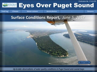
  • 1. Surface Conditions Report, June 5, 2017 Eyes Over Puget Sound Field log Climate Water column Aerial photos - Streams Publication No. 17-03-070 Up-to-date observations of water quality conditions in Puget Sound and coastal bays Start here
  • 2. Dr. Christopher Krembs (Editor) Personalimpressions p. 3 We have a new marine technician: AllisonBrownlee! Climateinfluences p. 5 The spring has generally beenwet. River flows are all above normal due to snow melt and warmer air temperatures. Watercolumn p. 8 Recordwinter andspring rains have createdsignificantly fresher conditions. Aerialphotography p. 10 Yellow-greenbloomsinbays near the KitsapPeninsula. Blooms in green, brown, andred brownnear estuaries of the Skagit, Stillaguamish, and PuyallupRivers. Redblooms inrivers of Willapa Bay. Streams p. 34 Coldand wet conditions inthe first half of 2017 have set the stage for a favorable supply of freshwater to the marine environment. LONG-TERMMARINEMONITORINGUNIT Skip Albertson Julia Bos Editorial assistanceprovided by: Allison Brownlee, CarolMaloy Marine conditionsfrom 6-5-2017 at a glance Field log Climate Water column Aerial photos - Streams Tyler Burks Mya Keyzers Allison Brownlee
  • 3. pH sensor Niskin bottle Personal Field Impression Field log Weather Water column Aerial photos - Streams Personal Field Impression 6-5-2017 Field log Climate Water column Aerial photos - StreamsField log Weather Water column Aerial photos - StreamsField log Climate Water column Aerial photos - Streams What types of data do we collect below the surface? We have a new marine technician! AllisonBrownlee has come fromthe City of San Diego where she collectedandanalyzedoceanographicdata for their expansive ocean monitoringprogram. Allisonjoins Mya Keyzers inthe marine waters fieldcrew who monitor Puget Sound and the coastal estuaries by bothsea plane and boat! Surrounding the sensors arewater-sampling Niskin bottles that we can programto collect water samples at discrete depths. We analyzefor: • Nutrients • Chlorophylla • TN (Total nitrogen) • TOC (Total organic carbon) • POC (Particulate organic carbon) • PN (Particulate organic nitrogen) • Dissolved oxygen • Salinity We usea SeaBird CTD (Conductivity, Temperature, Depth) profiler with added sensors to measurea suite of water column parameters: • Temperature • Salinity/Conductivity • Dissolved oxygen • PAR(Light) • Transmissivity • Fluorometry • Turbidity • pH
  • 4. Critter of the Month – The Tube-Dwelling Anemone Dany Burgess & Angela Eagleston Marine Sediment Monitoring Team Fun Facts! • The only tube anemone found in Puget Sound • Secretes a thread-like material to create its own black, slimy tube • Main predator is the giant nudibranch (photo below) • Can live up to 10 years Learn moreabout the tube-dwelling anemone and other critters on Ecology’s EcoConnectblog here Pachycerianthusfimbriatus Puget Sound is blooming with plankton right now, and this month’s flower-like critter is a reminder that the benthos has “blooms” of its own!Meet the tube-dwelling anemone, a delicate blossomat the bottom of Puget Sound. Photo courtesy of Mike Munroe Photo courtesy of John Yasaki Personal Field ImpressionEyes Under Puget Sound 6-5-2017 Field log Weather Water column Aerial photos - StreamsField log Climate Water column Aerial photos - Streams
  • 5. Climate Influences leading to 6-5-2017 Climate and naturalinfluences,includingweather,rivers,and the adjacent ocean,can affect our marine waters. Graphics are basedonprovisional dataandare subject to change. http://www.ecy.wa.gov/programs/eap/mar_wat/weather.html,page 26. higher No datalowerexpected *UpwellingAnomalies (PFEL) PDO = PacificDecadal Oscillation NPGO = North Pacific GyreOscillation ENSO = El Niño Southern Oscillation Field log Weather Water column Aerial photos - StreamsField log Climate Water column Aerial photos - Streams Summary: Air temperatures havebeen slightly warmer after a cool winter/spring. Precipitationlevels havebeen near normal, capping a wet spring. Sunshine levels havebeen abovenormal except near the coast(opposite of cloud cover). River flows areall above normal due to snow melt and warmer temperatures. Downwelling has been strong, though normalin May. ENSO and PDO aretrending warmer.
  • 6. We usea boatand a chartered float plane equipped with a CTD packageto access our monthly monitoring stations. We communicate data and environmental marine conditions using: 1. Marine Water Condition Index (MWCI) 2. Eyes OverPuget Sound (EOPS) 3. Anomaliesand sourcedata Field log Climate Water column Aerial photos - Streams Ourlong-termmarinemonitoringstationsinWashington Starthere Isl. . Station network of ambient water quality monitoring stations San Juan Isl.
  • 7. Field log Climate Water column Aerial photos - Streams HowwellisPugetSoundexchangingitswater? Year 2016 had record-breaking globaltemperatures. The year 2017 is looking much better. Fraser River flows are normal or higher than normal in June and similar to the year 2014. This means that water renewalin Puget Sound has returned to normal conditions this early summer. Fraser River Flow 0 2000 4000 6000 8000 10000 12000 Dec-13 Jan-14 Feb-14 Mar-14 Apr-14 May-14 Jun-14 Jul-14 Aug-14 Sep-14 Oct-14 Nov-14 Dec-14 Jan-15 Feb-15 Mar-15 Apr-15 May-15 Jun-15 Jul-15 Aug-15 Sep-15 Oct-15 Nov-15 Dec-15 Jan-16 Feb-16 Mar-16 Apr-16 May-16 Jun-16 Jul-16 Aug-16 Sep-16 Oct-16 Nov-16 Dec-16 Jan-17 Feb-17 Mar-17 Apr-17 May-17 Discharge(m3s-1) Higher than normal Lower than normal Expected FraserRiver
  • 8. Physical conditionstracked in historicalcontext Field log Climate Water column Aerial photos - Streams With the onset of 2017,the remarkably high watertemperatures from2015 & 2016 disappearedexcept in SouthHoodCanal deepwater. Recordwinterand spring rains havecreatedsignificantly fresher conditions. Badweather fromJanuary throughApril causedus to miss quite a few stations. Inaddition,our rigorous QA/QC caught some sensor issues in oxygen,resulting in data gaps. Near Normal Temperature LowerSalinity Region 1 2 3 4 5 6 7 8 9 10 11 12 1 2 3 4 5 6 7 8 9 10 11 12 1 2 3 4 1 2 3 4 5 6 7 8 9 10 11 12 1 2 3 4 5 6 7 8 9 10 11 12 1 2 3 4 1 2 3 4 5 6 7 8 9 10 11 12 1 2 3 4 5 6 7 8 9 10 11 12 1 2 3 4 Whidbey Basin Hood Canal Central Sound South Sound Grays Harbor Willapa Bay North Sound San Juan 2015 20152016 2017 20172015 20162016 2017 DO Data Gaps
  • 9. a) PacificDecadalOscillationIndex(PDO,temperature) (explanation) b) UpwellingIndex(anomalies)(Upwelling,low oxygen) (explanation) c) NorthPacificGyreOscillationIndex(NPGO, productivity) (explanation) Field log Climate Water column Aerial photos - Streams Theoceanaffectswaterquality: OceanClimateIndices NPGO(x10) PDO/UpwellingIndex Three-year running average of PDO, Upwelling, and NPGO indices scores . Ocean boundaryconditions long-term variability: (a)water is still warm (PDO), (b) upwellingoflow oxygen and high nutrient ocean water are low (UpwellingIndex anomaly),and (c) surface productivity alongthe coast is near normal (NPGO). -25 -20 -15 -10 -5 0 5 10 15 20 25 -1.5 -1 -0.5 0 0.5 1 1.5 1945 1950 1955 1960 1965 1970 1975 1980 1985 1990 1995 2000 2005 2010 2015
  • 10. Summary: Aerial photography6-5-2017 Jellyfishaggregations insome finger inlets of SouthSound. Unusual yellow-greenblooms inbays near the Kitsap Peninsula. Blooms ingreen, brownandred brownnear estuaries of the Skagit, Stillaguamishand Puyallup Rivers. Redblooms insome rivers of Willapa Bay at the coast. Field log Climate Water column Aerial photos - Streams Start here Mixing and Fronts: Tidal eddies near Hope Island, numerous internalwaves in Whidbey Basin. Debris: Macro-algaein Dyes Inlet, Colvos Passage, and Pickering Passage. Visible blooms: Red-brown blooms in Commencement and PortTownsend Bays. Yellow green blooms in Oyster Bay and parts of Liberty bay. Red bloom in rivers feeding Willapa Bay. Dark green water in Puget Sound suggesting high productivity. Jellyfish: Some patches in Budd, Eld, Totten, and Sinclair Inlets. BloomDebrisFront Suspendedsediment: Glacial flour near the Skagit and Puyallup rivers. Plume South Fork Palix River,BayCenter,WillapaBay Humpback Whale in Case Inlet click me to see me swim Courtesy of Graunke, Kyle,Ecology
  • 11. Strait of Juan de Fuca San Juan Islands Padilla Bay Main Basin Hood Canal South Sound Whidbey Basin Field log Climate Water column Aerial photos - Streams Sunny, then increasinglycloudyand hazytowards the end of the flight Flight Information: Aerial photography and navigation guide Flight route2 Tide data(Seattle): Time Height (ft) High/Low 02:35 AM 11.09 H 09:37 AM 0.69 L 4:29 PM 9.23 H 9:30 PM 5.40 L 6 11 4 1 Observation Maps: Central and NorthSound South Sound 12 7 5 1819 1617 14 3 9 8 10 13 15 20
  • 12. A. B. A. Jellyfish patches and small bloom. B. Aquaculture and effects on surface layer during incoming tide. Location: A. Eld Inlet,B. Totten Inlet (South Sound),1:02 PM. 1 Aerial photography 6-5-2017 Navigate Field log Climate Water column Aerial photos - Streams Bloom Debris jellyfish Bloom jellyfish mixing aquaculture Plume
  • 13. Bright yellow-greenbloom. Location: Oyster Bay/Dyes Inlet (Central Sound), 1:27 PM. 2 NavigateAerial photography 6-5-2017 Field log Climate Water column Aerial photos - Streams Bloom boat Debris
  • 14. 3 NavigateAerial photography 6-5-2017 Macro algae accumulating along tidal front. Location: Off WindyPoint/Dyes Inlet (Central Sound),1:29 PM. Field log Climate Water column Aerial photos - Streams boat Debris
  • 15. 4 Navigate Field log Climate Water column Aerial photos - Streams Aerial photography 6-5-2017 Bright yellow-greenbloom. Location: Off Keyport Saltwater Park,Liberty Bay (Central Sound), 1:32 PM. Bloom boat
  • 16. 5 NavigateAerial photography 6-5-2017 Field log Climate Water column Aerial photos - Streams Bloom and freshwater plume near Skunk Island. Location: Port Hadlock, Port Townsend Bay (Central Sound),1:46 PM. Skunk Island boat Bloom fire
  • 17. Bloom extending intoKilisut Harbor. Location: Port Townsend Bay(Central Sound),1:49 PM. 6 NavigateAerial photography 6-5-2017 Field log Climate Water column Aerial photos - Streams Rat Island marker Bloom Bloom Debris boat Bloom
  • 18. Skagit sediment plume extendinginto Penn Cove. Location: Penn Cove (WhidbeyBasin),1:54 PM. 7 NavigateAerial photography 6-5-2017 Field log Climate Water column Aerial photos - Streams Bloom boat
  • 19. A train of internal waves traveling towards Skagit Bay. Location: Entrance to Skagit Bay (WhidbeyBasin), 1:59 PM. 8 NavigateAerial photography 6-5-2017 Field log Climate Water column Aerial photos - Streams boat Polnell Point Camano Island Plume Internal waves
  • 20. Fed by meltwater in the mountains, the Skagit River is the largest freshwater contributor to Puget Sound. Location: North Fork Skagit River, Skagit Bay (WhidbeyBasin),2:01 PM. 9 NavigateAerial photography 6-5-2017 Field log Climate Water column Aerial photos - Streams Snow in the mountains Meltwater in rivers Glacial flour andfreshwater Estuary boat
  • 21. 10 NavigateAerial photography 6-5-2017 Patches of algae bloom in shallow, highly stratifiedwater of Skagit Bay. Location: Skagit Bay (WhidbeyBasin ),2:02 PM. Field log Climate Water column Aerial photos - Streams Wiley slough Mount Baker Skagit River Bloom Suspendedsediment
  • 22. NavigateAerial photography 6-5-2017 Bloom in shallow stratifiedwater of the Stillaguamish River Estuary. Location: Port Susan (WhidbeyBasin),2:06 PM. Field log Climate Water column Aerial photos - Streams 11 Stillaguamish River Bloom Suspendedsediment
  • 23. NavigateAerial photography 6-5-2017 Internal waves running northward and curving into shallow waters of Camano Island. Location: Port Susan (WhidbeyBasin),2:08 PM. Field log Climate Water column Aerial photos - Streams 12 Internal waves
  • 24. NavigateAerial photography 6-5-2017 Tidal front and macro-algae at the entrance and inside of Colvos Passage. Location:Point Vashon,Point Southworth,Colvos Passage (CentralSound),2:30 PM. Field log Climate Water column Aerial photos - Streams 13 Point Southworth Point Vashon, Debris Debris Debris Bloom
  • 25. NavigateAerial photography 6-5-2017 Internal waves in sediment-richwater of Puyallup River extendinginto Quartermaster Harbor. Location: Vashon Island (Central Sound),2:36 PM. Field log Climate Water column Aerial photos - Streams 14 Internal waves Plume Bloom
  • 26. NavigateAerial photography 6-5-2017 Puyallup River plume rich in glacial flour extendingfrom Commencement Bay into Puget Sound. Location: Commencement Bay(Central Sound),2:36 PM. Field log Climate Water column Aerial photos - Streams 15 Dash Point Mount Rainier Puyallup River Plume Bloom
  • 27. NavigateAerial photography 6-5-2017 Red-brown bloom in sediment-richfreshwater plume from the Puyallup River. Location: Point Defiance (Central Sound), 2:37 PM. Field log Climate Water column Aerial photos - Streams 16 Point Defiance Plume Bloom ferry boat boat
  • 28. NavigateAerial photography 6-5-2017 Sediment plume from the Puyallup River at the entrance to Colvos Passage. Location: Point Defiance (Central Sound),2:38 PM. Field log Climate Water column Aerial photos - Streams 17 Vashon Island Plume boat boat
  • 29. Field log Climate Water column Aerial photos - Streams NavigateAerial photography 6-5-2017 Sediment plume from the Puyallup River and red-brown bloom enteringthe Tacoma Narrows. Location: GigHarbor (Central Sound),2:38 PM. 18 Point Defiance Plume Bloom boat ferry
  • 30. NavigateAerial photography 6-5-2017 Schools of fish. Location: Raft Island,Carr Inlet (South Sound),2:41 PM. Field log Climate Water column Aerial photos - Streams 19 Raft Island fish fish fish fish fish
  • 31. NavigateAerial photography 6-5-2017 Bloom and organic material accumulating along tidal fronts. Location: Pitt Passage (South Sound),2:45 PM. Field log Climate Water column Aerial photos - Streams 20 boat Bloom Debris Debris boat
  • 32. North Sound Central Sound Numbers on map refer to picture numbers for spatial reference Date: 6-5-2017 Qualitative aerial observer map during transit Navigate Numbers on map refer to picture numbers for spatial reference Field log Climate Water column Aerial photos - Streams 17 16 15 14 13 n.a. 2 3 4 5 18 8 9 7 10 12 6 11 19
  • 33. Date: 6-5-2017 Qualitative aerial observer map during transit Numbers on map refer to picture numbers for spatial reference Navigate South Sound Field log Climate Water column Aerial photos - Streams 1 19 20
  • 34. Snowpack and stream flows are presently good Field log Climate Water column Aerial photos - Streams Tyler Burks, Ecology Cold and wet conditions in the firsthalf of 2017 haveset the stagefor a favorablesupply of freshwater to the marine environment. Key things to watch for in the coming months will be snowpack melt rates, and also how rain-dominated watersheds respond as we progress through thesummer. A. In late2016, conditions were favorable for a building snowpack and predominantly above normal streamflow conditions. Precipitation reached nearly 200% of normalin parts ofPuget Sound, while temperaturesrangedfrom normal to 2 ⁰F below normal. Presently, acoolspring has allowed thesnowpack to persistat an averageof160% forwatersheds draining to Puget Sound. In 2016, despite near normal snowpack conditions at higher elevations, a very warmspring led to early streamflow peaks and eventual deficits in Puget Sound. ByMay of last year (left) streamflow had already reachedlevels below the 10th percentile, while in other areas streamflowremained normal. In 2017 (right), due to a robust snowpack and mild spring temperatures, streamflowconditions have rangedfrom normal to much above normal for watersheds draining to Puget Sound. B. Comparison of May Monthly Streamflow, 2016 and 2017 Source: USGS
  • 35. Accesshistoric mooring data: http://www.ecy.wa.gov/pr ograms/eap/mar_wat/dat a.html - : Suzan.Pool@ecy.wa.gov Get data from Ecology’sMarine MonitoringPrograms Long–Term MonitoringNetwork Real–Time Sensor Network Accesscore monitoringdata: https://fortress.wa.gov/ec y/eap/marinewq/mwdata set.asp christopher.krembs@ecy.w a.gov Ecology’s long-termmarine monitoring stations Continuous track Field log Climate Water column Aerial photos - Streams Riverand Stream WaterQuality Monitoring http://www.ecy.wa.gov/programs/eap/fw_riv /rv_main.html Discontinued (fundingcuts)
  • 36. You may subscribe or unsubscribe to the Eyes Over Puget Sound email listservby going to: http://listserv.wa.gov/cgi-bin/wa?A0=ECOLOGY-EYES-OVER-PUGET-SOUND Many thanks to our business partners: Clipper Navigation,SwantownMarina,andKenmore Air. We are looking forfeedbackto improve ourproducts. Dr. ChristopherKrembs christopher.krembs@ecy.wa.gov Marine Monitoring Unit EnvironmentalAssessment Program WA Department of Ecology Field log Climate Water column Aerial photos - Streams