SlideShare a Scribd company logo
1 of 29
Download to read offline
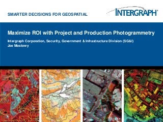
SMARTER DECISIONS FOR GEOSPATIAL


Maximize ROI with Project and Production Photogrammetry
Intergraph Corporation, Security, Government & Infrastructure Division (SG&I)
Joe Mostowy
Features, Customers, Priorities…


                          1-2 years:
                          Improve product lines by integrating the best
                          from each


                          3-5 years:
                          Single technology base with workstation,
                          workgroup, and Cloud processing paradigms


                                                                          2
Photogrammetry Customers


                                 Commercial Mapping Companies
   Government Mapping Agencies


                                  Individuals
                                                                3
User Paradigms:


                               THE PROJECT


              DO IT YOURSELF                 4
…and related priorities


        Factory
        •   Performance
        •   Accuracy
                                               Project
        •   Minimize Labor
                                               •   Accuracy
                                               •   Flexibility (data types)


                  Do-it-yourself
                  •   Flexibility (platform)
                  •   Accuracy


                                                                              5
ImageStation Family


                                                                                                                                           ImageStation
                                                                                                                                           Satellite
                                                                                                                                           Triangulation
                                                                                                                                           (ISST)


                  ImageStation   ImageStation   ImageStation
 ImageStation                                                   ImageStation   ImageStation
                  Feature        DTM            Stereo for
 Stereo Display                                                 OrthoPro       PixelQue
                  Collection     Collection     GeoMedia
 (ISSD)                                                         (ISOP)         (ISPQ)                                       ImageStation
                  (ISFC)         (ISDC)         (ISSG)                                                       ImageStation                  ImageStation
                                                                                              ImageStation                  Automatic
                                                                                                             Automatic                     Automatic
                                                                                              DTMQue                        Elevations –
                                                                                                             Elevations                    Triangulation
                                                                                              (ISDQ)                        Extended       (ISAT)
                                                                                                             (ISAE)
                                                                                                                            (ISAE-Ext)


                                                                                                                                           ImageStation
                                                                                                                                           Photogram-
            MicroStation                                       GeoMedia                                                                    metric
                                                                                                                                           Manager
                                                                                                                                           (ISPM)


                                                                 Windows O/S
ImageStation


   ISAE-Ext: Dense terrain surface extraction from RCD/DMC imagery

   Condor-enable ISAE

   Enhanced support for ingesting surfaces (more formats, better performance)

   Create an interface to exchange data between ISPM/ISAT with ORIMA and/or CAP-A

   Several enhancements to make workflows more efficient

   Fixes for customer reported issues


                                                                                     7
Increasing ROI… our immutable goal!


•   Semi-Global Matching (SGM), Q4
     •   Industry-standard method for
         dense surface matching
     •   Same algorithm used in Leica’s
         XPro generalized for “frame” data
     •   City modeling
     •   True Ortho


                  New Product: ImageStation Automatic Elevations-Extended
                                                                            8
LIDAR movie


              9
UAV workflows


                http://www.sensefly.com/products/swinglet-cam/
                                                                 10
UAV workflows


                11
UAV workflows


                Imagery courtesy of
                                      12
ImageStation to LPS Project Integration Video
                                                13
One packaging change to the LPS Family


                                         14
DIY 3D Mapping, Bentley with PRO600


•   Objective: Affordable CAD-based 3D mapping
•   PRO600 Fundamentals product moved to INACTIVE status, i.e. retired,
    since Bentley no longer offers the platform (PowerMap)
•   Choice of Bentley Platforms:
     •   Microstation
     •   Bentley Map v8i (SELECTseries 2)
     •   Bentley Map Enterprise v8i (SELECTseries 2)
•   Added BLK manipulation capability
•   Include Stereo pane
•   Separate “vector” and “DTM” tools (same paradigm as ImageStation and the
    ArcGIS-based 3D products)
•   Workgroup Scenario: One full LPS seat “feeding” many PRO600 stereo
    digitizing seats

                                                                               15
One packaging change to the LPS Family


                                         16
PRO600 with Bentley Map v8i


                              17
Next release high-lights by Product Family

LPS

•   Ribbonized UI

•   Enhanced Terrain Handling

•   LIDAR Command Tools

      •   RGB Encode, Classify, Subset,
      Filter by Class, Filter by Return


•   LIDAR Tools

      •   Display (2D, 3D,
      Profile), Editing, measure


•   New Sensors

      •   A3 stereo, Pleiades-1, DEIMOS RPC


                                              18
Growing list of sensors… VisionMap A3
LIDAR Measurement
LPS ribbon UI for 2013
24
2012 release high-lights by Product Family

ERDAS extensions for ArcGIS (SP3, January 2012)

•   Certified with ArcGIS 10 (SP3), SP4 imminent

•   New collection, QC, & visualization tools


                                                   25
DIY 3D Mapping, Esri


•   Stereo Analyst for ArcGIS
•   FeatureAssist for ArcGIS
•   Terrain Editor for ArcGIS


                                26
27
1-2 year development initiatives for combined portfolio

Photogrammetric Data Model…

•   Value: interoperability between product families

•   Value: true multi-user production environments

•   Value: OPEN data model for photogrammetry

•   Value: Sensor to finished product workflows

APM engine…

•   Value: efficient & accurate multi-image point matching to reduce edit time (labor)

•   Value: support for more generalized UAV use case

Rectification Engine…

•   Value: ortho becomes true ortho

•   Value: produce multiple products in one run


                                                                                         28
Features, Customers, Priorities = ROI


                           1-2 years:
                           Improve product lines by integrating the best
                           from each


                           3-5 years:
                           Single technology base with workstation,
                           workgroup, and Cloud processing paradigms


                                                                           29
Contacts

Product Line Executive – William.LaRocque@Intergraph.com

    Strategic selling support
    Campaigns
    Product packaging
    Product enhancement and strategy ideas
    Competitive Intelligence


Product Market Manager – Joe.Mostowy@Intergraph.com

    Pre-Sales support
    Demos & presentations
    Configuration support
    Event support
    RFP support
    Technical customer visits

© 2012 Intergraph Corporation                              30
Thank You


                                Joe Mostowy
                                Senior Software Consultant
                                Photogrammetry Solutions
                                Office (720) 381-5654
                                Mobile (303) 885-4190
                                Fax      (303) 799-9453
                                Joe.Mostowy@Intergraph.com
                                http://geospatial.intergraph.com/products.aspx


© 2012 Intergraph Corporation                                                    31

More Related Content

More from GIS in the Rockies

2018 GIS in the Rockies Vendor Showcase (Th): Building High Performance Gover...
2018 GIS in the Rockies Vendor Showcase (Th): Building High Performance Gover...2018 GIS in the Rockies Vendor Showcase (Th): Building High Performance Gover...
2018 GIS in the Rockies Vendor Showcase (Th): Building High Performance Gover...GIS in the Rockies
 
2018 GIS in Recreation: The Making of a Trail
2018 GIS in Recreation: The Making of a Trail2018 GIS in Recreation: The Making of a Trail
2018 GIS in Recreation: The Making of a TrailGIS in the Rockies
 
2018 GIS in Recreation: The Latest Trail Technology Crowdsourcing Maps and Apps
2018 GIS in Recreation: The Latest Trail Technology Crowdsourcing Maps and Apps2018 GIS in Recreation: The Latest Trail Technology Crowdsourcing Maps and Apps
2018 GIS in Recreation: The Latest Trail Technology Crowdsourcing Maps and AppsGIS in the Rockies
 
2018 GIS in the Rockies: Riparian Shrub Assessment of the Mancos River Canyon...
2018 GIS in the Rockies: Riparian Shrub Assessment of the Mancos River Canyon...2018 GIS in the Rockies: Riparian Shrub Assessment of the Mancos River Canyon...
2018 GIS in the Rockies: Riparian Shrub Assessment of the Mancos River Canyon...GIS in the Rockies
 
2018 GIS in Development: Partnerships Lead to Additional Recreational Content...
2018 GIS in Development: Partnerships Lead to Additional Recreational Content...2018 GIS in Development: Partnerships Lead to Additional Recreational Content...
2018 GIS in Development: Partnerships Lead to Additional Recreational Content...GIS in the Rockies
 
2018 GIS in Recreation: Adding Value to Colorado the Beautiful Initiative carr
2018 GIS in Recreation: Adding Value to Colorado the Beautiful Initiative carr2018 GIS in Recreation: Adding Value to Colorado the Beautiful Initiative carr
2018 GIS in Recreation: Adding Value to Colorado the Beautiful Initiative carrGIS in the Rockies
 
2018 GIS in Recreation: A Creek Runs Through It
2018 GIS in Recreation: A Creek Runs Through It2018 GIS in Recreation: A Creek Runs Through It
2018 GIS in Recreation: A Creek Runs Through ItGIS in the Rockies
 
2018 GIS in Recreation: Virtually Touring the National Trails
2018 GIS in Recreation: Virtually Touring the National Trails2018 GIS in Recreation: Virtually Touring the National Trails
2018 GIS in Recreation: Virtually Touring the National TrailsGIS in the Rockies
 
2018 GIS in the Rockies PLSC Track: Turning Towards the Future
2018 GIS in the Rockies PLSC Track: Turning Towards the Future2018 GIS in the Rockies PLSC Track: Turning Towards the Future
2018 GIS in the Rockies PLSC Track: Turning Towards the FutureGIS in the Rockies
 
2018 GIS in the Rockies PLSC: Intro to PLSS
2018 GIS in the Rockies PLSC: Intro to PLSS2018 GIS in the Rockies PLSC: Intro to PLSS
2018 GIS in the Rockies PLSC: Intro to PLSSGIS in the Rockies
 
2018 GIS in the Rockies PLSC Track: Grid to Ground NATRF2022
2018 GIS in the Rockies PLSC Track: Grid to Ground NATRF20222018 GIS in the Rockies PLSC Track: Grid to Ground NATRF2022
2018 GIS in the Rockies PLSC Track: Grid to Ground NATRF2022GIS in the Rockies
 
2018 GIS in Development: USGS and Citizen Science Success and Enhancements fo...
2018 GIS in Development: USGS and Citizen Science Success and Enhancements fo...2018 GIS in Development: USGS and Citizen Science Success and Enhancements fo...
2018 GIS in Development: USGS and Citizen Science Success and Enhancements fo...GIS in the Rockies
 
2018 GIS in Development: Semantic Web
2018 GIS in Development: Semantic Web2018 GIS in Development: Semantic Web
2018 GIS in Development: Semantic WebGIS in the Rockies
 
2018 GIS in Development: Look Ma, No Server and Big Data Using Serverless Fun...
2018 GIS in Development: Look Ma, No Server and Big Data Using Serverless Fun...2018 GIS in Development: Look Ma, No Server and Big Data Using Serverless Fun...
2018 GIS in Development: Look Ma, No Server and Big Data Using Serverless Fun...GIS in the Rockies
 
2018 GIS in Development: Grass GIS Striking Terrain Visualizations in the Roc...
2018 GIS in Development: Grass GIS Striking Terrain Visualizations in the Roc...2018 GIS in Development: Grass GIS Striking Terrain Visualizations in the Roc...
2018 GIS in Development: Grass GIS Striking Terrain Visualizations in the Roc...GIS in the Rockies
 
2018 GIS in Development: FOSS4G in the Government (Proof of Concept)
2018 GIS in Development: FOSS4G in the Government (Proof of Concept)2018 GIS in Development: FOSS4G in the Government (Proof of Concept)
2018 GIS in Development: FOSS4G in the Government (Proof of Concept)GIS in the Rockies
 
2018 GIS in Development: Developing a National Map of Subsurface Infrastructure
2018 GIS in Development: Developing a National Map of Subsurface Infrastructure2018 GIS in Development: Developing a National Map of Subsurface Infrastructure
2018 GIS in Development: Developing a National Map of Subsurface InfrastructureGIS in the Rockies
 
2018 ASPRS: Big Data: Utilizing Landsat to Detect Ephemeral Water Sources in ...
2018 ASPRS: Big Data: Utilizing Landsat to Detect Ephemeral Water Sources in ...2018 ASPRS: Big Data: Utilizing Landsat to Detect Ephemeral Water Sources in ...
2018 ASPRS: Big Data: Utilizing Landsat to Detect Ephemeral Water Sources in ...GIS in the Rockies
 
2018 ASPRS: Big Data: Front Range Oblique Photography Available Today
2018 ASPRS: Big Data: Front Range Oblique Photography Available Today2018 ASPRS: Big Data: Front Range Oblique Photography Available Today
2018 ASPRS: Big Data: Front Range Oblique Photography Available TodayGIS in the Rockies
 
2018 ASPRS: Big Data: Classification of Tropical Forest Tree Species Using Hi...
2018 ASPRS: Big Data: Classification of Tropical Forest Tree Species Using Hi...2018 ASPRS: Big Data: Classification of Tropical Forest Tree Species Using Hi...
2018 ASPRS: Big Data: Classification of Tropical Forest Tree Species Using Hi...GIS in the Rockies
 

More from GIS in the Rockies (20)

2018 GIS in the Rockies Vendor Showcase (Th): Building High Performance Gover...
2018 GIS in the Rockies Vendor Showcase (Th): Building High Performance Gover...2018 GIS in the Rockies Vendor Showcase (Th): Building High Performance Gover...
2018 GIS in the Rockies Vendor Showcase (Th): Building High Performance Gover...
 
2018 GIS in Recreation: The Making of a Trail
2018 GIS in Recreation: The Making of a Trail2018 GIS in Recreation: The Making of a Trail
2018 GIS in Recreation: The Making of a Trail
 
2018 GIS in Recreation: The Latest Trail Technology Crowdsourcing Maps and Apps
2018 GIS in Recreation: The Latest Trail Technology Crowdsourcing Maps and Apps2018 GIS in Recreation: The Latest Trail Technology Crowdsourcing Maps and Apps
2018 GIS in Recreation: The Latest Trail Technology Crowdsourcing Maps and Apps
 
2018 GIS in the Rockies: Riparian Shrub Assessment of the Mancos River Canyon...
2018 GIS in the Rockies: Riparian Shrub Assessment of the Mancos River Canyon...2018 GIS in the Rockies: Riparian Shrub Assessment of the Mancos River Canyon...
2018 GIS in the Rockies: Riparian Shrub Assessment of the Mancos River Canyon...
 
2018 GIS in Development: Partnerships Lead to Additional Recreational Content...
2018 GIS in Development: Partnerships Lead to Additional Recreational Content...2018 GIS in Development: Partnerships Lead to Additional Recreational Content...
2018 GIS in Development: Partnerships Lead to Additional Recreational Content...
 
2018 GIS in Recreation: Adding Value to Colorado the Beautiful Initiative carr
2018 GIS in Recreation: Adding Value to Colorado the Beautiful Initiative carr2018 GIS in Recreation: Adding Value to Colorado the Beautiful Initiative carr
2018 GIS in Recreation: Adding Value to Colorado the Beautiful Initiative carr
 
2018 GIS in Recreation: A Creek Runs Through It
2018 GIS in Recreation: A Creek Runs Through It2018 GIS in Recreation: A Creek Runs Through It
2018 GIS in Recreation: A Creek Runs Through It
 
2018 GIS in Recreation: Virtually Touring the National Trails
2018 GIS in Recreation: Virtually Touring the National Trails2018 GIS in Recreation: Virtually Touring the National Trails
2018 GIS in Recreation: Virtually Touring the National Trails
 
2018 GIS in the Rockies PLSC Track: Turning Towards the Future
2018 GIS in the Rockies PLSC Track: Turning Towards the Future2018 GIS in the Rockies PLSC Track: Turning Towards the Future
2018 GIS in the Rockies PLSC Track: Turning Towards the Future
 
2018 GIS in the Rockies PLSC: Intro to PLSS
2018 GIS in the Rockies PLSC: Intro to PLSS2018 GIS in the Rockies PLSC: Intro to PLSS
2018 GIS in the Rockies PLSC: Intro to PLSS
 
2018 GIS in the Rockies PLSC Track: Grid to Ground NATRF2022
2018 GIS in the Rockies PLSC Track: Grid to Ground NATRF20222018 GIS in the Rockies PLSC Track: Grid to Ground NATRF2022
2018 GIS in the Rockies PLSC Track: Grid to Ground NATRF2022
 
2018 GIS in Development: USGS and Citizen Science Success and Enhancements fo...
2018 GIS in Development: USGS and Citizen Science Success and Enhancements fo...2018 GIS in Development: USGS and Citizen Science Success and Enhancements fo...
2018 GIS in Development: USGS and Citizen Science Success and Enhancements fo...
 
2018 GIS in Development: Semantic Web
2018 GIS in Development: Semantic Web2018 GIS in Development: Semantic Web
2018 GIS in Development: Semantic Web
 
2018 GIS in Development: Look Ma, No Server and Big Data Using Serverless Fun...
2018 GIS in Development: Look Ma, No Server and Big Data Using Serverless Fun...2018 GIS in Development: Look Ma, No Server and Big Data Using Serverless Fun...
2018 GIS in Development: Look Ma, No Server and Big Data Using Serverless Fun...
 
2018 GIS in Development: Grass GIS Striking Terrain Visualizations in the Roc...
2018 GIS in Development: Grass GIS Striking Terrain Visualizations in the Roc...2018 GIS in Development: Grass GIS Striking Terrain Visualizations in the Roc...
2018 GIS in Development: Grass GIS Striking Terrain Visualizations in the Roc...
 
2018 GIS in Development: FOSS4G in the Government (Proof of Concept)
2018 GIS in Development: FOSS4G in the Government (Proof of Concept)2018 GIS in Development: FOSS4G in the Government (Proof of Concept)
2018 GIS in Development: FOSS4G in the Government (Proof of Concept)
 
2018 GIS in Development: Developing a National Map of Subsurface Infrastructure
2018 GIS in Development: Developing a National Map of Subsurface Infrastructure2018 GIS in Development: Developing a National Map of Subsurface Infrastructure
2018 GIS in Development: Developing a National Map of Subsurface Infrastructure
 
2018 ASPRS: Big Data: Utilizing Landsat to Detect Ephemeral Water Sources in ...
2018 ASPRS: Big Data: Utilizing Landsat to Detect Ephemeral Water Sources in ...2018 ASPRS: Big Data: Utilizing Landsat to Detect Ephemeral Water Sources in ...
2018 ASPRS: Big Data: Utilizing Landsat to Detect Ephemeral Water Sources in ...
 
2018 ASPRS: Big Data: Front Range Oblique Photography Available Today
2018 ASPRS: Big Data: Front Range Oblique Photography Available Today2018 ASPRS: Big Data: Front Range Oblique Photography Available Today
2018 ASPRS: Big Data: Front Range Oblique Photography Available Today
 
2018 ASPRS: Big Data: Classification of Tropical Forest Tree Species Using Hi...
2018 ASPRS: Big Data: Classification of Tropical Forest Tree Species Using Hi...2018 ASPRS: Big Data: Classification of Tropical Forest Tree Species Using Hi...
2018 ASPRS: Big Data: Classification of Tropical Forest Tree Species Using Hi...
 

2012 ASPRS Track, Manage ROI with Project and Production Photogrammetry OR Maximize ROI with Project and Production Photogrammetry, Joe Mostowy

  • 1. SMARTER DECISIONS FOR GEOSPATIAL Maximize ROI with Project and Production Photogrammetry Intergraph Corporation, Security, Government & Infrastructure Division (SG&I) Joe Mostowy
  • 2. Features, Customers, Priorities… 1-2 years: Improve product lines by integrating the best from each 3-5 years: Single technology base with workstation, workgroup, and Cloud processing paradigms 2
  • 3. Photogrammetry Customers Commercial Mapping Companies Government Mapping Agencies Individuals 3
  • 4. User Paradigms: THE PROJECT DO IT YOURSELF 4
  • 5. …and related priorities Factory • Performance • Accuracy Project • Minimize Labor • Accuracy • Flexibility (data types) Do-it-yourself • Flexibility (platform) • Accuracy 5
  • 6. ImageStation Family ImageStation Satellite Triangulation (ISST) ImageStation ImageStation ImageStation ImageStation ImageStation ImageStation Feature DTM Stereo for Stereo Display OrthoPro PixelQue Collection Collection GeoMedia (ISSD) (ISOP) (ISPQ) ImageStation (ISFC) (ISDC) (ISSG) ImageStation ImageStation ImageStation Automatic Automatic Automatic DTMQue Elevations – Elevations Triangulation (ISDQ) Extended (ISAT) (ISAE) (ISAE-Ext) ImageStation Photogram- MicroStation GeoMedia metric Manager (ISPM) Windows O/S
  • 7. ImageStation  ISAE-Ext: Dense terrain surface extraction from RCD/DMC imagery  Condor-enable ISAE  Enhanced support for ingesting surfaces (more formats, better performance)  Create an interface to exchange data between ISPM/ISAT with ORIMA and/or CAP-A  Several enhancements to make workflows more efficient  Fixes for customer reported issues 7
  • 8. Increasing ROI… our immutable goal! • Semi-Global Matching (SGM), Q4 • Industry-standard method for dense surface matching • Same algorithm used in Leica’s XPro generalized for “frame” data • City modeling • True Ortho New Product: ImageStation Automatic Elevations-Extended 8
  • 10. UAV workflows http://www.sensefly.com/products/swinglet-cam/ 10
  • 12. UAV workflows Imagery courtesy of 12
  • 13. ImageStation to LPS Project Integration Video 13
  • 14. One packaging change to the LPS Family 14
  • 15. DIY 3D Mapping, Bentley with PRO600 • Objective: Affordable CAD-based 3D mapping • PRO600 Fundamentals product moved to INACTIVE status, i.e. retired, since Bentley no longer offers the platform (PowerMap) • Choice of Bentley Platforms: • Microstation • Bentley Map v8i (SELECTseries 2) • Bentley Map Enterprise v8i (SELECTseries 2) • Added BLK manipulation capability • Include Stereo pane • Separate “vector” and “DTM” tools (same paradigm as ImageStation and the ArcGIS-based 3D products) • Workgroup Scenario: One full LPS seat “feeding” many PRO600 stereo digitizing seats 15
  • 16. One packaging change to the LPS Family 16
  • 17. PRO600 with Bentley Map v8i 17
  • 18. Next release high-lights by Product Family LPS • Ribbonized UI • Enhanced Terrain Handling • LIDAR Command Tools • RGB Encode, Classify, Subset, Filter by Class, Filter by Return • LIDAR Tools • Display (2D, 3D, Profile), Editing, measure • New Sensors • A3 stereo, Pleiades-1, DEIMOS RPC 18
  • 19. Growing list of sensors… VisionMap A3
  • 21. LPS ribbon UI for 2013
  • 22. 24
  • 23. 2012 release high-lights by Product Family ERDAS extensions for ArcGIS (SP3, January 2012) • Certified with ArcGIS 10 (SP3), SP4 imminent • New collection, QC, & visualization tools 25
  • 24. DIY 3D Mapping, Esri • Stereo Analyst for ArcGIS • FeatureAssist for ArcGIS • Terrain Editor for ArcGIS 26
  • 25. 27
  • 26. 1-2 year development initiatives for combined portfolio Photogrammetric Data Model… • Value: interoperability between product families • Value: true multi-user production environments • Value: OPEN data model for photogrammetry • Value: Sensor to finished product workflows APM engine… • Value: efficient & accurate multi-image point matching to reduce edit time (labor) • Value: support for more generalized UAV use case Rectification Engine… • Value: ortho becomes true ortho • Value: produce multiple products in one run 28
  • 27. Features, Customers, Priorities = ROI 1-2 years: Improve product lines by integrating the best from each 3-5 years: Single technology base with workstation, workgroup, and Cloud processing paradigms 29
  • 28. Contacts Product Line Executive – William.LaRocque@Intergraph.com  Strategic selling support  Campaigns  Product packaging  Product enhancement and strategy ideas  Competitive Intelligence Product Market Manager – Joe.Mostowy@Intergraph.com  Pre-Sales support  Demos & presentations  Configuration support  Event support  RFP support  Technical customer visits © 2012 Intergraph Corporation 30
  • 29. Thank You Joe Mostowy Senior Software Consultant Photogrammetry Solutions Office (720) 381-5654 Mobile (303) 885-4190 Fax (303) 799-9453 Joe.Mostowy@Intergraph.com http://geospatial.intergraph.com/products.aspx © 2012 Intergraph Corporation 31