Scientific, technical, and social research applied to risk reduction in Latin America and the Caribbean.
•
1 like•1,749 views

Scientific, technical, and social research applied to risk reduction in Latin America and the Caribbean.
![Introduction ,[object Object]](data:image/gif;base64,R0lGODlhAQABAIAAAAAAAP///yH5BAEAAAAALAAAAAABAAEAAAIBRAA7)
Recommended
Recommended
More Related Content
Viewers also liked
Viewers also liked (19)
Similar to Scientific, technical, and social research applied to risk reduction in Latin America and the Caribbean.
Similar to Scientific, technical, and social research applied to risk reduction in Latin America and the Caribbean. (20)
More from Global Risk Forum GRFDavos
More from Global Risk Forum GRFDavos (20)
Recently uploaded
Recently uploaded (20)
Scientific, technical, and social research applied to risk reduction in Latin America and the Caribbean.
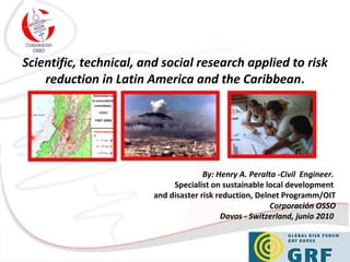
- 1. Scientific, technical, and social research applied to risk reduction in Latin America and the Caribbean . By: Henry A. Peralta -Civil Engineer. Specialist on sustainable local development and disaster risk reduction, Delnet Programm/OIT Corporación OSSO Davos - Switzerland, junio 2010
- 4. http://www.desenredando.org/ In addition to that the Osso group is one of the founders of “La Red”. La Red is a multidisciplinary group of specialists in disasters, and since the beginning of the ( 1990s) introduced a new risk and disaster conceptualization in Latin America and the Caribbean.
- 5. LINES OF ACTION In recent years the scientific and technical work has been associated primarily with the development of observing systems, acquisition and processing of environmental signs.
- 6. OSSO group designed, implemented and operated the Southwestern Regional Seismological Network from ( 1987 ) til ( 2007 ) and developed the National Tsunami Detection and Alert of Colombia from ( 1989) until today.
- 7. Online GIS developmented for Vulnerability assessment : http://sigvulgaleras.osso.org.co The group Usually generates information, remote sensing and spatial modeling and free online GIS applications. Develops social mapping exercises and planning-action-participation with communities and institutions.
- 9. Rural communities in tsunami risk areas Projects in vulnerable areas from afrodescendant communities . We have worked to increase a comprehensive perception of natural hazards, vulnerabilities and risks in diferent social groups like indigenous and afrodescendant communities
- 10. In academic circles, the OSSO group has supported the training and development of human resources for science and technology from a practical learning strategy.
- 12. DesInventar methodology applied to inventory of disasters effects. “ DesInventar” is a proven methodology for over 15 years in Latin America, the Caribbean and Asia, which have built databases for periods of more than 30 years of observation.
- 13. DesInventar training (Haiti, 2010). DesInventar has been applied to the Andean countries of Latin America and Caribean. “ DesInventar” has also been important to quantify and express spatially the effects of major disasters like Hurricane Mitch in Honduras and Nicaragua in ( 1998 ), torrential rains in the state of Vargas in Venezuela in ( 1999 ), the earthquake in Arequipa in southern Peru in ( 2001 ), the effects of the tsunami in Indonesia ( 2004 ) and the recent Haiti’s earthquake.
- 14. Atlas of the dynamic of the Andean Territory (2009) Download at :http://www.comunidadandina.org/predecan/atlasweb/index.html OSSO directed the Atlas of the dynamic of the Andean Territory: population and property exposed to natural hazards, funded by CAPRADE / PREDECAN / and the EUROPEAN COMMISSION.
- 15. Vulnerability assessment Another recent projects were the vulnerability assessment of the physical and functional volcanic phenomena in the area surrounding the Galeras volcano. Also the regional analysis of disaster losses and socio-economic variables in the Chaco, a pilot project focusing on Paraguay.
Editor's Notes
- Good Morning. First I would like to express my gratitude to the organization commitee of Global Risk Forum for allowing me to be here presenting this paper. This presentation is about the scientific, technical, social and applied contributions to the risk reduction in Latin America and the Caribbean, developed along twenty three ( 23 ) years by the Southwestern Seismological Observatory (OSSO) from Cali, Colombia.
- OSSO is a multidisciplinary Colombian research group, which was originated in the early (eighties) 1980s , and formally established in 1987 (nineteen eighty seven) .
- Osso's research has been focused on three topics: First in Earth sciences: seismology, applied geophysics, geology, environmental geology , geomorphology, and oceanography. Another research area has been the Engineering and technology: which corresponds to instrumentation development and software for monitoring environmental signals and inventory software for disasters. And Last but not least the Environment and Society: relates to vulnerability, risk reduction, disaster impact assessment methodologies and also the knowledge transfer.
- In addition to that the Osso group is one of the founders of “La Red”. La Red is a multidisciplinary group of specialists in disasters, and since the beginning of nineties the ( 1990s) introduced a new risk and disaster conceptualization in Latin America and the Caribbean.
- In recent years the scientific and technical work has been associated primarily with the development of observing systems, acquisition and processing of environmental signs.
- OSSO group designed, implemented and operated the Southwestern Regional Seismological Network from ( 1987 ) til ( 2007 ) and developed the National Tsunami Detection and Alert of Colombia from ( 1989) until today.
- the group Usually generates information, remote sensing and spatial modeling and free online GIS applications On the other hand, develops social mapping exercises and planning-action-participation with communities and institutions.
- These contributions, from a holistic approach to risk reduction, have contributed to the development of perceptions and skills by local and national disaster prevention authorities.
- We have worked to increase a comprehensive perception of natural hazards, vulnerabilities and risks in diferent social groups like indigenous and afrodescendant communities.
- In academic circles, the OSSO group has supported the training and development of human resources for science and technology from a practical learning strategy.
- Among our more recent contributions is “DesInventar online”, which is able to document the effects of disasters on various geographical contexts. This tool is available free online.
- “ DesInventar” is a proven methodology for over 15 years in Latin America, the Caribbean and Asia, which have built databases for periods of more than 30 years of observation.
- “ DesInventar” has also been important to quantify and express spatially the effects of major disasters like Hurricane Mitch in Honduras and Nicaragua in nineteen ninety eight ( 1998 ), torrential rains in the state of Vargas in Venezuela in nineteen ninety nine ( 1999 ), the earthquake in Arequipa in southern Peru in two thousand one ( 2001 ), the effects of the tsunami in Indonesia in two thousand four ( 2004 ) and the recent Haiti’s earthquake.
- On the other hand, OSSO directed the Atlas of the dynamic of the Andean Territory: population and property exposed to natural hazards, funded by CAPRADE / PREDECAN / and the EUROPEAN COMMISSION. This Atlas available free on line, seeks to be a reference for countries in terms of binational or multinational issues related to mitigating planning.
- Another recent projects were the vulnerability assessment of the physical and functional volcanic phenomena in the area surrounding the Galeras volcano. Also the regional analysis of disaster losses and socio-economic variables in the Chaco, a pilot project focusing on Paraguay.
- To conclude, it is necessary to recognize the existence of a transition from a vision based on the disaster and the development of a new vision based on the risk, the latter with a more modern, scientific and holistic character to move towards comprehensive risk reduction policies in the territories and communities that inhabit it. OSSO promotes the observation of environmental and social variables on a comprehensive, interdisciplinary and holistic risk for countries of the region.
- It is essential, especially in the context of Latin America and Caribbean countries, to support projects properly, observing and monitoring environmental and social variables, as long as possible. Lastly, it’s important continuous monitoring processes that allow human resources training scientific and technological capabilities to generate useful knowledge for actions to reduce risks and enable social, economic, and environmental development.
- Thank you very much for your attention.