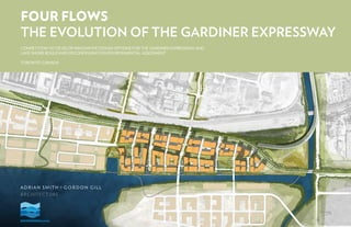
Contenu connexe Similaire à Replace as+gg booklet Similaire à Replace as+gg booklet (20) 1. FOUR FLOWS
THE EVOLUTION OF THE GARDINER EXPRESSWAY
COMPETITION TO DEVELOP INNOVATIVE DESIGN OPTIONS FOR THE GARDINER EXPRESSWAY AND
LAKE SHORE BOULEVARD RECONFIGURATION ENVIRONMENTAL ASSESSMENT
TORONTO, CANADA
2. 2 FOUR FLOWS - THE EVOLUTION OF THE GARDINER EXPRESSWAY © 2010 ADRIAN SMITH + GORDON GILL ARCHITECTURE
3. 3FOUR FLOWS - THE EVOLUTION OF THE GARDINER EXPRESSWAY© 2010 ADRIAN SMITH + GORDON GILL ARCHITECTURE
CONTENTS
NARRATIVE SUMMARY
FLOW 1: PEOPLE
FLOW 2: TRANSPORTATION
FLOW 3: LANDSCAPE AND WATER
FLOW 4: DEVELOPMENT
APPENDIX
4
7
19
33
45
61
4. 4 FOUR FLOWS - THE EVOLUTION OF THE GARDINER EXPRESSWAY © 2010 ADRIAN SMITH + GORDON GILL ARCHITECTURE
4 FOUR FLOWS - THE EVOLUTION OF THE GARDINER EXPRESSWAY
NARRATIVE SUMMARY
FOUR FLOWS:
THE EVOLUTION OF THE
GARDINER EXPRESSWAY
Adrian Smith + Gordon Gill Architecture LLP (AS+GG)
is pleased to present our proposal for the reconfigura-
tion of the Gardiner Expressway and Keating Channel
Precinct. We’ve strived to create an innovative and
economically-sound vision for the revitalization of this
vital piece of Toronto’s waterfront and infrastructure.
AS+GG recommends removing the elevated Gardiner
Expressway and replacing it with:
1. A new Gardiner Tunnel, serving through-traffic travel-
ling north and south on the Don Valley Parkway, and;
2. A new Lake Shore Boulevard, an innovative and
sustainable addition to Toronto’s downtown roadway
network.
We have entitled our design scheme “Four Flows: The
Evolution of Gardiner Expressway”.
We have chosen these words carefully. The words “flow”
and “evolution” imply definitive change, yet offer the pos-
sibility of a relatively seamless transition and a metamor-
phosis into something better. Our proposal offers these
possibilities and much more to the people of Toronto.
The “four flows” refer to four distinct elements that are
integral to the reinvention of Gardiner: 1) People, 2)
Transportation, 3) Natural Systems, and 4) Development.
The harmonious “flow” of these elements throughout the
site is basis of our design scheme and the linchpin to the
creation of a sustainable, successful 21st century district
for Toronto.
Flow 1: People. The seamless movement of people to
the water’s edge will create a vibrant waterfront district
and enhance the quality of life for Toronto’s citizens.
Flow 2: Transportation. Roads and transit systems
must promote access to the new Gardiner Expressway
while also providing the necessary capacity for those
traveling through Gardiner as a central thoroughfare in
the city.
Flow 3: Natural Systems. Environmental assets such
as the waterfront, Don River and new public parks will
create a rich landscape environment.
Flow 4: Development. An expanded tax base will
encourage development that creates long-term benefits
for the citizens of Toronto.
Finally, we use the word “evolution” to describe our
proposed metamorphosis of the Gardiner Expressway. It
is neither desirable nor possible to remove all vestiges of
the Gardiner. As with all things, it is time for the Gardiner
to move into the next phase of its existence, thus requir-
ing an evolution into the Gardiner Tunnel.
Design Team:
Adrian Smith + Gordon Gill Architecture
Chicago, Illinois
Adrian Smith, Partner
Gordon Gill, Partner
Robert Forest, Partner
312.920.1888
Hoerr Schaudt Landscape Architects
Chicago, Illinois
Halcrow /HalcrowYolles
Toronto, Canada
CB Richard Ellis
Toronto, Canada
RDH Architects
Toronto, Canada
IBM
Toronto, Canada
30 June 2010
5. 5FOUR FLOWS - THE EVOLUTION OF THE GARDINER EXPRESSWAY© 2010 ADRIAN SMITH + GORDON GILL ARCHITECTURE
the Gardiner), thus maintaining almost all current traffic
capacity. Additionally, we have provided future capacity
within Lake Shore Boulevard’s right-of-way that could be
used either for transit or an expanded lane design.
4. We have maintained and enhanced all public-transit
plans currently in place, and have provided areas for
transit expansion.
Lens 4: Urban Design
The defining characteristic of our urban design proposal
is our focus on people: enabling Torontonians to “flow”
to the lakefront. Our plan is designed to allow all citizens
access to the water while providing both innovative and
time-tested urban design concepts, including:
1. A system of appropriately-scaled development blocks
between .75 and 1.5 hectares, enabling exceptional
access through the development from north to south.
2. Incorporation of all current waterfront Toronto urban
design plans that fit with the proposed design.
3. A major new waterfront park, “Queens Landing”, to
organize and focus development in Keating Channel.
4. Refined street cross-sections that a create pedestrian-
friendly public-realm with 4 to 5-meter sidewalks.
Finally, we feel the 30% increase in new
development land that will yield tremendous
revenue for the city of Toronto. We feel this
revenue will contribute significantly if not
entirely to the cost of the Gardiner tunnel
and bridge.
Our “Four Flows” concept correlates directly with the
four lenses described by Waterfront Toronto for the
project evaluation:
Lens 1: Environment equals Flow 3: Natural Systems
Lens 2: Economics equals Flow 4: Development
Lens 3: Transportation equals Flow 2: Transportation; and
Lens 4: Urban Design equals Flow 1: People
AS+GG’s proposal addresses Waterfront Toronto’s four
lenses with the following recommendations:
Lens 1: Environment
1. The citizens of Toronto will benefit from over 60,000
square meters (sm) of new parks within Keating Channel
Precinct and over 170,000 sm of new public streets,
providing unprecedented access to the waterfront.
2. We have succeeded in providing continuous north-
south “green streets” every +/-100 meters, connecting
neighborhoods directly to the water and offering
innovative stormwater-cleansing techniques through
bio-filtration swales.
3. The waterfront is completely connected and
accessible from public streets along its entire length.
4. It is recommended that the Don River flood-control
and landscape design be completed, further expanding
the network of new parks at the Don River mouth.
Lens 2: Economics
1. We have created 30% more development land for
the citizens of Toronto than the previous Keating
Channel Precinct scheme, thus providing a long-and
short-term source of capital for proposed infrastructure
improvements.
2. Our proposal creates consolidated lakefront property,
with no parcel more than 200 meters from the water.
We believe the market desirability of this design will
support densities of up to 8-10 floor-area-ratio for an
average development block. This ratio, combined
with the increased land area, has significant economic
benefits.
3. The increase of the total development area in Keating
Channel will allow a significant gain in tax revenue for
this area. Further, much of the new development area
occurs on publicly-owned land previously unavailable
for development due to the existence of the Gardiner
Expressway.
Lens 3: Transportation
1. At the east end of the project site, the Gardiner
Tunnel would emerge from the ground at the East
Portal and transition into a remarkable new Green
Bridge, representing the next evolution of sustainable
infrastructure, over the Don River. At the west end of
the site, the Gardiner Tunnel would emerge at the
West Portal and ramp back up to the elevated
Gardiner Expressway.
2. Between the east and west tunnel portals, a new and
vastly improved sustainable Lake Shore Boulevard,
aligned directly above the Gardiner Tunnel, would set a
new standard for innovative infrastructure in Toronto.
3. All existing Gardiner traffic and lane capacity
can be maintained under the proposed design. Except
for Lake Shore Boulevard, we have neither added nor
removed lanes to any street in the project area (including
5FOUR FLOWS - THE EVOLUTION OF THE GARDINER EXPRESSWAY
INTEGRATED RESPONSE
6. PLANNING FOR THE GROWTH OF
ANY CITY IS ULTIMATELY ABOUT THE
RESIDENTS AND WORKERS. IT IS THEIR
QUALITY OF LIFE THAT SHOULD BE AT
THE FOREFRONT OF ALL DECISIONS.
8. 8 FOUR FLOWS - THE EVOLUTION OF THE GARDINER EXPRESSWAY © 2010 ADRIAN SMITH + GORDON GILL ARCHITECTURE
OVERALL VISION
The new Keating Channel District, Lake Shore Boule-
vard and proposed Gardiner Tunnel together will define
a new future for the east end of the Toronto waterfront.
Our design extends and strengthens the tremendous
work that has been completed in the Don Lands and
establishes a distinct vision for this unique precinct.
Planning for the growth of any city is ultimately about
the people that will reside, visit, shop and work in the
new district. It is their quality of life that should be at the
forefront of all decisions. Infrastructure exists to serve
their needs, rather than the inverse. We have kept these
principles in mind as we have prepared our proposal.
Thus, our first design principle is to ensure the flow of
people to, within and from the Keating Channel District
and the waterfront. All decisions have been made to
this end.
AERIAL VIEW OF PROPOSED KEATING CHANNEL PRECINCT
9. 9FOUR FLOWS - THE EVOLUTION OF THE GARDINER EXPRESSWAY© 2010 ADRIAN SMITH + GORDON GILL ARCHITECTURE
OVERALL VISION
AERIAL VIEW OF PROPOSED KEATING CHANNEL PRECINCT, FROM SOUTH
10. 10 FOUR FLOWS - THE EVOLUTION OF THE GARDINER EXPRESSWAY © 2010 ADRIAN SMITH + GORDON GILL ARCHITECTURE
VIEW OF PROPOSED BOULEVARD, LOOKING WEST
Our model for the planning of the Keating Channel Pre-
cinct is Battery Park City in New York, one of the most
successful North American waterfront districts in the last
20 years. Incorporating some aspects of this precedent,
the proposed AS+GG “Four Flows” scheme offers the
following design recommendations that will ensure the
flow of Toronto citizens to the lakefront.
• All north-south streets are aligned with current or
proposed Toronto streets, ensuring complete and
clear access to the waterfront.
• A focus on an active and positive pedestrian experi-
ence on all streets, with large sidewalks, extensive
landscaping and safe, accessible travel routes.
• A signature new “Queens Landing” park, providing
a clear focal point to the Precinct and around which
transit and density can be organized.
• A hierarchy of streets, including 1) north-south
“green finger” streets that lead residents to the water
from northern neighborhoods; 2) Secondary, internal
streets for service and local access; and 3) Two east-
west boulevards (Queen’s Quay and Lake Shore) to
connect the Precinct to adjacent development and
roadways.
• A completely accessible and continuous waterfront
connecting to the new Don River Park to Parliament
Slip.
We have designed the plan to ensure that people flow
through the Keating Channel District, gathering at key
civic places, strolling along the waterfront, biking through
the new park and street system, and shopping, working
and living in a mixed-use environment.
THE FLOW OF PEOPLE
THE URBAN DESIGN OF THE
KEATING CHANNEL PRECINCT
11. 11FOUR FLOWS - THE EVOLUTION OF THE GARDINER EXPRESSWAY© 2010 ADRIAN SMITH + GORDON GILL ARCHITECTURE
IN PROGRESS
EYE LEVEL VIEW OF PROPOSED LAKE SHORE BOULEVARD, LOOKING EAST
12. 12 FOUR FLOWS - THE EVOLUTION OF THE GARDINER EXPRESSWAY © 2010 ADRIAN SMITH + GORDON GILL ARCHITECTURE
ILLUSTRATIVE PLAN
1
2
3
4
5
6
7
8
9
10
11
12
13
14
15
17
18
4
9
10
1717
16
16
CHERRYSTREET
PARLIAMENTSTREET
13. 13FOUR FLOWS - THE EVOLUTION OF THE GARDINER EXPRESSWAY© 2010 ADRIAN SMITH + GORDON GILL ARCHITECTURE
PRIMARY PLAN ELEMENTS
1 Queen’s Quay Boulevard
2 Parliament Slip
3 School Park
4 Green Fingers
5 Queen’s Landing Park
6 Waterfront Park
7 Don River Mouth Park
8 Don River Greenway
9 Lake Shore Boulevard
10 Boulevard Bikeway (“The Berm”)
11 Tunnel Below Boulevard
12 ‘Green Bridge” – DVP Fly-over
13 Don Valley Parkway (DVP)
14 Elevated Gardiner Expressway
15 New Lake Shore Boulevard Bridge
16 Primary Green Streets
17 Secondary Green Streets
18 New bridge to Lower Don Lands
ILLUSTRATIVE PLAN
9 9
14. 14 FOUR FLOWS - THE EVOLUTION OF THE GARDINER EXPRESSWAY © 2010 ADRIAN SMITH + GORDON GILL ARCHITECTURE
What is perhaps most compelling about the location of the Keating
Channel District and the Lower Don Lands is their location within the
development, transportation and natural systems of the eastern down-
town area. The Don River ecosystem is the defining characteristic of
this area, with its unique flora and hydrologic systems. We have studied
these systems and brought the most appropriate elements forward in
our recommendations. These include:
• An understanding that the Keating Channel District should be con-
sidered the eastern edge of the downtown core, and as such needs
to have land uses that express this unique condition: both residential
and commercial.
• The seasonal fluctuations of the Don River, as it passes the site,
should be acknowledged through the creation of floodplains and
plant species that thrive in these areas.
DEVELOPMENT SYSTEM DIAGRAM
GREEN SYSTEM DIAGRAM OVERLAYED SYSTEM DIAGRAM
SYSTEM DIAGRAMS
TRANSPORTATION SYSTEM DIAGRAM
WATER SYSTEM DIAGRAM
15. 15FOUR FLOWS - THE EVOLUTION OF THE GARDINER EXPRESSWAY© 2010 ADRIAN SMITH + GORDON GILL ARCHITECTURE
CONTEXT PLAN
The context of the Gardiner Expressway and the Keating
Channel presents a unique opportunity for Toronto. This
site and transportation system is the eastern gateway for
the downtown, and also the future start of the downtown
waterfront. As one travels east, it is the departure point
for the central business district and a gateway to the
eastern neighborhoods of Toronto.
When these development aspects are combined with
the exceptionally unique natural assets of the shoreline
and the Don River, the result is a site of very strong civic
importance.
• The Gardiner Expressway and its connection to the
Don valley Parkway is a critical transportations cor-
ridor and must be maintained.
• The flora and fauna of both Lake Ontario and the
Don River has been accommodated in our planning.
We feel it is critical to reconnect these fractured
ecosystems in a way that begins to strengthen the
ecology of this unique area.
16. 16 FOUR FLOWS - THE EVOLUTION OF THE GARDINER EXPRESSWAY © 2010 ADRIAN SMITH + GORDON GILL ARCHITECTURE
Element 1:
Beautiful and Effective Roadway Infrastructure
The plan creates a comprehensive and hierarchical
roadway structure that allows complete access
throughout the districts. The roads have been carefully
sized relative to their position in the plan, and all have
generous sidewalks for pedestrian movement. Street
trees will be present on all streets, and many streets will
be lined with retail shops or active uses.
Element 2:
Transform the Ground Plane
We have designed the ground plane carefully,
considering not only soft surfaces, such as landscaping,
but also hard surfaces and porous paving. What defines
this plan is the integration of landscape and paved
surfaces, each carefully balanced. Paved surfaces
guide pedestrians to key focal points in the plan, while
landscape surfaces provide areas for storm-water
recovery and heat-island mitigation.
Element 3:
Increase Redevelopment Potential
The AS+GG design increases the land available for
development by 30% over the previous plan. Further,
due to the optimized waterfront parcels and access
to transportation systems, the plan recommends the
slightly increased density, resulting in over 600,000
sm gross floor-area of development (an average of
6 FAR on development parcels). When higher land
values, property taxes, and other returns to the city are
calculated, we feel strongly this plan will demonstrate
significant long-term economic benefit to the city.
Element 4:
Complement Existing Plans
Our proposal incorporates all plans that correlate with
our overall goals. These include: aligning new streets to
connect to existing streets; Creating proposed streets
where potential future connections may be desired;
linking, via a new bridge, to the proposed Lower Don
Lands Development; incorporating and extending transit
lines; and creating a fully interconnected network of
open space that enhances what is currently planned.
Element 5:
Enhance North-South Connectivity
The five primary north-south streets in our proposal align
exactly with planned or existing streets in neighboring
developments. This design allows connections that can
be made today to be realized, and connections that may
be desirable in the future to also be considered. Further,
we have created a hierarchy in the street system where
primary north-south streets, enhanced with landscaped
parkways that guide people to the waterfront from
northern neighborhoods. Even young children can safely
ride their bikes to the waterfront without altering their
route or losing their way…it is that clear.
Element 6:
Beautify the Rail Berm
We have proposed several options for beautifying the
and all north-south streets will graciously connect to their
counterparts north of the railroad.
Element 9:
Develop a Signature Don River Crossing
Perhaps the most striking aspect of our proposed plan
is the new Don River crossing, which we have entitled
the Green Bridge. This bridge is not like any other in
the world, and will become an immediate landmark for
Toronto. Its unique structural shape combined with its
graceful arc over the river is both understated and highly
innovative. Additionally, we propose several sustainable
features for the bride, including landscaped screens and
water-purification systems built into the bridge.
Element 10:
Promote Sustainability and Innovation
Many elements of this proposal are both sustainable
and innovative, and those that are not make significant
contributions to the civic life of Toronto. Starting with the
core proposal of a Smart Boulevard that serves multiple
sustainable functions while providing a gracious civic
boulevard for the city, the plan includes green streets
that manage storm-water, a new Don River Park that
accepts river fluctuations, and a waterfront that cleanses
water before releasing it into Lake Ontario. As the plan
evolves, even more sustainable attributes can
be imagined.
rail berm, but the primary strategy is two-fold: 1) to
create a much richer landscape experience that protects
and shelters bicyclists, and 2) to provide sustainable
and public art opportunities. We recommend creating
an undulating and stepped rail berm that can be
heavily landscaped, allowing the berm to act as a CO2
dispersal unit for the Tunnel. These stepped surfaces
can also hold public art or LED signage that will provide
information to motorists regarding traffic or weather
conditions.
Element 7:
Strengthen View Corridors to Water
In addition to guiding people to the waterfront, the
landscaped parks adjacent to north-south streets
reinforce views to the water. Further, our proposal places
no structures at the terminus of north-south streets.
This strategy places the water view as the premium
experience in the Precinct, an experience that every
citizen, if this plan is adopted, will have.
Element 8:
Devise Elegant Connections to Existing
Infrastructure
As the Gardiner Expressway joins the Gardiner Tunnel
and then emerges to become the new Green Bridge
across the Don River, we will join Toronto’s 20th-century
infrastructure to its 21st. This exciting bridge will create
a new definition of infrastructure and elegantly connect
the old to the new. Likewise, Lake Shore Boulevard will
completely redefine the idea of what a boulevard can be,
MEETING WATERFRONT TORONTO’S
TEN REQUIRED DESIGN ELEMENTS
17. 17FOUR FLOWS - THE EVOLUTION OF THE GARDINER EXPRESSWAY© 2010 ADRIAN SMITH + GORDON GILL ARCHITECTURE
BEAUTIFUL AND EFFECTIVE ROADWAY INFRASTRUCTURE COMPLEMENT EXISTING PLANS STRENGTHEN VIEW CORRIDORS TO WATER
DEVELOP A SIGNATURE DON RIVER CROSSINGTRANSFORM THE GROUND PLANEINCREASE REDEVELOPMENT POTENTIAL
18. THE NEW DON RIVER BRIDGE WILL BE
A MODERN LANDMARK FOR THE CITY,
GRACEFULLY ARCHING FROM THE
GARDINER TUNNEL TO THE DON
VALLEY PARKWAY.
20. 20FOUR FLOWS - THE EVOLUTION OF THE GARDINER EXPRESSWAY © 2010 ADRIAN SMITH + GORDON GILL ARCHITECTURE
1
2
3
4
5
6
7
8
9
10
11 1213
14
9
10
CHERRYSTREET
PARLIAMENTSTREET
10
TRANSPORTATION
21. 21FOUR FLOWS - THE EVOLUTION OF THE GARDINER EXPRESSWAY© 2010 ADRIAN SMITH + GORDON GILL ARCHITECTURE
PRIMARY TRANSPORT ELEMENTS
1 West Lake Shore Boulevard
2 Boulevard Bikeway (“The Berm”)
3 Tunnel Below Boulevard
4 ‘Green Bridge” – DVP Fly-over
5 Don Valley Parkway (DVP)
6 Sloped transition to Gardiner Expressway
7 Elevated Gardiner Expressway
8 New Lake Shore Boulevard Bridge
9 North Green Streets
10 South Green Streets
11 Secondary Green Streets
12 Alley
13 Queen’s Quay Boulevard
14 New bridge to Lower Don lands
15 East Lake Shore Boulevard
15
TRANSPORTATION
22. 22 FOUR FLOWS - THE EVOLUTION OF THE GARDINER EXPRESSWAY © 2010 ADRIAN SMITH + GORDON GILL ARCHITECTURE
CANOPY
The canopy serves several purposes. It provides a support structure
for the integrated photovoltaics, which will generate grid-connected
electricity to offset the demands from the lighting and traffic
management systems. The North face of the canopy will support a
green wall structure that will absorb some of the wind energy from
the North as well as attenuating rain and snowfall, providing shelter
to traffic on the bridge. Although, it is only expected to a small
amount, the greenwall biomass, in spring and summer will serve to
absorb some of the pollutants and carbon dioxide from traffic on
the bridge.
THE BRIDGE, STRUCTURE AND ROAD SURFACE
The bridge will be manufactured using as much reclaimed material
(aggregate from crushed concrete, reclaimed asphalt for the
pavement, recycled steel for reinforcement etc.) as possible. This
will significantly reduce the environmental impact of constructing
the new bridge and of demolishing the existing structures. Lighting
of the road will be achieved using low energy traffic volume
responsive luminaires, lane and edge markings will be via solar
powered LED systems and traffic signage will also be illuminated
using LEDs. The road shall include embedded heating elements to
maintain an ice-free surface.
STORM WATER
Water will drain from the highest point of the bridge by gravity in a
westerly direction and in a northerly direction. The northern flows
will discharge (via sediment traps and Stormwater interceptors)
into the Don River. The westerly flows will discharge via standing
pipes at each column into bioswales within the wetland park. These
bioswales will direct Stormwater into a reedbed on the edge of
the river that will serve to reduce any pollutant load entering the
channel.
THE GREEN PARK
Although described in detail elsewhere in the document, it is
worthwhile noting that a gently undulating topography will be
introduced into the currently flat green park and this will be
achieved using spoil material from the tunnel excavation – thus
serving to further reduce the environmental impact of hauling spoil
to a remote disposal site.
A SUSTAINABLE “GREEN BRIDGE”
SOLAR THERMAL ENERGY COLLECTION
ON BOARD TRAFFIC ANNOUNCEMENTS
SOLAR POWERED LED EDGE MARKINGS
CONCRETE BRIDGE FROM
RECLAIMED MATERIALS
NATURAL BIOFILTRATION
BIOSWALE
GREEN WALL BIOMASS
ABSORBS POLLUTANTS
LOW ENERGY
LED LIGHTING
SMART HIGHWAY
MONITORING SYSTEMS
23. 23FOUR FLOWS - THE EVOLUTION OF THE GARDINER EXPRESSWAY© 2010 ADRIAN SMITH + GORDON GILL ARCHITECTURE
A NEW DON RIVER BRIDGE
The new Don River Bridge will be a modern landmark
for the city, gracefully arcing from the Gardiner Tunnel
to the Don Valley Parkway. The bridge is formed by a
wing-shaped cross-section, providing structural rigidity
while sheltering cars from prevailing northwest winds.
Open to the south and east, the bridge will offer views
to Lake Ontario and to the city skyline. Plants may cover
the wire-mesh screen above the roadway. The new
landmark will provide adequate clearance over the CN
rail lines and meet the north-bound DVP before the
Richmond Street overpass.
24. 24 FOUR FLOWS - THE EVOLUTION OF THE GARDINER EXPRESSWAY © 2010 ADRIAN SMITH + GORDON GILL ARCHITECTURE
THE SMART BOULEVARD
CO
2
CO
2
CO
2
CO
2
512 GARDINER 501 KEATING
PLANT BASED
FILTRATION
SYSTEM
INTEGRATED THERMAL
COUPLING
L A K E S H O R E B O U L E V A R D
G A R D I N E R E X P R E S S W A Y
Concrete walls functions as thermal conductive heat exchanger
Excess heat from
building can be used to
warm road surfaces and
assist snow melt
Modular HDPE rain water
infiltration chambers will provide
a sustainable drainage solution
for water run off from the
Boulevard and bicycle path
1. Restructured Railway Embankment
The railway embankment will be restructured using
crushed concrete from the existing structures, backfilled
with spoil from the tunnel excavation. It will be planted
with evergreen trees to provide a visual barrier against
the railway and also to assist in the management of
Stormwater flows through infiltration.for the air intakes
to the building. In this way the road and buildings work
harmoniously to serve each other in reducing the
overall energy demands of the district and therefore
reducing carbon dioxide emissions resulting from
power generation.
2. Cycle Path
The network of cycle pathways is described later; how-
ever, the pavement will be asphalt concrete manufac-
tured from material reclaimed from the surfaces of the
Gardiner and the Boulevard, combined with shredded
tyres. The base course will manufactured using snow
free technology – an asphalt mixture that has additional
graphite added and contains embedded heating ele-
ments (resistors) to keep the pavement useable all year
round. The energy used for these heating elements will
be offset by energy produced using photovoltaics during
the sunnier seasons. Lighting will be responsive solar
powered LED lighting and the cycle path markings will
be solar powered LED studs.
3. Ground Source Heat Pumps
Ground Source Heat Pumps are commonly used
throughout Toronto and Canada to reduce the energy
demand of heating and cooling. We have adapted
this same principal and applied it to the Boulevard and
adjacent buildings. In winter, the road will be kept free
from ice through using heat that has been rejected from
the adjacent building’s HVAC systems coupled with
ground sourced heat. In summer, the system can be ap-
plied in reverse; heat from the buildings being rejected
deeper into the ground to mitigate the urban heat island
effect as well as using the relatively cool soil to provide
precooling for the air intakes to the building. In this way
the road and buildings work harmoniously to serve each
other in reducing the overall energy demands of the
district and therefore reducing carbon dioxide emissions
resulting from power generation.
4. The Boulevard
The boulevard will be driveable year round, without
the need for expensive and environmentally pollut-
ing road salting, through being heated in winter using
reject heating from the buildings. The pedestrian and
signage lighting as well as lane delineation studs will be
energy efficient LED, powered by photovoltaics. The
pedestrian areas will be surfaced with permeable paving
systems above modular rainwater infiltration chambers
below grade. Trees will be selected from a palette of
native species and will be planted in insulated contain-
ers to ensure that whilst the road adjacent is relatively
warm in winter, the soil around the trees remains at a
normal temperature to allow a natural spring - fall cycle
for the vegetation. The surface of the boulevard will be
constructed using crushed concrete (from demolished
materials), reclaimed asphalt and will incorporate rubber
from shredded tyres and potentially glass cullet.
1
2
33
25. 25FOUR FLOWS - THE EVOLUTION OF THE GARDINER EXPRESSWAY© 2010 ADRIAN SMITH + GORDON GILL ARCHITECTURE
A new “smart” Lake Shore Boulevard is the techno-
logical and transportation foundation of our proposal.
What makes it so smart? We have proposed a 45-meter
(ROW) boulevard that not only is beautiful and func-
tional but also provides many sustainable attributes, with
the resulting combination raising this boulevard to truly
new levels of intelligence.
The Tunnel
The tunnel will be built to the greatest extent possible
using recycled materials (concrete, asphalt etc.). As
much as possible of the tunnel will be pre-cast to allow
for the use of supplementary cementitious materials
(such as blast furnace slag or fly ash cement) to reduce
the embodied carbon of the built structure. Minimis-
ing the amount of excavation spoil is a priority, as the
haulage, and treatment, in case of contamination, is both
expensive and has an environmental impact. Opportuni-
ties to reduce this impact include re-use of spoil to build
up the embankment, minimising the cross-sectional area
of the tunnel and minimizing the depth below grade .
The tunnel will be illuminated through a combination of
light tubes (punched through the boulevard above) as
well as LED lighting, sensors within the tunnel will ensure
that the lighting intensity responds to traffic flows and
natural lighting intensity, much in the way that smart
lighting sensors work in offices. Ventilation will be driven
by the air movement of traffic, carbon monoxide sen-
sors will control mechanical ventilation systems so that
energy consumption is minimized.
BOULEVARD SECTION-PERSPECTIVE
THE SMART BOULEVARD
26. 26 FOUR FLOWS - THE EVOLUTION OF THE GARDINER EXPRESSWAY © 2010 ADRIAN SMITH + GORDON GILL ARCHITECTURE
PRECINCT TRANSPORTATION
HISTORIC WALKAUTOMOBIILE
TRANSITHISTORIC/ART WALK
Main Road System
Tunnel
Primary Regional Bicycle Trail
Secondary Bicycle Trail
Commuter Bicycle Trail
Transit system
Secondary Road System
Heritage Path
Arts Path
HERITAGE PATH
ARTS PATH
MAIN ROAD SYSTEM
SECONDARY ROAD SYSTEM
TUNNEL
Main Road System
Tunnel
Primary Regional Bicycle Trail
Secondary Bicycle Trail
Commuter Bicycle Trail
Transit system
Secondary Road System
Heritage Path
Arts Path
PRIMARY REGIONAL BICYCLE TRAIL
SECONDARY BICYCLE TRAIL
COMMUTER BICYCLE TRAIL
TRANSIT SYSTEM
COOPER STREET JARVIS STREET SHERBOURNE STREET
27. 27FOUR FLOWS - THE EVOLUTION OF THE GARDINER EXPRESSWAY© 2010 ADRIAN SMITH + GORDON GILL ARCHITECTURE
The Precinct will be served by a comprehensive system
of transportation routes and opportunities, including
bike, car, bus, streetcar, light-rail, and pedestrian provi-
sions. The compact network of streets provides a matrix
on which many modes can operate and not conflict. For
instance, bike lanes may be more suitable for smaller
streets rather than larger streets, and can be positioned
to not conflict with heavy automobile usage. Public
transit will be primarily directed to the two east-west
boulevards, where proper provisions can be made for
their operation. We have positioned the new Queen’s
Landing Park as a major transit hub for the Precinct.
Highlights Include:
• No development parcel is more than 150 meters
from planned transit routes.
• The entire district will be within a 5 minute walk of
transit stations.
• Queens Quay light-rail can be extended to the new
Queen’s Landing Park, and beyond if desired.
• Lake Shore Boulevard has been designed to accom-
modate light rail or bus rapid-transit.
• Service access will be provided through a system of
alleys, bisecting all blocks.
PRECINCT TRANSPORTATION
28. 28 FOUR FLOWS - THE EVOLUTION OF THE GARDINER EXPRESSWAY © 2010 ADRIAN SMITH + GORDON GILL ARCHITECTURE
CITY TRANSPORTATION
The evolution of the Gardiner Expressway into the
Gardiner Tunnel may have implications for city-wide
transportation, though we have designed the system to
carry the same number of lanes as currently serve the
Don Valley Parkway. Regardless, as part of the “Smart
Boulevard” concept we expect that certain technologies
can be included in the project that will provide real-
time information about traffic movements in other
parts of the city. This self-correcting system of traffic
management may provide Toronto with a more efficient
utilization of their transportation infrastructure.
• For south- and west-bound traffic approaching the
city, real-time information systems should provide
updates on Don Valley Parkway traffic loads.
• Alternate routes from the DVP to the downtown
core should be optimized.
• Mass-transit should continue to be enhanced and
expanded. As the waterfront continues to evolve,
transit routes will be more significant in a regional
transportation plan.
• Connect neighborhoods, such as the Beaches, with
supplemental transit alternatives such as water-taxis.
TAXI
29. 29FOUR FLOWS - THE EVOLUTION OF THE GARDINER EXPRESSWAY© 2010 ADRIAN SMITH + GORDON GILL ARCHITECTURE
WATERFRONT TRANSPORTATION
Consistent with the goals of Waterfront Toronto, we
envision the precedents established with the new Lake
Shore Boulevard to serve as models for future road and
transit changes throughout the waterfront.
As the eastern-most precinct of the waterfront, Keating
Channel Precinct serves as both the terminus and
beginning point for waterfront transit. This will include
the Queen’s Quay light rail/tram system, bus routes and
bikeways. It may also include future water taxi routes or
other emerging concepts.
The key connective elements of the waterfront are the
two boulevards running east-west, and as such they must
be designed for flexibility and evolution in themselves.
We believe we have illustrated a prototype for this
flexible street design.
STUDY AREA
BATHURST
SPADINA
AVE
YONGE
JARVIS
GERRARD
DUNDAS
QUEEN
BUSINESS
DISTRICT
SMART
BOULEVARD
TUNNEL
EXISTING
RAPID
TRANSIT
FUTURE
LIGHT RAPID
TRANSIT
FUTURE
RAPID TRANIST
AM Peak Vehicles
DVP/Lakeshore to
Gardiner
DVP/Lakeshore to
Lakeshore West
BRIDGE
30. 30 FOUR FLOWS - THE EVOLUTION OF THE GARDINER EXPRESSWAY © 2010 ADRIAN SMITH + GORDON GILL ARCHITECTURE
SMART GRIDComplex interconnected & dependent System of Systems
COMPLEX INTERCONNECTED AND DEPENDENT SYSTEM OF SYSTEMS INFUSION OF INTELLIGENCE INTO THE WAY THE WORLD WORKS
...IT CREATES NEW OPPORTUNITIES ACROSS INDUSTRIES AND COUNTRIES
...OUR PLANET IS BECOMING SMARTER
INTERCONNECTED
INSTRUMENTED
INTELLIGENT
OUR WORLD IS
BECOMING...
THE SMART PRINCIPLE - ACCUMULATING REAL WORLD DATA CONTAINS VALUABLE INFORMATION ABOUT PATTERNS OF BEHAVIOR
Toll collection only-
disconnected operational data
Transaction data from the
management of payments
Little automated use is made
of real-time traffic data
More granular charging by
location
Analysis of traffic patterns to
manage city congestion
Modeling traffic to predict
and manage entire system
Dynamic and congestion-
based pricing
Route planning and advice,
shippers, concrete haulers,
limo companies, theaters,
taxis, etc.
City-wide, dynamic traffic
optimization
31. 31FOUR FLOWS - THE EVOLUTION OF THE GARDINER EXPRESSWAY© 2010 ADRIAN SMITH + GORDON GILL ARCHITECTURE
SMART GRID
TRAINING
LEARNING STYLE
COMMUNICATION STYLE
PROBLEM-SOLVING
DECISION-MAKING
LEADERSHIP STYLE
FEEDBACK
TECHNOLOGY USE
JOB CHANGING
The Hard Way
Classroom
Top Down
Hierarchical
Seeks Approval
Command and
Control
No News is
Good News
Uncomfortable
Unwise
Too Much and
I’ll Leave
Facilitated
Guarded
Horizontal
Team Informed
Get out of
the Way
Once Per Year
Unsure
Sets Me Back
Required to
Keep Me
Independent
Hub and Spoke
Independent
Team Includes
Coach
Weekly/Daily
Unable to Work
Without It
Necessary
Continuous and
Expected
Collaborative
and Networked
Collaborative
Collaborative
Team Decides
Partner
On Demand
Unfathomable
if Not Provided
Part of My
Daily Routine
TRADITIONALIST BOOMER GEN X GAMING GEN
• HYDROLOGICAL & GROUNDWATER MODELING
• FLASH FLOOD FORECAST
• CATCHMENT ESTIMATION
• TRANSPORT OF SUBSTANCES (POLLUTANTS, ETC)
• LAND USE (WATERSHEDS, VEG RESTORATION)
• WATER MANAGEMENT, RESOURCE ALLOCATION
OPTIMIZATION, PLANNING, ETC
MOBILITY SERVICES
• REDUCE TRAFFIC AND POLLUTION
• RETAIN AND ATTRACT TALENT
• CUT FACILITY COSTS/IMPACT
INTELLIGENT TRANSPORTATION SYSTEMS
• REDUCE TRAFFIC CONGESTION
• REDUCE CO2 EMISSIONS
• INCREASE MASS TRANSIT USAGE
• IMPROVE ENVIRONMENT
• STOCKHOLM CASE STUDY: REDUCED TRAFFIC
CONGESTION 25%, CARBON EMISSIONS 15%
INTELLIGENT UTILITY NETWORKS
• REDUCE ENERGY USAGE
• IMPROVE GRID MANAGEMENT, REDUCE OUTAGES
• U.S. CASE STUDY: 10% ENERGY USE REDUCTION, UP TO
50% REDUCED LOAD ON ELECTRIC GRID
ADVANCED WATER MANAGEMENT
• FLOOD AVOIDANCE
• REDUCE WATER USAGE
• IBM CASE STUDY: 27% REDUCED WATER USAGE, WITH
30% INCREASE IN MANUFACTURING OUTPUT, SAVING IN
ENERGY AND WATER COST
SUSTAINABLE BUSINESS SOLUTIONS & SERVICES
• STRATEGY
• CORPORATE SOCIAL RESPONSIBILITY
• GREEN SIGMA TM
• BUSINESS OPERATIONS/SUPPLY CHAIN - SNOW
• SMARTER CITIES
• SMARTER BUILDINGS
• CAP AND TRADE SYSTEMS
ALTERNATIVE ENERGY RESEARCH
• IBM KNOW-HOW IN THIN FILMS, SEMICONDUCTORS,
ADVANCED PHOTOVOLTAIC MATERIALS, APPLYING
IT COOLING TECHNOLOGIES TO CONCENTRATOR
PHOTOVOLTAICS, IT TO ET, NANOMEMBRANES FOR
DESALINATION, ENERGY STORAGE, ETC.
APPLYING IBM GREEN INNOVATIONS (IBM.COM/GREEN) CHANGING DEMOGRAPHICS
To improve roadway performance, experience and safety an intelligent roadway
strategy is proposed. The strategy is based upon bidirectional sensing, traffic
behavior prediction and optimization, safety management and other systems
to improve the holistic performance of the roadway. The intelligent roadway
achieves this through a ubiquitous network of wireless and wired sensors, cameras
and feedback systems such as electronic signs and on-board vehicle communica-
tion technologies.
The intelligent roadway system extends beyond the motive infrastructure net-
work, actively engaging the neighboring developments that take advantage of the
roadway. Pricing signals can be sent to encourage commuters to take alternative
forms of transportation to work and school, emergency response can be better
coordinated and district scale low carbon energy solutions such as geothermal
heat exchange and photovoltaic power can be intelligently managed. The defini-
tion of a smart roadway extends to the construction and operation management
of the roadway as well. Computer based infrastructure lifecycle management
tools can enable lower cost and environmental impact from operations, procure-
ment and deconstruction at the end of life.
32. THE RESTORATIVE POWER
OF LANDSCAPE: REBUILDING
WATERFRONT ACCESS, TRANSFORMING
STREETS, AND CREATING AN URBAN
OPEN SPACE NETWORK FOR THE
PEOPLE OF TORONTO.
34. 34 FOUR FLOWS - THE EVOLUTION OF THE GARDINER EXPRESSWAY © 2010 ADRIAN SMITH + GORDON GILL ARCHITECTURE
The landscape treatment of the project area derives
inspiration from the flow of vegetation, traffic and water
through the space. Each zone of the project will in-
corporate multi-use spaces that provide regenerative
functions.
The Boulevard, located over the Gardiner Expressway
Tunnel, will make a powerful statement of commitment
to urban forestry. A robust landscape berm on the north-
ern edge of the boulevard will provide screening of the
railroad and focus the neighborhood toward the water.
North-South Green Streets reconnect the West Don
Lands Precinct to the Keating Channel Precinct and the
water’s edge. These wide “green fingers” will
provide public amenity space while conveying and
filtering stormwater.
The Waterfront of the Keating Channel will be signifi-
cantly transformed by removing the elevated express-
way, creating opportunities for a new experience of the
waterfront.
1
2
3 13
6
7 8
9
4
5
12
6
10
9
4
CHERRYSTREET
PARLIAMENTSTREET
4
3
11
LANDSCAPE AND WATER
35. 35FOUR FLOWS - THE EVOLUTION OF THE GARDINER EXPRESSWAY© 2010 ADRIAN SMITH + GORDON GILL ARCHITECTURE
The nexus of the Don River and the Keating
Channel provides an opportunity for a major piece of
public space influenced by the Don River Ecosystem
and also an exciting gateway experience for users of the
expressway.
The new Keating Channel District, Lake Shore
Boulevard and proposed Gardiner Tunnel together
will define a new future for the east end of the Toronto
waterfront. Our design extends and strengthens the
tremendous work that has been completed in the Don
Lands and establishes a distinct vision for this unique
precinct.
Planning for the growth of any city is ultimately about
the people that will reside, visit, shop and work in the
new district. It is their quality of life that should be at the
forefront of all decisions. Infrastructure exists to serve
their needs, rather than the inverse. We have kept these
principles in mind as we have prepared our proposal.
Thus, our first design principle is to ensure the flow of
people to, within and from the Keating Channel District
and the waterfront. All decisions have been made to
this end.
PRIMARY LANDSCAPE ELEMENTS
1 West Lake Shore Boulevard
2 Boulevard Bikeway (“The Berm”)
3 North Green Streets
4 South Green Streets
5 Secondary Green Streets
6 Queen’s Quay Boulevard
7 Parliament Slip Park
8 School Park
9 Green Fingers
10 Queen’s Landing Park
11 Waterfront Park
12 Don River Mouth Park
13 Don River Greenway
14 East Lake Shore Boulevard
14
LANDSCAPE AND WATER
36. 36 FOUR FLOWS - THE EVOLUTION OF THE GARDINER EXPRESSWAY © 2010 ADRIAN SMITH + GORDON GILL ARCHITECTURE
The “Smart Boulevard” will extend eastward from Sher-
bourne Street and will be constructed at grade on top
of the proposed expressway tunnel. East of the tunnel it
will curve southward, on grade, towards the Lake Shore
Boulevard Bridge, connecting to the Port Lands District.
The boulevard plantings will incorporate a unique urban
forestry approach: Fast growing trees will be planted be-
tween slower-growing trees to provide rapid tree canopy
cover. As the slow growing trees reach maturity the fast
growing trees will be harvested, allowing the longer-lived
trees to thrive. (See diagram)
Construction of a landscaped berm at the North edge
of the Boulevard will utilize excavated materials from the
tunnel to expand the shoulder of the adjacent railroad
right-of-way. The vertical South face of the berm will
incorporate three treatments including terraces, climb-
ing vines, and illuminated photovoltaic canopies linked
to the IBM Smart Grid. The crest of the berm will be
planted with evergreen trees to screen the railroad and
rail yard.
Concept
• The Boulevard will be the most distinctive Street in
Toronto.
• It will serve as a prototype for an urban forestry
concept for the rest of the Gardiner expressway.
• The urban forestry palette includes varieties of “fast”
and “slow” growing native trees to introduce diver-
sity and shade canopy.
• The berm will screen the railroad to the North.
• Elements of the berm will interact with the IBM
Smart Grid to interpret traffic flow conditions.
THE BOULEVARD
Acer rubrum /
Red Maple
Gymnocladus dioicus /
Kentucky Coffee Tree
Liriodendron tulipifera/
Tuliptree
Tilia americana/
American Linden
Quercus macrocarpa /
Burr Oak
Platanus acerifolia/
London Plane Tree
‘FAST’ GROWING TREES
‘SLOW’ GROWING TREES
Acer rubrum /
Red Maple
Gymnocladus dioicus /
Kentucky Coffee Tree
Liriodendron tulipifera/
Tuliptree
Tilia americana/
American Linden
Quercus macrocarpa /
Burr Oak
Platanus acerifolia/
London Plane Tree
‘FAST’ GROWING TREES
‘SLOW’ GROWING TREES‘SLOW’ GROWING TREES
RAIL EMANKMENT BERM TREATMENTS
‘FAST’ GROWING TREES
TERRACED BERMTREATMENT
BERM WITH PHOTOVOLTAIC CANOPY
BERM WITH VINES ON CABLETRELLIS
Evergreen
Tree Screen
Rail TracksPlanted
Terrace
The Boulevard
Evergreen
Tree Screen
Rail TracksPhotovoltainc
Canopy with
Smart Grid
Lighting Display
The Boulevard
Evergreen
Tree Screen
Rail TracksCable Trellis With
Vines at
3 meter Spacing
The Boulevard
Fill
Fill
Fill
37. 37FOUR FLOWS - THE EVOLUTION OF THE GARDINER EXPRESSWAY© 2010 ADRIAN SMITH + GORDON GILL ARCHITECTURE
5 YEARS 15 YEARS 30 YEARS
SLOW GROWING
FAST GROWING
MEDIUM
EVERGREEN
TREE CANOPIES
SLOW GROWING SLOW GROWING
FAST GROWING
MEDIUM
MEDIUM
EVERGREEN
EVERGREEN
TREE CANOPIES TREE CANOPIES
5YEARS
15YEARS
30YEARS
SMART BOULEVARD URBAN FORESTRY STRATEGY
Key Plan
THE BOULEVARD
38. 38 FOUR FLOWS - THE EVOLUTION OF THE GARDINER EXPRESSWAY © 2010 ADRIAN SMITH + GORDON GILL ARCHITECTURE
Sherbourne Street, Parliament Street, Trinity Street,
Cherry Street and Lawrence Street will become “Green
Streets” that improve North-South connectivity and ac-
cess to the water.
Generous setbacks will allow sufficient space for these
green fingers to fulfil the important the functions of
conveying, filtering and infiltrating stormwater as well as
providing public space in the street environment. Green
spaces will incorporate Best Management Practices for
stormwater management—including permeable pave-
ments, vegetated swales, flow-through planters and
infiltration planters. Ample root zone soil volume will be
provided to ensure street trees will develop large cano-
pies.
Concept:
• Utilize the North-South neighborhood streets as
green linear open space linking communities to the
waterfront.
• The open spaces provide a stormwater function and
reduce infrastructure costs.
• Green Streets will create a higher real estate values
for North-South street addresses.
GREEN STREETS
OREGON STREETSCAPE 12TH AVE GREEN STREET, SEATTLE WA
SEATTLE CIVIC CENTERRUSH HOSPITAL, CHICAGO
39. 39FOUR FLOWS - THE EVOLUTION OF THE GARDINER EXPRESSWAY© 2010 ADRIAN SMITH + GORDON GILL ARCHITECTURE
TYPICAL GREEN STREET SECTION
Continuous
“Green Finger” Park
2 Lanes
Southbound
Vegetated Infiltration Basin
Soil Infiltration Zone
2 Lanes
Northbound
Permeable
Pavement
Continuous Soil
Volume in Sidewalk
Continuous Soil
Volume in Sidewalk
Pipe Connection to
Keating Channel
Flow-through Planters
Key Plan
GREEN STREETS
40. 40FOUR FLOWS - THE EVOLUTION OF THE GARDINER EXPRESSWAY © 2010 ADRIAN SMITH + GORDON GILL ARCHITECTURE
The Don River Valley Parkway Landscape (see photo) is
the inspiration for this significant “elbow” of open space
at the confluence of the Don River and
Keating Channel.
As well as proving recreational space with access to the
shoreline and Don River, the park will form a natural
visual terminus to the Smart Boulevard. It will also
provide a rich experience for drivers entering and exiting
the expressway tunnel and iconic Don River bridge.
Concept
• Drivers traveling east will exit the tunnel surrounded
by a wooded prospect landscape and rise above the
tree canopy on the bridge.
• After crossing the Don River bridge, drivers
traveling west will glimpse a treetops of forested
foreground screening the Sediment and Debris
facility.
• Bike trails going north along the Don River will be
re-aligned west around the tunnel ramp. To the
south trails connect via Green Streets to the
waterfront of the Keating Channel
• Plantings will be native to Southern Ontario with a
diversity of deciduous trees for fall color, and some
conifers for year round interest and permanent
screening.
• The area of the park within the floodplain will be
planted with native wetland and marginal plants in
zones adapted to different flood levels and flooding
frequencies. The result is a series of wetlands and
food meadows.
DON RIVER ECOSYSTEM
Green Bridge Park, Hilversum Netherlands
EXISTING DON VALLEY PARKWAY
HONG KONG WETLAND PARK, JAPAN KEATING CHANNEL PLAN PRECINCT PLAN
( “Keating Channel Urban Design Guidelines” , 2009 Michael van Vaulkenburg
Associates Inc, pg 77)
41. 41FOUR FLOWS - THE EVOLUTION OF THE GARDINER EXPRESSWAY© 2010 ADRIAN SMITH + GORDON GILL ARCHITECTURE
Key Plan
Sediment
Debris
Management
Facility
Tunnel
Mouth
Landscape Berm
Wetland and
Flood Meadow
Meadow
Park
Don River
Bike Trail
Park
Park
Wilson Yard
Overflow
Flood Control
Wetland
Bridge
Native
Don Valley
Woodland
Rail Yard
Screen
Lakeshore Boulevard East
N0
METERS
50 100 150 200
Bike Trail
Bike Trail
DonValleyParkway
Bike Trail Access to
Keating Channel
Boulevard
G a r d i n e r E x p r e s s w a y B r i d g e
Woodland
Screen
DON RIVER ECOSYSTEM
42. 42 FOUR FLOWS - THE EVOLUTION OF THE GARDINER EXPRESSWAY © 2010 ADRIAN SMITH + GORDON GILL ARCHITECTURE
The absence of the massive structure on the top of
the channel wall will create new opportunities for use
and experience of the Keating Channel waterfront and
would extend Toronto’s waterfront potential the com-
plete length of the Keating Channel all the way east to
the Don River.
This dramatic change allows the addition of regenerative
green features to the previous design for the
Keating Channel Waterfront: Open rows of trees will
mirror the waterfront planned at East Bay Front Precinct.
Waterfront park space will visually connect to the Don
River Flood Plain green open space by the introduction
of infiltration strips of wetland, woodland and permeable
pavement.
The waterfront space will merge into the “Green Street”
North-South “fingers” at the terminus of each street.
Concept
• Create generous public waterfront open space
• Echo native vegetation of the Don River ecosystem
in the design of functional stormwater infiltration
zones.
• Connect to flood plain open space at the conflu-
ence of the Keating Channel and Don River.
THE WATERFRONT
Figure 53
Trinity Street
TIANJIN QIAOYUAN PARK, CHINA
WAITANGI PARK, WELLINGTON, NEW ZEALANDOIYMPIC SCULPTURE PARK, SEATTLE
TRINITY STREET
( “Keating Channel Urban Design Guidelines” , 2009 Michael van Vaulkenburg
Associates Inc, pg 77)
43. 43FOUR FLOWS - THE EVOLUTION OF THE GARDINER EXPRESSWAY© 2010 ADRIAN SMITH + GORDON GILL ARCHITECTURE
KEATING CHANNEL PROMENADE AND GARDINER COLONNADE
( “Keating Channel Urban Design Guidelines” , 2009 Michael van Vaulkenburg
Associates Inc, pg 77)
PROPOSED WATERFRONT EDGE
Continuous
“Green Finger” Park
PromenadeBoardwalk
Vegetated Infiltration Wetland Permeable
Pavement
Berm
Soil Infiltration Zone
Pipe Connection to Keating Channel
Key Plan
Historic
Channel Wall
THE WATERFRONT
44. THE DEVELOPMENT CHARACTER
OF THE KEATING CHANNEL
PRECINCT IS PREDICATED ON
WALKABILITY, APPROPRIATELY-SCALED
INFRASTRUCTURE, AND A RICH
MIX OF LAND USES.
47. The development character of the project will be one of
variety at the street-level, enhanced with elegant consis-
tency in the architecture. We recommend the develop-
ment of simple, yet focused design guidelines to control
the materials, massing and fundamental urban principles
of the plan.
• Queens Quay should have a strong street-wall, and
be positioned as a “main street”
• Larger floor-plate buildings should be located along
Lake Shore Boulevard.
• Place tallest buildings around Queen’s Landing Park
to maximize value of that investment.
• Given the 30% increase in land area many
opportunities exist for land utilization.
47FOUR FLOWS - THE EVOLUTION OF THE GARDINER EXPRESSWAY© 2010 ADRIAN SMITH + GORDON GILL ARCHITECTURE
DEVELOPMENT
48. 48FOUR FLOWS - THE EVOLUTION OF THE GARDINER EXPRESSWAY © 2010 ADRIAN SMITH + GORDON GILL ARCHITECTURE
DEVELOPMENT CHARACTER
The development character of the Keating Channel Pre-
cinct, as with all successful urban districts, is predicated
on walkability, appropriately scaled infrastructure, and
rich mix of land uses.
A modern and innovative design standard can be
established that is consistent with the classic principles of
great urbanism: holding street edges, a consistent ma-
terials palette, front doors on primary street, and service
through alleys behind buildings. Toronto must be the
beneficiary of a stable implementation of development
of the highest character.
49. CURRENT PLAN
EXISTING CONDITIONS CURRENT PLAN PROPOSED PLAN
PROPOSED PLAN CURRENT PLAN PROPOSED PLAN
49FOUR FLOWS - THE EVOLUTION OF THE GARDINER EXPRESSWAY© 2010 ADRIAN SMITH + GORDON GILL ARCHITECTURE
DEVELOPMENT CHARACTER
50. 50FOUR FLOWS - THE EVOLUTION OF THE GARDINER EXPRESSWAY © 2010 ADRIAN SMITH + GORDON GILL ARCHITECTURE
LAND USE
RESIDENTIAL
OFFICE
LEGEND
INSTITUTIONAL
OPEN SPACE
01
07
13
19
20
21
06
12 18
05
11
17
04
10
16
03
09
15
02
08
14
BATTERY PARK CITY
LIMIT OF STUDY AREA
The land uses within the Keating Channel District are
planned to ensure variety and flexibility as the project is
implemented. We propose mixed-use blocks through-
out the project. Mixed-use buildings may be appropri-
ate in some areas. Our core land use distribution consists
of approximately 25% office, 50% residential, 15% retail,
and 10% civic and institutional. These uses have been
distributed so that office and employment is primar-
ily between Queens Quay and Lake Shore Boulevard,
giving access to transit. Residential development will be
placed throughout the Precinct, with a heavy emphasis
on waterfront sites and water views.
• Queen’s Quay will form the primary retail streets,
though some retail will be support from pedestrian
movement along north-south streets.
• Restaurant and entertainment uses will be focused
around Queen’s Landing Park, providing an enter-
tainment nexus.
• Business addresses will be primarily along Lake
Shore Boulevard.
51. 51FOUR FLOWS - THE EVOLUTION OF THE GARDINER EXPRESSWAY© 2010 ADRIAN SMITH + GORDON GILL ARCHITECTURE
LAND USE
52. 52 FOUR FLOWS - THE EVOLUTION OF THE GARDINER EXPRESSWAY © 2010 ADRIAN SMITH + GORDON GILL ARCHITECTURE
Additional massing concepts include:
• Queens Quay should be strongly reinforced with a
consistent streetwall.
• Some building setbacks may be appropriate to
provide variety and create more intimate spaces
along streets.
• Building heights will be lowest at the water’s
edge and increase in height towards Lake Shore
Boulevard.
• North-South Streets will have taller buildings,
emphasizing these important corridors.
TYPICAL NORTH/SOUTH SECTION, LOOKING WEST
MASSING CONCEPTS
EAST/WEST SECTION
53. 53FOUR FLOWS - THE EVOLUTION OF THE GARDINER EXPRESSWAY© 2010 ADRIAN SMITH + GORDON GILL ARCHITECTURE
Water views and water frontage have been carefully
considered, as they will generate higher land values and
greater chance of timely implementation. Therefore, our
proposal for the massing of buildings within the Precinct
consists of several key principles:
• Place lower buildings closer to the water, and in-
crease height as buildings move away from the
water.
• Tallest buildings should be along Lake Shore Boule-
vard, where they can maintain water views and have
access to transit.
TYPICAL NORTH/SOUTH SECTION, LOOKING EAST THROUGH QUEEN’S LANDING PARK
MASSING CONCEPTS
54. 54 FOUR FLOWS - THE EVOLUTION OF THE GARDINER EXPRESSWAY © 2010 ADRIAN SMITH + GORDON GILL ARCHITECTURE
SCHEME A:
BASE SCHEME:
INCREASED DEVELOPMENT SITES BY 30 %
ECONOMIC SUMMARY
MAINTAINS BASE GFA, LOWER BASE DENSITY
MAINTAINS BASE GFA, INCREASES OPEN SPACE, INCREAS-
ES PARCEL VALUE
A.1 B.1 INCREASES BASE GFA BY 15%, MAINTAINS BASE DENSITY
INCREASES BASE GFA BY 15%, INCREASES OPEN SPACE, INCREASES
PARCEL VALUE
C.1 INCREASES BASE GFA BY 30%, INCREASED DENSITY
INCREASES BASE GFA BY 30%, INCREASES OPEN SPACE, INCREASES
PARCEL VALUE
A.2
B.2 C.2
30% INCREASE IN DEVELOPMENT
SITES SHOWN IN GREEN TONE BASE SCHEME
30% MORE
DEVELOPMENT
LAND
LOCATION PLAN OF STUDY AREA
BASE LINE GFA
55. 55FOUR FLOWS - THE EVOLUTION OF THE GARDINER EXPRESSWAY© 2010 ADRIAN SMITH + GORDON GILL ARCHITECTURE
ECONOMIC OVERVIEW
In addition to creating a practical
solution to the replacement of the
Gardiner Expressway, the design
proposal substantially increases the
land value of parcels in the immediate
area, primarily located within the
Keating Channel Precinct. This is
achieved without deviating from
the vision that has already been
established in the Keating Channel
Precinct Plan- we believe our design
proposal further advances
its principles.
By eliminating the Gardiner
Expressway and relocating Lake
Shore Boulevard, the design proposal
achieves a number of financial
benefits. Of primary importance,
approximately 30% more developable
land is created within the precinct
with the proposed AS+GG design.
Most of this additional land is on
public property and thus directly
contributes to Toronto’s revenue
stream as parcels are sold.
Additionally, the reorganization
of these thoroughfares enables
a contiguous district that is not
bisected by a large, elevated
expressway which generates noise,
reduces access to daylight and is a
physical and visual obstruction. This
results in a substantial improvement
to the quality of the public realm,
which in turn adds supplementary
value to the adjacent parcels. Our
research suggests that the qualitative
improvements can increase the value
of land by an additional 30%.
When combined, the increase in
land quantity and quality provides
up to approximately 60-70% more
value when compared to the plan
currently in place. In addition to these
benefits, the City can expect an
increase to tax revenues on an annual
basis due to the increase in land
and gross floor area, and qualitative
improvements. Over a 25 year period,
we estimate that this district could
yield significant additional cumulative
tax revenues. While more study is
needed to determine the precise
costs of infrastructure changes and
the consequential financial benefits,
we believe the revenues from the
30% development increase will
significantly contribute to the cost of
the proposed tunnel and bridge
Finally, our research also projects that
commercial and residential rents, as
well as housing sales will increase
in the order of 25% - 35% due to
qualitative improvements provided
in the design proposal. This may also
contribute to higher land values.
Due to the size of the project, we
expect that it will be phased and
constructed over a number of years.
The additional land and gross floor
area afforded by the design proposal
will provide a development cushion
and allow future flexibility to adjust
the district development as portions
come online. In other words, later
development phases can respond to
actual trends in real estate demand,
parking requirements and traffic.
The values provided herein,
particularly those related to tax
revenues, should be considered
preliminary. They are projections
based on previous trends and can be
influenced by many factors beyond
our control.
56. 56 FOUR FLOWS - THE EVOLUTION OF THE GARDINER EXPRESSWAY © 2010 ADRIAN SMITH + GORDON GILL ARCHITECTURE
PHASING
Phasing of the proposed AS+GG plan will need to be
carefully considered, as any disruption in traffic move-
ments may present logistical and political challenges.
However, we believe any short-term inconveniences
will be mitigated by the long-term benefits of the plan.
Generally, phasing for the development sites will
occur from west to east. A suggested phasing plan
may consist of:
PHASE 1: 0-3 Years
Transportation: Develop alternate access routes from
Gardiner Expressway to the Don valley Parkway.
These may include temporary widening of Lake Shore
Boulevard or identification of alternate routes to the
north of the Precinct. Begin demolition of Gardiner from
Jarvis to DVP.
Development: Clear western sites, initiate construction
on appropriate streets.
PHASE 2: 3-6 Years
Transportation: Initiate construction of the Gardiner
Tunnel, Lake Shore Boulevard and new Green Bridge.
Create alternate route for Lake Shore Boulevard Bridge.
Development: Clear central sites, initiate construction
on appropriate streets. Initiate construction on western
sites, finish appropriate streets and parks.
PHASE 3: 6-9 Years
Transportation: Finalize construction of the Gardiner
Tunnel, Lake Shore Boulevard and new Green Bridge.
Re-build Lake Shore Boulevard Bridge.
Development: Clear eastern sites, initiate construction
on appropriate streets. Initiate construction on central
sites, finish appropriate streets and parks. Finalize
construction on western sites.
PHASE 4: 9-12 Years
Transportation: Complete transit and light-rail systems,
as required.
Development: Initiate construction on eastern sites,
finish appropriate streets and parks. Finalize construction
on central sites.
INITIAL TECHNICAL PHASING CONCEPTS INITIAL TECHNICAL PHASING CONCEPTS
57. Innovative Design Competition ALTERNATE 1: 6.6 FAR (SAME GFA)
Master Plan Summary Table TEAM: AS+GG
SUMMARY
A B C D D.1 E F G H I J K L M N O P Q R S
Block
Number
Block Description Block Type Site Area
(Hectares)
Site Area
(meters 2)
Maximum
Block Height
(m)
Average
Block Height
(m)
Maximum
Building
Storeys
Total
(GFA m2
)
Office % Office
(GFA m2
)
Retail % Retail
(GFA m2
)
Residential
%
Residential
(GFA m2
)
Other % Other
(GFA m2
)
Phase # District Area
(Hectares)
Notes
District Area 28
01 Development Site Ds 0.64 6,366.68 70 36 22 47,750 35% 16,713 10% 4,775 50% 23,875 5% 2,388 1
02 Development Site Ds 0.48 4,769.23 47 30 11 35,769 35% 12,519 10% 3,577 50% 17,885 5% 1,788 1
03 Development Site Ds 0.48 4,817.15 47 27 11 36,129 35% 12,645 10% 3,613 50% 18,064 5% 1,806 1
04 Development Site Ds 0.58 5,852.41 58 29 18 43,893 35% 15,363 10% 4,389 50% 21,947 5% 2,195 2
05 Development Site Ds 0.61 6,080.13 60 28 18 45,601 30% 13,680 15% 6,840 50% 22,800 5% 2,280 2
06 Development Site Ds 0.60 5,960.75 40 23 12 44,706 30% 13,412 15% 6,706 45% 20,118 10% 4,471 2
07 Development Site Ds 0.57 5,679.17 64 33 20 42,594 30% 12,778 15% 6,389 50% 21,297 5% 2,130 3
08 Development Site Ds 0.33 3,337.11 35 31 10 25,028 40% 10,011 10% 2,503 45% 11,263 5% 1,251 3
09 Development Site Ds 0.84 8,383.31 40 25 12 50,300 0% 0 5% 2,515 70% 35,210 25% 12,575 1 School located in this block
10 Development Site Ds 1.16 11,594.00 52 30 16 69,564 0% 0 5% 3,478 70% 48,695 25% 17,391 1 Silos located in this block
11 Development Site Ds 0.82 8,242.00 35 22 9 41,210 5% 2,061 10% 4,121 75% 30,908 10% 4,121 1
12 Development Site Ds 0.65 6,465.00 34 18 8 32,325 15% 4,849 15% 4,849 65% 21,011 5% 1,616 2
13 Development Site Ds 0.76 7,657.00 41 19 13 38,285 10% 3,829 15% 5,743 70% 26,800 5% 1,914 2
14 Development Site Ds 0.55 5,482.80 55 27 17 27,414 10% 2,741 15% 4,112 65% 17,819 10% 2,741 2
15 Park Pa 0.38 3,836.46 0 0 0 0 0 0 0 100% 0 3 Park
16 Development Site Ds 0.41 4,138.00 100 41 33 37,242 10% 3,724 5% 1,862 80% 29,794 5% 1,862 3
17 Development Site Ds 0.60 6,023.00 67 31 21 48,184 15% 7,228 5% 2,409 65% 31,320 15% 7,228 3
18 Park Pa 1.03 10,342.00 0 0 0 0 0 0 0 100% 0 3 Park
19 Park Pa 2.46 24,638.00 0 0 0 0 0 0 0 100% 0 3 Park
20 Park Is 0.50 5,017.00 0 0 0 0 0 0 0 100% 0 3 Park
21 Park Pa 1.98 19,726.73 0 0 0 0 0 0 0 100% 0 2 Park
Street Areas ST 11.60
28.02 164,407.93 665,994 131,552 67,881 398,803 67,757 28.02
PHASES 19.8% 10.2% 60% 10.2% 100.0%
B
Phase
Number Total GFA 665,994 sm
1 Study Area 28.02 ha 280,249 sm Approximate Residential Population
2 Development sites 10.07 ha 100,743 sm 11,964
3 Parks 6.35 ha Approximate Units
Streets 11.60 ha 3,988
GROSS FAR 2.4 (Against total study area)
NET FAR 6.6 (Against development blocks only)
A
Description
West Sub-Precinct
Central Sub-Precinct
East Sub Precinct
DONROADWAY
STUDY AREA
KEATING CHANNEL
57FOUR FLOWS - THE EVOLUTION OF THE GARDINER EXPRESSWAY© 2010 ADRIAN SMITH + GORDON GILL ARCHITECTURE
DEVELOPMENT QUANTITIES
MASTER PLAN SUMMARY TABLE
MASTER PLAN KEY MAP
58. Innovative Design Competition
Master Plan Summary Table TEAM: AS+GG ALTERNATE 2: 7.5 FAR (+15% GFA)
SUMMARY
A B C D D.1 E F G H I J K L M N O P Q R S
Block
Number
Block Description Block Type Site Area
(Hectares)
Site Area
(meters 2)
Maximum
Block Height
(m)
Average
Block Height
(m)
Maximum
Building
Storeys
Total
(GFA m2
)
Office % Office
(GFA m2
)
Retail % Retail
(GFA m2
)
Residential
%
Residential
(GFA m2
)
Other % Other
(GFA m2
)
Phase # District Area
(Hectares)
Notes
District Area 28
01 Development Site Ds 0.64 6,366.68 70 36 22 54,117 30% 16,235 10% 5,412 55% 29,764 5% 2,706 1
02 Development Site Ds 0.48 4,769.23 47 30 11 38,154 30% 11,446 10% 3,815 55% 20,985 5% 1,908 1
03 Development Site Ds 0.48 4,817.15 47 27 11 40,946 30% 12,284 10% 4,095 55% 22,520 5% 2,047 1
04 Development Site Ds 0.58 5,852.41 58 29 18 46,819 30% 14,046 10% 4,682 55% 25,751 5% 2,341 2
05 Development Site Ds 0.61 6,080.13 60 28 18 51,681 30% 15,504 15% 7,752 50% 25,841 5% 2,584 2
06 Development Site Ds 0.60 5,960.75 40 23 12 50,666 30% 15,200 15% 7,600 45% 22,800 10% 5,067 2
07 Development Site Ds 0.57 5,679.17 64 33 20 45,433 30% 13,630 15% 6,815 50% 22,717 5% 2,272 3
08 Development Site Ds 0.33 3,337.11 35 31 10 26,697 30% 8,009 10% 2,670 55% 14,683 5% 1,335 3
09 Development Site Ds 0.84 8,383.31 40 25 12 58,683 0% 0 5% 2,934 70% 41,078 25% 14,671 1 School located in this block
10 Development Site Ds 1.16 11,594.00 52 30 16 81,158 0% 0 5% 4,058 70% 56,811 25% 20,290 1 Silos located in this block
11 Development Site Ds 0.82 8,242.00 35 22 9 49,452 10% 4,945 10% 4,945 75% 37,089 10% 4,945 1
12 Development Site Ds 0.65 6,465.00 34 18 8 38,790 10% 3,879 15% 5,819 70% 27,153 5% 1,940 2
13 Development Site Ds 0.76 7,657.00 41 19 13 45,942 10% 4,594 15% 6,891 70% 32,159 5% 2,297 2
14 Development Site Ds 0.55 5,482.80 55 27 17 32,897 10% 3,290 15% 4,935 65% 21,383 10% 3,290 2
15 Park Pa 0.38 3,836.46 0 0 0 0 0 0 0 100% 0 3 Park
16 Development Site Ds 0.41 4,138.00 100 41 33 41,380 10% 4,138 5% 2,069 80% 33,104 5% 2,069 3
17 Development Site Ds 0.60 6,023.00 67 31 21 54,207 15% 8,131 5% 2,710 65% 35,235 15% 8,131 3
18 Park Pa 1.03 10,342.00 0 0 0 0 0 0 0 100% 0 3 Park
19 Park Pa 2.46 24,638.00 0 0 0 0 0 0 0 100% 0 3 Park
20 Park Is 0.50 5,017.00 0 0 0 0 0 0 0 100% 0 3 Park
21 Park Pa 1.98 19,726.73 0 0 0 0 0 0 0 100% 0 2 Park
Street Areas ST 11.60
28.02 164,407.93 757,022 135,331 77,201 469,072 77,891 28.02
PHASES 17.9% 10.2% 62% 10.3% 100.3%
B
Phase
Number Total GFA 757,022 sm
1 Study Area 28.02 ha 280,249 sm Approximate Residential Population
2 Development sites 10.07 ha 100,743 sm 14,072
3 Parks 6.35 ha Approximate Units
Streets 11.60 ha 4,691
Gross FAR 2.70 (Against total study area)
Net FAR 7.51 (Against development blocks only)
A
Description
West Sub-Precinct
Central Sub-Precinct
East Sub Precinct
DONROADWAY
STUDY AREA
KEATING CHANNEL
MASTER PLAN KEY MAP
58 FOUR FLOWS - THE EVOLUTION OF THE GARDINER EXPRESSWAY © 2010 ADRIAN SMITH + GORDON GILL ARCHITECTURE
DEVELOPMENT QUANTITIES: OPTION 2
59. Innovative Design Competition ALTERNATE 3: 8.5 FAR (+30% GFA)
Master Plan Summary Table TEAM: AS+GG
SUMMARY
A B C D D.1 E F G H I J K L M N O P Q R S
Block
Number
Block Description Block Type Site Area
(Hectares)
Site Area
(meters 2)
Maximum
Block Height
(m)
Average
Block Height
(m)
Maximum
Building
Storeys
Total
(GFA m2
)
Office % Office
(GFA m2
)
Retail % Retail
(GFA m2
)
Residential
%
Residential
(GFA m2
)
Other % Other
(GFA m2
)
Phase # District Area
(Hectares)
Notes
District Area 28
01 Development Site Ds 0.64 6,366.68 70 36 22 57,300 30% 17,190 10% 5,730 55% 31,515 5% 2,865 1
02 Development Site Ds 0.48 4,769.23 47 30 11 42,923 30% 12,877 10% 4,292 55% 23,608 5% 2,146 1
03 Development Site Ds 0.48 4,817.15 47 27 11 43,354 30% 13,006 10% 4,335 55% 23,845 5% 2,168 1
04 Development Site Ds 0.58 5,852.41 58 29 18 52,672 30% 15,802 10% 5,267 55% 28,969 5% 2,634 2
05 Development Site Ds 0.61 6,080.13 60 28 18 54,721 30% 16,416 15% 8,208 50% 27,361 5% 2,736 2
06 Development Site Ds 0.60 5,960.75 40 23 12 53,647 30% 16,094 15% 8,047 45% 24,141 10% 5,365 2
07 Development Site Ds 0.57 5,679.17 64 33 20 51,113 30% 15,334 15% 7,667 50% 25,556 5% 2,556 3
08 Development Site Ds 0.33 3,337.11 35 31 10 30,034 30% 9,010 10% 3,003 55% 16,519 5% 1,502 3
09 Development Site Ds 0.84 8,383.31 40 25 12 75,450 0% 0 5% 3,772 70% 52,815 25% 18,862 1 School located in this block
10 Development Site Ds 1.16 11,594.00 52 30 16 81,158 0% 0 5% 4,058 70% 56,811 25% 20,290 1 Silos located in this block
11 Development Site Ds 0.82 8,242.00 35 22 9 49,452 10% 4,945 10% 4,945 75% 37,089 10% 4,945 1
12 Development Site Ds 0.65 6,465.00 34 18 8 51,720 10% 5,172 15% 7,758 70% 36,204 5% 2,586 2
13 Development Site Ds 0.76 7,657.00 41 19 13 61,256 10% 6,126 15% 9,188 70% 42,879 5% 3,063 2
14 Development Site Ds 0.55 5,482.80 55 27 17 43,862 10% 4,386 15% 6,579 65% 28,511 10% 4,386 2
15 Park Pa 0.38 3,836.46 0 0 0 0 0 0 0 100% 0 3 Park
16 Development Site Ds 0.41 4,138.00 100 41 33 49,656 10% 4,966 5% 2,483 80% 39,725 5% 2,483 3
17 Development Site Ds 0.60 6,023.00 67 31 21 60,230 15% 9,035 5% 3,012 65% 39,150 15% 9,035 3
18 Park Pa 1.03 10,342.00 0 0 0 0 0 0 0 100% 0 3 Park
19 Park Pa 2.46 24,638.00 0 0 0 0 0 0 0 100% 0 3 Park
20 Park Is 0.50 5,017.00 0 0 0 0 0 0 0 100% 0 3 Park
21 Park Pa 1.98 19,726.73 0 0 0 0 0 0 0 100% 0 2 Park
Street Areas ST 11.60
28.02 164,407.93 858,548 150,358 88,346 534,696 87,620 28.02
PHASES 17.5% 10.3% 62% 10.2% 100.3%
B
Phase
Number Total GFA 858,548 sm
1 Study Area 28.02 ha 280,249 sm Approximate Residential Population
2 Development sites 10.07 ha 100,743 sm 16,041
3 Parks 6.35 ha Approximate Units
Streets 11.60 ha 5,347
Potential Tax Revenue Per Year
Gross FAR 3.06 (Against total study area) 20
Net FAR 8.52 (Against development blocks only) YRS
$42,927,393 $858,547,860
$ PER YEAR TOTAL
A
Description
West Sub-Precinct
Central Sub-Precinct
East Sub Precinct
DONROADWAY
STUDY AREA
KEATING CHANNEL
MASTER PLAN KEY MAP
59FOUR FLOWS - THE EVOLUTION OF THE GARDINER EXPRESSWAY© 2010 ADRIAN SMITH + GORDON GILL ARCHITECTURE
DEVELOPMENT QUANTITIES: OPTION 3
62. 62 FOUR FLOWS - THE EVOLUTION OF THE GARDINER EXPRESSWAY © 2010 ADRIAN SMITH + GORDON GILL ARCHITECTURE
CBRE TECHNICAL SUMMARY
M E
Andrew G. Ki
CBRE Consul
T 416 815 2370
andrew.kidd@c
Gavin Yeung
CBRE Consul
T 416 874 7274
gavin.yeung@
This disclaimer sh
Ellis Advisory Se
© 2010 CB Richa
and does not repr
connection with t
Information prior
without notice or
Date:
To:
From:
Re:
PRELIMIN
Based on p
within sur
properties
Additional
Although a
as most la
developm
Smith + Go
City’s Gard
AS+GG Mas
Current Ke
Note:
Given norm
additional
developm
Additional
In addition
1) T
de
M O
idd | Vice Presiden
lting I CB Richard
0 | F 416 362 8085
cbre.com
| Associate Consul
lting I CB Richard
4 | F 416 362 8085
@cbre.com
hall apply to CB Richar
rvices Inc., and CB Rich
ard Ellis Limited, Real E
resent, warrant or guara
the Information and the
r to placing any reliance
obligation to the recipie
June 23, 201
Jonathan Or
Gavin Yeun
Keating Cha
NARY RESEA
preliminary d
rrounding the
s in and aroun
l Land
averages prov
nd traded in t
ent sites conta
ordon Gill Arc
Plan
iner Future D
ster Plan
eating Channel
: the above cha
mal market co
l value of appr
ent.
l Add‐Value Be
n to increasin
he consolidati
evelopment
nt
d Ellis Limited
5 | C 416 561 3945
ltant
d Ellis Limited
5 | C 416 859 4994
d Ellis Limited, a real e
hard Ellis Québec Limité
Estate Brokerage. The in
antee the accuracy, corr
recipient’s reliance upo
e upon the Information.
nt from CBRE.
10
rlove
ng
annel District
ARCH
iscussions wit
Keating Chan
nd the Keating
Property Typ
vide an idea of
the Keating Ch
ained in the C
chitecture LLP
evelopment P
l District
art includes on
onditions, land
roximately $1
enefits
g value throug
ion of land int
5
4
estate brokerage, and its
ée (collectively “CBRE”
nformation set out herein
rectness and completene
on the Information. The
The Information may
t Opinion of V
th CBRE’s Res
nnel District, C
g Channel Dist
pe
L
Of
Indust
f the current r
hannel area ar
ity’s Developm
P (“AS+GG”).
Averag
(Ac
Plan 0
1
0
nly developmen
d as parceled a
4,325,000 thr
gh an increase
to larger avera
Canadian affiliates, CB
”).
n (the "Information") is
ess of the Information.
e recipient of the Inform
change and any propert
Value
search Departm
CBRE has dete
rict.
and
ffice
trial
range in values
re smaller parc
ment Plan as w
ge Parcel
cres)
T
.84
.57
.47
nt sites within
according to t
rough an incre
e in the total a
age parcels th
14
Su
To
41
41
htt
B Richard Ellis Alberta L
intended for information
CBRE does not accept
mation should take such
ty described in the Info
ment and com
rmined the cu
$/Acre
$720,000
$2,300,000
$1,500,000
s of such prop
cels. Below is
well as the Ma
Total Land
(Acres)
19.41
25.14
‐
the district bo
the Master Pla
ease in the tota
amount of land
at would allow
5 King Street W
uite 600
oronto, ON M5H
6 362 2244 Tel
6 362 8085 Fax
tp://www.cbre.c
Limited, CB Richard Ell
nal purposes only. CBR
t or assume any respon
h steps as the recipient m
ormation may be withdr
mparable sales
urrent average
perties, they m
an estimate o
aster Plan dev
Estimated V
per Acre
‐
‐
$2,500,00
oundary as def
an developed b
al land availab
d, value is also
w for higher d
West
H 1J8
com/Consulting
lis Manitoba Limited, C
RE has not verified the In
sibility or liability of an
may deem necessary to
rawn from the market a
s of properties
e value of
may be mislead
of the total val
eloped by Adr
Value
e
Estim
Total
$48,5
$62,8
00
fined by AS+GG
by AS+GG crea
ble for
o created thro
density
CB Richard
nformation
ny kind in
verify the
at any time
s
ding,
ue of
rian
mated
l Value
25,000
50,000
‐
G
ates
ugh:
2) The removal of the Gardiner Expressway, thus removing:
a. physical barriers to development
b. a visual eyesore to the public and potential investors
c. air, noise and light pollution
and allowing:
d. increased visibility of Lake Ontario
e. increased rental rates
f. flexibility to consolidate parcels of land
g. increased green space
3) Opportunity for increased development investment interest
Studies of similar projects involving the tear down of a freeway and replacement with an underground tunnel
show that the market‐adjusted value of properties adjacent to the freeway increased relative to those of
comparable properties not adjacent to the freeway. Our initial discussions with experts from similar projects
shows that lands adjacent to the Gardiner Expressway tear down can expect a further increase in value
between 20‐30%.
Total Value Increase
Our preliminary estimates indicate that adjacent lands to the Gardiner Expressway in the Keating
Channel District will likely experience an approximate increase between 155% to 168%. This
increase is a function of the combination of increased land available from the AS+GG Master Plan and
and additional value‐add benefits as a result of the Gardiner Expressway teardown.
Furthermore, it is worth noting that our research shows commercial rents for properties adjacent to
similar projects have experience substantial gains. We expect commercial rents of properties
adjacent to the Gardiner project to increase ~25%‐35%.
FURTHER RESEARCH
We expect the planning, construction and at‐surface development for the AS+GG Master Plan to be completed
in approximately 1 market cycle. Following construction, we expect there to be significant investor interest in
the Keating Channel District due to many of the factors listed above. We expect increased investor interest to
drive three factors affecting value:
1) Amount of density: High‐rise density creates greater land value than low‐rise density
2) Type of density: Commercial, retail, residential and mixed‐use typically each create different
value
3) Quality of density: Location, efficiencies, and amenities will drive the quality of each type of
density
M E
Andrew G. Ki
CBRE Consul
T 416 815 2370
andrew.kidd@c
Gavin Yeung
CBRE Consul
T 416 874 7274
gavin.yeung@
This disclaimer sh
Ellis Advisory Se
© 2010 CB Richa
and does not repr
connection with t
Date:
To:
From:
Re:
PRELIMIN
Based on p
within sur
properties
Additional
Although a
as most la
developm
Smith + Go
City’s Gard
AS+GG Mas
Current Ke
Note:
Given norm
additional
developm
Additional
In addition
1) T
de
M O
idd | Vice Presiden
lting I CB Richard
0 | F 416 362 8085
cbre.com
| Associate Consul
lting I CB Richard
4 | F 416 362 8085
@cbre.com
hall apply to CB Richar
rvices Inc., and CB Rich
ard Ellis Limited, Real E
resent, warrant or guara
the Information and the
June 23, 201
Jonathan Or
Gavin Yeun
Keating Cha
NARY RESEA
preliminary d
rrounding the
s in and aroun
l Land
averages prov
nd traded in t
ent sites conta
ordon Gill Arc
Plan
iner Future D
ster Plan
eating Channel
: the above cha
mal market co
l value of appr
ent.
l Add‐Value Be
n to increasin
he consolidati
evelopment
nt
d Ellis Limited
5 | C 416 561 3945
ltant
d Ellis Limited
5 | C 416 859 4994
d Ellis Limited, a real e
hard Ellis Québec Limité
Estate Brokerage. The in
antee the accuracy, corr
recipient’s reliance upo
10
rlove
ng
annel District
ARCH
iscussions wit
Keating Chan
nd the Keating
Property Typ
vide an idea of
the Keating Ch
ained in the C
chitecture LLP
evelopment P
l District
art includes on
onditions, land
roximately $1
enefits
g value throug
ion of land int
5
4
estate brokerage, and its
ée (collectively “CBRE”
nformation set out herein
rectness and completene
on the Information. The
t Opinion of V
th CBRE’s Res
nnel District, C
g Channel Dist
pe
L
Of
Indust
f the current r
hannel area ar
ity’s Developm
P (“AS+GG”).
Averag
(Ac
Plan 0
1
0
nly developmen
d as parceled a
4,325,000 thr
gh an increase
to larger avera
Canadian affiliates, CB
”).
n (the "Information") is
ess of the Information.
e recipient of the Inform
Value
search Departm
CBRE has dete
rict.
and
ffice
trial
range in values
re smaller parc
ment Plan as w
ge Parcel
cres)
T
.84
.57
.47
nt sites within
according to t
rough an incre
e in the total a
age parcels th
14
Su
To
41
41
htt
B Richard Ellis Alberta L
intended for information
CBRE does not accept
mation should take such
ment and com
rmined the cu
$/Acre
$720,000
$2,300,000
$1,500,000
s of such prop
cels. Below is
well as the Ma
Total Land
(Acres)
19.41
25.14
‐
the district bo
the Master Pla
ease in the tota
amount of land
at would allow
5 King Street W
uite 600
oronto, ON M5H
6 362 2244 Tel
6 362 8085 Fax
tp://www.cbre.c
Limited, CB Richard Ell
nal purposes only. CBR
t or assume any respon
h steps as the recipient m
mparable sales
urrent average
perties, they m
an estimate o
aster Plan dev
Estimated V
per Acre
‐
‐
$2,500,00
oundary as def
an developed b
al land availab
d, value is also
w for higher d
West
H 1J8
com/Consulting
lis Manitoba Limited, C
RE has not verified the In
sibility or liability of an
may deem necessary to
s of properties
e value of
may be mislead
of the total val
eloped by Adr
Value
e
Estim
Total
$48,5
$62,8
00
fined by AS+GG
by AS+GG crea
ble for
o created thro
density
CB Richard
nformation
ny kind in
verify the
s
ding,
ue of
rian
mated
l Value
25,000
50,000
‐
G
ates
ugh:
63. 63FOUR FLOWS - THE EVOLUTION OF THE GARDINER EXPRESSWAY© 2010 ADRIAN SMITH + GORDON GILL ARCHITECTURE
CBRE TECHNICAL SUMMARY
Relative
Kea
Additional
The AS+GG
Channel P
measure t
Following
Following
measure a
Gardiner f
1) A
2) Cu
3) M
4) A
5) Ph
Below are
developm
Zoning an
e Market Value
ating Channel
l Tax Revenues
G Master Plan
recinct Maste
this increase.
Studies
g the prelimina
and confirm th
from Don Vall
ssess the zoni
urrent land de
Measure net ne
ssessing mark
hasing of deve
e some exampl
ent.
d Land Use Re
e: the above sh
District, post‐c
s
n would yield a
er Plan. A furth
ary research c
he impact on t
ey to Parliame
ing and land u
evelopment pa
ew developme
ket feasibility
elopment
les of work do
equirements
hows the cyclic
construction, i
a substantial i
her study by C
completed abo
the value of de
ent.
use requireme
attern of area
ent potential
of developme
one previously
cal nature of re
in comparison
ncrease in tax
CBRE upon aw
ove the next st
evelopment sit
nts of the Kea
s in and aroun
ent opportunit
y by CBRE to a
eal estate and
with the Cent
x revenues as
ward of the con
teps upon awa
tes adjacent a
ating Channel
nd the Keating
ties
assess the imp
the relative pe
tral Business D
compared wit
ntract would s
arding the con
and surroundi
District
g Channel Dist
pact on value f
erformance of
District (CBD)
th the Keating
seek to accura
ntract are to fu
ng the East
trict
for transit orie
f the
g
ately
urther
ented
Current La
Note: The
Measure N
and Developm
chart above d
Net New Deve
ment Pattern
deals exclusivel
areas will dea
lopment Pote
ly with residen
l with commer
ntial
ntial. Studies of
rcial, retail, re
of the Keating
esidential and
Channel Distri
mixed use
ict and surrouunding
64. 64FOUR FLOWS - THE EVOLUTION OF THE GARDINER EXPRESSWAY © 2010 ADRIAN SMITH + GORDON GILL ARCHITECTURE
CBRE TECHNICAL SUMMARY
65. 65FOUR FLOWS - THE EVOLUTION OF THE GARDINER EXPRESSWAY© 2010 ADRIAN SMITH + GORDON GILL ARCHITECTURE
CBRE TECHNICAL SUMMARY
7 units/acre = 0.2 times density 118 units/acre = 0.5 times deensity
7
75 un
units/acre =
its/acre = 2.0
0.2 times den
times density
sity
y
118 units/acre
110 units/acr
= 0.5 times de
re = 3.0 times
ensity
density
66. 66FOUR FLOWS - THE EVOLUTION OF THE GARDINER EXPRESSWAY © 2010 ADRIAN SMITH + GORDON GILL ARCHITECTURE
Opportunnities
CBRE TECHNICAL SUMMARY
67. 67FOUR FLOWS - THE EVOLUTION OF THE GARDINER EXPRESSWAY© 2010 ADRIAN SMITH + GORDON GILL ARCHITECTURE
Phasing of
f Developmen
Moderate
nt
Phasing Schedule Aggressiive Phasing Scchedule
CBRE TECHNICAL SUMMARY
PHASING OF DEVELOPMENT
68. 68FOUR FLOWS - THE EVOLUTION OF THE GARDINER EXPRESSWAY © 2010 ADRIAN SMITH + GORDON GILL ARCHITECTURE
HALCROW YOLLES TECHNICAL SUMMARY
1
Halcrow Transportation Demand Analysis for Gardiner Expressway and Lake Shore
Boulevard Reconfiguration Environmental Assessment
(Waterfront Toronto competition brief #2009-60).
1. Introduction
This document was prepared in support of the design proposal requirements for the
competition to develop innovative design options for the Gardiner Expressway and Lake
Shore Boulevard Reconfiguration Environmental Assessment (Waterfront Toronto
competition brief #2009-60). It provides the required north-south and east-west screenline
auto trip summaries, demonstrating the a.m. peak hour screenline traffic demand and
capacity for “existing conditions”, as well as for the “future base” scenario and the AS+GG
“future with design” scenario..
Based on information provided in recent Waterfront Toronto and City of Toronto
documents and associated data for the primary study area (including the East Bayfront and
Lower Don Lands precincts) related to land use by parcels, coverage and floor space by land
use type, dwelling unit and employment estimates were developed by Halcrow staff for two
future scenarios. As documented herein, the land use activity related estimates were
translated into estimates of auto driver trip rates for residential and commercial development
within the primary study area and the resultant estimates of AM peak period vehicles were
assigned to three screenlines shown in Figure 1.
Figure 1: Study area and Screenlines
.
EBF: East Bayfront
KC: Keating Channel Precinct (area of Lower Don Lands Precinct north of Keating Channel
RC: (area of Lower Don Lands south of Keating Channel)
2. Summary and Conclusions
Table 1 summarizes the results of the screenline analysis, showing the AM peak hour vehicle
volumes in relation to the estimated roadway capacities for the 3 screenlines shown in Figure 1.
Volume/Capacity ratios provide a convenient short-form indicator of changes in traffic conditions.
2
Table 1 – Summary of Findings
Gardiner Screenline Analysis (AM Peak Hour Vehicles and V/C Ratios)
Dir Existing Future Base Future with Design
EB 0.32 0.51 0.79
WB 0.42 0.53 0.81
NB 0.33 0.73 0.77
SB 0.31 0.54 0.60
EB 0.31 0.35 0.55
WB 0.49 0.63 0.90
Screenline A: Jarvis, from the Lake to
rail line
Screenline B: rail line, from Jarvis to
Don River
Screenline C: Don River, from rail line
to Shipping Channel
As shown in Table 1, estimated volume/capacity ratios for the existing situation (which reflects
2008-2009 traffic counts) shows that demands are equal to 31% to 49% of the available road
capacity. These v/c ratios, as discussed in Section 3.2, suggest that there is substantial reserve
capacity on the existing routes that serve the East Bayfront and Lower Don Lands precincts,
particularly on the existing Lakeshore Blvd and the Gardiner Expressway.1
As shown in Table 1, for the Future Base, and discussed in Section 3.3, the Base Case
transportation capacity assumptions (existing road network) appear to provide
sufficient roadway capacity to support planned development within the primary study area (East
Bayfront and Lower Don Lands Precincts). Volume/capacity ratios increase at all screenlines
and in all directions for 2031, with the highest v/c ratio being associated with northbound traffic
crossing Screenline B (the railway corridor), where a v/c ratio of .73 is estimated by 2031. With
the future base scenario, substantial reserve roadway capacity appears to be available at
Screenlines A and C.
The Future with Design Scenario, discussed in Section 3.4, reflects the both the reduced east-
west roadway capacity in the Gardiner/Lakeshore Corridor and the increased development
potential within the Keating Channel North Precinct associated with the AS+GG design proposal.
The estimated v/c ratios for the Future with Design scenario all show further increases compared
to the Base Case, with substantial increases in traffic congestion expected at Screenline A in both
directions and westbound crossing screenline C. Despite the very substantial reductions in
roadway capacity on the Gardiner Expressway, with the proposed replacement of the 6 to 8 lane
elevated freeway with a four lane freeway tunnel through the primary study area, the proposed
design appears to have sufficient capacity to accommodate vehicle travel to/from and through the
East Bayfront and Lower Don Lands precincts, although the AM peak hour v/c ratio for
westbound traffic at Screenline C is estimated to be .90 (which suggests congested conditions
consistent with Level of Service D-E) .
The road network assumed under the Future with Design scenario will be able to accommodate
anticipated traffic at all screenlines at congestion levels that are accepted within built up inner city
areas where local residents and workers have competitive travel options to driving, including
superior levels of accessible transit service.
1 Halcrow’s analysis reflects and is consistent with the information provided in recent detailed planning reports prepared
for the general study area, including the Lower Don Lands Class Environmental Assessment Master Plan (Waterfront
Toronto, Feb 2010) and associated documents including the February 17, 2010 Memo prepared by Delcan re Gardiner
Expressway EA. Results of Bluetooth Origin / Destination Survey — Summary.
69. 69FOUR FLOWS - THE EVOLUTION OF THE GARDINER EXPRESSWAY© 2010 ADRIAN SMITH + GORDON GILL ARCHITECTURE
HALCROW YOLLES TECHNICAL SUMMARY
3
3. Technical Documention
3.1 Study Area and Screenlines
The general approach to assessment of future traffic demands within the primary study area
can be described as follows: In order to assess the ability of existing and planned roads to
accommodate current and future traffic demands in and out of a study area, screenlines were
established near the boundaries of the primary study area.
Available traffic counts crossing the screenlines were compiled in order to understand the
current level of traffic in and out of the area by direction. Capacity was calculated based on
road type and number of lanes available for general traffic, by direction for the current
situation and for the future (2031).
Future traffic volumes crossing each screenline were then estimated using the methods
detailed below considering existing traffic volumes, background traffic growth and new auto
trip making that can be expected to result from planned development in the study area.
Finally, the estimated traffic volumes were divided by the available or planned peak hour
road capacity, to derive volume/capacity ratios (v/c ratios). These v/c ratios provide a
convenient summary of the utilization of available or planned road capacity across each
screenline.
The three screenlines were established to contain the key development parcels within the
primary study area: Screenline A just west of Jarvis Street, Screenline B, immediately south of
the Rail corridor north of Lake Shore Boulevard, and Screenline C, just west of the Don
Roadway, as illustrated in Figure 1..
3.2 Existing Conditions
Existing traffic counts were extracted from the City of Toronto data provided to the
competitors. No traffic data was available for the Commissioner Street at Screenline C.
Given it is a low volume roadway, a nominal hourly volume of 100 vehicles was assumed.
Per lane capacity assumptions are consistent with previous studies (reference).
As shown in Table 2, Existing Conditions, the analysis shows low v/c ratios of 0.31 to 0.49,
which shows that current traffic volumes are well within the available road capacity at the 3
screenlines. The current road network provides sufficient capacity for observed
inbound/outbound traffic at each screenline.
3.3. Future Base Conditions
To determine traffic volumes under future base (2031) conditions, estimates of annual traffic
grow rate were applied to existing traffic on each link, to reflect some modest growth in
through traffic at the 3 screenlines. These growth rates accommodate background traffic
growth, but not traffic related to planned development within the primary study area (East
Bayfront, Keating Channel and the rest of the Lower Don Lands).
The study area is located in a downtown setting where development is well established, and
little growth is expected in auto traffic, as growth over the last 20 years has been associated
with modal shifts to transit and walking. A rate of 0.5% per annum was applied to east/west
traffic crossing the north/south screenlines A and C, and a rate of 0.25% per annum was
applied to north/south traffic crossing the east/west screenline B. The slightly higher growth
rate crossing screenlines A and C accommodates the connectivity of the east-west routes,
4
while links crossing screenline B are adjacent to the lake and have little traffic growth
potential.
Table 2: Screenline Analysis – Existing Conditions
Screenline A: Jarvis, from the Lake to rail line
EB Gardiner Lakeshore Queens Quay Total
Lanes 4 3 2
Capacity/lane 1800 700 700
Capacity 7200 2100 1400 10700
Current AM Peak Hour volume 2390 495 486 3371
volume/capacity ratio 0.33 0.24 0.35 0.32
WB Gardiner Lakeshore Queens Quay Total
Lanes 4 3 2
Capacity/lane 1800 700 700
Capacity 7200 2100 1400 10700
Current AM Peak Hour volume 2854 954 643 4451
volume/capacity ratio 0.40 0.45 0.46 0.42
Screenline B: rail line, from Jarvis to Don River
NB Jarvis Sherbourne Parliament Cherry Total
Lanes 2 1 2 1
Capacity/lane 700 700 700 700
Capacity 1400 700 1400 700 4200
Current AM Peak Hour volume 285 495 450 151 1381
volume/capacity ratio 0.20 0.71 0.32 0.22 0.33
SB Jarvis Sherbourne Parliament Cherry Total
Lanes 2 1 2 1
Capacity/lane 700 700 700 700
Capacity 1400 700 1400 700 4200
Current AM Peak Hour volume 285 290 351 385 1311
volume/capacity ratio 0.20 0.41 0.25 0.55 0.31
Screenline C: Don River, from rail line to Shipping Channel
EB DVP Gardiner ramp Lakeshore Commissioner Total
Lanes 2 2 3 1
Capacity/lane 1800 1800 700 700
Capacity 3600 3600 2100 700 10000
Current AM Peak Hour volume 1818 814 348 100 3080
volume/capacity ratio 0.51 0.23 0.17 0.14 0.31
WB DVP Gardiner ramp Lakeshore Commissioner Total
Lanes 2 2 3 1
Capacity/lane 1800 1800 700 700
Capacity 3600 3600 2100 700 10000
Current AM Peak Hour volume 2253 1786 796 100 4935
volume/capacity ratio 0.63 0.50 0.38 0.14 0.49
70. 70 FOUR FLOWS - THE EVOLUTION OF THE GARDINER EXPRESSWAY © 2010 ADRIAN SMITH + GORDON GILL ARCHITECTURE
5
To estimate future auto traffic volumes, it was necessary to estimate the traffic associated
with new development proposed within the primary study area. In order to do this, data
from the Master Plan Summary Table provided to competitors was used to estimate 2031
dwelling units and employment for three sub-areas, East Bay Front, Keating Channel and
the remainder of the Low Don Lands Area (RC). These values were then used to estimate
AM peak hour auto driver traffic generated by local residents (a function of dwelling units)
and by local workers (a function of the number of employees). Transportation Tomorrow
Survey data for 2001 and 2006 were used to estimate current and future auto driver trips for
local residents, recognizing well established trends showing an increased proportion of local
residents walking to work or taking transit, rather than driving, Similarly, auto driver trip
rates to workplaces in the area east between Jarvis and the Don River, south of Queen Street
have shown stability or declines and these trends were captures in the auto driver trip rates
applied to estimates of future employment in the primary study area.
The estimated development potential, associated with the 2010-0414 Development Table
provided by Waterfront Toronto, and related trip generation and distribution estimates for
each subarea and screenline are summarized in Tables 3 and 4.
Table 3: Trip Generation Assumptions/Estimates for Future Base Case
Trip Generation
Residential GFA (m2) Residential DU
AM peak hour auto trip
rate (per DU)
AM peak hour
auto trips
Commercial
GFA (m2)
Employees
AM peak hour auto trip
rate (per employee)
AM peak hour
auto trips
EBF 187,144 5,294 0.11 582 360,954 12,633 0.125 1,579
KC 490,834 5,806 0.125 726 190,879 6,681 0.125 835
RC 692,845 8,195 0.15 1,229 269,439 9,430 0.125 1,179
Total 1,370,823 19,295 2,537 821,272 28,745 3,593
Outbound (residential) Trips Inbound (commercial) Trips
Peak hour demands = .5 of estimated AM Peak period demands
Table 4: Trip Distribution Assumptions/Estimates for Future Base Case
Trip Distribution
Screenline A Screenline B Screenline C Total
Outbound (Residential) Distribution 30% 65% 5%
Outbound (Residential) Trips 761 1649 127 2537
Inbound (Commercial) Distribution 50% 25% 25%
Inbound (Commercial) Trips 1797 898 898 3593
HALCROW YOLLES TECHNICAL SUMMARY
6
The trip generation and distribution assumptions developed by Halcrow were derived based
on 2001 and 2006 Transportation Tomorrow Survey (TTS) and 2001 and 2008 Kings Travel
Survey data documenting trip making behaviour by mode in the vicinity of our study area.
Halcrow’s review of 1996-2006 travel trends for the Downtown Core area south of Queen
shows that Auto Driver mode shares of total person trips declined from 29% to 22.5% over
ten years. While Downtown Toronto continued to grow as both an employment area and a
residential community, the TTS survey suggests that the total auto traffic destined for the
Downtown during the AM peak period actually declined.
The 2008 King's Survey results provide an even more updated basis for assessing the auto
demands.originating in new inner city residential areas such as the King-Parliament and
King-Spadina communities. Between 2001 and 2008, the auto driver mode share from AM
peak trips made by residents of the Kings communities declined from 35% to 23% for all
trips, while the proportion of all AM peak trips made by walking increased from 29% to
40% while transit’s share of total trips was stable at approximately 30%.
The typical AM peak auto driver trips per unit within the Kings area (approximately .33
trip/du reported in the 2001 TTS survey) were adjusted downward in lane with the modal
shifts indicated in the January 2010 Kings Travel Survey Bulletin-Draft.
In assessing future auto traffic demands, Halcrow assumed that the East Bayfront area
would have the highest walk/transit shares (consistent with the 2008 Kings Travel Survey
Bulletin – Draft), while the Other Lower Don Lands will likely have somewhat lower
transit/walk modal splits given the longer walk times to downtown jobs. Therefore, our
assumed auto driver trip rates vary accordingly, as documented in Table 3.
Considering both the low future background traffic growth and reasonable estimates of the
new AM peak auto driver trips associated with proposed developments for the primary study
area, the analysis shows increases in volume/capacity (v/c) ratio for all screenlines, as shown
in Table 5. The current road network would continue to provide sufficient capacity for
inbound/outbound traffic at each screenline under future base conditions.