An Introduction to NaturServe Canada
•
0 likes•248 views

NatureServe Canada is a network of conservation data centres across Canada that work to collect, manage, analyze, and share biodiversity information. This information is used to support conservation action and decision making. The network develops and applies consistent scientific methods and standards to aggregate biodiversity data on a national level. This includes information on over 48,000 species elements and 100,000 element occurrences. NatureServe Canada data is valuable for activities like species assessments, identification of critical habitat under SARA, and to inform natural resource management decisions.

Recommended
Recommended
More Related Content
Similar to An Introduction to NaturServe Canada
Similar to An Introduction to NaturServe Canada (20)
An Introduction to NaturServe Canada
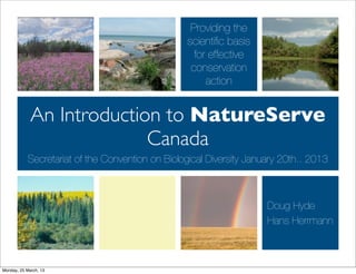
- 1. Providing the scientific basis for effective conservation action An Introduction to NatureServe Canada Secretariat of the Convention on Biological Diversity January 20th.. 2013 Doug Hyde Hans Herrmann Monday, 25 March, 13
- 2. Who We Are NatureServe Canada is a network of conservation data centres and natural heritage programs across the country ‣Experts committed to a consistent set of science-based methods and standards ‣These support the collection, processing and sharing of biodiversity information ‣This information supports conservation NatureServe Canada supports international action vegetation classification standards. Monday, 25 March, 13
- 3. Nine conservation data centres (CDCs) NatureServe • Atlantic Canada CDC (PEI, NS, NB and Newfoundland and Labrador) Canada • Centre de données sur le patrimoine naturel du Québec • Ontario Natural Heritage Information Centre • Manitoba CDC • Saskatchewan CDC • Alberta CIMS • British Columbia CDC • Yukon CDC • NWT CDC Invest $6 million annually Standards and consistent methods Data aggregated on a national basis Membership expanding Monday, 25 March, 13
- 4. Mission and Goals GOAL 2 GOAL 1 Build Conservation Advance Scientific Capacity Understanding Providing the scientific basis for effective conservation action GOAL 3 Inform Natural Resource Decisions Monday, 25 March, 13
- 5. Conservation Data Centre Activities ‣ Coordinate and conduct field surveys and inventories for rare and threatened species and ecological communities ‣ Collect, manage, analyze and distribute detailed locality and status data ‣ Some programs directly manage natural areas information, invasive alien species information ‣ Act as primary data custodians ‣ Provide data access at provincial/territorial level ‣ Support environmental reviews, assessments (COSEWIC and General Status) and planning Monday, 25 March, 13
- 6. How does NatureServe Canada add value? Monday, 25 March, 13
- 7. Develop and consistently apply methods and standards ‣ Science-based methods and standards allow data to aggregated, compared and shared ‣ Standardized “elements” - based on common taxonomy (species, ecological) ‣ Standardized “occurrences” - based on processing of primary observational data ‣ Standardized “ranks” - based on assessments using consistent criteria ‣ The only comprehensive national database on species at risk in Canada ‣ Access to primary data is fundamental to NatureServe and the CDCs Monday, 25 March, 13
- 8. Natural Heritage Methodology Monday, 25 March, 13
- 9. NatureServe’s Business Processes and Tools Monday, 25 March, 13
- 10. NatureServe’s Business Processes and Tools Monday, 25 March, 13
- 11. NatureServe’s Business Processes and Tools Refine Core Promote Conduct data Identify user Connect Heritage Observational processing needs, build Apply data to zoologists, Methods; Data steps, data web and modelling, and botanists, Conduct Standards; enhancements other other multi- ecologists, Natural Develop data and information variate data Heritage sharing apply mapping sharing analysis managers, Training agreements standards services developers Monday, 25 March, 13
- 12. NatureServe’s Business Processes and Tools Refine Core Promote Conduct data Identify user Connect Heritage Observational processing needs, build Apply data to zoologists, Methods; Data steps, data web and modelling, and botanists, Conduct Standards; enhancements other other multi- ecologists, Natural Develop data and information variate data Heritage sharing apply mapping sharing analysis managers, Training agreements standards services developers Monday, 25 March, 13
- 13. NatureServe’s Business Processes and Tools Kestrel Biotics Explorer Vista Hand Web Land- Taxi Services Held Scope Monday, 25 March, 13
- 14. Resources & Tools Monday, 25 March, 13
- 15. Monday, 25 March, 13
- 16. Tracker Supports tabular data management, including efforts to rank elements, occurrences Mapper Supports basic digital mapping, spatial analyses, and data visualization Exchanger Supports data exchange efforts, and will be enhanced through the development of Taxi, a system to manage taxonomic information Monday, 25 March, 13
- 17. Kestrel - Observational Data Management System Monday, 25 March, 13
- 18. Kestrel - Observational Data Management System Monday, 25 March, 13
- 19. Our Focus ‣ Add value to “primary” source data (observations) ‣ Access directly and through partnerships ‣ Review quality and process data into “element occurrences” (EOs) ‣ Update ranks, and inform a range of decisions that affect conservation ‣The processing into EO’s, promotes data access and sharing Monday, 25 March, 13
- 20. How much data do we have? ‣ Canadian dataset includes more than 48,000 elements (species) and 1,500 elements (communities), including all COSEWIC-assessed species ‣ Of these, 10,500 are actively tracked ‣ Approximately 100,000 EOs nationally ‣ Adding new data each year Monday, 25 March, 13
- 21. What is the value of NatureServe data? Monday, 25 March, 13
- 22. Types of data Taxonomy Element occurrences Ranks Monday, 25 March, 13
- 23. Taxonomy NatureServe Canada not focused on creating taxonomy Consumer of taxonomic information (list of elements) Aims to compare and reconcile taxonomic differences Act as a facilitator of common taxonomy within the network Taxonomic data and expertise used to inform Species assessments (General Status WG, COSEWIC) Data exchange Other networks (VasCan, ITIS) Monday, 25 March, 13
- 24. Value in context of SARA implementation Monday, 25 March, 13
- 25. Value in context of SARA implementation ‣ SARA requires ‣ The value of an EO ‣ an identification of the ‣ A basic unit of information to species’ critical habitat, to the identify critical habitat, to be extent possible, based on the complemented by knowledge best available information, of the biology of a species, including the information e.g. an assessment report or provided by COSEWIC recovery planner ‣ a schedule of studies to ‣ Where this basic unit of identify critical habitat, where information is not in place or available information is is incomplete, survey and inadequate inventory work needed Monday, 25 March, 13
- 26. Value in context of SARA implementation ‣ SARA requires ‣ The value of an EO ‣ an identification of the ‣ A basic unit of information to species’ critical habitat, to the identify critical habitat, to be extent possible, based on thenetwork (all provincesby knowledge The NatureServe Canada complemented and one territory) collects and manages EO’s the a consistentspecies, best available information, of on biology of a basis, includingcovering 85% of the species listed in SARA report or the information e.g. an assessment provided by COSEWIC recovery planner ‣ a schedule of studies to ‣ Where this basic unit of identify critical habitat, where information is not in place or available information is is incomplete, survey and inadequate inventory work needed Monday, 25 March, 13
- 27. Example Identifying regulatory habitat Monday, 25 March, 13
- 28. A process for protecting habitat based on EOs EO Species Habitat Buffered Species (unrefined, Habitat refined) Regulatory Species Habitat Mapping Habitat Guidelines Guidelines Clipped Species Habitat Monday, 25 March, 13
- 29. ‣Habitat ‣ Needed for every listed species ‣ Must include at least one EO (refined) Guidelines? ‣ Should not be based on historic observational records (>25 years old) ‣ Reflect a specific understanding of the biology of the species, in particular dissemination patterns/ behaviour ‣ Do not include habitat areas with poor habitat quality and context (i.e. dense development) ‣ Habitat of certain listed species may not be best addressed through regulation (eg. Peregrine falcon) ‣ In Canada, connected to vegetation classification efforts Monday, 25 March, 13
- 30. Integrated Conservation Planning ‣ Having spatially defined habitats in a single system allows for integrated planning - taking action for multiple species ‣ Protect habitats for multiple species simultaneously ‣ Focus also on controlling key Assisting to find lands of high activities likely to affect these conservation priority habitats, these species ‣ Refined EO basis for identifying individual species habitats Monday, 25 March, 13
- 31. NatureServe Ranks ‣ Use a suite of factors to assess the extinction or extirpation risk ‣ Rarity (6 factors) ‣ Trends (2 factors) ‣ Threats (2 factors) ‣ NatureServe Canada develops S- ranks (provincial ranks), N-ranks (national ranks) and some G-ranks (for endemics and some cross- boundary species) Monday, 25 March, 13
- 32. Who is using network data and how? Monday, 25 March, 13
- 33. NatureServe Canada data requests ‣BC CDC tracks Total Data Requests Consultants Government Academic client requests ~ ENGO Public Industry 900 per year Press USA CAN Requests: Government Breakdown ‣Response time from Int Unknown 6.5 to 2.7 days since Gov't Local 2004 ‣Time to process Requests: Consultant Breakdown Gov't Provincial Gov't Federal First Nations requests from 0.5 Consultant - Industry Consultant - Gov't hours in 2004 to Consultant - ENGO Consultant - unknown 0.25 hours in 2008 Consultant - Gov't Federal Consultant - First Nations Consultant - Gov't Local Consultant - Gov't Provincial Monday, 25 March, 13
- 34. How is our data being used? ‣ Assessment and conservation ‣ Program planning ‣ General Status program ‣ HSP ‣ COSEWIC ‣ Provincial Naturalists ‣ National Ranking Scheme ‣ Land use planning and environmental assessment ‣ Recovery Teams/RENEW (Sage Grouse) ‣ Suncor ‣ Agency planning and ‣ BC Hydro, Manitoba Hydro implementation ‣ Many other ‣ PCA, CWS ‣ Property management ‣ NRCan ‣ NRC ‣ CFIA ‣ NCC ‣ These partners and many ‣ No one else in Canada offers more contribute data this data Monday, 25 March, 13
- 35. What is the status of biodiversity data in Canada? Monday, 25 March, 13
- 36. Canada’s Biodiversity Fragmented, Data Deficit Well Inaccessible, Documented Incomplete Gaps in key areas of Canada, for many species/ecosystems More records are accessible from institutions outside Canada about Canada than from Canada Cost of data access has been higher than acquisition of new data Data can be of suspect quality; taxonomic capacity eroded, reference collections need investment Monday, 25 March, 13
- 37. Monday, 25 March, 13
- 38. NatureServe Data: Taxonomic Gaps Identification difficult, field work inaccurate, traditional taxonomic capacity eroding in time Monday, 25 March, 13
- 39. Data are not effective in supporting decision making Example: Environmental Assessment Implication? 3500 federal screenings per year. The costs of obtaining data generally outweigh the benefits to decision making. Adaptations? Sufficing: • Aggregate trusted data in the time available - hit known focal points Do it yourself data • Reinforces fragmentation • Solves short term problem, introduces new issues • Accuracy of identification • Parataxonomy Monday, 25 March, 13
- 40. How can we improve access to biodiversity data? Monday, 25 March, 13
- 41. A Vision: National institute for biodiversity data True cooperation: Ensures access, catalyzes programs and funds efforts at a national scale Lean & efficient: Enhances flow of data from critical sectors and data providers Cost effective: Shared systems and services to support individual efforts, allow broad scale queries of data Measurable and verifiable: Evaluated and recognized as meeting national need, avoid “whose data” HAS TO BE UNIQUELY CANADIAN Monday, 25 March, 13
- 42. - Join fragmented efforts (FBIP, NatureServe, Canadensys, BSC, CMoN, CWS, DFO, BIO...) Focus? - Promote a Canadian biodiversity data standards (based on DwC), creates spatial data products (range maps, predictive maps...) - Build on and invest in Canadian innovations (DNA Barcoding, +) to rapidly address data gaps - Set priorities every 3 years for a national biological survey, based on (1) an understanding of demand, (2) a synthesis of existing data (identification of gaps); updates the dynamic layer - Ensure data is accessible to conservation data centres (regulators), researchers, land use planners, private companies... - Produce reports based on expert input to address issues of the day Monday, 25 March, 13