A snapshot of the lower Indus Basin
•Download as PPTX, PDF•
1 like•1,086 views

Presented by IWMI's Arif Anwar at a media dialogue held in Kathmandu, Nepal, to mark the inaugural partners meeting of the "Informing Change in the Indus Basin" program, and following on from the "International Conference on Climate and Environmental Change Impacts on the Indus Basin Waters", February 20, 2016.

Recommended
Recommended
More Related Content
Similar to A snapshot of the lower Indus Basin
Similar to A snapshot of the lower Indus Basin (20)
More from International Water Management Institute (IWMI)
More from International Water Management Institute (IWMI) (20)
Recently uploaded
Recently uploaded (20)
A snapshot of the lower Indus Basin
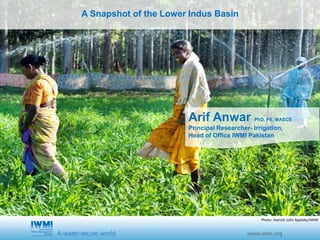
- 1. Cover slide option 1 TitleA Snapshot of the Lower Indus Basin Arif Anwar PhD, PE, MASCE Principal Researcher- Irrigation, Head of Office IWMI Pakistan Photo: Hamish John Appleby/IWMI
- 4. FACTS AND FIGURES • The Indus originates in China on the Tibetan Plateau and runs for 3,200 km across northern India and the length of Pakistan • Indus River Basin encompasses 1.12 million square kilometres • 47 % in Pakistan, 39% in India, 8% in China, and 6% in Afghanistan • The Lower Indus Basin extends over plains exhibiting subtropical arid and semi-arid to temperate sub-humid climates with precipitation 100-500 mm. • On the whole, the high-altitude catchments comprise net contributors to the basin’s water supplies and the lowland catchments constitute net consumers. • 300 million people live in this basin • Pakistan uses 63% of water in this basin and India uses
- 5. FACTS AND FIGURES PAKISTAN AND INDIA • Agriculture accounts for 93% of water withdrawn from the Indus • Pakistan has the world’s largest contiguous system of irrigated agriculture, • 95% of all the irrigation in Pakistan occurs within the basin. • 40% of Pakistan’s labour force is engaged in agriculture • Agriculture accounts for about 22% of Pakistan’s GDP • Agriculture accounts for 17% of India’s GDP • Occupies 55% percent of India’s economically active population • The combined Indo-Gangetic Plain constitutes the most intensely irrigated area on earth
- 9. IN CONCLUSION Are we doing enough? • Too little, too slow • Significant population pressure • Climate change • Land degradation • Socio-economic changes including urban migration • Business-as-usual approach • Youth unemployment • Social/income Disparity
- 10. THANK YOU