SlideShare a Scribd company logo
1 of 27
UNIT 5: FORMS OF
RELIEF
LEARNING OBJECTIVES
In this unit, the learner will be able to:
•Define relief.
•Identify the different forms of relief.
•State the relationship between relief and
human activities.
SLOPE, ALTITUDE AND CONTOURS
❖ Slope: is the rise or fall of the relief feature. It is a measure
of the degree of inclination of a feature in relation to the
horizontal plane.
Slope is determined by the angle of elevation.
Slopes are classified in the following types:
a) Concave slope
b) Convex slope
c) Steep slope
d) Gentle slope
TYPES OF SLOPES
a) Concave slope: this is a slope that has a steep section uphill and a
comparatively gentle section downhill. It is known as waning slope
b) Convex slope: this is a slope that is more or less gentle uphill but
comparatively steeper downhill
c) Gentle slope: this is a slope which is almost flat. Its elevation is flat
compared to the convex, concave, and steep slopes.
d) Steep slope: this is a slope that is almost vertical or relatively high
gradient.
Gradient: refers to steepness or gentleness of an area.
Even slope: is the term which is used when there is uniform change in
gradient between two points on the earth’s surface.
Steep slope
ALTITUDE
Altitude: this is the height or
elevation of a point above a
given reference point.
The reference point is the sea
level which is at a zero meter.
Altitude is expressed in feet
or meters.
Therefore, altitude is defined
as the height above the sea
level.
CONTOURS
A contour: is a line connecting points (places) of the same altitude on a
topographical map. Contours show the type of relief on the earth's
surface.
Interpretation of contours
✓Contours appearing close to each other represent Steep Slope
✓Contours spreading over a large area represent Extensive Plain
✓Contours forming concentric circles represent Hill or Mountain
✓Contours appear to overlap or cross each other represent Cliff
✓Contours are V or U shaped represent Valley.
FORMS OF RELIEF FEATURES
Relief features are classified into two main categories. These include
a) The continental relief features
b) The marine relief features
These relief features had been formed by both internal and external forces:
The internal forces such as:
• Tectonic plate movement,
• Vulcanicity,
• Earthquakes,
The external agents such as:
• Winds, ice,
• Rain leading to mass wasting and
• Erosion and deposition.
Vulcanicity as cause of major relief features
CONTINENTAL RELIEF FEATURES
The main forms of continental relief include the following:
a) Mountain: is a very large landform that rises above the area surrounding it.
It usually has a peak. Mountains may appear as single landmass or in a
chain called range.
Example mountains are:
❖ Mount Everest (8,848m) in Tibet (China-Nepal) found in Himalaya ranges. it
is the highest peak mount in the world
❖Mount Kilimanjaro (5,895m): It is found in Tanzania. It is the highest peak
mountain in Africa
❖Mount Karisimbi (4,507m): The highest peak mountain in Rwanda
❖Mount Aconcagua (6,960m): The highest peak in South America located in
Andes Mountain range in Argentina
❖Mount Denali (6,144m): The highest peak in North America located in Alaska
range in USA.
Mount Denali 6,144m Mount Aconcagua 6,960m
Comparison of mountains in the world
Himalaya mountain range is located in Asia and is
known to have highest mountain peaks in the world
Himalaya mountain range is located in Asia and is
known to have highest mountain peaks in the world
TYPES OF MOUNTAINS
Mountains are classified into the following types:
❖Block mountain: these mountains form due to the process of faulting. For
example, Mount Rwenzori (5,111m) in Uganda and DRC border
❖Volcanic mountains: these mountains forms due to the process of vulcanicity
(volcanic eruption), for example: Mt Elgon (4,321) between Kenya and
Uganda.
❖Fold mountains: these mountains form due to the process of folding. For
example;
❖Atlas range in northeast and Cape range in southeast of Africa
❖Himalayas in Asia
❖Andes mountain range in South America
❖Rockies in North America
❖Inselberg: these mountains form due to erosion, and accumulation of snow
and ice on the continent or sea/ocean.
b) Hill: this is a landmass that extends above the surrounding
terrain. However it is smaller than a mountain
c) Plateau: is a raised land that is almost flat at the top with
gentle slopes on all sides to the lower ground. For example,
the central plateaus of Rwanda, and the eastern African
plateaus in Africa.
d) Ridge: this is a linear, steep-sided upland. It is a relief
feature that consists of a chain of hills or mountains.
e) Escarpment: This is a steep slope that separates an area of
high ground from an area with lower ground.
f) Spurs: this is an area of high ground that sticks out of a
mountain hill
Hill Plateau
Ridge
Escarpments
g) Plain: this is an extensive area tract of flat land.
Plains are categorized into:
❖Peneplains: these form due to the wearing down of lands that were once
much higher. For example: Karamoja, Soroti in Uganda
❖Alluvial (flood) plains: these form
due to the accumulation of silts
brought down by rivers. For example;
Nyabarongo plain
❖Coastal plains: these form
alongside the coast due marine
deposition. For example, Rufiji Delta
on the coast of Tanzania
Flood Plain on Nyabarongo
river
h) Valley: This is a low area of land between hills or mountains, typically
with a river or stream flowing through it.
There are two types of valleys:
❖U-shaped valleys: these valleys are found between hills with gentle
slopes.
❖V-shaped valleys: these valleys are found between mountains with steep
slopes.
U Shaped Valley V Shaped Valley
MARINE RELIEF FEATURES
These are landforms that are found on the oceanic crust. They include beaches,
gulfs, cliffs, and capes.
Beaches
Gulf of Mexico
Cliff
Cape
The main relief features of the ocean bed
1. Continental shelf: is an underwater
landmass extends from the shorelines
towards the ocean deep. This region
represents 7.5% of the total ocean
area.
Continental shelves are wide in Japan,
Canada, U.S.A but narrow in Africa.
2. Continental slope: this is a steep
slope that extends from the edge of
the continental shelf to the deep
ocean plain. It consists of mud, and
silt, and is often cross cut by
submarine canyons. It is widely
20kms.
3. Continental rise: is an
underwater feature found
between the continental
slope and the abyssal plain.
4. Continental ridge: this is a
submarine mountain formed
from ocean volcanic
eruption. For example,
• East pacific ridges,
• Atlantic mid-ocean ridge, and
• Mid-Indian ocean ridge.
5. Oceanic trench: this is long
narrow steep-sided depression in
the oceanic crust. It is the deepest
part of the ocean. For example,
• Marianna trench in Pacific
Ocean with 10,994meters below
sea level.
• Java trench in Indian ocean,
• Tonga trench in Pacific ocean,
• Peru-Chile trench in Pacific
Ocean
• Atacama trench in Pacific ocean
6. Abyssal plain: is
underwater plain on the
deep ocean floor which
is usually found at
depths between 3,000
and 6,000meters.
It extends from continental
rise to mid-ocean ridge. It
therefore covers 50% of the
earth’s surface.
7. Oceanic island: is that rises to the surface from the floor of ocean basins.
Oceanic islands are formed by the continuous eruption with oceans. When these
oceanic islands are eroded, it results in formation of guyots. Examples:
• Azores, Ascension and Saint Helena islands in Atlantic ocean,
• Hawaiian islands in Pacific ocean.
• Madagascar island in Indian Ocean
Mnemba Island of Zanzbar in Tanzania
FIGURES SHOWING MARINE RELIEF FEATURES
RELIEF FEATURES AND HUMAN ACTIVITIES
❖Hill tops favour the construction of telephonic communication masts
❖Gentle sloping areas favour farming, construction of roads, and
settlement
❖Flat valleys promote rice, sugarcane and vegetable growing because of
the presence of water in them
❖Plains tend to favour cattle rearing, construction of railway lines, and
aerodromes, etc…….
❖Mountainous areas promote forestry which later favours lumbering
and attraction of tourists
❖Steep slopes hinder farming, transport and communication
development.
❖Steep slopes are less exploited because it demands high capital

More Related Content

What's hot

Introduction to geomorphology
Introduction to geomorphologyIntroduction to geomorphology
Introduction to geomorphologyMd. Nazir Hossain
 
Wind and its depositional features
Wind and its depositional featuresWind and its depositional features
Wind and its depositional featuresGCUF
 
Karst topography
Karst topographyKarst topography
Karst topographyPramoda Raj
 
Geology of Island arc
Geology of Island arcGeology of Island arc
Geology of Island arcShah Naseer
 
Erosional & depositional glacial landforms
Erosional & depositional glacial landformsErosional & depositional glacial landforms
Erosional & depositional glacial landformsNeha Gupta
 
Cycle of erosion, davis and penk
Cycle of erosion, davis and penkCycle of erosion, davis and penk
Cycle of erosion, davis and penkRajithK
 
Living with Tectonic Hazards
Living with Tectonic HazardsLiving with Tectonic Hazards
Living with Tectonic HazardsNicholas Wong
 
Geology of bangladesh
Geology of bangladeshGeology of bangladesh
Geology of bangladeshShuvo Roy
 
Glacial landforms AS Level Geography
Glacial landforms AS Level GeographyGlacial landforms AS Level Geography
Glacial landforms AS Level GeographyKatie-Ann Sheehan
 
aeolian landforms
 aeolian landforms aeolian landforms
aeolian landformsPramoda Raj
 
Types Drainage pattern presentation
Types Drainage pattern presentationTypes Drainage pattern presentation
Types Drainage pattern presentationKamrul Islam Karim
 
Introduction to Geomorphology
Introduction to Geomorphology Introduction to Geomorphology
Introduction to Geomorphology P.K. Mani
 
Fluvial landforms
Fluvial landformsFluvial landforms
Fluvial landformsMs Geoflake
 

What's hot (20)

Introduction to geomorphology
Introduction to geomorphologyIntroduction to geomorphology
Introduction to geomorphology
 
Theory of isostacy
Theory of isostacyTheory of isostacy
Theory of isostacy
 
Wind and its depositional features
Wind and its depositional featuresWind and its depositional features
Wind and its depositional features
 
Karst topography
Karst topographyKarst topography
Karst topography
 
Geology of Island arc
Geology of Island arcGeology of Island arc
Geology of Island arc
 
Isostasy
IsostasyIsostasy
Isostasy
 
Erosional & depositional glacial landforms
Erosional & depositional glacial landformsErosional & depositional glacial landforms
Erosional & depositional glacial landforms
 
Topography of ocean floors
Topography of ocean floorsTopography of ocean floors
Topography of ocean floors
 
Cycle of erosion, davis and penk
Cycle of erosion, davis and penkCycle of erosion, davis and penk
Cycle of erosion, davis and penk
 
Living with Tectonic Hazards
Living with Tectonic HazardsLiving with Tectonic Hazards
Living with Tectonic Hazards
 
Geology of bangladesh
Geology of bangladeshGeology of bangladesh
Geology of bangladesh
 
Isostasy
IsostasyIsostasy
Isostasy
 
Glacial landforms AS Level Geography
Glacial landforms AS Level GeographyGlacial landforms AS Level Geography
Glacial landforms AS Level Geography
 
aeolian landforms
 aeolian landforms aeolian landforms
aeolian landforms
 
Toposheet indexing .
Toposheet indexing .Toposheet indexing .
Toposheet indexing .
 
Types Drainage pattern presentation
Types Drainage pattern presentationTypes Drainage pattern presentation
Types Drainage pattern presentation
 
Volcano in geology based
Volcano in geology basedVolcano in geology based
Volcano in geology based
 
Introduction to Geomorphology
Introduction to Geomorphology Introduction to Geomorphology
Introduction to Geomorphology
 
Relief orders
Relief ordersRelief orders
Relief orders
 
Fluvial landforms
Fluvial landformsFluvial landforms
Fluvial landforms
 

Similar to Unit 5 Forms of Relief.pdf (20)

landforms of earth
landforms of earthlandforms of earth
landforms of earth
 
Mountains
MountainsMountains
Mountains
 
Faulting
FaultingFaulting
Faulting
 
Faulting
FaultingFaulting
Faulting
 
Mountains
MountainsMountains
Mountains
 
Mountains
MountainsMountains
Mountains
 
Major landforms of the earth
Major landforms of the earthMajor landforms of the earth
Major landforms of the earth
 
major landforms.pdf
major landforms.pdfmajor landforms.pdf
major landforms.pdf
 
UNIT 2. Geosphere
UNIT 2. GeosphereUNIT 2. Geosphere
UNIT 2. Geosphere
 
UNIT 2. Geosphere
UNIT 2. GeosphereUNIT 2. Geosphere
UNIT 2. Geosphere
 
Earthforms
EarthformsEarthforms
Earthforms
 
1.6 Plate Boundaries.pptx
1.6 Plate Boundaries.pptx1.6 Plate Boundaries.pptx
1.6 Plate Boundaries.pptx
 
Unit 2 (part 2): Landform
Unit 2 (part 2): LandformUnit 2 (part 2): Landform
Unit 2 (part 2): Landform
 
Mountain.pdf
Mountain.pdfMountain.pdf
Mountain.pdf
 
Mountain
MountainMountain
Mountain
 
UNIT 2. Geosphere
UNIT 2. GeosphereUNIT 2. Geosphere
UNIT 2. Geosphere
 
Unit 2. Geosphere
Unit 2. GeosphereUnit 2. Geosphere
Unit 2. Geosphere
 
GOEGARPHY.pptx
GOEGARPHY.pptxGOEGARPHY.pptx
GOEGARPHY.pptx
 
Geosphere
GeosphereGeosphere
Geosphere
 
Ppt mountain
Ppt mountainPpt mountain
Ppt mountain
 

More from DUSABIMANA Jean D Amour

Unit 17 Transport, communication and Trade in Rwanda....pptx
Unit 17 Transport, communication and Trade in Rwanda....pptxUnit 17 Transport, communication and Trade in Rwanda....pptx
Unit 17 Transport, communication and Trade in Rwanda....pptxDUSABIMANA Jean D Amour
 
Unit 3 Earth In relation to the universe.pdf
Unit 3 Earth In relation to the universe.pdfUnit 3 Earth In relation to the universe.pdf
Unit 3 Earth In relation to the universe.pdfDUSABIMANA Jean D Amour
 
Unit 4 Internal Structure of the Earth.pdf
Unit 4 Internal Structure of the Earth.pdfUnit 4 Internal Structure of the Earth.pdf
Unit 4 Internal Structure of the Earth.pdfDUSABIMANA Jean D Amour
 

More from DUSABIMANA Jean D Amour (17)

Unit 15 Power and Energy in Rwanda.pptx
Unit 15 Power and Energy in Rwanda.pptxUnit 15 Power and Energy in Rwanda.pptx
Unit 15 Power and Energy in Rwanda.pptx
 
Unit 17 Transport, communication and Trade in Rwanda....pptx
Unit 17 Transport, communication and Trade in Rwanda....pptxUnit 17 Transport, communication and Trade in Rwanda....pptx
Unit 17 Transport, communication and Trade in Rwanda....pptx
 
Unit 11 Agriculture in Rwanda.pptx
Unit 11 Agriculture in Rwanda.pptxUnit 11 Agriculture in Rwanda.pptx
Unit 11 Agriculture in Rwanda.pptx
 
Unit 10 Rural and urban settlement.pptx
Unit 10 Rural and urban settlement.pptxUnit 10 Rural and urban settlement.pptx
Unit 10 Rural and urban settlement.pptx
 
Unit 7 Vegetation in Rwanda.pptx
Unit 7 Vegetation in Rwanda.pptxUnit 7 Vegetation in Rwanda.pptx
Unit 7 Vegetation in Rwanda.pptx
 
Unit 8 Drainage system in Rwanda.pptx
Unit 8 Drainage system in Rwanda.pptxUnit 8 Drainage system in Rwanda.pptx
Unit 8 Drainage system in Rwanda.pptx
 
Unit 6 Climate in Rwanda.pptx
Unit 6 Climate in Rwanda.pptxUnit 6 Climate in Rwanda.pptx
Unit 6 Climate in Rwanda.pptx
 
Unit 9 Population.pptx
Unit 9 Population.pptxUnit 9 Population.pptx
Unit 9 Population.pptx
 
Unit 4 Rocks and minerals.pptx
Unit 4 Rocks and minerals.pptxUnit 4 Rocks and minerals.pptx
Unit 4 Rocks and minerals.pptx
 
Unit 1 Fieldwork techniques.pptx
Unit 1 Fieldwork techniques.pptxUnit 1 Fieldwork techniques.pptx
Unit 1 Fieldwork techniques.pptx
 
Unit 5 Soils in Rwanda.pptx
Unit 5 Soils in Rwanda.pptxUnit 5 Soils in Rwanda.pptx
Unit 5 Soils in Rwanda.pptx
 
Unit 3 Earth In relation to the universe.pdf
Unit 3 Earth In relation to the universe.pdfUnit 3 Earth In relation to the universe.pdf
Unit 3 Earth In relation to the universe.pdf
 
Unit 2 Elements of a map.pdf
Unit 2 Elements of a map.pdfUnit 2 Elements of a map.pdf
Unit 2 Elements of a map.pdf
 
Unit 7 Soils.pdf
Unit 7 Soils.pdfUnit 7 Soils.pdf
Unit 7 Soils.pdf
 
Unit 6 Rocks.pdf
Unit 6 Rocks.pdfUnit 6 Rocks.pdf
Unit 6 Rocks.pdf
 
UNIT 1 INTRODUCTION TO GEOGRAPHY.pdf
UNIT 1 INTRODUCTION TO GEOGRAPHY.pdfUNIT 1 INTRODUCTION TO GEOGRAPHY.pdf
UNIT 1 INTRODUCTION TO GEOGRAPHY.pdf
 
Unit 4 Internal Structure of the Earth.pdf
Unit 4 Internal Structure of the Earth.pdfUnit 4 Internal Structure of the Earth.pdf
Unit 4 Internal Structure of the Earth.pdf
 

Recently uploaded

Basic Civil Engineering first year Notes- Chapter 4 Building.pptx
Basic Civil Engineering first year Notes- Chapter 4 Building.pptxBasic Civil Engineering first year Notes- Chapter 4 Building.pptx
Basic Civil Engineering first year Notes- Chapter 4 Building.pptxDenish Jangid
 
SKILL OF INTRODUCING THE LESSON MICRO SKILLS.pptx
SKILL OF INTRODUCING THE LESSON MICRO SKILLS.pptxSKILL OF INTRODUCING THE LESSON MICRO SKILLS.pptx
SKILL OF INTRODUCING THE LESSON MICRO SKILLS.pptxAmanpreet Kaur
 
Accessible Digital Futures project (20/03/2024)
Accessible Digital Futures project (20/03/2024)Accessible Digital Futures project (20/03/2024)
Accessible Digital Futures project (20/03/2024)Jisc
 
Micro-Scholarship, What it is, How can it help me.pdf
Micro-Scholarship, What it is, How can it help me.pdfMicro-Scholarship, What it is, How can it help me.pdf
Micro-Scholarship, What it is, How can it help me.pdfPoh-Sun Goh
 
On National Teacher Day, meet the 2024-25 Kenan Fellows
On National Teacher Day, meet the 2024-25 Kenan FellowsOn National Teacher Day, meet the 2024-25 Kenan Fellows
On National Teacher Day, meet the 2024-25 Kenan FellowsMebane Rash
 
psychiatric nursing HISTORY COLLECTION .docx
psychiatric  nursing HISTORY  COLLECTION  .docxpsychiatric  nursing HISTORY  COLLECTION  .docx
psychiatric nursing HISTORY COLLECTION .docxPoojaSen20
 
Sociology 101 Demonstration of Learning Exhibit
Sociology 101 Demonstration of Learning ExhibitSociology 101 Demonstration of Learning Exhibit
Sociology 101 Demonstration of Learning Exhibitjbellavia9
 
2024-NATIONAL-LEARNING-CAMP-AND-OTHER.pptx
2024-NATIONAL-LEARNING-CAMP-AND-OTHER.pptx2024-NATIONAL-LEARNING-CAMP-AND-OTHER.pptx
2024-NATIONAL-LEARNING-CAMP-AND-OTHER.pptxMaritesTamaniVerdade
 
This PowerPoint helps students to consider the concept of infinity.
This PowerPoint helps students to consider the concept of infinity.This PowerPoint helps students to consider the concept of infinity.
This PowerPoint helps students to consider the concept of infinity.christianmathematics
 
TỔNG ÔN TẬP THI VÀO LỚP 10 MÔN TIẾNG ANH NĂM HỌC 2023 - 2024 CÓ ĐÁP ÁN (NGỮ Â...
TỔNG ÔN TẬP THI VÀO LỚP 10 MÔN TIẾNG ANH NĂM HỌC 2023 - 2024 CÓ ĐÁP ÁN (NGỮ Â...TỔNG ÔN TẬP THI VÀO LỚP 10 MÔN TIẾNG ANH NĂM HỌC 2023 - 2024 CÓ ĐÁP ÁN (NGỮ Â...
TỔNG ÔN TẬP THI VÀO LỚP 10 MÔN TIẾNG ANH NĂM HỌC 2023 - 2024 CÓ ĐÁP ÁN (NGỮ Â...Nguyen Thanh Tu Collection
 
Kodo Millet PPT made by Ghanshyam bairwa college of Agriculture kumher bhara...
Kodo Millet  PPT made by Ghanshyam bairwa college of Agriculture kumher bhara...Kodo Millet  PPT made by Ghanshyam bairwa college of Agriculture kumher bhara...
Kodo Millet PPT made by Ghanshyam bairwa college of Agriculture kumher bhara...pradhanghanshyam7136
 
UGC NET Paper 1 Mathematical Reasoning & Aptitude.pdf
UGC NET Paper 1 Mathematical Reasoning & Aptitude.pdfUGC NET Paper 1 Mathematical Reasoning & Aptitude.pdf
UGC NET Paper 1 Mathematical Reasoning & Aptitude.pdfNirmal Dwivedi
 
Activity 01 - Artificial Culture (1).pdf
Activity 01 - Artificial Culture (1).pdfActivity 01 - Artificial Culture (1).pdf
Activity 01 - Artificial Culture (1).pdfciinovamais
 
How to Create and Manage Wizard in Odoo 17
How to Create and Manage Wizard in Odoo 17How to Create and Manage Wizard in Odoo 17
How to Create and Manage Wizard in Odoo 17Celine George
 
Understanding Accommodations and Modifications
Understanding  Accommodations and ModificationsUnderstanding  Accommodations and Modifications
Understanding Accommodations and ModificationsMJDuyan
 
Python Notes for mca i year students osmania university.docx
Python Notes for mca i year students osmania university.docxPython Notes for mca i year students osmania university.docx
Python Notes for mca i year students osmania university.docxRamakrishna Reddy Bijjam
 
microwave assisted reaction. General introduction
microwave assisted reaction. General introductionmicrowave assisted reaction. General introduction
microwave assisted reaction. General introductionMaksud Ahmed
 
ICT Role in 21st Century Education & its Challenges.pptx
ICT Role in 21st Century Education & its Challenges.pptxICT Role in 21st Century Education & its Challenges.pptx
ICT Role in 21st Century Education & its Challenges.pptxAreebaZafar22
 
Introduction to Nonprofit Accounting: The Basics
Introduction to Nonprofit Accounting: The BasicsIntroduction to Nonprofit Accounting: The Basics
Introduction to Nonprofit Accounting: The BasicsTechSoup
 

Recently uploaded (20)

Basic Civil Engineering first year Notes- Chapter 4 Building.pptx
Basic Civil Engineering first year Notes- Chapter 4 Building.pptxBasic Civil Engineering first year Notes- Chapter 4 Building.pptx
Basic Civil Engineering first year Notes- Chapter 4 Building.pptx
 
SKILL OF INTRODUCING THE LESSON MICRO SKILLS.pptx
SKILL OF INTRODUCING THE LESSON MICRO SKILLS.pptxSKILL OF INTRODUCING THE LESSON MICRO SKILLS.pptx
SKILL OF INTRODUCING THE LESSON MICRO SKILLS.pptx
 
Accessible Digital Futures project (20/03/2024)
Accessible Digital Futures project (20/03/2024)Accessible Digital Futures project (20/03/2024)
Accessible Digital Futures project (20/03/2024)
 
Micro-Scholarship, What it is, How can it help me.pdf
Micro-Scholarship, What it is, How can it help me.pdfMicro-Scholarship, What it is, How can it help me.pdf
Micro-Scholarship, What it is, How can it help me.pdf
 
On National Teacher Day, meet the 2024-25 Kenan Fellows
On National Teacher Day, meet the 2024-25 Kenan FellowsOn National Teacher Day, meet the 2024-25 Kenan Fellows
On National Teacher Day, meet the 2024-25 Kenan Fellows
 
psychiatric nursing HISTORY COLLECTION .docx
psychiatric  nursing HISTORY  COLLECTION  .docxpsychiatric  nursing HISTORY  COLLECTION  .docx
psychiatric nursing HISTORY COLLECTION .docx
 
Sociology 101 Demonstration of Learning Exhibit
Sociology 101 Demonstration of Learning ExhibitSociology 101 Demonstration of Learning Exhibit
Sociology 101 Demonstration of Learning Exhibit
 
2024-NATIONAL-LEARNING-CAMP-AND-OTHER.pptx
2024-NATIONAL-LEARNING-CAMP-AND-OTHER.pptx2024-NATIONAL-LEARNING-CAMP-AND-OTHER.pptx
2024-NATIONAL-LEARNING-CAMP-AND-OTHER.pptx
 
This PowerPoint helps students to consider the concept of infinity.
This PowerPoint helps students to consider the concept of infinity.This PowerPoint helps students to consider the concept of infinity.
This PowerPoint helps students to consider the concept of infinity.
 
TỔNG ÔN TẬP THI VÀO LỚP 10 MÔN TIẾNG ANH NĂM HỌC 2023 - 2024 CÓ ĐÁP ÁN (NGỮ Â...
TỔNG ÔN TẬP THI VÀO LỚP 10 MÔN TIẾNG ANH NĂM HỌC 2023 - 2024 CÓ ĐÁP ÁN (NGỮ Â...TỔNG ÔN TẬP THI VÀO LỚP 10 MÔN TIẾNG ANH NĂM HỌC 2023 - 2024 CÓ ĐÁP ÁN (NGỮ Â...
TỔNG ÔN TẬP THI VÀO LỚP 10 MÔN TIẾNG ANH NĂM HỌC 2023 - 2024 CÓ ĐÁP ÁN (NGỮ Â...
 
Kodo Millet PPT made by Ghanshyam bairwa college of Agriculture kumher bhara...
Kodo Millet  PPT made by Ghanshyam bairwa college of Agriculture kumher bhara...Kodo Millet  PPT made by Ghanshyam bairwa college of Agriculture kumher bhara...
Kodo Millet PPT made by Ghanshyam bairwa college of Agriculture kumher bhara...
 
UGC NET Paper 1 Mathematical Reasoning & Aptitude.pdf
UGC NET Paper 1 Mathematical Reasoning & Aptitude.pdfUGC NET Paper 1 Mathematical Reasoning & Aptitude.pdf
UGC NET Paper 1 Mathematical Reasoning & Aptitude.pdf
 
Activity 01 - Artificial Culture (1).pdf
Activity 01 - Artificial Culture (1).pdfActivity 01 - Artificial Culture (1).pdf
Activity 01 - Artificial Culture (1).pdf
 
How to Create and Manage Wizard in Odoo 17
How to Create and Manage Wizard in Odoo 17How to Create and Manage Wizard in Odoo 17
How to Create and Manage Wizard in Odoo 17
 
Understanding Accommodations and Modifications
Understanding  Accommodations and ModificationsUnderstanding  Accommodations and Modifications
Understanding Accommodations and Modifications
 
Python Notes for mca i year students osmania university.docx
Python Notes for mca i year students osmania university.docxPython Notes for mca i year students osmania university.docx
Python Notes for mca i year students osmania university.docx
 
microwave assisted reaction. General introduction
microwave assisted reaction. General introductionmicrowave assisted reaction. General introduction
microwave assisted reaction. General introduction
 
ICT Role in 21st Century Education & its Challenges.pptx
ICT Role in 21st Century Education & its Challenges.pptxICT Role in 21st Century Education & its Challenges.pptx
ICT Role in 21st Century Education & its Challenges.pptx
 
Asian American Pacific Islander Month DDSD 2024.pptx
Asian American Pacific Islander Month DDSD 2024.pptxAsian American Pacific Islander Month DDSD 2024.pptx
Asian American Pacific Islander Month DDSD 2024.pptx
 
Introduction to Nonprofit Accounting: The Basics
Introduction to Nonprofit Accounting: The BasicsIntroduction to Nonprofit Accounting: The Basics
Introduction to Nonprofit Accounting: The Basics
 

Unit 5 Forms of Relief.pdf

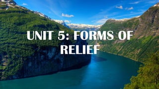
  • 1. UNIT 5: FORMS OF RELIEF
  • 2. LEARNING OBJECTIVES In this unit, the learner will be able to: •Define relief. •Identify the different forms of relief. •State the relationship between relief and human activities.
  • 3. SLOPE, ALTITUDE AND CONTOURS ❖ Slope: is the rise or fall of the relief feature. It is a measure of the degree of inclination of a feature in relation to the horizontal plane. Slope is determined by the angle of elevation. Slopes are classified in the following types: a) Concave slope b) Convex slope c) Steep slope d) Gentle slope
  • 4. TYPES OF SLOPES a) Concave slope: this is a slope that has a steep section uphill and a comparatively gentle section downhill. It is known as waning slope b) Convex slope: this is a slope that is more or less gentle uphill but comparatively steeper downhill c) Gentle slope: this is a slope which is almost flat. Its elevation is flat compared to the convex, concave, and steep slopes. d) Steep slope: this is a slope that is almost vertical or relatively high gradient. Gradient: refers to steepness or gentleness of an area. Even slope: is the term which is used when there is uniform change in gradient between two points on the earth’s surface.
  • 6. ALTITUDE Altitude: this is the height or elevation of a point above a given reference point. The reference point is the sea level which is at a zero meter. Altitude is expressed in feet or meters. Therefore, altitude is defined as the height above the sea level.
  • 7. CONTOURS A contour: is a line connecting points (places) of the same altitude on a topographical map. Contours show the type of relief on the earth's surface. Interpretation of contours ✓Contours appearing close to each other represent Steep Slope ✓Contours spreading over a large area represent Extensive Plain ✓Contours forming concentric circles represent Hill or Mountain ✓Contours appear to overlap or cross each other represent Cliff ✓Contours are V or U shaped represent Valley.
  • 8.
  • 9. FORMS OF RELIEF FEATURES Relief features are classified into two main categories. These include a) The continental relief features b) The marine relief features These relief features had been formed by both internal and external forces: The internal forces such as: • Tectonic plate movement, • Vulcanicity, • Earthquakes, The external agents such as: • Winds, ice, • Rain leading to mass wasting and • Erosion and deposition. Vulcanicity as cause of major relief features
  • 10. CONTINENTAL RELIEF FEATURES The main forms of continental relief include the following: a) Mountain: is a very large landform that rises above the area surrounding it. It usually has a peak. Mountains may appear as single landmass or in a chain called range. Example mountains are: ❖ Mount Everest (8,848m) in Tibet (China-Nepal) found in Himalaya ranges. it is the highest peak mount in the world ❖Mount Kilimanjaro (5,895m): It is found in Tanzania. It is the highest peak mountain in Africa ❖Mount Karisimbi (4,507m): The highest peak mountain in Rwanda ❖Mount Aconcagua (6,960m): The highest peak in South America located in Andes Mountain range in Argentina ❖Mount Denali (6,144m): The highest peak in North America located in Alaska range in USA.
  • 11. Mount Denali 6,144m Mount Aconcagua 6,960m Comparison of mountains in the world Himalaya mountain range is located in Asia and is known to have highest mountain peaks in the world Himalaya mountain range is located in Asia and is known to have highest mountain peaks in the world
  • 12. TYPES OF MOUNTAINS Mountains are classified into the following types: ❖Block mountain: these mountains form due to the process of faulting. For example, Mount Rwenzori (5,111m) in Uganda and DRC border ❖Volcanic mountains: these mountains forms due to the process of vulcanicity (volcanic eruption), for example: Mt Elgon (4,321) between Kenya and Uganda. ❖Fold mountains: these mountains form due to the process of folding. For example; ❖Atlas range in northeast and Cape range in southeast of Africa ❖Himalayas in Asia ❖Andes mountain range in South America ❖Rockies in North America ❖Inselberg: these mountains form due to erosion, and accumulation of snow and ice on the continent or sea/ocean.
  • 13.
  • 14. b) Hill: this is a landmass that extends above the surrounding terrain. However it is smaller than a mountain c) Plateau: is a raised land that is almost flat at the top with gentle slopes on all sides to the lower ground. For example, the central plateaus of Rwanda, and the eastern African plateaus in Africa. d) Ridge: this is a linear, steep-sided upland. It is a relief feature that consists of a chain of hills or mountains. e) Escarpment: This is a steep slope that separates an area of high ground from an area with lower ground. f) Spurs: this is an area of high ground that sticks out of a mountain hill
  • 16. g) Plain: this is an extensive area tract of flat land. Plains are categorized into: ❖Peneplains: these form due to the wearing down of lands that were once much higher. For example: Karamoja, Soroti in Uganda ❖Alluvial (flood) plains: these form due to the accumulation of silts brought down by rivers. For example; Nyabarongo plain ❖Coastal plains: these form alongside the coast due marine deposition. For example, Rufiji Delta on the coast of Tanzania Flood Plain on Nyabarongo river
  • 17. h) Valley: This is a low area of land between hills or mountains, typically with a river or stream flowing through it. There are two types of valleys: ❖U-shaped valleys: these valleys are found between hills with gentle slopes. ❖V-shaped valleys: these valleys are found between mountains with steep slopes. U Shaped Valley V Shaped Valley
  • 18. MARINE RELIEF FEATURES These are landforms that are found on the oceanic crust. They include beaches, gulfs, cliffs, and capes. Beaches Gulf of Mexico Cliff Cape
  • 19. The main relief features of the ocean bed
  • 20. 1. Continental shelf: is an underwater landmass extends from the shorelines towards the ocean deep. This region represents 7.5% of the total ocean area. Continental shelves are wide in Japan, Canada, U.S.A but narrow in Africa. 2. Continental slope: this is a steep slope that extends from the edge of the continental shelf to the deep ocean plain. It consists of mud, and silt, and is often cross cut by submarine canyons. It is widely 20kms.
  • 21. 3. Continental rise: is an underwater feature found between the continental slope and the abyssal plain. 4. Continental ridge: this is a submarine mountain formed from ocean volcanic eruption. For example, • East pacific ridges, • Atlantic mid-ocean ridge, and • Mid-Indian ocean ridge.
  • 22. 5. Oceanic trench: this is long narrow steep-sided depression in the oceanic crust. It is the deepest part of the ocean. For example, • Marianna trench in Pacific Ocean with 10,994meters below sea level. • Java trench in Indian ocean, • Tonga trench in Pacific ocean, • Peru-Chile trench in Pacific Ocean • Atacama trench in Pacific ocean
  • 23. 6. Abyssal plain: is underwater plain on the deep ocean floor which is usually found at depths between 3,000 and 6,000meters. It extends from continental rise to mid-ocean ridge. It therefore covers 50% of the earth’s surface.
  • 24. 7. Oceanic island: is that rises to the surface from the floor of ocean basins. Oceanic islands are formed by the continuous eruption with oceans. When these oceanic islands are eroded, it results in formation of guyots. Examples: • Azores, Ascension and Saint Helena islands in Atlantic ocean, • Hawaiian islands in Pacific ocean. • Madagascar island in Indian Ocean Mnemba Island of Zanzbar in Tanzania
  • 25. FIGURES SHOWING MARINE RELIEF FEATURES
  • 26.
  • 27. RELIEF FEATURES AND HUMAN ACTIVITIES ❖Hill tops favour the construction of telephonic communication masts ❖Gentle sloping areas favour farming, construction of roads, and settlement ❖Flat valleys promote rice, sugarcane and vegetable growing because of the presence of water in them ❖Plains tend to favour cattle rearing, construction of railway lines, and aerodromes, etc……. ❖Mountainous areas promote forestry which later favours lumbering and attraction of tourists ❖Steep slopes hinder farming, transport and communication development. ❖Steep slopes are less exploited because it demands high capital