1. A) perfect sphere
B) perfect ellipse
C) slightly oblate sphere
D) highly eccentric ellipse
1. The true shape of the Earth is best described as a
2. The table below shows the distance that an observer must
travel on a north-south line along the surface of the Earth
in order to change the observed altitude of Polaris by 5º.
A) is a perfect sphere
B) is flattened at the Equator
C) has a curved surface
D) has a very smooth surface
The best inference about the Earth's shape that can be
made from these observations is that the Earth
A) photographs of the Earth taken from space satellites
B) the amount of daylight received at the North Pole
on June 21
C) the changing orbital speed of the Earth in its orbit
around the Sun
D) the cyclic change of seasons
3. The best evidence that the Earth has a spherical shape is
provided by
A) greatest in diameter at the Equator
B) greatest in diameter at the poles
C) a perfect sphere
D) pear shaped
4. Measurements taken from space show the Earth to be
A) Polaris is located directly over the Tropic of Cancer
B) Polaris is the brightest and most easily located star
C) the altitude of Polaris is equal to the observer's
latitude
D) the position of Polaris changes with the seasons
5. The North Star (Polaris) can be used for navigation in
Earth's Northern Hemisphere because
A) apparent diameter of Polaris
B) altitude of Polaris
C) distance to the Sun
D) apparent diameter of the Sun
6. The latitude of a point in the Northern Hemisphere may
be determined by measuring the
A) 43º B) 47º C) 75º D) 90º
7. From Utica, New York, Polaris is observed at an
altitude of approximately
8. Base your answer to the following question on
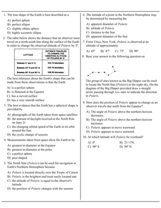
The group of stars known as the Big Dipper can be used
to locate the North Star (Polaris) in the night sky. On the
diagram of the Big Dipper provided draw a straight
arrow passing through two stars to indicate the direction
to Polaris.
A) The angle of Polaris above the northern horizon
decreases.
B) The angle of Polaris above the northern horizon
increases.
C) Polaris appears to move westward.
D) Polaris appears to move eastward.
9. How does the position of Polaris appear to change as an
observer travels due north from the Equator?
A) 0º B) 23 ½ºN.
C) 90º S. D) 90º N.
10. At which latitude will Polaris be overhead?
2. A) B)
C) D)
11. Which graph best represents the relationship between
the latitude of an observer and the observed altitude of
Polaris above the northern horizon?
A)
B)
C)
D)
12. Which graph best represents the altitude of Polaris
observed at northern latitude positions on the Earth's
surface?
A)
B)
C)
D)
13. Which diagram best represents the location of Polaris
for an observer located at the Equator?
3. A)
B)
C)
D)
14. Which diagram best shows the altitude of Polaris
observed near Buffalo, New York?
A) Equator
B) Tropic of Cancer
C) Arctic Circle
D) central New York State
15. At which location will the highest altitude of the star
Polaris be observed?
A) B)
C) D)
16. Which diagram represents the approximate altitude of
Polaris as seen by an observer located Syracuse, New
York?
A) Jamestown B) Plattsburgh
C) Oswego D) New York City
17. At which New York State location will an observer
most likely measure the altitude of Polaris as
approximately 42°?
A) 37º South B) 53º North
C) 37º North D) 90º North
18. At what latitude would an observer on the Earth find
the altitude of Polaris to be 37º?
A) Watertown B) Elmira
C) Buffalo D) Kingston
19. An observer in New York State measures the altitude of
Polaris to be 44º. The location of the observer is
nearest to
A) 23° B) 35° C) 44° D) 90°
20. Which altitude of Polaris could be observed in New
York State?
A) nearly spherical shape
B) nearly circular orbit around the Sun
C) variable length of day
D) fairly constant period of revolution
21. The latitude of an observer on Earth's surface can be
determined by measuring the altitude of Polaris
because Earth has a
A) Niagara Falls B) Elmira
C) Watertown D) Massena
22. At which location is the altitude of Polaris
approximately 42°?
A) Watertown B) Massena
C) Buffalo D) New York City
23. What could be the approximate location of an observer
if he measured the altitude of Polaris to be 41 degrees
above the horizon?
A) latitude B) longitude
C) solar time D) local time
24. The angle of the star Polaris above the northern
horizon can be used to determine an observer's
A) 0° latitude B) 0° longitude
C) Tropic of Cancer D) Tropic of Capricorn
25. Which reference line passes through both the
geographic North Pole and the geographic South Pole?
A) 0º longitude, 65º South latitude
B) 0º longitude, 65º North latitude
C) 0º latitude, 65º West longitude
D) 0º latitude, 65º East longitude
26. As a ship crosses the Prime Meridian, the altitude of
Polaris is 65º. What is the ship's location?
4. 27. The diagrams below show apparent changes in the positions of the stars in the Big Dipper that have
occurred in the past 200,000 years. The directions of individual star movements as seen from Earth are
shown by the arrows.
A) B)
C) D)
Which diagram best represents how the Big Dipper will appear when viewed from Earth in 20,000 years?
28. Base your answer to the following question on The
diagram below shows an observer on Earth viewing the
star Polaris.
A) 38° N B) 38° S C) 52° N D) 52° S
What is the observer's latitude?
5. 29. Which statement about Polaris is best illustrated by the
diagrams shown below?
A) Polaris is located in a winter constellation
B) Polaris is located at the zenith at each location.
C) Polaris' apparent movement through the sky
follows a south-to-north orientation.
D) Polaris' altitude is equal to a locations latitude.