Kathryn glynn mas 2017

The Massachusetts Office of Coastal Zone Management has provided over $9 million in grant funding since 2014 to 71 projects through their Coastal Resilience Grant program. The grants fund five types of projects: vulnerability and risk assessments of coastal communities and infrastructure; public education and outreach; development and implementation of local coastal management plans; engineering redesigns and retrofits to protect against sea level rise and storms; and installation of natural infrastructure to reduce coastal erosion and flooding. Example projects described in the document include vulnerability assessments mapping flooding risks in Beverly and identifying flood pathways in Swampscott, as well as sediment transport studies in Sandwich and Barnstable and a natural infrastructure project restoring Collins Cove in Salem.

Recommended
Recommended
More Related Content
What's hot
What's hot (20)
Viewers also liked
Viewers also liked (16)
Similar to Kathryn glynn mas 2017
Similar to Kathryn glynn mas 2017 (20)
More from GWT
More from GWT (20)
Recently uploaded
Recently uploaded (20)
Kathryn glynn mas 2017
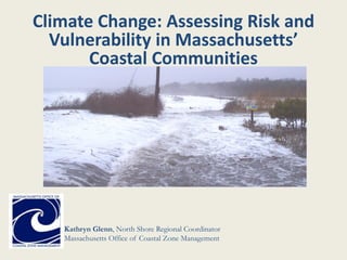
- 1. Kathryn Glenn, North Shore Regional Coordinator Massachusetts Office of Coastal Zone Management Climate Change: Assessing Risk and Vulnerability in Massachusetts’ Coastal Communities
- 2. CZM Coastal Resilience Grants • Goal: To reduce risks that are exacerbated by climate change: – Coastal storms – Flooding – Erosion – Sea level rise • 71 projects funded since 2014 • Approximately $9,000,000 since 2014 • 5 general types of projects funded
- 3. 5 Types of projects funded • Vulnerability and Risk Assessments* • Public Education and Communication • Local Management Measures • Redesigns and Retrofits • Natural Storm-Damage Protection Techniques
- 4. Vulnerability and Risk Assessment • Projects that map and evaluate: – vulnerable critical facilities – public infrastructure – other development – natural resources • Use best available techniques and climate information
- 5. Different Types of Assessment Community Vulnerability Assessments: • Beverly • Boston • Brewster • Chelsea • Gloucester • Hingham • Hull • Quincy Issue/Location specific Vulnerability Assessments: • Nantucket (flood pathways) • Provincetown (flood pathways) • Swampscott (flood pathways) • Truro (flood pathways) • Barnstable (sediment) • Brewster (sediment) • Duxbury (sediment) • Provincetown (sediment) • Sandwich/Barnstable (sediment) • Scituate (sediment) • Salem (green infrastructure) • Ipswich (green infrastructure) • Manchester-by-the-Sea (specific watershed) • Mattapoisett (potable water) • Wareham (wastewater)
- 6. Public Education and Communication • increase public understanding of climate impacts • develop support for management measures and other actions to address coastal impacts • Essex • Ipswich • Boston • Newbury • Hull • Salem • Brewster • Lynn • Quincy • Newburyport • Truro Projects that:
- 7. Local Management Measures Locally implemented tools: • community-based resilience adaptation plans • local ordinances • bylaws • standards • other management measures • Barnstable • Boston • Swampscott • Beverly • Salisbury • Newburyport • Newbury • Rowley • Ipswich • Essex
- 8. Engineering projects: •produce construction designs and plans to retrofit municipal facilities and infrastructure •e.g. wastewater treatment plants, pump stations, critical roadways and other public assets •Goal: to protect function given higher tides, greater storm surges, and more intense precipitation Redesigns and Retrofits •Hull •Oak Bluffs •Salem •Weymouth •Winthrop •New Bedford •Harwich •Marshfield •Plymouth •Wareham Photo: Oak Bluffs Photo: Hull
- 9. Natural Storm-Damage Protection Techniques Coastal green Infrastructure: • evaluate, design, permit, and implement natural or nature- based (hybrid) approaches • restore, enhance, or create natural erosion and flood protection services provided by public beaches, dunes, coastal banks, salt marshes, shellfish, and other resource areas • Barnstable • Brewster • Chilmark • Duxbury • Gosnold • Martha’s Vineyard • Newbury • Plymouth • Provincetown • Scituate • Gloucester • Sandwich • Popponesset Bay • Dennis • Edgartown • Falmouth • Winthrop
- 10. Community Vulnerability and Risk Assessment Example: Beverly • Uses best available information and approaches to model and map SLR scenarios for 2030 and 2070 • Percent flooding probability and depth of flooding (100/500 yr events) • Identifies, ranks and prioritizes at areas most at risk • Identifies local land use tools that can address the identified issues • Incorporates a robust public outreach component
- 11. Flood Pathway Identification Example: Swampscott • Model and maps identified specific low-lying areas that allow flooding during storm events • Performed localized wave run-up and overtopping analysis for each • Current and projected 2030 flood conditions were calculated • Sites assessed for appropriate green infrastructure approaches
- 12. Sediment Transport Example: Sandwich and Barnstable • From CC Canal to Barnstable Harbor • Regional shoreline management • Volume, rate, and direction of sediment transport studied • Intended to inform design, evaluation and implementation of regional strategies
- 13. Assess Areas for Feasibility of Green Infrastructure Example: Salem • Used criteria matrix to determine publicly owned waterfront sites in need of improved resilience • Physical, biological, social, and economic factors were considered • Ten sites chosen for further analysis for suitability for green infrastructure • Ultimately three locations determined to be suitable for green infrastructure • Currently working on design for Collins Cove restoration
- 14. Issue Specific Assessments Example: Mattapoisett • Two grants rounds • First assessed vulnerability of critical water and wastewater facilities • Looked at a suite of sea level rise and hurricane scenarios • Identified and prioritized actions according to risk • Second project focuses on assessing specific risk of an exposed water main • Modeling used to determine best options for relocation of the water main to ensure service
- 15. Great Marsh Vulnerability Assessment • Part of GM Resiliency Project • Funding from Sandy grant • Regional effort • IRWA and NWF • Salisbury, Newburyport, Newbury, Rowley, Ipswich, and Essex • Resiliency Task Forces • Extensive municipal input and public engagement • Individual and regional plans developed • Now into the implementation phase
- 16. CZM Contacts Kathryn Glenn, North Shore Regional Coordinator kathryn.glenn@state.ma.us 978-281-3868 2 State Fish Pier, Gloucester 01930 (regional office) Tricia Bowie, Coastal Resiliency Specialist patricia.bowie@state.ma.us 617-626-1186 251 Causeway St. Suite 800, Boston 02114 Julia Knisel, Coastal Shoreline and Floodplain Manager julia.knisel@state.ma.us 617-626-1191 251 Causeway St. Suite 800, Boston 02114