Marcellus and Utica Shale Databook 2014 – Sample Pages for Vol. 1
•
1 like•5,372 views

This document provides a summary of drilling activity in the Marcellus and Utica Shale regions from January to April 2014. It includes 87 detailed maps showing drilling permit data by county for Pennsylvania, Ohio, and West Virginia. The document also provides a regulatory update for states in the Marcellus/Utica regions and a directory of the most active drillers. Overall, the summary provides extensive permit and drilling statistics as well as pipeline and infrastructure maps to give readers a comprehensive overview of recent activity in the Marcellus and Utica Shale plays.

Recommended
Recommended
More Related Content
What's hot
What's hot (20)
Similar to Marcellus and Utica Shale Databook 2014 – Sample Pages for Vol. 1
Similar to Marcellus and Utica Shale Databook 2014 – Sample Pages for Vol. 1 (20)
More from Marcellus Drilling News
More from Marcellus Drilling News (20)
Recently uploaded
Recently uploaded (20)
Marcellus and Utica Shale Databook 2014 – Sample Pages for Vol. 1
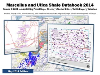
- 1. Marcellus and Utica Shale Databook 2014 Volume 1: 2014 Jan-Apr Drilling Permit Maps; Directory of Active Drillers, Well & Property Valuation 87 Detail Maps & Charts, Individual County Maps for Permits Issued Jan-Apr; Regulatory/Legal Update; Permits by Driller and More! May 2014 Edition
- 2. ©Marcellus and Utica Shale Databook 2014 – Volume 1 Sample Pages Table of Contents Section I - Overview Introduction & Methodology 6 Drilling Update Jan-Apr 2014 7-9 Natgas Prices: Supply & Demand 7 Henry Hub vs Marcellus Gas Spot Price (chart) 7 Working Gas in Storage – Eastern US (chart) 7 Rig Counts – A Trend Emerges 8 Marcellus/Utica Rig Counts by Play (chart) 8 New Well Starts Consistent in Northeast 8 Marcellus/Utica Well Counts by Play (chart) 8 State Rig Counts – 3 Takeaways 9 Marcellus/Utica Rig Counts by State (chart) 9 Permit Counts – Databook Innovation 10 Permits by Driller 2013-14: PA, OH, WV (chart) 10-13 Marcellus/Utica Permits Issued – Trends (chart) 14 Permits by County 2013-14: PA, OH, WV (chart) 14-15 Regulatory/Legal Update: PA, OH, WV, NY, MD 16-20 Marcellus/Utica Latest Lease Offers (map) 21 Wet Gas/Dry Gas Boundary (map) 22 Guide to Using the County Maps (chart) 23 Section II - Pennsylvania Permits PA Gas Well Permits – Entire State (map) 24 Allegheny County (map) 25 Armstrong County (map) 26 Beaver County (map) 27 Section II - Pennsylvania Permits (continued) Bradford County (map) 28 Butler County (map) 29 Cameron County (map) 30 Clarion County (map) 31 Clearfield County (map) 32 Clinton County (map) 33 Crawford County (map) 34 Elk County (map) 35 Fayette County (map) 36 Greene County (map) 37 Indiana County (map) 38 Jefferson County (map) 39 Lawrence County (map) 40 Lycoming County (map) 41 McKean County (map) 42 Mercer County (map) 43 Potter County (map) 44 Sullivan County (map) 45 Susquehanna County (map) 46 Tioga County (map) 47 Venango County (map) 48 Warren County (map) 49 Washington County (map) 50 Westmoreland County (map) 51 Wyoming County (map) 52
- 3. ©Marcellus and Utica Shale Databook 2014 – Volume 1 Sample Pages Table of Contents Section III - Ohio Permits OH Gas Well Permits – Entire State (map) 53 Belmont County (map) 54 Carroll County (map) 55 Columbiana County (map) 56 Guernsey County (map) 57 Harrison County (map) 58 Jefferson County (map) 59 Monroe County (map) 60 Noble County (map) 61 Tuscarawas County (map) 62 Washington County (map) 63 Section IV - West Virginia Permits WV Gas Well Permits – Entire State (map) 64 Barbour County (map) 65 Brooke County (map) 66 Doddridge County (map) 67 Gilmer County (map) 68 Harrison County (map) 69 Lewis County (map) 70 Marion County (map) 71 Marshall County (map) 72 Monongalia County (map) 73 Ohio County (map) 74 Preston County (map) 75 Ritchie County (map) 76 Taylor County (map) 77 Tyler County (map) 78 Upshur County (map) 79 Wetzel County (map) 80
- 4. ©Marcellus and Utica Shale Databook 2014 – Volume 1 Sample Pages Table of Contents Section V – How to Value Property & Mineral Rights in Shale Plays Disclaimer: Select Analytics, LLC, dba “ShaleNavigator” and Marcellus Drilling News, are not liable for any direct or indirect damages suffered related to the use of this Databook product arising from any errors, omissions, inaccuracies, or any other inadequacies of the Databook or the Recipient’s use of the Databook. In no event will Select Analytics, LLC’s, dba “ShaleNavigator”’s or Marcellus Drilling News’ liability to the Recipient or anyone else exceed the fee paid for the Databook product. Use of information provided in this report is at your own risk. Editor’s Note: If you spot anything you believe is inaccurate or should be added, tell us! You may qualify for a free MDN or ShaleNavigator subscription. Preface: Valuing Property, OGM Rights, Royalties 81 Appraisal Problem Overview 82 Methods of Appraisal 83 Appraisal Considerations for OGM Properties 84-85 Appraising a Unitized Parcel w/Royalties 86 Tools for Property Valuations 86 Tools for Property Valuations (chart) 87 Sales Comparison Approach & Conclusion 88 Section VI – Pipelines 101 – Regulations & Maps Types of Pipelines & Who Regulates Them 89 Agencies with Regulatory Oversight (chart) 90 Major Gas Pipelines – Eastern Marcellus (map) 91 Major Gas Pipelines – Western Marcellus (map) 92 Major Gas Pipelines – Utica (map) 93 Section VII – Directory of Active Drillers in the Marcellus/Utica AB Resources – Cabot Oil & Gas 94 Cameron Energy – Citrus Energy 95 CNX Gas – EnerVest Operating 96 EOG Resources – Hess 97 HG Energy – NOVUS Exploration 98 PDC Energy – Range Resources 99 Rex Energy – SWEPI/Shell 100 Sylvan Energy – XTO Energy 101
- 5. ©Marcellus and Utica Shale Databook 2014 – Volume 1 Sample Pages DRILLING UPDATE: JAN-APR 2014 Section I - Overview Natgas Prices: Function of Supply & Demand The price of natural gas in the northeast, particularly the Marcellus, rebounded and rose rather significantly in the January-April period. In the summer/fall timeframe of 2013 it seemed as if the price would never rebound! Marcellus gas in northeast Pennsylvania in 2013 was typically the lowest spot price for natural gas in the nation, due to the incredible quantities being pumped and lack of pipeline takeaway capacity. Then we had what is arguably one of the most brutal winters in our lifetime—at least in the northeast. Cold temperatures over long periods put a bigger than normal demand on natural gas supplies. Propane stocks in the Midwest hit critically low levels and some pipelines reversed flows to deliver propane to that region. A large quantity of natural gas is stored each year—mostly underground in hollowed out salt caverns and depleted oil and gas wells. Over the course of the winter “working gas in storage” is drawn down as residences and businesses use natural gas to heat their homes. Natural gas is a commodity—one of the purest commodities—very sensitive to supply and demand. As you might expect, when supplies get low, the price goes up. It is an inverse relationship. The chart for Working Gas in Storage for the eastern half of the U.S. shows gas in storage has reached unprecedented lows in the last four months. As you would expect, that has driven prices up—in both the dry gas northeastern region and wet gas southeastern region of the Marcellus. Will the price continue to trend up? For the balance of 2014, we expect it will—although month to month it will vary. It will take a lot of pumping to replenish super low stocks in storage between now and winter 2014-2015.
- 6. ©Marcellus and Utica Shale Databook 2014 – Volume 1 Sample Pages PERMITS BY DRILLER 2013-2014 Who’s Drilling & How Much? Section I - Overview This new section—unique to the Databook—was added in 2013. In it we take a look at the number of permits issued by “trimesters” or Jan-Apr, May-Aug and Sep-Dec—for each driller active in either the Marcellus and/or Utica Shale. The numbers reflect a permit received by that driller for a distinct, unique well (not pad, but individual well). That is, if the driller applied for and received a permit for any purpose—to begin drilling, to continue drilling, to frack, to re-drill, etc.—that number is included. This chart shows intent—an indication of potential activity. We filter out multiple permits for the same well and show only unique, distinct well locations. So a driller with a “46” for a given period means that driller received at least one permit for 46 different, distinct wells. Use this information to spot trends and get a high-level overview of activity for a particular driller—where they drill, when they drill, and how much they drill. Pennsylvania Ohio West Virginia 1T13 2T13 3T13 1T14 1T13 2T13 3T13 1T14 1T13 2T13 3T13 1T14 AB Resources 5 3 Alpha Shale 4 1 9 8 Alta Mesa 2 2 American Energy 8 8 Anadarko Petroleum 20 60 41 3 3 Antero Resources 12 19 18 30 204 213 216 241 Atlas Resources 2 12 1 1 1 3 BEUSA Energy 1 BP 3 2 Brammer Engineering 1 1 BRC Operating 11 2 4 Cabot Oil & Gas 46 53 63 63 Cameron Energy 1 Cambell Oil & Gas 1 2 1 Carrizo 8 11 20 2 4 Chesapeake Energy 250 137 77 329 92 96 63 82 67 119 87 96 Chevron 59 25 39 39 2 3 3 3 24 31 Chief Oil & Gas 36 53 74 35 4 4 Citrus Energy 5 2 2 CNX Gas/CONSOL Energy 31 26 27 53 8 7 4 58 105 75 64 DAC Energy 1 2 1 Denex Petroleum 1
- 7. ©Marcellus and Utica Shale Databook 2014 – Volume 1 Sample Pages REGULATORY/LEGAL UPDATE Pennsylvania Permitting and drilling in Pennsylvania is regulated by the Department of Environmental Protection (DEP). Act 13 Supreme Court Case In December 2013, the Pennsylvania Supreme Court handed down its decision on a case sitting before it for over a year—whether or not local municipalities should be able to retain the right to determine where oil and gas drilling is, and is not, allowed within their borders. This “home rule” case was brought by seven PA towns after the state passed the Act 13 shale drilling law in early 2012. The Act 13 law provided new, uniform rules that apply to all localities (setback provisions, etc.) which remedied a patchwork of uneven local laws. The towns argued that under state law they, and not the state, should have the right to determine where in their own communities drilling is should be allowed (and not allowed). After the case went through two lower courts, it landed on the Supreme Court’s docket in 2012 where it sat for some time. Four PA Supreme Court justices—the Republican Chief Justice and three Democrat justices—ruled in favor of local towns and against the state (and by extension, against the drilling industry). The decision not only affected zoning portions of the Act 13 law but other portions of the law as well. The Supreme Court sent important sections of the Act 13 law back to the lower Commonwealth court for further consideration. Depending on how the lower court rules in 2014, it is possible the Act 13 law will be found untenable and scrapped altogether, including the impact fee which has raised over $400 million in its first two years. All eyes will remain on the case as it proceeds in Commonwealth Court over the first half of 2014. Recently representatives for the drilling industry were allowed to join the case for arguments before the Commonwealth Court—after being barred from participating in the case as it worked its way all the way to the PA Supreme Court. One of the key issues that remain is whether or not the state Public Utilities Commission will still be the arbiter of whether or not a local town’s zoning regulations “cross the line” and infringe on existing (non-Act 13) state law. New Marcellus Regulations Almost Ready The Environmental Quality Board (EQB), the rulemaking body of the PA DEP, is currently conducting a series of meetings to elicit feedback on new Marcellus Shale drilling rules developed by the EQB over the past year or so. Under the Act 13 law the EQB was charged with formulating new rules to address well pad construction, water impoundments, pipelines and surface impacts of drilling, among other aspects of shale drilling. The EQB accepted public feedback at regional meetings, via the DEP website and via postal mail—until the middle of March. They are very close to a final version of new rules. It is expected the new rules will be released and in effect in the next month or two (May-June timeframe). Severance Tax a Real Possibility One cannot escape the fact that 2014 is an election year in Pennsylvania. Republican Gov. Tom Corbett is in a fight for his political life. The Democrat nominee running against Corbett is York, PA businessman Tom Wolf. Wolf and the Democrat party are beating the drums for a Marcellus Shale severance tax—in addition to the impact fee already collected. The Marcellus Shale Coalition—a group of PA’s largest drillers and midstream companies—believe such a tax would have a disastrous effect on the industry in PA, leading to a major slowdown in drilling. Will the Democrats take the governorship and reclaim both the House and Senate in PA? If they do, a severance tax is all but assured. This issue bears close watching. Section I - Overview
- 8. ©Marcellus and Utica Shale Databook 2014 – Volume 1 Sample Pages GUIDE TO USING THE COUNTY MAPS Section I - Overview #1 – The municipality or operator name is followed by two sets of numbers, with the second number in parentheses. Example: Cogan House – 4 (4). The first number - “4” in this case - shows the total number of permits issued. The second number - “(4)” in this case - indicates how many wells the permits were issued for. Usually a single well requires several permits during drilling, to allow the driller to continue to the next stage. #2 – A red dot indicates where a well pad is located. Each well pad can have from one to ten wells on it. Typically a pad will contain 2-4 wells. Because of the size of the maps (vastly reduced to show an entire county), sometimes the red dots will be “on top of each other” and sometimes will not be labeled with a driller’s name. #3 – The boundary of each county is indicated with a blue outline. #4 – Major gas pipelines are indicated with red lines and the name of the pipeline somewhere along the line. #5 – The location for pipeline compressor stations is indicated by a green triangle–the name is next to it.
- 9. ©Marcellus and Utica Shale Databook 2014 – Volume 1 Sample Pages Lycoming County Section II – Pennsylvania Permits By Municipality: Cogan House – 4 (4) Cummings – 8 (8) Eldred – 1 (1) Gamble – 9 (9) Lewis – 8 (8) McHenry – 5 (5) McIntyre – 13 (13) McNett – 3 (3) Pine – 1 (1) Upper Fairfield – 1 (1) By Operator: Anadarko Petroleum – 3 (3) Atlas – 1 (1) Chief Oil & Gas – 3 (3) EXCO Resources – 1 (1) Inflection Energy – 4 (4) PA General Energy – 10 (10) Range Resources – 8 (8) Seneca Resources – 9 (9) Southwestern Energy – 3 (3) SWEPI – 11 (11)
- 10. ©Marcellus and Utica Shale Databook 2014 – Volume 1 Sample Pages Noble County Section III – Ohio Permits By Municipality: Beaver – 7 (7) Marion – 8 (8) Seneca – 8 (7) Stock – 3 (3) By Operator: Antero Resources – 21 (21) CNX Gas – 2 (1) Eclipse Resources – 3 (3)
- 11. ©Marcellus and Utica Shale Databook 2014 – Volume 1 Sample Pages Upshur County Section IV – West Virginia Permits Entire County: 17 (9) By Operator: Chesapeake Energy – 6 (2) CNX Gas – 7 (3) EQT – 2 (2) Mountain V Oil & Gas – 1 (1) Ross & Wharton Gas – 1 (1)
- 12. ©Marcellus and Utica Shale Databook 2014 – Volume 1 Sample Pages Section V – Marcellus/Utica Well & Property Valuation HOW TO VALUE PROPERTY & MINERAL RIGHTS IN SHALE PLAYS Mike Coles: Valuing Property and Mineral Rights in the Marcellus/Utica Shale Plays Methods of Appraisal With the goal of estimating value of a particular property, appraisals are conducted for a variety of reasons such as tax planning, real estate conveyances (transfers or sales, for example), or to simply establish value for another reason. Banks also require appraisals as part of loan and mortgage reviews. With shale-area properties in different stages of maturity—some producing, some leased but not producing, some held by production, and others non-leased or with leases expired—the proper appraisal methodology must be used for each type. An appraiser has three standard methods of valuation: • Cost Approach: Replacement cost new less depreciation plus the land value. • Income Approach: The Income Approach in its simplest form is stated as the formula V=I÷R; where V=value; I=Income; and R=the Rate. As with the other approaches, the property’s Value is what we’re estimating. Income is received from rent, lease payments, etc. The Rate represents the rate of return an investor should reasonably expect to receive based on the risk of the investment. The higher the investor’s expected rate of return, the lower the property’s value, and vice versa. • Sales Comparison Approach: Recently sold similar transactions are identified along with the appropriate unit of economic measure. The sold price per unit (e.g. the standard for land is per-acre) is then adjusted based on positive and negative attributes comparing the subject to the comparable sale properties. The end result is an adjusted sale price per unit that indicates the value per unit of the subject. The value per unit is multiplied by the number of units to indicate the subject’s value. The Cost Approach is primarily applicable for new construction and estimating depreciation. The Cost Approach is not applicable for land valuation or OGM valuation. From the two remaining approaches, the appraiser chooses to one or both depending on the circumstance. The applicability of the Income Approach is less relevant in the leasing stage and the only approach to value a ‘royalty estate’. The Sales Comparison Approach is the most commonly used method before any royalty payments are received. The best example of this are auctions of OGM (with and without the land or “Surface Estate”). The data developed to inform potential buyers are a major portion of the items an appraiser needs in order to estimate OGM value. Properly done, the auction also serves to inform the seller. Those attending the auction typically bid on the property as a single purchase price. The market quickly determines the price paid per acre for comparison purposes. Considerable work must be put into the development of data for this approach. The subject and each comparable sale needs to be properly identified along with the attributes (positive and negative) that affect value.
- 13. ©Marcellus and Utica Shale Databook 2014 – Volume 1 Sample Pages Section VI – Pipeline Infrastructure PIPELINES 101 - REGULATIONS A Guide to Who Regulates What with Respect to Natural Gas Pipelines TYPE SITING SAFETY Interstate Transmission Pipelines Federal Energy Regulatory Commission (FERC) Pipeline and Hazardous Materials Safety Administration (PHMSA) Intrastate Transmission Pipelines OH: Ohio Power Siting Board (OPSB) PA: Dept. of Environmental Protection (DEP) WV: Public Service Commission (PSC) OH: Public Utilities Commission of Ohio (PUCO) PA: Public Utilities Commission (PUC) WV: Public Service Commission (PSC) Gathering Pipelines OH: Local municipalities PA: Dept. of Environmental Protection (DEP) WV: Local municipalities OH: Public Utilities Commission of Ohio (PUCO) PA: Public Utilities Commission (PUC) WV: Local municipalities Compressor Stations OH: Local municipalities PA: Dept. of Environmental Protection (DEP) WV: Public Service Commission (PSC) OH: Local municipalities PA: Dept. of Environmental Protection (DEP) WV: Public Service Commission (PSC) Agencies with Regulatory Oversight Source: MarcellusDrilling.com
- 14. ©Marcellus and Utica Shale Databook 2014 – Volume 1 Sample Pages Section VII – Directory of Active Drillers DIRECTORY OF ACTIVE DRILLERS Contact Details for the 90 Active Drillers in the Marcellus/Utica Shale Driller Name Address City State Zip Phone Web AB Resources 6802 W Snowville Rd Ste E Brecksville OH 44141 (440) 922-1250 http://www.abresources.com Alpha Shale Resources (Rice Energy) 171 Hillpointe Dr Ste 301 Canonsburg PA 15317 (724) 746-6720 http://www.riceenergy.com Alta Mesa 15021 Katy Fwy, 4th Floor Houston TX 77094 (281) 530-0991 http://www.altamesa.net American Energy Patners 301 NW 63rd, Ste 600 Oklahoma City OK 73154 (405) 418-8000 http://aep-lp.com Anadarko Petroleum 1201 Lake Robbins Dr The Woodlands TX 77380 (832) 636-1000 http://www.anadarko.com Antero Resources 1625 17th St Ste 300 Denver CO 80202 (303) 357-7310 http://www.anteroresources.com 175-D Elkcreek Rd Mount Clare WV 26408 (304) 622-3842 981 E Washington Ave Ellenboro WV 26346 (304) 869-3405 Atlas Energy 1000 Commerce Dr, 4th Fl Pittsburgh PA 15275 (800) 251-0171 http://www.atlasresourcepartners.com 1845 Walnut St, 10th Fl Philadelphia PA 19103 (877) 280-2857 800 Mountain View Dr Waynesburg PA 15370 (724) 852-1066 3500 Massillon Rd, Ste 100 Uniontown OH 44685 (330) 896-8510 1823 SR 14 Deerfield OH 44411 (330) 654-4343 1026-A Cookson Avd SE New Philadelphia OH 44663 (330) 339-3155 BEUSA Energy 4 Waterway Sq Pl The Woodlands TX 77380 (281) 296-1500 http://beusaenergy.com BP 501 Westlake Park Blvd Houston TX 77079 (281) 366-2000 http://www.bp.com 88 E Broad St, Ste 2000 Columbus OH 43215 (614) 227-5805 Brammer Engineering 400 Texas St, Ste 600 Shreveport LA 71101 (318) 429-2345 http://www.brammer.com BRC Operating (Bluescape Resources) 200 Crescent Ct, Ste 200 Dallas TX 75201 (214) 855-2261 http://bluescaperesources.com 701 Church St Summersville WV 26651 (304) 872-7222 Cabot Oil & Gas 840 Gessner Rd Ste 1400 Houston TX 77024 (281) 589-4600 http://www.cabotog.com 5 Penn Center W, Ste 401 Pittsburgh PA 15276 (412) 249-3850 8279 SR 29 Montrose PA 18801 (570) 278-3518
- 15. ©Marcellus and Utica Shale Databook 2014 – Volume 1 Sample Pages Marcellus and Utica Shale Databook 2014 Volume 1: 2014 Drilling Permits (Jan-Apr); 2013 Trends by State & County, Drilling Contacts, Property Valuations Publish Date: May 2014 Volume 2: 2014 Drilling Permits (May-Aug), List of Pipeline/Infrastructure Projects, Permits by Driller 2013-2014 Publish Date: Sep 2014 Volume 3: 2014 Drilling Permits (Sep-Dec), Waste Facility List, Calculating Well Decline Rates, Permits by Driller Publish Date: January 2015 Purchase Options: Buy each 2014 volume individually for $175, or buy all three for $525 $350 Buy the 2012 & 2013 series (6 volumes) for $175 Site licenses/volume discounts also available, contact us for details To purchase, contact: Marcellus Drilling News Web: marcellusdrilling.com/databook Email: databook@marcellusdrilling.com Phone: (607) 218-2005