1. “BUCHAREST ” STORE
3D LASER SCANNING | eBIM | 3D MODEL | RELEVEU 2D
B u c h a r e s t , R o m a n i a
2. 1
3D POINT CLOUD
2D SURVEY
3D MODEL
eBIM MODEL
360° PANORAMIC VIEW
ONLINE OR OFFLINE WEB PLATFORM
2
4
8
6
10
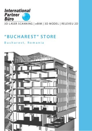
“ B U C H A R E S T ” S T O R E
LOCATION:
Blvd. Ion C. Bratianu, no. 36
Bucharest
Ilfov district, Romania
“Bucharest” Store - exterior view
Faster data collection, as compared to conventional methods;
Very low risk of occupational accidents;
Non-invasive method of data collection;
Full, authentic and accurate 3D copy of reality, unsurpassed by any other means or method
of measurement;
2D and 3D documentation provided to architects and structural engineers;
Conversion of data into 2D and 3D models compatible with all CAD software;
Structural details - complex documentation due to accuracy and large amount of data collected
through 3D laser scanning;
Restoration of complex architectural elements;
Providing all the necessary data for organizing the proposed intervention works;
Perfect alternative to conventional measurement methods.
3D Laser Scanning
Project purpose: eBIM | 3D Model | 2D Survey
Built in 1929, “Bucharest” General Store was one of the largest comercial
centres in Bucharest before 1989.
Measuring a total area of 4.088 sqm, the building of the former
“Bucharest” Store is currently out of use. Because of the advanced stage
of disrepair, it will soon undergo a process of rehabilitation.
Taking all these facts into account, it was decided that a detailed
documentation of the building’s current state was needed. Therefore, the
survey has been carried out using the 3D laser scanning method.
Advantages of the survey obtained through this innovative measurement technique,
supporting the rehabilitation project of “Bucharest” Store are:
International Partner Buro S.R.L.
Office:
www.ipartner.ro
office@ipartner.ro
+4 - 0722 998 663
Bucharest, Romania
PhD. Dipl.-Eng. Marian RăDOI
CEO - International Partner Buro S.R.L.
3D Laser Scanning & Surveying specialist
Member of ICOMOS Romania
+ 4 - 0766 462 766
marian.radoi@ipartner.ro
3. 2 3
DELIVERED PRODUCT:
eBIM MODEL
eBIM Model based on the
3D point cloud
eBim based on the 2D
survey (CAD to BIM)
These products are obtained based on the
3D laser scanning and are compatible to
CAD software, often exported as*rvt, *fbx,
*xml, *dwg, *dxf, *pdf files etc.
What is BIM | eBIM ?
Building Information Modelling (BIM) is the process of building a 3D model containing
parametric information about each element of a construction, including time and cost data. The
model can be used to make decisions during the whole life cycle of a building, from the design
stage to maintenance, preservation and rehabilitation works.
Existing Building Information (eBIM) provides a detailed and accurate 3D model of the current
stage of a construction made by processing the point cloud obtained from 3D laser scanning.
Detail level included in the 3D eBIM model:
- Visible structural elements (columns, beams, slabs);
- Exterior elements: exterior walls, roof;
- Partition elements: interior walls;
- Stairs, windows, doors;
- Sanitary fittings;
- Decorative architectural elements.
eBIM models can be generated in BIM software such as Autodesk Revit, Graphisoft ArchiCAD, RhinoBIM etc.
Advantages of the 3D eBIM model obtained from the 3D laser scanning:
Performing the 3D model faster, as compared to obtaining the model starting from the 2D survey;
High accuracy of the 3D model, as it is achieved by processing the point cloud obtained from the
3D laser scanning;
Complete documentation of the current state of the scanned building;
High level of detail of complex architectural, structural and installation elements;
The possibility of achieving accurate data about each building’s element, due to the parametric
3D eBIM model;
Full documentation provided to contractors, architects and engineers, enabling maintenance,
preservation and rehabilitation works.
3D LASER SCANNING
- larger amount of data
collected in a shorter period
of time;
- very low risk of occupational
accidents;
- non-invasive method of
data collection.
POINT CLOUD
- full and authentic 3D copy of
reality;
- the starting point for a complete
documentation of the building’s
current state;
- accuracy and high detail level of
the scanned object.
eBIM Model
- the delivered project is an
intelligent parametric 3D model;
- obtaining a detailed and accurate
model in a short time;
- enables a more efficient and
collaborative interaction between
the client, architect and engineer. Processing the 3D point cloud in Autodesk Revit - vertical section
Processing the 3D point cloud in Autodesk Revit - basement ceiling plan
Planning
eBIM
Analysis
DesignDemolition
Construction
DocumentationMaintenance
Rehabilitation
4. 4 5
3D point cloud - roof framing
3D point cloud - 5th floor section
DELIVERED PRODUCT:
3D POINT CLOUD
3D point cloud animations;
Simulations with insertion of a
proposed intervention on the
existing site achieved from the
3D point cloud;
Point cloud viewing system,
in free software, with the
possibility of measuring
distances and exporting point
clouds.
Advantages of the point clouds obtained from 3D laser scanning:
Point clouds are a full, authentic and accurate copy of reality, which cannont be obtained by any
other means or method of measurement;
The current state of the historical building can be thoroughly documented, based on the 3D
point cloud;
3D point clouds allow exact measurements of distances and areas and they represent the starting
point for the 2D survey and the 3D model.
Cross sections through the point cloud
3D point cloud - interior view
5. 6 7
DELIVERED PRODUCT:
3D MODEL
Exterior 3D volume
Interior 3D model
Roof framing 3D model
These products are obtained based on
the3D laser scanning and are compatible
to CAD software, often exported as *dwg,
*dxf, *3ds, *pdf files etc.
Advantages of the 3D model obtained from 3D laser scanning:
Allows measuring and viewing all architectural elements, even if they may not be
included in the 2D survey;
The 3D model may be used for volume measurements;
The roof framing model is an accurate 3D copy of the roof ’s framework, allowing structural
calculations for consolidation or addition works;
May be used for further editing in order to obtain realistic visualizations.
3D model - attic and roof framing
3D model - longitudinal section 3D model - cross section
6. 8 9
These products are obtained based on
the3D laser scanning and are compatible
to CAD software, often exported as *dwg,
*dxf, *3ds, *pdf files etc.
DELIVERED PRODUCT:
2D SURVEY
Floor plans
Façades
Roof framing plan
Roof plan
Cross section
Longitudinal section
Advantages of the 2D survey obtained from 3D laser scanning:
Accurate survey, unsurpassed by any other measurement techniques;
Very efficient for historical monuments with no rectangular spaces, where surveying by
conventional means would require time consuming procedures and increased human resources;
Very good quality/cost/time ratio;
No need for returning to the site for additional measurements.
Roof framing
Basement plan Main façade Cross section
Longitudinal section
7. 1 0 1 1
3D measurements
The general map offers the possibility of measuring distances and surfaces, and the 3D view allows
easy measurement of point-to-point distances.
360° panoramic view - on IPB WebShare platform or by means of free software - Scene LT.
Detailed panoramic display - each panoramic position provides a 360° view, including all the
details recorded.
Acces for authorized users
Authorized users may acces the original 3D data through the download option and may examine
data by using free software SCENE LT.
Basement view via IPB WebShare platform Roof framing view via IPB WebShare platform
Main facade view via IPB WebShare platform
First floor view via IPB WebShare platform
DELIVERED PRODUCT:
360° PANORAMIC
VIEW
ON ONLINE OR OFFLINE
WEB PLATFORM
WebShare online or offline
system for viewing scans
through panoramic views, with
the possibility of measuring
distances.
8. 1 2
C O N T A C T
Y O U R N U M B E R 1 O P T I O N
I N 3 D L A S E R S C A N N I N G
PhD Dipl.-Eng. Marian RADOI
CEO - International Partner Buro S.R.L.
3D Laser Scanning & Survey specialist
Member of ICOMOS Romania
International Council of Monuments and Sites
+ 4 - 0766 462 766
marian.radoi@ipartner.ro
OFFICE:
www.ipartner.ro
office@ipartner.ro
+ 4 - 0722 998 663
/ScanareLaser3D
/ipartner.ro
Bucharest, Romania
* International Partner Buro provides 3D laser scanning
services globally.
Planning
DesignDemolition
DocumentationMaintenance
Analysis
ConstructionRehabilitation
eBIM
3D LASER SCANNING POINT CLOUD eBIM model
EFFICIENCY AND ACCURACY IN SURVEYING EXISTING BUILDINGS
9. 3DLASERSCANNING
UAVFOTOGRAMMETRY
S U R V E Y
BIM
G I S
ARCHITECTURAL SURVEY
CONSTRUCTION SURVEY
ENGINEERING SURVEY
LAND SURVEY
3DBUILDINGMODELLLING
3DTERRAINMODELLING
2DDRAWINGS
CADASTRE
LANDREGISTRATION
www.ipartner.ro