
Recommandé
Recommandé
Contenu connexe
Tendances
Tendances (20)
Similaire à Lidar remote sensing md. yousuf gazi
Similaire à Lidar remote sensing md. yousuf gazi (20)
Plus de Md. Yousuf Gazi
Plus de Md. Yousuf Gazi (20)
Dernier
Dernier (20)
Lidar remote sensing md. yousuf gazi
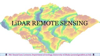
- 1. LiDAR REMOTE SENSING Md. Yousuf Gazi, Lecturer, Department of Geology, University of Dhaka (yousuf.geo@du.ac.bd)
- 2. Digital Elevation Model A Digital Elevation Model (DEM) is defined as a file or database containing elevation points over a contiguous area. DEM may be subdivided into: (a) Digital surface model (DSM) that contain elevation information about all features in the landscape, such as vegetation, building and other structures. (b) Digital terrain models (DTM) that contains elevation information about the bare-Earth surface without influencing of vegetation. Md. Yousuf Gazi, Lecturer, Department of Geology, University of Dhaka (yousuf.geo@du.ac.bd)
- 3. DEMs at resolutions Applicable to: Geomorphology Landslide & flood hazards Forestry/Ecology Civil Engineering Urban planning Volcanology Bathymetry Four major technologies are used to obtain elevation information, including (a) In situ surveying (b) Photogrammetry (c) Interferometric Synthetic Aperture Radar (d) Light Detection and Ranging (LiDAR) Md. Yousuf Gazi, Lecturer, Department of Geology, University of Dhaka (yousuf.geo@du.ac.bd)
- 4. Basic components of LiDAR Remote Sensing: • Laser scanner • GPS • Inertial Navigation System • Terrestrial, airborne or space platforms • x,y,z + attributes LiDAR Point Cloud: Md. Yousuf Gazi, Lecturer, Department of Geology, University of Dhaka (yousuf.geo@du.ac.bd)
- 5. Monochromaticity: A laser emits in only a very small portion of the spectrum. Intensity: In that narrow range of wavelengths the laser's output energy can exceed that of the sun or any other known source. Directionality: A laser emits light only in a very well defined direction. Coherence: Lasers emit light at only one phase. How How does laser light differ from ordinary light Md. Yousuf Gazi, Lecturer, Department of Geology, University of Dhaka (yousuf.geo@du.ac.bd)
- 6. Md. Yousuf Gazi, Lecturer, Department of Geology, University of Dhaka (yousuf.geo@du.ac.bd)