SlideShare a Scribd company logo
1 of 39
Download to read offline
Nisqually Delta Sediment Budget & Transport Dynamics
  to Inform Restoration and Climate Change Planning
               Eric Grossman, U.S. Geological Survey


Guy Gelfenbaum,
Andrew Stevens,
Chris Curran,
Steve Rubin,
Mike Hayes


PCMSC, WAWSC      Nisqually Indian Tribe
WERC, WFRC
How do physical processes redistribute sediment and organics
to shape marshes, channels, nearshore/tidal flats?
Tides/Hydrodynamics
Fish, Substrate,
Invertebrates (food-prey)
Elevation, Vegetation,
Water Quality
Conceptual Model and Methods

Methods:
1. GIS-Based “RAP” Model
2. Hydrodynamic Model
                                   lost
3. Field Measurements


                                 Sediment
                                 Delivery
1. “Rapid Assessment Protocol” - Potential Sediment Accretion
       Distribute sediment load scaled by transport connectivity

Data Needs:
1. Sediment load
2. Topography (DEM)
3. Tidal Data             lost


                      Sediment


                20-100K TY                              Czuba et al. 2011
              4.5-23.0K m3/yr                   20-100k TY
                                           USGS, 1974; This study
1. “Rapid Assessment Protocol” - Potential Sediment Accretion
       Distribute sediment load scaled by transport connectivity

Data Needs:
1. Sediment load
2. Topography (DEM)   lost
3. Tidal Data


          11-28%

                                       Grossman and Horne (in prep)


                20-100K TY
              4.5-23.0K m3/yr
1. “Rapid Assessment Protocol” - Potential Sediment Accretion
     Distribute sediment load scaled by transport connectivity


                   lost


        11-28%


              20-100K TY               Grossman and Horne (in prep)
            4.5-23.0K   m3/yr
2. Process-based hydrodynamic & sediment transport model
           Delft3D couples:
              wave - current
               interaction
    FLOW                   WAVES
       2 or
                               Bathymetry
       3D

   TRANSP                BOTTOM

 Sediment transport (van Rijn, 1993)
 Dynamic Morphology
 Wetting drying
 Vegetation – momentum
 (Baptist, 2005; Uittenboogaard, 2003)

                                            ~20-30 m grid resolution in
                                               the restoration area
2. Delft3D hydrodynamic & sediment transport model
                                 Tidal forcing well characterized


                              Tidal inundation reasonably modeled;
                              some channels not resolved properly


Tidal channel currents well
modeled for portions of the
tidal cycle. Roughness
(vegetation) not properly
characterized, yet!
Role of vegetation on
hydrodynamics & sediment
information need
Modeled Connectivity


                 1-Month time period,
                 Avg river discharge:
                       70 m3/s
3. Field Measurements - Methods
                                    Fluvial Inputs
                                    River Discharge, Sediment Load
                                    (2-yrs; 15-min)

                                  Nearshore Hydrodynamics
                                    Tides, Currents, Turbidity
                                    (2-yr, 3-mo; 5-min)
  WL   1             3
                                    Currents, SSC, X-Sections
                                    (Synoptic: tides, Qw)


           WL
                WL


    WL


    WL
3. Field Results: Fluvial inputs, WY2011


      Fines (silts and clays)
      ~48% of total load
3. Field Results: River-Marsh Connectivity


           Marsh Turbidity
   mean                        = 0.19
           River Turbidity


                                 River Turbidity


                              Marsh Turbidity
3. Field Results: Channel Velocities, Discharge
3. Field Results: Channel Discharge
                                      McAllister
                                       -10.1 cms


          Small Net Flow in
        (1.6 cms, <6% river)          Area1
                                       2.1 cms


              2.1 1.1 3.1 2.2
                                      Madrone
       10.1
                                       1.1 cms


                                      Leschi
                                       3.1 cms


                                      Area3
                                       2.2 cms
3. Field Measurements: Nearshore Sediments & Flux

                                     Suspended sediment
                                     tracks ~1:1 with
                                     turbidity
                                     Nearshore turbidity
                                     20-50% of river
3. Field Results: Channel Sediment Flux

   Net Flux into Marshes
        (370 m3/yr)
    Potential Accretion
       ~0.12mm/yr


            2.1 1.1 3.1 2.2
     10.1


            0.12 mm/yr
Vulnerability? Cumulative Impacts? Adaptive Management?


                             44M m3 of sediment since 1945
                                 (14-70x annual load)
Nearshore Response: Extensive channel incision
     Feb 2009                 Aug 2011

                                         25 m

                                              2m


                                         1-2 m of incision
                                         10-40 m widening
                2009                     ~5 km of channels

                                         Sediment
                       2011              redistributed
                                         367,500 m3
Nearshore Response: Sand export
                                  Photo=Jul 2011

                      Mapping
                      Aug 2012


                       50m
Nearshore Response: Sand export
McAllister Creek

Jul 2009                     Jul 2010

                                         Leading edge


                                         Sand bar


                                        incision


                                                        Leading edge
“Functional” Channel Habitat – Salinity Gradients
“Functional” Channel Habitat – Salinity

         high tide

                     2 hrs into ebb
                                       River


                                      Salt Wedge
Climate Change and Sea Level Rise
                                                         Winds/Waves

     Observations
     following maximum
     model prediction


                                     Lower rate due
                                     to wind stress?

      Rate ~3.75 mm/yr (2x the 20th century
                            Will sea level rise
      Marshes and coastal habitats response?
                            accelerate if it
     Brominski et al. 2011  relaxes?


IPCC. 2007; Church and White, 2011
“Green” Infrastructure: Coastal habitats to buffer impacts

                      Example, Stillaguamish Delta


                                      1964	
  Low	
  Marsh	
  
                                     Low	
  Marsh	
  Boundary	
  
                                      Boundary	
  
                                     1964	
  
                                     2004	


                                                   2012
                                                   Restoration
GCM-RCM Dynamic Downscaling: Hydrology, Sediment

                              Variable Infiltration Capacity (6km)
ECHAM5* & CCSM3 (A1B, A2)


  WRF

                               DHSVM (100m2)
Projected Climate Impacts to Sediment Delivery
                           Increase and earlier                   Seasonal sediment transport model
                             seasonal runoff


                            4
                                2080s
Sediment Load (MT/month)


                                                                       Curran and Grossman (In Review)
                            3
                                     Increase	
  in	
  flood	
  
                                     and	
  sediment	
  
                            2


                            1
                                              2010
                            0

                           Hamlet and Grossman (in prep)
Adaptive Management
    Opportunity?
Simulated levee breach
Model Results – Mud Deposition
http://coastalresilience.org
Flow to marsh = 3-6% of the river
Suspended sediment concentrations = 20-50% river
Sand exporting from marshes
Potential Accretion Rate:
<2 mm/yr (RAP); <0.3 mm/yr (measurements)
 2010-2011 river flow was low

Adaptive Management:
1-Alder Lake traps >15x equiv. annual sediment load to delta
2-New Distributary?

Climate Change Adaptation and Resilience
1-Changes in Sediment delivery and fate
2-Sea level rise/waves (erosion, channel salinities)
3-Ecosystem functional response?

Information Needs
1-Interaction of vegetation-hydrodynamics-geomorphology
2-Test fish use of “functional” channels (salinity gradients)
egrossman@usgs.gov
          Western Washington University


Any interested students please contact Eric

Coastalresilience.org

Salishsearestoration.org
Simulated	
  Flood	
  Event	
  
    Modeling
 Approach – Fine
   Sediment
    Dispersal
Investigate three scenarios
   1.  Flow Only (tides and
       river flood)
   2.  Flow and Waves
       (tides, river flood,
       and waves)
   3.  Flow + River Breach
       (tides, river flood,
       and river breach)

More Related Content

What's hot

Wegener_ResearchPoster
Wegener_ResearchPosterWegener_ResearchPoster
Wegener_ResearchPosterPamela Wegener
 
CL:AIRE Technical Bulletin TB4
CL:AIRE Technical Bulletin TB4CL:AIRE Technical Bulletin TB4
CL:AIRE Technical Bulletin TB4chrisberryman
 
Flood resilient presentation 05.16.12
Flood resilient presentation 05.16.12Flood resilient presentation 05.16.12
Flood resilient presentation 05.16.12Christopher Hayes
 
MIT Engineering Design Portfolio
MIT Engineering Design PortfolioMIT Engineering Design Portfolio
MIT Engineering Design Portfoliocmespi78
 
Maintain-for-less Mississippi 2011
Maintain-for-less Mississippi 2011Maintain-for-less Mississippi 2011
Maintain-for-less Mississippi 2011Matthijs Bos
 
Flow changes in the 3S basin of the Mekong
Flow changes in the 3S basin of the MekongFlow changes in the 3S basin of the Mekong
Flow changes in the 3S basin of the Mekongtacochrane
 
DSD-INT 2018 Assessment of runup reduction potential due to coral reef restor...
DSD-INT 2018 Assessment of runup reduction potential due to coral reef restor...DSD-INT 2018 Assessment of runup reduction potential due to coral reef restor...
DSD-INT 2018 Assessment of runup reduction potential due to coral reef restor...Deltares
 
Well Logging: 01 borehole environment
Well Logging: 01 borehole environmentWell Logging: 01 borehole environment
Well Logging: 01 borehole environmentkhaled Zidan
 
Q921 log lec4 v1
Q921 log lec4 v1Q921 log lec4 v1
Q921 log lec4 v1AFATous
 
Q921 log lec5 v1
Q921 log lec5 v1Q921 log lec5 v1
Q921 log lec5 v1AFATous
 
TobyTucker_Thesis_Final
TobyTucker_Thesis_FinalTobyTucker_Thesis_Final
TobyTucker_Thesis_FinalToby Tucker
 
DSD-INT 2018 Adjusting bed slope effects to improve beach dune behavior - Roe...
DSD-INT 2018 Adjusting bed slope effects to improve beach dune behavior - Roe...DSD-INT 2018 Adjusting bed slope effects to improve beach dune behavior - Roe...
DSD-INT 2018 Adjusting bed slope effects to improve beach dune behavior - Roe...Deltares
 
DSD-INT 2017 Morphodynamic analysis of intervention scenarios at the Belgian ...
DSD-INT 2017 Morphodynamic analysis of intervention scenarios at the Belgian ...DSD-INT 2017 Morphodynamic analysis of intervention scenarios at the Belgian ...
DSD-INT 2017 Morphodynamic analysis of intervention scenarios at the Belgian ...Deltares
 
0509 presentation to_rwqcb
0509 presentation to_rwqcb0509 presentation to_rwqcb
0509 presentation to_rwqcbguest68898e
 
TSherman Strat Poster
TSherman Strat PosterTSherman Strat Poster
TSherman Strat PosterTrent Sherman
 
Sonic log and its applications
Sonic log and its applicationsSonic log and its applications
Sonic log and its applicationsBadal Mathur
 
GIS in Action Poster
GIS in Action PosterGIS in Action Poster
GIS in Action Posteralstolnacke
 
Calculating porosity and water saturation
Calculating porosity and water saturationCalculating porosity and water saturation
Calculating porosity and water saturationhaider Shabaan Khalil
 

What's hot (20)

Wegener_ResearchPoster
Wegener_ResearchPosterWegener_ResearchPoster
Wegener_ResearchPoster
 
CL:AIRE Technical Bulletin TB4
CL:AIRE Technical Bulletin TB4CL:AIRE Technical Bulletin TB4
CL:AIRE Technical Bulletin TB4
 
Flood resilient presentation 05.16.12
Flood resilient presentation 05.16.12Flood resilient presentation 05.16.12
Flood resilient presentation 05.16.12
 
MIT Engineering Design Portfolio
MIT Engineering Design PortfolioMIT Engineering Design Portfolio
MIT Engineering Design Portfolio
 
Maintain-for-less Mississippi 2011
Maintain-for-less Mississippi 2011Maintain-for-less Mississippi 2011
Maintain-for-less Mississippi 2011
 
Flow changes in the 3S basin of the Mekong
Flow changes in the 3S basin of the MekongFlow changes in the 3S basin of the Mekong
Flow changes in the 3S basin of the Mekong
 
DSD-INT 2018 Assessment of runup reduction potential due to coral reef restor...
DSD-INT 2018 Assessment of runup reduction potential due to coral reef restor...DSD-INT 2018 Assessment of runup reduction potential due to coral reef restor...
DSD-INT 2018 Assessment of runup reduction potential due to coral reef restor...
 
Nature_Somenath
Nature_SomenathNature_Somenath
Nature_Somenath
 
Well Logging: 01 borehole environment
Well Logging: 01 borehole environmentWell Logging: 01 borehole environment
Well Logging: 01 borehole environment
 
Q921 log lec4 v1
Q921 log lec4 v1Q921 log lec4 v1
Q921 log lec4 v1
 
Q921 log lec5 v1
Q921 log lec5 v1Q921 log lec5 v1
Q921 log lec5 v1
 
TobyTucker_Thesis_Final
TobyTucker_Thesis_FinalTobyTucker_Thesis_Final
TobyTucker_Thesis_Final
 
DSD-INT 2018 Adjusting bed slope effects to improve beach dune behavior - Roe...
DSD-INT 2018 Adjusting bed slope effects to improve beach dune behavior - Roe...DSD-INT 2018 Adjusting bed slope effects to improve beach dune behavior - Roe...
DSD-INT 2018 Adjusting bed slope effects to improve beach dune behavior - Roe...
 
DSD-INT 2017 Morphodynamic analysis of intervention scenarios at the Belgian ...
DSD-INT 2017 Morphodynamic analysis of intervention scenarios at the Belgian ...DSD-INT 2017 Morphodynamic analysis of intervention scenarios at the Belgian ...
DSD-INT 2017 Morphodynamic analysis of intervention scenarios at the Belgian ...
 
0509 presentation to_rwqcb
0509 presentation to_rwqcb0509 presentation to_rwqcb
0509 presentation to_rwqcb
 
TSherman Strat Poster
TSherman Strat PosterTSherman Strat Poster
TSherman Strat Poster
 
Sonic log and its applications
Sonic log and its applicationsSonic log and its applications
Sonic log and its applications
 
GIS in Action Poster
GIS in Action PosterGIS in Action Poster
GIS in Action Poster
 
Calculating porosity and water saturation
Calculating porosity and water saturationCalculating porosity and water saturation
Calculating porosity and water saturation
 
Subwatershed Planning TMDLs
Subwatershed Planning TMDLsSubwatershed Planning TMDLs
Subwatershed Planning TMDLs
 

Viewers also liked

IAHR 2015 - Developing a transport model for plastic distribution in the Nort...
IAHR 2015 - Developing a transport model for plastic distribution in the Nort...IAHR 2015 - Developing a transport model for plastic distribution in the Nort...
IAHR 2015 - Developing a transport model for plastic distribution in the Nort...Deltares
 
DSD-INT 2015 - Delft3D 4 open source workshop - Adri Mourits
DSD-INT 2015 - Delft3D 4 open source workshop - Adri MouritsDSD-INT 2015 - Delft3D 4 open source workshop - Adri Mourits
DSD-INT 2015 - Delft3D 4 open source workshop - Adri MouritsDeltares
 
IAHR 2015 - Risc-KIT Resilience - Increasing Strategies for Coasts - toolKIT,...
IAHR 2015 - Risc-KIT Resilience - Increasing Strategies for Coasts - toolKIT,...IAHR 2015 - Risc-KIT Resilience - Increasing Strategies for Coasts - toolKIT,...
IAHR 2015 - Risc-KIT Resilience - Increasing Strategies for Coasts - toolKIT,...Deltares
 
DSD-INT 2014 - Symposium Next Generation Hydro Software (NGHS) - How to set u...
DSD-INT 2014 - Symposium Next Generation Hydro Software (NGHS) - How to set u...DSD-INT 2014 - Symposium Next Generation Hydro Software (NGHS) - How to set u...
DSD-INT 2014 - Symposium Next Generation Hydro Software (NGHS) - How to set u...Deltares
 
DSD-INT 2015 - Delft3D Flexible Mesh modelling of the Elbe river, Germany - M...
DSD-INT 2015 - Delft3D Flexible Mesh modelling of the Elbe river, Germany - M...DSD-INT 2015 - Delft3D Flexible Mesh modelling of the Elbe river, Germany - M...
DSD-INT 2015 - Delft3D Flexible Mesh modelling of the Elbe river, Germany - M...Deltares
 

Viewers also liked (6)

IAHR 2015 - Developing a transport model for plastic distribution in the Nort...
IAHR 2015 - Developing a transport model for plastic distribution in the Nort...IAHR 2015 - Developing a transport model for plastic distribution in the Nort...
IAHR 2015 - Developing a transport model for plastic distribution in the Nort...
 
DSD-INT 2015 - Delft3D 4 open source workshop - Adri Mourits
DSD-INT 2015 - Delft3D 4 open source workshop - Adri MouritsDSD-INT 2015 - Delft3D 4 open source workshop - Adri Mourits
DSD-INT 2015 - Delft3D 4 open source workshop - Adri Mourits
 
IAHR 2015 - Risc-KIT Resilience - Increasing Strategies for Coasts - toolKIT,...
IAHR 2015 - Risc-KIT Resilience - Increasing Strategies for Coasts - toolKIT,...IAHR 2015 - Risc-KIT Resilience - Increasing Strategies for Coasts - toolKIT,...
IAHR 2015 - Risc-KIT Resilience - Increasing Strategies for Coasts - toolKIT,...
 
Modeling sea-level rise and wave-driven inundation on Laysan Island: a geosp...
Modeling sea-level rise and wave-driven inundation on Laysan Island: a geosp...Modeling sea-level rise and wave-driven inundation on Laysan Island: a geosp...
Modeling sea-level rise and wave-driven inundation on Laysan Island: a geosp...
 
DSD-INT 2014 - Symposium Next Generation Hydro Software (NGHS) - How to set u...
DSD-INT 2014 - Symposium Next Generation Hydro Software (NGHS) - How to set u...DSD-INT 2014 - Symposium Next Generation Hydro Software (NGHS) - How to set u...
DSD-INT 2014 - Symposium Next Generation Hydro Software (NGHS) - How to set u...
 
DSD-INT 2015 - Delft3D Flexible Mesh modelling of the Elbe river, Germany - M...
DSD-INT 2015 - Delft3D Flexible Mesh modelling of the Elbe river, Germany - M...DSD-INT 2015 - Delft3D Flexible Mesh modelling of the Elbe river, Germany - M...
DSD-INT 2015 - Delft3D Flexible Mesh modelling of the Elbe river, Germany - M...
 

Similar to Nisqually Delta Sediment Budget & Transport Dynamics

Peatland management impacts on flood regulation
Peatland management impacts on flood regulationPeatland management impacts on flood regulation
Peatland management impacts on flood regulationAberdeen CES
 
Coastal engineering introduction
Coastal engineering introductionCoastal engineering introduction
Coastal engineering introductionJorge C. Palma
 
The stream power variation in a GIS environment as an index to evaluate the m...
The stream power variation in a GIS environment as an index to evaluate the m...The stream power variation in a GIS environment as an index to evaluate the m...
The stream power variation in a GIS environment as an index to evaluate the m...pierluigi de rosa
 
Ecohydrodynamics of cold-water corals - Juan moreno-Navas
Ecohydrodynamics of cold-water corals - Juan moreno-NavasEcohydrodynamics of cold-water corals - Juan moreno-Navas
Ecohydrodynamics of cold-water corals - Juan moreno-NavasHeriot-Watt University
 
Human Impacts on Sediment in Faga'alu
Human Impacts on Sediment in Faga'aluHuman Impacts on Sediment in Faga'alu
Human Impacts on Sediment in Faga'alualexmessina
 
DSD-INT 2017 Long-term morphodynamics of muddy backbarrier basins - Canestrelli
DSD-INT 2017 Long-term morphodynamics of muddy backbarrier basins - CanestrelliDSD-INT 2017 Long-term morphodynamics of muddy backbarrier basins - Canestrelli
DSD-INT 2017 Long-term morphodynamics of muddy backbarrier basins - CanestrelliDeltares
 
Overview of paddock to reef integrated monitoring, modelling and reporting, j...
Overview of paddock to reef integrated monitoring, modelling and reporting, j...Overview of paddock to reef integrated monitoring, modelling and reporting, j...
Overview of paddock to reef integrated monitoring, modelling and reporting, j...International WaterCentre
 
Tidal networks geomorphology
Tidal networks geomorphologyTidal networks geomorphology
Tidal networks geomorphologyRiccardo Rigon
 
SWOT_Fu_2011_IGARSS.ppt
SWOT_Fu_2011_IGARSS.pptSWOT_Fu_2011_IGARSS.ppt
SWOT_Fu_2011_IGARSS.pptgrssieee
 
Final Manuscript ACCURATE COLD SEEP IDENTIFICATION etc_Rev AJD_25-2-2016
Final Manuscript ACCURATE COLD SEEP IDENTIFICATION etc_Rev AJD_25-2-2016Final Manuscript ACCURATE COLD SEEP IDENTIFICATION etc_Rev AJD_25-2-2016
Final Manuscript ACCURATE COLD SEEP IDENTIFICATION etc_Rev AJD_25-2-2016Adrian Digby
 
Geology and Floodplain Management
Geology and Floodplain ManagementGeology and Floodplain Management
Geology and Floodplain ManagementKyle House
 
Processes and Landforms of the Willamette River and Floodplain
Processes and Landforms of the Willamette River and FloodplainProcesses and Landforms of the Willamette River and Floodplain
Processes and Landforms of the Willamette River and FloodplainWillamette River Initiative
 
Farms, Floods And Fluvial Geomorphology: Making The Most of Our Natural Resou...
Farms, Floods And Fluvial Geomorphology: Making The Most of Our Natural Resou...Farms, Floods And Fluvial Geomorphology: Making The Most of Our Natural Resou...
Farms, Floods And Fluvial Geomorphology: Making The Most of Our Natural Resou...National Institute of Food and Agriculture
 
Mms csl nabfinal 2002 ld
Mms csl nabfinal 2002 ldMms csl nabfinal 2002 ld
Mms csl nabfinal 2002 ldcnxsolutions
 
DSD-INT 2016 Assessment of hydrologic alterations using floodplain connectivi...
DSD-INT 2016 Assessment of hydrologic alterations using floodplain connectivi...DSD-INT 2016 Assessment of hydrologic alterations using floodplain connectivi...
DSD-INT 2016 Assessment of hydrologic alterations using floodplain connectivi...Deltares
 
Mountain Rivers Hydraul Geom.ppt
Mountain Rivers Hydraul Geom.pptMountain Rivers Hydraul Geom.ppt
Mountain Rivers Hydraul Geom.pptProfPGAgnihotri
 
12 - NIH 2 - Groundmanagement issues of Hard rocks-Sep-16
12 - NIH 2 - Groundmanagement issues of Hard rocks-Sep-1612 - NIH 2 - Groundmanagement issues of Hard rocks-Sep-16
12 - NIH 2 - Groundmanagement issues of Hard rocks-Sep-16indiawrm
 
Natural hazards, road construction, increased vulnerability in the Nepal Hima...
Natural hazards, road construction, increased vulnerability in the Nepal Hima...Natural hazards, road construction, increased vulnerability in the Nepal Hima...
Natural hazards, road construction, increased vulnerability in the Nepal Hima...University of the Highlands and Islands
 
Tandem-L-IGARSS-v2-final-2011.pdf
Tandem-L-IGARSS-v2-final-2011.pdfTandem-L-IGARSS-v2-final-2011.pdf
Tandem-L-IGARSS-v2-final-2011.pdfgrssieee
 

Similar to Nisqually Delta Sediment Budget & Transport Dynamics (20)

Peatland management impacts on flood regulation
Peatland management impacts on flood regulationPeatland management impacts on flood regulation
Peatland management impacts on flood regulation
 
Coastal engineering introduction
Coastal engineering introductionCoastal engineering introduction
Coastal engineering introduction
 
The stream power variation in a GIS environment as an index to evaluate the m...
The stream power variation in a GIS environment as an index to evaluate the m...The stream power variation in a GIS environment as an index to evaluate the m...
The stream power variation in a GIS environment as an index to evaluate the m...
 
Ecohydrodynamics of cold-water corals - Juan moreno-Navas
Ecohydrodynamics of cold-water corals - Juan moreno-NavasEcohydrodynamics of cold-water corals - Juan moreno-Navas
Ecohydrodynamics of cold-water corals - Juan moreno-Navas
 
Human Impacts on Sediment in Faga'alu
Human Impacts on Sediment in Faga'aluHuman Impacts on Sediment in Faga'alu
Human Impacts on Sediment in Faga'alu
 
DSD-INT 2017 Long-term morphodynamics of muddy backbarrier basins - Canestrelli
DSD-INT 2017 Long-term morphodynamics of muddy backbarrier basins - CanestrelliDSD-INT 2017 Long-term morphodynamics of muddy backbarrier basins - Canestrelli
DSD-INT 2017 Long-term morphodynamics of muddy backbarrier basins - Canestrelli
 
Overview of paddock to reef integrated monitoring, modelling and reporting, j...
Overview of paddock to reef integrated monitoring, modelling and reporting, j...Overview of paddock to reef integrated monitoring, modelling and reporting, j...
Overview of paddock to reef integrated monitoring, modelling and reporting, j...
 
Tidal networks geomorphology
Tidal networks geomorphologyTidal networks geomorphology
Tidal networks geomorphology
 
SWOT_Fu_2011_IGARSS.ppt
SWOT_Fu_2011_IGARSS.pptSWOT_Fu_2011_IGARSS.ppt
SWOT_Fu_2011_IGARSS.ppt
 
Final Manuscript ACCURATE COLD SEEP IDENTIFICATION etc_Rev AJD_25-2-2016
Final Manuscript ACCURATE COLD SEEP IDENTIFICATION etc_Rev AJD_25-2-2016Final Manuscript ACCURATE COLD SEEP IDENTIFICATION etc_Rev AJD_25-2-2016
Final Manuscript ACCURATE COLD SEEP IDENTIFICATION etc_Rev AJD_25-2-2016
 
Geology and Floodplain Management
Geology and Floodplain ManagementGeology and Floodplain Management
Geology and Floodplain Management
 
Basalt Presentation
Basalt PresentationBasalt Presentation
Basalt Presentation
 
Processes and Landforms of the Willamette River and Floodplain
Processes and Landforms of the Willamette River and FloodplainProcesses and Landforms of the Willamette River and Floodplain
Processes and Landforms of the Willamette River and Floodplain
 
Farms, Floods And Fluvial Geomorphology: Making The Most of Our Natural Resou...
Farms, Floods And Fluvial Geomorphology: Making The Most of Our Natural Resou...Farms, Floods And Fluvial Geomorphology: Making The Most of Our Natural Resou...
Farms, Floods And Fluvial Geomorphology: Making The Most of Our Natural Resou...
 
Mms csl nabfinal 2002 ld
Mms csl nabfinal 2002 ldMms csl nabfinal 2002 ld
Mms csl nabfinal 2002 ld
 
DSD-INT 2016 Assessment of hydrologic alterations using floodplain connectivi...
DSD-INT 2016 Assessment of hydrologic alterations using floodplain connectivi...DSD-INT 2016 Assessment of hydrologic alterations using floodplain connectivi...
DSD-INT 2016 Assessment of hydrologic alterations using floodplain connectivi...
 
Mountain Rivers Hydraul Geom.ppt
Mountain Rivers Hydraul Geom.pptMountain Rivers Hydraul Geom.ppt
Mountain Rivers Hydraul Geom.ppt
 
12 - NIH 2 - Groundmanagement issues of Hard rocks-Sep-16
12 - NIH 2 - Groundmanagement issues of Hard rocks-Sep-1612 - NIH 2 - Groundmanagement issues of Hard rocks-Sep-16
12 - NIH 2 - Groundmanagement issues of Hard rocks-Sep-16
 
Natural hazards, road construction, increased vulnerability in the Nepal Hima...
Natural hazards, road construction, increased vulnerability in the Nepal Hima...Natural hazards, road construction, increased vulnerability in the Nepal Hima...
Natural hazards, road construction, increased vulnerability in the Nepal Hima...
 
Tandem-L-IGARSS-v2-final-2011.pdf
Tandem-L-IGARSS-v2-final-2011.pdfTandem-L-IGARSS-v2-final-2011.pdf
Tandem-L-IGARSS-v2-final-2011.pdf
 

More from Nisqually River Council

Yil Me Hu Summer 2023 Edition - Nisqually Salmon Recovery Newsletter
Yil Me Hu Summer 2023 Edition - Nisqually Salmon Recovery NewsletterYil Me Hu Summer 2023 Edition - Nisqually Salmon Recovery Newsletter
Yil Me Hu Summer 2023 Edition - Nisqually Salmon Recovery NewsletterNisqually River Council
 
Yil Me Hu Spring 2024 - Nisqually Salmon Recovery Newsletter
Yil Me Hu Spring 2024 - Nisqually Salmon Recovery NewsletterYil Me Hu Spring 2024 - Nisqually Salmon Recovery Newsletter
Yil Me Hu Spring 2024 - Nisqually Salmon Recovery NewsletterNisqually River Council
 
Nisqually Watershed Stewardship Report 8.16.19
Nisqually Watershed Stewardship Report 8.16.19Nisqually Watershed Stewardship Report 8.16.19
Nisqually Watershed Stewardship Report 8.16.19Nisqually River Council
 
Nisqually River Education Project - NOAA ELG Presentation 2019
Nisqually River Education Project - NOAA ELG Presentation 2019Nisqually River Education Project - NOAA ELG Presentation 2019
Nisqually River Education Project - NOAA ELG Presentation 2019Nisqually River Council
 
Dynamic Habitat Models for Estuary-Dependent Species
Dynamic Habitat Models for Estuary-Dependent SpeciesDynamic Habitat Models for Estuary-Dependent Species
Dynamic Habitat Models for Estuary-Dependent SpeciesNisqually River Council
 
Nisqually Watershed Management Plan 2019 Addendum - Appendices
Nisqually Watershed Management Plan 2019 Addendum - AppendicesNisqually Watershed Management Plan 2019 Addendum - Appendices
Nisqually Watershed Management Plan 2019 Addendum - AppendicesNisqually River Council
 
Nisqually Watershed Management Plan 2019 Addendum - Figures
Nisqually Watershed Management Plan 2019 Addendum - FiguresNisqually Watershed Management Plan 2019 Addendum - Figures
Nisqually Watershed Management Plan 2019 Addendum - FiguresNisqually River Council
 
Nisqually Watershed Management Plan 2019 Addendum
Nisqually Watershed Management Plan 2019 Addendum Nisqually Watershed Management Plan 2019 Addendum
Nisqually Watershed Management Plan 2019 Addendum Nisqually River Council
 
2018 Nisqually Water Planning Unit Working Agreement
2018 Nisqually Water Planning Unit Working Agreement2018 Nisqually Water Planning Unit Working Agreement
2018 Nisqually Water Planning Unit Working AgreementNisqually River Council
 
Evaluating Biodiversity in the Salish Sea at Two Levels
Evaluating Biodiversity in the Salish Sea at Two LevelsEvaluating Biodiversity in the Salish Sea at Two Levels
Evaluating Biodiversity in the Salish Sea at Two LevelsNisqually River Council
 
Nisqually Watershed Stewardship Plan: Status Report 2018 Draft Presentation
Nisqually Watershed Stewardship Plan: Status Report 2018 Draft PresentationNisqually Watershed Stewardship Plan: Status Report 2018 Draft Presentation
Nisqually Watershed Stewardship Plan: Status Report 2018 Draft PresentationNisqually River Council
 

More from Nisqually River Council (20)

Yil Me Hu Summer 2023 Edition - Nisqually Salmon Recovery Newsletter
Yil Me Hu Summer 2023 Edition - Nisqually Salmon Recovery NewsletterYil Me Hu Summer 2023 Edition - Nisqually Salmon Recovery Newsletter
Yil Me Hu Summer 2023 Edition - Nisqually Salmon Recovery Newsletter
 
Yil Me Hu Spring 2024 - Nisqually Salmon Recovery Newsletter
Yil Me Hu Spring 2024 - Nisqually Salmon Recovery NewsletterYil Me Hu Spring 2024 - Nisqually Salmon Recovery Newsletter
Yil Me Hu Spring 2024 - Nisqually Salmon Recovery Newsletter
 
Yil Me Hu Summer 2022
Yil Me Hu Summer 2022Yil Me Hu Summer 2022
Yil Me Hu Summer 2022
 
Yil Me Hu Winter 2021
Yil Me Hu Winter 2021Yil Me Hu Winter 2021
Yil Me Hu Winter 2021
 
I-5 Study Report 2020
I-5 Study Report 2020I-5 Study Report 2020
I-5 Study Report 2020
 
Nisqually Watershed Stewardship Report 8.16.19
Nisqually Watershed Stewardship Report 8.16.19Nisqually Watershed Stewardship Report 8.16.19
Nisqually Watershed Stewardship Report 8.16.19
 
Nisqually River Education Project - NOAA ELG Presentation 2019
Nisqually River Education Project - NOAA ELG Presentation 2019Nisqually River Education Project - NOAA ELG Presentation 2019
Nisqually River Education Project - NOAA ELG Presentation 2019
 
Kayak Nisqually
Kayak Nisqually Kayak Nisqually
Kayak Nisqually
 
Dynamic Habitat Models for Estuary-Dependent Species
Dynamic Habitat Models for Estuary-Dependent SpeciesDynamic Habitat Models for Estuary-Dependent Species
Dynamic Habitat Models for Estuary-Dependent Species
 
Tacoma Metro Parks Public Engagement
Tacoma Metro Parks Public EngagementTacoma Metro Parks Public Engagement
Tacoma Metro Parks Public Engagement
 
Nisqually Watershed Management Plan 2019 Addendum - Appendices
Nisqually Watershed Management Plan 2019 Addendum - AppendicesNisqually Watershed Management Plan 2019 Addendum - Appendices
Nisqually Watershed Management Plan 2019 Addendum - Appendices
 
Nisqually Watershed Management Plan 2019 Addendum - Figures
Nisqually Watershed Management Plan 2019 Addendum - FiguresNisqually Watershed Management Plan 2019 Addendum - Figures
Nisqually Watershed Management Plan 2019 Addendum - Figures
 
Nisqually Watershed Management Plan 2019 Addendum
Nisqually Watershed Management Plan 2019 Addendum Nisqually Watershed Management Plan 2019 Addendum
Nisqually Watershed Management Plan 2019 Addendum
 
2018 Nisqually Water Planning Unit Working Agreement
2018 Nisqually Water Planning Unit Working Agreement2018 Nisqually Water Planning Unit Working Agreement
2018 Nisqually Water Planning Unit Working Agreement
 
Yil Me Hu Winter 2018-19
Yil Me Hu Winter 2018-19Yil Me Hu Winter 2018-19
Yil Me Hu Winter 2018-19
 
Remembering Medicine Creek
Remembering Medicine CreekRemembering Medicine Creek
Remembering Medicine Creek
 
Evaluating Biodiversity in the Salish Sea at Two Levels
Evaluating Biodiversity in the Salish Sea at Two LevelsEvaluating Biodiversity in the Salish Sea at Two Levels
Evaluating Biodiversity in the Salish Sea at Two Levels
 
Nisqually Stream Stewards Map 2018
Nisqually Stream Stewards Map 2018Nisqually Stream Stewards Map 2018
Nisqually Stream Stewards Map 2018
 
2018 SRFB PSAR Project Ranked List
2018 SRFB PSAR Project Ranked List2018 SRFB PSAR Project Ranked List
2018 SRFB PSAR Project Ranked List
 
Nisqually Watershed Stewardship Plan: Status Report 2018 Draft Presentation
Nisqually Watershed Stewardship Plan: Status Report 2018 Draft PresentationNisqually Watershed Stewardship Plan: Status Report 2018 Draft Presentation
Nisqually Watershed Stewardship Plan: Status Report 2018 Draft Presentation
 

Nisqually Delta Sediment Budget & Transport Dynamics

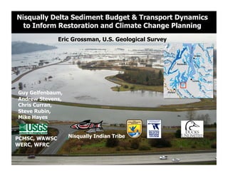
  • 1. Nisqually Delta Sediment Budget & Transport Dynamics to Inform Restoration and Climate Change Planning Eric Grossman, U.S. Geological Survey Guy Gelfenbaum, Andrew Stevens, Chris Curran, Steve Rubin, Mike Hayes PCMSC, WAWSC Nisqually Indian Tribe WERC, WFRC
  • 2. How do physical processes redistribute sediment and organics to shape marshes, channels, nearshore/tidal flats?
  • 4. Conceptual Model and Methods Methods: 1. GIS-Based “RAP” Model 2. Hydrodynamic Model lost 3. Field Measurements Sediment Delivery
  • 5. 1. “Rapid Assessment Protocol” - Potential Sediment Accretion Distribute sediment load scaled by transport connectivity Data Needs: 1. Sediment load 2. Topography (DEM) 3. Tidal Data lost Sediment 20-100K TY Czuba et al. 2011 4.5-23.0K m3/yr 20-100k TY USGS, 1974; This study
  • 6. 1. “Rapid Assessment Protocol” - Potential Sediment Accretion Distribute sediment load scaled by transport connectivity Data Needs: 1. Sediment load 2. Topography (DEM) lost 3. Tidal Data 11-28% Grossman and Horne (in prep) 20-100K TY 4.5-23.0K m3/yr
  • 7. 1. “Rapid Assessment Protocol” - Potential Sediment Accretion Distribute sediment load scaled by transport connectivity lost 11-28% 20-100K TY Grossman and Horne (in prep) 4.5-23.0K m3/yr
  • 8. 2. Process-based hydrodynamic & sediment transport model Delft3D couples: wave - current interaction FLOW WAVES 2 or Bathymetry 3D TRANSP BOTTOM Sediment transport (van Rijn, 1993) Dynamic Morphology Wetting drying Vegetation – momentum (Baptist, 2005; Uittenboogaard, 2003) ~20-30 m grid resolution in the restoration area
  • 9. 2. Delft3D hydrodynamic & sediment transport model Tidal forcing well characterized Tidal inundation reasonably modeled; some channels not resolved properly Tidal channel currents well modeled for portions of the tidal cycle. Roughness (vegetation) not properly characterized, yet!
  • 10. Role of vegetation on hydrodynamics & sediment information need
  • 11. Modeled Connectivity 1-Month time period, Avg river discharge: 70 m3/s
  • 12. 3. Field Measurements - Methods Fluvial Inputs River Discharge, Sediment Load (2-yrs; 15-min) Nearshore Hydrodynamics Tides, Currents, Turbidity (2-yr, 3-mo; 5-min) WL 1 3 Currents, SSC, X-Sections (Synoptic: tides, Qw) WL WL WL WL
  • 13. 3. Field Results: Fluvial inputs, WY2011
  • 14. 3. Field Results: Fluvial inputs, WY2011 Fines (silts and clays) ~48% of total load
  • 15. 3. Field Results: River-Marsh Connectivity Marsh Turbidity mean = 0.19 River Turbidity River Turbidity Marsh Turbidity
  • 16. 3. Field Results: Channel Velocities, Discharge
  • 17. 3. Field Results: Channel Discharge McAllister -10.1 cms Small Net Flow in (1.6 cms, <6% river) Area1 2.1 cms 2.1 1.1 3.1 2.2 Madrone 10.1 1.1 cms Leschi 3.1 cms Area3 2.2 cms
  • 18. 3. Field Measurements: Nearshore Sediments & Flux Suspended sediment tracks ~1:1 with turbidity Nearshore turbidity 20-50% of river
  • 19. 3. Field Results: Channel Sediment Flux Net Flux into Marshes (370 m3/yr) Potential Accretion ~0.12mm/yr 2.1 1.1 3.1 2.2 10.1 0.12 mm/yr
  • 20. Vulnerability? Cumulative Impacts? Adaptive Management? 44M m3 of sediment since 1945 (14-70x annual load)
  • 21. Nearshore Response: Extensive channel incision Feb 2009 Aug 2011 25 m 2m 1-2 m of incision 10-40 m widening 2009 ~5 km of channels Sediment 2011 redistributed 367,500 m3
  • 22. Nearshore Response: Sand export Photo=Jul 2011 Mapping Aug 2012 50m
  • 23. Nearshore Response: Sand export McAllister Creek Jul 2009 Jul 2010 Leading edge Sand bar incision Leading edge
  • 24.
  • 25.
  • 26. “Functional” Channel Habitat – Salinity Gradients
  • 27. “Functional” Channel Habitat – Salinity high tide 2 hrs into ebb River Salt Wedge
  • 28. Climate Change and Sea Level Rise Winds/Waves Observations following maximum model prediction Lower rate due to wind stress? Rate ~3.75 mm/yr (2x the 20th century Will sea level rise Marshes and coastal habitats response? accelerate if it Brominski et al. 2011 relaxes? IPCC. 2007; Church and White, 2011
  • 29. “Green” Infrastructure: Coastal habitats to buffer impacts Example, Stillaguamish Delta 1964  Low  Marsh   Low  Marsh  Boundary   Boundary   1964   2004   2012 Restoration
  • 30. GCM-RCM Dynamic Downscaling: Hydrology, Sediment Variable Infiltration Capacity (6km) ECHAM5* & CCSM3 (A1B, A2) WRF DHSVM (100m2)
  • 31. Projected Climate Impacts to Sediment Delivery Increase and earlier Seasonal sediment transport model seasonal runoff 4 2080s Sediment Load (MT/month) Curran and Grossman (In Review) 3 Increase  in  flood   and  sediment   2 1 2010 0 Hamlet and Grossman (in prep)
  • 32. Adaptive Management Opportunity? Simulated levee breach
  • 33. Model Results – Mud Deposition
  • 35.
  • 36. Flow to marsh = 3-6% of the river Suspended sediment concentrations = 20-50% river Sand exporting from marshes Potential Accretion Rate: <2 mm/yr (RAP); <0.3 mm/yr (measurements) 2010-2011 river flow was low Adaptive Management: 1-Alder Lake traps >15x equiv. annual sediment load to delta 2-New Distributary? Climate Change Adaptation and Resilience 1-Changes in Sediment delivery and fate 2-Sea level rise/waves (erosion, channel salinities) 3-Ecosystem functional response? Information Needs 1-Interaction of vegetation-hydrodynamics-geomorphology 2-Test fish use of “functional” channels (salinity gradients)
  • 37. egrossman@usgs.gov Western Washington University Any interested students please contact Eric Coastalresilience.org Salishsearestoration.org
  • 38.
  • 39. Simulated  Flood  Event   Modeling Approach – Fine Sediment Dispersal Investigate three scenarios 1.  Flow Only (tides and river flood) 2.  Flow and Waves (tides, river flood, and waves) 3.  Flow + River Breach (tides, river flood, and river breach)