Pierce County Surface Water Management Data Portal
•
1 like•649 views

Presentaion by: Renee Quenneville

Recommended
Recommended
More Related Content
What's hot
What's hot (15)
Viewers also liked
Viewers also liked (17)
Similar to Pierce County Surface Water Management Data Portal
Similar to Pierce County Surface Water Management Data Portal (20)
More from Nisqually River Council
More from Nisqually River Council (20)
Recently uploaded
Recently uploaded (20)
Pierce County Surface Water Management Data Portal
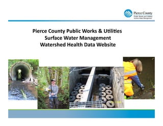
- 1. Pierce County Public Works & U4li4es Surface Water Management Watershed Health Data Website
- 2. Background Informa4on • Problem: Surface Water Management (SWM) collects watershed health monitoring data and had no public forum to easily share the data with the Public. • Solution: GIS Specialist/Database Administrator team assigned project to develop an interactive web-based data center. • Interdepartmental Project: PC GIS/SWM Technology staff and Public Works Communication & Accountability developed product for Public GIS
- 3. Data Collected by SWM Monitoring Staff: Monthly Water Quality Monitoring: Over 50 streams are sampled monthly. Shellfish Monitoring: Each quarter outfalls along Burley Lagoon, Rocky Creek and Filucy Bay are sampled. Weather Stations- 16 stations County Maintained Pond Levels- 4 with remote pond level access Ground Water Well Levels- 18 wells Biological Assessment macro invertebrate count (bugs) completed on streams every 5 years. SWM Capitol Improvement Project Support **National Pollution Discharge Elimination System Permit Support (NPDES): Our monitoring staff samples three outfall sites, four Best Management Practices sites, two program effectiveness studies and one flow reduction assessment site for permit compliance purposes.
- 4. Jus4fica4on Process: • Survey: Completed with SWM staff, assessed the costs and time associated with accessing/sharing our data • Results: 240 work hours or $8,000 per year was spent on fulfilling water quality data requests • Lack of Transparency: Data only available through Public Information Requests • Mapping: No ability to show the public extent of environmental monitoring
- 5. Development Steps: • SWM created the GIS feature classes & ‘view’ to database • Communication & Accountability division of PW&U, and SWM’s Education & Outreach Coordinator developed the look of the “Identify Results” boxes • Pierce County GIS built the “Identify Results” boxes, linked data & loaded the layer Into Public GIS
- 7. Data Available for Download
- 8. Link to Water Quality Website: www.piercecountywa.org/watershedhealthdata Renee Quenneville GIS Specialist rquenne@co.pierce.wa.us 253-798-4221