Geothermal resource assessment of asal field, republic of djibouti
•
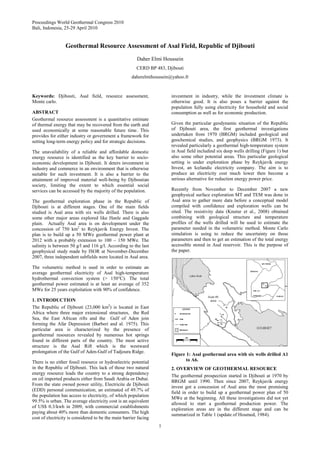
1 j'aime•1,717 vues

Geothermal resource assessment of asal field, republic of djibouti

Recommandé
Recommandé
Contenu connexe
Tendances
Tendances (20)
Similaire à Geothermal resource assessment of asal field, republic of djibouti
Similaire à Geothermal resource assessment of asal field, republic of djibouti (20)
Plus de Parti Djibouti
Plus de Parti Djibouti (20)
Dernier
Dernier (20)
Geothermal resource assessment of asal field, republic of djibouti
- 1. Proceedings World Geothermal Congress 2010 Bali, Indonesia, 25-29 April 2010 1 Geothermal Resource Assessment of Asal Field, Republic of Djibouti Daher Elmi Houssein CERD BP 483, Djibouti daherelmihoussein@yahoo.fr Keywords: Djibouti, Asal field, resource assessment, Monte carlo. ABSTRACT Geothermal resource assessment is a quantitative estimate of thermal energy that may be recovered from the earth and used economically at some reasonable future time. This provides for either industry or government a framework for setting long-term energy policy and for strategic decisions. The unavailability of a reliable and affordable domestic energy resource is identified as the key barrier to socio- economic development in Djibouti. It deters investment in industry and commerce in an environment that is otherwise suitable for such investment. It is also a barrier to the attainment of improved material well-being by Djiboutian society, limiting the extent to which essential social services can be accessed by the majority of the population. The geothermal exploration phase in the Republic of Djibouti is at different stages. One of the main fields studied is Asal area with six wells drilled. There is also some other major areas explored like Hanle and Gaggade plain. Actually Asal area is on development under the concession of 750 km2 to Reykjavik Energy Invest. The plan is to build up a 50 MWe geothermal power plant at 2012 with a probably extension to 100 – 150 MWe. The salinity is between 50 g/l and 116 g/l. According to the last geophysical study made by ISOR at November-December 2007, three independent subfields were located in Asal area. The volumetric method is used in order to estimate an average geothermal electricity of Asal high-temperature hydrothermal convection system (> 150°C). The total geothermal power estimated is at least an average of 352 MWe for 25 years exploitation with 90% of confidence. 1. INTRODUCTION The Republic of Djibouti (23,000 km2 ) is located in East Africa where three major extensional structures, the Red Sea, the East African rifts and the Gulf of Aden join forming the Afar Depression (Barberi and al. 1975). This particular area is characterized by the presence of geothermal resources revealed by numerous hot springs found in different parts of the country. The most active structure is the Asal Rift which is the westward prolongation of the Gulf of Aden-Gulf of Tadjoura Ridge. There is no either fossil resource or hydroelectric potential in the Republic of Djibouti. This lack of those two natural energy resource leads the country to a strong dependency on oil imported products either from Saudi Arabia or Dubai. From the state owned power utility, Electricite de Djibouti (EDD) personal communication, an estimated of 49.7% of the population has access to electricity, of which population 99.5% is urban. The average electricity cost is an equivalent of US$ 0.3/kwh in 2009, with commercial establishments paying about 40% more than domestic consumers. The high cost of electricity is considered to be the main barrier facing investment in industry, while the investment climate is otherwise good. It is also poses a barrier against the population fully using electricity for household and social consumption as well as for economic production. Given the particular geodynamic situation of the Republic of Djibouti area, the first geothermal investigations undertaken from 1970 (BRGM) included geological and geochemical studies, and geophysics (BRGM 1973). It revealed particularly a geothermal high-temperature system in Asal field includind six deep wells drilling (Figure 1) but also some other potential areas. This particular geological setting is under exploration phase by Reykjavik energy Invest, an Icelandic electricity company. The aim is to produce an electricity cost much lower then become a serious alternative for reduction energy power price. Recently from November to December 2007 a new geophysical surface exploration MT and TEM was done in Asal area to gather more data before a conceptual model compiled with confidence and exploration wells can be sited. The resistivity data (Knutur et al., 2008) obtained combining with geological structure and temperature profiles of the wells drilled will be used to estimate the parameter needed in the volumetric method. Monte Carlo simulation is using to reduce the uncertainty on those parameters and then to get an estimation of the total energy accessible stored in Asal reservoir. This is the purpose of the paper. Figure 1: Asal geothermal area with six wells drilled A1 to A6. 2. OVERVIEW OF GEOTHERMAL RESOURCE The geothermal prospection started in Djibouti at 1970 by BRGM until 1990. Then since 2007, Reykjavik energy invest got a concession of Asal area the most promising field in order to build up a geothermal power plan of 50 MWe at the beginning. All these investigations did not yet allowed to start a geothermal production power. The exploration areas are in the different stage and can be summarized in Table 1 (update of Houmed, 1984).
- 2. Houssein 2 Table 2: Actual stage of exploration and intensity of surface manifestations of different geothermal prospect areas in Djibouti (the degree of coverage or detail of each survey is indicated by crosses). All those above areas and some smaller geothermal field in Djibouti are represented on Figure 2 in the Republic of Djibouti. Figure 2: Geothermal prospect areas in Djibouti from 1970 to 1990. In this paper, the focus will be on the Asal field as it is under development and also has the most available data as geophysics, geology and physical well proprieties. 3. ASAL GEOTHERMAL FIELD The Asal geothermal system is located in the isthmus between Lake Asal and Ghoubet al Kharab (Figure 1) at a distance of about 120 km from Djibouti city. Altitudes range from -151 m at Lake Asal to +300 m at the highest point of the rift valley floor. The area is bounded by the high plateaus of Dalha to the north (above 1000 m high) and by 400 to 700 m high plateaus to the south, which separate Asal from the Gaggade and Hanle sedimentary plains (Figure 2). The region is arid with an average rainfall of 79 mm per year. Hydrogeological studies of the region show a general groundwater flow toward Lake Asal, which is the lowest point of the area and is occupied by a salt lake saturated in sodium chloride and calcium sulphates. The area is controlled by faults of tectonics, still active at present. The Asal area has been described as a segment of the world oceanic rift system by earlier investigators. A total of six deep wells have been drilled in the area, the first two in 1975 and the last four in 1987 and 1988. Well Asal 2 was damaged, wells Asal 4 and Asal 5 were impermeable although very hot, but wells Asal 1, 3 and 6 have produced extremely saline fluids from 1000-1300 m depth where the aquifer temperature is about 260°C (Daher, 2005). The temperature profile of A3, A4 and A5 are showed in Figure 3. Figure 3: Temperatures profiles of well A3, A4 and A5. Well test data from wells Asal 3, 4 and 6, including injection test data, draw-down test data, pressure build-up data and pressure interference data have been analyzed in order to estimate the reservoir properties of the Asal geothermal system. The permeability thickness of the deep geothermal reservoir is estimated to be about 4-8 Dm (Daher, 2005). During long-term exploitation a large pressure draw-down is observed in the reservoir (Figure 4). Wells Asal 3 and Asal 6 produce highly saline (120 g/l) reservoir fluid and the scaling of galena at high pressure reduces the discharge rate (Virkir-Orkint, 1990). Extensive exploration and field tests need to be performed to accurately estimate the actual size and capacity of the Asal reservoir. Figure 4: Output characteristic curves for different tests of well Asal 3. From November to December 2007, a field survey consisted of geological and geophysical studies were done in Asal area. The survey was led by ISOR, Icelandic Geosurvey a consulting and research institute. Finally a
- 3. Houssein 3 preliminary conceptual model by combining with the old data available (geochemistry, geology, drilling wells)is proposed (Figure 5). It revealed the presence of three geothermal independent reservoirs called for simplification Fiale, Gale le Goma and South of Asal Lake. Figure 5: A conceptual model of geothermal activity in the Asal rift. The figure shows resistivity at 3000 m below sea level, inferred lineaments in low resistivity (red lines), seismicity (dark green dots) and geothermal surface manifestations (light green). Inferred two main geothermal systems (Gale Le Goma and South of Asal Lake), sealed off and upper saline, are indicated and also a more open lower salinity under Lava Lake (Fiale) (modified Knutur, 2008). Actually Reykjavik Energy is more focused on Fiale zone (Figure 5) because it seems to have higher resistivity than the two others areas. Fiale is located in the central part of the rift and according to the seismicity data, it is the more active. Then the sea water is recharging and reducing the salinity concentration around 50 g/l. By comparing the two others fields the total dissolved solid TDS is 116 g/l. To estimate the total amount accessible energy in this area, the stored heat or volumetric method is applied. 4. VOLUMETRIC METHOD There are different methods for geothermal resource assessment as volume methods, surface heat flux, planar fracture methods and magmatic heat budget. All those methods are described by Muffler and Christiansen at 1978. The more often used it is the volumetric method and therefore it will applied for the case of Asal area. The volumetric method is adapted from mineral exploration and oil industry. It based on estimating total heat stored in a volume of rock referred to some base temperature (Muffler and Christiansen, 1978). It often used for first stage assessment, when data are limited either in the past or still main assessment method in some country (Muffler and Christiansen, 1978; White and Williams, 1975; Brook et al., 1979; Miyazaki et al., 1990, Ofwana, 2005 for examples). The main drawback is that the dynamic response of a reservoir to production is not considered, such as pressure response. Reservoirs with same heat content may have different permeability and recharge and, hence, very different production potentials. Then basics equations of this method use the conservation of mass and heat principles. Total energy content in the reservoir Eres (J) is the sum of thermal energy in rock matrix Erock (J) and in water/steam in pores Efluid (J). (1) (2) (3) Where ρ is density (kg/m3); is porosity: is heat capacity (J/kg°C); V is reservoir volume (m3 ); Tres is reservoir temperature (°C); Treference is the minimum temperature to generate some energy depending on method generation (°C). Finally the electricity power generation Pe (MWe) is calculated by using the following equation: (4) Where η, Rf, F and ∆t are conversion efficiency, recovery factor, plant capacity factor and plant life respectively or utilization time period. Some of the variables used in this method are estimated with an uncertainty and therefore are dealt by using a Monte Carlo simulation a technique that involves using random numbers and probability to solve problems. By choosing one random value for each variable out of their probability distributions one possible outcome of the volumetric method can be calculated. If this process is then repeated several times (for our study 1000) a discreet probability distribution for the outcome begins to form. For computations either Excel spreadsheet or new adopted statistical software @RISK can be used. 4.2 Variables Estimations For the reference temperature, for the purpose of the study it is for electricity generation and for flash steam plants, by far the most common, address water dominated reservoirs and temperatures above 180°C (European Geothermal Energy Council website; Wilcox, 2006). The fluid density for Asal deep reservoir is equal averagely 890 kg / m3 (Aquater, 1989) because of the high salinity content and the heat capacity close to 4800 J/ kg °C from water table. The density of the rock is determined from the gravity data made by BRGM at 1979 and it is equal to 2670 kg / m3 (Aquater, 1989). The deep Asal reservoir are considered to be formed by metamorphic rocks (Aquater, 1989) then the heat capacity of the rock is chosen as the same measured experimentally by Vosteen and Schellschmidt (2003) meaning between 0.8 and 1 kJ / kg °C. The conversion efficiency is estimated according to a reinjection or mineral extraction plan around 11% like Wairakei power plant (Thain and White, 1993). The porosity of the basalt rocks in Asal area is 10% (Aquater, 1989). The geothermal recovery factor as the ratio of extracted thermal energy (measured at the wellhead) t o the total thermal energy contained i n a given subsurface volume of rock and water (Muffler and Cataldi, 1978). And its range is between 0.05 to 0.2. A 95% of load factor is used based on 18 days preventive maintenance per year.
- 4. Houssein 4 In equations (2) and (3), it assumed that Tres is homogenous in direction of depth and therefore it will be the mean temperature in the entire reservoir volume. For Gale le Goma area (Figure 5) it is determined from well Asal 3 and 4 temperature profiles (Figure 3). The south of lake Asal has no well drilled but according to the resisvity map (Figure 5), it seems to have the same maximum temperature reservoir recognized in Gale le Goma area and it is for well A6 around 280°C (Daher, 2005). A5 is localized at Fiale area (Figure 1) and the maximum temperature measured is 350°C. Even if the permeability is very low around 0.4 Darcy meter (Daher, 2005) for A5, this can be increased by injecting high pressure air in order to open the fracture and therefore allow the convection started. Then expecting temperature of Fiale zone is taking constant at 350°C. From resistivity data made by ISOR (Arnasson, 2008), the surface areas of the three geothermal reservoirs Gale le Goma, Fiale and South of Lake Asal are estimated respectively 20, 12, 9 km2 . From the temperatures profiles (Figure 3) and magnetotellurics (MT) and transient electromagnetic (TEM) geophysical survey (Arnasson, 2008), the thickness of these reservoirs is varying between 1500 to 2000 m. All the input parameters are summarized in Table 2. Table 2: Actual stage of exploration and intensity of surface manifestations of different geothermal prospect areas in Djibouti (the degree of coverage or detail of each survey is indicated by crosses). 5. RESULTS AND DISCUSSIONS @RISK software developed by Palisade for uncertainties analysis using Monte Carlo simulation is used for computation (http://www.palisade.com/RISK/ ). All the results with 90% of confidence interval are summarized in Table 3 and Figure 6. Table 3: Power capacity estimated from volumetric method with 90% of probability confidence. Before any interpretation from the output power capacity, a clarification should be take care that all these results are obtained with a uncertainty size of the reservoir, with the highest one in South Alas Lake as there is no well drilled in this place, and recovery factor. Therefore the computation electricity power generation is giving an idea about the geothermal potential of Asal field before starting any project power development. Figure 6: Histogram probability distribution of power capacity. Asal area is on development actually for exploration of the high enthalpy reservoir on behalf of Reykjavik energy Invest in order to generate a 50 MWe in the next few years at Fiale area. This can be realistic as the minimum power capacity in this field obtained is 76 MWe. The aim is to extend the field at 100 to 120 MWe. 6. CONCLUSION Geothermal exploration has shown the existence of a number of potential areas suited to electric power development. Drilling at in Asal rift has encountered high temperature fluids from zones of high permeability. Potential of Asal geothermal reservoirs is 352 MWe within 41 km2 surface area and a thickness of 2000 m. From the actual Fiale geothermal reservoir project development managing by Reykjavik Energy Invest in order to build a power plant of 50 MWe at 2012 in the first phase, and later extension to 100- 150 MWe is possible as the power capacity calculated is between 77 and 206 MWe with 90% of interval confidence. Geothermal energy can be a serious alternative to reduce the electricity cost in Djibouti and therefore decreases the main constraint on industrial development, economic growth and social well-being of citizens. The risk of social instability arises from the constraint that the high cost and inadequate availability of energy imposes on the effort at sufficiently rapidly reducing poverty. The other prospects areas in Djibouti should be continued as: • Field geological reconnaissance • Preparation and realization of surface studies program • Exploration wells location • Exploration drilling REFERENCES http://www.egec.org/target/EGEC- Brochure%20Geothermal%20E&CHP.pdf
- 5. Houssein 5 Aquater, 1989: Djibouti geothermal exploration project Republic of Djibouti, final report. Aquater, report, 159 pp. Arnasson, K., Eysteinsson, H., and Vilhjalmsson, A.M, 2008 : The Asal geothermal field, Djibouti. Isor geophysical surface exploration ISOR-2008/019. Barberi F., Ferrara G., Santacroce R. and Varet J., 1975 : Structural evolution of th Afar triple junction. Afar Depression of Ethiopia, Bad Bergzarben, F.R. Germany, April 1-6 1974. Edition A. Pilger and A. Rösler, vol. 1. pp38-54. BRGM, 1970 : Reconnaissance géothermique du Territoire Français des Afars et des Issas. 70SGNGTM. pp59. BRGM, 1973 : Etude géophysique par sondages Melos et sondages électriques de la région du lac Asal (TFAI). 73SGN010GTH. 18pp. Brook, C.A., et al., 1979: Hydrothermal convection systems with reservoir temperatures > 90°C Assessment of geothermal resources of United States – 1978, U.S. Geological Survey Circular 790, p.18-85. Daher, E., 2005: Analysis of geothermal well test data from the Asal rift area, Republic of Djibouti. University Nation United Geothermal Traing Program UNU-GTP yearbook 2005. Houmed, A.M, 1984 : Geothermal prospects in the Djibouti Republic. Proceedings 6th New Zealand Geothermal Workshop. Miyazaki, Y., Tsu, H., Urai, M., Takakura, S., Okubo, Y., and Ogawa, K., 1990: Nationwide geothermal assessment in Japan by a volume method. Proceedings 12th New Zealand Geothermal Workshop. Muffler, L. J. P., and Christiansen, R. L., 1978: Geothermal resource assessment of the United States, Pure Applied Geophys., (in press). Ofwana, C., 2005: Resource Assessment of Olkaria 1 Geothermal Field, Kenya. Proceedings World Geothermal Congress 2005, Antalya, Turkey. Thain, I.A., and White, B.R., 1993: Wairakei power development efficiency studies. Proceedings 15th New Zealand Geothermal Workshop. Virkir-Orkint 1990: Djibouti. Geothermal scaling and corrosion study. Virkir-Orkint, Reykjavík, report, 109 pp. Vosteen, H. D. and Schellschmidt, R. (2003). Physics and Chemistry of the Earth 28 (2003) 499–509. White, D. E., and Williams, D. L., eds., 1975: Assessment of geothermal resources of the United States 1975, U. S. Geol. Survey Circ. 726, 155 p. Wilcox, G. (Editor), 2006: The future of geothermal energy, impact of enhanced geothermal systems [EGS] on the United Sates in the 21th Century. Massachusetts Institute of Technology.